• The Cycling News forum is looking to add some volunteer moderators with Red Rick's recent retirement. If you're interested in helping keep our discussions on track, send a direct message to @SHaines here on the forum, or use the Contact Us form to message the Community Team.

    In the meanwhile, please use the Report option if you see a post that doesn't fit within the forum rules.

    Thanks!

Race Design Thread

Page 229 - Get up to date with the latest news, scores & standings from the Cycling News Community.
Giro'd Italia stage 16: Salerno - Napoli (58 km ITT)
Frx1eWh.png

JHHecCE.png


To everyone on this forum:
If you ever post a race in this thread there are a few things you shouldn't do. For example don't write the whole post but just before you post it (maybe you only need to include the map and the profile of your stage and absolutely everything else is already done) you go to sleep and decide to post the stage on the next day. Thats because you might somehow be logged out on the next day and when you click on "preview" you don't see a preview of your post but a message that you have to log in again, and after you do that you return to your post but see that it is deleted and you can write everything again. Would be a pity if something like that ever happens, right? RIGHT? :eek:

So long story short:
This is a long TT. Start is in Salerno. Finish is in Napoli. Short climb at the beginning. Helicopter pictures of Vesuvio. Have fun!

Salerno:
salerno-shore-excursion-private-pompeii-tour-in-salerno-123732.jpg


Napoli:
TalentsNap.jpg
 
Gigs_98 said:
To everyone on this forum:
If you ever post a race in this thread there are a few things you shouldn't do. For example don't write the whole post but just before you post it (maybe you only need to include the map and the profile of your stage and absolutely everything else is already done) you go to sleep and decide to post the stage on the next day. Thats because you might somehow be logged out on the next day and when you click on "preview" you don't see a preview of your post but a message that you have to log in again, and after you do that you return to your post but see that it is deleted and you can write everything again. Would be a pity if something like that ever happens, right? RIGHT? :eek:
I have learnt this the hard way! Leaving your post half finished just sitting there, then coming back to it a few hours later is a recipe for getting rid of your hard work. Always open a new tab in your browser and login before you start writing again, if you do leave the post unfinished for a couple of hours.
 
Stage 18: Montbéliard - Gérardmer-La Mauselaine, 200km

28wf1c4.png


10ogn5t.png


GPM:
Ballon de Servance (cat.2) 9,0km @ 6,4%
Ballon d'Alsace (cat.1) 9,0km @ 6,9%
Col de Hundsruck (cat.3) 8,6km @ 4,0%
Le Grand Ballon (cat.1) 15,8km @ 6,2%
Col du Brabant (cat.3) 3,0km @ 8,6%
Col de Lauvy (cat.2) 4,5km @ 8,4%
Col des Hayes (cat.2) 6,0km @ 6,9%
Col de Grosse-Pierre (cat.3) 3,0km @ 7,5%
La Mauselaine (cat.3) 1,8km @ 10,3%

And so, back in France, it's the fifth stage with difficult climbing in a row, albeit straddling the rest day and that yesterday was relatively benign. However, this is the absolute final chance for the climbing-adept to make their moves, so today has got to count. And it's not a high mountain stage, so you'd better be willing to get creative. And it could see some vital action in the battle for the polka dots too, as after one stage in the Pyrenees, one in the Massif Central, two in the Alps and one in the Jura, it's time to finish the collection with one stage in the Vosges.

MONTBELIARD.jpg


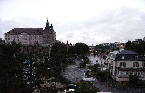
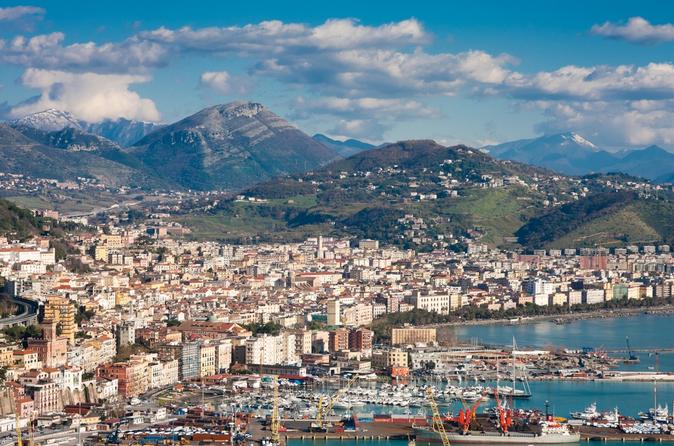
My last attempt at the Tour featured a stage transitioning between the Vosges and Alps that started in Sochaux, the home of PSA Peugeot-Citroën. That town is adjacent to and close to being subsumed by today's start town of Montbéliard, a key town between the Jura and Vosges and hence a popular town with traceurs. However, the last time the town hosted pro racing it was not the Tour but in fact the Tour de Romandie, which in 2012 featured a flat stage beginning in the town and returning to Switzerland nearby. Jonathan Hivert won the stage, for the record. The city's skyline is dominated by the Château de Montbéliard, a monument historique which served as the house of the Dukes of Württemberg, a legacy of the city's - and county's - time linked to the Holy Roman Empire and, resultantly, the city is an unusual religious exclave in France where protestants (here Lutheranism) are at least nominally in the majority.

In a stage with no fewer than nine categorized climbs as we move from Franche-Comté into Lorraine via the Alsace, there is likely to be a good battle to get into the break of the day to begin with. After all, you'll see a real mixed bag here - there will undoubtedly be some strong stagehunters, but in addition to these you will have any non-GC GPM contenders with so many points available, quite likely some domestiques for the key riders' teams to give them people to ride across to or for weaker climbers to get an advantage so they can be of use later on, and potentially even some sprinters and classics men who just want to make it to Paris so want to get an advance on beating the time cut (after all, who could blame them?). As a result, the first rolling section could be blisteringly quick with all the riders trying to get away and also the maillot jaune's team trying to monitor who gets away. We're unlikely to see a L'Aquila 2010 stage at this point in the race even if they do lose control (there's still too much GC action remaining for a Destilerías DYC 1985 stage too) but the race leader will be wary of the possibility of long distance ambushes if a contender gets too many men up the road. These climbs aren't the toughest in the Tour, they aren't the longest, the steepest or the highest altitude. But they will certainly have a cumulative effect, and they'll look rather nice on camera too.

55287485.jpg


First up is the cat.2 Ballon de Servance. At 9km at just over 6% it's a pretty reasonable ascent, albeit a long way from the finish. It's surprisingly only been ascended once by Le Tour, in 1988, when Robert Millar was first to its summit mid-stage in the Belfort-Besançon stage won by Jean-Paul van Poppel. It would lead in from its opposite side well to Planche des Belles Filles, however the shorter, steeper Côte des Chevrères is preferred at present. It begins with some false flat and includes a steeper ramp mid-way but should be plenty enough for the riders to start to warm their diesels. The next climb is only marginally more difficult, but owing to its historical value is granted cat.1 status. The Ballon d'Alsace was climbed all the way back in 1905 and is often considered the first mountain ever scaled in the Tour (although there are others who claim the crown, most notably the Col de la République, as the first pass of >1000m). The climb was a stalwart of the early days of the Tour, included every year from 1905 to 1914 and several times in the 1930s (it was one of the climbs won in the first ever Tour KOM competition, by Vicente Trueba), however in the post war era, it has become increasingly marginalized as a decisive climb. We haven't seen it since 2005, when it was included as a sop to tradition marking a century since its first climb, and was won by Michael Rasmussen. The picturesque summit includes Nordic skiing facilities, which of course I had to mention.

ballon-d-alsace-vues-aeriennes-oct-2011-jfl-05.jpg


The descent from here takes us to the two-stepped Col de Hundsruck, a low-lying pass on the southeastern tip of the range, which has only been seen twice by Le Tour, in 1972 when Portuguese great Joaquim Agostinho crested it first, and 25 years later when Didier Rous took the points in a transitional stage to Montbéliard. This leads us to the last real mountain of the race, the grand daddy of the Vosges, one of France's toughest climbs outside of the Alps and Pyrenées, the Grand Ballon. Obviously there are about 374 ways to reach the summit here and not all are as tough as others, but here we're climbing the second toughest (the toughest is from Moosch), from Wilier-sur-Thur.

GrandBallonSW.gif


faune-flore_03.jpg


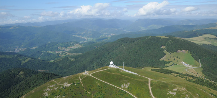
Keeping a watchful eye over its domain, the summit of the Grand Ballon is the highest point in the Alsace, and on a clear day you can see all the way down to the Bernese Alps from the observation tower. The climb from this side is nearly 16km long at 6% that gradually steepens, with the final 6,5km from the Col Amic to the summit being at just under 8% average and even including some pavé. Considering it's just about the toughest climb in northern France, however, surprisingly the climb has only been ascended six times in the history of the Tour de France; not only that, but only once - in the sorely lacking 1992 route that I've referenced so many times in this design - has it been climbed from one of the three tough cat.1 sides (the Moosch side could even debatably be considered HC), when the at-that-time-past-his-prime Laurent Fignon won both the climb and the stage. Apart from that it's been mid-stage transitional climb status, such as in 2005 and 2014 where it's effectively been a puncheur climb off the back of a different ascent onto the Route des Crêtes. Tony Martin was the last man over the summit, in the midst of that lengthy breakaway solo in 2014 that also allowed his namesake Tony Gallopin to borrow Nibali's maillot jaune for a day. The crest of this, the final cat.1 climb of my Tour de France, is 77km from the line, so anybody who's feeling mega daring had better have some help, as there's no respite at the end, for there is no descent just yet.

route-des-cr%C3%AAtes...jpg


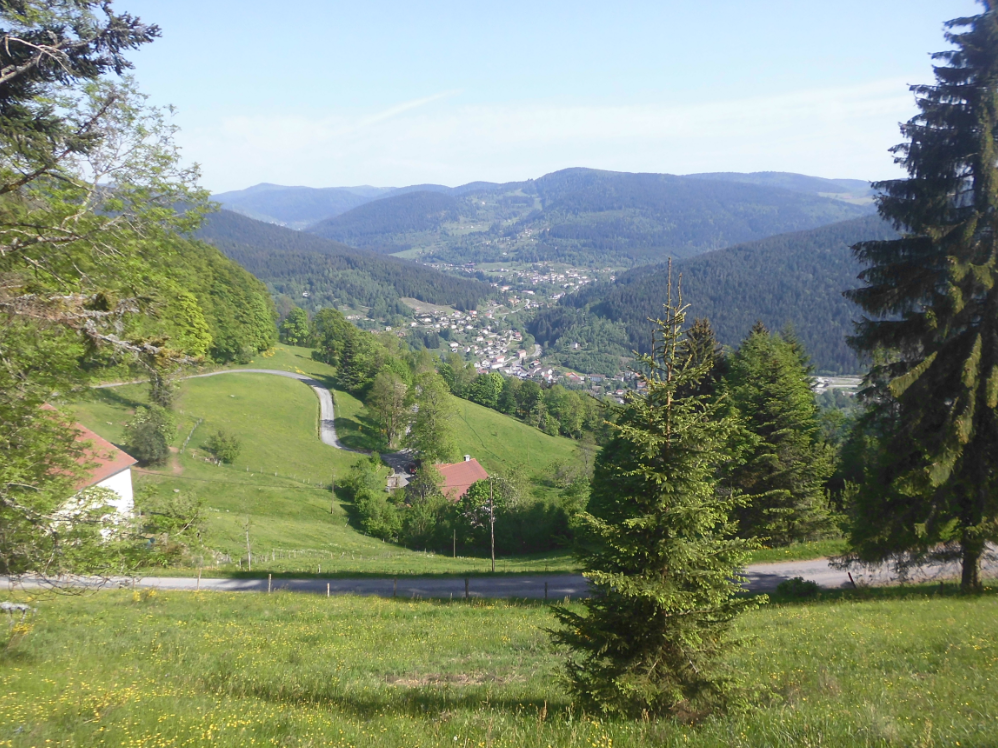
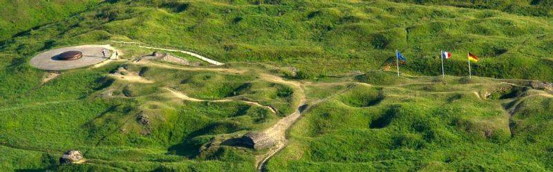
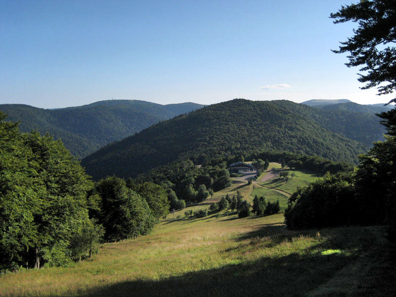
Instead, we then spend some time heading along the picturesque Route des Crêtes (above), a legendary ribbon road through the Vosges that spends much of its time on high plateau offering incredible panoramic views. We also pass another site known to fans, the wintersports station at 
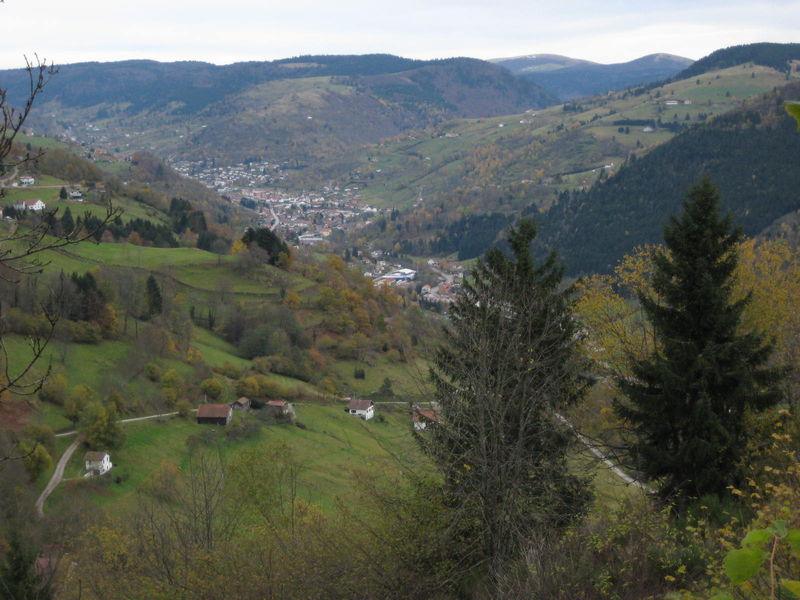
Le Markstein on the way, contesting the intermediate sprint at 68km to go. When this rolling terrain ends and the road heads downhill to take us away from the volcanic ridge, however, there are just under 60km remaining, and not a single one of them is flat. This is going to be a monster stage to control, because keeping your men fresh for a stage like this should be a nightmare off the back of two tough mountain stages (but it's why I suspect the La Chaux-de-Fonds stage may be quite benign). We arrive in the small town of La Bresse, home of former Olympic biathlon champion Véronique Claudel, which is very close to Gérardmer, as those who followed the 2014 race will know; it sits at the foot of the Col de Grosse-Pierre, which was the penultimate climb in that stage. However, we have a much more complex finale than that planned, as instead we loop to the south for the short but steep Col du Brabant, just 3km long but at over 8,5% average with several steeper ramps. This short climb crests at 42km from home, so maybe a little too far for most to consider going from, but with a technical descent and little chance for domestiques to chase back on, as well as the many tired legs in the bunch this deep into week 3, it offers a little tempter.

panorama-col-de-lauvy-sur-cornimont.png


Far more tempting is the Col de Lauvy (sometimes known as the Col de Lauwy following the previous German identity of the region). Another climb unknown to the Tour de France (!) it has some extremely inconsistent ramps and a steepest kilometre at 11,5%; if riders have significant time to make up - or if more one-dimensional climbers have a very slender advantage over stronger all-round riders - then this should be where they go; it crests at 32km remaining - with the steepest part 2/3 the way up - and is the steepest climb of the day in terms of ramps, if slightly shallower than Brabant in terms of overall gradient.

LauvyE.gif


Descending the more consistent western side of Lauvy takes us immediately onto another cat.2 climb, the Col des Hayes. As you can see there, near the summit there's a road to the Col de Lauvy that we could have taken to cut the corner off, but that would be cheating. This climb begins with 2km at 8,5% but then eases off in the middle before ramping back up again; cresting just over 21km from the line, again, you have options. Especially if there are still men up the road from earlier moves. Riders should, realistically, be strewn all over the place by now. There's been no rest to precede this, two mountain stages instead, there's precious little flat and we're deep in week 3 and in last chance saloon for many riders.

36646782.jpg


From here, we join the excellent early medium mountain stage from the 2014 Tour, the Le Mauselaine stage which was won solo by Blel Kadri while behind Contador and Nibali picked up a few seconds on the final ramps. We actually join that stage just before the summit of the third climb from home, the Col de la Croix des Moinats, however the part we climb is essentially 1,6km @ just over 4% and nothing serious. The descent then takes us back into La Bresse - although we are on the opposite side of the river here and do not cross over the previous route - for the penultimate climb, a steeper and tougher side of the Col de Grosse-Pierre than had previously been known. Like Croix des Moinats, it was introduced to the Tour for the first time in that 2014 stage, but with a max of 16% and a km at 11,3% in the middle, cresting at just over 10km from the line it's a final roll of the dice for those unwilling to wait.

If they do wait, of course, they will find themselves riding down into the premier wintersports town in the Vosges mountains, Gérardmer. A lakeside town of 8.500 inhabitants, it is accessed from the Col des Grosse-Pierre via the network of nordic trails at Les-Bas-Rupts that incorporate a number of nearby stations, and is the hometown of a number of wintersport athletes, most prominent at the moment being the Nordic Combined pro Maxime Laheurte. Owing to its range of facilities it is easy to see as a Tour host, perhaps as it has hosted the race on several occasions in the past, most recently in 2014 of course but before that hosting a stage finish in 2005 in a long transitional stage, off the back of the descent from the Col de la Schlucht.

Gerardmer_13383.jpg


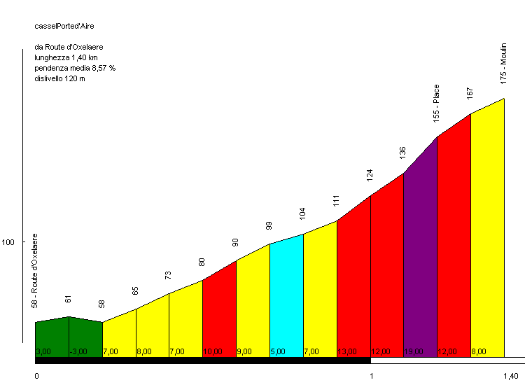
So, last thing's last: what we can expect to be the final decisive climb of Le Tour, the short, puncheur-friendly climb up to the Alpine ski station at La Mauselaine. Opening up with its toughest ramps, this climb was introduced to Le Tour in 2014, and served as a great introduction to the mountains in the stage referenced above.

profil_2014_8_col_gerardmer.png


You can see Kadri suffering up the final kilometre here. Now, you just have to imagine that suffering done with 200km of relentless climbing in your legs, off the back of two and a half weeks of difficult racing, following two consecutive mountain stages, and realise this stage could tear things apart worse than that 2013 Tirreno-Adriatico stage.

The climbing is more or less over now, so really, this should have been utter carnage, or else.

vue%20ger.JPG
 
Re:

Red Rick said:
Why is the col-with-the-greatest-name not in there?

I'm talking about the Platzerwasel, obviously
I've once done a stage with the same first half (though it started from Belfort) that after Grand Ballon descended down to Linthal and then did Boenlesgrab before the Petit Ballon - Platzerwasel combo at the end with the stage finish at Le Markstein.

Probably the toughest proper mountain stage you can have in the Vosges (that is realistic, if you have Bannstein and Firstplan instead of Boenlesgrab).
 
Because of the location of Platzerwaesel, I could only really use it if I either doubled back on myself, perhaps after adding Petit Ballon which would then give us about 11 climbs in the stage, which is fine in the Ardennes but where including legit cat.1s like Grand Ballon and Platzerwaesel is probably a bit too much to be realistically achievable at this point in the race,going to Col Amic instead of Le Grand Ballon and having a long loop around, in which case Platzerwaesel would serve little function other than to lengthen the stage and since there are already enough long stages in this Tour it might have been overkill, or to do a loop-de-loop which again would massively extend the distance. Le Grand Ballon is not in the stage with the expectation that it will see action, it is there to ensure that when they reach the last few climbs the legs are tired and the diesels are warm.

And now I introduce something seemingly lost to the Tour - the week three transitional stage.

Stage 19: Saint-Dié-des-Vosges - Verdun, 222km

amcidw.png


2pq6jxf.png


GPM:
Côte de Maron (cat.4) 2,6km @ 5,2%
Côte de Douaumont (cat.4) 3,3km @ 4,3%

It used to be that pretty much every year in Le Tour, the mountains would finish at the first half of the final week and there would then be a couple of transitional stages that eased riders back towards Paris for the finale, especially in the era where towns and cities (and theme parks) in central France took to ponying up the money for the final, race-deciding chrono (or, in the Indurain era, champion's lap of honour). These week 3 transitional stages would allow the GC men to call a truce as they prepared for their moment of truth in the penultimate stage ITT, and with many of the front line sprinters not in maillot vert contention having already gone home, they proved an important opportunity for stagehunters and those teams who had not been able to salvage anything from their Tour yet to make their mark. Think of stage 19 of the 2008 Tour where, in a profile not dissimilar to this, Sylvain Chavanel was able to finally, after about a bajillion attempts at stage wins that netted him the Grand Prix de la Combativité, make one stick as, with Cavendish no longer in the péloton having gone home to prepare for Beijing, Team Columbia were no longer willing to contribute to the pacemaking and CSC were content to allow Sastre to rest in the péloton. Improved transport links have meant, however, that it is no longer necessary to move in its direction to be readily accessible to Paris; this has opened up a tendency to run the mountains right up to the final day (2009 Ventoux, 2013 Semnoz, 2015 Alpe d'Huez), or even if there is a TT it is close to the final mountains (2011 Grenoble). In years where the Pyrenees follow the Alps this trend is less obvious, with 2010 and 2014 both including a Friday flat stage ahead of the chrono on the penultimate day. However, this route is taking an unorthodox route around France and so I'm in the Vosges deep in week 3, for the first time in God knows how long.

page_daccueil_saint_die_1.jpg


The town of Saint-Dié-des-Vosges, often known simply as Saint-Dié, is located along the Val de Meurthe in the eastern part of the Vosges, not far from yesterday's stage town of Gérardmer. The hometown of 19th Century French prime minister Jules Ferry, the town's location in an important trading valley route amongst lands disputed on several occasions has meant that the town has been sacked, razed and rebuilt and restored several times, most recently after the town on one side of the river was completely destroyed during World War II, after which a radical plan by Le Corbusier for the redevelopment was mooted but ultimately rejected. At the nearby Géoparc multiple sports are accommodated, with facilities including athletics tracks, multiple sports fields and a motor racing circuit. The town most recently saw cycling action in the 2011 edition of the now departed Tour de Lorraine, when Thomas de Gendt won ahead of Julien Simon and Pierre Rolland as their three-man break survived, however not by enough to prevent Anthony Roux taking the GC ahead of them on bonus seconds.

We're headed straight out of the mountains, however, and across the flat lands of central Lorraine. This region has seen Le Tour in recent years but never in this direction; in 2012 and 2014 the Vosges were of course utilized by Le Tour, but only as the first mountains of the race, so this region was of little consequence in the overall race. We pass through towns like Baccarat, not to be confused with the card game, and Lunéville, last seen in the Tour in 2005 in a long flat stage to Karlsruhe which was won by Robbie McEwen. The main target of this first third of the stage is the large city of Nancy, an economic and administrative centre for the Lorraine region which served as the de facto "capital of the east of France" in the age of empires (not the game). The city has over 100.000 inhabitants and has played host to eleven stage starts and thirteen stage finishes in the Tour de France between 1949, when Fausto Coppi won a time trial that finished in Nancy, and 2014, when Matteo Trentin won a long flat stage marred, as seemingly all of the first week of that particular edition was, by crashes. Winners in Nancy include the aforementioned Coppi, Bobet, van Looy, Zoetemelk and Hinault. The city was popular in the Tour in the 70s and 80s but lay dormant from 1988 to 2005, however as the Vosges reappear on ASO's collective horizon, it seems like the city may come back into fashion for the Grand Boucle.

26962_127_z.jpg


Set in hills around the Moselle's banks, after we pass through Nancy we have the first of two categorized climbs, an unthreatening cat.4 ascent. After slowing for the feed station in the formerly strategically important fortified town of Toul, the overall shape of break-chasing can take place as we head north on the plateau that separates the hills overlooking Verdun from the Moselle's banks around Metz and into the Woëvre region.

104627597.jpg


These plains are quite straightforward fare for the Tour, proper northeastern France flat stage terrain, however in the last 40km or so we loop back to the west and cross over the ridge around Douaumont; this is perhaps appropriate given the recent honouring of the centenary of the Battle of the Somme, because these are famous World War I battlefields; the enduring Battle of Verdun took place from February to December 1916 largely over this hilly ridge and is one of the most costly, both in terms of resources and human lives, battles in the history of the human race; casualties are certainly over 500.000, but other estimates have it at various figures approaching, close to, or even exceeding, a million. The overall number of casualties at Verdun throughout the war, as it was a defensive stronghold of the French with the Fort de Douaumont being a focal part of the national defences, has been estimated at 1,25 million of which the vast majority were incurred in the 1916 brutality. While I often go into lengthy tangents about the sites passed in the stages I design, no words I can write can really do justice to the horrors of war served here; perhaps the most telling sign is that after ten months of fighting concentrated in a very small area that continually churned and destroyed the surrounding land, which became a pitted, cratered quagmire of mud, blood and the remains, both human and mechanical, of war, the land still hasn't fully recovered a century later. Historian Antoine Prost described the Battle of Verdun alongside the Nazi extermination camps as marking "a transgression of the limits of the human condition".

1875781.jpeg


The main cycling obstacle of the day (yes, we're back to cycling, although it doesn't really seem so important when you think about it) is a fairly benign one in terms of its actual difficulty; it is more symbolic. At 3,3km at 4,3%, the climb to Douaumont from here is one of the easier sides of the many climbs on this ridge, but the summit - which comes with just 10km remaining - comes after a final kilometre at just over 6% (not enough to really damage the bunch but enough to disorganize the sprint trains especially if, as mentioned before, some of the big names have gone home meaning fewer teams interested in the sprint), and sits between the legendary Fort de Douaumont, over which so much of the battle was conducted, and the famous Ossuary, one of the most famous WWI cemeteries, a site of enormous national significance in France and possibly the most important cemetery in France, with well over 100.000 unidentified remains. There are a great many other cemeteries over the ridge and across the battlefield, both French and German, but the Ossuaire remains the most important; in addition because of erosion, groundworks and development, further remnants of the victims of the battle continue to be brought to the ossuary to this day.

ossuaire_de_douaumont_02_zoom.jpg


After the climb the riders will then swoop down into the city itself to a finish which is likely to either be a survivor (jeez, that phrase seems so inappropriate in this context when juxtaposed with the previous paragraphs) from the breakaway, or a sprint reduced by the jettisoning of some of the worst climbers in that run-in. If the fans are especially lucky, FDJ's Anthony Roux, a local man who has spent his whole career with Madiot's team, could emerge victorious, either in a lumpy reduced sprint as has become a speciality of his, or by fooling the sprinters' teams as he memorably did in a similarly transitional flat stage in the 2009 Vuelta. But really, this stage is more about the historical significance and moving back towards Paris. The last time Verdun hosted the Tour, however, you did see Laurent Jalabert and Ludo Dierckxsens narrowly evade the péloton's clutches, during the first week of the 2001 edition. I was surprised not to see the town as a stage host in either the 2014 or 2016 editions to be totally honest, especially with the former travelling through the region, although in fairness the 2014 race did pass Douaumont in the Épernay-Nancy stage.

199973.jpg
 
Stage 20: Épernay - Reims, 45,9km (CLM)

2ike104.png


a3yr7p.png


The Giro d'Italia has developed a trend for doing individual time trials in wine-producing areas. Valdobbiadene and Chianti in the last two seasons have been the main ones to mention, but this is a clear plan. So why not, well, steal the idea for the Tour's final, GC-settling contre-le-montre?

image_bswsliderztag


Yes, we're in the Champagne region, and so it's a time trial that pays homage to France's most famous drink (oh, ok, Orangina...), the sparkling wine that has become a tradition for celebrating victory in not just this but, pretty much, any sport. Épernay is a city of 25.000 which sits in the centre of the Champagne region and is famous especially with champagne tourists (in the literal sense, not as in 'pompous') as the biggest and most well-known entrepôt town. We start at Place de la République and do a loop of the town to begin which ends on the Avenue de Champagne.

diapositive02.jpg


This little loop around the town takes us past a number of the biggest names in the industry:
- Moët and Chandon
- Pol Roger
- Mercier
- de Castellane

Épernay is also the home of a former national cyclocross champion and one of France's most successful recent GC fighters, certainly of his generation (late 70s births) - which is pretty incredible when you consider he had to run his own team simultaneously. That's right, the sole owner, DS, mechanic, soigneur, road captain and team leader of Team Gadret, 4th in the 2011 Giro d'Italia (or 3rd now) Monsieur John Gadret (I've chosen that picture because it's absolutely hilarious. "The domestique"?! Gadret?!).

After leaving Gadretville, we then cross the Marne, then enter the Montagnes de Reims natural park, an attractive area split into wooded area and vineyards.

chamerycpnrmr-mcm_2010.jpg


This middle part of the chrono includes three short but sharp climbs; this is not a hilly TT like the 2013 Tour or the 2016 Giro; this is however also not pan-flat; a lot of the route will suit the powerhouse, don't get me wrong, but the first two climbs are a little under 2km in length and the last one only just over 1km and include some steep ramps. There are a lot of corners, but this isn't a TT full of super technical descents either. Each time-check is taken at the top of a climb, so that we can keep a steady guide to how the riders are doing with the battle against the clock. Again, though: this isn't a super tough TT that the specialists like Martin can't win; yes you need to have a bit of explosivity to get the best speed over the hills, but they're shortish, and much of the rest is going to allow you to properly open up the taps and go for it. If this happened five years ago, Fabian Cancellara would obliterate everybody, no doubt about it. Now, however, TTers like Martin aren't also explosive climbers; the flat sections are long and hard enough that he could win it, but people like Tom Dumoulin are possibly the biggest candidates to win because of the mixture of short Valkenburg-style hills and power roads, before we head on very flat and straight roads to Reims, one of the most important historical cities in France.

france-reims-cathedral.jpg


Of course, Reims is most famous for its cathedral, where all but one of France's kings have been crowned, but it has been an important city since pre-Roman times. It became the home of Christianity in France after the anointing of Clovis in the fifth century AD, at least until the Papal period in Avignon, however it retained its ceremonial purpose throughout the history of the French monarchy. Notre-Dame-de-Reims became a UNESCO World Heritage site, unsurprisingly, after restoration from the damage caused in the two World Wars was completed, but it's far from the only reason to bring the Tour to the city.

dsc00153-sl.jpg


We narrowly bypass the start-finish straight of the historic Reims-Gueux motor racing circuit, one of the fastest in the world back in the interwar and hosting the French GP on 14 occasions from 1938, through the inauguration of the Formula 1 World Championship in 1950 to 1966, after which it was supplanted by Rouen-les Essarts. The city also has a lot of cycling history, hosting the GP de Reims, a major track race in the early days of the sport, as early as 1897. The Tour de France has been to Reims a great many times too; it was first visited in 1938, when Fabien Galateau won a late race stage as they moved towards Paris and Gino Bartali carefully managed his lead. The city has hosted three finishes this millennium, all bunch sprints. 2002's was won by Robbie McEwen and 2014's, the most recent, by André Greipel, but perhaps most notably in 2010 this was the stage when Danilo Hondo became superman and did on his own what more or less every team had not been able to find a way to do for nearly two years, which is derail HTC-Columbia's well-oiled race-killing machine, totally dismantling their train, leaving Renshaw discombobulated, and allowing Ale-Jet to take the win while Cav had a tantrum and sat up, giving away points that eventually cost him the maillot vert when he recovered his confidence.

Reims' most famous cycling inhabitant is no sprinter, however. In fact, they're arguably the greatest all-rounder in the sport today, because they have achieved something which has never been achieved before in the history of cycling; Reims' most important cycling inhabitant is not in fact a son of the city but a daughter, for it is the multi-discipline women's star Pauline Ferrand-Prévot. For most people, any rainbow jersey is a great achievement. Some people are incredible talents who can win world championships along different disciplines. But it takes a pretty unique talent to hold the rainbow jerseys in three separate different disciplines of the sport... simultaneously. After all, after winning the 2014 Road Worlds in Ponferrada, she then picked up the 2015 Cyclocross Worlds in an epic duel with Sanne Cant (seriously, any of you who enjoy cyclocross, the women's Worlds in 2015 in Tábor are an incredible race), and then the 2015 Mountain Bike Worlds in Vallnord as well. We haven't seen much of Pauline this year as first she made the decision to focus on the mountain bike because of the upcoming Olympics, and she also got hurt early in the year as well, but with the collection of national and world titles she has across multiple disciplines, her stage racing credentials (obliterating the Emakumeen Bira and winning the Giro but for bonus seconds in 2014 while riding as a second-in-command), and the fact that she's still just 24 years old, we're sure to hear plenty more from her in the future.

Obviously Pauline won't be in the Tour de France (the fact that there isn't a women's Tour, and that ASO decided putting money towards a crit on the Champs Elysées and patted themselves on the back about doing so much for the exposure for women's cycling rather than helping fund or organize the Route de France, the rather anæmic leftover of the two competing attempts at setting up a women's version of the Tour independently, is a source of much irritation to me) but the city does show varying different cycling heritage as well: André Godinat, top 5 of Paris-Roubaix and winner of a Tour stage back in the 1930s, and also a tie-in to yesterday's historical monument as Reims is also the hometown of Léon Hourlier, a great track cyclist in the early days of the sport, who specialized in the sprint, won several national titles and track GP events, but who was tragically killed in 1915 while fighting for his country in the trenches of World War I, a month after his 30th birthday.

Leon_Hourlier_champion_Hutchinson.jpg


This connection of the cultural history of France, the link to the iconic champagne so intrinsically linked with victory (and enabling the maillot jaune at the end of the day to stock up ready for the road to Paris), the scenery of the Montagnes de Reims, the significance of the finish in front of the cathedral in Reims and the city's link to the sport's past and present mean that this will be a fitting, and glorious, setting for the final GC battle of my Tour de France.
 
Stage 21: Meaux - Paris-Champs-Elysées, 90km

11s2kc6.png


No need for any real explanation here. While I've played about with the final stages of the Giro and the Vuelta, the Tour's finish is too sacrosanct for any real variation to be introduced realistically, at least not since 1989 anyway.

meaux_1.jpg


This year's Paris-outskirts-town for the départ of the final stage, with its ceremonial champagne and then the loops of the Champs for those poor little subhumans we call sprinters, is Meaux, a city of around 50.000 people in the Seine-et-Marne département which is known for its cheese; it is one of a number of cheese-making towns around the historical Brie region after which the eponymous cheese is named; Brie de Meaux is arguably the most famous variety thereof, and a controlled appellation. I'm sure a local delicacy will go well with the champagne in the early parts of the stage.

Instead of the usual, I'm going to post the profiles of each stage back to back now, to give an idea of the flow of stages in the Tour. Because, let's face it, we all know what the profile of a Champs Elysées stage will look like, and we'll all agree beforehand it will be super boring unless somebody channels their inner Vino. But it's as much a part of the Tour's history as the colour yellow, châteaus, futile breaks from French wildcard teams in flat stages and the Col du freaking Tourmalet.

oriljb.jpg

k4tifs.png

2vabebl.png

2j4o55i.png

317jwr5.png

2vtdy1h.png

9tob9e.png

oaxlzc.png

w7hp3n.jpg

ok4ny8.png

25sljdf.png

2l8d894.png

2i9htnp.png

11bnq50.png

nclic6.png

10r8xkx.png

2s7ghma.png

10ogn5t.png

2pq6jxf.png

a3yr7p.png

14biwl1.png
 
Broken_Leg said:
Stage 21 – Orsay – Paris
120 km – Flat

Usual parade followed by the Champs Elysées circuit and mass sprint.
Not much to say about this stage.
Come on Broken_Leg! I belonged to the CAOrsay cycling team! A lot of little climbs nearby, with the Yvette river at 60m above sea level, and a plateau at 150-180m surrounding it. Many Cat 4 climbs, 1.5km @ 6% nearby. A great place to ride. A cool place to live, not much history, no vineyards. But a cool place.

Nice design :) .
 
Aug 21, 2015
380
0
0
Visit site
Tour of California Stage

Tour of California Stage 12: Weed - McCloud 40.2 km

TOC%2BStage%2B12.png


Stage%2B12.png


After the climbing is out of the way for this Tour of California, it is time to see if the time trialists can gain time back in a stage with their considerations in mind. We had the crazy stage in San Francisco back on stage 8 so this time trial is going to be much more suited to the specialists. There are a couple instances where things ramp up a bit but it is nothing worth getting the road bike out over. The biggest potential hiccup for the riders today would be the altitude which is over 3,000 feet(around 1,000 m) the entire time with exception to the finishing kms where we descend the Snowman's Hill Summit.

shasta.jpg

Mt. Shasta should be visible for almost all of the course towering over the riders

What makes this stage unrealistic?

This stage is one of the more reasonable ones with the only real area for concern being the lack of too much development around although the Mt. Shasta region should be able to host things.

After this stage the riders transfer down to Redding for the last desperate chance for riders to claim the yellow jersey before the race finishes in Sacramento.
 
I'm not sure if i shouldn't wait for @Gigs_98 to end his Giro. This race was created like a month ago so i hope it's a good time to publish it.

Giro del Trentino - opening post.

I was rather overprotective with this race. There are no or not much of difficult descents or narrow roads (besides one) because it's only a prep race and it hasn't the prestige of Suisse or Dauphine but still it's very popular and important in Giro prep. No one would risk any injury to win just a prep race so there was no need to include more difficult roads. Uphills aren't legbrakers either but that doesn't mean it's not a climbers race. They're still the favourites to win it. There won't be any stages for sprinters but punchers like Ulissi can try to snatch a stage (most propably the last one).

First stage is propably the only difference to the real Giro del Trentino as it's not a TTT in Riva del Garda but an ITT in Trento. It's 13km long and it reminds these from Suisse with a quite steep hill in the middle. Next stage detours to Bolzano province as it ends on Corno Renon ski station north of Bolzano. It's not a complicated stage, it's mostly flat only with the beggining and ending being mountainous. Next stage is more race design thread like as it's mostly up and down all day and the roads sometimes are quite narrow with a one quite difficult descent. Last stage ends in Cles which seems to Trentino like Milano for Giro d'Italia. It's a borderline medium mountain/mountain stage with an important tweak in a Cles lap. It's only one but it's quite lengthy and involves Passo Predaia (not to mistake with Fedaia -insert n exclamation marks-).

I've decided to change the climbs categorisation from 2, 1, HC to 3, 2, 1 so the profiles doesn't look too monotonic. Points distribution is the same as always. Otherwise i didn't change anything.

List of stages with their type and difficulty (the more difficult/important the more stars it gets):
Trento ITT, 13km **
Trento - Corno Renon, 160km, MTF ****
Siusi - Bertoldi, 170km, Mountain *****
Rovereto - Cles, 169km, Medium Mountain ***

Profiles:
Trento ITT:
r6rdpzL.png

Trento - Corno Renon:
HHfeH6X.png

Siusi - Bertoldi:
rSXFG0B.png

Rovereto - Cles:
NOB42xP.png
 
Giro d'Italia stage 17: Napoli - Vesuvio (177 km)
jGLww4t.png

REg4irn.png


The penultimate mountain stage is probably not what people would expect in this thread. Nevertheless although it's a mtf with hardly any very difficult climbs before this stage will probably at least be the most scenic one of the whole giro.
The start is still in Napoli and the first few kilometers are basically on the same roads as the final of the TT on stage 16. But while the TT route went through Pompei, stage 17 still goes along the coast through the town Castellammare di Stabia onto the beautiful Sorrento Pensinsula. After the riders pass the famous "famous beach" they tackle the first climb up to the town Molano. This is a realatively flat but long ascent which is 3rd category here, but might even be a 2nd category climb in races like the tour de france. The following descent is quite technical and is succeeded by an intermediate sprint in the for the peninsula eponymous city Sorrento
posizione.jpg


The riders ride through the beautiful landscape of the area but they will hardly have time to enjoy it since at this point of the stage it's a steady up and down. The next two 3rd category climbs, to Priora and Termini come directly after each other. Then after a long descent and two uncategorized bumps the 2nd hardest climb of the day to Pianillo starts. This ascent is also not very steep but it's length will still make it difficult. Once again the street is extremely scenic and will cause some beautiful camera pictures.
pWWPb5P.jpg


Then after a long descent and a short flat section the crucial part of the day starts. The Vesuvio is a climb which has been used several times in the giro, the last time in 2009, when it was the finish of the last mountain stage of the race. The climb is 10.4 kilometers long at 8.2%, so it's not an extremely long climb but it's a very steep one. Especially the last 1.5 km which are always steeper than 10% will really hurt and definitely cause time gaps.
bfgszCA.jpg


Now you might ask yourself, isn't it rather strange to make a mountain stage where attacks are basically only possible on the last climb, in the last week? Thats true, but there are still chances to attack to come and after the last ITT I think it's always interesting to see on all out fight on one single climb. On this stage there won't be any tactical games, any long range attacks and stuff like that. There will only be one big battle which is purely about strength.
Vesuvio.jpg
 
I really don't want to dig in the history of this place as there's just too much of it (it's Italy so no shock there) so i'll just jump straight into the route. Thanks to that this post won't be overwritten.

EDIT: Maybe i will wait a bit as Gigs will end his Giro but i don't know how much time it would take.

Giro del Trentino - library: link

Giro del Trentino stage 1 – Trento ITT, 12km, ~220m asc
KAHkk1f.jpg

r6rdpzL.png


Start: Trento, Via Roberto da Sanseverino, Piazzale Sanseverino
Finish: Trento, Via Antonio Rosmini, Università degli Studi di Trento, 280m straight
Time check: Trento, Via del Forte, top of Martignano climb

Climbs:
Martignano – 2,6km, 7,6%, 3 cat. 390m

It's a quite complicated ITT with mostly uphill or downhill and only a handful of straights. Stage begins on Piazzale Sanseverino, north of what looks like a new buisness centre (Parco Fratelli Michelin).

5e8sqBK.jpg

Viale della Costituzione, Trento.

The climb of the day, which is called Martignano – commune in Trento on top of the climb starts roughly 2,4km from the start. Run-in isn't very complicated with five 90deg turns and a tunnel under the rail tracks. It's mostly on two-lane roads except two 100m stretches on Via Ambrosi Francesco and Via dei Solteri which are slightly narrower.

This climb is short but quite irregular. It's 2,6km at 7,6% which makes a cat. 3 (2) hill but it's as steep as 14% at the beggining and 13% close to the top. It lies on the foothills of Monte Calisio (1097m a.s.l.). It goes through Via San Daniele Comboni - Via della Spalliera (max 14%) - Via Missioni Africane (roughly 300m false-flat) - Via Bellavista (max 12%) and Via del Forte (top of the climb). The roads range in width from a full two-lane to like 1,8-lane but the seem to be on a good surface. At the top of this climb there'll be the only time check on this stage. The fastest rider between Via dei Solteri sign and the summit wins the KOM and automatically the jersey.

hziH8PZ.jpg

Panorama of Martignano and Monte Calisio (1097m a.s.l.).

After the top on Via Pradiscola there will be roughly 1km of false-flat before the descent which starts on Via Marnighe. I consider this descent as quite difficult because it's quite steep (up to 13%) and has a handfull of tricky turns – only one of them i could consider as a serpentine even if it's just a roundabout. Thankfully practically all of the descent is on wide, 2-lane roads so it shouldn't pose any bigger safety problems. Part of this descent will go through anadjacent town of Cognola (Via Marnighe, Via San Vito). It ends on Piazza Venezia.

rnoPdFN.jpg

A monument of Alcide De Gasperi on Piazza Venezia.

Run-in to the finish line is slightly complicated with five 90deg turns in span of 2,5km on wide roads but it's propably the easiest part of this whole time trial. There is a small, 100m long cobble section on Largo Luigi Pigarelli but these are city cobbles and they shouldn't pose any problems to anyone (even Nieve or Pozzovivo). The finish line is located on Via Antonio Rosmini after 280m straight in between the facilities of Università degli Studi di Trento (Trento's university).

zmjI5vs.jpg

Castello del Buonconsiglio from XIII c.

sbgJbLJ.jpg

Fontana del Nettuno.

There is a slightly harder variant of Martignano climb which uses Via del Forte as far as Via Bassano and Via Muralta. This climb would have the same parameters as the one used in this stage but it would be a bit more irregular and max % is propably slightly bigger than on the used ascent (maybe even up to 20%). Sadly this road is very narrow, at times it's like 1-lane wide. Trentino isn't very demanding when it comes to roads but i prefere to be more conservative as overall ascent isn't any different and i'm ensured it's possible to use.

4Ktq3Gb.jpg

Alternative ascent of Martignano using Via del Forte.

If i would want to be even more evil then i could extend the climb from Martignano to Maderno (500m a.s.l.) with some patches definitely over 15% but sadly the road is very narrow (maybe even slightly more narrow than Via del Forte) so i decided to not risk it as still this stage is propably the least important in this Giro del Trentino.

This stage similar to the prologues in Tour de Suisse but it's longer and the climb is harder. Because the climb is harder and the time trial is technical i don't think prologue/TT specialists will have much to say here. It should be won by a more all-round climber (somebody like Nibali or Valverde) than a pure one.

There won't be any transfer as the next stage will start in Trento and go north to Bolzano province. It'll end in a MTF close to Bolzano. I don't think i've ever seen this MTF mentioned on this forum.
 
Giro d'Italia stage 18: Caserta - Formia (167 km)
NY7r97G.png

SjyeFX3.png


After the penultimate mountain stage the riders get one last easy day before the final two hard days in the mountains start. So it's again time for the sprinters to shine or maybe the peloton will let the break win since the sprint teams might be tired after yesterday (though the stage wasn't overly hard).
The start of the stage is in Caserta, a city which is famous for it's beautiful castle in front of which the stage will start.
foto-reggia.jpg


The riders then go westwards and after 60 km they are actually already quite close to the finish but instead of heading directly there they make an extra loop around the "Parco Naturale dei Monti Aurunci" a natural park with some pretty high mountains, but unfortunately there are not streets which go up there. The riders still ride through the scenic region and there is also a 4th category climb to San Nicola. The ascent is actually 15 kilometers long but only about 2.6% steep, so the actual climb are only the last few kilometers.
After the descent there are two more little bumps before the road flattens out and the sprint trains can start to work. The finish is located in Formia, an extremely old city which already existed in the Roman times. Today the town, which is located in the middle between Napoli and Roma, is a seaport which is however also a famous goal for tourists.
0616_FRONT_IMG_4659.jpg
 
railxmig said:
I really don't want to dig in the history of this place as there's just too much of it (it's Italy so no shock there) so i'll just jump straight into the route. Thanks to that this post won't be overwritten.

EDIT: Maybe i will wait a bit as Gigs will end his Giro but i don't know how much time it would take.
Just post your race. I don't think it's a problem if there are many races posted at the same time, and I don't know how long it will take for me to finish my giro. I'll try to do it as fast as possible but I'm not sure if I will have enough time.
 
Ok, so I'll finally start my first Grand Tour - the Tour de France.

This Tour is a bit experimental. I've tried to make it as real as possible, but also threw in a few innovations that I would love to see in the actual race. As I've already said, none of the MTFs in my race have been used in the real TDF, and some have never even been mentioned on this thread, so maybe there'll be some new ideas for future races.

Also, as I've already said, it's clockwise - Alps, then Pyrenees, and some other mountain chains along the way.

But first, we have the Grand Depart in the Hauts-de-France region. This region, formed by the territorial reforms is one of the better known areas in cycling, featuring hills (hint, hint) and cobbles (hint, hint). Some of the races here include 4 Jours de Dunkerque and, perhaps more importantly, Paris-Roubaix, both of which I will showcase. Its capital is Lille.

Tour de France
Stage 1: Lille - Boulogne-sur-Mer (207km)
ZQ58CmR.png

QYIucr0.png


We start in the capital, which is known for being a trade port for the textile, metal and chemical industry. It meant that many Belgian immigrants came to the area. Now, Lille is known for transport; this is where many TGV passengers go before heading to the UK. Lille still has a strong machinery and technological industry today. It also features a fantastic stadium, the Stade Pierre-Mauroy, which hosts many different events in lots of different disciplines.
GIBw0TI.jpg


The start is on the Place de la Republique in Lille. The riders then head to Villeneuve-d'Ascq, where the km0 ceremony is held, outside the stadium.
lNx7VaC.jpg


The riders then pass through Roubaix and head north-west, towards Armentieres. Then, they head towards the famous port city of Calais, where the intermediate sprint is. In the city, a turn south is made, towards Boulogne-sur-Mer, where this stage finishes. Boulogne is known for its fishing and port industry on which its local economy relies. It also features a beautiful, medieval castle and a stunning city centre. It's also worth noting that the football player Franck Ribery was born here.
MUU9Rhi.jpg


However, there is a twist. I like it when the first stage of a GT ends on a hill, such as the 2011 TdF (which, by the way, is my favourite Tour route in recent years- lots of action and fantastic emotions). Therefore, we have the runin to Boulogne from the 2012 TdF. This means four climbs - the Cote de Herquelingue, Cote de Quehun, , Cote de Mont Lambert and final climb. This will most likely mean the first yellow jersey will go to an attacker, such as Sagan, or Matthews. Alternatives include Alaphillipe and maybe even Valverde. Who knows? Drama from the start...

Start: Lille, Place de la Republique
Finish: Boulogne-sur-Mer, Boulevard Eurvin
Sprint: Calais

Climbs
Cote de Herquelingue (cat. 4, 1.3km at 5.8%)
Cote de Quehun (cat. 4, 1.4km at 5.%)
Cote de Mont Lambert (cat. 3, 1.3km at 8.4%)
Montee du Boulogne-sur-Mer (cat. 4, 0.7km at 7.4%)

Next stage
A homage to 4 Jours de Dunkerque... and an unusual visit to le pave.
 
@mikii4567, i'm worried we're destined to post at roughly the same time ;). BTW, i love your visuals.

Ok, i'll now jump to Italy. There are so many good ascents close to Bolzano and i've chosen maybe the lamest one. But this one has some space at the top so logistically it shouldn't pose many problems. I don't know but maybe Trentino could try Prati di Kohl. They once did Punta Veleno so maybe it's not that out of reach.

Giro del Trentino stage 2. Trento - Corno Renon, 160km, ~3400m asc
sAIEmaj.jpg

HHfeH6X.png


Start: Trento, Via Roberto da Sanseverino, Piazzale Sanseverino
Km 0: Trento, Via Brescia, cross with Via Papiria, 2,9km from the start
Finish: Corno Renon, parking
Sprint: Bolzano, Viale Druso Drususallee, 1,7km straight
Feed zone: Maso Nuovo, SP90
Start – km 0: Via Roberto da Sanseverino - Via Giuseppe Verdi - Piazza Duomo - Via Rodolfo Belenzani - Via Giannantonio Manci - Via San Marco - Via Bernardo Clesio - Via Torre Verde - Via Andrea Pozzo - Cavalcavia San Lorenzo - Ponte San Lorenzo - Via Brescia

Climbs:
Candriai - 10km, 7.7%, 1 cat. 970m
Andalo - 2,8km, 6,5%, 3 cat. 1015m
Kalterer Höhe - 7km, 6%, 2 cat. 665m
Auna di Sopra - 8,2km, 8,3%, 1 cat. 1383m
Corno Renon - 4,5km, 7,2%, 2 cat. 1535m

This stage is a borderline medium-mountain/mountain one which ends on a rather easy mtf in Corno Renon (or Rittner Horn in german) preceded by a harder (but not a leg breaker) ascent up to Auna di Sopra. I'm not sure if Corno Renon ever featured in Trentino or other smaller races. I know that Auna di Sopra was at least once in Giro (in 1995 if i remember correctly) and not sure if a couple of years ago in Trentino as well. I think i've seen this climb at least a couple of times in this thread.

For Trentino standards it's not a hard stage at all. The next stage will be significantly harder so this one should be more of a prelude than an actual queen stage. It's not thechnically very difficult as there is no need to take difficult roads in a prep race – most of the riders won't risk any injury before Giro d'Italia. There are a couple of serpentines and Auna di Sopra can be a bit tricky as it's not the widest of roads but it shouldn't be anything to complain.

Ok, now to the stage itself. It starts at the same place as yesterday. There's no sence in introducing Trento so i will only call up some places i could find while reaching km 0. From Piazzale Sanseverino riders will go into Piazza Duomo (Cattedrale di San Vigilio), then through Via Rodolfo Belenzani and Via Giannantonio Manci to Via Bernardo Clesio (Castello del Buonconsiglio). Then through Via Torre Verde (statue of Dante Alighieri) and Ponte San Lorenzo (over Adige) to reach km 0 on Via Brescia.

CRYi5y6.jpg


I'm not sure if there is any need to produce further as the wikipedia entry will most certainly do it better than me.

ue9OVqu.jpg

Cattedrale di San Vigilio on Piazza Duomo.
railxmig said:
zmjI5vs.jpg

Castello del Buonconsiglio from XIII c.
y021WsG.jpg

Statue of Dante Alighieri from XIX c.

As the riders will pass km 0 whey will immediately start climbing. Soon they'll turn into SP85 which should be well known as it's the Monte Bondone road. But they won't reach the top. In Candriai they'll turn right, down into Valle dei Laghi. This ascent is 10km at 7.7% and it's a cat. 1 climb. As it's with Monte Bondone this ascent is rather regular ranging from 7% to 9% with 11% max. On the profile below it ends where the Candriai sign is.

8LP3hLJ.gif

Profile of Candriai, part of Monte Bondone.

The descent down to Valle dei Laghi, while on a mostly two-lane road isn't that easy with roughly 10 serpentines and a couple of additional turns in span of roughly 9km. As the descent ends riders will turn left into SS45 to Sarche. Valle dei Laghi, or in english "Lake Valley" is called like that because of the amount of lakes in this rather small area. Some of them are Lago di Terlago, Lago di Toblino or Lago di Santa Massenza. In Padergnone, 3km before Sarche riders will go in between Lago di Toblino and Lago di Santa Massenza. Propably the most dominating monument in the region is Castel Toblino from XI c. which used to be an important lake fortress guarding the west entrance to Trento. Now it's a hotel and a restaurant.

QnOt7v1.jpg

Castel Toblino over Lago di Toblino.

In Sarche riders will turn left into SS237 to Ponte Arche via Valle del Sarca (Sarca is the main tributary of Lago di Garda). Most of this roughly 10km stretch is in tunnels which thankfully are lighten and the first 2,4km are uphill at roughly 6% (6 serpentines). Riders won't reach Ponte Arche as just before it in Villa Banale they'll turn north into SS421 to the well known Andalo. Andalo is a village placed on Paganella Plateau between Brenta Dolomites (Cima Tosa 3173m) west and Paganella Dolomites (Fai della Paganella) east.

STCGKn9.jpg

Lago di Molveno on the ascent to Andalo.

Andalo south is a difficult climb to categorise. While only last 3km before the Andalo plateau are significant the whole climb begins as far as Sarche making it roughly 30km long. Counting from Sarche it's a four stepped climb with lots of flat in between steeper stuff. For this race i decided to count only last 2,8km after Molveno which are the steepest one. This makes it 2,8km at 6,5% and a cat. 3 climb. As for now the KOM line will be roughly 3km before Andalo.

GglLqxU.gif

Profile of Andalo.

Descent to La Rocchetta (the entrance of Valle di Non) from Andalo is long and at first shallow but it gets steeper towards the end (up to 7%) with 4 serpentines in the last 1,5km. The road up and down from Andalo is mostly two-lane on a good surface so the descent shouldn't be very difficult. From La Rocchetta riders will turn right into SS43 to reach Mezzolombardo and Mezzocorona 3km later when they'll teurn into SP29. These twin towns on the west bank of Adige are separated by the Noce river (Val di Non & Val di Sole) which flows here into Adige. After riders will left Mezzocorona there'll be a feed zone in a hamlet of Maso Nuovo. They'll keep going on the west bank of Adige as far as San Giuseppe al Lago roughly 20km later. Because these 20km are flat riders will have a chance to chill before laft 60km which are much more demanding.

K85sBds.jpg

Lago di Caldaro in San Giuseppe al Lago.

After San Giuseppe al Lago riders will turn left into SP15 to Caldaro where the next climb of the day starts. The climb is 7km at 6%, it's cat. 2 and it's on a mostly two-lane road on a good surface but there are 300m in the town which are on very easy cobbles. This climb is actually an alternative Passo Mendola ascent as the top is on an intersection with SS42 Passo Mendola east where a restaurant named Kalterer Höhe is. If i transalted correctly the name of the restaurant would be Caldaro Heights. I absolutely don't know if this hill has any particular name. In France i would propably name it Lacets du Passo Mendola. Here i decided to go with the restaurant name.

DzKs0ce.jpg

The restaurant of Kalterer Höhe en route to Passo Mendola.

Descent down to Appiano is roughly 4km long on modernised a couple of years ago Passo Mendola road which is now two-lane. There are a couple of tricky bends with 5 serpentines. From Appiano the descent will continue as far as Bolzano with minor interruptions like a small uphill up to Cornaiano. In this town the road gets narrower and cobbled, but these are not difficult cobbles at all.

Down in Bolzano there'll be the only sprint of the day on Viale Druso Drususallee after roughly 1,7km straight. After that riders will go through Corso Italia and Piazza della Vittoria to reach SS508 (i think everybody heard about Passo di Pennes). I don't think Bolzano, the capital of South Tyrol, needs any introduction

8NUC5FK.jpg

Monumento Vittoria (Victory Monument in english) on Piazza della Vittoria of facist origins. Erected after incorporating South Tyrol to Italy after WW1.

The road up to Passo di Pennes for a long stretch is just a false-flat covered with tunnels (all of them lightened). This stage could be even dedicated to the tunnels as there are a good chunk of them on this stage. Riders will stay on SS508 as far as a small hamlet of Osteria Turisti and a Heiss Fensterbau door and window factory where they'll turn right into smaller, roughly 1,3-lane SP135 which immediately goes uphill.

The climb starts very steep with 1km at 10% with 12% max to then reach a small false flat. This whole climb is very irregular as there are at least two more steep sections with a whole 1km at 12,5% (14% max) 2km from the top. At the top there is another short and steep section of 11%. Rest of the climb is rather consistent at 7-8%. Overall it's 8,2km at 8,3% and it's a cat. 1 climb. After a short (less than 1km) and steep (roughly 10%) descent riders will reach a village of Auna di Sopra (the name of this climb).

NCeZ8eF.gif

Profile of Auna di Sopra climb, here counted from Bolzano but i counted from the Passo di Pennes sign.

From Auna di Sopra there is a roughly 1km and quite steep (max 10%) ascent and then rather shallow, but not easy (false turns) descent to Collalbo. The road is roughly the same as on the ascent. In Collalbo, the biggest town in Renon Range north of Bolzano riders will turn left into Via Tann where the last climb of the day starts.

This climb is up to the ski station of Corno Renon (Corno del Renon/Rittner Horn). It's a similar climb to Auna di Sopra – irregular with small bits of false flat and steep stuff up to 14%. The hardest part (1km at 10%) is roughly 1,5km from the top. Overall this climb is 4,5km at 7,2% and it's a cat. 2 climb. The climb on the profile below if from Auna di Sopra sign.

jbyNVnt.gif

Profile of Corno Renon climb (last 4,5km).

Finish line will be in the ski station after a tiny descent. Thankfully this ski station has a quite good amount of parking space and even if it's on gravel it shouldn't pose any logistic difficulties. The finish line could be placed like 200m later than i've planned originally.

DSVGWIr.jpg


What should be expected from this stage? Propably an attack on the 10% part 2km from the finish and rather small differences. Auna di Sopra should provide initial selection and a 20-30 man group should contest for the stage on the last climb. I didn't wanted to make this stage too difficult as the queen stage is the next one so this one is more like a run-in to that stage.
 
Oct 27, 2015
86
0
0
Visit site
Tonton said:
Broken_Leg said:
Stage 21 – Orsay – Paris
120 km – Flat

Usual parade followed by the Champs Elysées circuit and mass sprint.
Not much to say about this stage.
Come on Broken_Leg! I belonged to the CAOrsay cycling team! A lot of little climbs nearby, with the Yvette river at 60m above sea level, and a plateau at 150-180m surrounding it. Many Cat 4 climbs, 1.5km @ 6% nearby. A great place to ride. A cool place to live, not much history, no vineyards. But a cool place.

Nice design :) .

Thank you.
And sorry for not knowing CAOrsay (I do not have the encyclopedic knowledge of cycling of ... let's say Libertine Seguros :-()
And if I know that it's possible to design an interesting stage 21 around Paris, given how I suspect it'll be ridden, it's kind of a waste of time (hills in the south, a circuit around Montmartre ... or an ITT are all interesting possibilities we won't see or see again in a long time)
 
Hi Libertine, just saw your whole Tour. I haven't read through ALL stages, obviously, I let some of the flat be. Also some of the hilly stuff. I like Mur de Bretagne idea, as a matter of fact, I like it all, more or less. I always do and that goes for many of the stage makers.

BUT, I have one question, reading through your post, you have stressed many times that you don't like backloading. I know your Tour isn't 2011-backloaded, or 2012 Giro-backloaded, but in modern cycling, with the capabilities of the best riders in form of REALLY good domestiques, don't you worry that this will be a soft-pedal Luz-Ardiden case (its not THAT hard anyways), get through the ITT and the rouleur stages and then strike in the mountain stages starting with Beal? 5 in a row and a long ITT to finish it off, more or less in the last week. Not criticism, just interested and would like you have your take.
 
Re:

Valv.Piti said:
Hi Libertine, just saw your whole Tour. I haven't read through ALL stages, obviously, I let some of the flat be. Also some of the hilly stuff. I like Mur de Bretagne idea, as a matter of fact, I like it all, more or less. I always do and that goes for many of the stage makers.

BUT, I have one question, reading through your post, you have stressed many times that you don't like backloading. I know your Tour isn't 2011-backloaded, or 2012 Giro-backloaded, but in modern cycling, with the capabilities of the best riders in form of REALLY good domestiques, don't you worry that this will be a soft-pedal Luz-Ardiden case (its not THAT hard anyways), get through the ITT and the rouleur stages and then strike in the mountain stages starting with Beal? 5 in a row and a long ITT to finish it off, more or less in the last week. Not criticism, just interested and would like you have your take.
Sure, some riders will soft-pedal Luz-Ardiden, but with the San Sebastián stage being potentially difficult to control if top guys aren't on peak form waiting for the mountains near the end and wanting to save energy for Luz Ardiden, and then the MTF there on a HC climb, you've got a very good carrot there to get a lot of second-tier contenders up the road, because if that stage goes to the break, winning or placing high in that stage could net you a useful GC advantage that can set a second narrative of 'how long can they keep yellow' (à la Voeckler in 2011 or Arroyo in 2010) but also net a rider a lead in the KOM that isn't likely to be beaten until stage 14, so it's a stage presentation most days from there unless somebody picks up a good deal of points in stage 3 and picks up a lot of the points elsewhere. Look at the current Tour top 10 - somebody who isn't as tightly marked like Dan Martin (who's made a career in stage races of this kind of thing) or even Adam Yates could take the win while the leaders are looking at one another.

The sheer number of the rouleur stages in the middle will mean teams need to bring some rouleur helpers too; no good having a nine man mountain train unless you're Sky and Geraint Thomas is your rouleur man. The early mountains will also force a lot of reappraisal of goals for teams whose GC contender's job is simply to sit on and do a Zubeldia hoping for a top 10 at the end without ever being seen, a bit like in 2009 when Pellizotti lost a bunch of time early on so started hunting for the KOM; there are, however, very few pure sprinters' stages, so the GC men can't rely on the likes of Etixx and Dimension Data to do all their work for them on the flat as well. Sticking the Bréton stages at the end of week 1 is for crowds and also for the spectacle of the ribin, which I think deserves to be on a weekend and will also mean more rouleur help as well as the riders being more tired when they reach the dirt roads than normal as it's the last day before the rest day. Stage 11 is a potential banana skin as well, the second half is like a mini-Amstel Gold.

The other thing with soft-pedalling Luz Ardiden is that there are only two mountaintop finishes in the whole race, so it'd be ill-advised. More likely that the GC guns race it in whatever form they have then and then offload the jersey, probably in stage 6, to a break. But then, because they've been over a big MTF, it needs to be somebody relatively close on the GC to be able to gift it to, so they must be a decent climber - unless the break takes Luz and the GC men battle behind, a bit like the 2008 Giro with Visconti's stint in rosa. Also, the Swiss stage really isn't that hard, it's probably one for the break, whereas stage 18 in the Vosges could be trouble because it's all about lack of control.
 
railxmig said:
@mikii4567, i'm worried we're destined to post at roughly the same time ;). BTW, i love your visuals.

Thanks, and I don't mind sharing :) .

Tour de France
Stage 2: Saint Omer - Cassel (29km), team time trial
tyoEyM9.png

Ukds0dA.png


This stage is, again, partly inspired by the 2011 TdF. I am not a fan of TTTs, but I do think that they can be interesting, especially when held after a day where the bunch may have been a bit split, to ensure an interesting fight for the jersey.

The ramp is in Saint-Omer, an ancient city that has a lot to its history. In the 13th century, a lot of the town revolved around the textile industry, but between then and the 18th century multiple battles were fought here, including the Battle of Saint-Omer between the Anglo-Flemish and French armies. During both World Wars, Saint-Omer was used as an airfield, and is now known as a place for heritage tourism.
nctmZix.jpg


After the start, the riders head north-east, before turning east just after the first time check, which is in Nieurlet. Not long after is the second time check. in Wemaers-Cappel. Up until this point, the course was relatively easy, so the time gaps shouldn't be very big.

But then, the issue starts. Yesterday, I announced a homage to 4 Jours de Dunkerque; we thus climb Mont Cassel. This climb is 1.7km long and only averages 5%, but has points at double that. In addition, the final km is held on pave, before the summit and then a flat, wide but twisty road to Cassel. A Roman city (an idea for the participants of Race Design Challenge :D ), Cassel was used as an urban town and, after the collapse of the Empire, a border town between France and Belgium. Now, it features some stunning landmarks, although the majority of the town was rebuilt following a World War II battle.
tA7zyDu.jpg


This final will mean some climbing ability will be needed to succeed, along with TT skills. A team with 9xpuncheur could succeed at this, and hold the yellow jersey after this stage.

Start: Saint-Omer, Boulevard de Strasbourg
Finish: Cassel, Grand Place

Climbs
Mont Cassel (uncategorised)

Next stage
Another visit to a great race ;) ... and what will probably be a thrilling stage.
 
mikii4567 said:
Tour de France
Stage 2: Saint Omer - Cassel (29km), team time trial
tyoEyM9.png

Ukds0dA.png

This one is propably too narrow for a TdF but there is a different approach to Cassel. It's from south via Rue d'Aire which is roughly 1km at 9,7% of which last 500m are at roughly 14,5%. It's a quite narrow, asphalted (so no cobbles) but a very picturesque road nontheless (it goes under Porte d'Aire). I doubt the parameters are correct as the road doesn't look that steep so maybe it's closer to 500m at 10% but still a fine puncher hill. I'm actually not sure if this side isn't featured in Gent-Wevelgem. Of course i'm not questioning your design as you've chosen cobbles, it's just an intersting alternative.
CasselAire.png

65748790.jpg

Porte d'Aire.

Now i'll go back to Giro del Trentino as it's time for the queen stage. I think it could be quite realistic without Vetriolo Terme if only Nigra and Lavazè won't be covered in snow. The finish place might be rather unknown but it's one of the main ski stations in Lavarone, just east of Trento.

Giro del Trentino - library: link

Giro del Trentino stage 3. Siusi - Bertoldi, 169km, ~4650m asc
PNuFOQR.jpg

rSXFG0B.png


Start: Siusi, Via Kohlstatt, Ski lift Alpe di Siusi
Km 0: Castelrotto, SP24, Golf St. Vigil, 2,4km from the start
Finish: Bertoldi, Hotel Caminetto, 170m straight
Sprint: Pergine Valsugana, Viale degli Alpini, 330m straight
Feed zone: Dorà, SP71
Start – km 0: Via Kohlstatt - Via Sciliar - Castelrotto, SP24

Climbs:
Passo Nigra - 25,3km, 5,1%, 1 cat. 1770m
Passo di Lavazè - 12km, 7,8%, 1 cat. 1808m
Passo del Redebus - 15km, 4,1%, 2 cat. 1453m
Vetriolo Terme - 10km, 8,5%, 1 cat. 1383m
Monte Rovere - 9km, 9,2%, 1 cat. 1267m

While previous stage had mainly north direction this one goes south back to Trentino. It starts in Siusi which is mostly known for being a base to Alpe di Siusi. It's very popular in the cycling community and Giro d'Italia likes to visit on a regular basis so there's no need for a more complex introduction. The stage will start in a parking lot at the bottom of a ski lift up to Alpe di Siusi. Km 0 will be opposite to Hotel Vigilerhof close to St. Vigil golf course – beautifully located golf course.

A5PrOJB.jpg


BbvYeN8.jpg

Schlern (Sciliar) massif south of Siusi.

After km 0 riders will go down via SP24 to the outskirts of Prato Isarco where they'll turn left into Aica di Sopra to begin the first climb of the day – Passo Nigra. This climb is a long one – over 25km. It's two-stepped. First part up to Aica di Sopra is 6km at roughly 7,3% , then it's a lengthy 10km false flat on a plateau and the last part from San Cipriano is 8km at 7,7% (max 14%). I decided to count the last roughly 2km of slight uphill (1-3%) after the actual col too. Overall it makes 25,3km at 5,1% and it's a cat. 1 climb. On the profile below it begins from Alpe di Siusi sign and ends roughly 2km after Passo Nigra sign.

p5K7vZ2.gif

Profile of Passo Nigra.

The road up to Passo Nigra is of varied width and quality. To Tires which lies roughly in the middle of Passo Nigra the ascent is a two-lane road of varied quality. After Tires it narrows down to roughly 1,5-lane. However it widens back to 2-lane roughly 3km before before Passo Nigra. Descent down to Carezza is shallow and on a good and 2-lane wide road. In Carezza riders join SS241 (part of the strada dolomiti) close to the top of well known Passo di Costalunga. Riders are now just a couple of kms off the famous Val di Fassa. On SS241 descent continues down to Ponte Nova where riders will turn left into SS260 and the next climb.

This next climb is well known Passo Lavazè which is the highest point in this race (a local Cima Coppi) at 1808m a.s.l. It's thankfully under 2000m so maybe the weather won't pose many problems. Lavazè is steep from both sides. From Ponte Nova it's 12km at 7,8% which makes it a cat. 1 climb. It's one of the hardest climbs in this race. The highlight of this climb is a roughly 3km long stretch at around 10% with max at 12%. Last time Lavazè saw cycling was in Giro 2012 Pampeago stage where (if i remember correctly) Kreuziger attacked on Lavazè from a selected by Liquigas 30-40 man group and later managed to hold a late push by Hesjedal and win the stage.

SBCDkkv.gif

Profile of Passo Lavazè from Ponte Nova sign.

Descent from Lavazè will lead to Val di Fiemme and it's biggest town – Cavalese and then down to Trento just missing the famous winter sports area. This lower part of Val di Fiemme is more wild, forested and if there are any gaps in the forest then it's very picturesque.

Rqjt0Qy.jpg

View down Val di Fiemme from Piscine village. The road on the other side of the valley is SS612 Cavalese – Trento road.

X4yiXMy.jpg

Lago di Stramentizzo on the lower Val di Fiemme.

Riders will go via the east SP71 road rather than west SS612 one. This road a rather typical "balcony" road. It's twisty, mostly 2-lane with a couple of narrowing in the surrounding villages (Piscine, Valfloriana). There will be a feed zone in a hamlet of Dorà 9km before Sover. When they reach Sover roughly half-way down to Trento they'll turn left into Lagorai Dolomites and leave Val di Fiemme to tackle the next climb of the day.

This one is well known to Trentino as it's Passo Redebus. This time it's taken from it's two-stepped north side (most often used in Trentino, last time was used i think last year). From this side it's 15km at 4,1% and it's a cat. 2 climb. First part of this climb up to Monte Sover is roughly 3km at 8,8% (max 12%) followed by a long 7,5km flat section on Altopiano di Piné to Bedollo to end up with last 4,6km at 8,7% (max 15%).

RnHpCQW.gif

Profile of Passo Redebus from Sover.

JJ1MfBs.jpg

Monte Croce (2490m a.s.l.) in Lagorai Dolomites east of Passo Redebus.

Descent down from Redebus will lead to Valsugana and the town of Pergine Valsugana where will be a sprint to grab. It'll be on Viale degli Alpini after 330m straight. Known since Roman times Pergine was a rather important stay on the Roman Feltre – Trento military road. The biggest monument in the area is propably the Pergine castle on Monte Tegazzo. It's from the early middle-ages but it could be built on an old roman or even pre-roman fort. As to this day it doesn't look very well, needs some renovation. I would call it even creepy and it supposedly is haunted which only adds to its creepiness.

x4tEXIa.jpg

Castel Pergine.

Now back to the stage. Riders won't spend much time in Valsugana. In Pergine they will turn to Assizzi and then leave the valley into SP12 and the next climb. I'm not sure if this next climb isn't the hardest one in this Giro del Trentino. This climb is up to Vetriolo Terme so it's nothing new (last used in Giro 2014 Riffugio Panarotta stage) but the tackled side is rather forgotten. This west side is roughly the same as the more known south side. It's 10km at 8,5% which obviously makes it a cat. 1 climb. Because the top of this climb is only 30km from the finish it shouldn't be underestimated.

Gy9tkf3.gif

Profile of Vetriolo Terme climb up to the Levico Terme sign.

Vetriolo Terme is a quite well known spa in Valsugana. Not than long time ago it was a barely functioning ski station but it seems like it's slowly recovering.

jnGSSRR.jpg

Terme di Vetriolo.

If i remember last time Vetriolo Terme as a pass was used in the 80's. It's quite understandable as Giro get bigger and bigger with each year but Giro del Trentino is still a rather small race (it can handle Punta Veleno and other obscure roads) so it should handle this side without any bigger problems. The road is still narrow but it's like 1,3-lane and surface is in quite fine condition so nothing extreme. The biggest problem might be the descent down to Levico Terme as it's difficult, technical (9 serpentines in span of 6km) and not in the widest of roads. It switches between roughly 1,5-lane to almost 2-lane near the bottom.

Levico Terme is one of the main cities in Valsugana. It's quite strongly fortified – remnants of the Austro-Hungarian and WW1 times. Fort Tenna and Fort Col de la Bene are the biggest one in area. There are two quite sizeable lakes east of Levico Terme – Lago di Levico and Lago di Caldonazzo. Ride through Levico Terme is quite complicated as riders will pass through the city to reach an intersection of Via Brenta and Via Claudia Augusta on the outskirts to then come back to the city and then via Corso Centrale into narrowish Via Casotte and then to a vallage of Lochere south of Levico Terme where the last climb of the day begins. This transition is roughly 5km long.

CmsnAzm.jpg

Levico Terme seen from Lago di Levico.

nwO4aXv.jpg

Fort Tenna between Lago di Levico and Lago di Caldonazzo east of Levico Terme.

The last climb is only slightly easier than Vetriolo Terme. I'm unsure if it ever was in Giro d'Italia or Giro del Trentino but i assume the last one visited it someday. It's actually a perfectly plausible climb as the road isn't very narrow (like 1,2-lane) and the quality seems to be rather fine (judging partly from the satelite images). This climb is known as Monte Rovere (or Menador), it's located almost opposite to Vetriolo Terme in Gruppo degli Altipiani (part of Vicenza Alps) and it's 9km at 9,2% which makes it a cat. 1 climb. Like Vetriolo Terme it's steep (max 13%) but regular.

NHrUpEq.gif

Profile of Monte Rovere climb, here as Menador. First 2km are a bit different.

This climb is only 7,5km from the finish and these last 7,5km are quite bumpy. Descent down to Lavarone – central town of Altopiano di Lavarone important during WW1 – is short but tricky (particulary one very tight U-turn just after the top). Altopiano di Lavarone was at the front lines of WW1 which left it severly damaged. Now it's mostly a ski area (alpine skiing and cross-country) up to Passo Vezzena just east of Monte Rovere. The main access to it is in a village of Bertoldi north of Lavarone. It's there where the finish is located.

Run-in to Bertoldi is quite complicated. In Lavarone riders will turn right into a slightly smaller road (roughly 1,7-lane) to reach the finish line 1,3km later. These last 1,3km are slightly uphill with a small bit steeper part (up to like 5%) just before the village. Finish will be opposite to Hotel Caminetto after 170m straight. Because Bertoldi is the centre of Lavarone ski area there is quite a chunk of space available which should be enough for Giro del Trentino and maybe even Giro d'Italia. The Lavarone plateau propably did host a Giro del Trentino stage but i'm not sure if Bertoldi ever did but it looks like a quite realistic possibility so why not.

CYdbsJS.jpg


5cLFrNv.jpg

Bertoldi.

This stage is all about Monte Rovere with maybe Vetriolo Terme taking a small part but i doubt anyone will risk on the descent before Giro d'Italia so it should be softpedalled. Still a 20-30 man group before Monte Rovere isn't that far from reality (Vetriolo Terme is a difficult climb). Time differences should be quite big as the last 7-8km to Bertoldi should hold or increase the gaps and establish a small group of GC contenders sprinting to the finish line.

How realistic this stage can be? IMO Monte Rovere and finish in Lavarone ski area is quite possible, Vetriolo Terme is i think out of contention while the rest is.videly known. Scrapping Vetriolo Terme there would be like 10km from Pergine Valsugana to the bottom of Monte Rovere. I would use then the ascent from Caldonazzo rather than Lochere and i would go east of Lago di Caldonazzo via SP1.

Other possibilities? Originally i planned to finish in Bertoldi southwest from Riva del Garda via Passo Sommo and Passo Santa Barbara. Of course Passo Sommo is much before Bertoldi than Monte Rovere but the run-in to Bertoldi could be more hilly. A road via Pra' di Sopra south of Lago di Lavarone or Via Dante Alighieri south of Lavarone are short but quite steep and could be a fine boost to suprisingly difficult Passo Sommo (15,5km at 7,5%).

res8rkQ.jpg

Bertoldi via Passo Sommo & Pra' di Sopra.

JR75JK3.jpg

Bertoldi via Passo Sommo & Via Dante Alighieri.

Another possibility in Lavarone plateau is to end in Chiesa which is a village on top of a small hill north of Lago di Lavarone. There is small space in the centre of Chiesa and it would result in a puncher finish (500m at 5-6%).

Next stage will end as usual in Cles but with a small twist. These laps around Cles are quite lame and they need a small but very easy to incorporate update.
 

TRENDING THREADS