- Aug 8, 2017
- 242
- 43
- 9,080


Only recently and after a research into the Tour de France passage in Belgium territory I discovered the past existance and apparently use in cycling races with high logistic requirements of cobblestones sectors of long distance and above all with a plain profile, obviously different from those which are associated with Belgium and with more resemblance with the ones in northern France . These were part of Wallonie and to my knowledge were not used in recent Tour of Wallone editions.
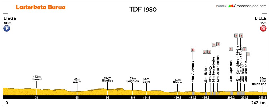
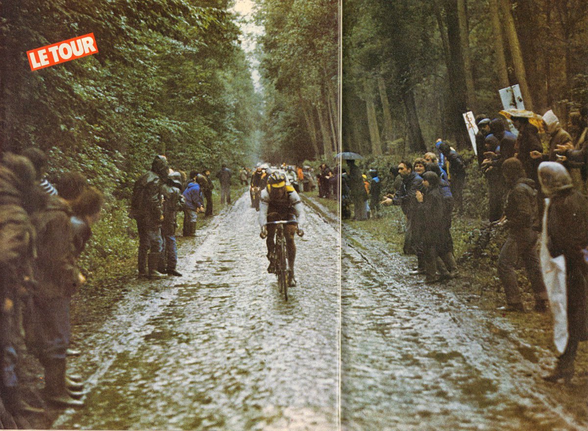
I support this on collected informations about the 5th stage of the 1980 TdF. The stage started in Liége, passed in Wallonie, ended in Lille and had at least 17km of cobblestones roads.
The position and the aproximate distance of the sectors in the stage are the following:
Km. 200 Sector - 5km
Km. 205 Sector - 1km
Km. 207 Sector - 2km
Km. 211 Sector - 2,4km
Km. 214 Sector - 1,8km
Km. 217 Sector
Km. 225 FRANCE
Km. 230 Sector - 2km
Km. 232 Sector - 2,2km
Km. 235 Sector - 1km
Km 249 Lille - finish
I look to know if anyone has any informations about the identity of the roads, if they still exist and are or not used in competition.


 )
)