Race Design Thread

Page 295 - Get up to date with the latest news, scores & standings from the Cycling News Community.
Stage 8: Livorno Ferraris - Livorno Ferraris, 89km

Vuqw76g.png


St1VsO8.png


After two serious climbing stages, the péloton will be relieved to travel back down into the Po floodplain and have a classic Giro Rosa type transitional stage, a flat stage looping around the same start and finish town in the floodplain and not one single GPM to mark it. The whole stage consists of circuits around three towns, two of the longer circuit to the west and three of the shorter one to the east. It's also a pretty short stage, which will come as positive respite after nearly 140km of a mountain stage yesterday - though there is a bit of a sting in the tail.

Livorno_Ferraris_panorama.jpg


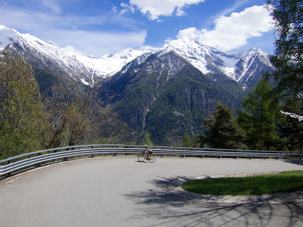
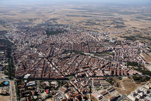
With the Alps visible in the distance, the riders will set off from Livorno Ferraris on their last real rouleur challenge of the race. Originally known as Livorno Vercellese, to differentiate it from the more important Tuscan port city, much like Riese Pio X or Sotto il Monte Giovanni XXIII, the city has been reappropriated in nomenclature to honour its most famous son, though on this occasion it is not a pope but a physicist, Galileo Ferraris, a pioneer of alternators, induction motors and other electrical engineering staples. It's a small town - only around 5000 inhabitants - and is one of the few locations in the race that hasn't been picked for a cycling connection. Instead this is sort of the quiet stage, that there often is at this stage in the Giro Rosa, one of the few stages where it truly resembles men's cycling with a break of the day and a chase and catch for the sprint, or on occasion an unthreatening break is allowed to go; this is as we by this stage have a position where the GC is now established and there are people who are satisfactorily distanced in the GC to be allowed to go (because most women's races are short and there is a tendency for the péloton to ride as one with various short-lived attempts to escape stretching its elastic over and over until it snaps rather than the somewhat artificial break of the day "action" that punctuates many men's races) - we've had a few near misses in recent years from the likes of Rozanne Slik and Ana Maria Covrig, the Romanian champion being a regular presence in these types of escapades owing to decent recovery but not competitive GC chops.

The first circuit is a 22km loop which starts off pan-flat into Bianzè, looping around the small town before heading southwest towards Cigliano. This small Piemontese town has an odd tendency towards Anglophony, with one of the highest incidences of emigration in the north of Italy, having lost a large amount of its population to North America and Argentina in the early 20th Century. A restaurant serving the appropriate fare is named North America, set up by parents of emigrant children, while the sports teams of the town have uncharacteristic Anglophone names - the football team is called "Orizzonti United" and the basketball team is "Basket Silvano".

1988134_1498384427-k3xD-U11003494227571NMC-1024x576%40LaStampa.it.jpg


The road to Cigliano has a vague uphill tendency but nothing tenable for any attacking platform to be created. There's then a slow meandering downhill toward the finish, in the Piazza Galileo Ferraris, as with the stones underfoot and the slight left turn into the sprint, riders will want to have a look at this finale first.

maxresdefault.jpg


After two laps of this circuit, however, we start the second and more important circuit. This 15,4km circuit starts off like the first, heading towards Bianzè, but once arriving there, rather than heading directly through the town the riders turn right, and begin a 4km sterrato section that will be undertaken three times in the stage. The road is narrow, it is exposed, and so it's a bit different to a lot of the challenges of the Montepaschi Strade Bianche one day race.

5794720.jpg


Strade Bianche has a fair few hills in it as well, and that's why often it has been puncheuses and even climbers who've been able to make the most of it - for example Kasia Niewiadoma has been on the podium three times in a row in Siena, but these pan-flat sectors with 9km rolling back to a sprint are a long way from her comfort zone; more powerful rouleuses among the main contenders may have more fun - van Vleuten for example - though I suspect the likes of Ellen van Dijk will have found the climbing too much for her and so would no longer be a threat if she took off here. It may have most to do with the occasional flat races with cobbles we sometimes see, such as the Zeeland stage in the BeNe Tour won by Alice Barnes in a two-up against Marianne Vos last season; in lieu of a women's Tro Bro Léon or Paris-Roubaix these are the kind of directions we need to be looking for a precedent. However even those are problematic as cobbles tend to be a bit more selective than sterrato and also 127km in the Netherlands after a prologue only is somewhat different to a faster and more furious 90km stage in the sweltering heat that often characterises the Giro Rosa, after a week of intense racing.

So, after the sterrato, around 7km remains of the circuit, so we run through the off-road section at around 42-38km to go, 26-22km to go and 11-7km to go. The first half of that 7km is absolutely ramrod straight and so will give the bunch the chance to make up any gaps - but given placement will be key in the sterrato, and none of the contenders will want to be caught behind anything, it's also possible some key helpers will be lost in the shuffle making chasing attacks harder - though getting out of sight and out of mind will be very tough indeed.

There's then a left hand turn at a roundabout where we loop around the southern ring of the Livorno Ferraris bypass, before swinging right with just over a kilometre to go on to Via Molino, however there is a tricky, technical two 90º corners - first right then left - at 500m remaining, before a final right-hander on to the main thoroughfare at 350m from the line. Given the smaller size of the péloton - and that the sterrato should have proven selective - this shouldn't be too much of a problem, and certainly it's nothing like as crazy as some of the finales that the women have had inflicted on them in the Women's Tour or in myriad Dutch races, but nevertheless it's a finish that will require a bit of care as the last thing any key contender wants is to get hurt before the final weekend's drama.
 
Stage 9: Pont-Saint-Martin - Champdepraz-Montavic, 77km

aJ1vBBI.jpg


XFww19Z.png


GPM:
Col Tze Core (cat.1) 16,0km @ 7,6%
Col d'Arlaz (cat.1) 7,5km @ 8,7%
Champdepraz-Montavic (cat.1) 10,7km @ 8,6%

It's queen stage time for the women as we head into... yes, you know it: the Valle d'Aosta.

Look, I know it's pretty predictable, given that my love of the route design possibilities of the region is well-known, but given I wanted to have some steep climbs backing into each other but within a short distance to keep to the Giro Rosa's habitual short queen stages principle when utilizing monster climbs such as these, and especially given that the region is almost totally uncharted territory for the Giro Rosa - mainly as there haven't been any stars from the area in recent years and before that, the longer version of the race from the 80s and 90s would run perilously close to clashing with the Giro della Valle d'Aosta U23 race (which I also failed to take into account in my two-week Giro Rosa before). This year, with the shuffling around of major races due to the World Cup, matching their Tour position in the calendar now has the two races overlapping.

Here, however, we make use of the options of the valley, and hell, if we can do a similar kind of stage where the men do a similar type of stage later in the day like with La Course on Izoard, this could save on problems too.

Pont-Saint-Martin-Il-ponte-%28foto-Kitamura%29.jpg


Anyway, the picturesque town of Pont-Saint-Martin with its preserved Roman bridge has long been the gateway to the Valle d'Aosta, Italy's smallest contiguous region and the only region of Italy not subdivided into further provinces. Being the window into the region has made it a common stop-off for the local race, at one of the extreme ends of the region, but also as a starting point for stages out of the region in larger stage races. Here we use it as the introduction, leading into the region for a stage which loops around itself as we only touch the southeastern corner of the fabled valley.

Rather than do the Perloz loop, which is common in the legendary espoir race in the region (winners include Gianni Motta, Ivan Gotti, Gilberto Simoni, Yaroslav Popovych, Thibaut Pinot and Fabio Aru), we head straight up to Verrès, which astute observers will note means one thing and one thing only where Libertine Seguros-designed routes are concerned: the Col Tze Core. We want to go straight to this as the stage is short, patterned after queen stages like the Stelvio one in 2010, so there's little time to waste on flat terrain.

Col-Tzecore-1.jpg


The hardest single climb of my Giro Rosa, the Col Tze Core is an unbelievably underused potential Giro legend which somehow will only be seeing the Corsa Rosa - of any kind - for the first time in the 2018 Giro d'Italia. The riders will have had little time to warm up their engines before the road turns uphill on the long and drawn out journey to Champoluc. Although a rarity in any other races, it's become a well known beast for the Giro della Valle d'Aosta, most notably in this 2011 stage which was won by Joe Dombrowski ahead of Kenny Elissonde and Fabio Aru. It connects well to many other major climbs of the area, such as Champremier, Breuil-Cervinia, the Col de Saint-Panthaléon (the Torgnon station is one of these routes as there are at least two options on this front) and the Col de Joux (which simultaneously offers multiple options, one which includes almost the full climb from Saint-Vincent, one which reduces it to a shorter climb, offering interesting potential).

TzecoreE.gif


In the women's péloton, this will be a killer. Hell, it's a killer for the men, but especially on the penultimate day of a Giro Rosa, a 16km climb like this, with multiple kilometres above 10%, is going to really hurt the legs and given that the time trial mileage thus far should mean that specialist climbers have time to make up - and especially given the automatic selectivity even without attacks that cat.2 type climbs are creating in the Emakumeen Bira right now, the chances riders aren't spread out all over the mountain on this first 16km climbing odyssey is slim. Which should give us ample opportunity to enjoy the scenery.

15245-800x577.jpg


There are still 48km left to ride after cresting Tze Core, but it's likely that action will commence long before that - I would expect that the first real selection is likely to be made at the kilometre at 8,5% around a quarter of the way up; if we look at similar climber's-last-chance stages such as the Madonna della Guardia stage in 2016, we'll see climbers who had significant deficits trying to make the race early on - Kasia Niewiadoma attacked to go solo from the first climb of the day, and Mara Abbott, even in the maglia rosa, knew that her deficiencies in time trialling compared to the likes of Stevens and van der Breggen necessitated an aggressive strategy. We can certainly hope for racing more along these lines, as this will then hopefully have rid many riders of their domestiques even before that left turn in Quincod that leads to a 3km @ 11% stretch of pain. If the big guns want to keep domestiques, they'll have to go easily enough in the opening salvos that they allow a strong breakaway to go, so that would offer a potentially interesting consideration too.

Strade_Val-dAosta.jpg


Of course, many occasions in the last few years have shown us that in women's cycling more so than men's, going downhill is just as important in creating gaps as going uphill, so it's a good job we have a long and sinuous descent into Saint-Vincent with a number of switchbacks and hairpins to negotiate, especially around the interestingly-named village of Moron. Just think of Mara Abbott losing almost all of a three minute advantage descending from the Mortirolo into Tirano, the Orica team chasing Annemiek van Vleuten down the Jaizkibel, self-same van Vleuten's horror crash out of a certain Olympic gold, or the myriad races lost by Emma Pooley and Evelyn Stevens due to naïveté in the descending department. An intermediate sprint at the bottom of the descent with bonus seconds available also incentivises the early attack so this should be fun.

36967138-1024x768.jpg


With 33km remaining at the sprint in Saint-Vincent, it's hopefully already pretty frenetic, so the riders will be glad of the feed station that follows, since after Tze Core they probably need to replenish their forces, since they're going into another significant cat.1 ascent straight afterwards, the Col d'Arlaz.

ArlazW.gif


Often used by traceurs as a linkway to the Col Tze Core, seeing as it joins the Verrès-Champoluc road after a short steep descent, the Col d'Arlaz is somewhat shorter than its big brother, but no less imposing in sections, with 4km averaging 10% in the middle. Cresting at just inside 20km from home, riders may well see this as an opportunity, especially if some have legs that just aren't answering them today. Here's a look at the climb - barely known outside of the espoir race although the link from it to Tze Core is investigated in this year's edition, which has an interesting stage to Champoluc via Arlaz, Tze Core and Joux. We, however, turn right after that short descent and head back to Verrès, thus descending the same road we climbed earlier, before I include the coup de gras, a barely known little climb to Champdepraz-Montavic, or the hamlet of Covarey at the top of the Mont Avic national park road.

EF08_Img014a_100515_Uscita%20Ferrata%20e%20panorama%20su%20Covarey_big.jpg


With the Centro Visitante and the Mont Avic Resort up here, there's enough room to host at least a smaller race and, unfortunately, the Giro Rosa does fall in to that category compared to the men's equivalent but even so, given what we've seen from Unipublic over the years, there's enough room here easily to host the Giro Rosa even at a larger level than now. It's been used as a climb in the Giro della Valle d'Aosta three times, with Petr Ignatenko and Andrea Manfredi winning road stages in 2010 and 2012 respectively, and a 2011 MTT on the final day being won by Fabio Aru - ahead of Dombrowski, Elissonde and Ilnur Zakarin, so a pretty good field there. Giro MTT shock winner Aleksandr Foliforov was 5th despite giving up quite a bit in age to those ahead of him.

The climb itself is a monster though - the women have taken on some climbs with some seriously steep finishes, such as San Domenico and Monte Beigua, while this year they take on Monte Zoncolan from Ovaro for the first time (the 1998 introduction of the climb was from Sutrio). This is steeper than the former but not as long, while not as tough as the latter but off the back of a much harder stage. And, you know: there's 5km at over 10% in the middle.

Veulla.gif


Patterned after several prior occasions when the women have taken on major ascents, such as 2016 to Tirano over the Mortirolo (78km), 2014 to Madonna del Ghisallo (80km), 2013 to Monte Beigua (73km), 2011 to Torre di Fraele/Cancano (70km) and 2010 to Stelvio (69km), this stage is the shortest of the race, but it's also quite likely to be the one that creates the biggest gaps, with the route being jam-packed with steep climbing of the kind that the women seldom get to compete on over such sustained distances. As arguably the final hurrah of the real climbers and on the penultimate day of the race, this ought to be raced hard and continually, and there are some for whom beating the time cut will be their only hope... this should also set up a grand finale in the final stage too.

04_monte_avic.jpg
 
When the stage is so short though, the x-axis is stretched out and makes the climbs look unnecessarily shallow. Even if one is critical of some organizers' tendency to make climbs look much tougher than they are, I think a bit of "y-axis doping" (as inrng likes to call it) would be in place, as long as you are only microdosing it :p

And overall nice route, even if I cannot evaluate it very well with my limited knowledge of women's cycling.
 
Stage 10: Moncalieri - Basilica di Supergà, 120km

TQKAzhP.png


AxfWsKg.png


GPM:
Supergà (Via dei Colli)(cat.2) 6,0km @ 5,8%
Supergà (Basilica)(cat.2) 4,9km @ 9,1%

It's the final day for the Giro Rosa, so a brisk hour and a bit's train to Torino takes us back to Piemonte for the grand finale. Major city finales are not in vogue in the Giro Rosa at present, Bergamo in 2012 probably the biggest in recent times - however there have also been a couple of finishes at iconic spots, such as 2014 at Madonna del Ghisallo. Here we go for a bit of a halfway house - much like 2017 at Torre del Greco, making the race easily accessible to a large city audience, as then they were close at hand to Napoli, and here we have the huge conurbation of Turin immediately accessible, as well as giving the riders something of a classic cycling location to enjoy a bit of prestige at.

C_a775c4cfa2.jpg


Before that, however, we have a race to get on with. We're starting on the southern edges of Turin's urban sprawl, in the city of Moncalieri. It is a historic city best known for its castle, founded in the 12th century when the city was first inaugurated, and then expanded later, which is a UNESCO World Heritage site as one of the residences of the Royal House of Savoy, along with thirteen other castles, palaces and halls in and around Piemonte. This particular castle was the favourite of Victor Emmanuel II, which has led it a contemporary splendour. With just over 50.000 inhabitants it's a sizable city but usually subsumed within its larger neighbour, whose metropolitan county it belongs to. The city has a couple of notable sporting families. The first is the Boggiatto family, a pair of swimming siblings, an elder male (Alessio) and a younger female (Chiara). In their case both have been to multiple Olympics for Italy, with Alessio being the significantly more successful. The second is the Ratto family, a pair of cycling siblings, an elder male (Daniele) and a younger female (Rossella). In their case, Rossella is the more successful though Daniele has a few significant successes in his own right.

ratto3_672-458_resize.jpg


Here you see Daniele and Rossella with the family. Although they moved to the Colzate area, near Bergamo, quite young, the pair are both born in Moncalieri and Rossella is the main reason for the stage starting here. A bit like the Longo Borghinis, there is a difference in achievement levels between the siblings, with the younger sister being more successful than the older brother, though the difference is not as pronounced as with their compatriots; Daniele retired at the age of 27, and was predominantly one of that class of Italian riders who go well in their one-day calendar, able to put together a strong sprint following a kind of stage that reduces the bunch or in a moderately punchy climb where the pure sprinters are disadvantaged but time gaps are not common - akin to a Gavazzi type of rider. Unfortunately, his peak period in his early mid 20s coincided with a period where he had Peter Sagan as a teammate, so he was instead packaged off to ply his trade picking up placements in races like País Vasco and Burgos with limited sprinting fields. He will likely be best remembered for winning a stage of the 2013 Vuelta from the breakaway, at the Santuari de Canolich in Andorra, a notable mountaintop finish for a rider not renowned especially as a climber.

By that point, however, it was already clear that li'l sis was going to outshine him. Rossella had announced her intentions when she was 14th in the Giro aged just 18 along with impressive finishes in other Italian stage races such as the Giro del Trentino and the Giro della Toscana. She caught the eye of the bosses at Team Hitec Products, the Norwegian team which already had Longo Borghini on board, and had a great season, finishing top 10 in the Trofeo Binda, and continuing to rack up positions in difficult races. She was 12th in the Giro, very consistently finishing in top 20s in each stage but not climbing with the best, and 4th in Ardêche where the climbing field was slightly weaker. She was one of many who withdrew from the Giro della Toscana despite strong GC positions, in protest at unsafe conditions, and then she set tongues wagging with a phenomenal World Championships road race on home roads in Firenze, as she won the bronze medal after coming into the closing stretches accompanied only by Marianne Vos and Emma Johansson. With Hitec unable to keep the two Italians, she moved to the Italian-based Estado de México team for 2014, and was generally awesome again. She won a stage of the inaugural Women's Tour of Britain, and would have won the GC but for bonus seconds, and continued to rack up results. No Giro invite meant we didn't get to see her there, but she had a hot finish to the season, finishing 4th in the Ardêche again, winning the Giro dell'Emilia (so this kind of finish today may be to her liking) and another strong performance in the Worlds, as when the Johansson-Vos-Armitstead-Longo Borghini quartet was away, she shadowed Ferrand-Prévot across to them, however her final position is deflated somewhat by leading out Bronzini after the third group on the road caught back up.

Then it all went wrong. Estado de México collapsed in a colossal funding shortfall, riders got limited training support and pay went awry. Rossella had a quieter year with the Italian INPA team, but on a lower budget, the racing calendar was less good and she got less strong development opportunities and support. She moved to Cylance and has remained there ever since; she has carved out a decent niche for herself and is still a good rider, who occasionally will show you the flashes of the brilliance she seemingly had as an espoir, but it seems she won't become the superstar she was touted as. However, she will sometimes rise up from her slumber, such as when she won the Winston-Salem classic or when she finished top 10 in Liège-Bastogne-Liège earlier this season. I am a fan of Rossella's and I still have hope, despite there having been so many false dawns. She's still only 24, for goodness' sakes.

Cjv1UUjWsAAYJK9.jpg


The first half of the stage is essentially an easing-in after yesterday's short but cruel mountain battles. For a lot of riders, they'll just want to get to the end of the race; long form stage racing is uncommon in women's cycling so ten days' consecutive racing will be tough, especially for some of the smaller teams for whom teenage neo-pros may well be there to make up the numbers, and also knowing the heat will likely be up in excess of 30º for much of the race. There isn't even an intermediate sprint to liven it up, so the riders will probably be happy to play men's cycling type tactics for the day, and allow an unthreatening breakaway to go while they ease in for the first hour and a half or so, until we get to the first intermediate sprint in the town of Chieri.

Dating back to Roman times, Chieri now houses 36.000 people. Moncalieri was originally founded by people fleeing Chieri during its siege by Holy Roman Emperor Frederick I (Barbarossa) but now has outgrown its parent city; Chieri is now more famous for the gunfire massacre in 2002 in which seven people were killed with multiple assault weapons - a fairly small-scale massacre by some standards but still one of Italy's biggest ever gunfire incidents in peacetime.

chieri-centro.jpg


This also directs us back toward the Colline del Po, the small ring of hills to the east of Turin in which we will be finishing the race. We actually traverse them via the easiest way possible at first, simply as this sets up the double climb which will be the defining final feature of the race. And it's a famous one - though we don't tackle it by its famous side first.

The Superga hill that overlooks Turin has a very grand and long history of prestige and of tragedy. It is one of the most prominent hills in the region and is known for its grandiose basilica, which was built in the aftermath of the Wars of the Spanish Succession, in order to house the tombs of the Royal House of Savoy. Completed in 1731, it maintained its regal prominence until the unification of Italy, and since then has become an iconic cycling spot owing to its prominent position as the key selective spot in the oldest one-day race in Italy, Milano-Torino. Historically this legendary semi-classic has finished in the city after a descent of the Supergà climb, but for the last few years, since it was rebooted in 2012 following a few years' absence, the race has finished at the summit, making for an interesting finale which is unclear in its specialisms between puncheurs and climbers. Many great legends of the sport have won the race, including Henri Pélissier, Costante Girardengo (the record-holder with five wins), Fiorenzo Magni, Ferdi Kübler, Miguel Poblet, Franco Balmamion, Gianni Motta, Franco Bitossi, Roger de Vlaeminck, Giuseppe Saronni, Francesco Moser, Gianni Bugno, Laurent Jalabert, Michele Bartoli and Alberto Contador. The course also was the site of the national championships in 2015, but more of that later.

superga_LI33234-U10602655146821dLE--990x556%40LaStampa.it.jpg


There is also some much more macabre but also more important history at the Basilica di Supergà, in the form of the notorious air disaster which took place on May 4th, 1949, when the entire Torino football squad - one of the greatest of all time, and known informally as Grande Torino, and at the time the leaders of Serie A - was killed when the Fiat aircraft taking them home from a game in Barcelona to Torino-Aeritalia airport was approaching from the south with the intention to cut left and descend from the Supergà hill in poor visibility, and veered too far north in the bad conditions; instead of descending through the area south of the hill, above Pino Torinese, the plane turned left and ploughed directly into the embankment of the hill immediately below the basilica, with the hill emerging in front of the pilot giving them no opportunity to react. The two prevailing theories are a miscalculation due to stronger-than-expected crosswinds meaning the plane's course was more due north than thought, and that a malfunctioning altimeter had led the pilot to believe they were at a markedly higher altitude and would comfortably clear the mountain. Everybody on board perished, including the entire team bar the reserve goalkeeper who had been rested and one injured defender, neither of whom had made the trip - 31 died in total, 23 of whom were Torino players. It was a disaster unmatched in the sport until 1965, when 87 people including 22 members of LAN Chile were killed in the Andes. In terms of number of players killed, the disaster was unparalleled until Allianza Lima's fatal flight in 1987 and, unbelievably, only surpassed in 2016 in the Chapecoense disaster. A monument to the lost team - some say Italy's greatest team - stands at the basilica to this day.

italy-piedmont-superga-basilica-torino-football-memorial-turin-january-grande-turin-hill-84436699.jpg


It is therefore a historic and cultural site of great pride and great tragedy in the region, and we will visit it twice on the course of the stage.

Firstly, we approach from the north, on the less well-trodden route from Rivodora. This allows us to differentiate the stage from the classic modern Milano-Torino route and the 2015 nationals route, which climb the traditional Sassi side twice. The categorized part of the climb is from 1,5km to 7,5km on this profile, as we don't go all the way to the basilica on this first time up, instead turning left shortly before the restaurant/bar (marked as Bar on the profile) at the Fontanella croce, which used to serve as the summit when Milano-Torino finished in the city. As you can see, this is a climb which therefore steepens up over the course of 4,5km from around 6% to a final kilometre at 10,5% and final 500m at 12%, before a short descent, flattening out and then a final 500m at 7,6%. After this point, the course is as you can see from Milano-Torino, with the descent through Pino Torinese and past the Observatory. You can view this via the finale from the 2016 race here. This descent then leads us into the final climb, where we arrive just at the east bank of the Po at the edges of Torino's city limits, into the suburb of Sassi, where the rack railway up to the summit begins, and then we have the very last climb of the Giro Rosa, the final chance for the battles to be made and the final chance for potential time to be gained, as this is a nasty little climb and riders can always break. This is definitely tough enough to break somebody.

http%3A%2F%2Fmedia.outdoorblog.it%2Fa%2Fa19%2Fsalita-superga-della-milano-torino-2016.jpg


For most of the women, the Colle di Supergà will be a new experience. But for a few (including Rossella Ratto mentioned above), they'll remember this pig of a final day ascent, because of those 2015 national championships. The women only had to climb the hill once, at the end of an otherwise Unipuerto race, but it also gives us an idea of the kind of gaps to expect:

1 Elena Cecchini (Lotto-Soudal) 3'23'59
2 Elisa Longo Borghini (Wiggle-Honda) +21"
3 Dalia Muccioli (Alé-Cipollini) +23"
4 Änna Zita Maria Stricker (INPA Sottoli-Giusfredi) +56"
5 Tatiana Guderzo (Hitec Products) +58"
6 Francesca Cauz (Alé-Cipollini) +59"
7 Elena Berlato (Alé-Cipollini) +1'08"
8 Rossella Ratto (INPA Sottoli-Giusfredi) +1'22"
9 Valentina Scandolara (Orica-GreenEdge) +1'35"
10 Asja Paladin (Top Girls-Fassa Bortolo) +1'41"

The highlights of that race can be viewed here.

Now, obviously, that wasn't just an all-up-the-final-climb sprint as there were significant moves ahead of it; likewise that was also an unclear predictor of what would happen with the elite péloton on the basis that obviously a national championships is restricted to the riders of that nationality, so a few things would be unclear - how well the big guns like van der Breggen, Vos, van Vleuten, Armitstead/Deignan, Niewiadoma, Ferrand-Prévot, Moolman-Pasio and their ilk would have done, for example, and also how much team tactics played into it given some riders were either on their own or riding for ersatz teams based on their official positions, rather than alone for their trade teams. Also riders who weren't in the contention for the win can happily have just sat up given it is a one-day race, while you may see more competition for places owing to the GC in a stage race. However, as you can see, the climb can open up severe gaps and is not to be underestimated. Which, hopefully, it will be seeing as it's a bit like the Montenars finish in the 2016 Giro, only a bit steeper - there a seemingly innocuous climb that was too big for a puncheur finish and too small for a mountaintop finish saw a quartet of Stevens, Abbott, Longo Borghini and Niewiadoma open up a gap and only 12 riders finish within a minute - and that was stage 2, not the final day! My hope is that because of its comparatively small size compared to Valcava and Champdepraz-Montavic, and because it was previously won by Cecchini who is a good all-rounder but not a specialist climber, it could be underestimated for its GC importance and if we DO have some riders close enough to raise hell in pursuit of the podium or of victory, then they have a proper theatre in which to do so, with ready accessibility for crowds as well. And much like in 2016 when the women could jump into Lake Garda at the finale, we have the scenic finish looking out over the Po floodplain and the city toward the Alps.

I wanted the potential for a grand finale as obviously it's well known I'm not a fan of parade stages, I wanted to make women's cycling more accessible at a couple of points in the race, and I wanted the women to get a chance to compete on some iconic climbs from cycling history. With a final day finish on a famous climb overlooking one of the biggest cities in the country whilst simultaneously not disrupting the city itself (making it logistically more viable), I think the Basilica di Supergà allows me to fulfil all three.

27t-860x450_c.jpg
 
I was doing a Vuelta many months ago, remember? The studies came in and I didn't post the last 2 stages. The last stage was this:
viewtopic.php?p=2199636#p2199636

Now comes the final GC relevant stage:
La Vuelta a Espana Stage 20 Arenas de San Pedro-Avila 122,65 km Medium Mountain
https://www.la-flamme-rouge.eu/maps/viewtrack/105624

KOM SPRINTS:
Collado de la Centenera (1st Category, 1342 m, 15.8 Km at 5.3%, Km 16.4)
Puerto de Serranillos (1st Category, 1565 m, 22.7 Km at 4.6%, Km 56.4)
Puerto de Aguilones (2nd Category, 1179 m, 4.3 Km at 7.4%, Km 79.4)
Puerto de Navalmoral (2nd Category, 1512 m, 14.9 Km at 4.5%, Km 101.0)

Collado de la Centenera:
Collada%20de%20la%20Centenera%20-por%20Arenas-.gif


Puerto de Serranillos:
Serranillos.gif


Puerto de Aguilones:
AGUISUR70.gif


Puerto de Navalmoral:
Navalmoral1.gif


Finish is in Avila after the cobbled climb to the hill. Last chance for GC riders. It can be excellent or very boring.
 
Race Summary
https://www.la-flamme-rouge.eu/maps/tours/view/6174

Total length: 3530,2 kms

9 Mountain stages
4 Hilly stages
3 ITTs
5 Flat stages

3 ESP climbs:
Alto de la Bobia
Pozo de la Nieve
Puerto de San Lorenzo

24 1C climbs:
Coll de Bracons
Santuari de Bellmunt
Coll d' Ares
Aramon Cerler
Lagunas de Neila (El Porton)
Lagunas de Neila
Alto de Urraki
A Barranca
Cruz de Barreiros
Alto de Bustellan
La Corredoria
Puertos del Marabio
Puerto de Somiedo
Puerto de Tarna
Alto de los Bedules
Puerto de Palombera
Portillo de Lunada
Puerto de Piedrafita
El Penon
Puerto del Piornal
El Travieso
Puerto de Pedro Bernardo
Collado de la Centenera
Puerto de Serranillos

5 various categorized uphill finishes:
1C: Santuari de Bellmunt, Aramon Cerler, Lagunas de Neila, El Travieso
3C: Monte Naranco (ITT)
 
Ávila on stage 20 is a perfect opportunity for some action though - people have got to try desperate things unless they're VDB strong.

Nordic Series 13: Tschengla

Yes, back to the Nordic Series, where we take our first trip around an Austrian venue, although with a fair few of the courses thus far some of the proposed stages have spent some of their duration in the country. But yet it's not one of the big Nordic meccas there - don't worry, I will get around to doing Seefeld, Obertilliach, Ramsau and the likes, but I did include stages there in a stage race, so I preferred not to retrace too many steps just yet. Instead, we're off to a little-known venue in the west of the country.

image.jpg


The Tschengla plateau sits in the Bürserberg commune in Vorarlberg, which as you will likely know is a cycling-supportive region, regularly hosting part of the Österreich-Rundfahrt and also sponsoring a team for several years which at one point was Pro-Conti, and even won the national tour in 2015 - quite comprehensively in fact - thanks to exiled Basque escalador Victor de la Parte. That was the same year that Vorarlberg, together with Liechtenstein, hosted the European Youth Olympic Festival. The cross-country events took place in Steg, which is in a valley in Liechtenstein, unfortunately not really offering much prospects in respect of route design, seeing as it's essentially a halfway station on the way to Malbun, and we already know all about Malbun. Helpfully, with the ski jumping in Montafon, the biathlon and the NoCo were in and around the Bürserberg area, including the creation of a brand new biathlon facility at Alpe Rona.

file6faeheayfu02dlb9nx1-500x391.jpg


15jan278j.jpg


Now, compared to, say, Val di Fiemme or La Clusaz, this is a pretty small venue, having stepped up for youth events, so not really settled for the World Cup circus. However, with the route of the ascent, there is the Brandnertal alpine station and the BikePark Brandnertal mountain bike venue at close quarters, there is plenty of capability to accommodate the trappings of a finish here, especially bearing in mind it's unlikely we'd be seeing the Giro, so it's only the smaller requirements of the Österreichrundfahrt, most likely, or possibly the Tour de Suisse, that would need to be considered. You know, seeing as this is, much like other plateau biathlon facilities, something of a one-way, got-to-be-an-MTF kind of venue, a bit like Plateau de Beille, Naturlandia-La Rabassa or Martell-Val Martello. Still, it's a potentially interesting mountaintop finish.

lSlGoGh.png


There you are - 8,5km at 8,1% - similar to La Cobertoria from the west, which was used as a mountaintop finish in the 2006 Vuelta. With a fairly balanced first third, all around the 7% mark, it then hits the overdrive button with the next 3km at over 10%, culminating in a steepest kilometre at around the 2,6-1,6km to go marker, averaging 12,5% and with multiple stretches of 18%. The last 1500m are a lot easier, mostly comfortable climbing with some flat in the middle, so the moves need to be made a bit earlier on to prevent a sprint-from-the-elites-that-remain situation developing. But in the upper parts of the climb it's fairly open - what with being a plateau and all - so getting out of sight to get out of mind could be tricky.

DSCN3157.jpg


Stage proposal #1: Innsbruck - Tschengla, 196km

IEmylcS.png


Starting in the 2018 World Championships host town of Innsbruck, my first proposal piggybacks the current vogue for cycling in the Tirol, as well as harking back to the final stage of the 2015 Österreichrundfahrt, won by Moreno Moser in a reduced sprint thanks to the neutered finale. The early climbs, while we're still in the Tirol, are the harder ones, with two legitimate HC climbs - the eastern side of the Kühtai Sattel - typically used as the main warmup for the Rettenbachferner in the Deutschlandtour, it was last seen in 2013, when the national tour used it as a mountaintop finish. Here it leads almost directly into the savage Hahntennjoch from its tougher eastern face, 17km at 7%, This should hopefully mean that we have a strong break and the mostly false-flat easy side of the Hochtannbergpass is not likely to be particularly decisive. More promising is Faschinajoch, an inconsistent 12km at just under 6% with some flat and some serious ramps, and given that it comes with 36km remaining, including some technical descending for much of it, this will hopefully create some interest before the final climb.

FaschinaN.gif


Otherwise, however, its main function will be to get rid of some domestiques who don't much care for its irregularities, meaning they can provide less assistance on the final ascent up to the Tschengla plateau.

Stage proposal #2: Winterthur - Tschengla, 200km

oc9ilqo.png


This version comes through from Switzerland, and would ideally be a Tour de Suisse mountain stage, followed by a trip from somewhere like Feldkirch or Dornbirn down towards Davos and those iconic TDS climbs in that region.

Whereas the first stage, all in Austria, went straight for the jugular with its two HC climbs straight off the bat, here we slowly build toward the carnage, rather like a Ventoux stage or the 2008 Angliru stage, slowly ramping up the difficulties of the precursors. The punchy Hemberg, gradual tempo drifter of Hochhamm and the inconsistent Schwägalp all chain together nicely to give some good continuity to the early climbs, but then after an uncategorised climb and a descent across the border briefly into Liechtenstein, around the town of Gamprin, home of probably the only currently active Liechtensteinisch sportsperson anybody could name, Olympic bronze medal-winning alpine skier Tina Weirather (she is of course the daughter of two other famous skiers, Liechtensteiner Hanni Wenzel - the only Liechtensteiner to ever win an Olympic gold - and Austrian former world champion Harti Weirather). Then we head through the valley into Austria, and take on the biggest challenge of the day, cresting with 45km remaining - the savage, hors catégorie Furkajoch.

FurkajochW.gif


IMG_3332.jpg


Like a lot of mountain roads in Germanophone Europe, this one reaches an ungodly gradient as it seems those practical Germans/Austrians/Schweizers were more keen on taking the most direct route than their counterparts in Francophone or Italian Europe. Unlike so many of those roads, however, pleasingly this one is a full-blown pass; all too often in Germany and Austria almighty steep roads are one-sided only, to elevated refuges or ski resorts, that are so steep they would kill racing at any other point in the stage. Furkajoch is a pleasing exception, building like a classic Alpine climb, easing off, and then hammering the riders with 7km at an inconsistent 9% to finish. The descent is broken up by a little dig between Damüls and Faschinajoch as we head down the same road as in proposal number 1, albeit with a slight difference in the choice of branch road at the base, enabling us to take on another minor climb (the section from the junction for Blons to Raggal on this profile) to break up the momentum before the finish. Here, there is the temptation if suitably late in the race for riders to give it a dig on Furkajoch, since the final climb is comparatively short, or at least make it tough, to limit the resources available to other riders on the final climb, since the steepness of Furkajoch will prove a warmup.

Stage proposal #3: Vaduz - Tschengla, 170km

ySEZ3i0.png


My third stage is another one that would probably have to be a Tour de Suisse stage but could feasibly be an Österreichrundfahrt one, assuming that Liechtenstein either pays up for a prologue or they include a Malbun MTF, which would be unlikely given the compulsory Kitzbüheler Horn climb and that this stage would also be a mountaintop finish, which would compress your entire mountain block very tightly together. The Tour de Suisse would be much more fertile ground, with this as a stage backing in from a stage with a finish at either Malbun (most likely), Flumserberg or Arosa. I obviously would prefer Malbun, as I do like that climb.

Here we visit some of the tougher climbs available in the tri-state border area, with the cat.2 Ruppenpass (close to Sankt Gallen) the only Swiss ascent before crossing the Alpine Rhine Valley into Austria, and climbing the Bödele Losenpass, a cat.1 climb similar in characteristics to the MTF (8,3km @ 8,4%) only on much better condition and wider roads.

boedele_4.jpg


Here we play with the formula a bit, climbing the Au side of Furkajoch, so bypassing where in proposal 1 we joined up and went via Faschinajoch. The eastern side of Furkajoch is easier than its western element, wearing its steepest gradients at the bottom, but still a worthy cat.1. It also means we can chain it to Dünserberg, another cat.1 climb which crests just 28km from the finish - closer than in either of the preceding stages, giving us greater connectivity of the climbs even if the climbs themselves are less challenging than in proposal number 2.

FurkajochE.gif
DunserbergW.gif


My only concern here is that the steep part of the descent of Furkajoch may be considered a problem which would negate this aspect of the stage entirely. So long as this is passable, however, this is a very viable stage which chains those climbs together quite fluently, minimising the amount of valley roads between the penultimate climb and the base of the Tschengla ascent at Bludenz. This is perhaps the most likely proposal to see action before the final climb, however proposal #2 may be preferred because of that tougher final 7km of the west side of Furkajoch. In theory you could go from Bödele Losenpass over Faschinajoch, then Dünserberg by its easier side, then repeat the run-in from proposal #2 but I thought that would probably be overkill.

Stage Proposal #4: Dornbirn - Tschengla, 184km

mCzybWr.png


The final proposal utilises that Vuelta trope of using the same road twice in different directions, often used to freshen up the Sierra de Madrid stages, but instead of climbs we're using the valley roads and the false flat between said climbs for that purpose, in a stage which is entirely within Vorarlberg and would serve as a good final stage to an Österreichrundfahrt running east to west. We start in Dornbirn, so very close to our finish, beginning immediately with the Furkajoch ascent we're now familiar with and, in effect, cloning the last 80km of proposal #2, save for the actual mountaintop finish which we save for later. Instead we head up through the valley past all of the Montafon facilities, which hosted a range of the 2015 EYOF events.

schruns-montafon-in-winter.jpg


At the village of Partenen, the road splits in two, between the classic Bielerhöhe road (the Silvretta-Hochalpenstraße) and Zeinisjoch/Galtür, a steeper road to a lower summit. I've elected to stick to the major road, but both are valid options, as although the road is a bit less good descending Galtür making the descent more decisive, if you went the other way the climb would be further from the line but steeper, and it's not like descending Bielerhöhe isn't technical - here's video descending the road that the riders would be climbing, cresting 65km from home.

To do this stage as presented, however, the Zeinisjoch would need a new coat of asphalt as a few sections are in a bad, bad way. Reversing the circuit would be more plausible at the time of writing. Either way, whether ascending or descending (ascending better for design, descending better for plausibility), let's agree that the Silvretta Hochalpenstraße looks great.

hochalpenstrasse-silvretta-oeffnungszeiten.jpg


Following the descent, I've broken up the trip back to Bludenz with a cat.2 climb to Bartholomäberg (around 4,5km @ 8,5%). Just over 20km from home, it's a little warm-up, but let's face it, as ever it's going to be all about the finish.

schifahren_02.jpg
 
Nordic Series 14: Liberec (Areal Vesec)

Although a frequent contributor to the sport's pantheon of top level cyclists, the Czech Republic has been relatively low in terms of number of races undertaken on its roads (cyclocross and mountain biking is of course another question). That is slowly in the process of changing, as we now have the Czech Cycling Tour, and the Tours of South and of East Bohemia, as well as the GP Czech Republic, one of the Visegrad series, the small victory that eventually came from former rider Józef Regec's attempts to resurrect the mighty Peace Race. Speaking of the Peace Race, of course, the Czechs are the ones that hold the rights to the name of the iconic Ostbloc battle, and so they also host the U23 Course de la Paix.

Strangely, the situation is almost completely reversed with the women - the Czechs are only a peripheral nation among women's road racing but they have a couple of fairly high standard stage races, the Graciá-Orlová race in April and the Tour de Féminin Krasná Lipá in July, both of which follow around a specific town over around five days.

The city of Liberec has not featured in any prominent races in the last 20 years, despite its status as the fifth biggest city in the country. It has some pretty epic history thanks to its position in a tri-point between the capitals that made up the Peace Race, and with the Jizera mountains around it and the iconic Ještěd TV tower overlooking it, it has been in a good position to be in a decisive position in the race of three capitals.

1280px-jested_letecky_pohled_0.jpg


Before that was there, however, the city had already shown up in the Friedensfahrt, appearing in the very first edition in 1948, in a very short stage which was won by Czechoslovakia's first real cycling hero, Jan Veselý. The preference for Karlovy Vary to be the entrance point to the country coming from the former DDR meant it was 1964 before the city was seen again, with the Belgian team's Jozef Spruyt, a three-time Tour stage winner, victorious. Pietro Guerra won in 1966, Billy Bilsland in 1967, Guido van Sweevelt in 1971 (a stage that began and ended in Liberec), before in 1978 Aleksandr Averin became the first Ostblocker since Veselý to triumph in the city, en route to his overall victory. That was the last time the race finished in the city, though in its dying throes in 1998, there was a stage with a mountaintop finish at Ještěd, which was won by Raimondas Rumšas.

1389078354_G2pIDGYjV28LkHADFSeZMhe2Ii7MNjllxZuadY3_-7RjjuG6j3wfQWm8c4b1yP-SsNSLnj4.jpg


vesec-letecky-min12.jpg


All this brings us to the Nordic connection - the Areál Vesec Nordic arena, which takes pride of place in the southeast of the city and hosted the Nordic World Championships in 2009. With the ski jumps on the Ještěd hill having hosted top level ski jumping and Nordic Combined, the existing cross-country facilities were upgraded to handle the demands of the World Championships, with easy access and the space to handle the top level athletes and the subsequent crowds as close to 200.000 fans packed the trails and some 600 athletes competed across the sports. The World Cup last used the cross-country trails here in 2013, with the renovated biathlon facility at Nové Město na Moravé taking over as the country's venue of choice (it also hosts the MTB World Cup) after being awarded the 2013 biathlon World Championships, which were a resounding success, undoubtedly bolstered by strong performances that year from Ondřej Moravec, Michal Šlesingr and out-of-nowhere breakout star Gabriela Soukalová. Liberec has nonetheless hosted the European Youth Olympic Festival in the interim, and the Ski Jumping World Cup returns to the large hill in the city next season, while the Nordic Combined World Cup has been there a few times also, though the 2014-15 events were cancelled due to a scheduling conflict.

bezecky-areal2.jpg

Plenty of space for facilities at Areál Vesec

Seeing as there aren't many major races in the Czech Republic, these stages would likely need to be used for their national Tour or for some surprising detours for the rejuvenated German race, the Tour de Pologne or a Grand Tour départ. I once considered a three-stage Grand Tour départ (Prague-Prague, Prague-Liberec, Trutnov-Brno) in the Czech Republic - there would be plenty of scope, and there's plenty of love for two-wheeled sport there, it's just it's mostly in the field or off-road otherwise.

Stage proposal #1: Praha - Liberec, 163km

Ra7Suht.png


The first proposal is a straightforward loop, which is in the kind of vein of the point above - potential for an early GT stage if the Czechs ever paid up for a start, for example. It's a fairly ordinary hilly to medium mountain stage, ending downhill so offering puncheurs plenty but also for sprinters who are durable to try to survive. The first half is flat, and then there are two and a half laps of a tricky circuit around the outskirts of Liberec, Ještěd mountain and the cross-country arena.

The loop consists of two climbs, Tetřeví Sedlo (also known as Výpřež), essentially the pass underneath the Ještěd tower and serving as a halfway house on the way there, and Rašovka, a smaller climb on the shoulder of the same mountain, on the opposite side. They both average around 6%, with the former climb being around 6km in length and the latter being around 3,5km in length. Placing the smaller climb closest the finish is both pragmatic from a course design perspective and geographically easier; neither obstacle is super threatening in and of itself, but it will keep riders on their toes, get rid of domestiques and sprinters, and create opportunities. The descent is fairly fast but then there is a stretch from around 2km to go to around 600m to go which is very narrow so positioning will be absolutely key here, and it will be possible to get out of sight and out of mind. With the final time up each climb being 24km and 7km from home respectively, there's plenty of opportunity to make these count.

Stage proposal #2: Mladá Boleslav - Liberec (Areál Vesec), 221km

RauvJYC.png


This is the "fully loaded" version of proposal #1, starting much closer to Liberec and therefore looping around a smaller area, enabling us to utilise all that strong mountainous terrain in the Riesengebirge north of the city. The most important of these early climbs is Smědava, which I used in one of my designs around the Jakuszyce venues, and which is also linked to Nordic sport in another way, as the key note climb in the Jizerská Padesátka (Jizerska 50km), a Visma Ski Classics staple ski marathon in the north of the Czech Republic which has run since the late 60s and has been a pro race since 2000, with the record winner being the Czech national ski marathon icon Stanislav Řezáč.

smedava-jizerska-50-jizerska-padesatka-ski-classics-bezecke-lyzovani-sport-lyzar-51-rocnik-27_galerie-980.jpg


This climb is a fairly stable one, but of a good length to tire out some legs, especially given that in order to return to Liberec and take on our two laps of the circuit used in proposal #1, we have to take on a couple of other smaller climbs, though I did add in Přichovice as a minor detour, which might be overkill for some as you can go directly from the summit of the cat.1 climb to Tanvald without the additional ascent. This also has the benefit of enabling us to descend from Rudolfóv directly into the middle of Liberec city, for an intermediate sprint, thus not confining the racing to the city's outskirts, as well as joining the circuit right near the start meaning the riders only get the one look at the run-in before they have to do it for real. The fully-loaded nature of this one makes this a serious medium-mountain stage as there's really precious little flat terrain for the riders to rest up so that while there are limited stretches that will truly break a field apart, the number of riders able to control it on such a strenuous stage for going up and down tempo will gradually reduce until potentially breaking apart.

Stage proposal #3: Most - Liberec, 197km

Cpgxc59.png


Our third prospective stage introduces a new run-in, and approaches Liberec by a different route. This enables us to use some Sudeten mountain climbs early on, which entails some steeper gradients than are around Liberec itself, potentially causing some riders to be dropped. The first serious climb here, Krupka, is 5,3km @ 9,6% - a serious threat in anyone's language.

krupka-2010-04-13-krupka-hrad-stola-06-_1.jpg


There's also a second steep climb, Děčinský Sněžník, known in the German language spoken by a large percentage of the local population until post-WWII in the region as Hoher Schneeberg, which has an iconic tower overlooking a scenic vantage point. As we are using it as a pass, we bypass the final steep section but we do do the first 4,3km @ 8% which you can see profiled here.

Sni%CC%81mek%20obrazovky%202014-07-25%20v%C2%A013.24.05%20%281%29.png


The middle third of the stage is rolling with only a couple of cat.3 climbs before we arrive in the Liberec region. We enter the city via the southern face of Tetřeví Sedlo, which is 8km @ 4,75% and mostly very consistent - much less challenging than the northern side seen in proposals 1 and 2. At around 45km from home it won't settle much, but it leads directly into the tougher side of the Rudolfov climb, which actually includes the extended section to Bedřichov, totalling 8km at 4,9%, beginning with a steep ramp then 2km false flat, then 4km at 6,5%, a brief flattening out then a final 2km at 6%. 25km from home, it offers the opportunity for some decisive action given it's likely we'd be talking about a field for a 2.1 race here. We then descend into the mountain resort town of Jablonec nad Nisou, hometown of the aforementioned biathlete Gabriela Soukalová, now known post-marriage as Koukalová, a somewhat popular but also divisive figure on the circuit owing to her preening and sometimes overly media-sanitised persona (I personally dislike her, but many do not share that opinion), the veneer of which has come off following her absence from the Olympic season, and a book release where she burns many bridges with her teammates.

jablonec-nad-nisou-czech-republic-winter-panorama-town-jizerske-hory-northern-bohemia-39475559.jpg


This leads us in to a small climb, a cat.3 only, that will lead in to the finish, from Jablonec to the village of Miliře. It's a narrow and sheltered road of 3,3km at around 6%, the first half being at just over 7%, the second half being mainly tempo around 5%. Cresting less than 7 kilometres from the Langlauf-arena, it's the last chance to make a difference. I don't see the sprinters surviving this one as though many will be able to survive tempo on Vypřež and Rudolfov the number of helpers available to control the puncheurs' inevitable moves late on will be limited by the work required to keep the group together after the Sudeten climbs early in the stage, so unless you're a versatile engine AND a sprinter, like a Peter Sagan type, and can do your own work and still sprint afterward, controlling this should be hard.

Ugh, mentioning Sagan and Koukalová in that short order. All we need now is Northug and I'll be about ready to cry in pain. Did I mention that 2009 saw Petter Northug win the 50km? I mean, at least it was 50 skate, rather than classic, but Northug winning a 50 is essentially a crime against skiing, therefore I won't link to it.

Stage proposal #4: Kutna Hora - Liberec (Areál Vesec), 212km

uqQowPM.png


Our final option approaches from the east of Prague, moving northward towards the foothills of the mountains in this corner of the Czech Republic. As a result, like proposal #1, the first half of the stage is flat. We then take on a number of ascents in the area around Železný Bród, as the stage begins to resemble an Ardennes classic (more Liège than the others, mind), going up and down repeatedly as the roads snake into and out of the Iser valley. The most notable climb, to a mountaintop called Kozákov, is around 8km in length and just over 5% in average, but the last 2km average over 8% as it gradually steepens.

riegrova-chata-koz%C3%A1kov-24.jpg


Coming out of Železný Bród, we have further classic cat.2 sized climbs, long enough to rid us of the sprinters, as we snake towards - but never quite enter - Jablonec, as we take two roads up the hillside from the Jizera towards the city but turn back before reaching it, to continue the saw-toothed character of the stage. After a climb to Kopanina which is again at around 5,5% (the decisive climbs in this stage all seem to be at that kind of level) which passes the famous half-destroyed castle of Frýdštejn only 20km remain, but they're all difficult, with an uncategorized climb as we again teeter along the ridge that separates the plateau from the river valley, before a final climb - this is the easiest of the final climbs I have used, just over 3km at 5,5% which is mostly very constant and doesn't really get up above the 10% marker at any point - which crests at just 6km from the line which should prevent anybody from being able to turn this into a large bunch finish, what with the last 45km including precisely zero flat roads.

There may not be any real cat.1/HC mountains to use around Liberec, but part of the benefit of using Nordic venues instead of Alpine ones is that you don't really need them. While, sure, many courses may only see flattish circuit races being possible around them, a location like Liberec gives you the option for serious saw-toothed stages and hilly odysseys without major mountain overkill, and open us up to a kind of racing we do not normally see from any stage finishing in a major skiing town.

800px-MS_2009_Liberec_Vesec1.jpg
 
Critérium du Dauphiné Libéré

During the Dauphiné, as I was bored with the route, I threw together some older ideas of mine (and others) and tried to make an alternative route with a much better macro-design. A race in its own right that offers riders the opportunities for real racing, as I think the race deserves much better than the treatment it gets from the ASO. While it doesn't have four MTFs, it should be hard enough to conduct racing, without being over the top.

C2aFQ4D.png


20px-Time_Trial.svg.png
Prologue: Lyon -> Lyon (4.8 km)
20px-Mediummountainstage.svg.png
Stage 1: Vienne -> Station de Chalmazel (187.5 km)
20px-Plainstage.svg.png
Stage 2: Ambert -> Montélimar (200.3 km)
20px-Time_Trial.svg.png
Stage 3: Orange -> Malaucène (50.8 km)
20px-Mediummountainstage.svg.png
Stage 4: Nyons -> Embrun (232.0 km)
20px-Plainstage.svg.png
Stage 5: Gap -> Aix-les-Bains (186.9 km)
20px-Mountainstage.svg.png
Stage 6: Chambéry -> Chamrousse (139.2 km)
20px-Mountainstage.svg.png
Stage 7: Grenoble -> Villard-de-Lans (175.6 km)

[This post will be updated with the stage details and overall statistics]

20px-Time_Trial.svg.png
Prologue: Lyon -> Lyon (4.8 km)

cKzoYQ0.png


DzDAPwb.png


No intermediate time checks.

An opening ITT in Lyon that takes the riders from Place Puvis de Chavannes to Parc Central, just as in '14. This time, it's shorter and dead-flat, though with 7 right angle bends - including an S-bend that takes the riders through a tunnel under the train station, after which the last 1100m are completely straight. While it begins on the Avenue Maréchal de Saxe, most of the route is on single lane roads and so most of the bends will have to be taken at lower speed, favoring the powerful and punchy riders who can accelerate up to speed after each bend.

20px-Mediummountainstage.svg.png
Stage 1: Vienne -> Station de Chalmazel (187.5 km)

HIOG7F0.png


JJGruke.png


Intermediate sprint: Saint-Étienne, km 80.0

Col de la République, 2nd category (12.1 km @ 5.2 %), km 64.2
Col de Baracuchet, 1st category (17.0 km @ 5.2 %), km 132.2
Col des Supeyres, 4th category (2.7 km @ 5.6 %), km 141.8
Col du Béal, 1st category (13.6 km @ 6.6 %), km 178.5


The first opportunity for the climbers to gain time, this stage will also likely give the yellow jersey to the winner. République and Baracuchet will provide the warmup (and mountain points for the breakaway), before the GC-showdown on Béal. As we saw in '14, it is hard enough for the cream to rise to the top and to make an early selection between contenders and pretenders. There is however still 9 km left after the top, with the last ~3km identical to the finish of stage 2 from '16, so a little regrouping could happen before the punchy sprint or a lonely rider could extend his gap as those behind look at each other.
 
Tour de France 2 by railxmig


Finally i have a Tour that hopefully is good enough to post here. Sadly, writing stuff takes a lot of time and this year i have a lot of work to do it seems. Because of that i decided to do a short synopsis of each stage as hopefully one day i'll post a much more detailed info about these stages.

This tour was created after the reveal of first 3 stages of the 2019 edition. One particular stage is so horrendous that it triggered me to go back to this race and do it myself. I also decided to combine the 2019 opening with what i supposed was the theme of this year's edition – climbs featuring dirt roads. I decided to go with early 2000's design with one elongated mountain block but without a string of 10000 sprint stages in the 1st week as said week is much harder than anything from said time.

I also had done an another tour. That one is a two mountain block option – each on each end of the tour. Sadly, i prefer to cover a bit more of France that its eastern edges but i may come back with a modified design combining both tours. Looking at the stages it looks great but looking at the map it's ridiculous.


https://www.la-flamme-rouge.eu/maps/viewtrack/201076
Stage 1. Gent – Gent, 10,8km, ITT
I2tIZH6.png


Originally the 2nd stage of this tour but because Koutermarkt operates in Sunday i switched it to Saturday. An elongated prologue from Vrijdagmarkt to Korenmarkt featuring plenty of sights, tram lines and 3 cobbled streets of which two are slightly uphill – Kantienberg and Bagattenstraat.

I decided to start in Gent because drawing of lots. I need to admit i got lucky as Gent is one of the best looking cities in Belgium. It's actually one of only a handful of sights i would love to visit myself. No hate for Belgium but in my eyes it's an ugly looking country. Sorry.


https://www.la-flamme-rouge.eu/maps/viewtrack/200022
Stage 2. Gent – Gent, 220km, hilly, cobbles (RVV-style).
Ai4kuAe.png


In style of the 2019 edition i'm also doing two days in the grand départ city. It's also my try at somewhat competently commemorate Merckx and not purposely miss every cobbled sector in the world by a smidge. It's also my first and only venture into the well explored Oudenaarde area as i'm more interested in Brabant south of Bruxelles. I've did this mainly because of historical reasons. I tried to include every more famous hellingen – Kappelmuur, Mont Saint-Laurent, Kruisberg, Kwaremont, Paterberg, Koppenberg, Taaienberg and Eikenberg (40km from the finish). The stage also features some cobbles outside of the Oudenaarde area – Staakte and Donaustraat.

I decided to switch the spotlights from the well known hellingen into some less explored ones north of Oudenaarde – Lange Aststraat and the only Paris-Roubaix like sectors of Molendamstraat and Oost Beertegemstraat (26km from the finish). The design of this stage is more similar to the likes of E3 or Omloop. I hope it's a fine enough Merckx commemoration (even if he was killing it everywhere but let's pretend he was just a classics guy as ASO seems to think). I guess a lot can happen in this stage but i guess the only GC relevant splits will be done via crashes.

cb4Qooi.jpg

dSx5MKO.jpg

Molendamstraat and Oost Beertegemstraat.

Places of interest: Gent (obviously), Oudenaarde, various hellingen around Oudenaarde, Dendermonde, Aalst, Zottegem, Geraardsbergen.


https://www.la-flamme-rouge.eu/maps/viewtrack/196439
Stage 3. Kortrijk – Abbeville, 195km, flat, potential echelons.
BQsY242.png


When doing echelon stages i rarely go near the coast as it's often crowded with seaside resorts and seaside forests. I more often check out the terrain 30-50km inwards and northern France has a number of roads to offer. I decided to limit myself to only 2-car or almost 2-car wide roads. Last roughly 80km have a lot of open space and leads mostly south which is very good for echelons as the wind in northern France is mostly W/SW. Hopefully it'll be mainly a sidewind than a headwind.

f5wNtGc.jpg

PMIDUmz.jpg

A small sample of last 80km.

Places of interest: Kortrjik, Mont Noir, Mont des Cats, Cassel, Saint-Omer, Montreuil, battle of Crécy-en-Ponthieu, Abbaye de Valloires, Abbeville.


https://www.la-flamme-rouge.eu/maps/viewtrack/200366
Stage 4. Eu-Le Tréport – Deauville-Trouville-sur-Mer, 189km, hilly.
XOprA5F.png


A very interesting stage from one urban area consisting of two cities – Eu and a very picturesque seaside resort of Le Tréport to another two-cities urban area of Deauville and Trouville-sur-Mer – both seaside resorts. I decided to not use the hills around Rouen as they're well explored but less charted hills south of Seine of which one – Côte de la Croix-Rouge (near Honfleur) features a short cobbled climb on Rue du Puits. It's a stage created for your Ulissi's, Battaglin's, Gilbert's etc. I'm not expecting any GC shifts but someone like Valverde, Yates bros, Alaphilippe or Bernal may try to win the stage and gain 5-10s + bonifs.

1024px-Le_Treport_Wikimedia_Commons.jpg

The cliffs of Le Tréport.

Places of interest: Château d'Eu, seaside cliffs of Le Tréport, Abbaye Saint-Wandrille, Pont de Brotonne, Boucles de la Seine, Pont-Audemer, Honfleur and Trouville-sur-Mer.


https://www.la-flamme-rouge.eu/maps/viewtrack/200450
Stage 5. Lisieux – Coutances, 214km, hilly/medium mountain, HTF.
uJycjdq.png


My venture into Normandy which doesn't include D-day (yay!) as i'm sick and tired of it while Operation Cobra and battle of Falaise are a bit overshadowed. This stage is dedicated to both aformentioned operations. It's also a flahute heaven with twists, turns, at times narrow-ish roads and plenty of ups and downs. I guess it'll be a crashes gallore and i'm sort of fine with it to test the guys' teams, positioning and bike handling. The finish is in the middle of Coutances on top of a short but nasty and narrow hill featuring ~20% sections (Rue Saint-Pierre and Rue du Puits Notre Dame). Positioning will be the key to success. I assume it's Ala vs Bala and some of GC hopes will die crashing. There's also a small mistake as on top of Côte de Saint-Clair the race goes thorugh Combray (D134 & D254).

1024px-Coutances_vue_nord.jpg

Coutances.

Places of interest: Lisieux, Mont-Ormel, Chambois, Falaise, Suisse Normande, Roche d'Oëtre, Saint-Lô, Coutances.


https://www.la-flamme-rouge.eu/maps/viewtrack/200901
Stage 6. Avranches – La Flèche, 194km, flat.
hygk1NM.png


Finally a day without any gimmicks. The Tour loves this region hence almost any bigger town featured in the race in the last 10 years. Because of that i decided for the overlooked one – La Flèche, home to a historic military school founded by Henry IV – Prytanée National Militaire. This stage does feature a tiny amount of Maine-et-Loire because there's a major hospital in the middle of nowhere. I have so much trouble with the placement of this hospital that i'll leave it for another day.

1024px-La_Fleche_-_Prytanee_02.jpg

Prytanée National Militaire, La Flèche.

Places of interest: Avranches, Mortain (Operation Lüttich), Laval, Durtal, La Flèche.


https://www.la-flamme-rouge.eu/maps/viewtrack/200783
Stage 7. Châtellerault – Poitiers, 42,4km, ITT.
h2u7KPH.png


One of the oldest stages i've created and finally i can use it. It's mainly dedicated to the history of Poitiers – one of the oldest and historically most important cities in France. It starts in Châtellerault – home to the remains of the first Poitiers. This time trial includes a number of hills in Forêt de Moulière and a short but steep ramp of Rue de la Barre on the northern outskirts of Poitiers. I hope 42km will be enough for TT specialists as it's the last test against the clock of the race.

Poitiers_hill.jpg

Poitiers.


https://www.la-flamme-rouge.eu/maps/viewtrack/200804
Stage 8. Poitiers – Guéret, 170km, hilly, breakaway heaven.
11GWsFr.png


For Saturday i have a stage ready of many, many visuals France has to offer or... complete wasteland of Limousin finishing in Guéret in the middle of this nothingness. It's still one of my favourite cities in France mainly because of it's remoteness, where everything is untouched by modern civilisation. Ok, let's get serious – there are two good hills around Guéret which hopefully will provide some action in the breakaway for the last 15km as i guess the peloton will roll 15 minutes behind. If you're lucky you may win the yellow and then try to do a Voeckler.

Places of interest: Poitiers, Le Dorat, Guéret.


https://www.la-flamme-rouge.eu/maps/viewtrack/200561
Stage 8. Guéret – Vulcania Park, 196km, medium mountain, pseudo-MTF.
WARxrvv.png


Climbs:
Côte de Manson – 7,6km, 6,6% (max 16-18%), cat. 2, 886m
Col des Goules – 8,8km, 6,2% (max 12%), cat. 2, 975m

My own take on Massif Central. I've decided to focus on the northern edges of the region which i feel is slightly less explored but Puy de Dôme and maybe Circuit de Charade. I decided to place my finish near the Vulcania Park near Puy de Lemptégy just north of Puy de Dôme. Sadly, it seems amusement parks in France have a hard time living (Disneyland Paris) so i doubt it might be a viable replacement of Puy de Dôme. This stage also features the first cat. 2 climbs of the race – Côte de Manson (Charade) and Col des Goules. The first climb includes the first 1,3km at 11,5% to Puy de Montaudoux (via a very narrow underpass under rail tracks) and the second climb has the first 4km at 7,6%. Last 3,7km are mostly flat but the last 400m are slightly uphill. I guess it should be a fine terrain for first minor GC skirmishes.

GoulesE.gif

Profile of Col des Goules.

Places of interest (plenty of them this time): Guéret, Ahun, Aubusson, Viaduc des Fades, Gorges de la Sioule, Meandre de Queuille, Gour de Tazenat, Château de Chazeron, Châtel-Guyon, Riom, Clermont-Ferrand, Royat, Vulcania Park.

To keep the posts relatively short i'll be posting one week per post. Next week should be either tomorrow or day after tomorrow.
 
railxmig said:
Finally i have a Tour that hopefully is good enough to post here. Sadly, writing stuff takes a lot of time and this year i have a lot of work to do it seems. Because of that i decided to do a short synopsis of each stage as hopefully one day i'll post a much more detailed info about these stages.

This tour was created after the reveal of first 3 stages of the 2019 edition. One particular stage is so horrendous that it triggered me to go back to this race and do it myself. I also decided to combine the 2019 opening with what i supposed was the theme of this year's edition – climbs featuring dirt roads. I decided to go with early 2000's design with one elongated mountain block but without a string of 10000 sprint stages in the 1st week as said week is much harder than anything from said time.

I also had done an another tour. That one is a two mountain block option – each on each end of the tour. Sadly, i prefer to cover a bit more of France that its eastern edges but i may come back with a modified design combining both tours. Looking at the stages it looks great but looking at the map it's ridiculous.
Using Mont Saleve in stage 2 is awesome. I like the finish at Col du Calvaire. Your Guzet-Neige stage is very good. I like your Andorra stage, maybe you could've put Comella? I like the stage to Menton a lot as well. Nice to use Station Mourtis as well. Some cobbles and the stage to Epernay are good as well. And of course the finish at Versailles. Maybe you could have put some more ITT kms though?

EDIT: I was waiting a lot for you to make one stick to make a comment, now you changed it again so my comment is meaningless now. :D
 
There's plenty of nice enough cities in Belgium, but if you do go to Gent do it during the Lichtfestivaal. I very much like the Gent-Gent stage although there is some trepidation at no Molenberg on the run-in - add that and you have a nice little version of Omloop of course, though you wouldn't expect to see the Koppenberg there seeing as it wouldn't be special in the Ronde if it was used in other classics (a one-off like Le Tour might be viable though seeing as it's months after that Sunday in April). Given your penchant for detail, railxmig, once you fill out proper fully fleshed out stage details, a single post covering an entire week's worth of stages will be a FORMIDABLE post.

These moves in the direction of Grand Tours brings me back to my favourite topic, of course, and that's the Spanish GT. I was working on a women's Tour of Denmark, a Vuelta a Colombia, and a couple of other Nordic Series posts, but it's been over a year since I ran through a Vuelta, and I'm at the stage of there being so many Vuelta concepts coming to mind that I'll have about ten full Vueltas cued up for release and just spam the thread with them and that'll be no fun for anybody. Given the length of the undertakings, Grand Tours can get quite a chore to get through. The other thing is that, posting in different orders affects which summits I go for due to my "no repetition in MTFs" rule - although after this edition (the 10th) I might relax that slightly with a very strict caveat: only barring repetition in road stages, to enable me to use a climb I have previously only used in an MTT since I won't have explored its route design possibilities fully that way.

After nine previous Vueltas, there are a lot of climbs that are therefore off the MTF menu. Angliru, Lagos de Covadonga (MTT previously though), Hazallanas, Cobertoria east, La Pandera, Cálar Alto southeast, Mont Carò, Els Cortals, Cerler, Formigal, Cumbres Verdes, La Morcuera south, Fuente del Chivo, El Morredero (MTT previously though), even Senhora da Graça... a lot is off limits now. Luckily, however, I have a somewhat experimental Vuelta on the cards, and given that we know, well, the Vuelta is playing catch up when it comes to using the terrain at its disposal, there's still plenty to discover since, like Italy, Spain does have the benefit that there are options for real variety in pacing rather than the mountains being concentrated in two specific areas like in France.

Vuelta #10

Stage 1: Madrid - Madrid, 6,1km (CRI)

q7SyUtE.png


NfSIkUS.png


This is, paradoxically, one of the biggest innovations of my course design and also the stage I will probably write the least about, not least because there isn't a great deal to write about it. After all, in a world of dramatic choices for the Grand Départ, starting the race in the capital of the country it tours is hardly a left-field choice. Except, really, it sort of is, because at least since Unipublic took over the organization of the race from El Correo-El Pueblo Vasco and the race's traditional finishing home of País Vasco was taken out of circulation, the race has, after a brief period of uncertainty over where it should finish, settled on the nation's erstwhile capital and largest city as its permanent finale. The Vuelta does still occasionally break that mould in a way that the Tour never does - 2014 finished with an epilogue in Santiago de Compostela, for example - but the race is still far more tied to a single finishing location than the Giro. I have only finished away from Madrid once in all of my Vueltas - Vuelta #4 began in Casablanca and ended in Barcelona - but here we're going to break from tradition and finish away from Madrid, because we're starting there instead.

One thing that this does play havoc with is, what happens to the women's Madrid Challenge, which takes place on the same finishing circuit as the mens' final parade stage? Two options: Unipublic moves the women to compete on a similar course to the men on a different day of the race, like is happening with La Course at the moment (for my money stages 9, 14 and 17 are the best suited to this), or Unipublic pulls their fingers out and gives the women a proper goddamn race instead of a pan-flat pseudo-crit.

histoire.jpg


Either way... I won't bore you all with the backstory of all the times the Vuelta has been to Madrid, because it's been practically every year, starting with the départ of the very first Vuelta, a 185km test to Valladolid, won by Belgian Antoine Dignef, who finished 3rd that year. Initial iterations of the race started and finished in Madrid, and it was only with the reboot of the race in 1955 under the control of El Pueblo-El Correo Vasco that this changed - though 1948 was the only time we got a Madrid ITT to start the race. It remained a continual presence on the route, often hosting circuit stages as well or out-and-back stages looping around the nearby Sierra de Guadarrama or on a circuit of the Cruz del Campo. In 1959 it served in the same function as here, as a départ for a race finishing elsewhere, and in 1963, 1964 and 1971 abortive attempts were made to reinstate the capital as the race's final destination - the latter being such a disappointment that the following year saw the first time the race didn't stop in Madrid at all. 1974 was the only edition until Unipublic took over the race five years afterward that saw the capital en route, but once the current owners were set in their current position, they swiftly turned a final day 84km stage in the capital into their finale of choice, and though 1985 and 1986 saw Salamanca and Jeréz de la Frontera, respectively, take final stage honours, in 1987 the race returned to Madrid for good. So listing every stage, every winner, and so on, would take days.

Similarly, going through the history of the city is not a viable option - there's a) a lot of it, and b) little relevance to why it's been picked as a stage host, which is usually how I like to colour these posts. It's pretty self-evident why I've chosen to start the race in Madrid: because I'm not going to finish it there.

Recorrido-Madrid-%C3%BAltima-etapa-vuelta-a-espa%C3%B1a.jpg


Therefore we have this, a prologue which is set up on the same roads as that usual finale, a 6km circuit up and down the Paseo del Prado, diverting to the west to head onto Gran Vía, before finishing at the Fuente de Cibeles.

1441793912_bb56e6793e9681b7f370e181a22ffe3e.jpeg


The other thing is that prologues seem to have become a dirty word to the Grand Tour organizers. As it is well known that I am not an advocate of the Team Time Trial, then so long as race organizers continue to design such poor stages when they want to start with a road stage (Prudhomme, I'm specifically looking in your direction here) there will be little better option than a prologue. It's short, it's fast, it enables the fans to see every rider individually and ensures that there are some gaps on the GC immediately. What's the problem with that, that is solved by an artificial means of separating riders that automatically benefits the riders who already have the biggest benefit - the strongest support squad - already, regardless of their actual talent level against the clock? What's the problem that is solved with a pan-flat first road stage that ends up with everybody on the same time and usually results in crashes because everybody's trying to protect their GC position?

Maybe we need a crowdfunding campaign or at least a hashtag for social media: save our prologues.
 
Forever The Best said:
railxmig said:
Finally i have a Tour that hopefully is good enough to post here. Sadly, writing stuff takes a lot of time and this year i have a lot of work to do it seems. Because of that i decided to do a short synopsis of each stage as hopefully one day i'll post a much more detailed info about these stages.

This tour was created after the reveal of first 3 stages of the 2019 edition. One particular stage is so horrendous that it triggered me to go back to this race and do it myself. I also decided to combine the 2019 opening with what i supposed was the theme of this year's edition – climbs featuring dirt roads. I decided to go with early 2000's design with one elongated mountain block but without a string of 10000 sprint stages in the 1st week as said week is much harder than anything from said time.

I also had done an another tour. That one is a two mountain block option – each on each end of the tour. Sadly, i prefer to cover a bit more of France that its eastern edges but i may come back with a modified design combining both tours. Looking at the stages it looks great but looking at the map it's ridiculous.
Using Mont Saleve in stage 2 is awesome. I like the finish at Col du Calvaire. Your Guzet-Neige stage is very good. I like your Andorra stage, maybe you could've put Comella? I like the stage to Menton a lot as well. Nice to use Station Mourtis as well. Some cobbles and the stage to Epernay are good as well. And of course the finish at Versailles. Maybe you could have put some more ITT kms though?

EDIT: I was waiting a lot for you to make one stick to make a comment, now you changed it again so my comment is meaningless now. :D
I think you're talking about this tour which i've thrown away because i didn't really liked it besides the Calvaire, Épernay, Andorra and Menton stages. That was my try at doing sort of a 3 mountain block race but i prefer to cover a bit more of France and somewhat contribute to this thread by showcasing some new things than copying others work. I still think maybe it's possible but with bigger transfers. For example: start with two serious mountain stages (probably in the Alps), go straight to northern France and then alongside the Atlantic coast to a hilly Normandie weekend, start the 2nd week with Pyrenees and then head to Massif Central and then have two serious mountain stages in Provance in the 3rd week.

Tour de France 2 by railxmig. Part 2.

https://www.la-flamme-rouge.eu/maps/viewtrack/210567
Stage 10. Mende – Brameloup Ski, 169km, medium mountain, HTF.
G7wTrUG.png


Climbs:
Col de Montmirat – 5km, 5%, cat. 3, 1046m
Col de Saint-Rôme – 7,1km, 6,9%, cat. 2, 909m
Côte de Montbanast – 4,8km, 4,2%, cat. 4, 882m
Montée de Naves d'Aubrac – 10,9km, 6,2%, cat. 1, 1138m
Montée de Brameloup – 6km, 4,8%, cat. 3, 1244m

A medium mountain stage mainly in Gorges du Tarn finishing on a very, very obscure ski station, which sadly i doubt will ever be featured in any more recognizeable race. Interestingly, there's quite plenty of space available but i guess no money on offer. This stage will probably change as i'm not sure if i want to see Naves d'Aubrac as it was just used in the Tour (is'm shocked it was though) but there are a number of options but none of them are cat. 1. That would also mean Montée de Naves d'Aubrac is the first cat. 1 (just barely) of the race. Last 40km feature a sizeable number of ups, downs and quite narrow roads. You won't win the Tour here but you may lose it (via crashes obviously). BTW, i wonder how many undiscovered ski station in very obscure places are there yet to be found.

altimetria-naves-de-aubrac-159521130594fc.jpg

Profile of Montée de Naves d'Aubrac.

Places of interest: Mende, Gorges du Tarn, Sainte-Enimie, Grotte de l'Aven Armand, Château de Blanquefort, Sévérac-le-Château, Brameloup (because of its remoteness).


https://www.la-flamme-rouge.eu/maps/viewtrack/210603
Stage 11. Millau – Narbonne, 169km, hilly.
ZZxR3c0.png


Just a transitional stage through Haut-Languedoc before the first part of the only mountain block of the race.

Places of interest: Viaduc du Millau, Roquefort-sur-Soulzon, Château de Montaigut, Lacaune, La Salvetat-sur-Agout, Lac du Laouzas, Narbonne


https://www.la-flamme-rouge.eu/maps/viewtrack/203965
Stage 12. Salses-le-Château – Ascou-Pailhères, 181km, mountain, (almost) MTF.
NBjfRnU.png


Climbs:
Col de Creu – 22,7km, 4,7%, cat. 1, 1712m
Col de Pailhères – 14,9km, 8,2%, cat. HC, 2001m

I decided to quote myself from the unfinished full description of this stage:
Paillères, introduced in 2003, was featured plenty of times in the Tour. So, what's new with this approach? I did a slightly modified route of the climb, making it slightly shorter but also overally steeper. The first change is in taking a direct route (D216 or Champ du Soula) from Usson to Rouze. It's 1,3km at roughly 10,5%. The road is not that narrow but it might be slightly out of shape as it's not as often used.

3VmZN7p.jpg

Champ du Soula (D216) in 2010.

The 2nd change is near the top and it's an alternative D25C near Col des Trabesses (1916m). It's 550m (shorter by 1km from the normal approach) at 9,6%. This little shortcut seems to be mostly unused but surfaced. Those shortcuts makes it 14,9km at 8,2% which is a pretty fair HC cat.

8Bb20Sh.jpg

D25C in 2009.

The finish line is 650m after the top on a quite sizeable parking lot of the Ascou-Pailhères ski station which makes it almost the first proper MTF of the race. It's not shown on profile as it would visually destroy it unless i would made the KOM line on the finish which would be kinda stupid.

PailheresE.gif

Profile of the classic side of Paillères.

Originally i thought of doing the other side of Paillères which would have the benefit of never being raced in a relatively big bike race but i found it a bit underwhelming. That side is all about the last 5km at roughly 9% which i think would make the race a bit lacklustre. The side i've chosen is more regular with only two small false-flats and two harder parts right at the beginning and near the top.
I'm still unsure if i want Jau, which i'm not sure if it's possible in the modern Tour, Creu or Llosa which will never see the light of the Tour (Gorges de Cabrils) or Quillane, which is the most probable. I hope Pailhères will be a fine enough first MTF and HC climb of the race.

Places of interest: various citadelles of Côte Vermeille, Villefranche-de-Conflent, Mont-Louis, Col de Creu, Château d'Usson


https://www.la-flamme-rouge.eu/maps/viewtrack/210945
Stage 13. Ax-les-Thermes - Col de Pause, 186km, mountain, MTF, dirt.
hqyx7B4.png


Climbs:
Col de Chioula – 9,4km, 6,8%, cat. 1, 1431m
Col de la Babourade – 3,6km, 4,7%, cat. 4, 654m
Port de Lers – 11,4km, 7%, cat. 1, 1517m
Col d'Agnès – 4km, 7,3%, cat. 2, 1570m
Col de Latrape – 5km, 7,4%, cat. 2, 1110m
Col de Pause – 9,1km, 9,4%, cat. HC, 1545m

White roads:
Col de Pause – 3,1km, ****

I have an almost fully done description of this stage but here i'm only going to put an excerpt of it:
Pause is very similar to Menté, which means borderline 1/HC territory. It's always hard to judge, which category to give in such cases. I decided to upgrade it to HC mainly because of the last 3km on dirt. Otherwise it probably would be cat. 1. Besides, it also gives me 7 HC climbs in the race and Tour likes to have 7 of them.

Col_de_Pause_Couflens_profile.gif

Profile of Col de Pause.

I've wrote a small piece about this climb here. In short – it's relentless 9% with last 5km at 10% with a nice backdrop over a lushful green valley. If you're on MTB you can go as far as Port d'Aula (2260m) on the French-Spanish border. Port d'Aula is 18km at 8,7%, kinda comparable with Portet. Because of a bug the profile doesn't show the last 3km are on dirt. Yes, it's not Portet but i heard they want to surface it in its entirety. I'm not planning on surfacing Pause, but only 1km between tarmac and dirt, which is on very broken tarmac.
That's my try on the dirt climbs concept. There'll be another stage with this concept in mind.

Places of interest: various Cathar castles, Tarascon-sur-Ariège, Grotte de Niaux, Vallée d'Ustou, Col de Pause


https://www.la-flamme-rouge.eu/maps/viewtrack/211028
Stage 14. Saint-Lizier – Barèges-Tournaboup 1450, 183km, mountain.
o9MQ4NN.png


Climbs:
Col des Ares – 6,5km, 4,7%, cat. 3, 797m
Port de Balès – 11,8km, 7,7% (max 14%), cat. 1, 1755m
Col de Peyresourde – 9,7km, 7,6%, cat. 1, 1569m
Col d'Aspin – 11,9km, 6,6%, cat. 2, 1490m
Col du Tourmalet (Souvenir Jacques Goddet) – 13km, 8,6% (max 12%), cat. HC, 2115m

Trying to revive a dead horse. I've did this because i really like Tourmalet. It's still one of the hardest climbs in the Pyrenees even if it doesn't do much as normally it's a points gallore for the breakaway somewhere in the middle of a stage and it does suffer from oversaturation. However, last time the eastern side of Tourmalet was properly ridden in i think 2004 with the finish at La Mongie (won by Ivan Basso in front of Lance Armstrong) and fully in 2003 when Jan Ullrich tried something on Armstrong and it was a fine try resulting in dropping Vino.

Tourmalet2.gif

Profile of Tourmalet.

The finish is in Barèges-Tournaboup. There are two ski stations on each side of Tourmalet. They're part of a ski area of Pic du Midi. La Mongie is well known and it was used as a finish in 2002, 2004 and in 1970, when Bernard Thévenet won. There's also a less known station on the other side of Tourmalet called Tournaboup (also Barèges-Tournaboup, Superbarèges and Tournaboup 1450). It's part of the spa town of Barèges on the lower slopes of Tourmalet. It's roughly halfway up the western side of Tourmalet. It's characterised by a quite large parking lot.

rando%2Bcol%2Bde%2BBar%25C3%25A8ges%2Bdepuis%2BBar%25C3%25A8ges.jpg

Tournaboup.

The finish is after an 8km long, quite technical descent. Hopefully this stage will force the peloton to properly ride the eastern side of Tourmalet as last time i think it was in 2004. Even if nothing will happen (which is kinda unbelievable) at least Tourmalet being on Saturday and close to the finish line will gather lots, lots of crowds.

Places of interest: Saint-Lizier, Bagnères-de-Luchon, Saint-Bertrand-de-Comminges, Tourmalet


https://www.la-flamme-rouge.eu/maps/viewtrack/212181
Stage 15. Tarbes – Marmande, 181km, flat.
K4hJJAK.png


Having a flat stage on Sunday is not the best usage of a weekend but i had a finish planned in Marmande since 2013 or 2014, when i read somewhere that the was interested in a Tour stage while they were heavilly pushing for i think Bergerac because accoring to ASO in western Occitania only it and Perigeux exist. It's also there to somewhat separate the big mountain block into two but just two days is hardly a separation. This stage is sponsored by the Armagnac wines.

Places of interest: Tarbes, Saint-Mont, Nogaro, Eauze, Abbaye de Flaran, Condom, Nérac, Buzet-sur-Baïse, Marmande
 
Afaik, it was only in 2007 that they didn't go by Champ du Soula.

EDIT: wait, or was that the Le Village road I'm confusing it with?!

EDIT2: Just confirmed. It is indeed Champ du Soula that is usually taken, but Le Village that is not.
 
Re:

Netserk said:
Afaik, it was only in 2007 that they didn't go by Champ du Soula.

EDIT: wait, or was that the Le Village road I'm confusing it with?!
Thanks for the info. I was using this Google Maps chart as my research but i guess it's wrong.

EDIT: This LE Village road looks kinda unaccessible. Otherwise i would include it.

EDIT 2: I've decided for a quick research. According to this profile it's 15,3km long. if the climb starts from D16/D118 crossroad at Usson-les-Bains then this climb is indeed 15,3km including Champ du Soula.
 
I like your cobbled stage and the one to Vulcania Park. Seeing some more obscure climbs like Col de Pause is very good. Nice first MTF with Paliheres and using Tourmalet in a relevant way with a descent finish is very good too. Liking the use of Naves d' Aubrac in a close way to the finish unlike that Tour stage.
 
Tour de France 2 by railxmig. Part 3.

https://www.la-flamme-rouge.eu/maps/viewtrack/201399
Stage 16. Die – Pipay-les-Sept-Laux, 176km, mountain, MTF.
VBlA71L.png


Climbs:
Col de Rousset – 18,1km, 4,6%, cat. 2, 1254m
Côte de Saint-Julien-en-Vercors – 4,6km, 4,3%, cat. 4, 917m
Col de Palaquit – 15,6km, 5,9%, cat. 1, 1154m
Côte du Tournoud – 8,9km, 7,4%, cat. 1, 1006m
Montée de Pipay-les-Sept-Laux – 19,3km, 6,9%, cat. HC, 1564m

The Belledonne massif is more known for Allevard and Val Pelouse. Interestingly Pipay doesn't seem to have too much love even if it's basically La Plagne but 1km shorter. Pipay is the smallest of Les-Sept-Laux stations which include Prapoutel (1980 Tour) and Pleynet (1981 Tour). It's good 35 years since the Tour visited any of said stations. As a run-up i'm using Palaquit and Tournoud (Margains) which includes the first kms of certain Col du Coq. I decided to start in Die because i like the name and i already have Condom on the previous stage. Sadly, Corps was just out of my reach. While it's technically one of the hardest climbs in this Tour it's only an inauguration to the 2nd part of the main mountain block so it's mostly to give hurt to the legs as i'm expecting the main action to ensue later.

stage-13-col-de-palaquit.png

Profile of Palaquit.

MargainsS.gif

Profile of Tournoud.

PipayLesSeptLauxN.gif

Profile of Pipay-les-Sept-Laux.

Places of interest: Die, Vercors massif, Gorges de la Bourne, Grenoble and its local forts.


https://www.la-flamme-rouge.eu/maps/viewtrack/197283
Stage 17. Pontcharra – Moûtiers, 190km, mountain.
Vx231tE.png


Climbs:
Montée de la Table – 8,2km, 7%, cat. 1, 898m
Col du Grand-Cucheron – 3,4km, 6,9%, cat. 2, 1188m
Col de la Croix de Fer – 22,4km, 7%, cat. HC, 2067m
Col du Mollard – 5,7km, 6,8%, cat. 2, 1638m
Col de la Madeleine – 18,8km, 8%, cat. HC, 2000m
Côte des Emptes – 2,2km, 9,8%, cat. 2, 692m

The only 5000m gain stage but there's a bunch of over 4500m ones. Originally it started as the last stage of the mountain block. Next i've moved the finish to Valmorel but because i have more than enough MTFs i've ended up with something in between. This is my last real venture into both Croix de Fer and Madeleine which both are one of the hardest climbs France have on offer. This time i decided to combine both the hardest sides in one stage. I decided for the Montgelaffrey option for Madeleine but i think it's just as hard as the regular route. The highlight of this stage is Côte des Emptes – a very steep and narrow road to Les Emptes on the lower slopes of Valmorel. It can be used as the bottom of Valmorel to maybe ensure a higher selection of doms. If it's the last stage then Madeleine is carnage but in this instance i think it'll be a reduced GC group fightning on Emptes.

CroixDeFerNW.gif

Profile of Croix de Fer.

MadeleineSW.gif

Profile of Madeleine.


https://www.la-flamme-rouge.eu/maps/viewtrack/210334
Stage 18. Albertville – Verbier, 191km, mountain, H/MTF, dirt roads.
UZ0FJBR.png


Climbs:
Col du Lein – 14km, 8,8%, cat. HC, 1695m
Montée de Verbier – 10,4km, 6%, cat. 2, 1468m (Chemin du Diablay – 6,1km, 9,8%)

White roads:
Col du Lein – 1,5km, **
Chemin du Diablay et Route du Soleil – 6km, ***

My 2nd and last stage featuring climbs with dirt. I'm not as psychic towards Lein as some peeps seems to be but i've included it because it features a smidge of dirt at the top. If not this i wouldn't go for Lein as it's a very hard climb and i prefered to go slightly easier on this stage to maybe encourage some racing on the previous two. There's Champex and Planches as viable alternatives so it's not a problem.

Now a bit more about this weird approach to Verbier. The route i've taken starts in Montagnier and consists mainly of Chemin du Diablay – a small and very steep road of which last 2,7km are on a quite difficult dirt. The climb ends when joining Route du Soleil (5,4km from the finish) and after 500m on tarmac it's time for an easier, but very bumpy 2,8km on Route du Soleil. After 850m the race rejoins the classic side of Verbier. For now the finish line is quite low but it is possible to put as high as ~1650m.

2PQj4Hp.jpg

n06IWDP.jpg

Chemin du Diablay.

6K3utzA.jpg

6K3utzA.jpg

Route du Soleil.

I think the showdown will be on Chemin du Diablay with a tug of war on Route du Soleil. I think Lein will also provide a fairly sizeable selection while Saisies almost always delivers a lot of racing. The time splits can be quite large.

Places of interest: Megève, Saint-Gervais-les-Bains, Chamonix-Mont-Blanc, Martigny, Verbier


https://www.la-flamme-rouge.eu/maps/viewtrack/209816
Stage 19. Martigny – La Chaux-de-Fonds, 211km, medium mountain.
F21VL3p.png


Climbs:
Col des Mosses – 18,8km, 5,5%, cat. 1, 1445m
Côte des Lignières – 4,4km, 8,1%, cat. 2, 797m
Col du Chasseral – 8km, 8,6%, cat. 1, 1502m
Col du Mont-Soleil – 4,5km, 9,5%, cat. 2, 1249m

Like in 2016 it's a stage entirely in Switzerland mainly because Genève prefers to be outside of France. It's not really bad as i have a slightly different run-in to La Chaux-de-Fonds ready as i'm sick and tired of Vue-des-Alpes. You can sort of compare Chasseral and Mont-Soleil to Menté and Portet-d'Aspet while La Chaux-de-Fonds finish can be sort of compared with Saint-Girons. The top of Chasseral is 36km while Mont-Soleil is 20km from the finish line. If it was in the middle of the race i guess it should solely be a breakaway affair but at the end of the race and an extensive mountain block there may be a chance of major GC action in the last 30-20km.

sI7Jw8I.jpg

A mock-up profile of Col du Chasseral. The false-flat is closer to 4km than 5km long.

SoleilS.gif

Profile of Mont-Soleil.

Places of interest:
Martigny, Abbaye de Saint-Maurice, Aigle, Gruyères, Bulle, Romont, Avenches, Mont-Vully, Saint-Imier, La Chaux-de-Fonds


https://www.la-flamme-rouge.eu/maps/viewtrack/211222
Stage 20. Pontarlier - Dijon, 186km, hilly.
90UVKOB.png


It's back to France with the only stage in the non-mountainous eastern part of the country – Bourgogne. This stage is here because the Paris one won't be a parade and i prefer to have a finish in a city with decent TGV connection with Paris and whereabouts. Dijon should be more than ok for that. Of course Bourgogne is famous for its wine and this stage is sponsored by it. Rather than for a bland sprint finish i decided to feature some amount of the hills of Côte d'Or near the finish. The run-in to the finish is also technically quite complicated.

59e8a3ac5f400_hotel-de-charme-bourgogne-relais-du-silence.jpg

Vineyards of Bourgogne.

Places of interest: Salins-les-Bains, Cirque du Fer a Cheval, Beaune, Nuits-Saint-Georges, Côte d'Or, Dijon


https://www.la-flamme-rouge.eu/maps/viewtrack/210182
Stage 21. Fontainebleau – Paris. Champs-Elysées, 137km, flat, cobbles.
Nibh22K.png


Cobbles:
Rue de Milly – 1,3km, ***
Rue des Montils – 0,9km, ***
Place Jean-Baptiste-Clément x4 – 300m, *
Place du Tertre x4 – 400m, *

Not a parade stage feauring the cobbles of Champcueil and uphill cobbles of the Montmartre hill (Sacré-Cœur) just north of Champs-Elysées. I'm too tired to do a more detailed look but it's twisty, narrow and overally quite nasty. There may be some parts of 10% but the climbs are short and not very steep. Hope it's enough to give some life into those robotic Paris parades.

N2cEl4M.jpg

Rue Gabrielle, part of Place Jean-Baptiste-Clément sector.

W99Peno.jpg

Rue des Saules, part of Place du Tertre sector.
 
I'm a fan of Pipay-les-7-Laux. Definitely the most interesting of those 7-Laux climbs.

Stage 2: Getafe - San Lorenzo de El Escorial, 184km

WoJuHnI.jpg


ymwTFtM.png


GPM:
Alto del León (cat.2) 8,3km @ 6,4%
Alto de Hoya de la Guija (cat.3) 4,2km @ 7,1%
Alto del Robledondo (cat.3) 4,3km @ 5,5%
Alto de San Lorenzo de El Escorial (cat.3) 3,8km @ 6,9%

While this is an experimental Vuelta in a number of ways, here we begin with something a lot more well-trodden and traditional as, given we're leaving the Comunidad de Madrid early in the race, it means no scope for traditional Vuelta staples like Navacerrada, Morcuera and Cotos. Therefore there do need to be some sops to tradition, as well as providing interesting stages on weekends when there is the maximum TV audience available (bland flat stages at the weekend are a complete waste of the potential audience benefit, especially in a country like Spain where the nation's history in the sport is indelibly tied to stage racing and mountain climbing).

The stage begins in the outskirts of the Madrid urban area, in the strong industrial city of Getafe. Although home to the Cerro de Los Ángeles, a hill which is considered the geographic centre of the Iberian peninsula, the majority of the area is flat which has led to its use as the site of a prominent Spanish Air Force base, which is the only real impediment to its expansion, meaning that the urban sprawl of Madrid has extended into and beyond the city. Despite its proximity to Leganés, hometown of Carlos Sastre, and Fuenlabrada, which used to have its own cycling team (Relax-GAM/Relax-Fuenlabrada), however, Getafe does not really have much of a heritage of cycling, and if you've heard of the location, which most people have, it's probably because of the football team, whose stadium serves as the départ for today's stage.

16.jpg


With three sides of the stadium not covered, the Estadio Coliseum Alfonso Pérez is one of the few grounds at this level which still exposes the crowd to inclement weather, and has a capacity of 18.000. The relatively small size of the ground is, like with "Madrid's Third Club" Rayo Vallecano, partly a legacy of the club's proximity to the downtown Madrid teams, Real and Atlético, who bogart much of the fanbase in this part of the country. Nevertheless, Getafe have a fairly proud history of their own, despite a brief recent return to La Liga 1|2|3, and this season only just missed out on European football for 2018-19. They're also known for their irreverence, perhaps bred out of their desire to be noticed under the shadow of those larger neighbours, which has led to controversies such as the season ticket campaign featuring Biblical figures sacrificing themselves for Getafe CF, and a pornographic advert campaign to try to persuade their fans to breed more than their rivals and increase their fanbase.

getafe-desde-el-aire-850-01.JPG


The stage itself is a hilly one, but the riders will get a fairly low-key introduction to affairs in the form of a relaxed start, the rolling terrain giving an opportunity for the first escapees to form their breaks. There are more mountains points on offer today than is typical on a first road stage, so this may also incentivize a few teams in the hope of picking up a jersey they can hold for a bit. There is an uncategorized ramp into Valdemorillo but for the most part we slowly draw our way out of the urban conglomeration around Madrid and into the Sierra de Guadarrama's foothills in preparation for the more challenging obstacles to come.

It is after we pass through Collada Villalba that things start to get challenging. This town at the foot of the Navacerrada and León mountain passes was a staple of the Vuelta in the 2000s as well as, together with nearby Alcobendas, hosting its own short stage race in Critérium International format. The Vuelta has had intermediate stages finish here a number of times, with Pablo Lastras in 2002, Filippo Simeoni in 2003, Constantino Zaballa in 2004, and Samuel Sánchez in a time trial in 2007 being recent winners. The Clásica Alcobendas y Collada Villalba has run from the 80s until 2009 and was won variously by Laurent Jalabert, Abraham Olano, David Moncoutié, Iban Mayo, Joseba Beloki, Pavel Tonkov and Ezequiel Mosquera. This also, here in this stage, serves as a lead-in to the first climb of the day, one of the Vuelta's most historic, the Alto del León.

LeonGuada.gif


leonpuertoguadarrama.png


Now, the Alto del León / Alto de los Leones / Puerto de Guadarrama (it has gone by varying nomenclature) is far from the most imposing climb in the world. It's only 8km in length, its overall gradient is not especially steep, it doesn't have any monster ramps, and it is on wide open, well-used roads given its fairly nodal nature. But what it does have is a ton of history. The Vuelta a España has passed over these roads no fewer than 42 times, dating all the way back to 1935 when it was the first ever categorized climb in the history of the Vuelta, with the Swiss rider Leo Amberg cresting it first; it was then used from its less challenging western side on the way back to Madrid on the final day, with Italian Eduardo Molinar the first to the summit that time as Gustaaf Deloor was happy to just keep his eyes on Mariano Cañardo. Similar roles, far from finishes, have been the staple of the climb, with it only coming after the 1941 reboot of the race that a Spaniard took the climb, with the rest of Europe rather busier at war, and throughout the following era many Spanish climbing greats have taken the legendary summit, especially as for much of the 40s and 50s it would wind up being one of the tougher climbs in the race, with the Asturian monoliths limited mainly to Fito and Pajáres in those days, Cantabria being restricted to Escudo and La Sía, and País Vasco featuring Urkiola, Arrate and Sollube as its go-to climbs. Jesús Loroño, Julio Jiménez, Antonio Karmany, Fernando Manzaneque, António Gómez del Moral and José Manuel Fuente were all among the riders to take maximum points on the climb in this era, before the ETA disruption led to the race's traditional finishes in Euskadi coming off the menu and the Alto del León taking on a new role, often as an introduction to a final mountain block overlooking Madrid or, as in the notorious 1985 stage where the Vuelta was 'stolen', as the end of an intermediate stage and final roll of the dice. In this time Pedro Delgado and Faustino Rúperez were the biggest names, before a resurgence of Spanish cycling in the wake of Indurain led to some routes with some very repetitious Comunidad de Madrid stages in the late 90s and early 00s, and José María Jiménez, Santi Blanco, Claus Michael Møller and Eladio Jiménez brought some escalador prestige to the climb before it settled into its role as one of the smaller cousins of the region, especially once more brutal MTFs were added - first Abantos, and then the ante was upped with the introduction of Bola del Mundo in 2010, the last time the riders crested the Alto del León but where fear of the impending monster climb led to a tame bunch and Philippe Gilbert winning the historic summit from the breakaway.

So yes, this is a sop to history, the first climb of the Vuelta is the same one as in 1935 in the very first Vuelta a España. It won't be significant here though, and the climb will therefore be restricted to a similar role to recent times when it's been a break's plaything (perhaps not like the last time I used it, in a previous Vuelta, as a lead in to a punchy finish in Los Ángeles de San Rafaél, a clone of the 1997 stage won by Chava), seeing as 100km still remain. We are now in the Provincia de Ávila, although we do not stop for long, instead after a rolling period taking on the - uncategorised - northern side of the Puerto de La Lancha, 8km at just under 3% with 2 sections of around 2km at 4,5% the nearest thing to an actual challenge. As we know, Spain is full of uncategorized bumps, but none of these ramps get close to a real challenge.

las-navas-del-marques-castillo-magalia.jpg


After a short similar ramp of around 2km at 5%, we have, 49km from home, the second meta volante of the day, outside the scenic castle of Las Navas del Marqués. This is where it signals some more threatening terrain for the rest of the day, as I do like to settle a bit of GC significance early. The sprinters will have their time to shine, but today is not that time. The main leaders have to decide whether to try to do a Sky and lead from the front throughout, or if it's better to ship the jersey to a breakaway, a tactic which is seemingly out of vogue at present, so that the sprinters' teams will need to work in some of the stages to come without the assistance of the red jersey's team.

At this stage things start to resemble the 2011 Vuelta stage to San Lorenzo de El Escorial, which was won in typical fashion of the time by Joaquím Rodríguez, and also the epic stage 20 of my 5th Vuelta design which had some similarities. We eschew the more well-known Cruz Verde climb in favour of two back-to-back smaller climbs, Hoya de la Guija (I have used the Vuelta's nomenclature, but the climb is also known as the Alto del Carrascal) - featuring 2km of fairly straightforward climbing, a short descent and then a steep ramp of a kilometre at 10,5% and a max of 14%, and the more consistent and straightforward Alto del Robledondo.

carrascal45.gif

robledondoporrobledondoperfil.png


In the 2011 Vuelta they descended through Cruz Verde, took the left hand fork in the road into San Lorenzo itself (rather than its sister neighbourhood, just called El Escorial, at the base of the hill) then, before they got to the finish, bore left and did the last part of the Pinar de Abantos climb that I used in my 5th Vuelta's stage here - only I went first through Abantos, then on the second time around descended to El Escorial and climbed through the finish then up to Pinar de Abantos before looping around to the north of San Lorenzo to repeat the climb up to the line. I don't quite clone that here as it's a different San Lorenzo circuit, to make it a bit less a) repetitive, and b) challenging given that this is the first road stage.

Instead, the Alto del Robledondo crests at 27,4km from the line, and we descend through Cruz Verde and take the right fork toward El Escorial, where we take our first look at the finishing climb through the city, culminating in that nasty ramp on Calle Cañada Nueva which gets up to a leg-breaking 28%.

10.jpg


27-c-nueva-meta-vuelta-reuters.jpg


The first time we pass through the finishing line, there are 12,7km remaining, but we do actually continue to climb a little further - only around 250m - before turning left (in the previous stage we took a left slightly earlier then a subsequent right onto Carretera de la Presa to go up to Pinar de Abantos, however this eliminates the possibility of turning left afterward and means you can only continue to climb up to Pinar), and this is why I have categorized the first ascent of San Lorenzo de El Escorial and not the second - because the second time up we don't do the full climb, we only climb up to where the finish line is. Thanks to the APM guys (as ever), there's a bit more clarity to be explained here:

First time up the ascent - all of this profile:
254D4448063B4D2C5053304D2C4F16.jpg


Tthat final 240m is the difference-maker as the final climb is more akin to this, which is the profile of the Pinar de Abantos climb I used before. Note the small, barely perceptible descent where the left-right is before it ramps up again - in that stage the trappings of the finish could go further up the climb, today however they will go on that section of road as it is unused:
pinarabantos.png


We have a short loop between ascents where what we do is pass the finishing line on Calle Cañada Nueva, continue ascending on Calle Cesário Pontón and Calle Cerro de Abantos, then descend on Carretera de la Presa (which we ascended on the way to Pinar de Abantos in my other stage) and onto Calle Pinar, and then we are going along towards Cruz Verde on the road which was descended in the 2011 Vuelta, passing Casa del Infante and its historic gardens with their view of the monastery for which San Lorenzo is famous, and go as far as the fork in the road where it joins the M-505, where we turn left onto the course we took earlier and repeat ourselves, descending under the watchful eye of the monastery and taking on the final climb to the finish, which is uncategorized despite its challenge as it was in 2011.

royal-seat-san-lorenzo-de-el-escorial-historical-residence-king-spain-kilometres-northwest-madrid-spain-90426096.jpg


Given that unlike on the previous occasion that I finished in San Lorenzo de El Escorial, this isn't the penultimate day, and that on that occasion there were numerous other significant climbs - Mijáres, Mediano, Abantos - in 230km, I don't envisage the fictional universe my races inhabit will see this stage produce gaps of the same kind. The péloton will still be somewhat tetchy with riders unsure of their form and trying to avoid time loss, so I think we'll get a fairly quiet bunch until the final couple of loops, unless there's a hilly World Championships and some of the puncheurs want to test their form. I do expect, however, we'll get some fairly significant secondary contenders and stagehunters attacking on the first time up Calle Cañada Nueva, and then a grand finale among the primary contenders as they contest time in the closing stages.

The stage will show off one of Spain's cultural monuments and a UNESCO World Heritage site, it visits some traditional spots for the sport of cycling, it's mostly very accessible to fans from a major conurbation, it continues to delay the point at which I will have to wrestle over whether to include Valle de los Caídos (there's a very, very good reason that while the Vuelta continues to seek out hills and mountains to finish on in the Madrid area, this one has never come up for consideration, perhaps helped by the fact José Joaquín Rojas has yet to join Unipublic's route design committee), and it will provide a grandstand finish with the riders crawling by on extremely steep gradients with periodic stretches of cobbles - what's not to like?

vista-san-lorenzo-10.jpg
 
I love your Alpine stages, railxmig.
Pipay Sept Laux <3
The Moutiers stage is excellent as well with Madeleine in a meaningful place.
Lein-Verbier combo is very good and climbing Verbier from a different side with gravel is just excellent.
And I love your La Chaux de Fonds stage too with Chasseral-Mont Soleil combo. I think I did a similar stage with 3 climbs after Chasseral which was +50 km from the line that I also posted here.
 
Stage 3: Aranjuez - Albacete, 183km

ifHOizv.jpg


DkfDkJk.png


After a heavy GC weekend to begin the race, with the main contenders having to be on guard in the hilly stage to San Lorenzo de El Escorial and a short time trial, there is, to a great extent, some respite here as we leave Comunidad de Madrid once and for all shortly after the start, and charge headlong for the plains of La Mancha.

AranjuezINT02.jpg


Sometimes with its name extended to "Real Sitio y Villa de Aranjuez", this city of 55.000 inhabitants lies at the southern extremity of Comunidad de Madrid, a little peninsula of the capital territory jutting into terrain that remains part of Castile. It was of course always going to be part of the Comunidad de Madrid, owing to its royal significance, having been one of the royal estates of the Spanish crown since the 16th century - and for almost 200 years the only people allowed to live in the town were the royal family and selected prominent nobles. For that reason, it is full of regal splendour, with palaces, villas, gardens and a cultural landscape that was granted UNESCO World Heritage status in 2001. As a result, the stage start is listed in true Vuelta style as "Aranjuez-Palácio Real" as we will be starting from the iconic royal palace. Its iconic status also led to it being the host city for multiple treaties in the Age of Empires, from securing Spain's participation in the American War of Independence to ceding the Louisiana territory to France.

Outside of Spain, however, it is perhaps most famous as the inspiration behind the most famous piece of classical music to have come out of the Iberian peninsula, Joaquín Rodrigo's Concierto de Aranjuez, inspired by the palatial gardens and for many people the only piece for classical guitar that they can name - indeed the lead instrument is often appended in Anglophone sources as "Rodrigo's Guitar Concerto" (with or without appending the city's name) much as Samuel Barber's Adagio is often listed as "Barber's Adagio for Strings". You can view a performance featuring flamenco virtuoso Paco de Lucía here. Composed in the immediate aftermath of the Civil War, Rodrigo worked within strict ideological confines of ensuring that the work was seen as neutral, so as not to rile the newly-instated head of state; by celebrating an earlier history of Spain and reducing the work's inspiration to the cool inspiration of beautiful nature and architecture Rodrigo was able to produce a work that was able to transcend the politically-charged motifs of the time; sections of the work have been lifted, amended, interpreted or paid homage to numerous times across a variety of musical styles, by legendary artists including Miles Davis, Chick Corea, Led Zeppelin, Deep Purple, Demis Roussos and Carlos Santana.

Jardines-de-Aranjuez.jpg


There's a fair bit of rambling necessary here, as I need to prepare commentators, seeing as it's quite likely that little will happen early on in the stage at least - there is likely to be a GC ceasefire for much of it, and seeing as there are absolutely no categorized climbs, there's not even any intrigue for secondary jerseys as most sprinters will be keen to bring this to a bunch gallop and take advantage of their first opportunity of the race. The stage does have a note of interest for cycling fans, though, in that it passes through two cities which both share their names with cycling heroes of years gone by. Very early in the stage the riders pass through the city of Ocaña, which formerly held great importance as a final overnighting spot for commuters to Madrid from the south, until 1752 when Aranjuez was opened up to non-nobles, reducing the value of an overnight stay in Ocaña; its historical significance was further eroded by the damage caused in the 1809 Battle of Ocaña during the Peninsular War, a heavy defeat for the Spanish forces. Now, it is restoring some of that significance as a transport hub as multiple nodal routes intersect here or near here, but its importance remains minor compared to its neighbours that have expanded somewhat in the last 200 years.

The other city that shares its name with a prominent ex-cyclist is Pedro Muñoz, a city of just under 10.000 which lies on the Meseta Central. In stark contrast to Ocaña, it is a city which had historically been relatively insignificant but has grown in importance due to its strength as a business centre in the last 200 years along with the development of viticulture in the nearby area. The city is a bastion of classical Spanish architecture, but is otherwise not a site of great cultural or historical importance, although it is the hometown of former cyclist José Luís Laguía, an early star for the Reynolds team which has continued in the péloton to this day (as Movistar presently), and winner of a record five Vuelta GPM titles (José María Jiménez and David Moncoutié are both one short). He did have a few years as a DS at Kelme and a brief cup of tea at Movistar ten years after that, but that did not become a long term deal.

The Pedro Muñoz that is why the stage references two former cyclists, however, was a rival of Laguía back in the 80s, riding for Zor, Teka and Fagor, famous names of the era in Spanish cycling all. Pedro Muñoz Machín Rodríguez, to give him his full name, is perhaps best known for winning the polka dots and a mountain stage to Foppolo at the 1986 Giro d'Italia, but he managed four GT top tens (two at the Vuelta, one at the Tour and one at the Giro) as well as taking GC wins at a number of smaller Spanish stage races - the Vuelta a Valencia, Vuelta a Asturias and Vuelta a Castilla (precursor to today's Vuelta a Castilla y León) - and stage wins at major races like País Vasco, Catalunya and Paris-Nice. His greatest GC placement in a Grand Tour was 2nd, in the 1981 Vuelta, finishing 2'09 behind eventual winner Giovanni Battaglin, and winning a stage in the third week.

%25C3%25A7.jpg


This one is basically a flat stage through the Meseta with the hope of there being wind to create action. Though far less common now than when the race was in April, there is still a history of "trial by echelon" in Albacete in La Vuelta, so it's not guaranteed to be a sprint. I've written about the tradition of Albacete stages before, so I'll copy that here and save us both the time and effort.

Albacete has a very notorious reputation in the history of the Vuelta; it has hosted stages on no fewer than 42 occasions, and developed a tradition in the race's formative years for providing riders with trial by crosswind - it was introduced to the race in 1942 when Julián Berrendero surprised everybody with an attack on the first flat stage, thought not to favour him, taking the stage win and becoming the first man to go coast to coast with the leader's jersey. A copy of this stage was the first of Délio Rodríguez' record breaking number of stage wins in 1947, which stood for 30 years until Freddy Maertens set his absurd record of 13. Other winners in the city include Miguel Poblet, José Pérez Francés, Sean Kelly, Uwe Raab, Djamolidine Abdoujaparov, Laurent Jalabert, Óscar Freire and Alessandro Petacchi. For many years, a stage to Albacete was something to be feared by the Spanish péloton with its focus on featherweight grimpeurs and its leaders mainly laying low until the race arrived in the mountains; for many years the Spanish teams suffered as the riders from northern Europe taught them lesson upon lesson in waaijer racing, a lesson that the national péloton struggled to learn, since the majority of the national calendar was based in mountainous regions like País Vasco, Navarra, Cantabria, Asturias, Catalunya and Burgos, and with the top climbers from Spanish teams often only going abroad for races in similar terrain like the Giro and the Tour de Suisse in those days, they simply didn't get enough experience racing in the crosswinds to be able to deal with the specialists when it blew across these vast, exposed flatlands.

El-llano-desde-Chinchilla-Provincia-de-Albacete-lugares-para-visitar-Castilla-la-Mancha-by-machbel.jpg


Since the Vuelta moved to September, the weather has been less volatile and that has meant that the stages have been less selective, although there is still the underlying threat as, as soon as the wind blows in this region, it will have an impact; in 2003, when Ale-Jet won, the group contesting the victory was under 30, and a further group of 60 was a minute down. The rest lost over ten minutes. In 2001 it was trimmed to 39, and in 2000 42 riders contested the final sprint. The most recent trip to Albacete came in the 2014 Vuelta, in a typically pan-flat stage which Nacer Bouhanni won in the sprint, but not before the group had been trimmed to just 50. So the biggest guns in the race are going to have to be vigilant, for this is not going to be easy to stay at the front here. The city was also the venue for the 2010 national championships, in which Caisse d'Epargne forced a split in the crosswinds where they had five riders present, then José Iván Gutiérrez was able to escape and take the win solo with the group of 12 behind being anchored by his teammates. So there's possibilities here.

So yes, it's a pure flat stage, but it's a flat stage that could be surprisingly important. In 2003, Valverde lost over a minute of his 2'25 deficit in the wind in Albacete, along with defending champion THE AITORMINATOR© and Unai Osa (whose time loss was the difference between 6th and 9th on GC); in 2001, David Plaza, Abraham Olano, Unai Osa (again) and Santiago Blanco were among those who lost 1'17, while in 2000 Heras, Escartín and Sastre lost a minute, Óscar Sevilla lost 3, Aitor Osa 4 and his brother Unai (are you sensing a pattern here) over 5. So no chance for riders to take it easy, because after the rest day the big climbers should be at the top of the leaderboard, but they have to be attentive because it's not the harmless sprint stage they might want it to be...

3778398743_1aacb5eeed1.jpg
 
Stage 4: Hellín - Las Canteras de Cocentaina, 169km

34823dl.png


2zs396x.jpg


GPM:
Port de Biar (cat.3) 3,8km @ 4,1%
Alt de Tibi (cat.3) 4,9km @ 5,6%
Puerto de Carrasqueta (cat.2) 12,0km @ 4,8%
Alto de Las Canteras (cat.2) 5,0km @ 7,8%

The difficult start to the Vuelta continues as we move from Castilla-La Mancha and into Comunidad Valenciana with the first summit finish of the race, and allow the climbers to test each others' legs for real for the first time for real, after the initial salvos of San Lorenzo de El Escorial on Sunday.

Before we get there, however, we're setting off from the very south of the province of Albacete, in the city of Hellín. With its population of 30.000 it is one of the largest settlements in this corner of La Mancha outside of the provincial capital itself, with one of the more famous Semana Santa celebrations in Spain - the tamborada, one of many processions and celebrations undertaken during the holy week, a cacophonous procession featuring upward of 20.000 drummers while floats representing the events of Easter are carried through the city, while the percussion builds to a crescendo and fills the streets. Hellín has hosted the Vuelta a couple of times before, in 2007 when it hosted the finish of stage 12, a sprint won as so many were at that stage by Alessandro Petacchi, and the subsequent stage start in stage 13, which resulted in a two-up sprint won by Andreas Klier ahead of Tom Stamsnijder in Torrepacheco. More recently, last year Hellín hosted the start of Stage 8, which finished in Xorret del Catí and though it headed through several of the same towns as me, the start isn't quite the same.

Hellin12.jpg


The riders leave La Mancha early on and pass into Murcia - however there are no stage hosts in the home region of Alejandro Valverde and Luís León Sánchez this time, instead we travel through rolling terrain still relatively high up the meseta plateau and through two cities hosting Denominación de Origén status, Jumilla and Yecla. Terrain is rolling - there's a significant increase in altitude between the two, though gradients are something of a nonsense from the GPM point of view - and dotted, as you might expect, with vineyards, however for the most part the first half of this stage is such that you would be forgiven for expecting one of 'those' Vuelta stages, in baking heat through the parched countryside of the south while a lone breakaway, historically for Andalucía-Caja Sur, but nowadays perhaps most likely from Burgos-BH, has the thankless task of animating the race, while the bunch ambles languidly along behind them. It is for reasons like this that I can recall riders like José António López Gil and Javier Chacón to this day, as it would often be them that got the call to go out up the road, and then curse aloud that nobody wanted to go with them, thus dooming them to four hours of lonely suffering.

portada.png


Luckily, however, after Yecla, we cross into the Comunidad Valenciana, and the geography gets a bit more interesting from a racing point of view. After Villena, which like Hellín has also served as the depart for a stage ending with the Xorret del Catí climb, this time a serious medium mountain stage in 2010 which was won by David Moncoutié from the breakaway, setting him up to take his third of four consecutive GPMs at the Vuelta, the climbs begin.

Interestingly, our first categorized climb featured in both of those Xorret del Catí stages mentioned above. In 2010, it was not a categorized climb, but in 2017 it was, so I have bowed to recency and awarded cat.3 status to the rather unthreatening Port de Biar. I mean, seriously, it's not going to cause any significant splits. As I'm not, however, bowing to recency by putting the finish at Xorret del Catí - that's off the menu after I used it in my very first Vuelta in this thread, one which had a number of flaws that subsequent editions have ironed out but that has meant that that particular wall has not been available to me - there's no continuation of the loops and copying the 2017 stage by going over the Puerto de Onil; instead we head past the region's most famous mid-length steep assassin, keeping it to our right as the péloton heads on a downhill saunter past Castalla and to the small town of Tibi, where two back to back ascents await.

TibiW.gif
CarrasquetaS.gif


(last 12,5km only of the second of those)

La Carrasqueta is a long-established Vuelta climb, but it's only since 1998 that it has seen the lead-in via the Alt de Tibi. As a result, the latter has only ever been taken by the break - Juan Carlos Vicário, José Miguel Elias and David de la Fuente being the three to crest it in the lead - whereas Carrasqueta, which here features just under 25km from the finish, a more decisive position in the race than it usually occupies, has a Vuelta history dating all the way back to 1941, and as a result has been the site of some much more significant racing. The first three times the race took on the climb, the same man, one of the legendary founding fathers of Spanish cycling - Julián Berrendero. Known as El Negro de los Ojos Azules (a nickname that surely would not fly in today's world), he won the Vuelta twice, in 1941 and 1942, and won the GPM in 1941 and 1945 (taking a further GPM at the Tour de France in 1936 for good measure) and was first to the Carrasqueta summit in 1947 as well as using it to supplement his GPM totals in both of his victories in that classification.

The climb has been a periodic en vogue climb in the Vuelta though, and after the 1940s, it became a rarity until the 1970s, where it became a staple, appearing regularly until 1984, after which it fell off the agenda again for another decade. A combination of strong climbers (Felipe Yáñez, José Luís Laguía, Gonzalo Aja) and break specialists tend to trade the climb, which was seen twice in 2009 in consecutive stages (stage 8 to Aitana, and stage 9 to... you guessed it - Xorret del Catí) and once in 2010, before being consigned to the scrap heap. Here, I expect it to serve as an appetizer, a chance for the riders to get their engines up to speed for the finale, seeing as it's close enough to the finish to allow for moves, but too consistent and tempo-suited a climb for any of these to stick unless the bunch miscalculates.

SAM_1430.JPG


However, there is an incentive to make it hard, to get rid of threats to any GC candidate who likes the idea of some bonus seconds as there's only a gradual descent into Alcoy - some more durable sprinter types may make it over Tibi and Carrasqueta and consider this a good chance to pick up some extra points for that classification since they won't get anything for the stage finish, thus taking bonus seconds off the agenda.

Alcoi.jpg


I have used La Carrasqueta twice in my races - once in the very first Vuelta, in the aforementioned Xorret del Catí stage, and once in I believe my 7th Vuelta, in an intermediate stage to Alcoy here. It's never been in as decisive a spot as this, however, as it's really a direct lead-in, albeit via the intermediate at Alcoy and the final loop to Cocentaina, to today's finish. Cocentaina is in vogue with cycling - it hosted the national championships road race in 2016, which were won by José Joaquín Rojas, and earlier this year the climb which I am using as a finish was introduced to cycling for the first time. This may be inspired by one of the city's more famous sons, Rafael Valls, an established climbing hand who has on occasion turned his hand to extremely strong form and picked up some wins in early season races, but now has become a recognized mountain domestique at Movistar.

21ahf2g.jpg


Now, the stage of the 2018 Volta a Comunitat Valenciana which introduced the climb looked like this - as you can see, using Carrasqueta and Tibi, but including two laps of a somewhat unnecessary loop based on the 2016 national championship route that is surplus to requirements in this route. Climbs of this kind - middling in length but with some seriously tough gradients - are the meat and drink of the Vuelta, as they've turned steep but less than lengthy climbs like Arrate, Urkiola and, more recently, the likes of Peña Cabarga into household names. Though perhaps the climb that this one best resembles is the Alto del Cordal, famous as the lead-in climb par excellence for Angliru.

With the final climb being frustratingly inconsistent for the riders, the benefit of drafting will hopefully be limited, and though we appear to have come out of the gate hot, riders with a fuller knowledge of the parcours will know that this is a somewhat backloaded route, so they need to take advantage of any good form early in the race as there are limited such opportunities and they don't want to enable a rider to ride themselves back into form and not have been sufficiently weakened and removed from contention while under-strength, a bit like Hesjedal in 2012 or Froome in 2018. This sinuous piece of tarmac stretched over the connective route between a number of mines on the fringes of the Serra de Mariola national park has - as with many Spanish climbs of comparable size and characteristics - numerous inconsistencies that make tempo climbing nigh on impossible; the dusty roads and the varying form in February meant we got an interesting finale which split the leaders and resulted in a gap of just over a minute splitting the top 20 - time gaps were still fairly marked and following a short TT and a short hill finish in the first two stages, this should create some good action. Alejandro Valverde won that day, and he is precisely the kind of rider I would expect to see looking to profit here - along with the likes of the Yates brothers (Adam was 2nd on the stage), Froome, Dani Moreno, Ulissi, Urán, Vuillermoz, Izagirre, Albasini, Woods, Dan Martin - it is perhaps too long for the puncheurs, but still requires great explosivity. However, some more forceful riders like Luís León Sánchez were strong that day, so perhaps that type of rider comes back into contention too. It's full of intrigue and as we haven't reached saturation point with the climb, riders are still uncertain on where to dose their efforts, so we can still get some interesting racing going on.

nando-js-vuelta-ciclista.jpg