• The Cycling News forum is looking to add some volunteer moderators with Red Rick's recent retirement. If you're interested in helping keep our discussions on track, send a direct message to @SHaines here on the forum, or use the Contact Us form to message the Community Team.

    In the meanwhile, please use the Report option if you see a post that doesn't fit within the forum rules.

    Thanks!

Race Design Thread

Page 109 - Get up to date with the latest news, scores & standings from the Cycling News Community.
Tour of Britian - Stage 3 - Weymouth - Minehead 211km

I would have liked to do a stage around Exmoor and Dartmoor individually but I did not have the room to fit them both in so I have joined them together. We start in one popular seaside town of Weymouth and end at another in minehead with its huge Butlins family resort.
The climbing starts almost straight away with the ascent of Abbotsbury hill which touches double figures in places. After two other milder climbs we reach Salcombe hill where we have the first 20% section of the Tour.
After a 35km stretch north we finally reach the climb of Porlock (5km@7.5%) and head up towards the Exmoor national park. The first half of the climb is the toughest with a nice 25% burst to really put the riders into the red. After a short descent down we reach Dunkery beacon which is another 5km's long but even steeper! At the top of this climb we have just an 18km dash down into Minehead so a good descender could make a move here if nobody has attacked on the climb.


http://postimage.org/


http://postimage.org/

Profile of Dunkery Beacon:

http://postimage.org/

Minehead:

http://postimage.org/app.php

Climbs:
Abbotsbury Hill - 13km - 1.5k @ 7.5% CAT 3
Childeok Hill - 32km - 1.8k @ 5% CAT 4
Harepath Hill - 54km - 2k @ 5% CAT 4
Salcombe Hill - 67km - 1.3k @ 13% CAT 3
Porlock - 171km - 5k @ 7.5% CAT 1
Dunkery Beacon - 5k @ 8% CAT 1
 
Tour of Britain - Stage 4 - Weston-Super-Mare - Cheltenham Racecourse 158km

A relatively short stage and finally the sprinters have a good chance, although it wont be entirely straightforward as we make the transition from the South West towards the corner of Wales for tomorrow. we have 2 official climbs which are reasonably tough but both come in the first half of the route.

The rest of the profile is fairly rolling with a few little kicks up to keep the peloton aware. With around 25km to go there is a 4% drag past the small town of Stroud which may just take the sting out of the sprinters legs as it goes on for around 5km. We reach one of the best racecourses in Britain at Cheltenham for a probable bunch finale ahead of tomorrows first MTF.


http://postimage.org/


screenshot

Climbs:
Cheddar Gorge - 21km - 2k @ 6% CAT 4
Weston Hill - 62km - 1.8k @ 8.5% CAT 3
 
I did not realise there was more than one climb of that magnitude in Exmoor and Dartmoor. To be honest I didn't know there were any, except that I remember Porlock Hill being mentioned in the Great Unknown Climbs thread.

I have designed a Worlds circuit.

Having moaned about how we get sprinters' Worlds courses but there aren't many that the pure climbers can win, I thought I'd set to producing a proper tough course that would not be a total walk-in-the-park for the Quintanas and Froomes and would still fit the format of a Worlds course, but would still be a good tough race - I'm thinking perhaps along similar lines to Lombardia.

So where could we put such a race, where there's good enough terrain, and there's love of cycling? Somewhere with a reasonably good-sized city which has this kind of terrain just outside of it? Oh, let's have a run through my posting history and take a guess, shall we?

Yes, here we are in Bilbao.

2i4s2v.png


The circuit I have designed is 18,9km in length. The women and juniors will handle 8 laps (151km), the U23s 10 laps (189km) and the elite men 14 laps (265km). It isn't pure up-and-down; the climbs are short and there is a flatter half of the course, however the amount of climbing will be pretty intense - each lap includes nearly 400m of climbing, so multiply that by 14 and you have a recipe for destruction.

fwosp4.png


Using tracks4bikers to get a bit more detail on the climbing part of the circuit, this shows up the following:

mipctj.png


The course starts on Gran Via, facing the opposite direction to when Igor Antón won his fantastic Vuelta stage win in 2011 here. The first part of the course takes in a few obvious spots, such as Plaza Moyua and crossing the bridge by the Guggenheim Museum. There is then a rolling section into the Uribarri district before a slightly technical drop back to the banks of the Nervión and a passage around the edges of the scenic streets that make up Casco Viejo. At Plaza Atxuri, the western terminus of the Euskotren, we cross the Nervión once more, before at 6,8km into the circuit the real climbing begins.

The first climb is the twisty, snaking Zumadibidea which climbs from Abusu or La Peña to the fashionable San Adrián district. This windy road is 900m long and much of its length is at 10-11%. Once the riders are into San Adrián the road continues uphill for another 700m or so at false flat gradients. As such the climb overall only ends up averaging around 6%, but trust me, that opening part is steep and there is plenty of scope to make a decisive move there. The final time the climb will crest with 10,5km remaining. This is followed by a fast descent with a couple of sweeping corners, before we turn to the south once more and take on the main climb of the day. Once more there is almost a kilometre of false flat before we handle the main body of the climb to San Justo. This is the same as the first 1,8km of this profile, a destructively inconsistent climb which totals 1,8km @ 8,0% but with 3 sections of 15% or more and a maximum of 22% with some seriously steep stuff near the top cresting on its final time 6,5km from the end. We take the turn towards Peñascal, which is technical and includes a 270º right hander (!!!). Here there is a very short but steep ramp (350m at around 10%, which doesn't really show up on that climb detail from tracks4bikers unfortunately) at 4,4km from the line, before a brief descent including a difficult hairpin before the final 3,3km are pan flat and fairly straight.

As the climbs are all short, a puncheur has a good chance to compete here, but the cumulative climbing is also going to help a pure climber. Brutal slopes are hidden by meagre average gradients and inconsistencies, and all in all it's a Worlds course that is very befitting in style of a Worlds in Bilbao, in my opinion.
 
Libertine Seguros said:
I did not realise there was more than one climb of that magnitude in Exmoor and Dartmoor. To be honest I didn't know there were any, except that I remember Porlock Hill being mentioned in the Great Unknown Climbs thread.

Yes if you start at Porlock there are some real testing climbs on pretty much any road you wish to take out of that town. To the west there is the town of Lynmouth where you can head up to the Exmoor forest with a climb of Lynton's hill (6k @6%). From here you can also join up with the Porlock hill and Dunkery Beacon climbs too. To the east out of Lynmouth is Countisbury hill, another tough test of 3km @ 10%.
 
Tour of Britain - Stage 5 - Monmouth - Mountain Ash 223km

Here it is, after 4 days the race goes up another notch with the first uphill finish of the race. Before this the peloton have 4000m of climbing to do as we zig-zag our way around south Wales.
We start just inside the border at Monmouth and we have a rather gentle 30km of flat before the first test of the day. At this point there is very little flat left in the final 190k's. The first climb is the famous Tumble, averaging over 7% for its 6km it will sort out bunch straight away. We then head towards the Brecon Beacons national park and the climb of Llangynidr Mountain, again its 6km long but a slightly less steep 6.9%.
With a couple of smaller climbs the peleton would have negotiated we then approach Bryn Du, The official profile is 5km @ 5.1% but this is very misleading as the first 3km average nearly 10% with a slight descent and then false flat rise to Bryn Du.
After two more tough climbs of Mountain row and Rhigos we reach the ascent of Mountain Ash with the leading group surely down to a minimum. At 3.8km long and averaging almost 10% it will be a severe test after a strenuous day in the saddle, the first half of the climb is the hardest which includes a 200m stretch of over 26% and regular ramps of 15%. The road has a levelling off before a final 800m section of 6% at the summit. Whoever comes out on top here will fancy their chances of a Tour win, however there are still some tough tests, with an even bigger summit finish to come...


http://postimage.org/app.php

http://postimage.org/

The Tumble:

http://postimage.org/

Mountain Ash profile from mapmyride:

http://postimage.org/


The climbs:
The Tumble - 39km - 6k @ 7.2% CAT 1
Llangynidr Mountain - 69km - 6k @ 6.9% CAT 1
Manmoel - 84km - 2.5k @ 6% CAT 3
Tonypandy - 135km - 3k @ 6% CAT 3
Stanleytown - 146km - 2.8k @ 7% CAT 3
Bryn Du - 162km - 5k @ 5.1% CAT 3
Mountain Row - 171km - 2.2k @ 8% CAT 2
Rhigos - 192km - 3k @ 5.5% CAT 3
Mountain Ash - 223km - 3.8k @ 9.8% CAT 1
 
Libertine Seguros said:
I know the ToB is finishing at the Tumble in a few weeks, how much room is there at the summit of Mountain Ash?

In real life I don't think the Tour could ever finish there. It's a single track road up to the top, although there is quite a bit of room up there most cars/team coaches would have stay in the town at the bottom of the climb.
 
Tour of Britain - stage 6 - Leominster - Stockport 191km

After yesterdays brutal stage the peloton can have a temporary sigh of relief as we have a relatively flat transitional stage. Having spent the first 5 days around the south of Britain we now head north for the final stages.
The sprinters have their 2nd proper chance of the Tour and their last one until the final day. All they have to negotiate is one climb of the Burway after 53km. The Burway is a nice test and averages almost 10% for it's 3km duration with the first km of the climb having regular ramps of over 15%.
We make our way over the river Severn at Shrewsbury before heading north to the outskirts of Manchester and the town of Stockport. Teams with sprinters will surely have to control this on their own. The GC teams would be more than happy to let a break go with the next 2 dreaded stages looming large...


http://postimage.org/

http://postimage.org/app.php

Climb:
The Burway - 53km - 3k @ 9.5% CAT 2
 
Tour of Britain - stage 7 - Halifax - Leyburn 201km

So we move into Yorkshire for the first part of 2 tough stages that will decide who wins this years Tour. We start in the town of Halifax and move onto a loop that will incorporate 2 tricky climbs in the opening kilometres. First up is Halifax lane on the east of town, a real brute of a hill with some nasty 25% sections. The next climb is Shibden wall, at just 1km long people may think it's nothing special but when you consider the last 600 metres are all rough cobblestone's at approaching 20% it becomes another stern test for the peloton.
We move north from Halifax and into the Dales as we ascend Hillings Lane, Norwood Edge and Greenhill How before the next big test during the second half of the stage. With just 80km to go we reach Fleet Moss, it has several roads up the hill so the peleton will be tackling the climb twice! Once from either side. first up we go up the southern slope before a loop around and climb the tougher Northern ascent.
By this point it will surely be a very select front group that moves onto Oxnoop scar and it's long 15% section. From here we again loop around towards Buttertubs, a real stop-start climb averaging almost 7%. We then head East until we reach the picturesque little town of Leyburn for the finish, however the riders are not done climbing yet! With 6km to go we go up the brilliantly named Sissy Bank where there are sure to be fireworks from some who want to gain precious time.
With over 3500m of climbing the bunch will need to rest up well, for tomorrow we have to final summit finish of the race, and what a summit it is...


http://postimage.org/

http://postimage.org/

Shibden Wall:

http://postimage.org/

Oxnop Scar:

http://postimage.org/

Climbs:
Halifax Lane - 10km - 1.6k @ 11% CAT 3
Shibden Wall (cobbled) - 1k @ 11.5% CAT 3
Hillings Lane - 45km - 1k @ 7% CAT 4
Norwood Edge - 1.9k - @ 8% CAT 3
Greenhill How - 81km - 3.9k @ 7.5% CAT 2
Fleet Moss (South) 123km - 3k @ 8.5% CAT 2
Fleet Moss (North) 141km - 5k @ 6% CAT 2
Oxnop Scar - 157km - 2k @ 13% CAT 2
Buttertubs Pass - 168km - 3.6k @ 6.5% CAT 2
Sissy Bank - 197km - 2k @ 6% CAT 4
 
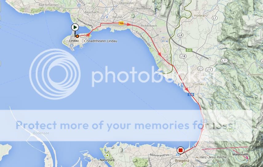
Now that it has been euthanized into the "Brussels Cycling Classic", Paris-Bruxelles has become a thing of the past. Which is kind of sad, but at the same time in recent years the race had become something of a sprinter's classic, with the climbs like the Keperenberg no longer breaking up the race and a winners' list in recent years including Fran Ventoso, Denis Galimzyanov and Robbie McEwen no fewer than five times. Obviously, these are not the names you would see up in the mix in, say, de Ronde. The revision of the race to a purely Belgian affair has led to two editions that end in bunch sprints too.

I have brought back the old Paris-Bruxelles in terms of start and finish (Soissons - Bruxelles if we want to get technical), but previous key climbs like the Alsemberg and Keperenberg have been discarded in favour of a tougher route with some serious cobbles. The race distance has also been bumped up from 220km to 240km.

28wlcib.png


11rf1y0.png


The race has 21 obstacles, the final 13 of which are in the final 60 kilometres. Some are easier than others. The distance to the finish will be noted with each.

1. Côte de Laffaux (1,8km @ 4,4%, tarmac) - 233,6km
A gradual climb not far outside Soissons that is a mere intro to the day.

2. Laon (2,0km @ 4,7%, tarmac) - 206,2km
A picturesque walled town that I have always wanted to host a Tour de Picardie stage along similar lines to the Mont Cassel stage of Dunkerque in recent years. There are several routes up to the top of the town and a few stretches of cobbles in the town centre.

3. Côte de Saint-Gobert (1,6km @ 3,6%, tarmac) - 174,8km
Another gradual climb heading north toward Vervins. On a main road and very straight.

4. Côte de la Croix de Foigny (1,3km @ 6,0%, tarmac) - 156,7km
The first climb with any serious ramps, getting up to 10% on quite a narrow road, although we're still way away from anywhere decisive and the route is still tarmac at this point.

5. Côte de la Rue des Marais (1,9km @ 3,5%, tarmac) - 149,3km
A bumpy climb from Wimy that follows almost straight on from Croix de Foigny as we leave the Aisne département and enter Nord south of Fourmies.

6. Côte des Beaux Sarts (1,0km @ 5,2%, tarmac) - 124,0km
A short drag up to the former sanatorium that is L'Hôpital de Liessies, and also serves as our final climb in France before passing by Jeumont & into Belgium.

7. Rue Alphonse Parent (550m @ 5,4%, kasseien) - 79,2km
Our first cobbled climb is this stretch of not-especially challenging road from Rue Haute to Rue Alphonse Parent in La Louvière. It is mostly consistent.

8. Mariemont (500m @ 7,2%, kasseien/tarmac) - 75,5km
This is our first serious climb, and where the first selections could be made. The main body of this climb is Rue Nazareth, a cobbled ascent of 350m averaging as near as can be to 10%. Riders however get a bit of respite after this, though, so wanting to get away here would mean a group would need to work together ahead of the upcoming obstacles. And much of the stretch between this and the next obstacles are major roads & dead straight as well.

9. Rue Felicien Canart-Rue Henri Tombeur (3,2km, kasseistrook) - 56,4km
The longest single stretch of cobbles in the race, this difficult patch of racing around the village of Bornival is mostly on well-maintained cobbles. In the middle of it there is a climb of roughly 1,7km @ 3,6% with a maximum of 9%, but I have not counted this separately as it comes in the middle of the cobbled stretch, with both cobbles before & after. The sector ends on Rue Henri Tombeur before turning back to the north.

10. Côte de Fauquez (1,0km, 4,5%, tarmac) - 51,3km
A brief, tarmacked berg between two difficult kasseistrooken

11. Rue de la Ferme du Pré (1,5km, kasseistrook) - 43,8km
Like the stretch around Bornival, this long stretch of cobbles hides a climb - this is the Côte de la Ferme du Pré, 500m at 6,8% with a maximum of 11%, disguised as the opening third of a longer stretch of cobbles - after the ascent is done with there is another kilometre of mostly flat cobbled road to deal with. This is also one of those stretches where there is no way to cheat, with high verges and no real crown in the road either.

12. Côte de Sainte-Croix (500m, 7,0%, kasseien/tarmac) - 35,5km
The next climb is a short but nasty one; we are climbing the first 500m of this profile, keeping all the most brutal bits. The section from 200m to 500m is on the steep Rue des Comtes de Rubiano, the last 200m of which as you can see is on cobbles.

13. Rue de la Vallée (300m, kasseistrook) - 34,9km
There is literally 300m of respite after the Côte de Sainte-Croix before the riders have a flat, slightly downhill stretch of further cobbles on Rue de la Vallée. These ones are in a somewhat worse condition as well.

14. Dikkemeerweg (1,0km @ 5,3%, kasseien) - 27,2km
With a maximum gradient of 11% and some really nasty cobbles, this could be where the moves begin to be made in earnest. This is not a pretty sight for the riders, and should force a selection if nothing else. This is here as my replacement for the Alsemberg.

15. Grote Hertstraat (1,75km, kasseistrook) - 24,4km
Barely a kilometre after cresting Dikkemeerweg, the riders have a brief stretch on some narrow bricked roads before taking on nearly 2km of further cobbles. Mostly flat but occasionally sauntering vaguely downhill, these are probably the worst condition cobbles the riders will face all day. Any selection forced on Dikkemeerweg will surely be able to consolidate an advantage here, as well as giving a platform to attack for the more skilled bike handlers.

16. Rollebeekstraat (700m @ 7,3%, kasseien) - 20,7km
Now on the outskirts of Beersel, the riders face another difficult climb. With a maximum of 13%, Rollebeekstraat is a difficult but not super tough climb on its own, but with the likely gaps being forced and the lack of room into which riders can escape the cobbles there are moves to be made here.

17. Kasteelstraat (200m @ 4,0%, kasseien) - 20,3km
Yes, you read that right - only 200m tarmac before the next stretch of kasseien, on the last part of Kasteelstraat. Kasteelstraat is actually a longer cobbled climb, but it crosses the tarmac road partway up; Kasteelstraat and Rollebeekstraat are parallel, and Rollebeekstraat is slightly tougher, so I have gone with it before a short blast of Kasteelstraat before descending towards Brussels.

18. Sint-Sébastiaanstraat (300m @ 6,3%, kasseien) - 16,7km
Unfortunately my route did not allow me to add the short but tough Beukenstraat without adding a long tarmac section between climbs or a circuit so short racing would become confused and impossible to regulate. So instead I've taken on this smaller but still interesting climb in Linkebeek. Again it's short, but it's shadowy and sinister, maxing out at 13% near the railway station. It is a good opportunity for a rider with a small gap from the previous climbs to get themselves out of sight and out of mind.

19. Beukenberg (400m @ 7,0%, kasseien/tarmac) - 11,7km
Now in the Brussels suburb of Uccle/Ukkel, the final climbs come beginning with this one, which starts with a short, sharp cobbled city street averaging 10% for 200m, before flattening out on tarmac.

20. Avenue Vanderaey (600m @ 4,8%, kasseien) - 9,9km
The final marked ascent of the day (there is a brief rise on Chaussée d'Ixelles a little later that could see attacks if a group is still together) is this mostly consistent at around 5% drag through suburban, well-maintained cobbled streets.

21. Palais de Bruxelles/Koninklijk Paleis van Brussel (600m, kasseistrook) - 1,9km
The last cobbles of the day are, much like Roubaix, a ceremonial stretch in effect, on Place de Palais in front of the Royal Palace and around.

After this we have the descent of the Coudenberg, Rue de l'Hôpital and Rue du Lombard before passing the Bourse and sprinting to the finish line at Place de Brouckere. The final 550m are dead straight in case there's a possibility of a sprint, but really this shouldn't be a bunch finish anymore.
 
Tour of Britain- Stage 8 - Ulverston - Great Dun Fell 206km

Here we have the last decisive stage of this year's Tour with the finish up near the radar station on Great Dun Fell, Britains highest paved road at 848 meters. Before we arrive there the peloton will also have to deal with some of Cumbria's most well known hill's in a tricky day of climbing.
We start at Ulverston just north of Barrow, from here the bunch will head north-west to the first climb of the day on logans Brook. A long drag of over 6km's will get the riders warmed up. From here we then head back east and follow the river Esk where the bunch will climb the Hardknott Pass and Wrynose Pass double, although the easier side of the Wrynose which leads to a tricky descent.
The small hill of Dunmail Rise the leads the bunch to another of Cumbria's deadly double climbs. This time its the Honister Pass and Newlands House climbs within 8km of each other, both have sections 20% and average double figures for around 2km.
The final climb before Great Dun Fell comes 50km from the finish, a little more flat than I would have liked but it had to be done to incorporate it all. Comb Beck is another sharp test of 10% for 2.5km and will ensure that we head towards the summit finish with the GC group very much thinned out.
Great Dun Fell is tough climb, officially it is 6km long and 9.5% in gradient with a nice 20% ramp and several irregular sections it will not be easy to control. It will be a finish for the true climbers and a real chance to put serious time into their rivals and perhaps take the leaders jersey too.


http://postimage.org/

http://postimage.org/

Great Dun Fell:

http://postimage.org/app.php

http://postimage.org/

Climbs:
Logan Beck - 25km - 6.5k @ 6% CAT 2
Hardknott Pass - 57km - 2.2k @ 11% CAT 2
Wrynose Pass - 62km - 2k @ 7% CAT 3
Dunmail Rise - 84km - 2.5k @ 6% CAT 4
Honister Pass - 114km - 2.4k @ 10% CAT 2
Newlands House - 122km - 1.9k @ 11% CAT 3
Comb Beck 150km - 2.5k @ 10% CAT 2
Great Dun Fell - 206km - 6k @ 9.5% CAT 1
 
Tour of Britain - Stage 9 - Dumfries - Edinburgh 166km

So here we are, the final of 9 days taking in 1 ITT, 2 summit finishes, 3 countries, 4 national Parks and 23,842 metres of climbing (who said Britain had no decent climbs?). We head across the border in to Scotland and start in the town of Dumfries which has hosted the Tour before.
The sprinters, perhaps the whole peloton will be happy to hear there is just 1 climb today, the long drag up to Mennock Pass, nothing too serious averaging 5% for 5km and the summit being passed with well over 100km's to go.
The riders arrive in the beautiful city of Edinburgh and begin a clockwise loop around the North of the city and then through the centre not far from the castle. They will cross the finish line with 18km to go and begin the loop again before what is sure to be a mad sprint for final glory. Here the leader will cross the line and the celebrations can begin, one thing is for sure, they will have earned it!


http://postimage.org/

http://postimage.org/

Final circuit:

http://postimage.org/

Edinburgh:

http://postimage.org/

Climb:
Mennock Pass - 47km - 5k @ 5% CAT 3
 

Luigi_Max

BANNED
Aug 9, 2014
131
0
0
Visit site
Love the route. Britain may not have true mountain climbs but you have shown comprehensively that Britain certainly has plenty of hilly country and lots of hills to make some hard racing. Well done.
 
Luigi_Max said:
How do I get images from openrunner to display here?

You have to use a picture sharing site, I use Postimage.org but there are plenty of others out there. Then take a screenshot of what you want to upload and upload it to the picture sharing site. Once your picture is uploaded it will give you the URL address to copy and paste on to your post. Sorry if this confuses you, I'm sure someone else can explain better.
 

Luigi_Max

BANNED
Aug 9, 2014
131
0
0
Visit site
Pricey_sky said:
You have to use a picture sharing site, I use Postimage.org but there are plenty of others out there. Then take a screenshot of what you want to upload and upload it to the picture sharing site. Once your picture is uploaded it will give you the URL address to copy and paste on to your post. Sorry if this confuses you, I'm sure someone else can explain better.

No that does not confuse me at all, I can do that if that is what is needed, not that difficult to do at all.
 
Jul 24, 2014
150
0
0
Visit site
Although I've only recently joined the forum, I have been reading through a lot of this thread, (a great initiative btw!) looking at some of the fantastic, innovative and varied routes people have been coming up with and just wishing that ASO would hire Libertine :p

Although it's the GT that people seem to like designing the most, I have come up with a Giro route that, having gone through four complete redrafts, I believe offers balance and plenty of opportunity for riders of all types to display their abilities. With as many summit finishes as ITTs (2.5), it may on the face of it sound horribly 2012TdF-ish but fear not, there are plenty of obstacles along the way.
In summary, it's the antidote to what the Giro has been doing wrong recently; no backloading, no overload of MTFs, more than one ITT etc.

I have so many unused ideas in this one that I will have to make another, perhaps more mountainous version later on, especially as I have managed to omit places like Calabria, Friuli, Sicily and Sardinia which deserve to be a part of the Giro.
 
Jul 24, 2014
150
0
0
Visit site
Giro d'Italia Stage 1: Lindau (GER) - Bregenz (AUT) ITT (Prologue) | 9.84km

Stage1map_zps10792cf4.jpg

Stage1profile_zps0002aa1a.jpg


Climb details:
none

For the first time in Giro history, the Grande Partenza will take place in Germany, in what is only the 12th foreign start for the race. The beautiful city of Lindau has been chosen for this special occasion, with the race starting from the Altstadt that juts out on Lake Constance and is connected by a single road bridge to the mainland. We have a 10km completely flat prologue/short ITT on our hands today, and it is not very technical, only a couple of 90 degree turns early on as we head out of Lindau, but otherwise it is a course for the pure power machines who are able to turn a huge gear for a short distance, as the road sweeps gently round the edge of the lake.
After 5.2km we cross over the border to Austria, and charge along round the lakeside to the town of Bregenz, famous for its annual opera festival which sees a floating stage being constructed on the lake each year - an example here, where today's short, but perhaps sweet, stage will conclude. Time gaps won't be massive - they never are in prologues, natch - but 20 or 30 seconds gained here over pure climbers could come in handy later on in the race when the GC battle hots up. Of course, it will also give everyone a good chance to see who looks in good shape and so on.

This Giro will be visiting many beautiful places in Italy over the course of its three weeks, but the panoramic views that will be afforded to the riders, not that they will be focussing on the views, mind, as they set out to beat the clock on their own, must surely rank up there as some of the most picturesque.

Lindau:
Lindau-Insel-von-oben_gallery_big.jpg


Bregenz:
bregenz-bodensee--dietmar-walser-vorarlberg-tourismus--d.jpg
 
Jul 24, 2014
150
0
0
Visit site
Giro d'Italia Stage 2: Konstanz (GER) - Luzern (SUI) | 166km

Stage2map_zps5287caaf.jpg

Stage2profile_zps6f58c027.jpg


Climb details:
Hulftegg Pass (cat.4; 3.5km @ 5.7%)
Etzel (cat.2; 4.6km @ 11.2%)


Stage 2 sees us set off from the opposite end of the lake, in Konstanz, the city which lends its name to the lake itself. Although the stage title states we begin today in Germany, the riders will only have to ride for 900m before they cross into Switzerland, making it the third country to be visited by the Giro this year (and they haven't even got to Italy yet!). The stage proceeds through rolling terrain through northern Switzerland, including the first categorised climb of the Giro, the Hulftegg Pass, which brings us into the Zurich canton.

After a fairly steep descent, we cross the Zürichsee at Rapperswil-Jona, depositing us at the base of the day's serious climb. Winding its narrow path up beside the Etzel mountain, the Etzelstrasse, at nearly 5km long with an average gradient of 11%, is a climb not to be taken lightly. However, the sprinters will be thankful that there are still 70km to go after the top of the climb, so they have some time to recover. But, having descended to arrive at Brunnen, and then take a trip round the beautiful Vierwaldstättersee (Lake Lucerne), they also have to be wary of a small uncategorised lump which tops out 7km from the finish in Lucerne, leading to a fast and uncomplicated descent down into the city. The finish is on the wide lakefront Schweizerhofquai after a straightforward run in off the descent.
Although a bunch sprint is very much the most likely outcome here, the Guardinis of this world might suffer a bit from the brutal second-category climb and there's always an outside chance that a daring attacker could take it to the peloton on the final uncategorised climb. Hopefully an interesting day.

Konstanz:
konstanz.jpg


Luzern:
Lucerne-Switzerland.jpg


Next stage could be controversial, and possibly rather unfeasible, but I couldn't resist! How's that for a cliffhanger?
 

TRENDING THREADS