• The Cycling News forum is looking to add some volunteer moderators with Red Rick's recent retirement. If you're interested in helping keep our discussions on track, send a direct message to @SHaines here on the forum, or use the Contact Us form to message the Community Team.

    In the meanwhile, please use the Report option if you see a post that doesn't fit within the forum rules.

    Thanks!

Gravel climbs

Page 3 - Get up to date with the latest news, scores & standings from the Cycling News Community.
...and there was me thinking my 240km stage to Kandili was brutal... that just used Ovit and continued to Gölyürt.
Speaking of Gölyurt, it is also an option, you can add it to the stage that started from Of, and continue to Erzurum, however that would make the distance 275 km. Also, I have posted some photos from google maps. That part of the country is amazing for route designing, with climbs like Ovit, Soğanlı Pass, Mt. Şekersu Village and Gölyurt.
 
Now for something more known:
Soğanlı Pass(D-915) - 41 km at %4.9 ( Turkey's Most Dangerous Road ) 2358 m
The famous D-915 between Of and Bayburt. The climb is very long, has some tough parts, but it is not the reason why it is here.
As can be seen from this profile, it is long with second part of the climb being steeper ( It also has some false-flat from Of to Çaykara, which should sap the legs already before the cllimb )
https://www.la-flamme-rouge.eu/maps/viewtrack/146771?climb=2
And it has 31 km of sterrato during the climb. And sterrato continues for another 7.5 kms at the descent ( the descent I already talked about when talking about Mt. Şekersu Village )
https://www.la-flamme-rouge.eu/maps/viewtrack/146771
I can do a huge write up about this climb, but let me just post this link which gives some more info.
https://www.dangerousroads.org/europe/turkey/3923-bayburt-of-yolu-d915.html
And the risk of landslides too.
Here is a Turkish cycling blog doing the climb, with more photos:
http://www.pedalla.com/dunyanin-en-tehlikeli-yolunda-2-adam-2-dahon-1-gun-of-derebasi/
http://www.pedalla.com/dunyanin-en-tehlikeli-yolunda-2-adam-2-dahon-2-gun-derebasi-bayburt/


And here is a photo:
3785e989776856cf400b01100db02d13.jpg


And here is another potential stage with Soğanlı Pass and Gölyurt and going to Kandilli Ski Resort ( stage finish idea shamelessly snipped from Libertine's Nordic Series - hope you are okay with that):
https://www.cronoescalada.com/index.php/tracks/viewVuelta2016/624485/304042
 
Now gaining more altitude...
Palandöken Pass ( Palandöken Ski Resort ) 2972 m 13.5 km at %7.47
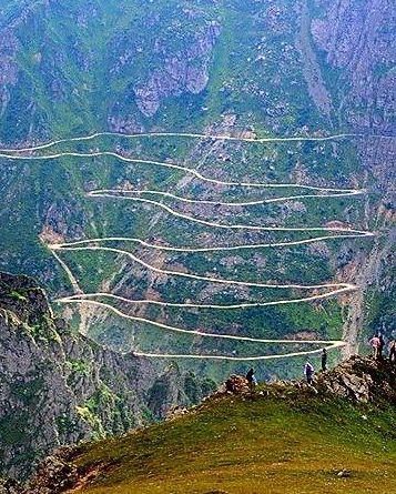
A very tough climb, and after we arrive to Palandöken Ski Resort, it shows why. The last 10 km on sterrato. And we have a pitch of 600 m that averages %18.9! A 6 km part of the climb ( between km 3.3 and 9.3 ) averages %10.2. And to add even more difficulty, the climb already started at almosT 2000m and ends at 2972 m. ( The road is driveable for cars from what I get on google earth )
https://www.cronoescalada.com/index.php/puertos/viewProfile/20060/6962
What to do now?
After reaching the top of the climb, you can have a shallow descent of around 2km at %5 to the junction with asphalt, the original Palandöken Pass ( the 2km road is not technical, with only one hairpin with low gradients ( between %1-4 ), so no worries there ). From then, you can descend back to Erzurum from the conventional asphalted descent.
Here is a very tough stage I have designed, from İkizdere to Erzurum, using the tough side of Ovit ( though we start from 538 m, cutting out lots of the false flat earlier, from km 35,5 or so in this profile: https://www.climbbybike.com/climb/ovit-climb/17046, then climbing Gölyurt ( another very tough climb, 16.5 km at %6.8 ), long flat road to Erzurum ( albeeit with some small hills ), then climbing Palandöken Pass from the gravel side and descending back to Erzurum from the conventional side. 252 km for 5100+ meters of elevation gain, and in high altitude.
https://www.cronoescalada.com/index.php/tracks/viewVuelta2016/624519/304034

Sadly, I haven't found photos of the gravel parts of the climb, but from what I get on google earth, the road is rideable.
 
Last edited:
I'm surprised nobody has posted this:
Cormet d' Areches 2108 m

The north side:
ArechesN.gif


The south side:
ArechesS.gif


As you can see, both sides are very tough and both sides have a couple of kms of gravel near the top. The north side can be a penultimate climb before La Plagne or Les Arcs, you can also do a hard climb-easy climb combo by finishing at Montvalezan, or you can also continue to La Rosiere, or you can also go to Tignes but then top of the climb would be almost 60 km from the finish, whilst the south side can be used before Pre-Roselend or Bisanne-Saisies ( you can also stick Plan Villard before Bisanne, would be 10 km @ 6,2 ). You can also have a descent finish at Aime or Beaufort after the climb and its descent, of course.

There are photos of the climb from both sides in this site, just click the side you want and then click photo gallery:
https://en.cols-cyclisme.com/recherche/Cormet d'Arêches.htm
 
The Ski station above Rifugio Sapienza on Mount Etna, it adds 5km at 11.2% on unpaved roads (here's a profile of the whole climb), but the road is wide and seems to be ok, a bit of work would be needed, but probably just the same amount that you need to do before using Finestre in a race. There's a Ski station on top of the climb, so there would be enough space for hosting a MTF, it would be stunning and pretty unique.
Would be stunning as a finish of Nibali's last Giro.
 

TRENDING THREADS