Stage 5: Stoke-on-Trent - Bradford, 196km
Climbs:
Swiss Hill (cat.3) 0,7km @ 9,7%
Lane Ends (cat.3) 1,4km @ 5,9%
Holme Moss (cat.2) 4,0km @ 6,9%
Scapegoat Hill (cat.2) 2,1km @ 8,2%
Stainland Road (cat.3) 1,0km @ 10,0%
Woodhouse Lane (cat.3) 0,3km @ 12,7%
Gibb Lane (cat.2) 0,7km @ 11,9%
Windy Bank Lane (cat.3) 1,4km @ 7,8%
Ploughcroft Lane (cat.3) 0,5km @ 13,2%
Trooper Lane (cat.1) 0,7km @ 19,6%
The Hough (cat.3) 0,5km @ 13,0%
Shibden Wall (cat.1) 0,9km @ 14,8%
Haworth (cat.3) 0,5km @ 7,0%
Tim Lane (cat.3) 0,9km @ 9,6%
Thwaites Brow (cat.1) 1,2km @ 10,3%
Hainworth Lane (cat.1) 1,5km @ 10,5%
This is the pretty much undisputed queen stage of the Tour of Britain, and an absolute hell. On the plus side, specialist rouleurs will surely see this as a good opportunity to ensure they are in form for the Worlds if appropriate - as the longest road stage of the Tour this is also the one with the most categorised climbs, with no fewer than SIXTEEN, of which the underlined ten are at least partially cobbled, which must surely bring joy to the heart of precisely nobody who has to actually ride this stage.
After the longest transfer of the race, the riders will set off from regular ToB stop Stoke-on-Trent on their hellacious journey, which could most definitely be considered as a stand-alone one-day classic. The early parts of the stage are fairly benign, to ease the riders into the proceedings and allow a break to form. After about 45km, however, we get our first taste of cobbles as the riders take on
Swiss Hill, a
short, sharp berg that gives us a taste of what is to come. Its presence here, with 150km remaining, is merely ceremonial. After it we are back to flat terrain south of Manchester before a couple of small hills take us into
Glossop, gateway to the Peak District. Turning right here will take us over Snake Pass, a famous British mountain pass, but going straight over takes us to the climb of
Holme Moss, another well-known British climb that we will see featured from its other (harder) side in the Tour de France this year. Still, this side has its
moments.
After Holme Moss a couple of slopes and uncategorised climbs take us onto our next summit, that of Scapegoat Hill. Another puncheur's climb, the stage rather seems designed for the puncheur at this point, especially when it is followed by a kilometre at 10% up Stainland Road. Indeed, with 80km remaining you'd start to wonder if this is a stage for Purito. But I'm having none of it, for now we arrive at the outskirts of the West Yorkshire town of Halifax, and now it's time for the strongmen to come out and play.
First on our menu of British hellingen, with 72km remaining is the wide open, accessible
Woodhouse Lane. The average is 12,7%, but the climb is fairly consistent, and leads onto some mild uphill on wide city roads before a narrow descent.
Next up, with 65km remaining, is the steep, swooping
Gibb Lane, a real Vlaamse Ardennen styled climb that
gets all the way up to 27% on its inconsistent slopes. This is followed by the tarmacked, comparatively comfortable Windy Bank Lane with 58km remaining. It's still not an easy climb, but the tarmac and the gradients only being around 8% average are more manageable, and it doesn't take a super-tough rouleur to muscle over this one.
Just 3km later, we turn left onto the very straight but tricky
Ploughcroft Lane. Averaging 13% for 500m, this is another short but brutal stretch of Kopfsteinpflaster; at the summit we arrive at a dry ski slope, which we approach from the west, and turn south. A GPM banner will be diagonally across the road from southwest to north-east - we will see it from the other side later. We then descend back into Halifax on a couple of wide open roads before hitting potentially the toughest climb of the day.
At 50km remaining, the riders turn left onto an extremely steep and agonizing road with a few sharp bends; according to Strava we are hitting 30% at times. And after 300m of this agony, the road turns to
brutal cobbles to rattle the riders' bones some more. The views back into town from the summit showcase just how
disgustingly brutal this climb is. Bearing in mind we have 6-man teams here, controlling this race will be nigh on impossible and things could already be an absolute mess by this point; this is a stage for the strongest of strong men only.
Descending from Southowram, the riders will enjoy a very brief respite before just 3km later they hit
The Hough, another 500m cobbled stretch (hidden among a longer more gradual climb), albeit in much better condition than Ploughcroft Lane or Trooper Lane. The mostly consistent 13% is pretty tame in comparison to Trooper Lane, which is why I've followed it with another killer. After 3km of descending narrow roads the riders hit the iconic
Shibden Wall, an agonising climb used in the Tour of Britain back in the 80s (you can see some Irish guy riding it
here). The average is as near as can be to 15%, but it gets higher, reaching up to
25% as riders curse the day that they were born. This is the climb that approaches the dry ski slope from the east, and then turns to the north; going straight on at the summit takes us down Ploughcroft Lane, and if it's wet, descending 13% cobbles is a bad, bad idea. 44km remain at the summit.
At this point, the riders get a bit of a rest. The groups on the road should be splintered all over the place by this point, and so they will relish the chance to have 15 or so kilometres of respite...the feeling of smooth tarmac that isn't slanted uphill at 20% will make them happy. The next climb (which doesn't even show as a climb on mapmyride, it's one of the jagged rises before the last cluster of categorised climbs) is also going to be seen in the Tour de France in July - a comparatively benign stretch of uphill cobbles through the centre of the
picturesque village of Haworth. This is to ease us into endgame; 27km remain after this, and it leads almost immediately into another short, sharp ascent, this time on tarmac up Tim Lane. At this point we cross the town of Keighley and the real endgame begins.
It is still possible that at this point no real attacks have come; groups will be splintered more by attrition than anything else (but how attritional this day has been!). But with 19km remaining, the action can be delayed no further. This action comes in the form of
Thwaites Brow, one of Britain's most savage cobbled climbs. Cobbles are in poor condition and smoothed over with occasional tarmac blotches on the pavé; once more gradients get over 20%, and though not all of the climb is cobbled, we do have over a kilometre of ascent here where attacks can be made or broken. There's
plenty of room for fans and damn, I really want to see this race now. Following on from this there is a brief downhill before our final berg of the day,
Hainworth Lane. Only 400-450m of this ascent are on the kasseien, but they are the most important. Yea, sure, the last kilometre or so is still at 9-10% and tarmacked so more puncheur than rouleur, but what are you afraid of, that Purito somehow got over Shibden Wall and Thwaites Brow in the front group?
13km remain at the summit of Hainworth Lane, and no they are not flat. But they aren't exactly destructive either - a descent, then a couple of kilometres uphill at 3-4%, before a similarly shallow downhill towards the line. The final 1,8km are absolutely straight into the centre of Bradford, but again - what are you afraid of, a bunch sprint?
Again, this could be a standalone Classic. The Classics specialists are built for this kind of thing, and a race as hard as this could be an instant favourite in much the same way as Montepaschi Strade Bianche has been almost immediately taken to heart by cycling fans. Though London may have the fans, a race like this would be infinitely more likely to be taken to heart by the sport's fanatics across the globe.
Stoke-on-Trent:
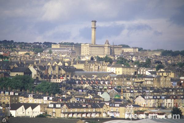
Bradford: