• The Cycling News forum is still looking to add volunteer moderators with. If you're interested in helping keep our discussions on track, send a direct message to @SHaines here on the forum, or use the Contact Us form to message the Community Team.

    In the meanwhile, please use the Report option if you see a post that doesn't fit within the forum rules.

    Thanks!

Race Design Thread

Page 146 - Get up to date with the latest news, scores & standings from the Cycling News Community.
KAKANIEN RUNDFAHRT

(Sun) stage 1: Krakau - Strbske Pleso, 165 km

hl5weqf6fxs.png

19one5gi1qjm.png


The first stage leads into the High Tatra, the highest part of the Carpathian mountain system. This is not a high mountain stage, however. There is a bit of climbing, especially to the Polana Głodówka pass at km 106. Shortly after that we enter Slovakia and take the Cesta Slobody, a ring road around the High Tatra. This culminates in the climb to Strbske Pleso, a tourist destination and host of the 1970 Nordic World Championships and of the 2015 Winter Universiade. It is located at a lake of the same name. The final drag up to the finish is 11 km long at 3%. It does get up to 6% in the final kilometer, which should be too much for some sprinters. I expect a sprint from a rather large bunch.
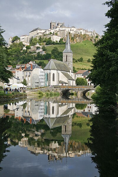

Strbske Pleso
1hitk6pk2uaw.jpg
 
KAKANIEN RUNDFAHRT

(Mon) stage 2: Poprad - Vac, 219 km

iy865jyn6ir8.png

n4henef9f29t.png


A long stage from Slovakia to Hungary, from the Tatra mountains to the river Danube. Poprad lies in the valley below Strbske Pleso, it put in a bid to host the 2006 Winter Olympics, but lost to Torino. The stage is hilly at first, but gets flatter as we leave the Tatra. There are however some small hills in the final 25 km, which surely will annoy the sprinter teams and might give the edge to the attackers.


Poprad
e2zz4hhouimb.jpg


Vac
url
 
Giro Del Trentino
Stage 1: Borgo Valsugana - Alpe di Siusi 116.2km
A killer to start off with. 2 HC climbs, one 1st category, one 2nd category and a 3rd category to soften the legs for the extreme test.
The day starts off climbing. A 22km climb averaging 7.1%. Then a long descent before a false flat before the 1st category climb, 9.8km at about 8%.
Another descent and an intermediate sprint before we head upwards once again out of the valley for 5.2km at 6.3%. Then comes the final huge effort up to Alpe di Siusi. No flat for nearly 30km, only uphill; admittedly, it sometimes averages only 2 or 3%. A 3rd category climb of 10km, all very benign, before a false flat to the town of Siusi before we head up to Compatsch and beyond. Only 11.9km long it climbs over 1000m, averaging 9.2%.
You reach Compatsch and although riders might hope the finish line was there, we take a left urn and reach the steepest part of the climb, with pitches reaching over 15% in places. It is less than 3km until the end of the stage after you reach the small village, but you climb another 280 meters. A stage only for the brave, the reward is a fantastic view over the plateau and the Dolomites.
 

Attachments

  • gdt.png
    gdt.png
    37 KB · Views: 775
Tour Complet de France n°2, stage 4: La Grand-Combe - Marvejols: 141km, medium mountains (Languedoc - Roussillon)

We continue the streak of short stages. While the two previous stages still had a decent espoir race length, the 4th one barely exceeds that of a junior race. But the mere 141km are no indication at all of the overall difficulty of the stage. There are a few flat stretches when using valleys in between today's major climbs, but for most of the day it's either up or down.

800px-Vue_de_la_grand-combe.JPG

La Grand-Combe

Being a former mining town La Grand-Combe has seen its population dwindle the last five decades. By no means a big town, it is still big enough to host a Tour stage start.
Immediately after the official start the road starts to climb for 3km. A short descent and some false flat kilometers give way to the second climb of the day, the Col de Portes.
The small village Chamborigaud will act as the foot of the 3rd climb of the day, and we're not even 20km into this stage. The slopes of this climb are quite gentle and flatten out after 5km or so.
After some false flat, both descending and climbing the 4the climb of the day is the first big one. 6.3km at 6.6% is no killer climb, but nothing to sneeze at either. If the pace is high since the start of the stage, as can be expected in this kind of stages in the Tour, many riders will already start to struggle to follow the heads of state on this climb. Lucky for them the summit is followed by 30km of slowly descending and wide roads to Florac, where the intermediate sprint will be contested.
Immediately after another climb starts. The col de Pierre Plate is steeper than the previous climbs this stage, and things will become even steeper.
The descent to Montbrun will leave some time for a breather as the peloton rides a few kilometers along the river tarn through the scenic Gorges du Tarn.
Not for very long, however, as the 6th and most difficult climb of the day starts a bit after the 50km to go sign. The Causse de Sauveterre crests at 1023m after a climb of 6.7km@7.5%, with a steep part of 4km at 9% average after the first km.
There's no real descent a first, but some rolling, slowly descending roads, steepening towards the Lot valley.
The last flat kilometers along the river Lot are a prelude to a -hopefully- exciting final, with two short climbs in the final 20km.
The Côte de Goudard is almost a carbon copy of the Côte de la Croix Neuve in nearby Mende, albeit a little less steep, while the Côte d'Inosse is the final springboard for anyone aiming at a stage victory, only 6.5 descending kilometers to go from the summit.

Map & Profile:
13z5mvt.jpg


Difficulty: ***

Climbs:
Côte du Pradel: km3.5; 3km @ 6%; 3rd cat
Col de Portes: km10; 4.3km @ 4.9%; 4th cat (profile of the first two climbs)
Côte du Travers km24.5; 5km @ 4.8%; 4th cat
Col de la Croix de Berthel: km39; 6.6km @ 6.3%; 2nd cat; 1088m
Col de Pierre Plate: km74; 6.2km@7.5%; 2nd cat; 1016m
Causse de Sauveterre: km99; 6.7km@7.5%; 2nd cat; 1023m
Côte de Goudard: km124.5; 3km@9.2%; 3rd cat; 1025m (the numbers from the topographic maps of France seem a litle bit different than those of cyclingcols. I value the former higher)
Côte d'Inosse: km134.5; 3.3km@7.1%; 3rd cat

Intermediate sprint:
Florac: km67
 
Re: Tour of California 2

Tour of California Stage 2: Crescent City - Eureka; 189 km

PKf2dZG.png


clicking on the profile links to higher resolution image

The second stage should be for sprinters as we head south along the coast from Crescent City to Eureka.

The first difficulty of the stage start only just after about 5 kilometers with a first categorised climb of the race in Redwoods State Park with its amazing forests featuring the Earth's tallest trees. The battle for the first mountain jersey as well as the break of the day should happen here (if not straight from the gun). Afterwards the road follows along the lagoons of the Humboldt Lagoons State Park and we arrive at the first intermediate sprint in Trinidad at km 96.

After few small but fairly steep hills and second categorised climb of the day a long flat section follows, which could have potential for echelons, especially between 50 to 40 kms to go between Arcata and Eureke when the route goes round the Arcata Bay with two bridges over sea as well. The most common wind direction here is northwest, so ideal for cross/tailwind. At 40 km to go we enter the city of Eureka for the firs time though and unless there is a team willing to continue to push on, everything should come back together.

The last part of the stage is dominated by short, sharp inclines in Eureka which do not exceed 30 metres in altitude gain, but should hopefully string out the field and lower the chances of inevitable crashes, because otherwise this part is pretty technical. There is one larger ascent at 25 km to go to Ridgewood, but at less than 5% average for 2.5 km it's nothing serious. After this short detour, route heads back to Eureka for a loop around the city featuring no less than 7 of the aforementioned hills with 2 of them being in the last 5 km. The last one on Fern Drive is probably the most serious with 300 metres at over 8% and could provide an opportunity to upset the sprinters, cresting just 3 kms to the finish. It is no easy run in even after this though with 2 90° corners in the last kilometer and the home straight is not exactly a boulevard either.

Eureka:
eureka16.jpg
 
Lets try again with stage three in Campania.
Giro della Campania Stage 3 Benevento - Montevergine (148km)

p3UzoE0.png


BV119Qc.png


E3C8H3R.png


Climbs:
Camposauro
Vetta del Taburno
Serra della Strada
Montevergine

Primes:
Arbusti
Montesarchio
Avelino

Feed Zone:
Roccabascerana

The longest stage of the race is also the queen stage. We start in the town of Benevento and head west along w main road towards the second prime of the day. However it's only a short tip along it, before we are off onto the a rolling road, which includes an uncategorised climb. After heading down the other side of this uncategorised climb, the riders will pass through a village and out onto the first categorised climb of the day. This the Camposauro. Then after a descent down to the bottom of the next climb, we have the first prime on the slopes of the Vetta del Taburno at Arbusti. They will then ride on to the peak of the climb, before dropping down to Montesarchio for a prime. With another uncatorgorised climb up to Roccabascerana for the feed zone. After a quick descent back down, we join the 2011 stage 7 finale. This will take us up the Serra della Strada. With a narrow descent down, the riders will have to be cautious. When the road becomes more major it's just a short section to Avellino. From here we shall start the final climb. This is the Montevergineclimb. It was used in 2011 giro on stage 7. The stage was won by Bart de Clerq on the twisting road with twenty two hairpins. (I think :D ).

Start:
BENEVENTO%20DALL%20ALTO.jpg


Finish:
thumb.php
 
Tour Complet de France n°2, stage 5: Saint-Flour - Decazeville: 218km, medium mountains (Auvergne - Midi-Pyrenées)

The 5th stage is the first one with a real pro race length and will view a transfer by car (but mainly on a highway) the evening before. The only reason for the transfer to Saint-Flour is to incorporate the Auvergne region in this Tour Complet. One could make a similar stage from Marvejols.

400px-Saint-Flour_depuis_les_berges_de_L%27Ander.jpg

Saint-Flour

Anyway, this stage is a mixture of stage 12 of Another Dutch Guy's Tour without Alps and Pyrenees and the last stage of the Midi Libre I designed a year ago. The 218km between the start and the finish in Decazeville are so complicated that I won't give a description. Let's just say that a stage with 14 climbs of varying difficulty on sinuous and often narrow roads is something for the daring...

Map & Profile:
311s67l.jpg


Difficulty: ****

Climbs:
Côte de Rouire: km19; 2.4km @ 5.9%; 4th cat
Côte de Thérondels; km44.5; 4km @ 5%; 3rd cat
Côte de Pleaux: km58.5; 1.8km @ 6.7%; 4th cat
Côte de Saint-Hippolyrte: km 86.5; 4.7km @ 7.5%; 2nd cat
Côte de Vernassals: km99.5; 5.7km @ 7.6%; 2nd cat
Côte d'Enguialès: km118.5; 6km @ 6.9%; 2nd cat
Côte de Seveyrac: km131; 4 hm @ 8.1%; 2nd cat
Côte de la Chestonnerie: km148; 6.4km @ 6.7%; 2nd cat
Côte de Valayssac: km158.5; 3.4km @ 7.2%; 3rd cat
Côte de Sénergues: km166.5; 3.2km @ 5%; 4th cat
Côte du Prat: km181; 3.7km @ 8.9% (initial section of 2.2km @ 11%); 2nd cat
Côte de Roquemaurel: km186; 1.8km @ 11.7%; 3rd cat
Côte de la Linière: km 197.5; 3km @ 9%; 3rd cat
Côte de Rouméguière: km214.5; 1.8km @ 7.4%; 4th cat

Intermediate sprint:
Entraygues-sur-Truyères; km 127.5
 
Jun 30, 2014
7,060
2
0
That stage looks amazing.
Creating a TdF is one of those things that I'm always torn on, on one hand I have a few ideas for good stages, maybe even too many, on the other hand there are only a few regions that you can use to create really awesome hilly or medium mountain stages.
The first week is always the big problem for me, I'd like to have a challenging first week and an early MTF, so the Vosges would be perfect, but I want to have the Pyrenees before the Alpes, something like the 2006 TdF would be good, maybe with a Grand Depart in in Basel but then I would have too many boring flat stages in the first week.
 
Re:

Mayomaniac said:
That stage looks amazing.
Creating a TdF is one of those things that I'm always torn on, on one hand I have a few ideas for good stages, maybe even too many, on the other hand there are only a few regions that you can use to create really awesome hilly or medium mountain stages.
The first week is always the big problem for me, I'd like to have a challenging first week and an early MTF, so the Vosges would be perfect, but I want to have the Pyrenees before the Alpes, something like the 2006 TdF would be good, maybe with a Grand Depart in in Basel but then I would have too many boring flat stages in the first week.

There are indeed few regions that are suited to create "really awesome" hilly or medium mountain stages, but almost all (administrative) regions can have some stages that are good enough. The regions that pose the biggest difficulties are Centre (but some opportunities around Sancerre), Pays de la Loire (with some opportunities in the Alpes Mancelles and the area around Mont des Alouettes) and above all Poitou-Charentes (which seems to be the flattest region of them all).
That stage 5 of me will never be designed in reality, but sometimes it can be enough to have a succession of some 4th category climbs in 10 or 15km near the finish.
Regarding your Tour: you can start in the northeast of France (Champagne/Ardennes, Lorraine or even Alsace), have an easy mtf in the Vosges on day 3 or 4, some flat and hilly stages in Franche Comté, Burgundy, Centre before medium mountain stage in Auvergne the first weekend. Then a rest day with transfer (the transfer, if any, on the first restday tends to be quite long in reality), a long tt, pyrenees, transition stages and the Alps right before Paris.
It's not that difficult to create a Giro-like Tour.
 
Jun 30, 2014
7,060
2
0
Re: Re:

rghysens said:
Mayomaniac said:
That stage looks amazing.
Creating a TdF is one of those things that I'm always torn on, on one hand I have a few ideas for good stages, maybe even too many, on the other hand there are only a few regions that you can use to create really awesome hilly or medium mountain stages.
The first week is always the big problem for me, I'd like to have a challenging first week and an early MTF, so the Vosges would be perfect, but I want to have the Pyrenees before the Alpes, something like the 2006 TdF would be good, maybe with a Grand Depart in in Basel but then I would have too many boring flat stages in the first week.

There are indeed few regions that are suited to create "really awesome" hilly or medium mountain stages, but almost all (administrative) regions can have some stages that are good enough. That stage 5 of me will never be designed in reality, but sometimes it can be enough to have a succession of some 4th category climbs in 10 or 15km near the finish.
Regarding your Tour: you can start in the northeast of France (Champagne/Ardennes, Lorraine or even Alsace), have an easy mtf in the Vosges on day 3 or 4, some flat and hilly stages in Franche Comté, Burgundy, Centre before medium mountain stage in Auvergne the first weekend. Then a rest day with transfer (the transfer, if any, on the first restday tends to be quite long), a long tt, pyrenees, transition stages and the Alps right before Paris.
It's not that difficult to create a Giro-like Tour.
Yes, that would probably be the best option for the first week, I've already thought about that and I could use a few stages that I've already created.
Thanks for your advice
 
Alternatively you could start in Brittany or the Vendée (both very traditional cycling areas) and have an early "MTF" type stage to somewhere like La Loge-des-Gardes before angling southwestwards to the Pyrenees. There's enough space to finish at the Pas de Peyrol if you really wanted (perhaps best from the north with the steep finale?), or maybe Super-Lioran. Maybe if you have a route a bit like 2008's, you could have La Stèle leading into Chastreix-Sancy instead of Super-Besse?
 
Jun 30, 2014
7,060
2
0
I already want to use Pas de Peyrol before Col de Perthus, the finish would be in Saint-Jacques-des-Blats. Is there enough space on Col de Perthus to hold a MTF?
 
Due to not wanting a MTF followed by another, this stage sits in between, but would have been stage 3 to follow after the finish in Salerno
Giro della Campania Stage 4 Salerno - Pompeii (106km)

0y9vf3a.png


ZyL3Ei8.png


lPYHtKF.png


Climbs:
Colli di Fontanelle

Primes:
Sant' Agata sui Due Golfi
Sorrento
Castellamare di Stabia

Feed Zone:
Colli di Fontanelle

Back in Salerno, we start stage four. This is a coastal stage on the Amalficoast. They have quite a few uncatorgorised climbs, however we have the big catorgorised one at Colli di Fontanelle. We will have the feed zone at the top aswell. They will then head for the prime at Sant' Agata sui Due Golfi. The second will be later at Sorrento and the third at Castellamare di Stabia. From here, it's an urban enviroment, so expect plenty of unwanted views (because you want to see the racing) of Vesuvius and the Roman Remains at Pompeii. We finish in the in the centre of Pomepeiiat the piazza

Start:
phoca_thumb_l_Salerno20dallalto.jpg


Finish:
643168-piazza-at-pompeii-new-town.jpeg
 
Giro della Campania Stage 5 Caserta - Monte Vesuvio (110km)

1xKuF9c.png


tmgLleC.png


dtRRlRR.png


Climbs:
Monte Vesuvio

Primes:
Ercolano
Pompeii
San Giuseppe Vesuviano

Feed Zone:
Torre del Grecco

Not much to say about the stage but here we go! Today's stage start's in Caserta. We head south to the outskirts of Naples before hitting the coast at Ercolanowhere the first prime is. The feed zone at Torre del Grecofollows. We then have a prime at yesterday's finish in Pompeii. Then the third and final prime is at San Giuseppe Vesuviano. We do a loop of the the famous mountain, before actuallly climbing it. Due to limited space at the top, all team buses will be at the bottom, however once everyone has crossed the line the finish gantry will be dismantled and two 65 seater buses will take the riders and their bikes back down to the bottom!

Start:
Campania_Caserta2_tango7174.jpg


Finish:
mount-vesuvius-italy_thumb.jpg


Only two stages to go!!!!
 
Giro Del Trentino Stage 2: Siusi allo Sciliar- Pramajur 206.3km

Stage 2 and we head West from Siusi and Bolzano to Pramajur, a small skiing village in the north-east of the region. Not as hard as Stage 1, but almost twice as long. 5 categorised climbs today, all 2nd category apart from Edelweiss, which is HC.
We start climbing straight away, although a simple climb to start off with before climbing starts to get serious. 10km in and we start ascending an undulating 10km climb. This is just an appetiser. Then we head down to Bolzano and head up the Edelweiss. 30km of rolling terrain greets the riders when they get to the top. The riders will then go to Merano for the feed zone, before a long false flat, past the first TV in Scilandro. The first of 3 2nd category climbs is now to be taken on, a steady climb. A bit of flat precedes the hardest climb of the day, 4.5 km @ 11.7%. A very short descent a the second TV before quick rise takes us to the highest point of the day, 2100 meters. A technical descent and a swoop around the lake before the we cross over the previous route and up to Pramajur.

Pramajur:
home_photo2_gross.jpg


Siusi:
D-0885-seis-am-schlern-mit-schlern.jpg


Profile:
 

Attachments

  • GDT stage 2(2).png
    GDT stage 2(2).png
    140.8 KB · Views: 979
Thanks to Fauniera for letting me use some of your stage 1 in your Tirreno!

Giro della Campania Stage 6 TT Bagnoli - Pozzouli (24.5km)

RVs7vuj.png


BGVNMjk.png


RhgaY6v.png


Climbs:
Pianura
Acadamia

Primes:
None (TT)

Split Times:
Pianura
Acadamia


Today we have the Time Trial. This is a 24km test of man and muscle from Bagnolito Pozzouli. We start by heading north towards the first split time check in Pianura. This is also the top of the catorgory 4 climb although it's not listed on the profile. They will then descend into the town of Pozzuoli. This is where it says the split time check is, however it isn't. This is at the top of the Acadamia climb. After a descent to the start line in Bagnoli, we weave our way to thecoast. From here we wiggle our way along the coast line to the finish in Pozzuoli.

Race area:
Pozzuoli_NASA_ISS004-E-5376_modified_names.jpg
 
Tour of California Stage 3: Eureka - Liscom Hill; 178 km


The third stage sees the first significant hills arrive and is the last stage near the coast for a long time. We start in Eureka where the previous stage finished and head south for a 65km long detour with two ascents of Table Bluff and once up Tompkins Hill. The roads here are fairly narrow compared to the highway and the hills are quite steep albeit short, but shouldn't pose any problem at this point in the stage. After coming back along the highway there is the first intermediate sprint in Eureka.

From here onwards things start to get serious. The first climb up to Kneeland through The Springs follows. This one is more irregular so the total average of just over 5% doesn't do the climb justice. The first 4 km of this ascent average about 8% and later on there is another section of 3.5 km at 8%. There is only a short descent coming up after which riders tackle the Fickle Hill road, which is in much worse state. The first 2.5 km of it are unpaved and then becomes very narrow as the climb up Fickle Hill starts. It is basically a singletrack (for cars) for the next 8 km. The descent is long and undulating, but not very technical.

A 15 km long flat section culminates with another ascent of Kneeland, this time regular and steep all the way. It is surely the hardest climb until the second weekend with first high mountain stages. The KOM points are awarded at 45 km from the finish so the bunch should be radically thinned down after this. First part of the descent is the same as previously, but instead of turning left to Fickle Hill, route continues down to Butler Valley with some views of the surrounding hills. After the second sprint in Maple Creek the road becomes worse again and is covered in dirt occasionally. This section is up and down all the time with one third category climb which is followed by a steep and technical descent, fortunately on a better surface.

From the foot of the descent it is 6 km of flat roads before a sharp right-hand turn indicating the start of the final ascent to the line. Liscom Hill is 1.9 km long and with an average of 10% is surely going to make some differences even between the main contenders.

Last few kilometers:
TKb9krU.png
 
Tour of California Stage 4: Mad River - Redding; 163 km


Stage four could see a break going away (with many riders possibly out of contention) as well as a reduced bunch sprint. It follows a western direction and there is climbing to be done straight from the start in Mad River. The last meaningful climb though is Buckhorn Summit (which has an intermediate sprint at the top) with still 45 km to go. From there on it is just a descent down to Whiskeytown Lake and the final run in to Redding on wide roads. The whole stage is in fact done on very good roads unlike the previous one. There are several corners in the last few kilometers, but the very last one is almost completely straight and on a very wide road.

Finish area in Redding:
cp-parkmarina2-lg.jpg
 
Tour Complet de France n°2, stage 6: Figeac - Limoges: 196.5km, flat (Midi-Pyrenées - Limousin)

After two days of medium mountain madness, it's time for a more quiet stage.
But first, the race caravan has to make a small transfer from Decazeville to Figeac (28km through the scenic Lot river valley).

From Figeac the peloton heads northwest for about half the stage, mostly on flat to rolling main roads. At that point, in the village of Terrasson-Lavilledieu, the intermediate sprint is contested.
Then, the roads slowly bend north, heading for Limoges. The capital of the Limousin pretends, like so many other cities, to be build on 7 hills. That particular feature is something that characterizes the final of this stage.
After the long uphill drag from Le Vigen to La Croix de l'arbre, the peloton will plunge itself to the banks of the Vienne, before crossing it and climbing to the city center, that towers about 60m above the river.
Stage 2 of the 2007 Paris-Nice saw a similar design of the closing kilometers, and both punchy climbers and strong sprinters were in the mix for stage victory. While that may have been the case in that Paris-Nice, I don't think the final ramp of 1.2km @ 5% will entice the punchy climbers to be confident in a possible stage victory. They had their fun the previous two stages.

800px-Centre-ville_et_champ_de_Juillet.JPG

Limoges

Map & Profile:
vi0ajt.jpg


Difficulty: *

Climbs:
Côte de Belle Combe: km10; 3.4km @ 4.1%; 4th cat
Côte de la Croix d'Arbre: km189; 3.4km @ 4%; 4th cat

Intermediate sprint:
Terrasson-Lavilledieu: km 100
 
Tour Complet de France n°2, stage 7: Angoulême-Angoulême: 58.5km, ITT (Poitou-Charentes)

After a transfer of a bit more than 100km, the 7th stage will take place in and around Angoulême. This city of 40000 inhabitants is quite famous for its annual comic-book festival.

Today's task will be less leisurely for the main contenders for the maillot jaune. A time trial of almost 60km, although on flat roads, is nothing to sneeze at. The course itself, apart from the opening and closing kilometers, is not very complicated. It follows the D674 out of the city center until the intersection with the D5, then takes a sharp left hand turn to follow the D5 until the village of Villebois-Lavalette, where the D16 is taken for about 5km.
Another sharp left hand turn leads the riders on the way back to Angoulême.

800px-Angouleme.jpg

Angoulême

Map & Profile:
67ldah.jpg


Difficulty: ****
 
KAKANIEN RUNDFAHRT

(Tue) stage 3: Budapest - Budapest, 165 km

qh4znnn9griy.png

wg2n834o4wyh.png


As one of the two focal points of the double Empire, Budapest deserves a special role in this tour, and therefore gets an entire stage. It is a circuit race, with 15 laps of a 11 km circuit. The center of the stage is the
Castle District (Budai Várnegyed). It is situated on top of a hill and is one of the most beautiful parts of the town. We start right there, at the Trinity Place (Szentháromság tér), in front of the Mathias Church. The riders will take a tour of the lovely district, with its cobbled roads, then descend a bit before they will visit the mighty castle itself, before they descend for good and cross the Danube, which is 300 meters wide at this point.

Via the Elisabeth Bridge we enter Pest and ride through some impressive streets, before we turn west and ride along the Danube and pass the imposing Parliament Building. The Chain Bridge brings us back to Buda, with Castle Hill already in view. The climb is 1,4 km long and has an average gradient of 5%. It is a bit steeper at the bottom, with gradients of 7,5%. After half the climb we pass Fisherman's Bastion (Halászbástya), one of the most impressive buildings of Budapest.

The top of the climb provides nice views of the city. The last 400 meters are on very nice cobbles, at the finishing straight the gradient increases a little bit. This is not an easy circuit, but not a super tough one either. Most likely the puncheurs will fight it out at the last hill.


Budapest
hi72ociyudyw.jpg
 
KAKANIEN RUNDFAHRT

(Wed) stage 4: Gödöllö - Debrecen, 209 km

piaru1imzb7.png

tjeshr7wnake.png


It doesn't get much flatter than the Puszta, and there is a lot of Puszta today; especially in the last third of the stage, when we ride through Hortobagy national park. Obviously the biggest Puszta fans are the sprinters, who also enjoy a trouble-free run-in on a wide boulevard in Debrecen.


Gödöllö
G%C3%B6d%C3%B6ll%C5%91_-_Palace.jpg


Debrecen
ulla56z7c9xa.jpg