Race Design Thread

Page 292 - Get up to date with the latest news, scores & standings from the Cycling News Community.
Nordic Series 10: Soldier Hollow

The Nordic disciplines are of course named for the countries that were the origin of the sports, but they have spread throughout the world. To date in the Nordic Series I have focused entirely on European venues, because much like cross-country skiing, ski jumping, Nordic Combined and biathlon, cycling has become a global sport but with most of its historical roots remaining in Europe. Unlike the Nordic disciplines cycling isn't restricted to specific areas that can provide suitable weather, as all it requires are roads, and so there hasn't been the same level of expansion into high altitude areas that can produce great endurance athletes, such as East Africa and Latin America, because of the paucity of snow (though there are some athletes competing from Argentina and Chile, and the World Championships escapades of inexperienced Venezuelan Adriano Solano made him a cult hero, when he entered qualification for the 10km classic at Lahti despite having never clipped in on snow before).

That is not the case in North America and East Asia, however. The Japanese have become major players in ski jumping and, in Nordic Combined, Akito Watabe has now completed his first World Cup overall victory after six straight years in the top 3. And the Americans have just scored their first Olympic gold in Cross-Country thanks to the sprint team of Kikkan Randall and Jessica Diggins, and have had a presence, if not at the front, then at least in respectable position in the field, in both XC and biathlon - though since Bill Demong's retirement their presence in NoCo has rather tailed off. However, the US does have a lot of interest in Alpine skiing, ice hockey and other winter Olympic disciplines, and as a result they have hosted the winter Games several times; the most recent of these occasions being 2002, when after missing out to Nagano in 1998, the candidacy of Salt Lake City led to the capital of Utah becoming the third American host (and fourth time the Games had been in the US, as Lake Placid hosted twice).

55546_G08_W01.jpg


As Utah did not have the same Nordic tradition as New England, which has multiple venues suited for cross-country and biathlon, the organizers had to build a new venue at Soldier Hollow, a state of the art complex two hours outside Salt Lake City, the furthest venue from the host, with the altitude ensuring reliable snowfall and built onto the shoulder of a mountain ridge to enable some challenges in the terrain without it becoming too ridiculous or having to use too much of the out-and-back format that some venues built into steep mountainside can suffer from (and indeed some of the courses at Cesena-Sansicario did four years later).

Of course, however, if you ask any Nordic sports fan to name anything about the 2002 Salt Lake City Olympics, there's a good chance that they will mention this guy:

10865419.jpg


Johann "Juanito" Mühlegg was undoubtedly the star of the 2002 Olympics in the Nordic sports, skiing away from the opposition to win by minutes each time, regardless of in time trial or mass start format (though the 30km pursuit is probably the best race to show to illustrate how ridiculous he was), although no matter how easy the victory, it's hard to say he made it look effortless, because his ski technique was wasteful and inefficient and looked like he was constantly on the very ragged edge of the sport as he splashed around in the snow like a child in a swimming pool. Per Elofsson, a very elegant skier by contrast, attributed going too far into the red trying to stay with Mühlegg as the initial catalyst that set into motion his abrupt decline. And the furore that broke out when Mühlegg tested positive for darbopoietin, second-generation EPO, overshadowed the other candidate for star of the show, quadruple gold-medal winning biathlete Ole Einar Bjørndalen, who won every discipline there was to win even in a field including legends of the game like Ricco Groß, Sven Fischer and Raphael Poirée.

Like a lot of Olympic venues, however, the Soldier Hollow facilities did not become a fixture of the World Cup, with the Nordic disciplines' focus on affordability for the largest number of contestant countries and the European traditional bases of the sport - and the profitability with the proximity to major supportive nations - meant that North American legs of the World Cups would be periodic - for example the Biathlon World Cup tends to package a couple of North American rounds together and make that journey once every 3-4 years. And the distances involved in the USA are also a handicap - SLC is a fair distance from any of the other Nordic venues, so even connecting to other Canadian or American venues entails a fairly significant amount of travelling, unlike Valcartier and the New England venues. As a result, Soldier Hollow has remained predominantly used for amateurs and for national/continental level competition since, although the Biathlon World Cup is making its first trip to Soldier Hollow since the 2001 test event next season - unfortunately just in time for two of the men who've been flying the flag for the sport in the US since those Games to have retired, with Tim Burke, the first American to wear the yellow bib of World Cup leader, with two stints in the lead in 2009-10, and who later the married Soldier Hollow Individual gold medallist, Andrea Henkel, and Lowell Bailey, the first American to be crowned World Champion in biathlon when he won the 2017 Individual World Championships race in Hochfilzen, and whose proficiency with the guitar also made him a favourite for the IBU's fun-and-games videos that helped fans to get to know the characters of the sport. Although I can readily anticipate that we'll see both of them in Soldier Hollow in some capacity, same with Bjørndalen who still hasn't brought his retirement saga to a close. After all, the organizers are going to be more keen to honour that than Mühlegg.

TubingSoldierHollow3307-fs-021809-800x600.jpg


From a cycling perspective, the venue is sort of interesting and sort of not. It lies in a ridge, just south of the town of Midway. There are, as ever in America, some very straight roads through the area, and the venue lies up a short but inconsequential ascent - around 800m at 5-6%, so enough for it not to be one for the pure sprinters, not enough for it to suit the outright puncheurs. Maybe something a bit like the Stirling finishes we're used to in the Tour Down Under would be a good comparison.

However, we're not likely to see things come to a sprint in the draft stages I have presented, since the venue also lies in a plateau between some serious mountain passes, which is helpful because I think all of us can agree that the Tour of Utah has been easily the best of the US stage races of recent years, producing some very good racing owing to less bluster and less attention being foisted on the quality of the names brought in to just rack up some training miles, instead featuring lesser fields fighting tooth and nail to lay a marker down. Soldier Hollow itself has only hosted the race once, in 2015, when it as the start of a stage that featured that typical US stage race problem - a profile which looks extremely selective only for the gradients to mostly be in and around the 3% range, due to the difficulty of reading the scale especially given the American insistence on using feet and miles, making calculating those gradients a lot more tricky. The stage ended in a sprint which you can see here, in nearby Heber Valley, which was won by Eric Young of the Optum p/b Kelly Benefit Strategies team.

With mountain passes like Guardsman Pass, Empire Pass, American Fork Canyon, Mount Nebo and so on, however, as well as the now traditional Snowbird Mountain Resort MTF, there's plenty of opportunity in Utah to create some serious mountain stages with a finish at Soldier Hollow. As is often the case in American races, however, because the mountain passes are often much newer and built with much more modern equipment to link much bigger distances than the old European roads, there's a lot of middling gradients, so often it is altitude and attrition that force selectivity. But that's not to say those cannot produce selective or exciting racing, because they potentially can. Here's how.

Stage proposal #1: Provo - Soldier Hollow, 138km

niHA24f.png


The first proposal is the shortest of the stages, a nice piggyback onto the current fad for short mountain stages, but really just because I couldn't be bothered to find a suitable stage start host south of Provo just to extend the opening flat section of the stage. The first climb of the day is American Fork Canyon, a wonderfully scenic ascent which lies just to the south of the traditional Tour of Utah grounds and has therefore been included in the race a couple of times, most notably as the main warmup before the Snowbird MTF in 2017's queen stage. As ever, we hit upon immediate problems in translation, as we have to ascertain what is meant when this blog on Utah cycling gives its explanation of the climb (this is "Alpine Loop South Side", for the record). I get 9 miles = 14,4km and 2800 feet = 850m, so we're talking an approximate of 14,4km @ 5,9% - a worthy cat.1.

Whereas the real life Tour of Utah then descended and headed around the suburbs I've added another smaller climb, but really there's only the two 'significant' climbs in this stage, and the second is the all important one, as it crests just over 20km from the finish. Often climbed from the opposite side to this owing to its proximity to Snowbird enabling it to back onto the mountaintop finish, the neverending, sinuous rise up to Guardsman Pass is a Tour of Utah classic.

https://archive.sltrib.com/images/2014/0613/winterroads_061414~5.jpg[/url]

Guardsman Pass from this side is [url=https://www.flux.utah.edu/~mike/climbs/html/bigc-2.html]16,9 miles and 4790 feet[/url] which, again, requires some translation - 27km and 1450m, so 5,4% average - not the toughest out there, but with ramps of up to 15% that's going to hurt, especially with a tough and technical descent into Midway and then only really a 6km or so flat run-in before that little kicker into Soldier Hollow. This will probably entail the usual modus operandi of North American races of the final climb being a matter of attrition and then those toughest ramps near the summit being the decisive ones, but if you add somebody like Nibali to the mix with the descent to come, it could get mighty chaotic.

[b]Stage proposal #2: Willard - Soldier Hollow, 184km[/b]

[img]https://i.imgur.com/UGtcUGA.png

Coming from the north, this is a somewhat longer stage featuring a wider array of climbs. The first part of the stage recalls stage 5 of the 2016 edition with the double-header of the North Ogden Divide trailhead pass, and then the slightly easier Trappers Loop road. A long middle part of the stage to consolidate the advantage of the breakaway then leads onto the worst named climb in the history of the sport - Big Mountain Pass. I mean, it looks pretty great, but you know, it's about 7km at 7%, then a flattening out and then a final kicker - among its brethren in Utah it doesn't really deserve the grandeur of its name. I've given it a slightly generous cat.1 status because of that first part, but also because we're going over 2250m yet again... like ever in Utah. What it does allow for, however, is a better level of climb connectivity than often in the American stage races as it backs directly into another climb - again around 9km but mostly fairly straightforward tempo riding at 5-6% with a false flat stretch in the middle. There's then very little flat - just frustrating rolling terrain - through Kimball Junction to popular Tour of Utah host town Park City. Park City most recently hosted the race in 2016, in this stage won solo by Lachlan Morton, climbing the opposite side of the Empire Pass climb to the one we are about to take on. Lachlan Norris, Cadel Evans, Paco Mancebo, Levi Leipheimer and Sergio Henao are the other victors in the city.

Empire Pass from the north is around 8km @ 7,5% but that only tells part of the story as it is very inconsistent. It quickly steepens to 2km at over 9% (the third kilometre is at 10%) before gradually easing off again, then a really brutal section where it kicks up to 9,4% before a kilometre at nearly 13%, which will really be felt, before a final false flat kilometre to the summit, where the road then tilts for downhill false flat after diverging from the Guardsmans Pass road, and utilizing the same descent as we used in the first proposal.

Stage proposal #3: Soldier Hollow - Soldier Hollow, 165km

NoqsGLZ.png


Another popular feature in US stage races is stages that start and finish in the same place, partly for sponsor reasons and partly as a lot of these events like to keep the race caravan in one place for much of the event, and travel around that, rather than moving from town to town - this has become less the case in recent years but when the event was establishing itself most of the stage hosts were within a couple of hours' travel of SLC in any given direction.

This stage once more takes its cues from some of the Park City to Park City stages of past Tours of Utah, most notably the 2016 one, but also with some inspiration from the Logan Canyon stage as well, with the out-and-back nature looping around and using the same climb from multiple sides, a bit like the 2015 Vuelta's decisive Cercedilla stage. First up, we clone the opening loop of the 2016 stage, but in the opposite direction, so going over Big Pole Road to reach the mountain summit before the Wolf Creek Ranches, rather than climbing that steep but shorter ramp. It is still a decently steep climb - around 6,5km @ 7,2% - before the actual summit of the road is nothing but false flat over a ridge road, although after the Wolf Creek Ranches, the climb that was used in 2016 was pretty tough, so it's fairly steep. After this we head across rolling terrain that will be known from that 2015 stage into Heber City, before crossing to Interlaken, a suburb not far from Midway named after the picturesque Swiss town of the same name. The climb is similar in stats to Kandel mentioned in my previous Nordic series post - 12km, 8%, but the steepest 9% average nearly 10%. This is the side we've descended in the two stages to date - and will descend again later today - and is the only one I've given HC to here. There's about 65km remaining at the summit before the riders descend into Park City, and then there's around a 15km loop around Kimball Junction and Snyderville to enable the stragglers to get off the descent before the race leaders arrive once more on the Park City to Empire Pass road, facing the opposite direction. From here, the stage is the same as the second option, going over the inconsistent northern side of Empire Pass which crests 21km from home, and then descending the steep, technical southern side into Midway before the slight kicker into Soldier Hollow once more.

Stage 4: Nephi - Soldier Hollow, 176km

UvjwGG4.png


The only one of my stages that doesn't feature the same descent into Interlaken/Midway from Guardsman or Empire Passes, this one approaches from the south and is less of a decisive mountain stage and more a breakaway stage - potentially a banana skin for the GC as the climbs are too tough for most sprinters, but hard to make a solo or small group attack work from the péloton, so teams will have to get creative - however if anybody too dangerous gets into the break, that could be dangerous too.

bad4660098


The Mount Nebo scenic drive is not the toughest climb out there, and with the long stretch across the mountain ridge it isn't the most decisive, but it is challenging enough. Stages have gone over Mount Nebo to Payson - around a 37-38km descent - twice in the history of the Tour of Utah, and both times they've been won by Lachlan Morton. In 2013, he won solo ahead of an elite group led home by Greg van Avermaet, while in 2016 the Australian just managed to sneak away from breakmates Adrien Costa and Andrew Talansky. Here, the climb isn't intended to be decisive, but a big climb such as this early in the stage will undoubtedly result in a very strong break that then has to consolidate its lead over the long flat through the valley that runs northwards from Payson and around the eastern shore of Utah Lake. Eventually the riders will sweep to their right in Cedar Hills, and take on the easier side of the American Fork Canyon Alpine Loop, which per the stats before is around 18km at a flat 5%, split by a false flat kilometre into two sections that aren't that much above that - around 5,5% consistently. This is a tempo grinder, for sure, but cresting 37km from the line, there is always the possibility that somebody feels daring, and tries to do something, but they've then got to try to hold on to it through the descent and then around 20km of rolling valley roads, after which that fairly unthreatening repecho that you can see below, up to the finishing line at the cross-country stadium, might feel that little bit more painful...

6831115244_2ba657750c_b.jpg
 
I thought I had posted this already but apparently not

La Flèche Wallonne

Every year, we have the same debate over whether the walloon arrow needs to change. It's usually split into two camps: those that say the finish on the Mur de Huy is an iconic tradition and it acts as the race for puncheurs; and others who say the finish is not a tradition and stifles racing. Both, I think, are right. It has become iconic, but has only recently been permanently adopted as the finish line and so perhaps isn't a tradition (what even is a tradition?). It is the world championship for uphill sprints, but it is, for 198.5km, very dull. We have also had a similar discussion over the Amstel race and the Cauberg, but to a lesser extent, and last year after they changed it did become much more exiciting. So, why not do it here too? The race is charleroi-huy, which isn't much of a change from past years - the start in charleroi is almost more of a tradition than the finish in huy. However, it returns to pre-mur de huy length, reaching 235+km, rather than less than 200. As a homage to older editions of the race, there are cobbles at the start of the race for the opening 100km. The second half is very hilly, like the race today, and consists of effectively two loops. There is a longer loop which is taken once and another shorter one which is taken once as well. The main difference is the finish, however. It no longer is an uphill victory for Valverde, but it is a downhill victory for Valverde. The Mur will still very likely be the pivotal moment, but now instead of being 300m from the finish it is 20km away.

E8Sayw8.png

lCKD31z.jpg


The first 70km are pan flat but are about 20% on cobbles. The cobbled sectors are never that hard, but are often pretty long. The first has typiccaly 'belgian' cobbles. They're laid out nicely, but the road is narrow and there isn't, after the first 500m, any way of avoding them. The second likewise. The third sector is in considerably worse shape, and apart from the still-small cobbles wouldn't look out of place as a 3 star section in paris-roubaix. In the second sector the crown is basically smooth, here it's grass. So with that out of order, riders will have to take the sides which seem very bumpy. The fourth sector is in great condition but incredibly long. 6.1km of it. It will take its toll on the riders' arses, and their legs. A hill precedes the citadelle de namur, which doesn't need too much description.

Namur-Belgium-DesignHotels-a-01.jpg


The first real hill is the Triple Mur de Monty, which announces the entrance into the 'hill' section of the race. After some more hills, the riders approach the Thier de Huy, and thus begins the first Huy loop.

Ok9jtcn.jpg

For the first loop, the riders take a right turn at the junction at the rue chemin lecomte. On the second, they go up the hill.

I expect this part to be mostly teams working to bring back the break or tire out their oppenents; I doubt any moves will come until the second loop. The thier de huy is about 2km at 7% in all, but the first 1km is at 11%. It should be a real test, and could prompt attacks on the second loop. After passing the finish line, they take the Mur de Huy, which is of course the Mur de Huy. At the top of the climb there is a fair amount of flase flat on an exposed area which will tire riders out, both if they're chasing and if they're attacking. I don't see groups of more than ten riders at this point, as even if nobody has attacked, the road is narrow and the pace would have been high, so there will have been some natural selection anyway. (the cote richemont section earlier is also very bumpy, so some secondary riders could attack there.). The final climb(s) of the day, after a pretty easy descent, is the rue chemin lecomte and another short rise. These will be used as a final springboard to reach the finish line either solo or with only one or two companions. The first 400m of the rise is at almost 9%, so it's a pretty hard pitch, especially after 230km of hills and cobbles. The next 1.4km is less steep, at only 3 or 4%, before a short descent the final pitch: another 500m at 9% before dying down a bit and becoming a short (<1km) false flat of ca. 5% and a power descent to the line. The gaps at the top of the final rise will most likely be the ones at the bottom, unless Cancellara is chasing or the rider really, really, tries to crash. I admit the finish is probably not OK for a very big sprint so hopefully that won't be the case.

So, is this better than the current route? Or at least is there ideas here? anyway, my next race is probably going to be either a reformed 2018 giro or a tour of savoy (the historical kingdom)
 
Vuelta a España stage 18: Sahagún - Alto de l'Angliru (179 km)
rXwioi6.png

2XhYW4Y.jpg


Enough rest for the riders as the athletes face the final sequence of mountain stages. We start in flat land though, in the city Sahagún, a little southeastwards of León, which is also the first place the riders are headed and the place where the first and only intermediate sprint of the day takes place.
As the peloton heads northwards it slowly but surely gets into mountainous regions, the stage however remains more or less flat. After over 120 km the riders ride over the first pass of the day, the Puerto de Pajares, a pass which from this side is hardly a climb though, and more of a false flat road. The descent however is long and quite steep. (btw, this north side of the Pajares is the majority of the climb to Cuitu Negru, the ultra steep mtf from the vuelta 2012. That said, those steepest ramps come on a dead end road you would climb if you turn left at the top of the pass) The descent takes the riders to Pola de Lena a quite famous city, at least for cycling fans as there is a number of climbs that start here, like the Alto de Cobertoria or the Alto del Cordal, which is also the next climb the riders face in my stage.
elcoedal.PNG


Another pass starting in Pola de Lena is the Collado de Puerco, which connects the same valleys as the Cordal but is significantly harder. Why did I use the Cordal then, you ask? Simple, because I forgot about the Puerco when I created the profile :eek: 
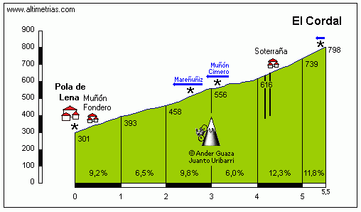
Anyway as the Cordal was also used in the stages I use for my tribute it kinda fits this way too.
As you can see on the profile the Alto del Cordal is very irregular and steep, but due to it's length of only around 5.5 kilometers it doesn't really serve a greater purpose than already tiring some domestiques considering what's still to come. A very tricky descent brings the riders to the little town La Vega where the final climb of the day starts and it's an absolutely brutal one, the Alto de l'Angliru.
189.gif

922dc36d3fad70fff81b593fe6325e13.jpg


I posted the profile for the the sake of completeness, but I don't think anyone reading this needs it as the steepness of this climb is very well known. The climb really consists of two very different halves. The first 6 kilometer are only a bit over 6% steep, which still is anything but flat considering the last of these 6 km's is hardly ascending at all. But of course all of that is nothing compared what comes in the 2nd half which is constantly over 10% steep, with a whole kilometer with a gradient of 17% and stretches up to 23%. If you discuss the hardest climbs ever ridden in gt's this one is definitely up there. At least I have a hard time finding anything comparable to the last 6.5 kilometers of this climb. The stage doesn't finish quite at the highest point. There are still a few hundred slightly descending meters to go until the riders finally reach the finish line.
I know there isn't much climbing before the Angliru, but I didn't want to overdo it with extremely hard queen stages, and realistically there wouldn't be much happening before the Angliru anyway, considering how hard it is. For all climbers still fighting for the gc this is the best place to gain time, although not the last one. Still, if you are clearly stronger than everyone else you can gain a bunch of time on these gradients and saving energy for later stages will definitely not be worth it.

Contador tribute:
Including the Angliru in a Contador tribute Vuelta is surely not the most surprising thing ever. After all this is the only place in Spain where he has won two vuelta stages.
The first time he won here was in 2008 and although it's easy to forget about this stage win with the more recent one still fresh in everyones mind, one shouldn't forget how important it actually was. Although Contador, who was in his absolute prime at the time, won the tour 2007 and the giro 2008, the last two gt's he entered, he wasn't the undisputed leader of his team. The situation wasn't quite like in the 2009 tour de france when Lance Armstrong, who joined Contador's team, claimed the leader role despite being clearly weaker, but rather the other way around as Contador's teammate Levi Leipheimer was basically on par with Contador and only finished the final gc 46 seconds behind the Spaniard. There was only one stage where Contador was clearly a level above the American, and it was the one finishing on the Angliru where Contador won the stage 42 seconds in front of Alejandro Valverde, 58 seconds in front of Joaquim Rodriguez and crucially 1:05 in front of Leipheimer. Granted, the rest of the race might have paned out differently if this stage hadn't happened but without a doubt it was the most important step to Contador's first vuelta title.
1504858987_502474_1504859117_noticia_normal.jpg


That said, I think in 20 years the stage everyone will remember was stage 20 of the 2017 Vuelta a España, from Carver de Asturias to the Alto de l'Angliru. After a disappointing 2017 season with lots of close 2nd places, a tour de france where he couldn't live up to the expectations and not one single win in the whole year so far Contador announced the 2017 Vuelta would be the last race of his career. After losing a bunch of time in an early mountain stage to Andorra all hope Contador would end his career on a high seemed lost, but it turned out the stage to Andorra was only a bad day and with a huge disadvantage which made him no serious threat for the red jersey Contador rode the last three weeks of his career in an extraordinarily entertaining fashion, basically attacking every time as soon as the road went upwards. But while Contador was probably among the three strongest riders in the race he just couldn't get the first victory of the year. And so Contador headed into stage 20, the last mountain stage of his career and the last chance to win a cycling race.
The stage was very chaotic due to Vincenzo Nibali's team attacking on the descent of the Alto de Cobertoria, and many gc riders lost contact to the peloton early. When Nibali attacked again on the descent of the Alto del Cortal it didn't go as well though and Nibali crashed. In the process the pace went down so the Italian could join the group again. Contador used this slight hesitation and, in a season in which he was constantly criticized for having become a bad descender, he attacked on the last descent of his cycling career together with his teammate Jarlinson Pantano. He gapped the peloton, but there was still a long way to go and climbing the whole Angliru on his own, holding off the riders behind seemed like an impossible task. That's what many of the leftovers of the breakaway thought as well, so Enric Mas, Adam Yates and others decided to pay tribute to the legend who was catching them and towed Contador up the first half of the climb. His advantage increased and when he dropped everyone who was still left with him on the 2nd half of the climb el Pistolero faced a 6 kilometer long battle between him and the gc riders around one minute behind. While Chris Froome and Wout Poels, the two strongest riders from the group behind came frighteningly close to Contador, they didn't catch him and on the last mountain stage of his career the Spaniard celebrated one of his greatest victories ever.
1505131008_920700_1505131291_noticia_normal.jpg

DKIaRnzUQAAKDK4.jpg

37-Pistolero.jpg
 
Vuelta a España stage 19: Oviedo - Alto de la Farrapona (194 km)
KtzyTpy.png

rKJ2K5t.jpg


As the end of the vuelta comes closer the riders face the last high mountain stage of the race. The day kicks off in Oviedo from where the peloton heads westwards. The first half of the stage is a lot easier than the 2nd one but still anything but flat. There are two categorized climbs on the way to the intermediate sprint in Belmonte which almost marks the halfway point of the stage. First the relatively gradual climb to Cabruñana, which is followed by the longest really flat section of the day. Still, before the riders climb the 2nd pass of the day, there are a few uncategorized ramps to get over. Then after around 77 kilometers the riders start to climb the Alto de Carricedo, another 3rd category climb, which comes quite close to being 2nd category though.

The athletes then descend into a valley which would already bring them to the bottom of the last climb of the day, IF you were just following the valley. As that would be a very lame last mountain stage the riders instead have to turn left and climb the first of a series of 1st category ascents. The first of those is the climb to San Martín de Ondes. I don't know if this pass has any other official name, so I just named it after a town near the top of the climb. The street used is a narrow, very inconsistent one, which will lead the riders through the beautiful Asturian landscape.
1%2B(Copiar).jpg


After a very tricky descent there is another very steep but uncategorized climb, until the riders finally return to the valley again. There won't be a lot of rest though as almost immediately after the descent the next ascent starts, the Puerto de Marabio. While this climb is at least a little more known than the previous one, it's still a rather narrow road, last used in the Vuelta in 2002, that brings the riders to the top of the pass.
maravio1.gif


In my stage I only use the climb from km 8.5 onwards. As you can see, the majority of the climb isn't extremely hard, but there are around 3 kilometers near the top with a gradient of over 10% and numerous stretches of 14% or more. This climb probably still comes a little early for attacks, but if you have a strong team you can definitely use it to drastically reduce the peloton and set up a big attack a bit later.
After the next descent there again ins't any respite as the Puerto de San Lorenzo starts right away.
SanLorenzo1.gif


While the climbs so far haven't been very famous ones, the San Lorenzo is definitely one of the most known passes in Spain. As this is a country where very hard passes (no dead end roads you could use as mtf's but real passes with two sides) are a bit rearer than in France and especially Italy, the Puerto de San Lorenzo, as well as the Alto de Cobertoria a bit more eastwards, absolutely stand out and are therefore very popular obstacles for the route designers of the actual Vuelta. Especially the last 5 kilometers averaging no less than 11% (according to cyclingcols) make this ascent absolutely brutal and offer a great opportunity to either attack or isolate your opponent. While the descent isn't as technical as the previous ones and on a wider road, it's also very steep, so especially in rain this offers another chance to distance your opponents.

After the descent there have been almost 80 kilometers in a row which were almost completely up and down, and that doesn't change now. However the next, well over 10 kilometers, are already part of the final climb, the Alto de la Farrapona, this climb starts rather shallow and only really gets steep near the end, finishing with around 7 kilometers at over 8%. Although there are already some steep stretches on the flatter part, most attacks will surely come on those last 7 k. Considering how hard the stage has already been so far the time gaps could be huge especially if someone shows bravery and attacks before the final climb. The opportunity is surely there to use this stage to turn around the gc.
farrapona.gif

farrapona.jpg


Contador tribute:
This stage is dedicated to Contador's 2014 Vuelta triumph. A triumph which came after a season with many ups and downs. The whole spring went almost perfectly for el Pistolero winning both Tirreno Adriatico and the Vuelta al Pais Vasco, and although he only got 2nd in the Criterium du Dauphine after losing the gc on the last day to Andrew Talansky he went into the tour de france as one of the main favorites, even more so after Chris Froome who was expected to be his main rival crashed out early. However after he already showed good shape in the first medium mountain stages he crashed in the first high mountain stage and had to abandon the race as well. So it turned out the duel between Contador and Froome wasn't cancelled but postponed, as the two faced each other again in the Vuelta where they both tried to rescue their season. While Contador claimed to not be in good shape prior to the race it turned out quite soon that he could compete for the win. he took the race lead after Nairo Quintana crashed in an ITT on stage 10 and for the rest of the race had to defend it against a Froome whose shape seemingly became better and better.
Stage 16 finishing on the Alto de la Farrapona was the stage where the Brit wanted to make his first big attack and when he attacked at the beginning of the steep section of the final climb he immediately dropped everyone, except Contador. Froome tried to get the Spaniard off his wheel for the next kilometers but just couldn't finish the job and so after entering the final kilometer it was Contador who accelerated, and Froome couldn't respond. El Pistolero won the stage 16 seconds in front of his big rival and extended his race lead to over one and a half minutes. Froome used the same tactics against Contador again on stage 20, with the same result of Contador dropping him close to the finish. So the Spaniard went on to win his third Vuelta title.
069397a81e325ee5e6b8767f4bd6ea9a.jpg

1410161978_271478_1410194787_noticia_grande.jpg
 
The climb to San Martín de Ondes is known as La Colledoria. I like the connectivity there, as ever La Farrapona is a tricky one as in and of itself it should settle things but it is easier to get a gap on San Lorenzo, that's why a lot of traceurs prefer Valle del Lago off the back of San Loreno. That said, one minor alteration I would have made to the Angliru stage is to head north from Sahagún at the start as, since you're not putting any major obstacles before El Cordal, I'd have entered Asturias via the Puerto de San Isidro, which has the Fuentes de Invierno ski station that Contador won the stage to in 2008 at it, and then you could simply descend into Felechosa and Pola de Lena exactly as you have done.

Although it might be considered less desirable to remind people of that stage, one of Contador's less honorable wins - he had arranged a deal with Valverde that in exchange for the Abarcá duo not double teaming him on the Anglirú he would work to get Valverde the stage win on San Isidro (Valverde forgetting his rain jacket and being inattentive, followed by a bit of retribution from Euskaltel for Caisse trying to prevent them getting into the maillot oro in order to keep Levi in it and foster discord in Astana, meant he was a few minutes back and little threat to Alberto at this point), however Valverde hit the wall and bonked under an infernal rhythm being set by Ezequiel Mosquera, who trailed everybody bar Contador and Leipheimer off his wheel, and they stayed there, glued to his wheel, not taking turns, before each nipping out in the last 200m to take the 1-2 on the stage and leave Eze with nothing.
 
I have a problem with my next race. One option does have a two-peak mountain block but it looks ridiculous on a map (only eastern parts of France). Another one i like more as it covers more of France, but it's mostly an early 00's route with a clear distinction between flat and mountain blocks, so i guess peeps won't like it. I cannot find the right balance between something new and quality of racing. It may sound harsh but i also don't know if i care about your opinion or not.

I have a couple of stages that will most probably stay no matter what and the one below is one of them. I've read on Velowire that there are apparently some cobbles near the village of Champcueil. I decided to have a look at them myself and they do look tasty. Champcueil is located in the dep. of Essonne. It's just west of Melun and south of Évry/Corbeil-Essonnes. Both cities are part of the outer circle of Paris' agglomeration. Thanks to this location it can be used for a stage just before the Paris one, after the last mountain block.

QF4Wk8d.jpg

Map of the Champcueil cobbles.

The cobbles of Champcueil seems to be slightly bigger (chunkier) than those of Paris-Roubaix. There are 3 of them - Rue de Milly, Rue de la Butte Geoliette and Rue des Montils. There are quite close to each other so it's quite easy to link them. Rue de Milly is the only one with any elevation change.

WOvACxa.jpg

Rue de Milly.

lF05CsI.jpg

Rue de la Butte Geoliette.

Below is a sample stage ulitising these cobbles. it's short and starts relatively near Paris as i assume it'll be after a significant TGV-based transfer. It can be placed just before the Paris parade stage, unless you're me, then you have a lap featuring the hardest side of the Meudon observatory and a finish in front of the Eiffel tower.

IZiB95I.png

Melun - Corbeil-Essonnes.

0xe8jqS.png

Saint-Germain-en-Laye - Paris.

If i will ever decide on the route of my Tour (maybe Paris-Nice?) then i will expand more on both stages.

How much do you love Tourmalet? I now it doesn't have the greatest of reputations on this forum, but with Plateau de Beille (which also seems to have an awful reputation) it's one of the hardest Pyrenean climbs. It can be used as an MTF or as a descent finish at La Mongie. However, there is also another side (similar to Peyragudes), that's left unused - Barèges-Tournaboup, but i think that'll be for a different thread.
 
Gigs_98 said:
The real question is, can you somehow combine these two stages and make it the 2024 olympic road race?
Sadly, Champcueil is good 40-50km off the centre of Paris, but if you want something interesting, then play with the Sacré-Cœur climb (Montmartre) in the 18th arrondissement. You will have hours or even days of fun. I personally recommend Rue d'Orchampt/Rue Norvins and Rue Saint-Vincent/Rue des Saules. However, getting out of it can be a problem. I guess Rue Lamarck could be a viable option.
 
I like both Tourmalet and PdB. The former especially so with finishes at Lac de Payolle, Bagnères-de-Bigorre, Luz-Ardiden, Gavarnie, and to a lesser extend Hautacam and Loudenvielle. Nothing wrong with that, and unlike some others here, I think it's good to have some climbs used often. Even if PdB doesn't link well, it is a proper MTF, and like AdH it is steepest at the bottom and easy at the top.
 
Re:

Netserk said:
I like both Tourmalet and PdB. The former especially so with finishes at Lac de Payolle, Bagnères-de-Bigorre, Luz-Ardiden, Gavarnie, and to a lesser extend Hautacam and Loudenvielle. Nothing wrong with that, and unlike some others here, I think it's good to have some climbs used often. Even if PdB doesn't link well, it is a proper MTF, and like AdH it is steepest at the bottom and easy at the top.
I don't really get Gavarnie. There are good 15-20km of false-flat before the proper climb starts and itself is nothing more than an uphill finish. I would also add-in La Mongie and Barèges-Tournaboup as viable options for an immediate descent finish.

I've did for @Gigs_98 a quick mock-up for a potential olympic/TdF lap in Paris featuring short cobbled climbs (hellingen) to Place Jean-Baptiste-Clément and Place du Tertre finishing in Champs-Élysées which can be found here: https://www.la-flamme-rouge.eu/maps/viewtrack/204579
YvUOEJ3.png


Hellingen:
Place Jean-Baptiste-Clément - 480m, ~7% (max ~14%)
Place du Tertre - 520m, ~8% (max 14-16%)

BKEzyOB.jpg

Rue Drevet, part of the climb to Place Jean-Baptiste-Clément.

oCEkKdd.jpg

Rue des Saules, Part of the climb to Place du Tertre.

As for the Contador race. Every person in the world has a lighter and darker side. IMO if you're doing a commemorative race to someone i find it good to acknowledge the nicer and less nicer things someone did. Contador seems to be mostly likeable and he doesn't seem to have too many controversial instances like the Port de Balès chaingate or the mentioned Fuentes de Invierno/San Isidro stage. if i would for example do a Voeckler commemorative race (Tonton?) i would also add in Galibier and AdH, where he lost 2011 TdF in spectacular and very expressive fasion.
 
railxmig said:
I have a problem with my next race. One option does have a two-peak mountain block but it looks ridiculous on a map (only eastern parts of France). Another one i like more as it covers more of France, but it's mostly an early 00's route with a clear distinction between flat and mountain blocks, so i guess peeps won't like it. I cannot find the right balance between something new and quality of racing. It may sound harsh but i also don't know if i care about your opinion or not.
Make something that you like first. A lot of us have opinions on route design that overlap, but they won't map onto one another perfectly. In general if your other routes are anything to go by there will be a lot that people will like regardless, and people are never going to love something unreservedly because even if you unleash a flawless and innovative route, some of them will curse that you had those ideas first ;)

How much do you love Tourmalet? I now it doesn't have the greatest of reputations on this forum, but with Plateau de Beille (which also seems to have an awful reputation) it's one of the hardest Pyrenean climbs. It can be used as an MTF or as a descent finish at La Mongie. However, there is also another side (similar to Peyragudes), that's left unused - Barèges-Tournaboup, but i think that'll be for a different thread.
I actually quite like PDB as a finishing climb, the issue with it is more about finding appropriate connecting climbs or where to place it. It works well at the start of a mountain block but given its location in the Pyrenees that more or less forces it to go in a clockwise route, whereas at the end it runs the risk of neutralising the stages ahead of it. I've never really been happy with any stage I've designed there but it isn't a problem with PDB.

Tourmalet, on the other hand, I really dislike, but the problem is that its overuse is largely because it is the only such pass in that part of the Pyrenees, and because those are the areas that pay up, and the Tour doesn't stray far from a specific ring of passes, it never gets skipped. When I did my somewhat experimental Tour based on unusual earlier routes, I ended up using it, but I think there is also the factor that the reason it is used so often is because of ASO using such a limited number of Pyrenean climbs which means people are reluctant to use it when fantasy designing because you aren't beholden to the same limitations as ASO in real life (not to mention that ASO also get very lazy in real life, connecting stage towns by predictable routes because they can sell the name of the climb rather than the actual value of the route). The actual climb of Tourmalet is pretty good, but the problem is because it's so stupendously overused, every rider knows it like the back of their hand now, where to expend effort, where to preserve it, so its value in terms of selectivity is greatly diminished.
 
Part of the problem of the Tourmalet is that it's also almost always placed in the stage in a way that it doens't get action. It's either very far from the finish line, or when it's the penultimate climb, the final climb is either HC itself or preceded by a bunch of false flat.

The Tourmalet MTF in 2010 was decent enough, but that was also circumstance more than the climb itself.

It's use in the 2018 right is basically hit or miss I think. Could be another irrelevant ascent or it could be the climb of 2018.
 
Jun 30, 2014
7,060
2
0
Oh well, I never finished my Iranian stage race. :eek:
I've got a few stage races that would be interesting.
- A Tour de Romandie
- A Tour of Wyoming with mountains and a potenial crosswinds stage with unpaved roads.
- A big U23 race in the Northeast of the USA, 8 days of racing of one of them featuring two half stages, not many longer climbs, most of them are rather short and steep.

Other than that I still have a route for the Tour of California and an Argentinian stage race in Jujuy and Salta that are finished, but I'd prefer to post one of he other 3 races.
 
Re:

Mayomaniac said:
Oh well, I never finished my Iranian stage race. :eek:
I've got a few stage races that would be interesting.
- A Tour de Romandie
- A Tour of Wyoming with mountains and a potenial crosswinds stage with unpaved roads.
- A big U23 race in the Northeast of the USA, 8 days of racing of one of them featuring two half stages, not many longer climbs, most of them are rather short and steep.

Other than that I still have a route for the Tour of California and an Argentinian stage race in Jujuy and Salta that are finished, but I'd prefer to post one of he other 3 races.
While personally i would like to see Romandie, as i'm really fond of Suisse climbs (i will definitely do a Romandie myself in the future) i am also very interested with Wyoming. For now i would go with Wyoming first and then Romandie.

Tour de Pologne 2

In October 2017 i finally had ready my 2nd (and most probably last) Tour de Pologne as i had some unfinished business in the country. Sadly, somehow (i don't know, how) Libertine managed to do something around Elbląg 5-10y ago and it broke my spirits. Thankfully, i found maybe a better alternative for a cobbled stage. This discovery triggered me to finally finish this race.

Stages 2-5 are written down and ready to go as they are from my original draft. The rest was created just today, and i will need to write something about them and that takes some time. I'll try to do this ASAP, before Mayomaniac (and others) will start his races as Gigs is finishing his Alberto celebration. I'll try to post the first stage today in the evening or relatively early tomorrow. I hope to have 1 stage per day (max 2 days). It should take me roughly 1 week.

This race will consist of a genuine MTF, LBL type of a stage, a HTF, short ITT and a cobbled stage. I also tried to combine as many historic and/or interesting places as i only could, which resulted in stages being quite long (avg 200km) and relatively big transfers (avg 70-100km). Also, some of the hosting towns and finishes are probably to small for this race, but i hope the stages will compensate these oversights.
 
Unlike the majority of one week races, Tour de Pologne starts on Saturday. That means it's preferable to have the biggest cities early. So, let's kick off with one that seems to be fond of Tour de Pologne – Kraków (Cracov).

https://www.la-flamme-rouge.eu/maps/viewtrack/204878
Tour de Pologne 2 – stage 1. Kraków – Kraków, 15,4km, ITT.
18f0SlX.jpg

V5BLTKa.png


I don't think Cracov needs any in-depth presentation, but even an abstract ended being way too long. It was the 2nd capital of Poland from XI c. (formally XIV c.) to XVI c. It was also one of the most important trading centers between west and east since IX-X c. It's the most well-preserved historic city in Poland, which managed to escape the destruction of both World Wars. A quite big historic centre (stare miasto) dates back to the romanesque and gothic period. This historic centre is walled off by Planty – a park, which was created in early XIX c. in place of the demolished XIII-XIV c. city walls. Now only a small portion with St. Florian's Gate (Brama Floriańska) and a late XV c. barbican (barbakan) attached to it (one of only handfull still surviving in Europe) is still standing. Cracov is also home to the 2nd oldest (after the Prague) university in central Europe – Jagiellonian University founded in XIV c.

1024px-Barbakan_Krakow_z_ulicy_Basztowej.jpg

Cracov's barbican.

In the middle of the historical center is the main square (market, rynek główny) – a very large XIII c. town square, believed to be one of the biggest medieval squares in Europe. This square is home to the XV c. cloth hall (Sukiennice, in the middle of the square), XV c. St. Mary's Basilica (Kościół Mariacki), XIII c. town hall tower – the only remnant of the original town hall, very small romanesque St. Adalbert's Church from early XI c. – one of the oldest still remaining in Poland and plenty of XV-XVIII c. apartments. St. Mary's Basilica also has a Saint Mary's trumpet call (hejnał mariacki) played every noon from the belfry.

1024px-Sukiennice_and_Main_Market_Square_Krakow_Poland.JPG

Main square and cloth hall and town hall tower behind.

Rynekkrk.jpg

A different angle of the main square with St. Mary's Basilica.

1024px-Church_of_St_Adalbert%2C_2_Main_Market_square%2COld_Town%2CKrakow%2CPoland.jpg

St. Adalbert's Church in the main square.

Located between the southern tip of the historic centre and the north bank of Vistula river is Wawel – a small hill, home to the royal residence complex which consists of a Royal Castle and Wawel Cathedral (Basilica of Saints Stanislaus and Wenceslaus). Both monuments date back to IX-X c. and were rebuilded/expanded several times in at the time most popular styles, hence their very clustered, chaotic appearance. The Wawel Cathedral was the place, where Polish kings were crowned and buried while the castle was their main residence. The Wawel hill is also home to a myth of a dragon eating virgins. I guess it was a medieval political pro-family propaganda.

1024px-Wawel_castle.jpg

Mix of architectural styles within the Wawel complex.

768px-Wawel_katedra2.jpg

Wawel Cathedral.

The last historical monument i will mention is Krakus Mound (Kopiec Kraka) on the other side of Vistula river. The origins of this mound are uncertain, but it was probably created by Vistulans or even Avars in VIII c. To this mound is tied a myth about the origins of the city and it's supposed founder – King Krakus. Nearby is also a smaller Wanda Mound (Kopiec Wandy) dating from roughly the same period. Interestingly, according to a myth Wanda was the daughter of Krakus and decided to drown in the Vistula river to not marry a German. Poland didn't like Germany even in the oldest of times.

1024px-Kopiec_Krakusa.jpg

Krakus Mound.

Because of the very long and rich history of the Kingdom of Poland i prefer to end here as i don't want it to be an encyclopedia. Cracov was one of the main towns of the Polish tribe Vistualns (their capital was probably Wiślica – now a village NE of Cracov), which in VIII-X c were in constant wars with the Great Moravia (a long story for a different time and race). During the X c they were in Czechia. In late X c. they were conquered by Poles from Greater Poland (Mieszko I). After the Congress of Gniezno in year 1000 it was one of the newly created bishoprics with Wrocław and Kołobrzeg. In 1241 the city was sacked by Tatars. That's also, where the Saint Mary's trumpet call originated (the trumpeter being shot by an arrow in the middle of playing on the belfry).

Cracov became de facto capital of Poland after the pagan rebellion of 1032-1039 during which Czech prince Břetislav I raided Silesia (Wrocław, Legnica) and Greater Poland (Gniezno, Poznań, Biecz, Ostrów Lednicki etc.). Lesser Poland escaped the raid and largely also the pagan rebellion hence Cracov was largely intact. That's why the next Polish prince – Casimir the Restorer decided to move the seat to Cracov.

From XII to XIV c. there was (like with many European countries at that time) also a period, when the country was partitioned. In theory every male member of the royal family had its own land, but the prince of Cracov was considered to be the senior – main ruler of the country. However soon this system became a mess and within this mess Poland lost Pomerania and Silesia to Holy Roman Empire and newly introduced Teutonic Knights. At the end of the partition period the new ruler of Poland – Władysław Lokietek (Vladislav the Elbow High) decided to restore Cracov as now the formal capital of the country and it stayed like that to Sigismund Vasa, who in 1596 moved the capital to Warsaw.

875px-Mon_Henrykow_Slaskich_%281201-1241%29.JPG

Poland in the first half of XIII c.

There are many, many more stories and sights of Cracov like the historic Jewish district of Kazimierz dating back to XIV c. but i feel this post is already too long and i even once didn't mention the stage. It's a shorter version of the last Cracov's ITT from 2016. I'm cutting the loop off near the Krakus Mound using Wielicka and Powstańców Śląskich streets. Of course the start and finish are on the opposite sides of the main square. It's not the longest nor toughest tests against the clock, but it should be fine enough for this race, as Poland is not particulary known for high mountains and Tour de Pologne itself (but the last edition, where there was no ITT) was mostly won by guys that are strong against the clock (but theoretically Majka in 2014).

RTUhq6m.jpg

Start and finish of the Cracov ITT.

I guess that's all for now. The next stage will enter the Beskid Mountains.
 
Nordic Series 11: Lago di Tesero-Val di Fiemme

This is a post that, to be honest, I'd been holding back for a while as it's quite daunting, given the myriad opportunities that are offered here. The Val di Fiemme is an iconic location in cross-country skiing and offers so many possibilities for cycling that it's remarkable, and so producing sufficient stages that I was happy with, with sufficient variety, and also showcasing some innovation, left me with the same kind of problem that are why I find the Österreich-Rundfahrt and the Tour de Suisse so difficult to design - so many options. I also didn't want to put in too much repetition, since railxmig already included some options using the ski jump Tramplin de Praz at Predazzo which hosts the ski jumping and NoCo disciplines and I didn't want to steal their thunder either, although I am moving my finishes a few kilometres down the road to the Lago di Tesero venue.

stadio-del-fondo_2013_3_panoramica.jpeg


This iconic stadium features plenty of space (you can finish either outside or even, in particularly selective stages, up a narrow tarmacked trail that allows you to finish in the stadium itself) and with the proximity to the towns and cities of Tesero, Predazzo, Moena and Cavalese there's plenty of accommodation and amenities nearby. I have previously used it as a stage start, in my Giro Rosa from a few years ago, but not previously as a stage finish, even in my Giro del Trentino that was based entirely around linking biathlon and XC skiing venues. You know, the area is capable of hosting the top level international competitions in XC, ski jumping and NoCo simultaneously along with thousands of screaming fans, so it has everything it needs to be able to cope with the influx of top level bike racing.

Sitting between two monolithic passes, the Passo Lavazè and the Passo Manghen, there are a lot of options here although in the past, the Giro has tended to play it safe and go with the Alpe di Pampeago MTF with stages such as this one from 2008, won like every good mountain stage in the 2008 Giro by a CERA-fuelled Emanuele Sella.

giro_de_italia_perfil_et14_G_2008_giro.jpg


Innovation in 2012 led to the use of the Pampeago as a pass, which I have borrowed from, although this was unfortunately in the 2012 Giro, as a result racing was pretty tame. Not waiting for an MTF takes this aspect out of the race, as we will be finishing in the valley for the most part.

However, although it has hosted the Nordic World Ski Championships three times - in 1991, 2003 and most recently in 2013 - the Val di Fiemme Nordic venues aren't just known for that. In addition they've hosted the cross-country and even the biathlon at the Winter Universiade in 2013, after the original host, Maribor, had to withdraw, and every year the venue serves to showcase the finale of the Tour de Ski, a skiing stage race which draws upon the traditions of road cycling for its inspiration, with bonus seconds available, youth bibs for best U23, and race formats that show a significant amount of cross-pollination between the sports. Typically a final weekend of the Tour de Ski will consist of a decent distance classic race including some of the traditional climbs of the venue - the stadium finishing Zorzi, Pojer, which is my personal favourite, and the most iconic of them, Chiesa, so named for the scenic church the athletes sweep past - before the coup de gras, a 9km pursuit race which begins at the stadium and then ascends the Alpine ski run at the Alpe Cermis, which is a one-off super-test for the World's best, for whom such gradients are atypical except in comparatively short - and iconic - ascents like Mördarbacken at Falun. Crowds line the mountaintop finish several deep, and the athletes suffer like dogs and crawl by, often having to resort to alternate skate, in a real one-off spectacle that is a sight to behold.

pag-17-spettatori-tour-de-ski.jpg


And yet, the biggest problem from a race design point of view with regards to Alpe Cermis is that there really isn't much space there - the road they take from Lago di Tesero up to the climb is very limiting and the possibility to use it for cycling isn't really there - notwithstanding that the road is not parallel to the climb and is much more gradual - still a decent challenge but not really viable from a race design point of view. Much more promising is the other piece of annual skiing history that the Val di Fiemme has to offer.

marcialonga-2018-val-fiemme-val-fassa-sci-nordico-trentino.jpg


If XC skiing in general shares some tactical ground with cycling, that's nothing on ski marathons, Worldloppet, Visma Ski Classics or whatever the ultra-long-distance series is choosing to be known by these days. Of course, there are no races which match the Vasaloppet for legend, but the Marcialonga, Italy's greatest ski race, is one of the few that contend for the slightly smaller crown. Held over 70km, it heads uphill from Moena through the Val di Fassa before turning back on itself in Canazei, a famous cycling town as it sits at the base of the Passo Pordoi and Passo Sella and also at the bottom of the descent from the far greater Passo di Fedaia, before returning through the Val di Fassa and into the Val di Fiemme on a slowly downhill route, before an iconic final climb, which has various names but typically has reverted to "Salita della Cascata". This is on an actual road, pleasingly, which is a minor road which leaves the SP232 opposite the Cascata dell'Avisio di Cavalese, and winds its way up an ascent of 144m in just over 1,6km - it's around 1650m at 8,6% - into the town, through narrow town streets and then hanging a right into the finishing straight on the Viale Celeste Mendini. You can see the final climb here from the 2013 edition - and here you can see it in summer, on the tarmac, which as you can see is perfectly suitable for cycling! I have categorized this climb - which comes around 6km from the ski stadium in Lago di Tesero - in my stage designs but in an actual Giro this would almost certainly be an uncategorized climb. As you can see, Cavalese is plenty big enough to host the Giro so could host any smaller race that would be in the area - Girobio, Tour of the Alps and so on - and therefore any of my stage suggestions that include this little ramp can also have a clone of the Marcialonga finish, with a puncheur finale, as a design option.

marcialonga2016-cascata-600x480.jpg


Putting this kind of little sting in the tail after a real monster stage over the likes of Manghen could create some interesting challenges, as well as offering the options for less brutal medium mountain stages here, as after all we are fairly far south in the region and if tougher mountain stages are to come then there's no need to kill the racing either, so I've presented a couple of lighter, intermediate stage options as well as the high mountains. Personally I prefer to then have the little run-in to the ski stadium in Lago di Tesero rather than the puncheur finish, but it could well reflect similarities to, say, the Briançon finish with the iconic pavé in the citadel or Gouveia after Torre in 2003 in the Volta, and similar types of finish if they were to finish in Cavalese à la the Marcialonga.

But anyway - there are a lot of climbs in this area to profile, so on with the show.

Proposal #1: Belluno - Lago di Tesero-Val di Fiemme, 170km

7UkEoMQ.png


Here we have what would be a classic initial gambit, entering the mountains from the south. It would work best following a mountaintop finish in the area around Belluno, somewhere like Piancavallo or Nevegal, given the direction of travel somewhere like Tre Cime is probably too far, and Monte Grappa would mean we would be looping around the previous day's stage, but still not beyond the realms of possibility. The first climb of the day (and the uncategorized additional summit at Passo di Cereda) is optional, but as this likely wouldn't be the first mountain stage of a chain, I anticipate that we wouldn't want to simplify it. At the same time, however, the monolithic Passo Manghen doens't require too much before it - it has historically been used in conjunction with Alpe di Pampeago and so hasn't been the decisive climb in and of itself, unless like the 2008 stage, the king of the mountains is absolutely on fire. But here, Manghen is moved into the most decisive role possible, as the key note climb of the day, and at well over 20km averaging 7% and with the final 7km averaging 9,5%, it has traits in common with both Mont Ventoux and the Colle di Agnello, two monster ascents with humongous legacy that Manghen has never been allowed to attain for itself.

ManghenS.gif


Here, the summit of Manghen is 26km from the finish, and the majority of that is made up of a similarly difficult descent, winding its way down the mountainside for 16km of sinuous tarmac, the first 6 of which averaging 10% and yet known to be absolutely safe as it's been handled in racing many times before. After arriving in Molina di Fiemme, the riders then have a short trip up the valley road to the waterfall where they turn left and take on that punchy little climb into Cavalese from the Marcialonga, cresting 6km from the finish, just to break up any group that forms on the descent further, as obviously we can often see small groups become larger ones on descents such as this, and I would argue that this essentially represents an amped up version of the uncategorized Garagaltza ascent in the Oñati stage of the 2012 Vuelta al País Vasco as a run-in.

Proposal #2: Bussolengo - Lago di Tesero-Val di Fiemme, 205km

5cZ45Bk.png


The second stage proposal is like the "fully loaded" version of the previous one, again to follow some monstrous MTF or to lead into the final mountains of the race - coming from the south this would likely entail a preceding stage in the southern extremities of the nearby Alps if there were mountains at all - Punta Veleno is perhaps the only realistic such option. Most likely, this would be a 'final roll of the dice' type stage, what with it having four serious, serious ascents in it and no MTF. Or, in current cycling trend, as stage 19 with a 120km Dolomite stage as the final mountain stage the next day.

All of these climbs are potential monsters. The first, San Valentino in Brentonico, is climbed from Avio (until 4,5km remaining on that profile). I'm not sure which side (there are many) they climbed when the not-at-all-mourned Giro di Padania staged a mountaintop finish there a few years ago, but Ivan Basso won comprehensively as the top 20 were split by five and a half minutes. Neighbouring San Giacomo has been used for MTFs in Trentino a couple of times since, but San Valentino is the tougher climb, at least from this side. After that we include the Passo di Bordala, again from a tougher side than seen in its one appearance in the Giro, which was as the second part of a double-summit with the Passo di Santa Barbara in the infamous Passo Coè stage which was a 7 hour festival of riders cracking at the end of the 2002 Giro, where inexperienced maglia rosa Cadel Evans was taught a humiliating lesson in the pressures of leading a Grand Tour that took him almost a decade to finally right. That day they only climbed the final third of this southern side, but the full extent of the climb is just under 15km and 6,9%. Then we take on the Passo di Sommo, which is one of a couple of stop-off climbs en route to the Passo Valbona. The town of Folgaria is just beneath the summit and is where the Passo Coè/Valbona west road splits from the Sommo/Valbona east road. Sommo itself is only a stopping point on the way up there, and yet is in and of itself 15,6km @ 7,4% so no laughing matter. It's only been used as a summit in and of itself in the Giro twice, both times being topped by Spaniards, who until the advent of the Colombians in the 1980s were the purveyors par excellence of flaky and inconsistent, but mercurial and super-talented mountain climbers. Mariano Díaz won the summit in 1968 and then in 1974 when it was the feature climb of the Sella Valsugana stage which saw one of several long-distance raids by José Manuel Fuente in a futile, doomed attempt to win back the 9 minutes he'd lost into Sanremo.

Essentially this stage serves as a "more sugar! More butter!" version of the first stage as the finish is the same, but it also showcases some really tough but underappreciated climbs, which is a bonus since I find Giri so hard to design owing to the embarrassment of riches that Italy has in the way of difficult ascents.

Proposal #3: Treviso - Lago di Tesero-Val di Fiemme, 172km

iVFXg6L.png


Of course, not every stage proposal into the Val di Fiemme needs to be a monster, and this isn't a valley like, say, the Vall d'Aran, where there's only really the one major route in. Not to mention that the valley itself has climbs in it. This proposal is like an easier version of the redesigned 2009 Pinerolo stage, with Sestrieres as a long grinder of a climb and then the Pramartino finish. Here, the role of Sestrieres is filled by the long, but relatively consistent Passo Rolle. At 22km at 5,5%, it's going to thin the bunch but not create too much action in and of itself; however it's long enough to rid the group of a lot of domestiques. This enables us to head into the Val di Fiemme itself and then we can actually pass, after Predazzo, into Tesero town, though this is on the opposite side of the river from Lago di Tesero and so we don't need to worry about loops or criss-crossing the finish. The Passo di Pramadiccio is the nearest summit to Lago di Tesero, actually, but it's about approaching it the right way. I have chosen to climb the eastern side, which is the tougher ascent, 6,3km @ 7,2%. It would probably actually be cat.3 in the Giro, come to think of it, but I've put cat.2 here. By this route you do go to the north of Cavalese on the descent, so we could descend directly to the finish from here, which would put the summit 13km from the line instead of 23km, however I take a slightly more scenic descent to the west of Cavalese (we do enter the north of the town but not crossing where the Salita della Cascata reaches the town so we can still use that finish).

PramadiccioE.gif
PramadiccioW.gif


Here, there's no single obvious platform for the attacks as there is in the first two stages. Rolle is unlikely to create decisive attacks, yet it's drawn out enough that it could allow for an ambush if a team plays its cards right. However, Pramadiccio will be more likely, but also be quite nervous as there's still the small Marcialonga climb to consider, and while that is wide enough to deal with it, positioning on that climb if a large group gets there will be crucial as we've seen in many goat track puncheur climbs over the years in Tirreno-Adriatico and País Vasco most notably.

Proposal #4: Darfo Boario Terme - Lago di Tesero-Val di Fiemme, 210km

xht7Lfl.png


In some ways this is one of the more unlikely proposals and in some ways it's actually my favourite of the options owing to that rather unconventional run-in. It's sort of a medium mountain stage and sort of a trap because it really can't be underestimated.

The length of the stage is a factor, although to be honest that Palù di Giovo loop was only really included because of the village's iconic cycling status thanks to the Moser/Simoni link, and isn't expected to really impact the outcome much. The Passo di Tonale here fulfils the role of simply ensuring we can't have a weak breakaway due to the seemingly never-ending gradual toning up of the climbing on the first third of the stage - essentially we climb 1500m in 70km which is barely 2%, but it is just slowly, slowly getting harder until you realise you're in a full-blown climb. Tonale is a very common Giro climb owing to essentially being the only lateral connective road in that area other than Stelvio. I could have sent us over the easy side of Mendola to give a stage like 2011's to Tirano but preferred just to head around the valley to add the distance before the sting in the tail, the climb to Trodena.

TrodenaW.gif


GetImage.ashx


Being in a natural park, Trodena is a scenic mountaintop small town that is unknown to the Giro, strangely enough given that final 7km at 10% and the proximity to other large climbs. Sella Valsugana has been more or less unheard of since that 1974 stage, yet could you imagine Trodena, Manghen north and then that medium sized finish with absolutely no flat, unlike the rolling terrain from Sommo to Borgo Valsugana? That would be a monster. Anyway, here the mid-length but steep ascent can do its thing, but there's no descent to speak of, as after it crests, 20km from the line, there is literally 2km of descent before around 3km of the finish of the Passo di San Lugano climb, which are only around 4% and not worth categorizing here. There's then only rolling downhill before the final Via Campanari climb - so there's no true respite, nor is there a chance to catch back on to those who've dropped you on the Trodena climb without having to fight hard in the rolling terrain - so working out who to collaborate with will be key, as obviously 7km at 10% will rid the bunch of most of its helpers. And there's still that puncheur climb to come, so it's like a much tougher version of the Asiago finish from the 2017 Giro.

Proposal #5: Verona - Lago di Tesero-Val di Fiemme, 168km

VyFq8s0.png


This is the easiest stage option - this would be best suited to a stage 13 kind of scenario, leading into the high mountains but without really using them, keeping them for the weekend stages to come, or if the finish is going to be somewhere like Venice or Trieste like in 2014, as around stage 18 to bring us to our final mountains without giving too much away - and will likely be a stage taken by the breakaway, but with the finale offering the opportunity for the GC men to fight out a few seconds and offer a preview for what's to come. Essentially the first half of the stage is flat, heading into the Trentino valley, before a more difficult second half. Most of the climbing is not especially steep, so potentially given the low gradients the Giro wouldn't even categorize anything until late on in this stage, but you know, let's be fair. From Civezzano to Baselga di Pinè is about 11km at 4,5% so it's worth some points. It's the toughest climb of the stage, however, and isn't likely to drop too many, being the first climb of the day and with the péloton likely saving some of its legs.

Instead, they'll be waiting for the last two climbs. If the break takes this, I expect Altrei / Anterivo to prove the decisive ascent, coming 24km from home and with that kilometre at 9% in the middle, but from the bunch it's likely to be left until the last climb, which as before means positioning on the way from Molina di Fiemme to the Cascata is going to be key.

Proposal #6: Brunico-Bruneck - Lago di Tesero-Val di Fiemme, 198km

HptOrrX.png


This one is a much more archetypal Dolomite stage, using some of the Giro's best known and best loved ascents as we approach from the north. It looks more like a "classic" mountain stage than a lot of the other suggestions for the venue, and is also the first not to include the Marcialonga finish as a finale - due to our approaching the Val di Fiemme from the northeast, although if you wanted you could put the Pramadiccio finish from proposal #3 appended on to the end of this stage, however I don't feel that's necessary and would only disincentivise moves on the tougher earlier climbs.

The climbs here are all well known to traceurs, of course, as they are well-known ascents from the Giro of varying characteristics. The Passo delle Erbe, or Würzjoch, was introduced in 1993 from the west and 1994 from the east, with this tougher, two-stepped eastern side being reprised in 2005 and then the longer, more gradual western side being used in 2006 in the abortive Kronplatz stage. The brutal northern side, however, has not been seen in racing to date, despite resembling a (marginally) easier version of the Alto de Hazallanas which has been such a hit in Spain. This ought to sort the wheat from the chaff before a classic combo of the long and gradual Valparola and the steep but shortish (by these standards) Giau (since we're only doing the final 9km here) cresting 75km from home before a long and technical descent. Normally I would go - obviously - to the Passo di Fedaia (Fedaia!) here, but that would just lead to a long valley descent, and using the Fedaia (Fedaia!) in a stage akin to a 2009 Tour stage would be a pure insult. So instead to bring the final climb close enough to the finish to make it decisive, we head southwest and take on the Passo Valles.

rifugio-capanna-passo-valles-15.aspx


Of a large and dramatic size, the Passo di Valles from this, its toughest side, is 20km at 6,3% with the final 7km averaging 9% - without that little flat kicker a couple of kilometres from the line you'd have 5km averaging over 10% leading into that. This cresting 28km from the line, all of which is descent, should enable the riders to make this decisive, as the opportunities are there if they want them.

Proposal #7: Rovereto - Lago di Tesero-Val di Fiemme, 181km

HOURSxt.png


The only proposal that features a trip through the finishing line before the actual finish, this stage also brings the climb of Manghen further away from the finish to imitate the 2012 Giro stage referenced at the beginning, where the use of Alpe di Pampeago as a pass opened up a new world of choice where previously the site had only been available as an MTF - much like the ASO's repaving of the Col de Sarenne road gave us the alternative options with Alpe d'Huez that had until then only been traceur pipe dreams, but could now be appended to realistic possibilities.

Giro_2012_Treviso-Alpe-di-Pampeago-Val-di-Fiemme_profile.jpg


Now, obviously we're not including the mountaintop finish here, so that isn't in and of itself a stage we can eminently clone. However, save for that final ascent, it's not unreasonable to include in that manner. Admittedly, I didn't need to include the little riser into Cavalese between Manghen and Lago di Tesero (for this stage, since it's not intended to be relevant to the outcome, I elected to use the traditional main road into Cavalese from Molina rather than the Salita della Cascata). While the long brute of Manghen is now pushed all the way back to 70km from the line, we do have the monster that is the Passo di Pampeago, at 10,5km @ 9,7%, just 31km from the line (closer than in 2012 where also the final climb also being to Pampeago with its super steep ramps meant that riders were unwilling to be aggressive earlier, although in fairness in the 2012 Giro I don't think a race organizing committee made up of Jacky Durand, Vino and the ghost of Frank Vandenbroucke threatening to execute any rider not caught attacking over 40km from the finish at least once in the race could have wrung some interesting racing out of that soporific péloton. Apart from Matteo Rabottini, the only drug you should have been testing the 2012 Giro péloton for is codeine.

Anyway, that's not even the final climb because we then have the last 6km of Lavazè to encounter before descending via the Passo di Pramadiccio into the finish. The final climb is 17,6km from the line so we've got a stage that encourages plenty of action.

Proposal #8: Brixen-Bressanone - Lago di Tesero-Val di Fiemme, 149km

AUx56Fy.png


Here's where I get nasty, and introduce a whole new brute.

Admittedly, the early climbs in this stage are not easy ones. Laion is a pretty notable 7km @ 9% and the Obergummer, from its hardest side, is a legitimately brutal 12,3km @ 8,2% and is completely unknown to the Corsa Rosa, which is remarkable given its proximity to Bolzano and its brutality. It connects very well with the Passo Lavazè although I've chosen to link it with San Floriano which has a brutal last few kilometres - 6km at almost 11% - and has only been seen once by the Giro, with a longer and more gradual run-in (a long false flat layup to where we join the start of our climb), in the 1998 Alpe di Pampeago stage.

pampeago.jpg


From here we make our way across San Pietro and down into the main valley around Auer-Ora until the real brute of my stage begins. It is, in effect, two climbs, but they become one in much the same manner as Télégraphe and Galibier or Soulor and Aubisque. The first, we already met earlier - it's that surprisingly tough Trodena climb. but no sooner have we done that 2km descent than, instead of heading over the Passo di San Lugano like before, we cross the road and head toward the tiny village of Redagno. From here things get interesting.

D-0460-aldein-ort-radein-forstweg-nach-jochgrimm-gurndin-alm.jpg


When the road turns uphill again at Fontanefredde (aka Kaltenbrunn, which therefore shares its name with a German biathlon factory!), we start a road up to the Passo di Oclini, or Jochgrimm (sometimes Grimmjoch, but the former is preferred) in the region's preferred German (at least in these villages). The overall picture of this climb is 13km @ 7,4%, but that doesn't clarify that the last 8km are all on sterrato. Historically I had thought that this pass was not achievable for road bikes, however one of the posters at quäl dich has ridden it, and reports that it is passable for road bikes, in much the same way as Finestre or Kronplatz, so it comes back onto my agenda. It looks pretty great, actually.

D-0449-aldein-ort-radein-forstweg-nach-jochgrimm-gurndin-alm.jpg


B-0419-aldein-jochgrimm-forstweg.jpg


The overall is that we have a climb of around 26km at 6,5% but that's broken up into 10km at 8,5%, a short descent and then 13km @ 7,4% - with the final 8km on sterrato. Either way it's a monster, and crests less than 20km from the line, with a short narrow descent of 4km into the Passo Lavazè before a tougher and more direct finish than the previous stage, descending through the steeper side of Pramadiccio to bring the summit closer to the line.

Proposal #9: Lago di Tesero-Val di Fiemme Circuit, 28km

0cK7nhp.png


With some venues, like those in flatter areas in Scandinavia, and places where snow cover is not a problem and so the need for venues to be at altitude or in mountain ranges is less pressing, such as Russia and New England, there isn't much more than a slightly hilly circuit that can be done with the venue, but that doesn't mean that TT courses or potential nationals/Worlds circuits shouldn't be overlooked for possibilities here. In fact I think they are fertile ground for smaller races and will be the best options for integrating some Nordic venues into cycling - especially those located in countries which may not have their own national Tour on the kind of level that justified major mountain stages, or that do not have the geography to suit that.

With the potential to start outside and finish inside the stadium, you absolutely could do this as an ITT, but I would prefer a circuit race. It's perhaps a bit long for a Worlds circuit but an Italian national championship here would be very interesting, with three climbs on the circuit, the first being short and punchy, the second, in the middle of the course and rising out of Cavalese partway up to the Passo di Pramadiccio, being the longest (2,6km @ 7,0%) and then the Marcialonga ascent into the other end of the town being the last one. Relentless hills can create good courses and it's not like the rest of the circuit is pan flat either, you're generally either going up or down other than the 4km plateau or so between Tesero town and Cavalese north side before that middle climb - but in a 28km circuit that's less significant than a 14km circuit, for example...

Anyway, there are still countless other things one could do with the Val di Fiemme - loops with only the second part of Pampeago, going directly from San Floriano to Lavazè like in the 1998 Giro, using Cima di Campo ahead of Manghen, using Redebus southeast to lead into the Altrei - Cavalese finish from proposal #5, going over only the last part of Valles after Fedaia and San Pellegrino, and so on. The possibilities are almost endless, and that's why it's a dauntingly long post, and that's also why it's a damn shame the Val di Fiemme is not already paying up for stage finishes at Lago di Tesero.
 
Sorry for the delay but i've chosen a very bad time to do this race. Yesterday was Paris-Roubaix while the Ardennes classics are incoming. That means lots of distractions. I'm leaving some outdated stuff (like Tour de Suisse mention) for your amusement.

Around 2015 Przehyba was resurfaced and the asphalt was extended to roughly 300m before the top. Finally Poland has a proper (TdF cat. 1) climb, which maybe Tour de Pologne could try to use one day, especially as it's close to Nowy Sącz (but i think it's under the jurisdiction of Piwniczna-Zdrój). This fact distracted me from Tour de Suisse.

Last stage: link

https://www.la-flamme-rouge.eu/maps/viewtrack/164929
Tour de Pologne 2 – stage 2. Wieliczka Salt Mine – Przehyba, 191km, mountain, MTF.
tID89hY.jpg

8tk4eGM.png


Climbs:
Różnowa – 2,8km, 4,9%, cat. 3, 379m
Przęłecz Wielkie Drogi – 3km, 5,1%, cat. 2, 579m
Falsztyn – 3km, 4,6%, cat. 3, 672m
Przełęcz Osice – 5km, 3,8%, cat. 2, 667m
Jazowisko – 3km, 6,4% (max 14%), cat. 2, 547m
Przehyba – 10km, 7,5% (max 16%), cat. 1, 1128m

The stage starts in Wieliczka – not the oldest but the most known of Kraków's medieval salt mines. Mining in the area was cultivated from at least X c. but the mine itself was opened during the Bolesław the Chaste rule of Kraków in XIII c. Like with nearby salt mine of Bochnia it was manly an investment of princess Kinga and Hungarians. It was operating up to the 90's. Nowadays it's open to public. It's known for its salt sculptures, salt chandeliers and a spa complex.

Wieliczka-color.jpg

St. Kinga's shaft, Wieliczka Salt Mine.

Wieliczka-daVinci.jpg

Even DaVinci's Last Supper is carved into the rock-salt wall.

The first 100km to Nowy Targ goes alongside the real TdP stages to Zakopane and/or Bukowina. From Nowy Targ however i'm not heading towards Tatras, but very Swiss like Spisz (Spiš) and a small mountain range of Pieniny, just east of Tatras.

800px-Nowy_Targ_kosciol_sw_Anny_1.jpg

XVI c. St. Ann's Church, Nowy Targ.

Just after Nowy Targ is worth to mention a small village called Dębno – home to a well preserved XVI c. wooden St. Michael Archangel's Church, which is an UNESCO site. It has the oldest existing polychrome made from wood in Europe (from XVI c.). There are not many wooden buildings preserved in Poland. If you want a lot more, then go more towards east (Ukraine, Belarus, Russia etc.) but it's interesting to see a different historic building material than stone (France, Italy).

5414776_kosciol-sw-michala-archaniola--w-debnie-podhalanskim.jpg

St. Michael Archangel's Church, Dębno.

Polish Spisz is very small – consists only of Pieniny and Lake Czorsztyn. The Slovakian Spiš is much bigger. It consists of a couple of major Carpathian valleys – Hornád, Poprad, Torysa and Sekčov. For a long time Slovakia was Hungarian. Thanks to usually very good relationship between Poland and Hungary Spiš developed as a major trade and mining region mainly populated by German traders and miners. The region was heavily damaged during various wars of XVII-XVIII c. between Transylvania and the Habsburg part of Hungary but there are still plenty of towns and monuments preserved from its golden age.

d559d8256435600a1818b6c7b47f6a36.jpg

Ruins of Spiš Castle.

Chram_sv._Jakuba_Levoca.jpg

Levoča, the Slovakian Nuremberg.

1024px-Kosice_-_St._Elisabeth_Cathedral_1.JPG

St. Elisabeth Cathedral, Košice.

Polish side of Spisz was littered with border forts (it was the border between Hungary and Poland), of which some survived and some didn't. The main fort in the area is Niedzica castle, which lies on a cliff over Czorsztyn Lake. It's a bavarian-like XIV c. stronghold, which thanks to it's location has a fair share of legends (including even an Incas curse). Just on the other side of the lake is the XIV c. Czorsztyn Castle. Peloton will next go across the Pieniny on the outskirts of Pieniny NP via Przełęcz Osice.

1024px-Niedzica_Castle%2C_Niedzica-Zamek_village%2C_Nowy_Targ_County%2C_Lesser_Poland_Voivodeship%2C_Poland.jpg

Niedzica Castle with Czorsztyn Castle in the background.

n6TLjmh.jpg

Polish side of Spisz.

Pieniny is a small mountain range just east of High Tatras. It's home to a quite amusing 982m high mountain called Trzy Korony (Three Crowns). It's also home to the Dunajec gorge – a quite popular canoe spot. Sadly, there's no road that goes through this gorge so i need to use the only road in the region to Przełęcz Osice. It's an irregular, two-stepped climb. While the avg gradient is not high it has very brief spikes of 9-10%. The descent leads back to the Dunajec valley in Krościenko nad Dunajcem.

1024px-Rafting_on_the_Dunajec_River.jpg

Trzy Korony (Three Crowns), 982m – the main mountain of Pieniny with Dunajec river at the bottom.

Krościenko nad Dunajcem is a XIV c. touristic centre of Pieniny and HQ to Pieniny NP. Through the middle ages it was one of many trade centers between Poland and Hungary. After the 1st partition of Poland it went to Austro-Hungarian Empire. In XIX c. the town was rebranded as a spa.

1024px-Kro%C5%9Bcienko_nad_Dunajcem.jpg

Krościenko nad Dunajcem.

For the next 25km the race continues alongside the Dunajec river passing through the villages of Tylmanowa and Łącko. The race leaves Dunajec valley in the village of Jazowisko, where the 2nd to last climb of the day starts. This climb has very tough first 500m at roughly 12% (max 14%). The next 2km are easier at roughly 5% (max 8%). Overall, it's 3km at 6,4%. For polish standards it's a serious climb, borderline cat.2/1, but compared with the next climb is looks like an unsignificant bump. In the profile below the ascent ends at 4km sign. The descent leads to the village of Czarny Potok and then through Olszana back to Dunajec valley.

XGKrMaA.jpg

Profile of Jazowisko climb.

Peloton will cross Dunajec in Gołkowice Dolne. This village, with nearby Gołkowice Górne, is a result of Josephine colonization from late XVIII c., when the newly incorporated by the Austro-Hungarian Empire lands (Galicia, modern Lesser Poland) were populated by German colonists. In Gołkowice Górne starts the main attraction of the race.

Przehyba is a mountain in small Pasmo Radziejowej range, part of Beskid Sądecki. It's one of the highest summits in the region standing at 1175m. The neighboring Radziejowa is the highest at 1266m. Przehyba is home to a mountain shelter, radio station and various hiking trails. The road to the top is one of the hardest ascents in Poland and one of the most popular in amateur cycling circles. Considering it's Sunday the roadside should be very much crowded. The road is surfaced up to roughly 300m from the top. These 3 videos showing off the climb:
https://www.youtube.com/watch?v=yHN3GCHR6IM – Przehyba 2017.05.13 part 1
https://www.youtube.com/watch?v=pXvDugoGT44 – Przehyba 2017.05.13 part 2
https://www.youtube.com/watch?v=6Wc0MxYgv5g – Przehyba 2017.05.13 part 3

For the finish line i (for now) decided to go as far as possible (at 1128m), but there are also some open places roughly 1km or 900m (Przełęcz Minkowska) from the finish line. I guess the podium and buses could be placed in nearby town of Stary Sącz (15km from Przehyba).

Przehyba is a very tough climb – a strong TdF cat. 1 and maybe a weak Giro cat. 1. I'm counting only last 10km at 7,5%, omitting the first couple of quite irregular, but mostly false-flat kms. It's a rather regular climb with only tiny bits of false-flat and small amount of sudden percentage spikes. The hardest part of the climb is in the middle with 3,5km at 10% (max 16%). The first possible finish place is at just over 1000m at the end of this 3,5km wall. The 2nd possible finish is on Przełęcz Minkowska at 1038m with easier 600m after the middle wall. The finish i went with is at 1128m, which includes a 800m section at 11,3%.

rFNZIQj.jpg

Profile of Przehyba. The place i highlighted is the finish line.

Because it's Sunday i expect a good amount of people on Przehyba, as it would be the first real climb of Tour de Pologne, which is not outside the country. I guess the middle 3,5km wall should do a lot of damage. I guess Majka would be happy to see this in the real race. Is it possible? TdP last year managed to get a finish on a Huy-type murito in Szczyrk. I guess it could be possible if you could only place the most basic finish instalations on the site. The climb is not a part of any national or natural park afaik.

Next stage will stay in the Nowy Sącz region featuring Beskid Sądecki and Beskid Wyspowy, so expect many short, narrow and steep walls with and Ardennes style stage just for the upcoming Ardennes classics.
 
Vuelta a España stage 20: Ribadesella - Fuente Dé (175 km)
1JJyi7n.png

Hd8ZuXf.png


Stage 19 was the last high mountain stage, but there is still a medium mountain stage to come, where vital time can be gained or lost.
After a, to be honest borderline, transfer, stage 20 starts in Ribadesella. For the first 90 km the peloton will roll eastwards along the coast on mostly flat streets. Then the direction of the stage changes completely as the route makes a 180° turn and starts to go westwards as the riders have to tackle the first climbs of the day. The first pass of the stage is the 3rd category Collado de Carmona, which is directly followed by another 3rd cat pass, the Collado de Ozalba.
After another descent the riders still don't get the chance to catch breath, as without any flat in between the next climb starts. This one is a bit harder though, and therefore a 2nd category climb, the Collado de Hoz.
collado-de-la-hoz-sobrelapena-profile.png


This climb is still not exactly a monster, but the steep 12 and 13% ramps in the middle can certainly hurt. A very tricky descent brings the riders to a valley, which the route follows for a few kilometer. While this isn't exactly a climb, this part of the stage also isn't completely flat, but rather a shallow uphill drag. After around 15 kilometers the riders turn right and the uphill drag becomes an actual climb as the athletes ascend to the stage finish in Fuente Dé.
fuente-de-profile.png


Although, this is a 2nd category climb, it isn't exactly more monstrous than the passes earlier in the stage. The length of the ascent means that if ridden at a very high pace this climb can still be selective, but still, apart from the last and the very first kilometers the climb is also more of a false flat street. That said, the low gradients mean that if you have already attacked before the last climb you won't necessarily blow up. And this is also the purpose of this stage. I didn't want to give climbers another stage where they can gain a minute on lesser climbers despite waiting for the last 5 kilometers. You can probably gain a few seconds with a late attack so riders with a small advantage in the gc can't feel safe yet, but if you really want to turn the gc upside down here, you need to attack earlier.
The three climbs in quick succession are ofc not the most brutal ones out there, but all of them have relatively high gradients, and there is basically no flat kilometer for 45 kilometers in a row. If you are riding against team sky, it's gonna be hard to make an attack stick, but often the leader doesn't have a strong team and defending on this terrain suddenly gets incredibly difficult. (Stage 20 of the 2015 Vuelta comes to mind)

Contador tribute:
Of course I couldn't make a Contador tribute Vuelta without using Fuente Dé. Alberto Contador has made many memorable attacks and achieved many great wins, but really nothing comes close to stage 17 of the 2012 Vuelta a España.
The point of departure was very complicated for Contador. After his doping ban the spaniard made his big comeback in his home gt, but time and time again failed to beat Joaquim Rodriguez in the shape of his life. After a brutal mountain top finish in Cuitu Negru on stage 16 Contador was still around half a minute behind his compatriot and there were only two stages left where Contador could really gain any time. First the relatively easy mountain top finish in Fuente Dé and then the really hard mtf in the Bola del Mundo on stage 20. Ofc Contador could have waited for stage 20 and hope to finally drop Rodriguez there, but considering their performances so far it seemed more likely that Purito would drop el Pistolero again than the other way around. In other words, if Contador wanted to win the gc he had to do something remarkable, and so he did.
Just when absolutely nobody expected it he attacked Rodriguez on the Collado de Hoz. Nobody responded immediately and as Rodriguez team wasn't strong he wasn't able to pull Contador back once he reacted. The exact opposite was the case. When the final climb of the day started Contador had a substantial lead. After Rodriguez had already worked a lot at the front, Alejandro Valverde attacked and almost managed to catch Alberto, but Contador just held on and got the greatest stage win of his whole career as Purito lost 2:38 on him. Four days later El Pistolero could celebrate his 2nd vuelta title and a perfect comeback.
20123739_180592_670.jpg

20120905-DB0P1723.jpg
 
Wow, what a great post, LS.

One of the best stages in modern time, Giggs. That Vuelta had no business being that good, but I can honestly say that was what got me into cycling again. Memories of Purito, Bala and Contador at or close to their absolute peak doing amazing stuff day in and day out. This day takes the case though, it was a legendary attack.
On this particular stage tho, Valverde's strength is often forgotten. He was super strong on the rolling roads to Fuente Dé and very close to upset Contador like he did on La Gallina, but Im very glad he got this statement victory to go along with the title. Its suited.
 
Introducing Across Jutland.

Since we have a lot of Danes in here, I thought I would make an harder alternative to the Tour of Denmark. Across Jutland has no traditional sprinter, time trials or mountain stages, but will be a great test for the classics specialists. The riders will be exposed to ultra-steep walls, rolling hills, difficult cobblestone sectors, trembling dirt roads and windy coastal terrain. Unlike Tour of Denmark, there will be no kitschy laps. The first one to cross the finish line has won the stage.

As a Norwegian, I find Danish is super easy to read (it's almost identical to Norwegian) but a bit harder to understand. Therefore, I had an slight advantage when I was doing my research.

LGFt2S9.png


Prologue: Ebeltoft - Ebeltoft, 8.5 km

Across Jutland will start with a 8.5k longish prologue the quint town of Ebeltoft. An old port known for it's timber-framed houses, corroded copper towers and last but not least: cobbled lanes. Ebeltoft was probably built around 1200. It's protected cove made it a good natural harbor. From medieval times and up to the industrialization age, the economy was largely based on fishing and shipping. The harbor is also where the start ramp is located. It will start in front of Danish frigate Jylland (Jutland in Danish), one of largest wooden warships ever created.

19_image013.jpg


19_image020.jpg


While the ITT is literally pancake flat, it has a twist in order to make it a grand test for the Northern classics enthusiasts: cobbles. 2.5 km into the time trial, the route changes it's character as we hit the heart of Ebeltoft town. A 1500 meter long pavé leading to the church features plenty of obstacles such as stairs, signs, bumps, so the riders will have to watch out. Some of Denmark's oldest, well-preserved buildings are located on this track.

1024px-Ebeltoft_gl._bydel.JPG


1024px-Centre_d%27Ebeltoft.JPG


The cobbles are of varying difficulty but there is nowhere to hide. The entire center of the city is covered in cobblestone including the pavement and square.

After having passed the church. The riders will have to tackle the last, lumpy cobbled sector (Overgade) before heading towards the coast again where the finish line is also located.

ebeltoft-church-djursland-denmark-92887759.jpg

The path to the church dating back to the late Middle Ages is somewhat Kapelmuur-esque.

38332590.jpg

The narrow Overgade.

All the streets pictured in the post are used in the cobbled time trial.
 
Across Jutland, Stage 1: Grenå - Aars, 173.5 km

ME8d44T.png


Once the prologue is completed, it is time for the first lumpy test. This is by far the easiest stage but a nice introduction to what's in store. It will take us from Grenå (which is known as Jutland's snout), past the big town of Randers, up north to the small town of Aars. It's considered a sprinter stage with a twist.

The starting point is The Kattegat Center, a large public aquarium home to more than 250 species of marine animals - including seals, fish, sharks and more recently penguins. Grenå, like Ebeltoft, grew into a town because of its coastal location. A great opportunity for maritime trade and fishing.

22feesp4bl34zhmb.jpg

The Kattegat Center, drone shot from the coast.

Dyr_akvarier_Kattegatcentret_oplevelser.jpg

The Kattegat Center, interior design.

From Grenå, through Djursland, the road is very straight forward without any major obstacles before we reach the larger town of Randers which is where the first second sprint is located.

It's placed right in front of Randers Regnskov, one of the very few tropical zoos in Europe. The three domes (an African, a South American and an Asian) is home to a abundance of free-living exotic animals in a stimulated tropical rainforest climate with vines, giant waterfalls and lots of real flora.

randers_regnskov-solnedgang.jpg


After the sprint, the road starts to kick up and we are likely to see to first breakaway succeeded. The riders will tackle some narrow roads leading to the first real challenge, the cobbled sqaure of Mariager.

1832808.jpg

The 1 km pave of Mariager is a bit worse than the sector in Ebeltoft but is located too far from the finish to be crucial.

Mariager, also known as the City of Roses, is another romantic city with cobbled streets and old half-timbered houses decorated with roses. The nature around Mariager also provides excellent opportunities for hiking, cycling, angling and sailing. From Hohøj, the largest bronze age in Scandinavia, there is a magnificent view.

Hohøj is also used as the downhill on this route following the semi-cobbled climb Sødisbakken (1.4 km to 5.1%).

105033_1280_832_0_0_0_0_2.jpg

Some tasty cobbles in the buttom of the Sødisbakken-climb.

After Sødisbakken, the peloton will tackle some lumpy roads leading up to Hulvejen, a hill in the middle of Rold Forest, a little less than 40 km before the finish line.

d931f468-0d93-409d-8f43-3e698cd87e39.jpg

Hulvejen is a 1.2 km hill at about 6.1%. The first half is steep (about 10%) and features some of only hairpins in Denmark. The second half is mild with 3-5% gradients.

14534853.jpg

Rold Forest is the second largest forest in Denmark and full of spectacular roads.

After having crossed some of Himmerland's main towns such as Skørping and Støvring, the riders are finally reaching the "grand finale" in Aars.

Aars is known as the city of Kimberly and is the largest town in the western part of Himmerland. There are many exciting specialty stores, cafes and restaurants. 90% of those are located in Himmerlandsgade, a pseudo-berg, where also the finish line is. The final uphill drag (500 m at 4%) on red setts is likely to decide to outcome. GP Himmerland Rundt, apparently one of the most famous Danish one-stage races, has it's finish line here.

GP_Himmerland_Rundt_2016_Krister_Hagen_Jonas_Gregaard_Dion_Beukeboom_peloton.jpg

The cobbles are a 1/5 on the ranking scale. But it will be an untraditional sprint that is likely to cause some few gaps among the favorites.

GP_Himmerland_Rundt_2014_Magnus_Cort_sejr.jpg

Magnus Cort winning GP Himmerland Rundt in 2014. Credits to Feltet.dk.
 

TRENDING THREADS