World Championships RR: Calgary, Canada
My first trip to North America for one of these Worlds courses sees me looking at something that sort of fits in with the wintersport theme that I’ve gone back to the well on frequently, but doesn’t continue with the Nordic Series because we may be in a Winter Olympic city, but the Nordic events were held over at Canmore, not within Calgary itself, whereas I’ve put the World Championships in the city.
Just because I’ve put the World Championships in the city rather than the outlying venues doesn’t mean that I’ve not taken the 1988 Winter Olympics into account when designing the race. Far from it, in fact.
It’s also probably the most ‘classic’ World Championships route I’ve put in yet, with a punchy but not too difficult climb early in the circuit and a secondary obstacle, easier and not threatening in its own right, on a circuit layout. While the placement of said obstacles on the lap, and the difficulty of said obstacles may vary, this format is a very common World Championships trope, with examples such as Zürich 1946 (a 700m climb at the start of the lap and a longer but shallower climb at the end), Solingen 1954, the second Reims-Gueux route in 1958 (a very good facsimile for this course in fact); Salò di Garda 1962; Imola 1968, Gap 1972, the later Valkenburg circuit used in 1979, 1998 and 2012, Villach 1987, Utsonomiya 1990, Oslo 1993, Lisbon 2001, Hamilton 2003, Geelong 2010 and Ponferrada 2014 all demonstrating characteristics of this kind, while the “main ascent early in the circuit and then a gradual downward sauntering” approach also crops up in Varese 1951, Lugano 1953, Karl-Marx-Stadt (Sachsenring) 1960, Montello 1985, and perhaps to an extent Bergen 2017.
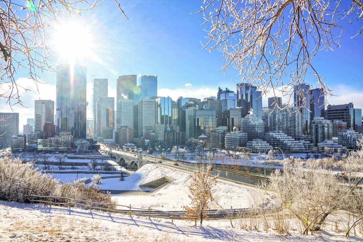
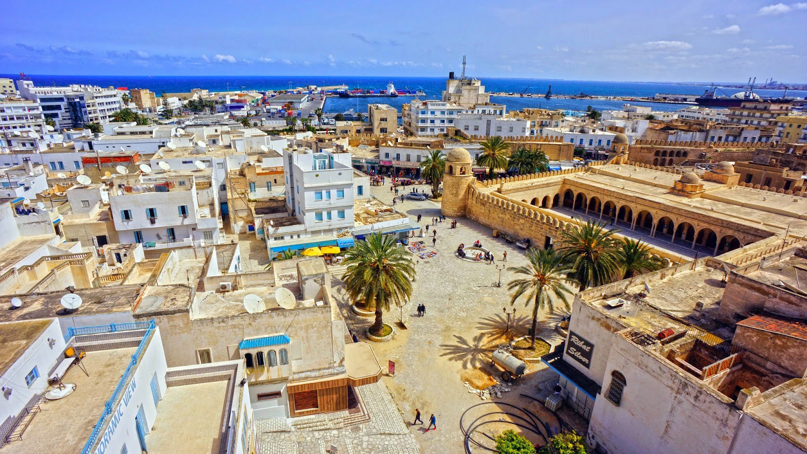
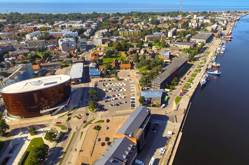
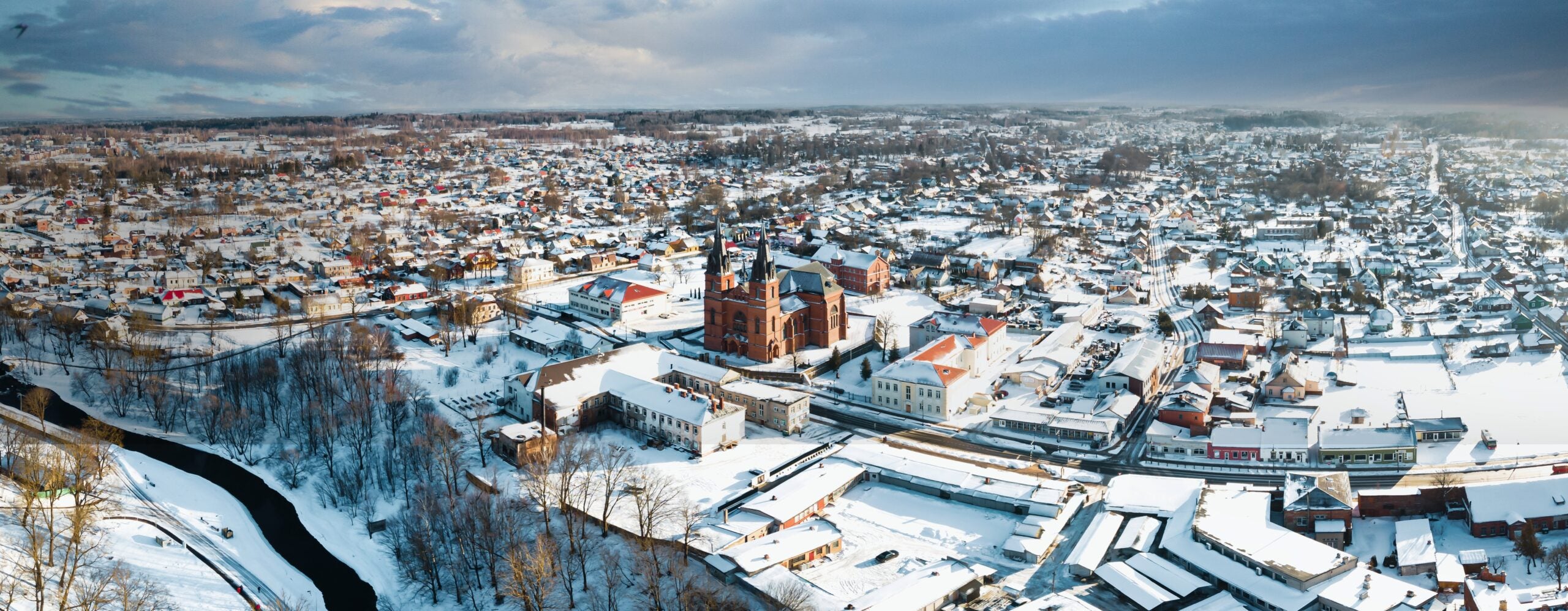
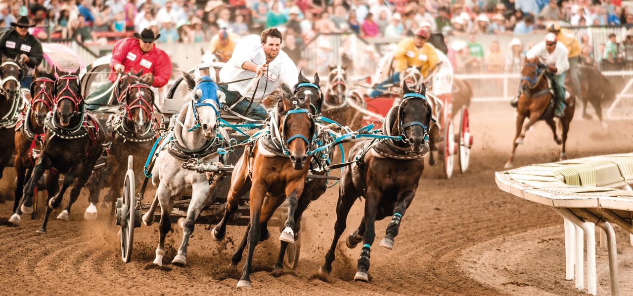
Home to just under 1,5 million people, Calgary is the third largest city in Canada, and is ranked the most liveable city in North America, bolstered in its reputation by the largest proportion of millionaires per capita in the country. This area has been inhabited for some 11.000 years, but the modern city’s history is much younger; the first white settler was a cartographer and fur trader who overwintered here in 1783, and 90 years after him came the first European settlers, who used the nearby bend in the Elbow River as a stopping point, and shortly afterwards a mountie station was established to regulate the fur trade and American bootlegging. As the government started to promote cattle ranching in Alberta, the convenient location at the bend in the river made Calgary a burgeoning centre for trading and as a destination point for travelling into the Albertan interior. The rapid expansion was also supported by legislation requiring houses to be built from sandstone, which in turn supported quarrying interests in the area. The association with cattle was continued by the inauguration in 1912 of the Calgary Stampede, one of the world’s most famous rodeos and horse racing festivals, now grown into a huge annual event that is well ingrained into the city’s culture.
The Stampede is referenced alongside the city in many of its sporting endeavours; the city’s CFL franchise is called the Calgary Stampeders, while from the 50s through to the end of the 80s when the Territory days ended for good, Calgary supported arguably (because Montréal and Lutte Internationale could make a case) the strongest and best known wrestling territory in Canada. Back in the days before globalisation, different regions had favoured styles of wrestling and wrestlers would often train in one and then journey from region to region to make money and gain experience. The American northeast enjoyed the OTT pageantry that we nowadays associate the sport with, the South - especially the Memphis territory - liked brawlers and blood feuds, and the west coast liked Mexican-influenced gymnastics and fast-paced action. The Canadians, however? They became associated primarily with sound, amateur wrestling-inspired bouts that were lower on showmanship and higher on technical skills, telling stories more through moves and holds.
Calgary’s main wrestling promotion was Stampede Wrestling, established by catch-as-catch-can wizard Stu Hart, and serving as an NWA affiliate north of the border. It became renowned more, however, for the
Hart Family Dungeon, a wrestling school in the basement of an old army hospital and led by Hart alongside Japanese wrestler Mr. Hito. Stu Hart was notorious for using legit wrestling stretches to punish students with sadistic glee, and the wrestlers that graduated it tended to come with reputations as strong and technically gifted fighters. The most obvious graduates would be Stu’s two sons, Bret “The Hitman” Hart - a future WWF World Champion - and Owen Hart, but other graduates would include “Superstar” Billy Graham, Greg “The Hammer” Valentine, Davey Boy Smith and The Dynamite Kid (a tag team of British origin known as The British Bulldogs, with Davey Boy later known simply as The British Bulldog after Dynamite Kid was forced into retirement by injuries), Chris Jericho, Edge and Christian and, if I can be serious for a minute, Lance Storm. There’s also Chris Benoit, but he has rather been airbrushed out due to his crimes. As well as the two best known sons of Stu Hart, the family’s tendrils extend further into the annals of wrestling; in total Stu and Helen Hart had 12 children. Diana, one of the youngest, married Davey Boy Smith rendering the Bulldog an in-law of Bret and Owen; her older sister Ellie married Jim “The Anvil” Neidhart, thus creating the best known version of the faction “The Hart Foundation”. Their daughter Nattie, her partner Tyson Kidd, and Davey and Diana’s son Harry Smith, founded a “New Hart Foundation” team in the late 2000s and came to WWE as “The Hart Dynasty”. Dynamite Kid and Brian Pillman are also considered, though they are not directly related by blood or marriage, to be close affiliates of the Harts, and the latter was the only wrestler not connected by either of those two means to Stu Hart to compete with the Hart Foundation. In addition to this, the father of “Macho Man” Randy Savage was a well known wrestler in the 50s and 60s, and Savage’s younger brother Lanny Poffo was born in Calgary while his father was working for Stampede Wrestling.
No Kayfabe needed
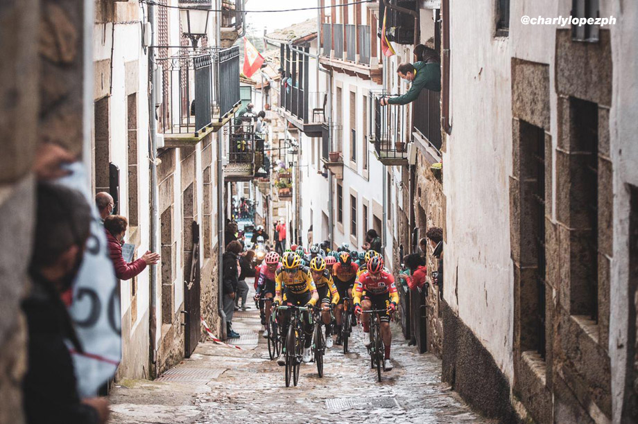
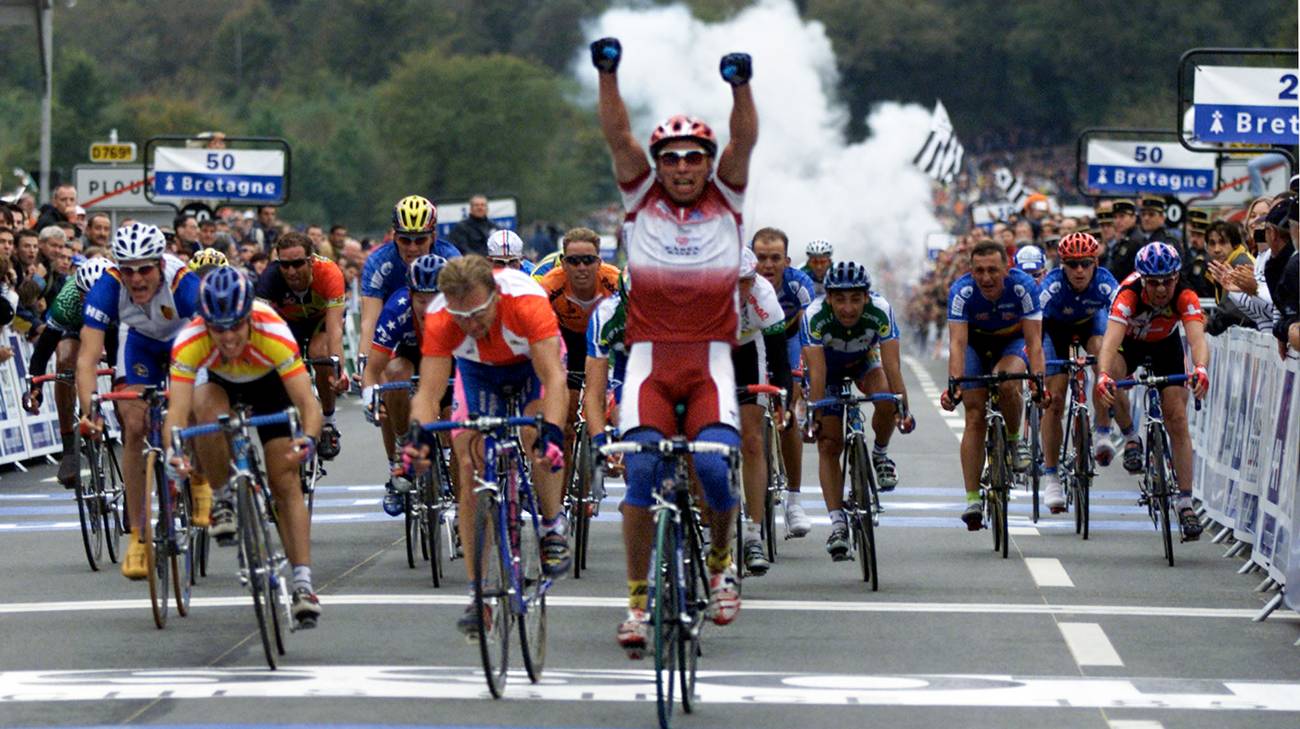
Calgary has been used in pro cycling a couple of times; whereas most cycling interest in terms of racing has been in Ontario and Quebec, the highest profile stage race touring an actual Canadian province was here in Alberta, running from 2013 to 2017, and the first edition finished with a short sprint stage
from Okotoks to Calgary which was won by Peter Sagan. The following year the direction of travel was reversed, so instead of running Edmonton to Calgary, they ran Calgary to Edmonton, with the former hosting a prologue and the latter the final sprint. The 2014 edition’s prologue in Calgary was won by Tom Dumoulin but after this the city faded from use with Edmonton taking centre stage. But for the most part it is for other sports that the city is known.
Nowadays oil and gas have replaced ranching as major commodity industries in the area, and it was this interest that saw the rapid expansion of the city to its present day size, as well as attracting an NHL franchise, as the Atlanta Flames were relocated to Alberta to form one of the most storied rivalries in the sport, the
Battle of Alberta between the Calgary Flames and the Edmonton Oilers. Their feeder team, the Wranglers, moved into the city in 2022 after previously being based in Stockton (then known as the Heat, they adopted the Wranglers name from a defunct WHL team from the 70s and 80s), and a junior team, the Calgary Hitmen, also use the city as their home (their name inspired by their original bankroller, the aforementioned Bret “The Hitman” Hart). And perhaps more crucially, it brought the Winter Olympics in 1988.
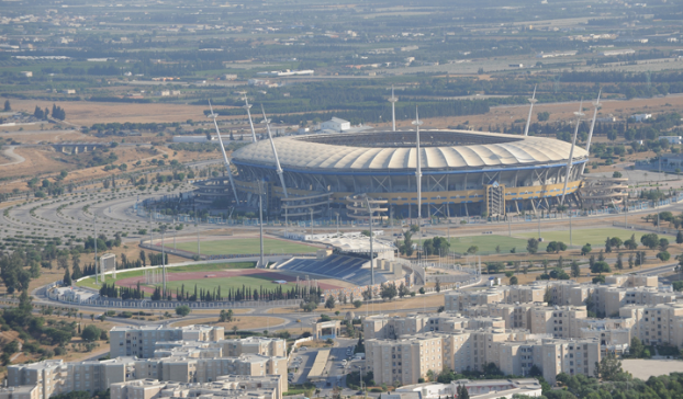
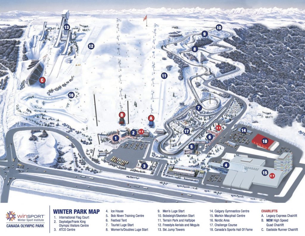
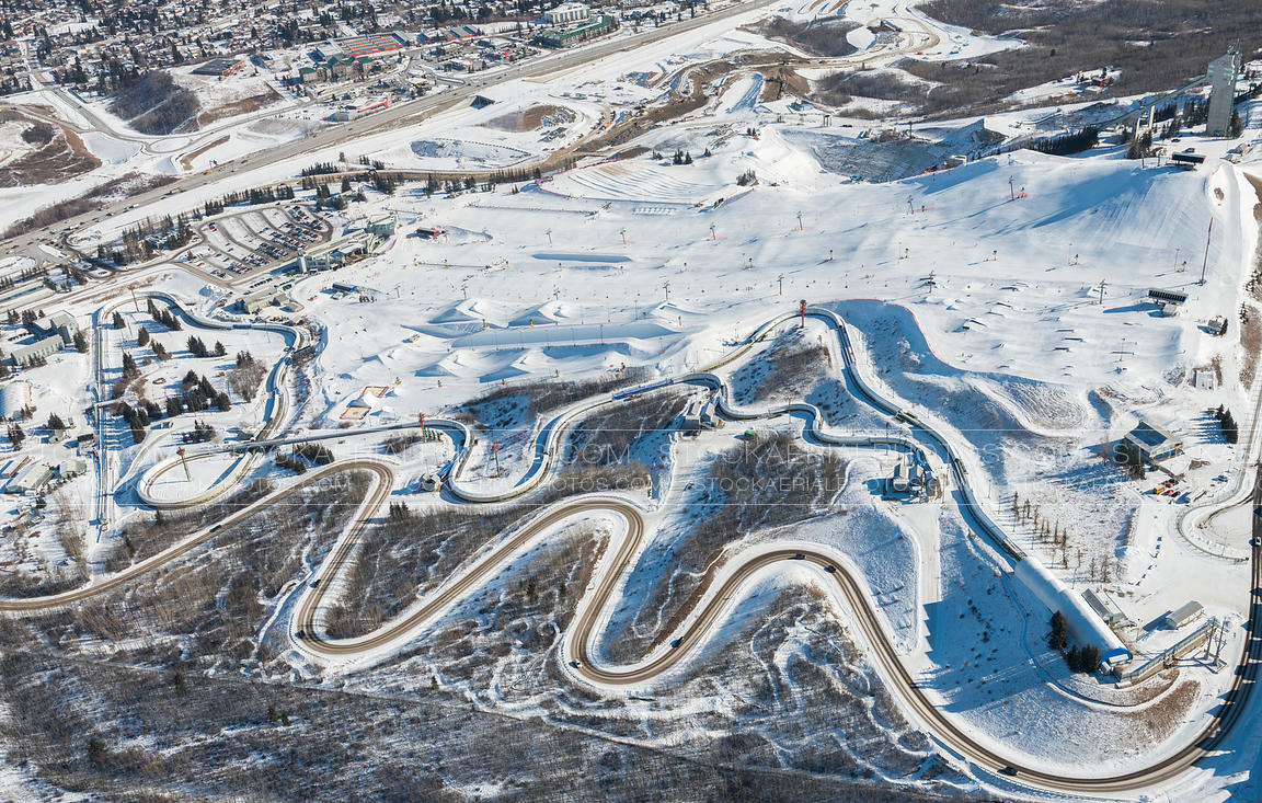
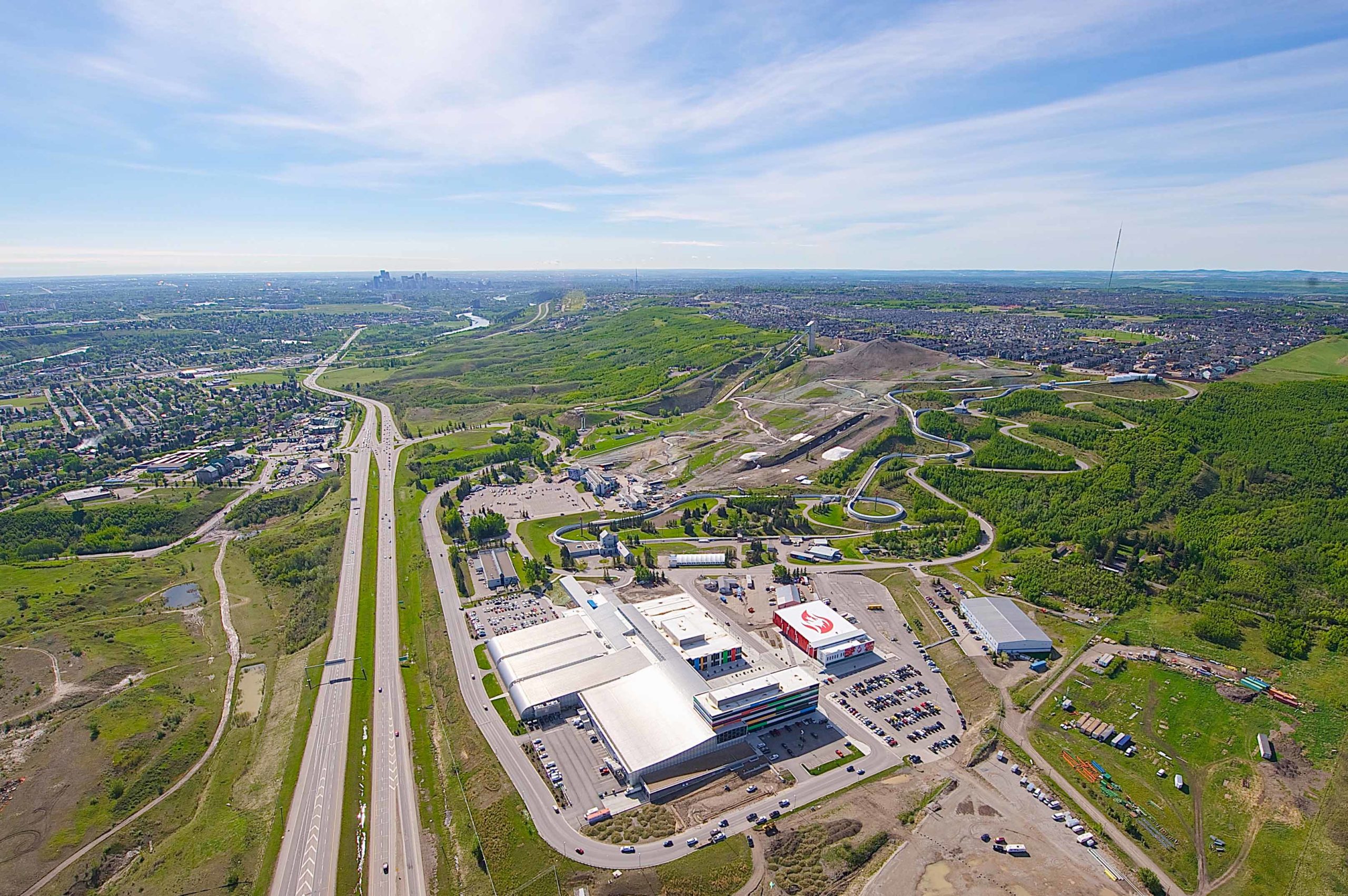
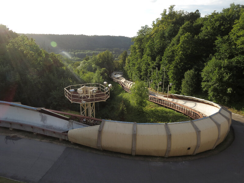
Winsport Canada Olympic Park today. Note the service road for the bobsleigh and ski jumps in the foreground.
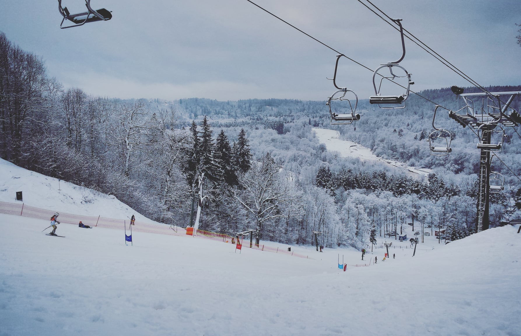
The Canada Olympic Park hosted the bobsleigh/luge, some of the arena sports (especially the curling, which is commonly held at the top level here to this day) and the ski jumping as well as the Nordic Combined (to avoid having to build two complexes or having the athletes transfer to Canmore between sections of competition) and the freestyle skiing (which at the time consisted of two disciplines, Aerials and - no, really - Ski Ballet) at the 1988 Games and is now sponsored by WinSport, the successor to the Calgary Olympic Development Association, serving as a centre for development of Canadian wintersport athletes, introducing some smaller alpine runs, halfpipes and a terrain park for moguls and other X Games type disciplines. However, of perhaps more interest to us will be that the park, in summer, is converted for XCO and downhill mountain bike disciplines, where it is a popular competition spot on the North American and domestic calendars.
As you might expect as a result of this, most of Calgary’s sporting sons and daughters
not related by blood or marriage to the Hart family (I know, definition of ‘sport’ and all that) are wintersport athletes, such as recent ski jumping world champion Alexandria Loutitt, hockey players Bill Gadsby, Taylor Hall, Cale Makar, Jaret Anderson-Dolan, Jay Beagle, Jake Bean, Dany Heatley, Tim Hunter, Jarome Iginla, Larry Kwong, Tyler Myers, William Nylander, Jim Peplinski, Brayden Point, Jason Smith and Mike Vernon, freestyle skier Brady Leman, figure skater Jamie Salé (an Olympic champion), curlers Ben Hebert, Cori Morris, Cheryl Bernard, Amy Nixon and Julie Skinner, lugers Sam Edney and Alex Gough, speed-skater Gilmore Junio, Paralympic cross-country skier and biathlete Brian McKeever, regular biathlete Nathan Smith, and ski-crosser Aleisha Cline, but there are others such as NFL veteran Nate Burleson, former Washington Redskins quarterback Mark Rypien, who won two Superbowls - one of which as MVP - for the team, English footballer Owen Hargreaves (born in Canada to English and German parents), swimmer Curtis Myden, Olympic champion swimmer Mark Tewksbury and Olympic gold medallist gymnast Kyle Shewfelt.
No cyclists though. So let’s try and inspire some.
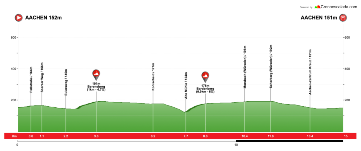
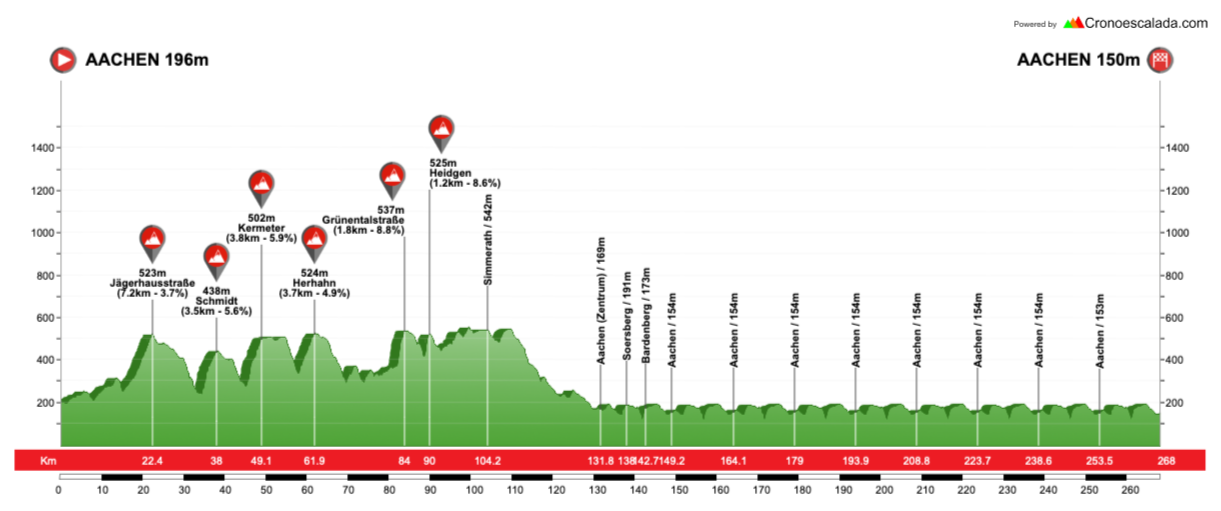
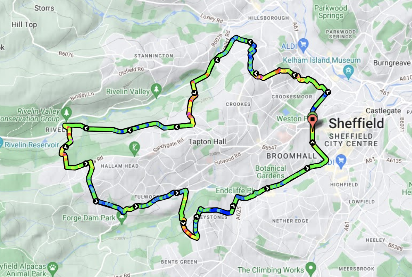
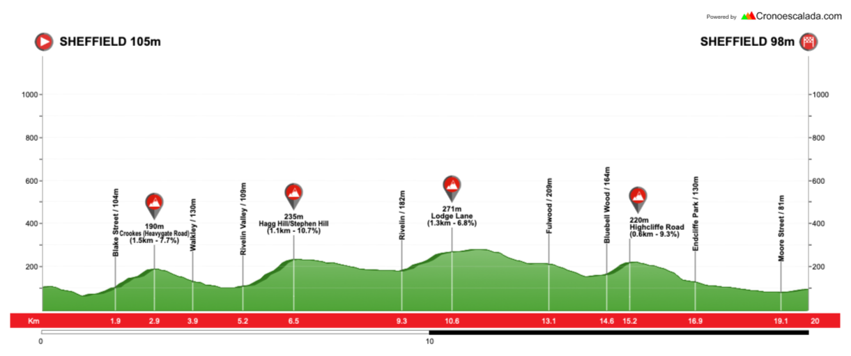
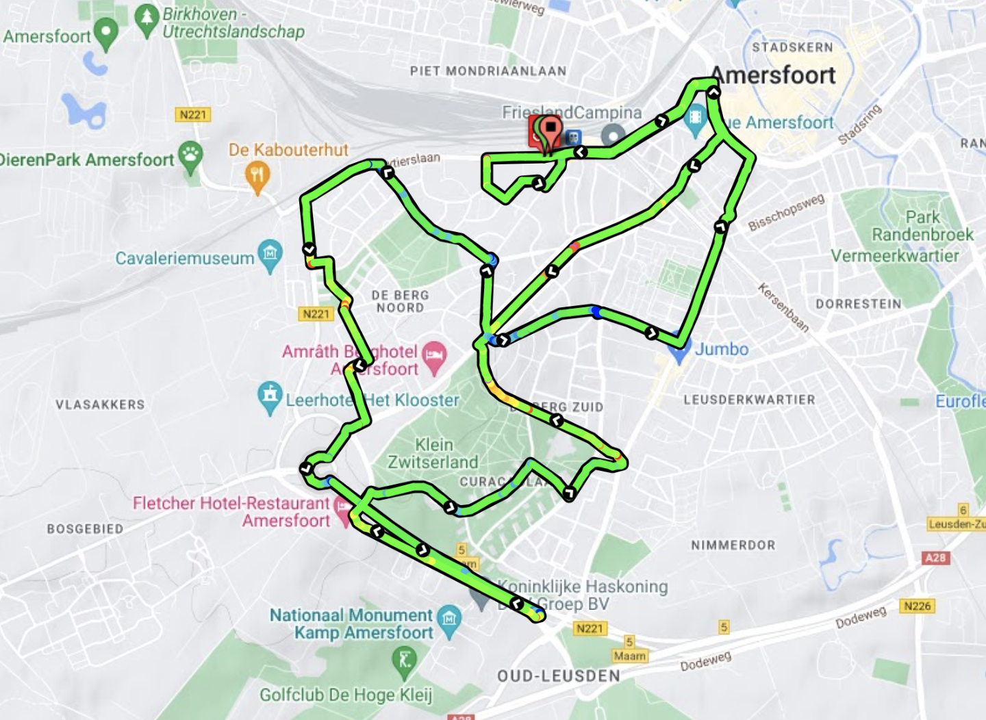
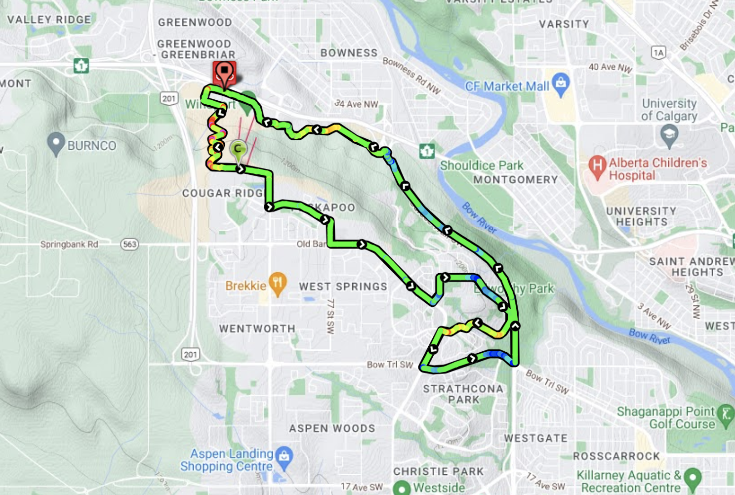
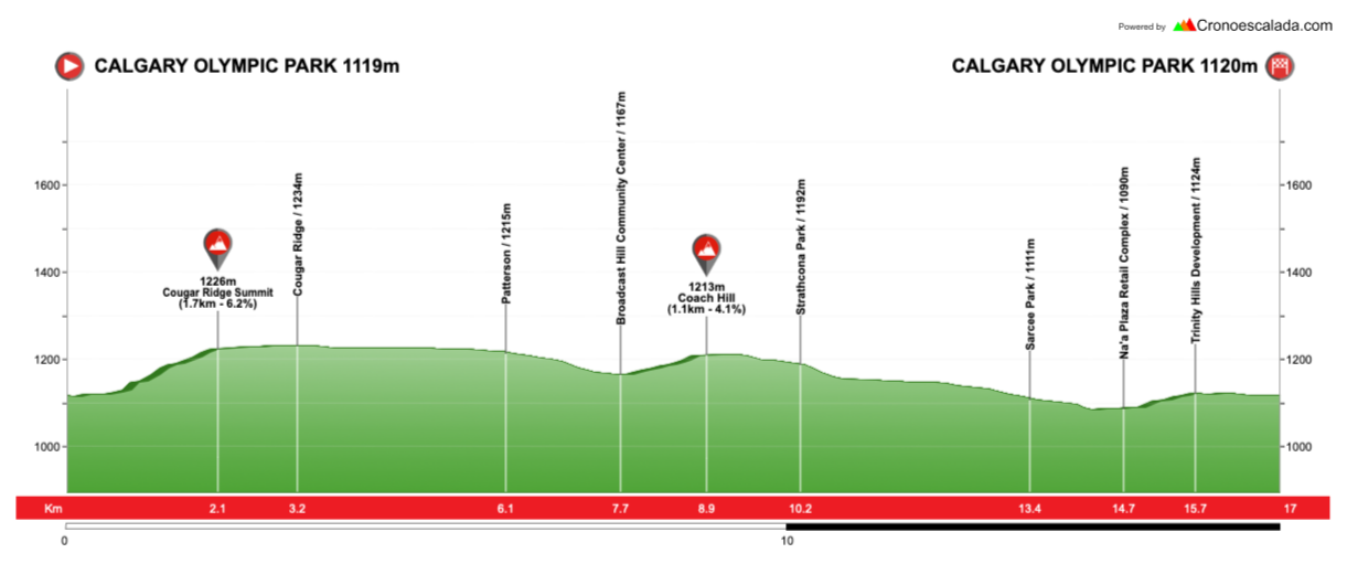
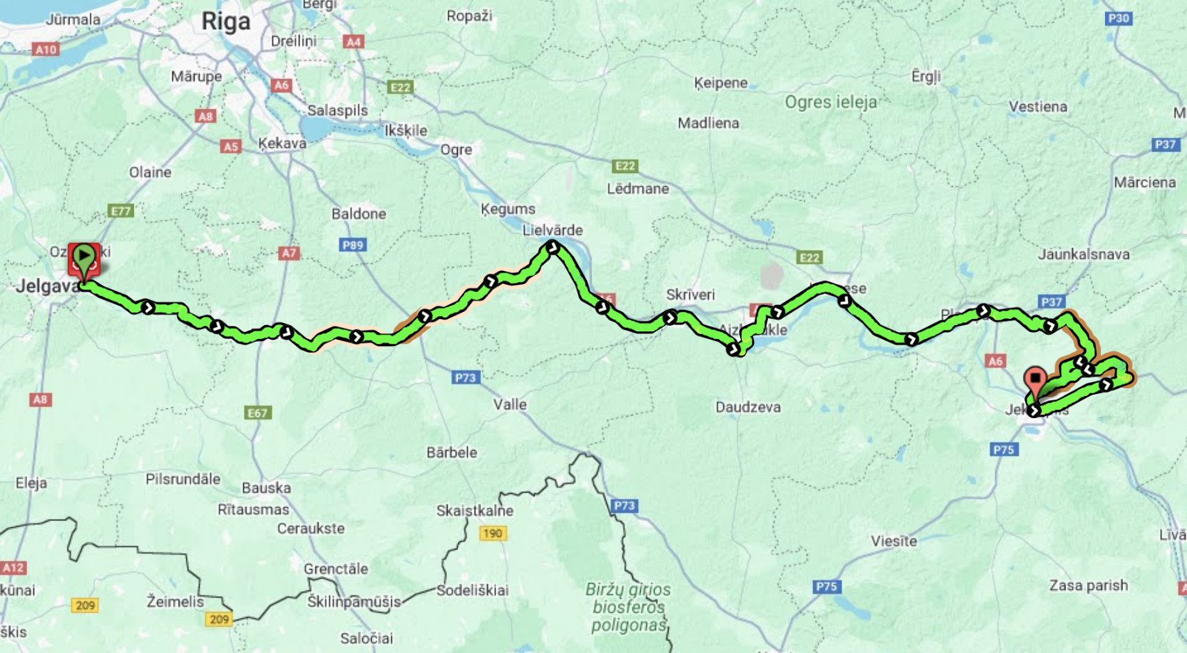
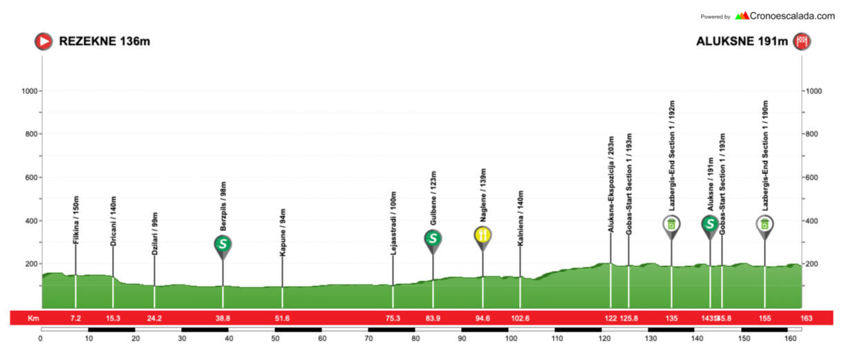
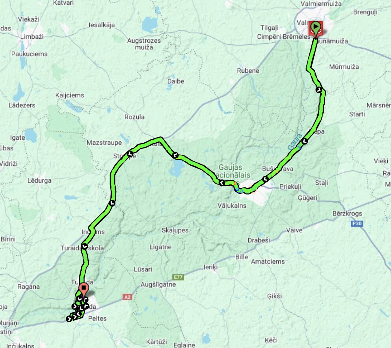
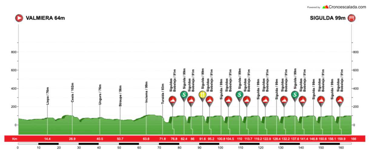
The circuit here is 16,9km in length so I’m looking at 9 laps for the women (152,1km), 11 for the U23 men (185,9km), and 16 for the elite men (270,4km), as a pure circuit race Worlds.
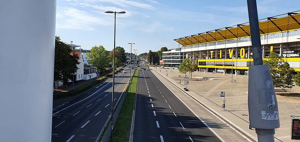
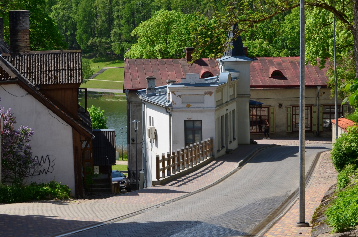
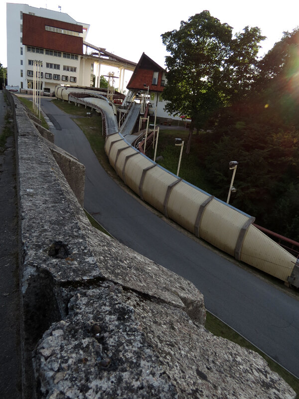
Winsport Arena and Park from the west. Finishing straight in foreground in front of Winsport Arena.
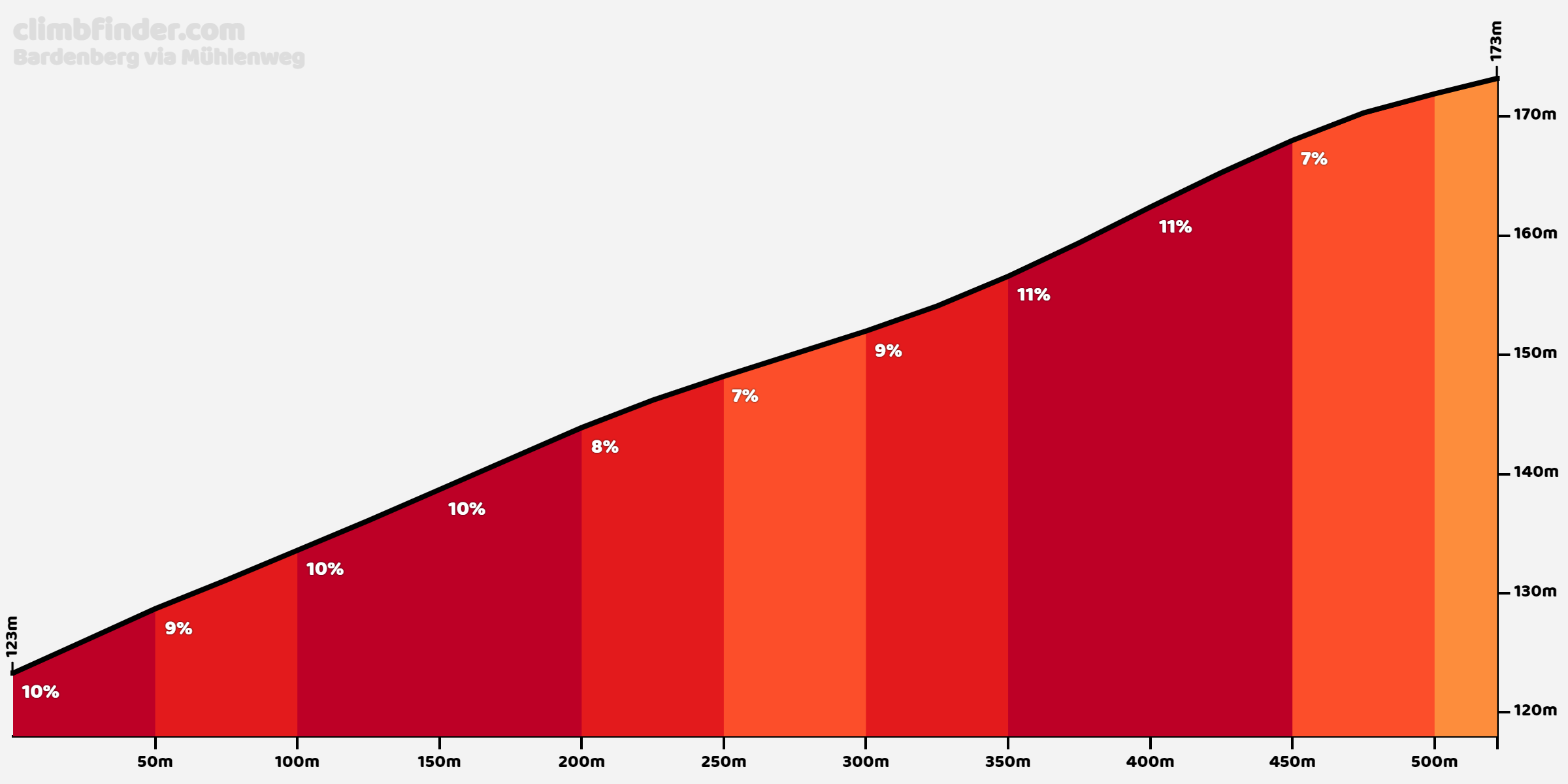
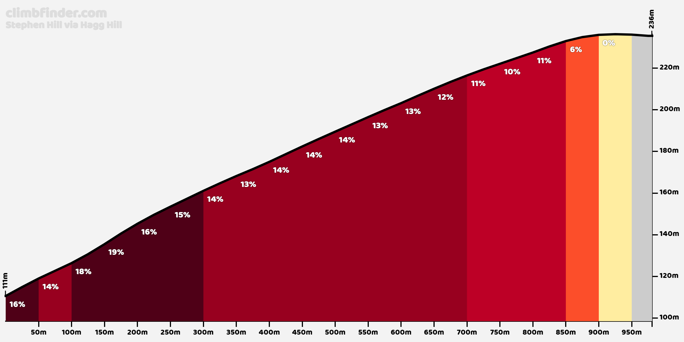
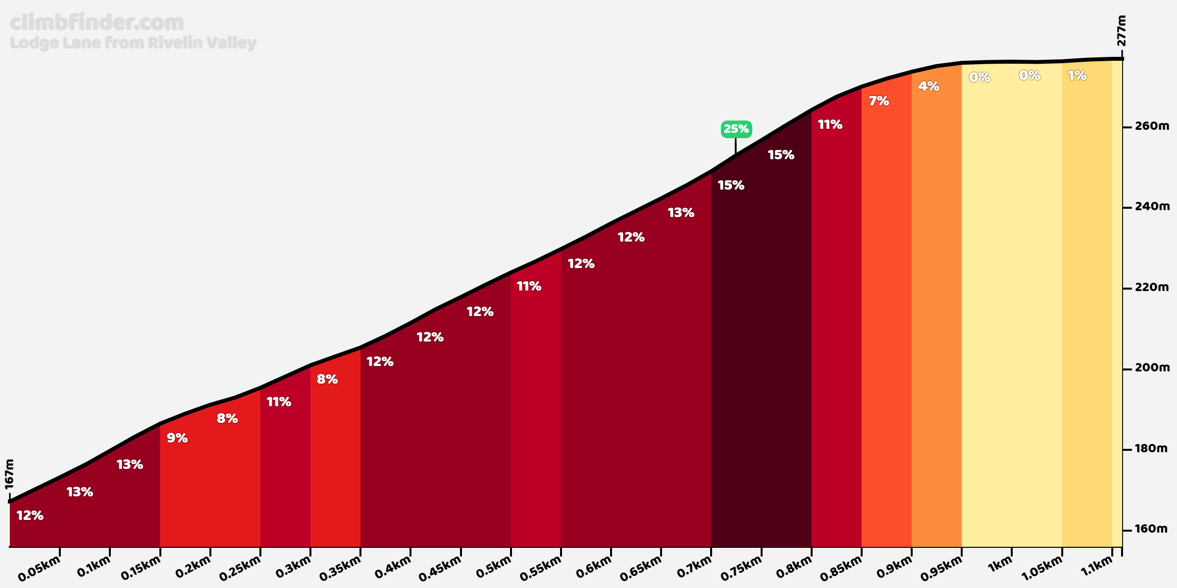
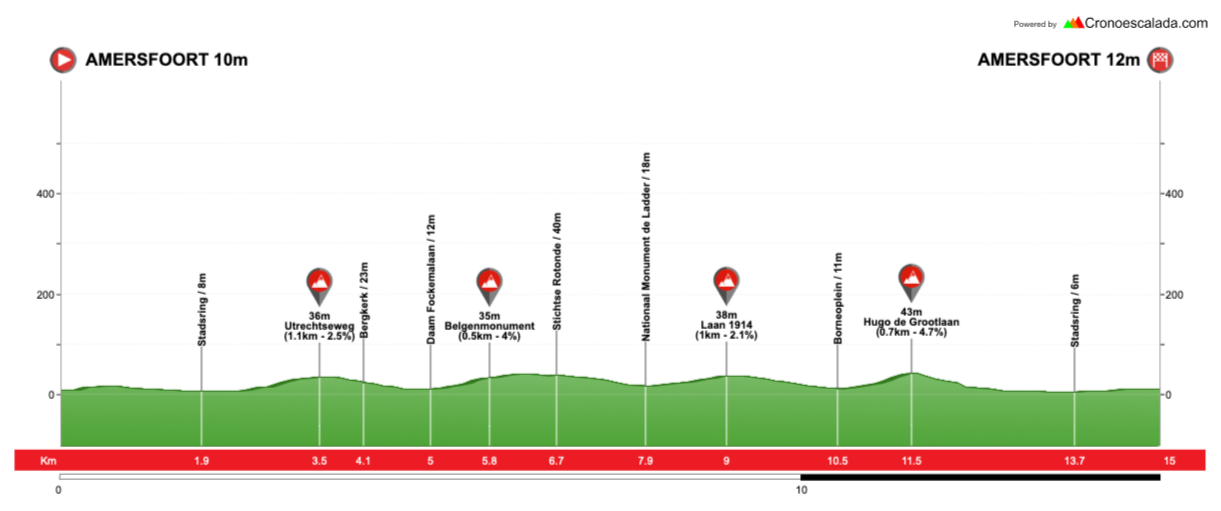
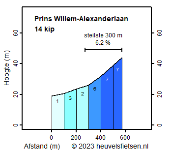
The above picture shows the start and finish of each lap. We will take the left curve and then 90º subsequent left at the car park at the start of each lap, before the sharp right and the snaking bobsleigh service road up the hill. With seven snaking corners of varying difficulties, it’s a pretty classic Worlds-style obstacle, totalling 1,7km at 6,2%, but after a short run-up leaving the arena complex, it’s 1,2km at 7,6% before flattening out again at the summit. The summit coming so soon in the circuit also means it is over 14km from the line, which sprinters will like, so long as they can handle the many laps they will be taking.

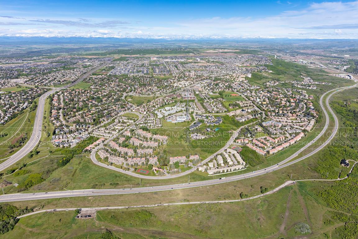
This is the main climb of the circuit; it is followed by around 4km of flat and false flat around the Cougar Ridge hilltop district, before descending through Patterson Heights and back up Coach Hill on Patina Drive SW - this is 1,1km at just over 4% so it’s an option for an attack in a small group, but it isn’t going to automatically drop anybody; it’s exactly 8km from the line at the summit, so there is the chance to break away and make a move if the group is fairly small, but you aren’t going to easily drop an organised péloton here.
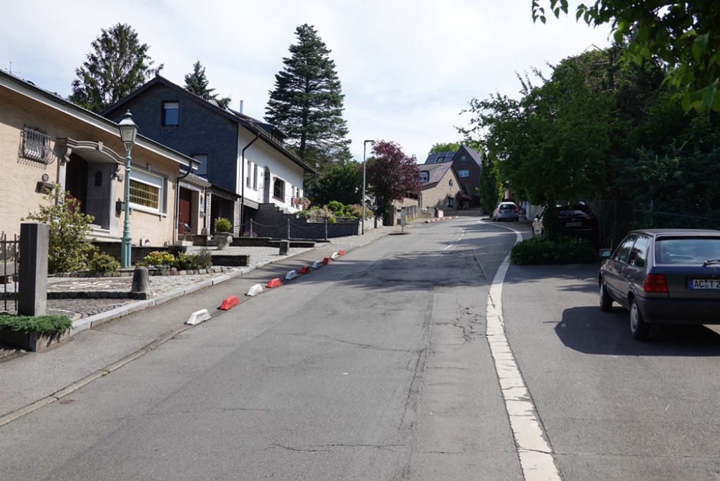
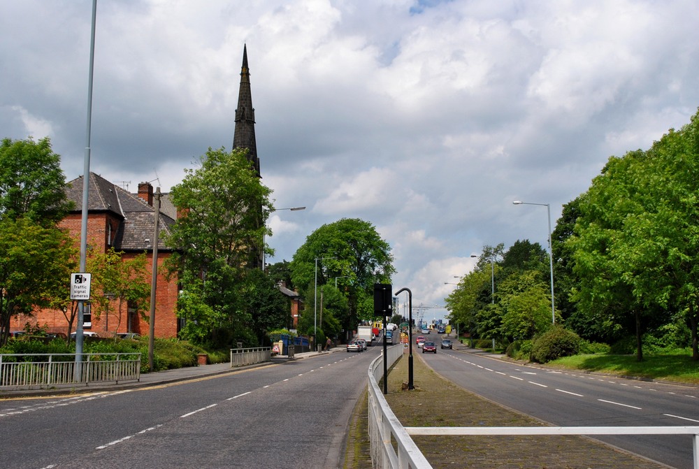
Patina Drive SW, which we descend and then climb, is the perimeter road of this development
We then descend back down on the highway road. We then turn left onto Na’a Drive and head directly back to the WinSport Arena. I originally preferred to extend the circuit into Bowness to make the climbs a bit further from the finish, but after reviewing I think this route will be superior, as it enables us to create a somewhat more interesting and challenging finale that will make this less likely to be a regular sprint and enable some intrigue in the final few kilometres, whereas the original, slightly longer (18,9km) circuit featured a very straight and slightly uphill (2-3%) drag before crossing Canadian Highway 1 and then having the same final couple of corners and finishing straight as we have here.
Instead, it’s a left-hander at the freeway junction roundabout, before a tricky penultimate kilometre which takes us past the new Trinity Hills development; we pass a retail park before a left-hand sweeper at 1,9km from the finish, which takes us to a 250m at 7% climb, then a couple of light bends (one right, one left), and then a right hand sweeper which finishes the uphill section here, at 1200m to go. The overall for this climb is 700m at 5%, which is just about enough to potentially be decisive, but that 1200m remaining mean it’s not just about that uphill. That right-handed is fairly significantly sweeping, but with a very broad radius. We then cross two roundabouts - one at 1100m from home and the second at 900m. The interesting thing here is that we have gone from one freeway junction where we have exited a road which passes underneath the freeway, along a road running parallel to the freeway to an adjacent junction where the lesser road actually bridges over the freeway. There’s then those two sweeping corners you can see on the picture above, 750m and 450m from the line respectively, but not technical at all and I don’t think that other than the roundabouts no corners in the last few kilometres will be a crash risk.
The climbs on this route make it comparable to, say, Bergen, or an easier version of Montréal, but for me the difficulty is more akin to Madrid or Hamilton, and the layout is perhaps more similar to Lisbon. Obviously the Montréal Worlds on the updated course have yet to happen (although the GP Montréal can be used as examples), but looking at those precedents, we can look at likely outcomes. Lisbon ended with Óscar Freire winning a sprint from a group of 45; Igor Astarloa won solo in Hamilton ahead of a small group largely comprising puncheurs, then a group of just under 40 finished 12” behind him; Tom Boonen won a sprint from a group of 27 in Madrid; while Bergen ended up with an almost identical scenario, Peter Sagan winning a sprint of just under 30. I think this will probably be similar - the tricky run-in is not enough to make it a puncheur thing (especially given the last kilometre favours the chasers), but it’s enough to offer some potential for breaking out of the bunch if it’s not organised around a sprint, for example if there are no teams with coherent leadouts prepared.