
Race Design Thread
Page 111 - Get up to date with the latest news, scores & standings from the Cycling News Community.
You are using an out of date browser. It may not display this or other websites correctly.
You should upgrade or use an alternative browser.
You should upgrade or use an alternative browser.
- Feb 20, 2010
- 33,250
- 15,780
- 28,180
Stage 2: Casablanca (Marruecos) - Rabat (Marruecos), 154km


Puertos:
Alto de Oued Akrach (143m) - 2,3km @ 5,0% (cat.3) - km 118
Metas Volantes:
Temara - km 75
Rabat (1er Paso por la Línea de Meta) - km 140
On the second day of the Vuelta, the riders head from the largest city in Morocco to the country's capital, a smaller city further north along the Atlantic coast still nevertheless home to 1,2 million people in its extended metropolitan area.
For the most part the route is fairly quiet and scenic; the main issue will be if the heat is too difficult, but as mentioned with the Casablanca TT, it would actually be worse in many Andalucían stages than here on the Moroccan coast. The other problem is of course wind, and indeed the first half of the stage is all along the coastline, so expect the first part of the stage to be raced hard and fast at least until the first intermediate sprint in Temara. A lot of the route will be on these coastal roads, with the striped high kerbing and the sandy, dusty scenery. It's not typical GT fare. As the stage heads into its second half, we loop around in a southeasterly direction to head inland, through Tamesna and into some rolling terrain. As we head uphill through El Aouda, the landscape becomes a bit greener as we head into the valley of the river Bouregreg.
Here, we face the first categorized climb of the Vuelta. The sweeping curves of the road up to Avenue Oued Akrach are not especially steep, though 300m or so at 9% in the middle of the climb will be felt. However, it is sufficiently far from the finish that it is unlikely to cause a sprint as we gradually head downhill towards Rabat and undertake two laps of a 14km circuit. The circuit takes in a number of the impressive sights of the city, including the awe-inspiring Kasbah des Oudayas, the walls of the Medina, the Tour Hassan, the Mausoleum of Mohammed V and the Parlement Marocain before finishing on the scenic Avenue Mohammed V in front of Mosquée Assounna.
All in all, likely to be a sprint, a pretty short stage, but should at least give some nice TV pictures.
Casablanca:

Rabat:

Puertos:
Alto de Oued Akrach (143m) - 2,3km @ 5,0% (cat.3) - km 118
Metas Volantes:
Temara - km 75
Rabat (1er Paso por la Línea de Meta) - km 140
On the second day of the Vuelta, the riders head from the largest city in Morocco to the country's capital, a smaller city further north along the Atlantic coast still nevertheless home to 1,2 million people in its extended metropolitan area.
For the most part the route is fairly quiet and scenic; the main issue will be if the heat is too difficult, but as mentioned with the Casablanca TT, it would actually be worse in many Andalucían stages than here on the Moroccan coast. The other problem is of course wind, and indeed the first half of the stage is all along the coastline, so expect the first part of the stage to be raced hard and fast at least until the first intermediate sprint in Temara. A lot of the route will be on these coastal roads, with the striped high kerbing and the sandy, dusty scenery. It's not typical GT fare. As the stage heads into its second half, we loop around in a southeasterly direction to head inland, through Tamesna and into some rolling terrain. As we head uphill through El Aouda, the landscape becomes a bit greener as we head into the valley of the river Bouregreg.
Here, we face the first categorized climb of the Vuelta. The sweeping curves of the road up to Avenue Oued Akrach are not especially steep, though 300m or so at 9% in the middle of the climb will be felt. However, it is sufficiently far from the finish that it is unlikely to cause a sprint as we gradually head downhill towards Rabat and undertake two laps of a 14km circuit. The circuit takes in a number of the impressive sights of the city, including the awe-inspiring Kasbah des Oudayas, the walls of the Medina, the Tour Hassan, the Mausoleum of Mohammed V and the Parlement Marocain before finishing on the scenic Avenue Mohammed V in front of Mosquée Assounna.
All in all, likely to be a sprint, a pretty short stage, but should at least give some nice TV pictures.
Casablanca:
Rabat:
- Feb 20, 2010
- 33,250
- 15,780
- 28,180
Stage 3: Alcazarquivir (Marruecos) - Tánger (Marruecos), 148km


Puertos:
Alto del Cabo de Espartel (227m) - 4,6km @ 4,6% (cat.3) - km 105
Alto de Remillate (246m) - 2,8km @ 6,9% (cat.3) - km 135
Metas Volantes:
Asilah - km 54
Tánger (Palais Marshan)(1er Paso por la Línea de Meta) - km 121
Heading northward from Rabat for a couple of hours and slightly inland, the third stage of the Vuelta is both the last day in Morocco and the first potential GC banana skin, even though the stage is short and liable to be over quite quickly. Bizarrely enough this is likely to be the hottest of the Moroccan stages as though we have headed north, there is more time spent away from the cooling effects of the sea - although much of the first half remains on the coast as with yesterday's stage.
The stage begins in Ksar el-Kébir (Moroccan Arabic for "The Big Castle"), a former Spanish garrison town that now serves as an important regional centre and as a stop-off town in connecting north coast cities such as Tangier and Tetouan with Fés, Rabat and Casablanca. The first part of the stage is over rolling countryside before reaching the coastal fortified city of Asilah, with the fortifications protecting its pristine blue and white buildings from harm. The first intermediate sprint is on one of those typical coastal corniches, in fact, before the riders are subjected to the possibility of wind for 50km of dead flat coastal roads.
The final 50km make things a bit tougher, however. First we arrive at Cap Spartel (Cabo Espartel in Spanish), the northwestern extremity of Africa and home to the Caves of Hercules. From here, we start to climb our first categorised climb of the day, a comparatively gradual climb which nevertheless gets up to 11% at one point. Some false flat and rolling terrain from the summit takes us to Parc Rmillate, which offers spectacular views of the Moroccan coast as well as to Andalucía across the Straits of Gibraltar. Here we join a 27km circuit which we do a lap and a half of.
The first thing we do is descend back into Tangier. I like Tangier a lot, it's a very interesting city, and here we are going to have a bit of a loop around it. First we pass the city's famous port, and then we have an out-and-back along Avenue Mohammed VI, Tangier's famous beachfront corniche. And I mean an out-and-back too - there's a 180 turn around a roundabout at the far end. I wanted to get that sea front view in and also take the final climb an extra km or so from the finish. I know that the corniche would also make a wonderful finish, but I had something a little more complex in mind. This isn't really a puncheur's finish in the Murito style, but certainly puncheurs and more durable sprinters can duke this one out. With about 2km from the finishing line we leave the corniche and head up the uphill Rue de la Plage - around 400m at 6% leading to the Grand Socco, one of Tangier's most famous squares. From here we take the flat Rue d'Italie before heading up the steep Rue de la Kasbah - another 400m at 8% which maxes out at 15%, and crests at Bab el-Kasbah, the main entrance to the famous Kasbah, about 850m from the line. The rest of the run-in is mostly straight and uphill at 1-2% as we pass Stade Marchan and finish close to the summer residence of the King of Morocco.
The first time we pass the line, 27km remain. The route has a smooth descent broken up by a short, uncategorised ascent at 22km to go. The main real challenge here is the climb back up to the summit of Parc Rmillate, the Alto Remillate in Spanish, which you could perhaps call the first serious climb of the Vuelta. At 2,8km in length and just under 7% on average, there is plenty of scope to make this a worthwhile climb to make a move on, especially given that its summit comes just 13km from the finish. A maximum of 13% and 500m that average 10% right in the middle of the climb will offer an opportunity for the aggressive rider, especially as the descent will take some of the sting out of the remaining distance - just 9km left after the descent. The drawback is that not too much of this is technical - though there is that 180º right hander with 3,5km to go. Nevertheless, even if all attacks are neutralised, the unusual nature of the run-in ought to make this an interesting finale.
The stage today was short as this is our final day in Morocco. After the race is over, riders will travel across to Algeciras by boat, and the Vuelta returns to its homeland. The transfer is, however, only 70km and can be done in a couple of hours, so I don't feel the need to throw in the bonus rest day that the Giro did from Dublin, or the early rest day from the Giro in Denmark and the Vuelta in the Netherlands. Spain awaits.
Alcazarquivir:

Tánger:
Puertos:
Alto del Cabo de Espartel (227m) - 4,6km @ 4,6% (cat.3) - km 105
Alto de Remillate (246m) - 2,8km @ 6,9% (cat.3) - km 135
Metas Volantes:
Asilah - km 54
Tánger (Palais Marshan)(1er Paso por la Línea de Meta) - km 121
Heading northward from Rabat for a couple of hours and slightly inland, the third stage of the Vuelta is both the last day in Morocco and the first potential GC banana skin, even though the stage is short and liable to be over quite quickly. Bizarrely enough this is likely to be the hottest of the Moroccan stages as though we have headed north, there is more time spent away from the cooling effects of the sea - although much of the first half remains on the coast as with yesterday's stage.
The stage begins in Ksar el-Kébir (Moroccan Arabic for "The Big Castle"), a former Spanish garrison town that now serves as an important regional centre and as a stop-off town in connecting north coast cities such as Tangier and Tetouan with Fés, Rabat and Casablanca. The first part of the stage is over rolling countryside before reaching the coastal fortified city of Asilah, with the fortifications protecting its pristine blue and white buildings from harm. The first intermediate sprint is on one of those typical coastal corniches, in fact, before the riders are subjected to the possibility of wind for 50km of dead flat coastal roads.
The final 50km make things a bit tougher, however. First we arrive at Cap Spartel (Cabo Espartel in Spanish), the northwestern extremity of Africa and home to the Caves of Hercules. From here, we start to climb our first categorised climb of the day, a comparatively gradual climb which nevertheless gets up to 11% at one point. Some false flat and rolling terrain from the summit takes us to Parc Rmillate, which offers spectacular views of the Moroccan coast as well as to Andalucía across the Straits of Gibraltar. Here we join a 27km circuit which we do a lap and a half of.
The first thing we do is descend back into Tangier. I like Tangier a lot, it's a very interesting city, and here we are going to have a bit of a loop around it. First we pass the city's famous port, and then we have an out-and-back along Avenue Mohammed VI, Tangier's famous beachfront corniche. And I mean an out-and-back too - there's a 180 turn around a roundabout at the far end. I wanted to get that sea front view in and also take the final climb an extra km or so from the finish. I know that the corniche would also make a wonderful finish, but I had something a little more complex in mind. This isn't really a puncheur's finish in the Murito style, but certainly puncheurs and more durable sprinters can duke this one out. With about 2km from the finishing line we leave the corniche and head up the uphill Rue de la Plage - around 400m at 6% leading to the Grand Socco, one of Tangier's most famous squares. From here we take the flat Rue d'Italie before heading up the steep Rue de la Kasbah - another 400m at 8% which maxes out at 15%, and crests at Bab el-Kasbah, the main entrance to the famous Kasbah, about 850m from the line. The rest of the run-in is mostly straight and uphill at 1-2% as we pass Stade Marchan and finish close to the summer residence of the King of Morocco.
The first time we pass the line, 27km remain. The route has a smooth descent broken up by a short, uncategorised ascent at 22km to go. The main real challenge here is the climb back up to the summit of Parc Rmillate, the Alto Remillate in Spanish, which you could perhaps call the first serious climb of the Vuelta. At 2,8km in length and just under 7% on average, there is plenty of scope to make this a worthwhile climb to make a move on, especially given that its summit comes just 13km from the finish. A maximum of 13% and 500m that average 10% right in the middle of the climb will offer an opportunity for the aggressive rider, especially as the descent will take some of the sting out of the remaining distance - just 9km left after the descent. The drawback is that not too much of this is technical - though there is that 180º right hander with 3,5km to go. Nevertheless, even if all attacks are neutralised, the unusual nature of the run-in ought to make this an interesting finale.
The stage today was short as this is our final day in Morocco. After the race is over, riders will travel across to Algeciras by boat, and the Vuelta returns to its homeland. The transfer is, however, only 70km and can be done in a couple of hours, so I don't feel the need to throw in the bonus rest day that the Giro did from Dublin, or the early rest day from the Giro in Denmark and the Vuelta in the Netherlands. Spain awaits.
Alcazarquivir:
Tánger:
- Jul 24, 2014
- 150
- 0
- 0
I really like the start in Morocco there - when I was playing around with possible Vuelta stages looking for somewhere to start Morocco was high on my list. Also nice that it's a foreign Depart that is actually interesting terrain-wise (wouldn't expect anything else from you, mind) - stage 3 could potentially see quite a bit of action. Looking forward to see what Spain has to offer the fourth time round!
- Feb 20, 2010
- 33,250
- 15,780
- 28,180
Stage 4: Algeciras - Málaga (Parador de Málaga-Gibralfaro), 186km


Puertos:
Puerto de Ojén (533m) 12,3km @ 4,2% (cat.2) - km 85
Puerto del León (940m) 16,3km @ 5,6% (cat.1) - km 158
Metas Volantes:
Marbella - km 73
Málaga - km 140
Now back on Spanish territory, the Vuelta continues its policy of staying by the coast for one more day, heading along the Mediterranean until we reach the Costa del Sol. The transfer shouldn't have been too bad as the riders stay in Algeciras, where the ferries will have deposited them after the short Moroccan stages, and depart from the same town in the morning. I was tempted by Gibraltar, however I did already put a finish there in my second Vuelta route, and thought it too close to Algeciras for re-use. Therefore we head northeast for the first stage with some real climbing to be done.
This stage is also the first of a few nods to Vuelta stages in recent years. This one is a nod to the 3rd stage of the 2010 Vuelta, which had a similar profile and an identical run-in. Here's the profile. On that day, we got quite an interesting chase-down as even though the main contenders were comparatively timid on the Puerto del León, the combination of difficult heat and a long, challenging climb meant that the bunch was heavily reduced, while Xacobeo-Galicia's Serafín Martínez dropped his break companions on its slopes and went solo on an escapade that only ended with a kilometre to go on the uncategorized hilltop finish. Philippe Gilbert eventually won the stage, closely pursued by Joaquím Rodríguez, with Igor Antón coming in 3rd place ten seconds further back. Gaps opened up were comparatively small but it set the race up very nicely. And as Málaga likes to host the race (hosting every other year in the 2000s including the Grand Départ in 2006, and now will host this again in 2015), this is a nice way to use their keenness to produce some interesting racing.
Here is video of the closing stages of that day.
My stage is also about 30km longer than that stage, which began in Marbella, which for me hosts an intermediate stage and is some 70km into the stage. For me, the two climbs are much closer together too, as in 2010 to pad out the distance they included a much longer flat detour between the Puerto de Ijén and Málaga - the original stage design, with 2x climbs of the Puerto del León, shows the more direct route that I am taking - although like in 2010 I am only climbing León once - this stage comes off the back of a ferry transfer and is longer in distance, plus given it's early in the race and I have much in store for the riders yet, I did not want to go overkill too early.
On the other hand, I have included a harder side of the Puerto de Ijén (only climbing to kilometre 12 on that profile) through the village itself on the A-7103 rather than using the A-355 as in 2010. It's about 5km at 6%, then some descent and false flat, then 4km @ 5%, with a maximum of 10%. There is then plenty of time to recover as we head back towards the Costa del Sol for a second intermediate sprint which, though in the host city, is not on the first passing of the finishing line as per Rabat and Tangier, however, as the finishing line is at a dead end.
The Puerto del León is the first cat.1 climb of the Vuelta and crests 28km from the line. Although there are several stretches at 10%, it is however a primarily fairly consistent climb, and therefore I do not expect it to totally shred the race at least until after the slight flattening out at Venta el Detalle, as the final 2km of ascent are the steepest. As a result it will be a war of attrition and a strong tempo from a major team could well see many of the traditional puncheurs dropped and contenders who are in poor condition (such as with Scarponi or Antón in the 2011 race) may not welcome this early test. There is then the additional challenge of a descent which in places is highly technical, with a couple of sections with switchbacks coming in quick succession. This may give a breakaway more of a chance of surviving to the last as Serafín Martínez did - though the descent ends with 6,5km remaining. There are 4,8km of pure flat power riding before the sting in the tail, the short puncheur finish climbing up to the Parador de Málaga-Gibralfaro and its impressive view of the city and the Mediterranean. At 1,7km averaging 5,9%, this is not the toughest puncheur finish in the world, but coming straight off the back of a cat.1 climb it will certainly give options to open up gaps. Especially if some strong stage-hunting puncheurs are able to get over the Puerto del León in their hunt for Worlds form, as especially if there is a hilly Worlds route some GC men that are too strong to let go will have strong puncheur credentials.
Algeciras:

Málaga:

Puertos:
Puerto de Ojén (533m) 12,3km @ 4,2% (cat.2) - km 85
Puerto del León (940m) 16,3km @ 5,6% (cat.1) - km 158
Metas Volantes:
Marbella - km 73
Málaga - km 140
Now back on Spanish territory, the Vuelta continues its policy of staying by the coast for one more day, heading along the Mediterranean until we reach the Costa del Sol. The transfer shouldn't have been too bad as the riders stay in Algeciras, where the ferries will have deposited them after the short Moroccan stages, and depart from the same town in the morning. I was tempted by Gibraltar, however I did already put a finish there in my second Vuelta route, and thought it too close to Algeciras for re-use. Therefore we head northeast for the first stage with some real climbing to be done.
This stage is also the first of a few nods to Vuelta stages in recent years. This one is a nod to the 3rd stage of the 2010 Vuelta, which had a similar profile and an identical run-in. Here's the profile. On that day, we got quite an interesting chase-down as even though the main contenders were comparatively timid on the Puerto del León, the combination of difficult heat and a long, challenging climb meant that the bunch was heavily reduced, while Xacobeo-Galicia's Serafín Martínez dropped his break companions on its slopes and went solo on an escapade that only ended with a kilometre to go on the uncategorized hilltop finish. Philippe Gilbert eventually won the stage, closely pursued by Joaquím Rodríguez, with Igor Antón coming in 3rd place ten seconds further back. Gaps opened up were comparatively small but it set the race up very nicely. And as Málaga likes to host the race (hosting every other year in the 2000s including the Grand Départ in 2006, and now will host this again in 2015), this is a nice way to use their keenness to produce some interesting racing.
Here is video of the closing stages of that day.
My stage is also about 30km longer than that stage, which began in Marbella, which for me hosts an intermediate stage and is some 70km into the stage. For me, the two climbs are much closer together too, as in 2010 to pad out the distance they included a much longer flat detour between the Puerto de Ijén and Málaga - the original stage design, with 2x climbs of the Puerto del León, shows the more direct route that I am taking - although like in 2010 I am only climbing León once - this stage comes off the back of a ferry transfer and is longer in distance, plus given it's early in the race and I have much in store for the riders yet, I did not want to go overkill too early.
On the other hand, I have included a harder side of the Puerto de Ijén (only climbing to kilometre 12 on that profile) through the village itself on the A-7103 rather than using the A-355 as in 2010. It's about 5km at 6%, then some descent and false flat, then 4km @ 5%, with a maximum of 10%. There is then plenty of time to recover as we head back towards the Costa del Sol for a second intermediate sprint which, though in the host city, is not on the first passing of the finishing line as per Rabat and Tangier, however, as the finishing line is at a dead end.
The Puerto del León is the first cat.1 climb of the Vuelta and crests 28km from the line. Although there are several stretches at 10%, it is however a primarily fairly consistent climb, and therefore I do not expect it to totally shred the race at least until after the slight flattening out at Venta el Detalle, as the final 2km of ascent are the steepest. As a result it will be a war of attrition and a strong tempo from a major team could well see many of the traditional puncheurs dropped and contenders who are in poor condition (such as with Scarponi or Antón in the 2011 race) may not welcome this early test. There is then the additional challenge of a descent which in places is highly technical, with a couple of sections with switchbacks coming in quick succession. This may give a breakaway more of a chance of surviving to the last as Serafín Martínez did - though the descent ends with 6,5km remaining. There are 4,8km of pure flat power riding before the sting in the tail, the short puncheur finish climbing up to the Parador de Málaga-Gibralfaro and its impressive view of the city and the Mediterranean. At 1,7km averaging 5,9%, this is not the toughest puncheur finish in the world, but coming straight off the back of a cat.1 climb it will certainly give options to open up gaps. Especially if some strong stage-hunting puncheurs are able to get over the Puerto del León in their hunt for Worlds form, as especially if there is a hilly Worlds route some GC men that are too strong to let go will have strong puncheur credentials.
Algeciras:
Málaga:
- Oct 12, 2013
- 2,430
- 31
- 6,530
Tour de France
Stage 10: Oloron-Sainte-Marie - Saint-Jean-Pied-de-Port, 190 km


After starting in the north of France we have come the whole way to the foot of the Pyrenees. This is the only stage in the Pyrenees and the last stage before the first rest day. So there is no reason to hold back, and the stage is suitably hard. In terms of steepness it is actually the hardest stage of this Tour, which is no surprise as it mostly takes place in the wonderful Basque mountains. Col d'Ichère and Col de Labays are the first climbs of the day, followed by a brief return to the valley and Col de la Hourcère/Issarbe. Things get steep with the hard east side of Col Bagargui (km 131) which has a 5 km section that averages 10,3%.
Then we take a little detour to take in Errozate. The approach from the southeast is of course the much shorter side of Errozate, but it is still hard, with the last 3 km being 10,5% steep. The descent from Errozate is a challenge. It is very steep, and all of the 14 km are on small roads. A good descender certainly can make a difference here. Two climbs remain, and they are like twins; both are short and steep, both on small roads. The penultimate climb is Irei, which is 4,45 km long and 12% steep. The descent is nearly as steep. I'm not sure about the name of the final climb, i think it is Behicaro (maybe Libertine knows more?). Whatever it's name, it is brutal with 4,1 km at 12,2%. The descent to the finish is on a slightly bigger road.
climbs:
Col d'Ichère 5,1 km 6,1%
Col de Labays 16,8 km 5,7%
Col de la Hourcère/Issarbe 11,5 km 8,6%
Larrau 3 km 8,5%
Col Bagargui 10 km 8%
Errozate 6 km 7,1%
Irei 4,45 km 12%
Behicaro 4,1 km 12,2%
Wednesday is a rest day which includes a transfer to Côte d'Azur.
Oloron-Sainte-Marie

Saint-Jean-Pied-de-Port

Stage 10: Oloron-Sainte-Marie - Saint-Jean-Pied-de-Port, 190 km
After starting in the north of France we have come the whole way to the foot of the Pyrenees. This is the only stage in the Pyrenees and the last stage before the first rest day. So there is no reason to hold back, and the stage is suitably hard. In terms of steepness it is actually the hardest stage of this Tour, which is no surprise as it mostly takes place in the wonderful Basque mountains. Col d'Ichère and Col de Labays are the first climbs of the day, followed by a brief return to the valley and Col de la Hourcère/Issarbe. Things get steep with the hard east side of Col Bagargui (km 131) which has a 5 km section that averages 10,3%.
Then we take a little detour to take in Errozate. The approach from the southeast is of course the much shorter side of Errozate, but it is still hard, with the last 3 km being 10,5% steep. The descent from Errozate is a challenge. It is very steep, and all of the 14 km are on small roads. A good descender certainly can make a difference here. Two climbs remain, and they are like twins; both are short and steep, both on small roads. The penultimate climb is Irei, which is 4,45 km long and 12% steep. The descent is nearly as steep. I'm not sure about the name of the final climb, i think it is Behicaro (maybe Libertine knows more?). Whatever it's name, it is brutal with 4,1 km at 12,2%. The descent to the finish is on a slightly bigger road.
climbs:
Col d'Ichère 5,1 km 6,1%
Col de Labays 16,8 km 5,7%
Col de la Hourcère/Issarbe 11,5 km 8,6%
Larrau 3 km 8,5%
Col Bagargui 10 km 8%
Errozate 6 km 7,1%
Irei 4,45 km 12%
Behicaro 4,1 km 12,2%
Wednesday is a rest day which includes a transfer to Côte d'Azur.
Oloron-Sainte-Marie
Saint-Jean-Pied-de-Port


- Jul 24, 2014
- 150
- 0
- 0
Giro d'Italia Stage 8: Livorno - Il Ciocco | 171km
Climb details:
Valle Benedetta (cat.4; 5.6% @ 6.4%)
Passo di Prato Calci (cat.1; 10km @ 7.4%)
Altopiano delle Pizzorne (cat.1; 13km @ 6.7%)
Passo del Trebbio (cat.3; 10.5km @ 4.8%)
Tereglio (cat.3; 9.3km @ 4.7%)
Il Ciocco (cat.3; 4km @ 10.3%)
The first weekend stage sees us depart from the port of Livorno and head inland through north-western Tuscany, tackling some difficult climbs en route to the resort of Il Ciocco, which played host to a stage finish in the 1995 Giro, won by Enrico Zaina. However, unlike then, when it was approached from the north with the famous San Pellegrino in Alpe climb preceding it, today we are approaching from the south and tackling some lesser-known climbs.
Having set off from Livorno, the first 45 kilometres present little difficulty to the riders; bar the 4th category climb to Valle Benedetta, which on another day would probably have merited 3rd category status with it's five and a half kilometres averaging over 6%, but there are many other more difficult climbs to tackle today; it is not until we pass the city of Pisa and it's famous tower that the action begins, profile-wise.
The first major difficulty of the day is the Passo di Prato Calci. The best profile I can find of this climb is this, we turn off where it says 'bivio Buti' and continue on for another 2km at around 8%. It's definitely a hard climb, and deserves its 1st category status. We summit very near the Monte Serra mentioned in the climb profile - there is a road up but it is very narrow and also a dead end!
A steep and very twisty descent takes us back down to sea level as we have to ride across the plains past the city of Lucca towards our next climb. And this one's a bit of a beast - the Altopiano delle Pizzorne. The details tell you that it averages 6.7%, but that includes the flat part between the false summit and the actual summit of the climb. If we knock that part off, and the first 1.5km which are of negligible difficulty, we end up with a climb that is 10km long at 8%. Km7-Km10.5 is all well over 10%. The road is in good condition (although it gets slightly worse nearer the top), and the views spectacular - what more could you want from a climb?
Despite the awesomeness of this climb, we still have more than 70km left to race. We plunge down another technical descent - I think I counted about 16 hairpins or sharp >90-degree bends in the 9km of descending as we reach the foot at the village of Villa Basilica. This time we don't have boring flat roads in between the climbs, we head straight on to the Passo del Trebbio, a fairly consistent climb, that is not particularly steep, but all adds to the cumulative climbing of the day. More hairpins are the order of the day on the way down as we descend the harder side of the climb into the lovely country town of Bagni di Lucca. Here we turn in a westerly direction as we begin to come closer to the finish line. A detour is taken up the climb of Tereglio to pad out the stage a bit, but this in itself is a climb to be reckoned with - gloriously inconsistent, an average of 4.7% does laughable justice to the difficulty of this climb with several prolonged sections at 8,9 and 10% The roads here are narrow, but at this point the peloton will not be very large, providing the racing hasn't been completed in a particularly dozy fashion up until this point. Topping out just before the beautiful village of Tereglio, perched precariously on the hillside, which we pass through no doubt at a rapid pace as we fly down an uncomplicated descent and briefly cross over our earlier steps as we correct our direction towards the north-west. A little flat follows, perhaps enough to discourage attacks on the vicious slopes at Tereglio, but perhaps not.
The last 10km are a nice little 1-2 punch, first a non-categorised climb up to the hamlet of Cantombacci to the west of Il Ciocco, and then the finishing climb itself. This nasty 'muro', as it were, kicks up to 10% almost straight away and then lessens slightly to around 8-9% for a kilometre and a half or so, and then kicks back up, with the last 500m being at a scary 14%. Being a road up to a luxury resort, it is well-maintained and to me, the most surprising thing about it is that it has not been re-visited in the 19 years since it was last included. The road actually continues upwards to Baite di Calabaia (the finish at Il Ciocco is marked on the profile) but the road surface deteriorates rapidly after you pass the resort and, although initially I thought about trying to end the stage up at the top, it simply wouldn't work logistically.
Realistically, I expect the action would come down to the last 10km, but the preceding 160km will have worn down the riders considerably and so we could see some decent-sized gaps appearing, and the 10% average of Il Ciocco will likely come as a shock to the legs for some of the more tired riders.
Livorno:

Il Ciocco:

Climb details:
Valle Benedetta (cat.4; 5.6% @ 6.4%)
Passo di Prato Calci (cat.1; 10km @ 7.4%)
Altopiano delle Pizzorne (cat.1; 13km @ 6.7%)
Passo del Trebbio (cat.3; 10.5km @ 4.8%)
Tereglio (cat.3; 9.3km @ 4.7%)
Il Ciocco (cat.3; 4km @ 10.3%)
The first weekend stage sees us depart from the port of Livorno and head inland through north-western Tuscany, tackling some difficult climbs en route to the resort of Il Ciocco, which played host to a stage finish in the 1995 Giro, won by Enrico Zaina. However, unlike then, when it was approached from the north with the famous San Pellegrino in Alpe climb preceding it, today we are approaching from the south and tackling some lesser-known climbs.
Having set off from Livorno, the first 45 kilometres present little difficulty to the riders; bar the 4th category climb to Valle Benedetta, which on another day would probably have merited 3rd category status with it's five and a half kilometres averaging over 6%, but there are many other more difficult climbs to tackle today; it is not until we pass the city of Pisa and it's famous tower that the action begins, profile-wise.
The first major difficulty of the day is the Passo di Prato Calci. The best profile I can find of this climb is this, we turn off where it says 'bivio Buti' and continue on for another 2km at around 8%. It's definitely a hard climb, and deserves its 1st category status. We summit very near the Monte Serra mentioned in the climb profile - there is a road up but it is very narrow and also a dead end!
A steep and very twisty descent takes us back down to sea level as we have to ride across the plains past the city of Lucca towards our next climb. And this one's a bit of a beast - the Altopiano delle Pizzorne. The details tell you that it averages 6.7%, but that includes the flat part between the false summit and the actual summit of the climb. If we knock that part off, and the first 1.5km which are of negligible difficulty, we end up with a climb that is 10km long at 8%. Km7-Km10.5 is all well over 10%. The road is in good condition (although it gets slightly worse nearer the top), and the views spectacular - what more could you want from a climb?
Despite the awesomeness of this climb, we still have more than 70km left to race. We plunge down another technical descent - I think I counted about 16 hairpins or sharp >90-degree bends in the 9km of descending as we reach the foot at the village of Villa Basilica. This time we don't have boring flat roads in between the climbs, we head straight on to the Passo del Trebbio, a fairly consistent climb, that is not particularly steep, but all adds to the cumulative climbing of the day. More hairpins are the order of the day on the way down as we descend the harder side of the climb into the lovely country town of Bagni di Lucca. Here we turn in a westerly direction as we begin to come closer to the finish line. A detour is taken up the climb of Tereglio to pad out the stage a bit, but this in itself is a climb to be reckoned with - gloriously inconsistent, an average of 4.7% does laughable justice to the difficulty of this climb with several prolonged sections at 8,9 and 10% The roads here are narrow, but at this point the peloton will not be very large, providing the racing hasn't been completed in a particularly dozy fashion up until this point. Topping out just before the beautiful village of Tereglio, perched precariously on the hillside, which we pass through no doubt at a rapid pace as we fly down an uncomplicated descent and briefly cross over our earlier steps as we correct our direction towards the north-west. A little flat follows, perhaps enough to discourage attacks on the vicious slopes at Tereglio, but perhaps not.
The last 10km are a nice little 1-2 punch, first a non-categorised climb up to the hamlet of Cantombacci to the west of Il Ciocco, and then the finishing climb itself. This nasty 'muro', as it were, kicks up to 10% almost straight away and then lessens slightly to around 8-9% for a kilometre and a half or so, and then kicks back up, with the last 500m being at a scary 14%. Being a road up to a luxury resort, it is well-maintained and to me, the most surprising thing about it is that it has not been re-visited in the 19 years since it was last included. The road actually continues upwards to Baite di Calabaia (the finish at Il Ciocco is marked on the profile) but the road surface deteriorates rapidly after you pass the resort and, although initially I thought about trying to end the stage up at the top, it simply wouldn't work logistically.
Realistically, I expect the action would come down to the last 10km, but the preceding 160km will have worn down the riders considerably and so we could see some decent-sized gaps appearing, and the 10% average of Il Ciocco will likely come as a shock to the legs for some of the more tired riders.
Livorno:
Il Ciocco:
- Feb 20, 2010
- 33,250
- 15,780
- 28,180
Stage 5: Torrox-Costa - La Zubia (Alto de las Cumbres Verdes), 182km


Puertos:
Mirador de la Cabra Montés (1002m) 17,1km @ 5,2% (cat.1) - km 61
Collada de las Sabinas-Alto de la Sierra Nevada (2384m) 27,4km @ 6,4% (cat.ESP) - km 145
Alto de las Cumbres Verdes (1215m) 6,1km @ 8,4% (cat.2) - km 182 (meta)
Metas Volantes:
Granada - km 107
Cájar - km 174
Yes, it's the first high mountain stage of the Vuelta, and it is a shout out to this year's mostly horrible route, believe it or not. This is an example of what could be done with the climb that was débuted in this year's race just a couple of days ago. And it should be category 2.
Beginning in the coastal town of Torrox-Costa (the coastal counterpart to the hilltop town of Torrox nearby), this stage is an exercise in showing Unipublic what they should have done. While they started further south in Benalmadena, and therefore to do this stage in full might have been a bit much, I do think that choosing to use Zafarraya to turn inland from the Costa del Sol to the inland plateau was a bit lame, when there are better options. While if I was approaching from the southeast these would have included Puerto Camacho, La Contraviesa and my personal favourite, Haza del Lino, the southwest is a little more limited. For that reason I have chosen to go for the splendidly-named Mirador de la Cabra Montés (translates as lookout post/viewpoint of the mountain goat), which has a fairly low gradient and is mostly very consistent, but with that small dip in the middle - the last 11km are at 6% average, regular as clockwork. In fact, the points may be given out at the Mirador, but it isn't the end of the climb - after a rolling stretch of 3-4km the road turns upwards again until we reach the real summit, which is called the Collado de los Poyos del Pescado. This gives a total climb of 24,3km @ 4,8%. In a flatter stage I would probably have categorized the ascent to Poyos del Pescado (it's about 3km at 6,7%) however off the back of Cabra Montés it's just a small rise.
After this, there is about 15km of flat plateau riding, before the altitude starts to drop once more and we descend at a gradual pace down towards Granada, where the first intermediate sprint will be held, 75km from the finish. A few kilometres riding into the valley around Pinos Genil, and then we're onto the business end of the stage - with 64km remaining, we hit one of Spain's most brutal climbs, and of ascents that are genuinely raceable you could make a legitimate argument that it is the most brutal outright. That's right, the insanely tough Haza Llana side of the Alto de la Sierra Nevada via Collada de las Sabinas. The Vuelta has never fully raced this version of the climb, much to our disappointment, however they have raced it as far as El Dornajo, including the Embalse de Canales, the stunning view of Güejar Sierra and the most brutal stretch of 5km averaging 11% and including more ramps of 15%+ than you can keep count of, in the 2013 race (video here), and the stretch from El Dornajo to the Collado de las Sabinas itself was raced in the 2009 edition (they took a slightly different route into Pradollano so as to finish at the top station within the town) after initially climbing the difficult and inconsistent Alto del Monachil (that's the name the Vuelta uses - it is also known as the Collado Muerto and in popular parlance also El Purche is its most common name) in one of the toughest mountain stages the Vuelta has ever put together, won by now-beloved escape artist David Moncoutié (video here - part 1 of 3).
I wrote about the brutality of this climb in my thread about the ESP climbs that the Vuelta is not using - my post about it is here (also that reminds me I didn't get round to correcting the factual inaccuracy about Zoetemelk winning the first Sierra Nevada finish, since Felipe Yáñez in fact won that day as was pointed out to me by icefire). Suffice to say, I am not expecting this one to go to the final climb of the day, regardless of the style of Unipuerto and also regardless that there are 37km remaining at the summit of the climb at the top of the Sierra Nevada ski town of Pradollano - meaning that the most brutal climbing is between 50 and 55km from the finish. The bunch will simply be shredded by this and unless they totally soft-pedal it to the point of the 2009 Tour péloton turning away in disgust at the shameful display of soft-pedalling, we will be heads of state only at the absolute most when this one crests. At 2384m, this would be the Cima Alberto Fernández in nearly any Vuelta. Strangely though, not in this one - though it is perhaps worthwhile to have a separate award for this ascent not unlike how the Tour has a "highest Pyrenean peak" type secondary climbing award. Given it's in Pradollano, I would probably like this to honour Xavier Tondó, given that the tragic accident that caused his death was in the town.
After this, the descent is long. We then have a long descent that matches up to the vast majority of the difficult MTT from 2004's race - that is to say, the wide and fairly gradual 5% or so of the main route on the A-395 from El Dornajo to Pradollano, then the steeper roads of El Purche, whose profile is already detailed above.
At the base, there is the small town of Monachil, followed by Barrio de la Vega and then an intermediate sprint in Cájar which is liable to only be of token importance to the points competition but with the possibility of some enticing bonus seconds for the GC men if they are at the head of the field right now, which you may probably expect after the brutality of Sierra Nevada. Then we have the final climb of the day, which you saw in La Vuelta just a couple of days ago. We approach it by a slightly different route, so that the "comienza puerto" sign is slightly earlier here, leading to a climb of around 6km at 8,4%, although all of the steep sections and the whole climb from La Zubia onwards is exactly as per the 2014 Vuelta. I have, however, only categorised this 2nd category, because really, it is simply a light dessert after the enormous mixed grill that is Sierra Nevada por Haza Llana.
The good news, of course, is that because the preceding climb is so tough as to create gaps by attrition, it is unlikely there will be any domestiques on this ascent, and as we know, the climb is straight as an arrow, which will have a psychological impact on the riders who have monster climbing in their legs already, and can see the 10% slopes stretching out in front of them. The gaps created here should be large, very large. You have to be in form for all three weeks in my Vuelta, trust me.
Torrox-Costa:

Cumbres Verdes:

Puertos:
Mirador de la Cabra Montés (1002m) 17,1km @ 5,2% (cat.1) - km 61
Collada de las Sabinas-Alto de la Sierra Nevada (2384m) 27,4km @ 6,4% (cat.ESP) - km 145
Alto de las Cumbres Verdes (1215m) 6,1km @ 8,4% (cat.2) - km 182 (meta)
Metas Volantes:
Granada - km 107
Cájar - km 174
Yes, it's the first high mountain stage of the Vuelta, and it is a shout out to this year's mostly horrible route, believe it or not. This is an example of what could be done with the climb that was débuted in this year's race just a couple of days ago. And it should be category 2.
Beginning in the coastal town of Torrox-Costa (the coastal counterpart to the hilltop town of Torrox nearby), this stage is an exercise in showing Unipublic what they should have done. While they started further south in Benalmadena, and therefore to do this stage in full might have been a bit much, I do think that choosing to use Zafarraya to turn inland from the Costa del Sol to the inland plateau was a bit lame, when there are better options. While if I was approaching from the southeast these would have included Puerto Camacho, La Contraviesa and my personal favourite, Haza del Lino, the southwest is a little more limited. For that reason I have chosen to go for the splendidly-named Mirador de la Cabra Montés (translates as lookout post/viewpoint of the mountain goat), which has a fairly low gradient and is mostly very consistent, but with that small dip in the middle - the last 11km are at 6% average, regular as clockwork. In fact, the points may be given out at the Mirador, but it isn't the end of the climb - after a rolling stretch of 3-4km the road turns upwards again until we reach the real summit, which is called the Collado de los Poyos del Pescado. This gives a total climb of 24,3km @ 4,8%. In a flatter stage I would probably have categorized the ascent to Poyos del Pescado (it's about 3km at 6,7%) however off the back of Cabra Montés it's just a small rise.
After this, there is about 15km of flat plateau riding, before the altitude starts to drop once more and we descend at a gradual pace down towards Granada, where the first intermediate sprint will be held, 75km from the finish. A few kilometres riding into the valley around Pinos Genil, and then we're onto the business end of the stage - with 64km remaining, we hit one of Spain's most brutal climbs, and of ascents that are genuinely raceable you could make a legitimate argument that it is the most brutal outright. That's right, the insanely tough Haza Llana side of the Alto de la Sierra Nevada via Collada de las Sabinas. The Vuelta has never fully raced this version of the climb, much to our disappointment, however they have raced it as far as El Dornajo, including the Embalse de Canales, the stunning view of Güejar Sierra and the most brutal stretch of 5km averaging 11% and including more ramps of 15%+ than you can keep count of, in the 2013 race (video here), and the stretch from El Dornajo to the Collado de las Sabinas itself was raced in the 2009 edition (they took a slightly different route into Pradollano so as to finish at the top station within the town) after initially climbing the difficult and inconsistent Alto del Monachil (that's the name the Vuelta uses - it is also known as the Collado Muerto and in popular parlance also El Purche is its most common name) in one of the toughest mountain stages the Vuelta has ever put together, won by now-beloved escape artist David Moncoutié (video here - part 1 of 3).
I wrote about the brutality of this climb in my thread about the ESP climbs that the Vuelta is not using - my post about it is here (also that reminds me I didn't get round to correcting the factual inaccuracy about Zoetemelk winning the first Sierra Nevada finish, since Felipe Yáñez in fact won that day as was pointed out to me by icefire). Suffice to say, I am not expecting this one to go to the final climb of the day, regardless of the style of Unipuerto and also regardless that there are 37km remaining at the summit of the climb at the top of the Sierra Nevada ski town of Pradollano - meaning that the most brutal climbing is between 50 and 55km from the finish. The bunch will simply be shredded by this and unless they totally soft-pedal it to the point of the 2009 Tour péloton turning away in disgust at the shameful display of soft-pedalling, we will be heads of state only at the absolute most when this one crests. At 2384m, this would be the Cima Alberto Fernández in nearly any Vuelta. Strangely though, not in this one - though it is perhaps worthwhile to have a separate award for this ascent not unlike how the Tour has a "highest Pyrenean peak" type secondary climbing award. Given it's in Pradollano, I would probably like this to honour Xavier Tondó, given that the tragic accident that caused his death was in the town.
After this, the descent is long. We then have a long descent that matches up to the vast majority of the difficult MTT from 2004's race - that is to say, the wide and fairly gradual 5% or so of the main route on the A-395 from El Dornajo to Pradollano, then the steeper roads of El Purche, whose profile is already detailed above.
At the base, there is the small town of Monachil, followed by Barrio de la Vega and then an intermediate sprint in Cájar which is liable to only be of token importance to the points competition but with the possibility of some enticing bonus seconds for the GC men if they are at the head of the field right now, which you may probably expect after the brutality of Sierra Nevada. Then we have the final climb of the day, which you saw in La Vuelta just a couple of days ago. We approach it by a slightly different route, so that the "comienza puerto" sign is slightly earlier here, leading to a climb of around 6km at 8,4%, although all of the steep sections and the whole climb from La Zubia onwards is exactly as per the 2014 Vuelta. I have, however, only categorised this 2nd category, because really, it is simply a light dessert after the enormous mixed grill that is Sierra Nevada por Haza Llana.
The good news, of course, is that because the preceding climb is so tough as to create gaps by attrition, it is unlikely there will be any domestiques on this ascent, and as we know, the climb is straight as an arrow, which will have a psychological impact on the riders who have monster climbing in their legs already, and can see the 10% slopes stretching out in front of them. The gaps created here should be large, very large. You have to be in form for all three weeks in my Vuelta, trust me.
Torrox-Costa:
Cumbres Verdes:
- Feb 20, 2010
- 33,250
- 15,780
- 28,180
fauniera - I don't think that climb has a particular name, it's just a junction on the way to Arnostegi from Donibane Garazi. Certainly I can't find a name for it other than Orisson, the name of the Réfuge about 100m altitude and about a kilometre further up the road, so I don't think that would be right. That's a pure brutality stage right there, like a beefed up version of my stage 10 in my Tour which used the same area but coming from a different direction so the first half of your stage is far more brutal than mine. I must say that descending the normally-climbed side of Errozate would make for TERRIFYING racing! In my (not yet complete) 2nd attempt at the Tour, I decided to try and make an ASO-friendly Iparraldean stage (i.e. using wider, accessible roads, not putting 60km of flat after the last climb ") ) but there are so many aamzing climbs in that area that it's just depressing that ASO can't go the RCS or Unipublic route with it and go for it. Saint-Jean-Pied-de-Port should be to the French Pyrenées what Briançon is to the French Alps or Cortina d'Ampezzo is to the Dolomites: the city from which it all spreads and that the races use as a continual stop off point for monstrous queen stages.
) but there are so many aamzing climbs in that area that it's just depressing that ASO can't go the RCS or Unipublic route with it and go for it. Saint-Jean-Pied-de-Port should be to the French Pyrenées what Briançon is to the French Alps or Cortina d'Ampezzo is to the Dolomites: the city from which it all spreads and that the races use as a continual stop off point for monstrous queen stages.
As for the brutal double-small-but-super-steep climbs to finish after all that, it's been a while since we've seen this but I think this stage has earnt it, regardless of how unrealistic it may be for Prudhomme and his team.

Stromeon, I like the use of an almost forgotten mountain area for a weekend stage. The Giro has just so many, so many possibilities in the mountains and this is an area that never seems to be seen in the races - even if you acknowledge we may only see moves late in the day!
) but there are so many aamzing climbs in that area that it's just depressing that ASO can't go the RCS or Unipublic route with it and go for it. Saint-Jean-Pied-de-Port should be to the French Pyrenées what Briançon is to the French Alps or Cortina d'Ampezzo is to the Dolomites: the city from which it all spreads and that the races use as a continual stop off point for monstrous queen stages.As for the brutal double-small-but-super-steep climbs to finish after all that, it's been a while since we've seen this but I think this stage has earnt it, regardless of how unrealistic it may be for Prudhomme and his team.
Stromeon, I like the use of an almost forgotten mountain area for a weekend stage. The Giro has just so many, so many possibilities in the mountains and this is an area that never seems to be seen in the races - even if you acknowledge we may only see moves late in the day!
- Feb 20, 2010
- 33,250
- 15,780
- 28,180
Stage 6: Jaén - Ciudad Real, 204km


Puertos:
Alto de la Venta El Charco (730m) 17,6km @ 2,7% (cat.3) - km 75
Puerto de Niefla (902m) 2,0km @ 6,2% (cat.3) - km 124
Metas Volantes:
Brazatortas - km 142
Puertollano - km 161
After the destructive climbing and the altitude gain in yesterday's difficult mountain stage, the riders will perhaps be grateful for one of "those" Vuelta stages the following day. Linking two cities which can regularly be relied on to support the race, this is the longest stage of the race to date, and also, I'm afraid to say, probably the least interesting. The heat will probably be over 30º, there will be a lonely breakaway of only a couple of riders, maybe even one completely on their own as we often saw in the heydays of Andalucía-Caja Sur (Javier Chacón in the Logroño stage in 2012, José António López Gil in stages in Andalucía in 2008 and Jesús Rosendo in the equivalent stage in 2009 spring to mind), and the chances are that the sprint teams will control things and give the Jersey rojo an unofficial day off.
It's not all plains and empty spaces though - while the route does head through comparatively uninhabited terrain and there are few major towns on the route, we do get the unspoilt beauty of the Parque Natural Sierra de Cardeña y Montoro, through which the riders will slowly climb up a long but very gently inclined climb - hence why it is only cat.3 despite being nearly 20km in length. The climb is named for a small village close to the summit. After a while on the plateau a brief downhill (similarly light and easy to the ascent) takes us to the municipality of Fuencaliente, after which we swap the Parque Natural for the Sierra Madrona, although the part of it we are travelling through does not have more serious climbs like the Puerto de los Rehoyos in it. Instead, the only categorization-worthy climb is the short Puerto de Niefla, but given that this crests over 60km from the finish nobody would anticipate this to have any overwhelming effect on the stage result.
Perhaps it is a shame that with the scenery of the Sierras de Cardena and Madrona behind us, we head into the plains of Castilla-la Mancha for the final stretch, which after intermediate sprints in Brazatortas and Puertollano, will be more of the typical Vuelta fare through the area - scorched plains, scorching heat, and a sprinter to take the spoils. Still, the GC hopefuls will be glad for a day off... they don't get many.
Jaén:
Ciudad Real:
- Feb 20, 2010
- 33,250
- 15,780
- 28,180
Stage 7: Toledo - Toledo, 51,0km (CRI)


Timechecks:
Mocejón - km 20,8
Avenida Castilla-La Mancha - km 33,4
Avenida de la Cava - km 44,3
Yes, we're not out of week 1 yet and, having had one massive mountain stage, the longest contrarreloj of the race takes place - I expect some pretty significant time-gaps before the second weekend. The last time the Vuelta had an ITT as long as this was 2007, with the 52km Zaragoza ITT won by Bert Grabsch. They have come close in recent years with the 46km Peñafiel TT in 2010 and the 47km Salamanca TT in 2011, however the trend is for reducing the distances against the clock, so this is quite a departure (also, 2009 was the last time we had two full length individual time trials - neither over 40km - and also the last time we had three stages against the clock in La Vuelta at all).
The actual route does have certain similarities to the 2009 Toledo CRI in which Alejandro Valverde secured his only GT win to date, and in which David Millar got an impressive win and David Herrero managed a top 10 in both TTs of his final professional race - for some reason the then 29 year old was not re-signed by Xacobeo and couldn't find a ride anywhere. A very odd tale. The start in the suburb of Santa María de Benquerencía with a loop around its industrial polígono is exactly the same as on that day, although after returning to the N-400 that day they headed straight for the centre of Toledo on a 26km route; today we turn north east and have a much longer, tougher test. It's a lot of one man vs. his machine, with several sections of views like this, first on the N-400, then on the CM-4006 before we have our first intermediate checkpoint at Mocejón. At this point the riders turn back towards Toledo on the CM-4001.
Like in 2009, the riders will avoid going into the heart of Toledo immediately, and instead circumnavigate the southern bank of the Río Tajo on a rolling, slightly undulating road which offers stunning views of the city. A short (around 1,8km @ 6%, no puntable) climb up to the luxurious retreat of El Cigarral de las Mercedes follows before descending down to the banks of the river and crossing here. The route from here is slightly bumpier and longer than its counterpart in 2009; rather than just coming down Avenida de Barber, here we have a slight uphill drag (no gradients worth real consideration) on Avenida de Portugal before heading back down towards the old city.
In 2009, the riders finished in front of the scenic Puerta de Bisagra, however today, we are going to head into town for a short cobbled climb in to the finish - about 700m at 7,5%, nothing too major, but with 50km of ITT already in the legs it could cause some pain. Riders will pass the Puerta del Sol as they ascend the edges of the old city walls on Calle de las Carretas before crossing the line at Plaza de Zocodover with its colorful displays for Corpus Christi.
After the difficult mountain stage in stage 5, this one puts the time trial specialists back to the fore, and should hopefully mean that there is plenty of motivation for the climbers to make up time in the stages to come.
Toledo:
- Oct 12, 2013
- 2,430
- 31
- 6,530
Libertine Seguros said:Saint-Jean-Pied-de-Port should be to the French Pyrenées what Briançon is to the French Alps or Cortina d'Ampezzo is to the Dolomites: the city from which it all spreads and that the races use as a continual stop off point for monstrous queen stages.
Absolutely! So many great climbs there, but we will probably never see them. The Vuelta and Euskal Herriko Itzulia don't seem to be interested either.
Ah Toledo, such a beautiful city.
- Oct 12, 2013
- 2,430
- 31
- 6,530
Tour de France
Stage 11: Le Lavandou - Nice, 194 km


After the rest day the race continues with one of its most scenic stages. Along the shores of Côte d'Azur we move to the east. After 98 km the course turns inland to climb Tanneron from the south. This side has often been used as a descent into Mandelieu by Paris-Nice. The finale begins with the long but shallow climb to La Gaude. It is 10 km long and quite consistently 3% steep. That's hardly enough for sprinters to get dropped, but should be a springboard for plenty of attacks. The descent is quite similar, again 10 km at 3%, then 8 flat km lead to the finish line at Promenade des Anglais.
Le Lavandou

Nice

Stage 11: Le Lavandou - Nice, 194 km
After the rest day the race continues with one of its most scenic stages. Along the shores of Côte d'Azur we move to the east. After 98 km the course turns inland to climb Tanneron from the south. This side has often been used as a descent into Mandelieu by Paris-Nice. The finale begins with the long but shallow climb to La Gaude. It is 10 km long and quite consistently 3% steep. That's hardly enough for sprinters to get dropped, but should be a springboard for plenty of attacks. The descent is quite similar, again 10 km at 3%, then 8 flat km lead to the finish line at Promenade des Anglais.
Le Lavandou
Nice
- Oct 12, 2013
- 2,430
- 31
- 6,530
Tour de France
Stage 12: Nice - Valberg, 171 km

The Alpes Maritimes are the location of this first of three consecutive mountain stages. It will suprise nobody that Col d'Èze is the first climb of the day, followed by a beautiful ride on Grand Corniche. Col de Braus is next, before the Tour tackles Col de Turini aka hairpin heaven for the first time since 1973 (when Lopez-Carril won the gpm). The approach from the southeast is not the hardest, but with 24 km one of the longest climbs of this Tour. We descend the countless hairpins of the west side (should look good on TV), then climb Col Saint-Martin. The overall contenders probably will wait for the penultimate climb, Col de la Couillole, which has not been visited by the Tour since 1975 (when Lucien van Impe was first on top). With 16,6 km at 7,2% it is a truly hard climb. The rest is not so spectacular: a short descent and 7 km at 4% on a big road to the ski station of Valberg, which is basically the only place in the region that could accommodate the Tour.
climbs:
Col d'Èze 10 km 4,9%
Col de Braus 10,1 km 6,4%
Col de Turini (1.607m) 24,3 km 5,2%
Col Saint-Martin (1.503m) 20,5 km 4,9%
Col de la Couillole (1.678m) 16,6 km 7,2%
Valberg (1.672m) 7 km 4%
One could also include Col de la Madone, the stage then would look like this. But i figured that would be too hard, especially as this stage is followed by two more hard mountain stages.
Valberg

Stage 12: Nice - Valberg, 171 km
The Alpes Maritimes are the location of this first of three consecutive mountain stages. It will suprise nobody that Col d'Èze is the first climb of the day, followed by a beautiful ride on Grand Corniche. Col de Braus is next, before the Tour tackles Col de Turini aka hairpin heaven for the first time since 1973 (when Lopez-Carril won the gpm). The approach from the southeast is not the hardest, but with 24 km one of the longest climbs of this Tour. We descend the countless hairpins of the west side (should look good on TV), then climb Col Saint-Martin. The overall contenders probably will wait for the penultimate climb, Col de la Couillole, which has not been visited by the Tour since 1975 (when Lucien van Impe was first on top). With 16,6 km at 7,2% it is a truly hard climb. The rest is not so spectacular: a short descent and 7 km at 4% on a big road to the ski station of Valberg, which is basically the only place in the region that could accommodate the Tour.
climbs:
Col d'Èze 10 km 4,9%
Col de Braus 10,1 km 6,4%
Col de Turini (1.607m) 24,3 km 5,2%
Col Saint-Martin (1.503m) 20,5 km 4,9%
Col de la Couillole (1.678m) 16,6 km 7,2%
Valberg (1.672m) 7 km 4%
One could also include Col de la Madone, the stage then would look like this. But i figured that would be too hard, especially as this stage is followed by two more hard mountain stages.
Valberg
- Oct 12, 2013
- 2,430
- 31
- 6,530
Tour de France
Stage 13: Valberg - Cime de la Bonette, 110 km


There is a rumour that the Tour 2015 will include a mountain top finish at Cime de la Bonette. This is sort of my version of that. We start with the descent from Valberg. As this is on a good, wide road there is no reason to neutralise this. First climb is the beautiful and difficult Col de la Cayolle. After half of the descent towards Barcelonette we turn right into the valley of Moutière and climb the west side of Col de la Moutière. This side is completely unpaved. Here is a video of it. As you can see, the road is not yet rideable in most places, therefore ASO has to make the effort to prepare the climb just as RCS prepared Finestre. After that we have 8 km of unpaved road at 7,4% gradient. The video ends at a junction. By turning right, we would reach the summit of Col de la Moutière in less than a km. We are however turning left. This means 3 more unpaved km at 7,6%. After these 3 km we reach the road to Col de la Bonette at a point called Faux Col de Restefond (you can see that here in the background). Back on tarmac, 2 km remain to Col de la Bonette (2.715m).
The route then descend the Bonette to the south, towards the Tinée valley, then turns right at Pont Haut to climb Col de la Moutière from its south side. This side is completely paved and clearly steeper than either of the traditional sides of Bonette. The scenery here is stunning as well, as it is during the entire stage. After a short and spectacular descent (still on tarmac) we reach the same junction as some 40 km before. You know what follows next. Again the 3 km of gravel, surely a hotspot for the crowds, then the final kms towards Col de la Bonette. This time the riders will also ride the extra (steep) km to finish at 2.802m at Cime de la Bonette.
climbs:
Col de la Cayolle (2.327m) 15 km 7,2%
Col de la Bonette (2.715m) 13 km (the first 11 km unpaved) 6,8%
Col de la Moutière (2.452m) 14 km 7,9%
Cime de la Bonette (2.802m) 6 km (the first 3 km unpaved) 6,6%
Cime de la Bonette (at the left, with the south side of Col de la Moutière in the background)

Stage 13: Valberg - Cime de la Bonette, 110 km
There is a rumour that the Tour 2015 will include a mountain top finish at Cime de la Bonette. This is sort of my version of that. We start with the descent from Valberg. As this is on a good, wide road there is no reason to neutralise this. First climb is the beautiful and difficult Col de la Cayolle. After half of the descent towards Barcelonette we turn right into the valley of Moutière and climb the west side of Col de la Moutière. This side is completely unpaved. Here is a video of it. As you can see, the road is not yet rideable in most places, therefore ASO has to make the effort to prepare the climb just as RCS prepared Finestre. After that we have 8 km of unpaved road at 7,4% gradient. The video ends at a junction. By turning right, we would reach the summit of Col de la Moutière in less than a km. We are however turning left. This means 3 more unpaved km at 7,6%. After these 3 km we reach the road to Col de la Bonette at a point called Faux Col de Restefond (you can see that here in the background). Back on tarmac, 2 km remain to Col de la Bonette (2.715m).
The route then descend the Bonette to the south, towards the Tinée valley, then turns right at Pont Haut to climb Col de la Moutière from its south side. This side is completely paved and clearly steeper than either of the traditional sides of Bonette. The scenery here is stunning as well, as it is during the entire stage. After a short and spectacular descent (still on tarmac) we reach the same junction as some 40 km before. You know what follows next. Again the 3 km of gravel, surely a hotspot for the crowds, then the final kms towards Col de la Bonette. This time the riders will also ride the extra (steep) km to finish at 2.802m at Cime de la Bonette.
climbs:
Col de la Cayolle (2.327m) 15 km 7,2%
Col de la Bonette (2.715m) 13 km (the first 11 km unpaved) 6,8%
Col de la Moutière (2.452m) 14 km 7,9%
Cime de la Bonette (2.802m) 6 km (the first 3 km unpaved) 6,6%
Cime de la Bonette (at the left, with the south side of Col de la Moutière in the background)
- Feb 20, 2010
- 33,250
- 15,780
- 28,180
You might need to shrink a few photos down I'm afraid, some of those are stretching the forum. Always like Alpes-Maritimes though, and Col des Braus is one that I always mark out for. Do love that climb.
In Spain, it's the first weekend.
Stage 8: Talavera de la Reina - Ávila, 145km


Puertos:
Alto de El Piélago (1221m) 15,1km @ 4,9% (cat.2) - km 33
Puerto de Mijáres (1670m) 22,2km @ 4,8% (cat.1) - km 90
Puerto del Navalmoral (1514m) 8,4km @ 5,3% (cat.2) - km 123
Metas Volantes:
Burgohondo - km 107
Navalmoral - km 114
The second Saturday of the race sees a short and fast mountain stage which will favour a breakaway, linking two traditional hosts of La Vuelta and one of it's most beloved finishes, the cobbled ascent in front of the city walls in Ávila. This year's route is the fifth consecutive year without an Ávila finish, which is the longest we've been without its scenic run-in for a long time. It has nevertheless featured in 3 of my 4 Vuelta routes now, as it does bear bringing back - regardless of whether we may never see again the kind of savagery brought to the climb in the 1999 stage, with an exhibition by Frank Vandenbroucke from the group of elites which he had whittled down on the preceding climbs.
This stage will probably not be raced especially aggressively by the heads of state, until the final run-in. However, as it is short but the extremely lumpy profile will ensure a strong break, the battle for the stage should be very interesting - especially as several will have to deal with fatigue from yesterday's time trial.
One of the first things we do is tackle a surprisingly unknown Spanish climb, the Puerto de El Piélago. This mountain in the Toledo province has about six routes to the summit; we are taking the toughest. Although it is not steep it is long and inconsistent enough that I would have given it 1st category if it were being used in a more decisive position on the stage. It is one of a small handful of contenders for the hardest climb in Castilla-La Mancha, one of Spain's flattest regions. The other options to my mind are La Borriqueta's northwest face, Monte Ardal and the Alto Rey, for the record. It reaches a maximum of 10% and grinds along for over 15km rather early in the stage, so should ensure a strong breakaway over its semi-sheltered slopes.
The next climb is a much more well-known climb to aficionados of La Vuelta. The Puerto de Mijáres is similar to El Piélago in many ways - similarly wearing its max gradients at around the halfway point or just before, averaging just under 5% - however the climb is 50% longer and that means it definitely justifies cat.1. This double act of climbing was in fact used in the originally mooted 18th stage of the 2009 race - which also links the two cities we are linking in this route - however by the time the race took place El Piélago had been excised from the route, which subsequently looked like this. Mijáres may not be complex but its length does mean we will see a number of riders fall away through attrition and it does have some pretty switchbacks and dramatic vistas to keep the cameramen entertained if the riding is defensive.
While the 2009 route took a detour to the east in order to fit in the difficult Puerto del Mediano, this did however mean that the longer and more gradual climbs were rendered irrelevances to the stage. Here this should not be the case, as the stage is very short and the route from the Puerto de Mijáres to Ávila is much more direct so the climbing is closer to the finish. In fact we go straight through the two intermediate sprints in Burgohondo and Navalmoral very close to one another (in fact you can see them both on the profile for the final climb of the day) before leading to the Puerto del Navalmoral, a windy but otherwise uncomplicated ascent averaging just 5,3%. It never gets above 9%, but one of its steepest sections is near the finish and the summit is just 22km from the line, so there are plenty of options for stagehunters to make this count.
From there, there is about 12km of gradual descending - however this is not at all technical and on fairly wide roads in good condition - and a few kilometres of flat before the riders take on the famous little cobbled climb alongside the fortifications of Ávila. This is absolutely not worth categorizing - the profile indicates a lack of steepness - however as this is with only a kilometre remaining, there is the potential for a two-pronged race - first the battle for stage honours, and secondly among the main bunch should any GC winners wish to gain a few seconds. This was sort of what we got in 2009, when Philip Deignan escaped alone to win while Valverde tried to sneak away for some extra seconds unsuccessfully in the group behind.
Now, make that stage shorter and more dramatic, give more incentive to attack and place it a week earlier when there is still a lot of time to be won and lost, and this is what you get.
Talavera de la Reina:
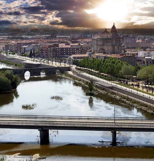
Ávila:

In Spain, it's the first weekend.
Stage 8: Talavera de la Reina - Ávila, 145km
Puertos:
Alto de El Piélago (1221m) 15,1km @ 4,9% (cat.2) - km 33
Puerto de Mijáres (1670m) 22,2km @ 4,8% (cat.1) - km 90
Puerto del Navalmoral (1514m) 8,4km @ 5,3% (cat.2) - km 123
Metas Volantes:
Burgohondo - km 107
Navalmoral - km 114
The second Saturday of the race sees a short and fast mountain stage which will favour a breakaway, linking two traditional hosts of La Vuelta and one of it's most beloved finishes, the cobbled ascent in front of the city walls in Ávila. This year's route is the fifth consecutive year without an Ávila finish, which is the longest we've been without its scenic run-in for a long time. It has nevertheless featured in 3 of my 4 Vuelta routes now, as it does bear bringing back - regardless of whether we may never see again the kind of savagery brought to the climb in the 1999 stage, with an exhibition by Frank Vandenbroucke from the group of elites which he had whittled down on the preceding climbs.
This stage will probably not be raced especially aggressively by the heads of state, until the final run-in. However, as it is short but the extremely lumpy profile will ensure a strong break, the battle for the stage should be very interesting - especially as several will have to deal with fatigue from yesterday's time trial.
One of the first things we do is tackle a surprisingly unknown Spanish climb, the Puerto de El Piélago. This mountain in the Toledo province has about six routes to the summit; we are taking the toughest. Although it is not steep it is long and inconsistent enough that I would have given it 1st category if it were being used in a more decisive position on the stage. It is one of a small handful of contenders for the hardest climb in Castilla-La Mancha, one of Spain's flattest regions. The other options to my mind are La Borriqueta's northwest face, Monte Ardal and the Alto Rey, for the record. It reaches a maximum of 10% and grinds along for over 15km rather early in the stage, so should ensure a strong breakaway over its semi-sheltered slopes.
The next climb is a much more well-known climb to aficionados of La Vuelta. The Puerto de Mijáres is similar to El Piélago in many ways - similarly wearing its max gradients at around the halfway point or just before, averaging just under 5% - however the climb is 50% longer and that means it definitely justifies cat.1. This double act of climbing was in fact used in the originally mooted 18th stage of the 2009 race - which also links the two cities we are linking in this route - however by the time the race took place El Piélago had been excised from the route, which subsequently looked like this. Mijáres may not be complex but its length does mean we will see a number of riders fall away through attrition and it does have some pretty switchbacks and dramatic vistas to keep the cameramen entertained if the riding is defensive.
While the 2009 route took a detour to the east in order to fit in the difficult Puerto del Mediano, this did however mean that the longer and more gradual climbs were rendered irrelevances to the stage. Here this should not be the case, as the stage is very short and the route from the Puerto de Mijáres to Ávila is much more direct so the climbing is closer to the finish. In fact we go straight through the two intermediate sprints in Burgohondo and Navalmoral very close to one another (in fact you can see them both on the profile for the final climb of the day) before leading to the Puerto del Navalmoral, a windy but otherwise uncomplicated ascent averaging just 5,3%. It never gets above 9%, but one of its steepest sections is near the finish and the summit is just 22km from the line, so there are plenty of options for stagehunters to make this count.
From there, there is about 12km of gradual descending - however this is not at all technical and on fairly wide roads in good condition - and a few kilometres of flat before the riders take on the famous little cobbled climb alongside the fortifications of Ávila. This is absolutely not worth categorizing - the profile indicates a lack of steepness - however as this is with only a kilometre remaining, there is the potential for a two-pronged race - first the battle for stage honours, and secondly among the main bunch should any GC winners wish to gain a few seconds. This was sort of what we got in 2009, when Philip Deignan escaped alone to win while Valverde tried to sneak away for some extra seconds unsuccessfully in the group behind.
Now, make that stage shorter and more dramatic, give more incentive to attack and place it a week earlier when there is still a lot of time to be won and lost, and this is what you get.
Talavera de la Reina:
Ávila:


I just take my pen back on this thread to congratulate Libertine on her Paris-Brussels route.
Amazing to see that you found a huge pack of climbs that I don't even know. I didn't feel like finishing my Paris-Brussels, have the feeling nobody was interested. I was personally rather looking for flat cobbles, my favourites but you did a great job. Great tribute to this great classic, too.
..and if you say I inspired you, then it's an honour for me.
Amazing to see that you found a huge pack of climbs that I don't even know.
I didn't feel like finishing my Paris-Brussels, have the feeling nobody was interested. I was personally rather looking for flat cobbles, my favourites but you did a great job. Great tribute to this great classic, too. ..and if you say I inspired you, then it's an honour for me.
- Feb 20, 2010
- 33,250
- 15,780
- 28,180
Stage 9: Collado Villalba - La Granja de San Ildefonso, 238km


Puertos:
Alto de Abantos (1640m) 11,5km @ 5,4% (cat.1) - km 27
Puerto de la Lancha (1485m) 6,6km @ 3,5% (cat.3) - km 62
Puerto de Guadarrama-Alto del León (1511m) 5,7km @ 4,9% (cat.3) - km 98
Puerto de Navacerrada (1860m) 17,5km @ 5,1% (cat.1) - km 126
Puerto de la Morcuera (1776m) 13,3km @ 4,8% (cat.2) - km 164
Puerto de Navacerrada (1860m) 12,0km @ 6,4% (cat.1) - km 213
Fuente de la Reina (1596m) 3,3km @ 7,9% (cat.2) - km 225
Metas Volantes:
Rascafría - km 149
Manzanares El Real - km 188
The final day before the rest day is the toughest stage to date, and absolutely the kind of stage that the Vuelta never puts on nowadays. At almost up to the UCI limit on stage length and with no fewer than seven categorized climbs (well, six, as one of them is climbed twice), this stage is the closest my race route gets to Madrid, so I thought I'd better make it a worthwhile stage. And with a rest day to follow it, it might tempt some exciting racing out of the riders. Still haven't used Bola del Mundo in four race routes... this stage, like the one preceding it, was influenced by the 2009 race, which finished in the same place using some of the same climbs, and was the final chance for the climbers in that race. Samuel Sánchez attacked near the summit of the final climb and tried to distance Valverde on the descent, but couldn't (although he gave up rather too easily to my mind). With the group sitting up all the main contenders came back together, and future Vuelta winner Juan José Cobo was able to escape from the bunch of the elites to take the stage.
We start in Comunidad de Madrid, in the city of Collado Villalba. The city has hosted the race a fair few times & is well located in the centre of the part of the region that has the climbs in it. And it doesn't take us long to get climbing either, with only 15km into the stage when we reach San Lorenzo de El Escorial, which signals the commencement of one of La Vuelta's most famous ascents, the Alto de Abantos. Formerly a staple of the race appearing more often than not in the closing stages, it was last ascended as the final MTF of the 2007 edition, in a stage won by Samuel Sánchez. However, the tarmac at the summit of the climb was in a lamentable state, and therefore putting the decisive moments of a stage there is a dangerous call. I felt, on the other hand, as a sop to tradition and also because of its glorious inconsistency giving us a proper early climb in the stage, that it would probably be ok in this role. Especially as the descent on the Ávila side is long and gradual so anybody caught out by bad luck due to the surface would be able to come back. And its tricky nature, veering between terrible steepness and false flats, will ensure that the breakaway in the stage is a strong one.
The road connecting Abantos to the N-VI taking us back into Madrid province goes over a pass called Collada de la Mina. Unfortunately while the Abantos side is in poor condition, the northern face is currently so bad as to be simply unusable, so we have to take a long loop over the Puerto de la Lancha, a much more gradual climb that is in much better condition. This then enables us to turn back east and pass over the easy side of the Puerto de Guadarrama, also known as the Alto del León (the name the Vuelta tends to prefer), in order to re-enter Madrid province.
The descent from this, which is wide, fast and non-technical, takes us onto one of the Vuelta's most storied and traditional ascents of all, the ski station at the Puerto de Navacerrada. Even when the Vuelta wasn't climbing it, this legendary ascent would find itself in the Clásica Alcobendas or the Vuelta a Castilla y León, and it is one of the Vuelta's main "classic climbs" that date back well into the race's history. In reality , a lot of its reputation is to do with its location; overlooking Madrid it swiftly became a regular "last chance for the climbers" ascent late in the race; the profile of this side shows that it is not an Anglirú or anything - not unless you stick the extra few kilometres to Bola del Mundo on top of it, anyway. At this point, we're still over 100km from the finish, though, so I doubt we'll see too much action. The climb then backs immediately onto an intermediate sprint in the cobbled streets of Rascafría, before immediately heading into the next climb, the category 2 ascent of Puerto de la Morcuera from its easier northern side. Although it averages little less than Abantos, is longer and closer to the finish, it does not have many ramps and maxes out at 9%, so I have given this the lower categorization. We are getting some good altitude here, and there are also some glorious views at the summit, we then have a technical descent into Miraflores de la Sierra.
There is then, unfortunately, around 30km of flat terrain, the longest stretch of the stage and that will likely mean that any moves will be nullified at this point; it would be a very optimistic rider to have gone solo on Navacerrada or Morcuera with the distance to the finish remaining. This period of flat is broken up by an intermediate sprint in Manzanares El Real, before with 45km remaining, the fireworks begin. Hopefully riders having five climbs and nearly 200km already in their legs, and the knowledge that they have a rest tomorrow, will mean some action as we take on a slightly different approach to Navacerrada, this time the side from Mataelpino, most of which is the same as the classic southern face but has a slightly different introduction. The profile for it is here and as you can see it is the phase from 4km-2km from the summit that is likely to see the moves. The climb is quite wide with plenty of space to keep an eye on moves, and cresting 25km from the finish before a twisty and highly technical descent means it could yield action.
In the 2009 stage, the riders headed straight for La Granja de San Ildefonso here. I don't go so easy on them this time - although what I chose instead is a little bit of a secret. So secret, in fact, that the road doesn't appear on google maps, and is barely even noted on altimetrias - the profile for the Segovian side of Navacerrada only shows a couple of junctions for a Camino Forestal - the one at around 3km of that profile is a junction which breaks off of the descent and entails passing through a gate, onto a short and steep climb. This is a stop off point on the way to the sadly unpaved Puerto de Fuenfría, called the Fuente de la Reina. The full profile from Valsaín looks like this, however we are only doing the final 3,3km of it. Like a few other similar roads in the area, this has recently been repaved, so there is perfectly good tarmac to climb. It's sometimes narrow and hidden away, but it's perfectly ascendable. And though it's short and the average gradient wouldn't seem to merit that cat.2 status, the final 1,3km are absolutely brutal, and with the final 300m averaging 20% (!!!), cresting 14km from the finish and with riders already having six climbs and 220km distance already in the legs, this should break people apart for sure.
The descent is downhill false flat except for 2km that average around about 10% and will require a bit of care. From there it's just four kilometres until the finish in front of the Palácio Real & the riders will get a well-earnt rest day in Segovia. Gaps should be big & put the focus back on the climbers after the 50+ kilometres of contrarreloj in Toledo.
Collado Villalba:

La Granja de San Ildefonso:
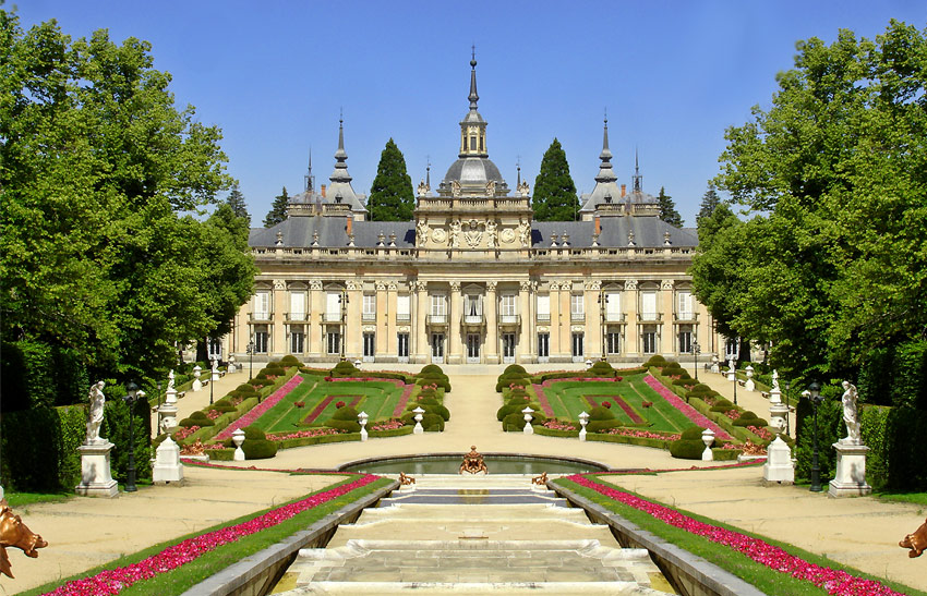
Puertos:
Alto de Abantos (1640m) 11,5km @ 5,4% (cat.1) - km 27
Puerto de la Lancha (1485m) 6,6km @ 3,5% (cat.3) - km 62
Puerto de Guadarrama-Alto del León (1511m) 5,7km @ 4,9% (cat.3) - km 98
Puerto de Navacerrada (1860m) 17,5km @ 5,1% (cat.1) - km 126
Puerto de la Morcuera (1776m) 13,3km @ 4,8% (cat.2) - km 164
Puerto de Navacerrada (1860m) 12,0km @ 6,4% (cat.1) - km 213
Fuente de la Reina (1596m) 3,3km @ 7,9% (cat.2) - km 225
Metas Volantes:
Rascafría - km 149
Manzanares El Real - km 188
The final day before the rest day is the toughest stage to date, and absolutely the kind of stage that the Vuelta never puts on nowadays. At almost up to the UCI limit on stage length and with no fewer than seven categorized climbs (well, six, as one of them is climbed twice), this stage is the closest my race route gets to Madrid, so I thought I'd better make it a worthwhile stage. And with a rest day to follow it, it might tempt some exciting racing out of the riders. Still haven't used Bola del Mundo in four race routes... this stage, like the one preceding it, was influenced by the 2009 race, which finished in the same place using some of the same climbs, and was the final chance for the climbers in that race. Samuel Sánchez attacked near the summit of the final climb and tried to distance Valverde on the descent, but couldn't (although he gave up rather too easily to my mind). With the group sitting up all the main contenders came back together, and future Vuelta winner Juan José Cobo was able to escape from the bunch of the elites to take the stage.
We start in Comunidad de Madrid, in the city of Collado Villalba. The city has hosted the race a fair few times & is well located in the centre of the part of the region that has the climbs in it. And it doesn't take us long to get climbing either, with only 15km into the stage when we reach San Lorenzo de El Escorial, which signals the commencement of one of La Vuelta's most famous ascents, the Alto de Abantos. Formerly a staple of the race appearing more often than not in the closing stages, it was last ascended as the final MTF of the 2007 edition, in a stage won by Samuel Sánchez. However, the tarmac at the summit of the climb was in a lamentable state, and therefore putting the decisive moments of a stage there is a dangerous call. I felt, on the other hand, as a sop to tradition and also because of its glorious inconsistency giving us a proper early climb in the stage, that it would probably be ok in this role. Especially as the descent on the Ávila side is long and gradual so anybody caught out by bad luck due to the surface would be able to come back. And its tricky nature, veering between terrible steepness and false flats, will ensure that the breakaway in the stage is a strong one.
The road connecting Abantos to the N-VI taking us back into Madrid province goes over a pass called Collada de la Mina. Unfortunately while the Abantos side is in poor condition, the northern face is currently so bad as to be simply unusable, so we have to take a long loop over the Puerto de la Lancha, a much more gradual climb that is in much better condition. This then enables us to turn back east and pass over the easy side of the Puerto de Guadarrama, also known as the Alto del León (the name the Vuelta tends to prefer), in order to re-enter Madrid province.
The descent from this, which is wide, fast and non-technical, takes us onto one of the Vuelta's most storied and traditional ascents of all, the ski station at the Puerto de Navacerrada. Even when the Vuelta wasn't climbing it, this legendary ascent would find itself in the Clásica Alcobendas or the Vuelta a Castilla y León, and it is one of the Vuelta's main "classic climbs" that date back well into the race's history. In reality , a lot of its reputation is to do with its location; overlooking Madrid it swiftly became a regular "last chance for the climbers" ascent late in the race; the profile of this side shows that it is not an Anglirú or anything - not unless you stick the extra few kilometres to Bola del Mundo on top of it, anyway. At this point, we're still over 100km from the finish, though, so I doubt we'll see too much action. The climb then backs immediately onto an intermediate sprint in the cobbled streets of Rascafría, before immediately heading into the next climb, the category 2 ascent of Puerto de la Morcuera from its easier northern side. Although it averages little less than Abantos, is longer and closer to the finish, it does not have many ramps and maxes out at 9%, so I have given this the lower categorization. We are getting some good altitude here, and there are also some glorious views at the summit, we then have a technical descent into Miraflores de la Sierra.
There is then, unfortunately, around 30km of flat terrain, the longest stretch of the stage and that will likely mean that any moves will be nullified at this point; it would be a very optimistic rider to have gone solo on Navacerrada or Morcuera with the distance to the finish remaining. This period of flat is broken up by an intermediate sprint in Manzanares El Real, before with 45km remaining, the fireworks begin. Hopefully riders having five climbs and nearly 200km already in their legs, and the knowledge that they have a rest tomorrow, will mean some action as we take on a slightly different approach to Navacerrada, this time the side from Mataelpino, most of which is the same as the classic southern face but has a slightly different introduction. The profile for it is here and as you can see it is the phase from 4km-2km from the summit that is likely to see the moves. The climb is quite wide with plenty of space to keep an eye on moves, and cresting 25km from the finish before a twisty and highly technical descent means it could yield action.
In the 2009 stage, the riders headed straight for La Granja de San Ildefonso here. I don't go so easy on them this time - although what I chose instead is a little bit of a secret. So secret, in fact, that the road doesn't appear on google maps, and is barely even noted on altimetrias - the profile for the Segovian side of Navacerrada only shows a couple of junctions for a Camino Forestal - the one at around 3km of that profile is a junction which breaks off of the descent and entails passing through a gate, onto a short and steep climb. This is a stop off point on the way to the sadly unpaved Puerto de Fuenfría, called the Fuente de la Reina. The full profile from Valsaín looks like this, however we are only doing the final 3,3km of it. Like a few other similar roads in the area, this has recently been repaved, so there is perfectly good tarmac to climb. It's sometimes narrow and hidden away, but it's perfectly ascendable. And though it's short and the average gradient wouldn't seem to merit that cat.2 status, the final 1,3km are absolutely brutal, and with the final 300m averaging 20% (!!!), cresting 14km from the finish and with riders already having six climbs and 220km distance already in the legs, this should break people apart for sure.
The descent is downhill false flat except for 2km that average around about 10% and will require a bit of care. From there it's just four kilometres until the finish in front of the Palácio Real & the riders will get a well-earnt rest day in Segovia. Gaps should be big & put the focus back on the climbers after the 50+ kilometres of contrarreloj in Toledo.
Collado Villalba:
La Granja de San Ildefonso:
- Feb 20, 2010
- 33,250
- 15,780
- 28,180
At times it's very narrow but it's not especially technical with very few corners. Shouldn't be a real problem.
After the rest day, we return with... a rest day.
Stage 10: Valladolid - Astorga, 160km


Puertos:
no hay puertos de montaña
Metas Volantes:
Valderas - km 82
La Bañeza - km 129
I don't like circuit races in Grand Tours, so this is my equivalent of tomorrow's Vuelta stage in Logroño - a featureless and flat transitional day that will see the riders cross the plains in Castilla y León to move towards the north west of the country. The stage is very similar to a stage in my first Vuelta route, in fact, however I have fixed up the run-in a little to make it safer for a sprint.
That's about all there is to say about this one, to be honest - it's the kind of stage I will moan about in real races, but short of putting a much longer stage finishing in Bembibre or Ponferrada there's not a great deal that can be done heading along linking these cities - although views at the finish will do their damnedest to warn the riders what is coming up... And the other point is that as the last stage before the rest day was 240km with seven categorised climbs, and I have another tough GC day tomorrow, there need to be some easy days.
...right?
Valladolid:

Astorga:

After the rest day, we return with... a rest day.
Stage 10: Valladolid - Astorga, 160km
Puertos:
no hay puertos de montaña
Metas Volantes:
Valderas - km 82
La Bañeza - km 129
I don't like circuit races in Grand Tours, so this is my equivalent of tomorrow's Vuelta stage in Logroño - a featureless and flat transitional day that will see the riders cross the plains in Castilla y León to move towards the north west of the country. The stage is very similar to a stage in my first Vuelta route, in fact, however I have fixed up the run-in a little to make it safer for a sprint.
That's about all there is to say about this one, to be honest - it's the kind of stage I will moan about in real races, but short of putting a much longer stage finishing in Bembibre or Ponferrada there's not a great deal that can be done heading along linking these cities - although views at the finish will do their damnedest to warn the riders what is coming up... And the other point is that as the last stage before the rest day was 240km with seven categorised climbs, and I have another tough GC day tomorrow, there need to be some easy days.
...right?
Valladolid:
Astorga:
- Feb 20, 2010
- 33,250
- 15,780
- 28,180
Stage 11: O Barco de Valdeorras - Vigo, 230km


Puertos:
Alto de Abrence (480m) 5,1km @ 4,0% (cat.3) - km 51
Alto de Guitara (604m) 9,4km @ 3,3% (cat.3) - km 80
Costiña de Canedo (385m) 2,0km @ 12,6% (cat.2) - km 116
Alto das Cavadas (659m) 13,0km @ 4,2% (cat.2) - km 157
Alto de Fontefría (790m) 4,6km @ 4,2% (cat.3) - km 169
Alto de la Cruz de San Cibrán (336m) 3,2km @ 8,3% (cat.3) - km 199
Alto de San Cosme (392m) 5,4km @ 6,8% (cat.2) - km 212
Monte dos Pozos (327m) 1,8km @ 8,1% (cat.3) - km 222
Metas Volantes:
Ponteareas - km 190
O Porriño - km 206
The mid-way point in the Vuelta sees the second truly un-Vuelta-like stage of up-and-down all day over a long stage of over 200km, this time through the lower parts of the Maciza Galaica and heading towards the Atlantic coast via a large number of 2nd- and 3rd-category climbs. Although the important climbing in respect of realistic GC moves takes place fairly late in the stage, with so many climbs this one will prove a very tough one to control even if gradients are fairly light for much of the stage. Hey, the riders have had a rest day followed by a sprint stage without a single categorized climb, so it's only fair that we put them up to a killer hilly/intermediate stage, right?
Having crossed past Ponferrada and into Galicia, the race begins in O Barco de Valdeorras, a wine-producing town with pre-Roman history. Valdeorras is a scenic valley and a Denominación de Origen for wine production, so the riders will be heading through mountain vistas dotted with vineyards for the first part of the stage. After passing through Quiroga we have our first climb of the day, a fairly benign grind up to the village of Abrence. The route then flattens out and we pass through Monforte de Lemos with its imposing Castillo/Parador, before the road heads gradually skyward once more - only at low gradients thus far. The summit of this climb is the Alto de Guitara, which is then followed by a windy road down to the banks of the Río Sil, and the incredible views that the river's path create.
For a while we follow the road along the river, so this will be a good one for the TV camera coverage until we get to the provincial capital of Ourense with its Roman architecture and historic centre. Shortly after this we have the steepest climb of the day, a short puncheur climb but steep enough to merit category 2. The Costiña de Canedo is a proper muro, which has appeared as a finishing wall in one of my previous Vuelta designs. Averaging over 12% over 2 kilometres of dead straight riding, it almost exactly marks the midway point in the stage, and is the first point at which the weakest climbers will start to have problems. Here's the profile.
After this things ease up somewhat; there's a twisty but wide and smooth descent back to the riverside and then the riders pass through Ribadavia. After this we wave goodbye to the Río Sil once and for all though, and turn uphill once more on our trip westward. The Alto de Fontefría is the highest point we will reach in the stage and a very long climb, however this is pretty gradual and has been split up for categorization purposes into its first 2/3 or so, the Alto das Cavadas, and then the final 4km or so which ramp up again after a period of false flat. Here's the profile, which shows the steepest stuff - a section of 10% or thereabouts - is near the bottom. From here it's not so much the difficulty of the climbs but the cumulative effects of distance and the amount of time that has been spent climbing that will create problems.
After a long and uncomplicated descent and an intermediate sprint with 40km remaining in Ponteareas, which hosted La Vuelta in 2011 & 2012, the part of the stage I envision being important begins. The final 35km have three categorized climbs and some serious gradients, although none of the climbs are over-long, so there is the possibility that durable puncheurs can be there. This is rather Lombardia-inspired, so hopefully we can get that kind of racing going, with time gaps generated and GC contenders coming out to play.
The first of these climbs, cresting with 32km remaining, is San Cibran. We are climbing to where it signposts San Martiño on that profile, so just over 3km at 8,3% including 3 ramps of 20%. You might question my choice of "Cruz" over "Cruce" in the nomenclature, but there is a cross at the summit, so Cruz it is. A very fast and straight descent then takes us into O Porriño where, if the break have been hoovered up, time bonifications will be available at the intermediate sprint giving another incentive to the chase.
Then things get even tougher, with the hardest of the climbs in the run-in, the inconsistent and painful Alto de San Cosme, the first 5,4km of that profile. That section of 2km @ 11,2% in particular with its maximum gradient of 16% will cause some major difficulties especially as this is the 7th categorised climb of the day & comes over 200km in. The climb finishes adjacent to the main campus of Universidade de Vigo and comes with just 18km remaining, so I anticipate fireworks on the climb. However, not long after that - just 7-8km of gentle descent - we have the final categorized ascent of the day, the short puncheur special dig on the narrow road to Parque Forestal Monte dos Pozos with its incredible views down to the finish, which is shorter than its predecessors and not as brutal ramp-wise, although the last 300m average 13%. At this point the line is 8km away, most of which are downhill, so I would be very disappointed if there haven't been serious moves here. In the unlikely event that there haven't, there's still one final opportunity - the last kilometre is uphill although uncategorized. Baixada Igreja is about 500m at 8%, before the riders turn onto Gran Via for the finishing straight, which is slightly tilted uphill but not enough to be considered a climb.
This is a stage that could just be for the breakaway, but the GC men will need to be vigilant at all times, and a high pace throughout could burn through the péloton and leave some real suffering.
O Barco de Valdeorras:
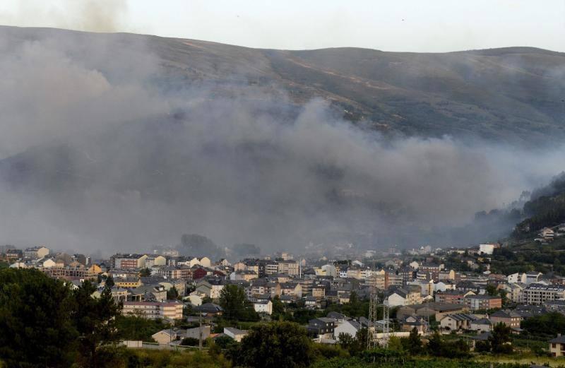
Vigo:

Puertos:
Alto de Abrence (480m) 5,1km @ 4,0% (cat.3) - km 51
Alto de Guitara (604m) 9,4km @ 3,3% (cat.3) - km 80
Costiña de Canedo (385m) 2,0km @ 12,6% (cat.2) - km 116
Alto das Cavadas (659m) 13,0km @ 4,2% (cat.2) - km 157
Alto de Fontefría (790m) 4,6km @ 4,2% (cat.3) - km 169
Alto de la Cruz de San Cibrán (336m) 3,2km @ 8,3% (cat.3) - km 199
Alto de San Cosme (392m) 5,4km @ 6,8% (cat.2) - km 212
Monte dos Pozos (327m) 1,8km @ 8,1% (cat.3) - km 222
Metas Volantes:
Ponteareas - km 190
O Porriño - km 206
The mid-way point in the Vuelta sees the second truly un-Vuelta-like stage of up-and-down all day over a long stage of over 200km, this time through the lower parts of the Maciza Galaica and heading towards the Atlantic coast via a large number of 2nd- and 3rd-category climbs. Although the important climbing in respect of realistic GC moves takes place fairly late in the stage, with so many climbs this one will prove a very tough one to control even if gradients are fairly light for much of the stage. Hey, the riders have had a rest day followed by a sprint stage without a single categorized climb, so it's only fair that we put them up to a killer hilly/intermediate stage, right?
Having crossed past Ponferrada and into Galicia, the race begins in O Barco de Valdeorras, a wine-producing town with pre-Roman history. Valdeorras is a scenic valley and a Denominación de Origen for wine production, so the riders will be heading through mountain vistas dotted with vineyards for the first part of the stage. After passing through Quiroga we have our first climb of the day, a fairly benign grind up to the village of Abrence. The route then flattens out and we pass through Monforte de Lemos with its imposing Castillo/Parador, before the road heads gradually skyward once more - only at low gradients thus far. The summit of this climb is the Alto de Guitara, which is then followed by a windy road down to the banks of the Río Sil, and the incredible views that the river's path create.
For a while we follow the road along the river, so this will be a good one for the TV camera coverage until we get to the provincial capital of Ourense with its Roman architecture and historic centre. Shortly after this we have the steepest climb of the day, a short puncheur climb but steep enough to merit category 2. The Costiña de Canedo is a proper muro, which has appeared as a finishing wall in one of my previous Vuelta designs. Averaging over 12% over 2 kilometres of dead straight riding, it almost exactly marks the midway point in the stage, and is the first point at which the weakest climbers will start to have problems. Here's the profile.
After this things ease up somewhat; there's a twisty but wide and smooth descent back to the riverside and then the riders pass through Ribadavia. After this we wave goodbye to the Río Sil once and for all though, and turn uphill once more on our trip westward. The Alto de Fontefría is the highest point we will reach in the stage and a very long climb, however this is pretty gradual and has been split up for categorization purposes into its first 2/3 or so, the Alto das Cavadas, and then the final 4km or so which ramp up again after a period of false flat. Here's the profile, which shows the steepest stuff - a section of 10% or thereabouts - is near the bottom. From here it's not so much the difficulty of the climbs but the cumulative effects of distance and the amount of time that has been spent climbing that will create problems.
After a long and uncomplicated descent and an intermediate sprint with 40km remaining in Ponteareas, which hosted La Vuelta in 2011 & 2012, the part of the stage I envision being important begins. The final 35km have three categorized climbs and some serious gradients, although none of the climbs are over-long, so there is the possibility that durable puncheurs can be there. This is rather Lombardia-inspired, so hopefully we can get that kind of racing going, with time gaps generated and GC contenders coming out to play.
The first of these climbs, cresting with 32km remaining, is San Cibran. We are climbing to where it signposts San Martiño on that profile, so just over 3km at 8,3% including 3 ramps of 20%. You might question my choice of "Cruz" over "Cruce" in the nomenclature, but there is a cross at the summit, so Cruz it is. A very fast and straight descent then takes us into O Porriño where, if the break have been hoovered up, time bonifications will be available at the intermediate sprint giving another incentive to the chase.
Then things get even tougher, with the hardest of the climbs in the run-in, the inconsistent and painful Alto de San Cosme, the first 5,4km of that profile. That section of 2km @ 11,2% in particular with its maximum gradient of 16% will cause some major difficulties especially as this is the 7th categorised climb of the day & comes over 200km in. The climb finishes adjacent to the main campus of Universidade de Vigo and comes with just 18km remaining, so I anticipate fireworks on the climb. However, not long after that - just 7-8km of gentle descent - we have the final categorized ascent of the day, the short puncheur special dig on the narrow road to Parque Forestal Monte dos Pozos with its incredible views down to the finish, which is shorter than its predecessors and not as brutal ramp-wise, although the last 300m average 13%. At this point the line is 8km away, most of which are downhill, so I would be very disappointed if there haven't been serious moves here. In the unlikely event that there haven't, there's still one final opportunity - the last kilometre is uphill although uncategorized. Baixada Igreja is about 500m at 8%, before the riders turn onto Gran Via for the finishing straight, which is slightly tilted uphill but not enough to be considered a climb.
This is a stage that could just be for the breakaway, but the GC men will need to be vigilant at all times, and a high pace throughout could burn through the péloton and leave some real suffering.
O Barco de Valdeorras:
Vigo:
- Feb 20, 2010
- 33,250
- 15,780
- 28,180
Stage 12: Pontevedra - Noia, 170km


Puertos:
no hay puertos de montaña
Metas Volantes:
Vilagarcía de Arousa - km 75
Rianxo - km 105
The profile for this one, thanks to Mapmyride's epic scale ridiculousness, looks like Liège-Bastogne-Liège, but don't be fooled - this is flat. Definitely flat. At the same time, this stage which snakes along the Galician coastline in the style of recent years does have quite a lot of time spent ascending and descending, it's just that no climbs are worthy of categorization and there are no sustained efforts.
The other issue with this stage is that it is side on to the sea almost all the way, so if the wind begins to blow, this could get chaotic. Sometimes other parts of the land will obscure the prevailing winds, however the final 40km are all prime echelon fodder if the wind plays ball. And who doesn't like some waaier racing? Especially coming off the back of a 230km stage with eight climbs, some tired legs could really be hoping for a calm breeze today because there are big stages to come, so they would really rather be able to take it easy today rather than have to ride flat out to prevent being lost in the wind today.
The scenery will be good today, however. From Sanxenxo with its lovely beaches to the peninsular town of O Grove early in the stage, from the charming Vilanova de Arousa and the Atlantic views of A Illa de Arousa to stunning hillside and beachfront in Vilagarcía, the peninsular outcrop that is Carril, the bay in Rianxo, the scenic seafront at Ribeira to the characterful Porto do Son, this stage will offer some incredible helicam fodder if nothing else. The final kilometre is dead straight so should be perfect for a sprint from whatever size group remains.
Pontevedra:
Noia:
- Feb 20, 2010
- 33,250
- 15,780
- 28,180
Library post
Fantasy Vueltas a España (users L-Z)
Vuelta a España: Stage 1 Stage 2 Stage 3 Stage 4 Stage 5 Stage 6 Stage 7 Stage 8 Stage 9 Stage 10 Stage 11 Stage 12 Stage 13 Stage 14 Stage 15 Stage 16 Stage 17 Stage 18 Stage 19 Stage 20 Stage 21 (Libertine Seguros)
Vuelta a España (2): Stage 1 Stage 2 Stage 3 Stage 4 Stage 5 Stage 6 Stage 7 Stage 8 Stage 9 Stage 10 Stage 11 Stage 12 Stage 13 Stage 14 Stage 15 Stage 16 Stage 17 Stage 18 Stage 19 Stage 20 Stage 21 (Libertine Seguros)
Vuelta a España (3): Stage 1 Stage 2 Stage 3 Stage 4 Stage 5 Stage 6 Stage 7 Stage 8 Stage 9 Stage 10 Stage 11 Stage 12 Stage 13 Stage 14 Stage 15 Stage 16 Stage 17 Stage 18 Stage 19 Stage 20 Stage 21 (Libertine Seguros)
Vuelta a España (4): Stage 1 Stage 2 Stage 3 Stage 4 Stage 5 Stage 6 Stage 7 Stage 8 Stage 9 Stage 10 Stage 11 Stage 12 Stage 13 Stage 14 Stage 15 Stage 16 Stage 17 Stage 18 Stage 19 Stage 20 Stage 21 (Libertine Seguros)
Vuelta a España: Entire parcours (roundabout)
Vuelta a España: Entire parcours (Viskovitz)
More will be added here as they are posted. All library posts are linked from the original post in the thread.
- Jun 10, 2013
- 9,240
- 5
- 17,495
World Championship RR: Seattle, Washington.
World Championship Road Race: Seattle, Washington.
Thinking about the two Canadian classics led me to create a World Championships circuit in North America. As possible to the North. After examining the great cities near the US-CA border, on both sides, I chose Seattle. Perfect spot, perfect terrain, the jewel of the Northwest I'd say. No other city was that hilly in it's metropolitan area, other than, of course, both Montréal and Québec.
I was experimenting on the terrain and came up with two possible routes. The one which I discarded started and finished on Queen Anne Hill, a neighborhood and geographic feature, northwest of downtown Seattle. It is 139 meters high in it's top and it is the highest named hill in the city. After the summit, where the start/finish line is located, there was a false flat before riders started descending west to Interbay and then hit another small hill up to Lawton Park, descend to Gilman Avenue and ride four or five kilometers of flat to east before the most difficult climb en route, up to Queen Anne, though from the north via the 4th Avenue N, 1km @10%. Cyclists would then descend again to Lower Queen Anne, which stands to the south, and climb to the finish line via Queen Anne Av. itself. The circuit was slightly longer than 17km's and had 410 meters of elevation in each lap.
The final circuit is 15,500m and consists of 16 laps making it 248km's. It starts and finishes in Madison street, slightly west of Madison Park, neighborhood in east central Seattle near Lake Washington. Cyclists climb the street (west) to Washington Park and turn left (south) on the 2nd Avenue E to Madrona and the eastern side of the Central District. This circuit is also located predominantly on a residential area. Riders initiate a small but steep descent before climbing again to Leschi and gradually coming down, even further south, to Colman Park. Now cyclists meet the lakeshore by riding in the Lakeside Ave. heading north, which is interrupted by a small kick up to Leschi Park and back to the waterfront, now on Lake Washington Blvd. A bit more false flat and riders hit the last climb of the circuit again up to Washington Park, although from a different direction and street, by going through Lakeview Park, on the first slopes, and then the 36th Av. E, where the higher gradients are. Cyclists then descend to McGilvra Blvd before the intersection with Madison Street and eventually reaching the finish line.
Hilltops:
Lower north Washington Park (Madison street): 500m @ 7%, max: 8%
E. Cherry St (via 34th Ave): 1,500m @ 6%, max: 8%.
Leschi: 1,100m @ 6%, max: 12%.
Washington Park: 700m @ 7%, max: 9%
Last slope (Madison Street): 150m @ 10%
Elevation gain: @5040m

Seattle
World Championship Road Race: Seattle, Washington.
Thinking about the two Canadian classics led me to create a World Championships circuit in North America. As possible to the North. After examining the great cities near the US-CA border, on both sides, I chose Seattle. Perfect spot, perfect terrain, the jewel of the Northwest I'd say. No other city was that hilly in it's metropolitan area, other than, of course, both Montréal and Québec.
I was experimenting on the terrain and came up with two possible routes. The one which I discarded started and finished on Queen Anne Hill, a neighborhood and geographic feature, northwest of downtown Seattle. It is 139 meters high in it's top and it is the highest named hill in the city. After the summit, where the start/finish line is located, there was a false flat before riders started descending west to Interbay and then hit another small hill up to Lawton Park, descend to Gilman Avenue and ride four or five kilometers of flat to east before the most difficult climb en route, up to Queen Anne, though from the north via the 4th Avenue N, 1km @10%. Cyclists would then descend again to Lower Queen Anne, which stands to the south, and climb to the finish line via Queen Anne Av. itself. The circuit was slightly longer than 17km's and had 410 meters of elevation in each lap.
The final circuit is 15,500m and consists of 16 laps making it 248km's. It starts and finishes in Madison street, slightly west of Madison Park, neighborhood in east central Seattle near Lake Washington. Cyclists climb the street (west) to Washington Park and turn left (south) on the 2nd Avenue E to Madrona and the eastern side of the Central District. This circuit is also located predominantly on a residential area. Riders initiate a small but steep descent before climbing again to Leschi and gradually coming down, even further south, to Colman Park. Now cyclists meet the lakeshore by riding in the Lakeside Ave. heading north, which is interrupted by a small kick up to Leschi Park and back to the waterfront, now on Lake Washington Blvd. A bit more false flat and riders hit the last climb of the circuit again up to Washington Park, although from a different direction and street, by going through Lakeview Park, on the first slopes, and then the 36th Av. E, where the higher gradients are. Cyclists then descend to McGilvra Blvd before the intersection with Madison Street and eventually reaching the finish line.
Hilltops:
Lower north Washington Park (Madison street): 500m @ 7%, max: 8%
E. Cherry St (via 34th Ave): 1,500m @ 6%, max: 8%.
Leschi: 1,100m @ 6%, max: 12%.
Washington Park: 700m @ 7%, max: 9%
Last slope (Madison Street): 150m @ 10%
Elevation gain: @5040m
Seattle
TRENDING THREADS
-
 Paris-Roubaix 2026, one day monument, April 12
- Started by Lequack
- Replies: 2K
-

-
 Itzulia Basque Country 2026, April 6-11
- Started by Dazed and Confused
- Replies: 2K
-

-
 Ronde van Vlaanderen 2026, monument, April 5 (men's)
- Started by Krzysztof_O
- Replies: 1K
-
 Teams & Riders The Remco Evenepoel is the next Eddy Merckx thread
- Started by DNP-Old
- Replies: 39K
-
 Teams & Riders Tadej Pogačar discussion thread
- Started by Lequack
- Replies: 44K

Cyclingnews is part of Future plc, an international media group and leading digital publisher. Visit our corporate site.
© Future Publishing Limited Quay House, The Ambury, Bath BA1 1UA. All rights reserved. England and Wales company registration number 2008885.