• The Cycling News forum is looking to add some volunteer moderators with Red Rick's recent retirement. If you're interested in helping keep our discussions on track, send a direct message to @SHaines here on the forum, or use the Contact Us form to message the Community Team.

    In the meanwhile, please use the Report option if you see a post that doesn't fit within the forum rules.

    Thanks!

Race Design Thread

Page 151 - Get up to date with the latest news, scores & standings from the Cycling News Community.
GIRO D'ITALIA STAGE 6: TERNI - ASISSI 192.5 KM -- MEDIUM MOUNTAIN
This stage goes through rolling terrain of Umbria, four Cat. 3 climbs on the way. We start by heading out of Terni towards Spoleto, over a steep and short Cat 3 climb, a beautiful city for our first TV, and then we encounter a Cat 3 up to Baiano. Longer and less steep climb, this one. Rolling terrain continues with another 2 Cat.3 climbs, before an uphill finish to Asissi - same finish place of 2012, the finish is exactly the same as 2012, but I got it slightly wrong on the route. Could create time gaps of 3 or 4 seconds between the favourites, but they probably won't win the stage, unless if they are also great on short steep finishes. Assisi, the finish, is an incredibly beautiful medieval city.

Profile
gJqvDnml.png


Assisi
default_panoramica_02.jpg
 
GIRO D'ITALIA STAGE 7: PERUGIA - PONTE CALCARA 199km -- MEDIUM MOUNTAIN
The most difficult stage of this Giro so far. The stage begins in Perugia and has 50km out of the start which is pretty rolling territory with the typical central Italian scenery and countryside, before a long 120km flat stretch. Then hell is reached. The second (after Partenio in stage 4) of the dangerously steep climbs. Monte Catria is 5km at 15.9%. remember, this is only the average. To make it worse - it is unpaved It peaks at 22% and has a 1.5km section at 18.5%. Too steep to have any attacks on it straight away, although there is a section of only 8.5% where some riders might try to ride away, although I;m not sure if they will have the energy. Groups will be only 5 or 6 maximum at the top of the climb before they begin the descent. They will be empty by the end of this climb, and the descent is technical in places to give the better descenders a chance to catch up so they are in the front group for a finish that really does suit them. After the 10km descent, another climb starts, 8.6km long at only 5.9%, although getting up yo about 11%. The success or the riders is dependent on how they recover after the Catria. If they are empty, then will continue losing time throughout these 8.6km. If they have recovered, then there is plenty of chances to put minutes into your rivals. After the climb is crested there is a VERY fast descent into the small town of Ponte Calcara.

To make it more fun, roughly 80% of the last 30km is on sterrato. Including all of the descents.

Profile: (including a hash version of sterrato)
14Ryd8ll.png


Monte Catria:
monte-catria-cima.jpg
 
Jun 30, 2014
7,060
2
0
Visit site
Re:

Brullnux said:
GIRO D'ITALIA STAGE 7: PERUGIA - PONTE CALCARA 199km -- MEDIUM MOUNTAIN
The most difficult stage of this Giro so far. The stage begins in Perugia and has 50km out of the start which is pretty rolling territory with the typical central Italian scenery and countryside, before a long 120km flat stretch. Then hell is reached. The second (after Partenio in stage 4) of the dangerously steep climbs. Monte Catria is 5km at 15.9%. remember, this is only the average. To make it worse - it is unpaved It peaks at 22% and has a 1.5km section at 18.5%. Too steep to have any attacks on it straight away, although there is a section of only 8.5% where some riders might try to ride away, although I;m not sure if they will have the energy. Groups will be only 5 or 6 maximum at the top of the climb before they begin the descent. They will be empty by the end of this climb, and the descent is technical in places to give the better descenders a chance to catch up so they are in the front group for a finish that really does suit them. After the 10km descent, another climb starts, 8.6km long at only 5.9%, although getting up yo about 11%. The success or the riders is dependent on how they recover after the Catria. If they are empty, then will continue losing time throughout these 8.6km. If they have recovered, then there is plenty of chances to put minutes into your rivals. After the climb is crested there is a VERY fast descent into the small town of Ponte Calcara.

To make it more fun, roughly 80% of the last 30km is on sterrato. Including all of the descents.

Profile: (including a hash version of sterrato)
14Ryd8ll.png


Monte Catria:
monte-catria-cima.jpg
Looks great, is there a profile of this side of Monte Catria? Where did you get those gradients from? I'm just asking because I can't find them on the internet.
 
Re: Re:

Mayomaniac said:
Brullnux said:
GIRO D'ITALIA STAGE 7: PERUGIA - PONTE CALCARA 199km -- MEDIUM MOUNTAIN
The most difficult stage of this Giro so far. The stage begins in Perugia and has 50km out of the start which is pretty rolling territory with the typical central Italian scenery and countryside, before a long 120km flat stretch. Then hell is reached. The second (after Partenio in stage 4) of the dangerously steep climbs. Monte Catria is 5km at 15.9%. remember, this is only the average. To make it worse - it is unpaved It peaks at 22% and has a 1.5km section at 18.5%. Too steep to have any attacks on it straight away, although there is a section of only 8.5% where some riders might try to ride away, although I;m not sure if they will have the energy. Groups will be only 5 or 6 maximum at the top of the climb before they begin the descent. They will be empty by the end of this climb, and the descent is technical in places to give the better descenders a chance to catch up so they are in the front group for a finish that really does suit them. After the 10km descent, another climb starts, 8.6km long at only 5.9%, although getting up yo about 11%. The success or the riders is dependent on how they recover after the Catria. If they are empty, then will continue losing time throughout these 8.6km. If they have recovered, then there is plenty of chances to put minutes into your rivals. After the climb is crested there is a VERY fast descent into the small town of Ponte Calcara.

To make it more fun, roughly 80% of the last 30km is on sterrato. Including all of the descents.

Profile: (including a hash version of sterrato)
14Ryd8ll.png


Monte Catria:
monte-catria-cima.jpg
Looks great, is there a profile of this side of Monte Catria? Where did you get those gradients from? I'm just asking because I can't find them on the internet.
I was looking for other sides to climb it and found this side mostly by accident. The numbers I got from the Cronoescalada map, so I'm not sure how reliable they are, but for now they're the only ones so :eek:
 
KAKANIEN RUNDFAHRT

(Sun) stage 14: Kranj - Velika planina, 116 km

4k6b7d6c1ge6.png

dy4agdc9qaxw.png


The second and last stage in the Alps is much shorter than the first one. It's not much easier, though. The first kilometers are easier than yesterday, as the Seebergsattel needs time to get going. The last 5 km have 6,3%. The pass is at the border to Austria, we will spend 14 kilometers in the basically bankrupt but beautiful province of Kärnten (Carinthia). The climb out of Kärnten is much harder than the climb into it. Paulitschsattel features 5 km at 10,3% (we use only the last 7 km of the profile).

After a short descent we spend some 15 km on Solcava panoramic road. The road is undulating and, well, panoramic. Big chunks of this road are sterrato, in total 6,6 km including a descent. After a few smaller climbs we head south to the mountain top finish at Velika planina, the biggest pasture in Slovenia.

The climb is 10,8 km long at 8,5%. The final 5,6 km are on sterrato again and have an average gradient of 8,6%. With 2,3 km to go, there is a steep section of 1,5 km at 11,7% just as the the road gets out of the woods and into open pastures. The next 600 meters are nearly flat, the final 200 meters are uphill.

Monday is a rest and transfer day.


Kranj
9ogaq6ah5zbi.jpg


final climb
1nprx8oepv.png


Velika planina
g8d6wk2mnall.jpg
 
Tour Complet de France n°2, stage 17: Pontarlier - Tournus: 188.5km, hilly (Franche-Comté - Bourgogne)

A transitional stage before the Alps.

800px-Sa%C3%B4ne_Tournus4.JPG

Tournus

Map & Profile:
2ps377t.jpg


Difficulty: **

Climbs:
Côte de Burgy: km152; 3km @ 4.5%; 4th cat
Col de la Pistole: km163; 4.3km @ 4.8%; 4th cat
Col des Chèvres: km180; 1.8km @ 8.1%; 4th cat

Intermediate Sprint: Lons-le-Saunier; km75
 
Fantasy Thomas Jefferson Tour of Virginia

My idea would be that this race had a similar dimention to the Tour of Utah as far as exposure and number of World Tour teams go, but I don't know where I'd place it on the American calendar. Maybe after the World Championships, this year conveniently taking place in VA, or maybe between that and the Bucks County Classic, when all the leaves are brown.

The Mother of States seems perfect for cycling - great (not size wise) and paved roads where you'd least expect them, uncongested secondary routes, hills, lot's of hills, and amazing scenery. This being my first take on it, you will have to excuse me for not including the East, littoral of the state, as I found it pretty dull and hard to come up with not completely flat stage(s). That said, this tour is raced mainly around the Blue Ridge Mountains area, and so as you'd expect it, restricted to a small cut of the state. In the end I felt like so much could be done in this region, perhaps up two weeks of intense racing wthout shortage of difficulties, but to keep it somewhat realistic and because I'm a lazy ass, I came up with only four stages. Certainly I will do some tweeks here and there in the future as well as adding more race days for the sake of it.

Roughly, it kicks off with an individual time trial in Manassas, starting and finishing on the close outskirts of the city. Cyclists then head south through bumpy roads on to Charlottesville, was this not Thomas Jefferson's Tour of Virginia. Ok, i'm lying, I just like UVA too much. Then there's the easier and less important stage as far as the overall comes, a chance for the sprinters in Lexington. But these races are always mighty crazy and hard to control, so don't discard an attacker winning. The last stage is also the most difficult one (now, don't expect some alpine brutality as in posts above - while it would be possible to come up with some sort of Lousã or Massif Central on steroids, I think it wouldn't be needed and could in fact prevent good racing here) Anyway, that's it for an introduction. Since it's a relatively short stage race I thought I'd keep it all in one post.

Stage 1: Manassas - Manassas, 8,7km's ITT
I guess this stage could be dedicated to one of our forumites for where it takes place and particularly for where it ends. It starts in front of Bennett Elementary, south of Manassas, past one of the residential areas, and too heads south, but not before turning slightly west to Godwin Drive instead of going further, as we don't want to block one of the citie's main lanes, in and out: Prince William Parkway. You may be wondering why this is a stage, but I think it wouldn't make much sence calling it a prologue in such a short race. Back at it. After a few meters, riders turn left continuing their short journey south, via an overpass across the highway, now on Lucasville Road, where halfway through is the intermediate time check. At the end of the line, riders hit the small house cluster of Brentsville, only to turn back on a a parallel road to Lucasville, called ( wait for it...) Brentsvile Rd. I bet you didn't expect that. Riders should now be on the last part of their individual effort, finishing not much past the Calvary Chapel of Manassas, near a small parking lot a couple of dozens of meters away.

sfKTap1.png


Stage 2: Culpeper - Charlottesville, 162km's
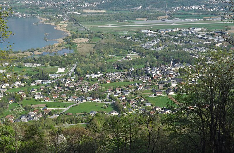
Assuming some decent gaps were made on that time trial, riders go on to the second GC defining stage. A quick look makes you think it will be all about the finale, but the roads all the way down from Culpeper are very irregular and sometimes nasty sharp, as is the case of the race's first categorized climb, Old Rapidon Road - that's 600 meters at 11% average on an unpaved road - unfortunately I got no images of it other than the pixelated google street view, which seems to be the norm in these parts. That's a cat4. by the way. My categorization system is a bit sloppy and random, so forgive me any inconsistencies. After that riders go a few kilometers west on state route 230, turning back heading south after going through Pratts, not much before the first intermediate sprint in Rochelle. Blue Ridge Turnpike is another saw tooth type of climb, also a cat4, this time one full kilometer averaging 8%. Immediately after that not much goes down besides the riders, who gradually approach the Tour's largest city.

Once we're in downtown Charlottesville, there are the last sprint points for the taking, before riders head north to the University of Virginia Campus, with it's blaze coloured brick walls blending with the reds and oranges from the surrounding trees. Once past the Rotunda (work of Jefferson himself), they start the climb up to the Observatory Mountain, which is 1,5 kilometers at 7% but toping 12%. This is probably where the Helicam would give you a stunning panorama of the McCornick Obs. with the Lawn and the Scott Stadium on the background (Go Cavaliers, cof, cof.)

Riders then descend and take Jefferson Park Avenue and a couple 'other minor streets until they reach the Lyman hills past the schools district, descent again and hit the Thomas Jefferson Parkway (that easier ending part) and then turn left up to the Unesco World Herritage Site, Thomas Jeferson's resting place, the scenic Monticello overlooking the city. The Thomas Jefferson Foundation were afraid of any construction nearby going above the plantation, and so in 2003 they acquired the Montalto, the other, higher peak across the small valley, and that's precisely where riders head, and where they'll finish atop. Not really needed to say why the Monticello isn't categorized, despite being more than a kilometer long on tight roads averaging 10%. Montalto is 1.6km's long and averaging 8%, but some sections are as inclined as 11%.
aFAvwd7.png


On second thought, I may not be able to put it all in one post. :p
 
Jun 30, 2014
7,060
2
0
Visit site
Nice BigMac, I've just finished a race that I'd call the Tour of Vermont and New Hampshire that consists of 8 stages. I'll probably start posting it in the next few days, it's not an area where you can create multi mountain stages, but there are a few steep climbs that you unfortunately have to use as a MTF because they are a dead end, but there are a few ungodly steep hills that I'll use and I'm happy about the fact that the race will feature only 2 sprint stages. So the whole race will have a prologue, a final ITT, 2 hilly stages with a downhill finish, 2 uphill finishes and 2 sprint stages, it should be balanced.
 
Thanks Mayo. I'll be looking forward to it. Funny you pick two of the smaller states, but also two of the most mountainous, if you can call them that. Couldn't be more true about the dead ends. On the positive side, on the East coast you are much more likely to find paved roads even if just leading to some private land on a hill. Gives you more possibilities for uphill finishes than, say, California. Cheers.
 
Re:

Jspear said:
@BigMac
I'm interested to see if Skyline drive made it into your stage designs....a very nice ride (no cat 1 climbs, plenty of 3,4, and 5's. A couple cat 2 climbs), beautiful scenery. All on one 109 mile road right through the National Shenandoah Park.

I initially had it in my plans, all the way from Vesuvius, catching some of the Blue Ridge Pkwy, up to Front Royal finishing with a little upshill kick. It left me impressed indeed. Then I thought it would give a nice one day race and put it aside to use later.
 
Re: Re:

BigMac said:
Jspear said:
@BigMac
I'm interested to see if Skyline drive made it into your stage designs....a very nice ride (no cat 1 climbs, plenty of 3,4, and 5's. A couple cat 2 climbs), beautiful scenery. All on one 109 mile road right through the National Shenandoah Park.

I initially had it in my plans, all the way from Vesuvius, catching some of the Blue Ridge Pkwy, up to Front Royal finishing with a little upshill kick. It left me impressed indeed. Then I thought it would give a nice one day race and put it aside to use later.

Ah I see....that would make a very good one day race.
 
Jun 30, 2014
7,060
2
0
Visit site
Re:

BigMac said:
Thanks Mayo. I'll be looking forward to it. Funny you pick two of the smaller states, but also two of the most mountainous, if you can call them that. Couldn't be more true about the dead ends. On the positive side, on the East coast you are much more likely to find paved roads even if just leading to some private land on a hill. Gives you more possibilities for uphill finishes than, say, California. Cheers.
I choose those 2 states because the climbs are almost the polar opposite of those that you find in Colorado, short but very steep and at low altitude, most climbs in Colorado are long climbs with moderate gradient at high altitue.
 
Re:

BigMac said:
Thanks Mayo. I'll be looking forward to it. Funny you pick two of the smaller states, but also two of the most mountainous, if you can call them that. Couldn't be more true about the dead ends. On the positive side, on the East coast you are much more likely to find paved roads even if just leading to some private land on a hill. Gives you more possibilities for uphill finishes than, say, California. Cheers.
The lack of connecting climbs is a regular bane of anybody designing "new world" stage races, I find. Unless you get areas which are absolutely chocked full of mountains so that in many areas you can't actually avoid them, like California or much of Colombia, there's usually much wider open areas so most of the roads bypass the mountains and the toughest climbs are one-way routes, usually to a mining town or ski resort. TheBigT had this problem with an Australian stage race, and I had it as well with the Vuelta a Argentina. There's also the issue that a lot of the Americas are less densely populated than the sport's traditional European homelands, and so the number of towns in the mountainous areas that require connecting to the outside world becomes more limited so the routes to do so are not as numerous.
 
Jun 30, 2014
7,060
2
0
Visit site
Tour of Vermont and New Hampshire

prologue Saint Albans; 6,2km
cfl77yopdlvd.png

dq1vm35z6hj6.png

The Tour of Vermont and New Hampshire starts with a prologue in Saint Albans.
The first half of the prologue is pretty much a pure power test, the 2nd half is more technical, the final 3km feature 16 90 degree corners, the winner should be a prologue specialist who's also a great bike handler.
The stage will finish near the Taylor Park church
showcase-news-8-8-678x400.jpg

Architectural-Spring-10-15-01345.jpg
 
Jun 30, 2014
7,060
2
0
Visit site
Stage 1 Saint Albans - Newport; 136km
vpjuofqor36e.png

z78kz884qpr.png

The first roaad stage of the Tour of Vermont and New Hampshire is a short stage for the spinters, perhaps even a little bit too short, but it's just a transitional stage and I wanted to have a stage finish in Newport, VT.
The stage starts in Saint Albans and the first 50km of false flat will bring the riders very close to the Canadian border, the the first climb of the days starts on the State Route 105. The first part of the climb is more of a false flat, 5,5km at 3,5%, then we have 4,7km at 5,6%. After the following descent we have 3km of false flat before the next climb starts, 7,8km at 5% with a max. gradient of 10% and we ride right past Jay Peak, a moutain that is known for the Jay Peak ski resort.
Just like the previous descent this one is also your typical american descent on wide roads, right after it we have an uncategorised climb, 8,9km at 3,9%. After the following descent to Lowell we have a little bit of rolling terrain and short steep descent, the final 28km are false flat and will bring the riders to Newport.
This one should go to the sprinters, the climbs are pretty easy and the last 28k are flat, they souldn't have any problems to control this stage. The next stage will also be the first test for the gc-riders and I've tried to use the 2 pretty boring sprint stages as transitional stages to avoid very long transfers.
Newport:
newport_aerial2.jpg

4NewportAutumn2011_2.jpg
 
Jun 30, 2014
7,060
2
0
Visit site
Stage 2 Newport - Lincoln; 193,6km
s1zqdib2w91.png

sfyataqxzxlw.png

The first hard stage of this race.
The race starts in Newport and after 18km we have the first climb of the day, 3,2km at 6,8% with 135 steep ramps. Most of the remaining stage before the final 2 climbs is just false flat, you have a climb in the middle of the stage on the Vermont State Road 108 that goes through Smugglers' Notch State Park, 5,7km at 5,2%.
After over 154km we get the first serious climb of the day, Appalachian Gap. 4,9km at 8,1% with multiple slopes at 18%, some sources even say that whole final km is about 18% steep.
After the descent we have 10km of false flat before the final climb starts Lincoln Gap, 6,5km at 7,2%, but most of the climb is just false flat and a shoer steep downhill section, the final 2,5km are 17,8% steep, with 25% steep ramps, a climb that puts even the Muro di Somaro to shame.
The climb ends with 7km to go and after the descent only the final 3,6km that will bring the riders to Lincoln, VT are false flat.
This should be the first test for the gc riders, the 2 final climbs are hard enough to seperate the contenders form the Pretenders. I really wanted to end the stage with those 2 climbs, maybe I could have built a short circuit around them, but then the riders would softpedal the rest of the stage and wait for the final lap.
Lincoln Gap:
lincoln-gap.jpg

Lincoln:
lincoln.jpg
 
Jun 30, 2014
7,060
2
0
Visit site
roundabout said:
I don't think Lincoln gap is fully paved, especially not on the side you are using as the descent
Isn't the steep first part of the descent paved? The unpave part of the descent should have a more gentle gradient, It shouldn't be a big problem.
 
TransAlp stage 6: Innerkirchen-St.Moritz (211km)
The penultimate mountain stage of this tour starts in Innerkirchen. The first 75 km are only up and down and there are two HC passes in this first part of the stage. Both the Sustenpass and the Oberalppass are not very steep but especially the sustenpass is very long. However these climbs won't cause much action, only the fight who will get into the break. After the descent from the Oberalppass there is an intermediate sprint in Trujetsch. However the descent goes on after the sprint and will finally flatten out after 96 km. From here on the route is mostly flat until the start of the final climb only interrupted by the 3rd category to flims and there will also be another intermediate sprint in Thusis. The final climb itself, the Julierpass, is a pretty strange one because steep and flat sections alternate often, only the last about 6 k´s are evenly steep. From the top of the pass the finish is only 13 km away and the last 5 kilometers are flat so the descent isn't that long, and also not very difficult. The finish line is located in St. Moritz, a town which calls itself the inventor of the winter tourism. There have been two olympic games there in 1928 and 1948 held in St. Moritz and this town also held some skiing world championships (and the next skiing WC will also be in St. Moritz). Moreover there are world cup races in St.Moritz every year.

bFWt51dl.png

ArdEgWTl.png


Julierpass:
R6ZcaOal.jpg

qTpN9Ibl.gif


St.Moritz:
FOnO8HMl.jpg


climbs:
Sustenpass (HC)
Oberalppass (HC)
Flims (3rd cat.)
Julierpass (1st cat.)
 
Tour Complet de France n°2, stage 18: Mâcon - Le Bourget-du-Lac: 156.5km, high mountains (Bourgogne - Rhône-Alpes)

So far we have crossed 18 regions in 17 stages. Centre and Île-de-France will feature in the last stage, but the next three days the peloton will journey through Rhône-Alpes. That's necessary to balance out the almost 125km against the clock, even if the tricky medium mountain stages in the first week may have created havoc.

Although Mâcon, on the right bank of the Saône is part of Burgundy, the official start on the left bank of the Saône will be in the Rhône-Alpes region.
The first part of the stage will have very few difficulties on offer, as it crosses the plain between the Saône and Rhône. This area is characterised by France's little Finland: la Dombes, with countless little lakes and ponds. The intermediate sprint in Lagnieu after 69km marks the end of the first, flat, part of the stage. The next few kilometers the peloton can reorganise itself, the climbers will come to the front, as the first Alpine climb is awaiting. The col de Portes isn't the most difficult climb and featured in the 7th stage of the 2003 Tour de France. The road offers some nice views while the gradient switches from quite steep to nearly flat and back.
The descent on a narrow road isn't steep, but rather straightforward, with only in the last part a few switchbacks.
The flat part between Contrevoz and Yenne can be used to regain contact with the first group on the road, if this will be allowed by the climbers' teams, because straight ahead lies a monster, sleeping since 1974.

The Mont du Chat is one of the most difficult climbs of France, even though the average gradient of this western slope assumes otherwise. When leaving Yenne, the road starts to climb, first very gradually: 1%, 2%, 3%, but becoming steeper to reach 5% at Saint-Paul after 5km and 7.5% a bit further on the road. Then it eases off a bit for the next kilometers, only to hit back after 9km. What comes next is something one might expect in the Giro or Vuelta, but is rather unseen in France: an average of a wee little bit under 11% for 8 straight kilometers. On the summit, the riders can enjoy beautiful views on the Lake of Bourget, Aix-les-Bains, Chambéry or even the Mont Blanc when the sky is clear.
They probably won't, because this ordeal is followed by a steep descent to Le Bourget du Lac. Hemmed in between the mountain and the lake, this little town is often overlooked for finish location, in favor of neighbouring Chambéry or Aix-les-Bains, but has the advantage that there's no flat road after the descent. That way the best climbers will be enticed to throw their cards on the table during the ascent of the Mont du Chat, even when they know what's still to come: the undeniable queen stage.

800px-Le_Bourget-du-Lac_%28Savoie%29.JPG

Le Bourget-du-Lac

Map & Profile:
2psivmh.jpg


Difficulty: ****

Climbs:
Col de Portes: km87; 14.3km @ 5.4%; 2nd cat; 1008m
Mont du Chat: km 142; 17km @ 7.4% (8km @ 11%); HC; 1504m
 
Tour Complet de France n°2, stage 19: Chambéry - Bourg-Saint-Maurice: 234km, high mountains (Rhône-Alpes)

The undeniable queen stage!
Ban mtf's!!
Screw youtube cycling!!!

Map & profile:
fu46xz.jpg


Difficulty: *****

Climbs:
Col de Champ-Laurent: km 39.5; 9.8km @ 8.2%; 1st cat; 1116m
Col du Grand Cucheron: km 46.5; 4km @ 7.8%; 2nd cat; 1189m
Col de la Madeleine: km 92.5; 19km @ 8%; HC; 1993m
Col de Grand Naves: km135; 13.5km @ 6.8%; 1st cat; 1405m
Col du Tra: km 166; 9.6km @ 8.1%; 1st cat; 1321m
Col du Sauget: km 188; 10km @ 9.2%; HC; 1692m
Les Arcs 1800: km 214.5; 13km @ 7.3%; 1st cat; 1719m
 
Great Grand Tour of Britain
I've toyed with the idea of a 2 week GT of Britain for a while and finally got around to it. I have included as many parts of Britain as possible even though i've still had to miss out out a few areas! The total distance is 2570km and ive tried to keep transfers as minimal as possible for realism (apart from 1 transfer which will be become apparent). There are 15 stages and stage 1a and 1b are split on the opening day. Time bonuses of 10,6,4 will apply for all stages apart from the iTT's.

Hope you enjoy...

ToB: Stage 1a - Belfast prologue - 4.5km

The opening morning of the Tour will include a quick blast around the centre of Belfast, time gaps will of course be minimal but it will give us our first yellow jersey wearer.

JaggCsi.png


Stage 1b - Belfast - Belfast - 71km

The afternoon of day 1 will see a short road stage, the riders will head east towards Bangor where we have the first sprint which carries added time bonuses (3,2,1). There are 3 short hills on the route which im sure the break will fight it out amongst themselves. None of the hills are very challenging and given its such a short stage it should all come back for a bunch sprint. If a sprinter has not lost too many seconds on the mornings prologue they could take the leaders jersey here.

y7wXcPO.png


mvXtT6i.png


Climbs:
7km Ballismiscow Road 1.6k @ 6.9%
15km Whinney Hill 1km @ 7.5%
44km Carrowreagh Road 1.6km @ 7.8%
 
Stage 2: Belfast - Belfast Castle - 134km

Again it's another short stage but we need an early finish today due to a 2 hour ferry transfer to Scotland this evening. Before that we have a tricky looking final day in Northern Ireland which includes 6 climbs along the way and steep climb up to the finish at Belfast castle. The first sprint of the day comes early so its a chance for either a sprinter to gain extra points or a GC rider to grab a few seconds. The hardest tests's for the riders come during the middle of the stage as they ride up the Crumlin climb followed by the 10% White Rock hill and Hanchstown hill which averages over 7%.
The final climb up to the castle is only 600 metres however it is a single lane road and averages over 9%. A rider who is poorly positioned could lose valuable seconds here.

SyvSRvD.png


5jpuHJG.png


Climbs:
28km Red Brae Road 1.9km @ 6.4%
38km Knockagh Road 2.6km @ 6.3%
62km Crumlin 2.3km @ 6.8%
80km White Rock 1km @ 10.2%
88km Hanchstown Hill 1.6km @ 7.2%
113km Pond Park 1.5km @ 5.6%
134km Belfast Castle 600m @ 9.2%

Belfast Castle climb:

6TePN9b.png
 

TRENDING THREADS