• The Cycling News forum is looking to add some volunteer moderators with Red Rick's recent retirement. If you're interested in helping keep our discussions on track, send a direct message to @SHaines here on the forum, or use the Contact Us form to message the Community Team.

    In the meanwhile, please use the Report option if you see a post that doesn't fit within the forum rules.

    Thanks!

Race Design Thread

Page 210 - Get up to date with the latest news, scores & standings from the Cycling News Community.
Oct 4, 2015
417
1
3,030
Visit site
Tour de France Stage 13: Gap - Avignon, 182km
27wwy9x.png

9tk1sy.png

Climbs: Perty (9,5km @ 5,2%)

Stage 13 finally takes us out of the Alps, with a (mostly) flat stage to Avignon. The only climb of the stage, the Col de Perty, will probably serve as a good launchpad for breakaways, which might make it to the finish line if sprinter teams get careless.
 
Despite the fact that bp92's Tour de France is still on its way, i'll start with my own TdF. I think both will be different enough in presentation and course to not be too confusing.

I announced my second Tour without Alps and Pyrenees a few weeks ago and here it is.
The same rules apply as with my first Tour without Alps and Pyrenees: no climbs east of the Rhone, except in the departements Var and Vaucluse, no climbs south of the Garonne and Canal du Midi. Furthermore, I'll try not to incorporate any major climbs I used in my first Tour sans Alpes et Pyrenées. Since I used most of the hardest climbs in the Vosges, Jura and Massif Central in my first Tour sans Alpes et Pyrenées, I will have very few stages that can be categorized as "high mountains" (rather a succession of some 1st category and HC climbs, than really high climbs).
Therefore this Tour is even less realistic than the first one, and should rather be considered to be a collection of hard medium mountain stages in a TdF-mould.

Tour de France sans Alpes et Pyrenées n°2; Prologue: Dunkerque - Dunkerque: 8.2km

I start out quite lazy and used the exact course of the real-life 2001 Tour de France prologue.

j63i4w.jpg


On that occasion Christophe Moreau took the spoils in front of Igor Gonzalez de Galdeano, Lance Armstrong and Jan Ullrich.

It's a course with some long, straight roads and very few technical corners, suited to the real powerhouses.
 
Stage 3: Fuentes de Oñoro - Aldeadávila-Arribes del Duero, 155km

2efnlnc.png


ixbmt2.png


GPM:
Alto de Poiares (cat.2) 4,1km @ 11,6%
Alto de Saucelle (cat.2) 9,0km @ 5,6%
Alto de Aldeadávila (cat.3) 3,5km @ 5,9%

The first weekday stage of the Vuelta is a pretty strange one, through a very sparsely populated area and with the majority of the stage not even on Spanish soil. But it should be a scenic one.

fuentes-de-onoro-351329_960_720.jpg


The stage start town, Fuentes de Oñoro, is a small town/village in two parts; an old village a couple of kilometres to the east and the more modern cluster around the train station and road border crossing. The town was the location of an important battle in the Peninsular War, but nowadays is more famous simply for being the border town between the two Iberian nations. It has recent cycling history too, hosting a very bizarre stage of the 2015 Vuelta a Castilla y León, which spent 205 of its 206km in Portugal, and included some of the most brutal climbing the country has to offer - including the freaking Alto da Torre - in the first half of the stage, then a long flattish run-in. The stage had to be temporarily annulled due to snow on the Serra da Estrela, before being restarted, and with Lokosphinx's Sergey Shilov taking the win from the reduced bunch.

fronteira_de_vilar_formoso.jpg


Here we are reversing the principle, going straight into Portugal after just a kilometre of racing, crossing into the neighbouring town of Vilar Formoso. The next 111km of racing are through a quiet part of eastern Portugal, with few sizable towns and cities to break up the natural landscape over these rolling hills. Perhaps the biggest of these is Pinhel, which recently returned to cycling interest, hosting stage 1 of the 2015 Volta a Portugal, as the northeastern region of Bragança returned to the menu for the first time in many years. There's then a long period of uphill false flat towards Figueira de Castelo Rodrigo, overlooked by the mountain known as Marofa, a sometime fantasy Volta organizers' summit finish as it would make a good cat.2 climb from its opposite side and offers some nearby options for a tricky run-in. Overlooked by the mighty Cristo Rei statue on the mountain, the riders will bisect Marofa and Castelo Rodrigo on their way to the Douro/Duero.

m.jpg


The main body of the stage is the second half, once we've reached the banks of the river. Known as the Douro to the Portuguese and the Duero to the Spanish, it empties into the Atlantic at Porto and provides fertility and attractive geography to much of eastern Spain and northern Portugal. The rest of the stage will take in the two natural parks along the Spanish/Portuguese border in the area, the Parque Nacional do Douro Internacional and the Parque Natural Arribes del Duero; in this region, the Duero has carved a high-sided natural gorge into the surrounding plains, creating a gorgeous natural landscape which will ensure that the helicam footage is incredible.

8733038_uguEc.jpeg


arribes-duero1.jpg


This isn't about some natural park exhibition though; the riders will have some struggling to do, because despite its short length this is a nice Worlds tune-up with a complex run-in, but before that they will have to show their durability over two cat.2 climbs.

The first is the short but extremely steep Alto de Poiares, which you can see from the profile will really hit the riders hard. 4km at over 11% with two stretches at 25% and three more over 20% - this one will put some suffering in the legs for sure. Patterned after Xorret del Catí I did consider whether this should get cat.1 despite its short length, however it's over 50km from home though, so while it will rid us of the sprinters I don't see it being super hard-fought, whereas Xorret del Catí is usually a finishing climb. The gradual and multi-stepped descent takes us to the border between Portugal and Spain, and with 43km remaining we return to the country we're supposed to be touring, crossing the border at the Salto de Saucelle, a particularly famous dam.

Salto%20de%20saucelle.JPG


From here we have one of the tougher climbs in this part of Spain, but not as tough as Poiares; the Alto de Saucelle is, apart from that kilometre at 8,5% early on, fairly consistent; nevertheless it's long enough and close enough to the summit of Poiares that it should have consequences on the size of the group that fights on towards the finish and the summit's just 35km from home. I can't see there being 100 in the péloton here. From here much of the finish is about riding along the edges of the deep ridges down to the Duero (not literally, we aren't riding directly against steep gorge faces like this!!!) as the bunch jostles for position ahead of the finale.

At La Zarza de Pumareda, however, we leave the road that leads to our finishing town of Aldeadávila, which has been chosen more because it's one of the few in the area large enough to host the race than anything else. It's also the location of another dam, possibly the best known of the region.

aldeadavila.jpg


Although the road takes us all the way to the dam, there's no parallel road back up that connects to the town (only another similar one-way route to another dam north of the town) and so instead we connect up with the hilly road to the Alto de Aldeadávila - effectively joining this profile at the 5km mark and giving us a final climb of 3,5km in length which crests just 5,1km from the line. The first kilometre of this climb is at 9% so this is a good chance for punchy riders to get some Worlds tune-up racing done, and with time gaps that ought to be small because of the short length of the Team Time Trial, a chance for the Jersey Rojo should tempt some aggressors before the final run-in.

My stage shows some similarities (quite a lot, actually), to a PRC proposed one-day race in the area, although they placed the finish much closer to the final climb at a Mirador overlooking the dam, and started in Fermoselle so as to only traverse the Arribes del Duero-Douro Internacional area, although the Poiares-Saucelle-Aldeadávila combination is the same. In fairness though: this is imo the best design you can make in the area while still being halfway realistically achievable. And the area is almost unknown to cycling and ungodly beautiful; it would make a really nice and unusual Vuelta diversion early in the race, instead of one of those wide open plains stages where the weather's too hot for fans to be around, they're racing through sparsely populated areas, but the geography isn't as stunning as it could be here.

ayuntamiento-aldeadavila-de-la-ribera-51127122.jpg
 
Stage 4: Zamora - Plataforma de Gredos, 204km

11j2lig.png


23k93cw.png


GPM:
Puerto de las Fuentes (cat.2) 9,0km @ 4,3%
Alto de la Peña Negra (cat.1) 14,8km @ 5,7%
Plataforma de Gredos (cat.2) 11,6km @ 4,2%

The route does a little loop-de-loop, as today we pass by the eastern side of Salamanca, where we started the race three days ago; the Vuelta seems to like these little mini-Tours of an area to start the route, however, so I don't think this will prove any problem. This is the "Montevergine di Mercogliano" stage, the fairly mild MTF in an intermediate stage that will remove some of the chaff from contention and loosen up the tension in the péloton so that we don't have a dozen teams all trying to vie for space at the front protecting their leader with another five trying to pilot their sprinters through late on as well.

zamora--644x362.jpg


The city of Zamora, owing to its convenient location between many of the cities of Castilla y León and at the exit of the Macizo Galaico, has featured in a few of my Vueltas as a stage start, although not typically in stages as interesting in profile as this one. In the real Vuelta, it has featured twice in the last decade; in 2006 as the start of a flat stage won by Thor Hushovd, and in 2008 as the finish of an oddly-designed stage with the Alto de Foncebadón (erroneously called Acebo) at the start then a full flat run-in, which was won by Tom Boonen. It has since featured regularly in the Vuelta a Castilla y León, most recently as a stage start for the Alto de Lubián MTFs, but perhaps most notably hosting the ITT in 2011 which was won by Richie Porte, but enabled Xavier Tondó to take the lead which he defended the following day to take his final career victory before his untimely death.

The first half of this stage is similarly flat to those stages surrounding the city; a large amount of the area around here is pan-flat high Castilian plain, and there's no getting around that; like the Po valley in Italy, you almost have to traverse this vast flat expanse at some point in a Vuelta route. Perhaps the only real point of interest in the first half is the early intermediate sprint in Peñaranda de Bracamonte, the biggest town passed through in the stage.

13877890.jpg


Once we're into the second half of the stage, it livens up a bit, however. There are four climbs (three categorized) in the final 90km, along with a preceding uncategorized drag as we head into the Sierra de Gredos. The first is the Puerto de las Fuentes which is pretty unthreatening (and lopsided, we're climbing the easier northern side) with its toughest kilometres only around 6% and an average of 4,3% (I've omitted the barely registering first three km or so), but should soften legs up slightly. The riders would typically bear left here and head for the climbs around traditional Vuelta staple Ávila, but instead I will have them turn right and head over the uncategorized Puerto de Villatoro, again climbed from the easier side, not that the harder side is particularly threatening either! This takes us into Piedrahita, from which we start the biggest and toughest climb of the day, and of the race so far, the Alto de la Peña Negra.

10657208.jpg


PenaNegra.gif


At nearly 15km in length, this is a not inconsiderable climb; the average is a shade under 6% and it hasn't been seen in the Vuelta since it was the first climb in an intermediate stage in 2004. It was used fairly frequently in the early 90s, most notably 1995 when Laurent Jalabert led over it in an attack group in the Salamanca-Ávila stage for his 3rd of 5 wins in the race. Like many climbs in the Ávila region it is fairly consistent in its gradient, although it's a little steeper than, say, Pedro Bernardo, Serranillos or Mijáres which may help make it decisive. Also, it crests just 27km out, so the pace should be high. Because there aren't too many real steep ramps to provide attacking platforms I don't expect this to turn into a Mortirolo-Aprica stage despite the profile, however team leaders will want to shell some of the dead weight here and make rivals do more work than they'd like. Especially as there's nowhere to hide; this climb is very exposed to the elements.

Pto.-Pe%C3%B1a-Negra-1.jpg


In some of my Vueltas, its 1910m would make it one of the highest points in the race and a candidate for the Cima Alberto Fernández, but in this particular Vuelta we'll be going above that. Either way, we are now led into a twisty and technical descent of around half of the remaining distance. It isn't particularly steep but will give riders a chance to make some time or put some pressure on rivals coming to the final climb and its unusual ramps.

8fc241908aeeebcfa313f290b0788a17o.jpg


The final climb is a relatively mild one. It is another combination I have seen used on PRC, although they typically prefer to use the punchy finish at Parador de Gredos in their designs there it seems, rather than this more sustained ascent. A bit like the Albergue de Ancáres finish, this is an inconsistent but Aprica-esque easier climb to append onto the tougher earlier climb, averaging a little over 4%, albeit over a very variable set of gradients. There's a kilometre at around 9% early in the climb, with a max of 15%, before about 3km of rolling to false flat, another ramp of up to 13%, a climb of around 750m, a descent of similar length, and then a final 4km at 7%; this kind of inconsistency will break up a lot of rhythms and hopefully make it hard for domestiques shelled on Peña Negra to be there for their leaders once we get to that finale, but I do see this as very much the "sprint of the elites" MTF that will reduce the contenders without truly breaking the field apart. There's a sizable car park at the summit as this serves as about the only dead-end MTF - or indeed MTF-capable climbs given the space requirements - in the entire region!

aparcamiento-plataforma-de-gredos-eduardo-hinojal-11_1.jpg
 
Oct 4, 2015
417
1
3,030
Visit site
Tour de France Stage 14: Alès - Mont Aigoual, 192km
i3xlqh.png

25qzomv.png

Climbs: Rédarès (5,2km @ 3,3%), Taillade (3,1km @ 4,3%), Alzon (6,2km @ 5,1%), Pierre Plantée (5,8km @ 5,9%), Trèves (Causse Noir) (5,7km @ 6,1%), Meyrueis (4,9km @ 6,1%), Aigoual (11,9km @ 3,9%)

Stage 14 takes us into the Massif Central for another medium mountain stage, this time with a summit finish at Mont Aigoual.
The first half of the stage is mostly flat, with two cat.4 bumps before the flat run-in to Le Vigan. The second half, however, features five categorized climbs in a generally-ascending route to the summit finish at Aigoual.
AigoualW.gif

The summit finish itself is a very shallow climb, with its hardest section being 2km at 6% near the end of the climb. If riders decide to save their energy for the upcoming Pyrenees, the stage will probably end in a breakaway and maybe some small gaps among the favorites. However, the stage will be very hard to control, so should any GC outsiders sneak into a breakaway it will be hard to catch up to them.
 
Tour de France sans Alpes et Pyrenées n°2; stage 1: Dunkerque - Le Quesnoy: 193.5km, cobbles

I think everytime the Tour crosses the north of France, or even starts north of France, a cobbled stage should be mandatory. A real cobbled stage has a big impact on GC and often provides some nice racing. A least if the cobbles are difficult enough and are close enough to the finish. The cobbles not being difficult enough was the reason the stage to Cambrai didn't bring the same spectacle as the stages to Arenberg in 2010 and 2014.

This stage will fulfill the role of shaking the GC, putting the lightweight climbers at a disadvantage and forcing them at attacking in the hills and mountains.

Here's today's course:

1zz6g4l.jpg


The stage starts in Dunkerque, with a short neutralized start and crosses picturesque Bergues after 8km. The little fortified town became famous in France after the movie "Bienvenue chez les Chti's".
Some wide, straight roads lead to another famous town in "French Flanders", the part of the old county of Flanders that was annexed by France in the 17th century: Cassel. Mont Cassel often plays a prominent role in the 4 days of Dunkirk and the hill also features in Ghent-Wevelgem. Today it will be the only categorized climb of the day, but with more than 150km to go on this stage, it won't have any impact on the racing today.
If it already didn't happen, its flanks may see a breakaway form for a good part of the remainder of the day.
The descent, partially on relatively smooth cobbles, may be a bit dangerous when wet, but there's still a long way to go. So, no one should take any risks.

The next 70km are mainly raced on wide roads, moving southeast, more or less parallel with the Belgian-French border. After 100km the bunch crosses Bersée, a well-known name from Paris-Roubaix, and for the next 33km the race will follow the course of Paris-Roubaix, albeit in the opposite direction. In this part of the stage 6 cobbled sectors will be covered, good for a total of 14,2 km. The last of these 6 will be the 3700m long sector from Wandignies-Hamage to Warnaing. In paris-Roubaix tnat's the longest sector (together with the one of Quievy), here it won't be.
It is followed by 4 smooth kilometres before the first "unknown" sector is used. The 3200m long sector between Hélesmes and Hertain is composed of the first part of the final sector of stage 3 of the 2010 tour (not used in P-R), the final part of the Haveluy sector of P-R and 700m of "new" cobbles, unused in recent racing. Next on the menu is another "new" sector, 1700m long between Bellaing and Haveluy. The course then heads for Denain, where we get a second serving of "Roubaix-Paris". The 13km between Denain and Famars only contain one cobblestone sector, from Monchaux-sur-Ecaillon to Maing. This stretch is often used by Paris-Roubaix and serves a bit as a calming point after the initial hostilities.

Today, the heat will turn up as the course approaches the most difficult sector of the day: a 3900m long 5* track from Famars to Préseau. It was last used in the 1996 version of Paris-Roubaix (but in the opposite direction), and partially on a couple of occasions since 2005. The difficulty of this sector is not only due its length or bad state of the cobbles, it also slowly rising for about half its length. First there's a short descent (500m @ 5%), on quite good cobbles, then an uphill false flat of 2000m @ 2.3%, on bad cobbles. The final part is flat or slowly descending. This awful sector is almost immediatly followed by some cobbles to Artres that have been tarmaced over some decades ago. The asphalt cover has been crumbling ever since and in some places very few of it remains. Despite the length of the sector (1900m), it only deserves a 1* rating because of the tarmac. By now it's only 25km to the finish.

This is by no means the end of today's ordeal, as there are 3 more cobblestone sectors in the next 15km, but none are really difficult. The final cobbles start with a little less than 8km to go. It is a prolongation of the sector of Le Buat that was used a couple of times since 2005 and also will be used in 2016. It starts from the village of Escarmain, with 1500m of cobbles that definitely need some cleaning to be used in a real race. After these initial 1500m the D109 is crossed and the traditional uphill sector of le Buat can be tackled and will be finished with a bit more than 4km to go. The finish will be close to the ramparts of le Quesnoy, which will lead to some nice aerial views.

The final:
rlgcxf.jpg


Cobblestones:
Bersée to Auchy-les-Orchies: km103; 2600m; 4*
Orchies: km108; 1700m; 3*
Orchies to Beuvry-la-Forêt: km113; 1400m; 3*
Sars-et-Rosières to Brillon: km119; 2400m; 3*
Tilloy-lez-Marchiennes to Warlaing: km122.5; 2400m; 3*
Wandignies-Hamages to Hornaing: km130.5; 3700m; 4*
Hélesmes to Hertain; km 138; 3200m; 5*
Bellaing to Haveluy: km144; 1700m; 4*
Monchaux-sur-Ecaillon to Maing; km 156; 1600m; 3*
Famars to Préseau: km164; 3900m; 5*
Préseau to Artres: km167; 1900m; 1*
Artres to Quérenaing: km170; 1300m; 2*
Quérenaing to Verchain-Maugré: km173; 1600m; 3*
Saint-Martin-sur-Ecaillon to Vertain: km183; 2300m; 3*
Escarmain to Ruesnes: km189; 3200m; 5*

Climbs:
Mont Cassel: km29.5; 2.2km @ 4.8%; cat4
 
Stage 5: Talavera de la Reina - Ciudad Real, 172km

2pt0w45.png


3322s6x.png


After having started the Vuelta with our little loop around eastern Castilla y León, we are now in Castilla-La Mancha for our first truly flat stage; while the Ciudad Rodrigo stage was for the sprinters, more durability will have been required for that one than today, where there isn't a single categorized climb as we link some supportive Vuelta cities of recent years.

talavera-de-la-reina-toledo-09.jpg


The stage begins in Talavera de la Reina, a historic city fabled for its pottery which was renamed Talavera del Tajo under Franco before its royal name was restored. Its most famous son in the modern péloton is veteran climber David Arroyo, winner of a Vuelta stage and of course the man who nearly stole that Giro. I'll link you to the legendary Mortirolo stage - part 1 is here, from which you can link to the other parts - because let's face it, you can't watch that stage enough. Arroyo's descent of the Mortirolo and subsequent heartbreak on Aprica is one of the most compelling and breathtaking stories the sport has given us in recent years. Anyway, this won't be a stage for him.

Talavera has featured in a few recent Vueltas, typically as a transitional city on the way from the Sierra Nevada to the finishing stages around the Sierra de Madrid in week 3; in both 2007 and 2009 it hosted the finish of a flat stage from Ciudad Real (so the reverse of today's stage). The 2007 stage was in fact almost identical to this one run backwards and was won in the sprint by Daniele Bennati, whereas 2009's was longer and due to a miscalculation Anthony Roux just held off the bunch by a bike length from the charging Greipel in a fantastic finish. Both years saw the city serve as the départ for the following day's stage to Ávila (won by José Luís Pérez and Philip Deignan respectively); in addition, a further sprint stage from Almadén followed in 2011, and was won by Marcel Kittel while the following stage was the exciting and beautifully designed San Lorenzo de El Escorial stage won by Purito. The city also hosted the national road race in 2008, which was won by Alejandro Valverde in a two up sprint against Óscar Sevilla after Caisse d'Épargne did a number on Babyface, sparing us the potential horror that would have been a Rock Racing Spanish National champion's outfit!

This stage is, like those 2007 and 2009 stages, bound to be flat and it would require miscalculation for the sprinters not to come out on top here. There aren't too many obvious landmarks to call out on the way, nor are there real obstacles, although the land isn't truly flat, and the stage finish is 300m higher than the start. Navahermosa is probably the most notable town, which gives you an idea of the landscape - proper Vuelta fare, this. This should be baking hot, and if so there may be some attrition, and some of the more limited sprinters mightn't have fun; if we're lucky it ends up like Stage 6 of the 2011 Giro which was won by Fran Ventoso from a tired group sprint; however I don't anticipate this being anything other than the typical bunch sprint.

284723-navahermosa.jpg


The other point of interest on the route will be the vast reservoir that is the Embalse Torre de Abraham, which will break up some of the arid landscape and helps lend a verdant touch to part of the route. The reservoir is surrounded by rolling hills, but none of these are passed by a route worthy of giving any points for.

9144337633_403bb89aee_b.jpg


From here it's just out into the plains of La Mancha with their typical villages and windmills (Carlton Kirby is chomping at the bit to make some "tilting at windmills" references so he can laugh to himself) before the finish in Ciudad Real. Ciudad Real is of course the city with the most pointless major airport in Europe, but it's also the home of Don Quixote; although Cervantes himself has no lasting connection to the city, Ciudad Real is the city which has adopted his fictional hidalgo as its own, and the stage finish is located by the Museo del Quijote. The city has hosted the Vuelta a few times recently - those stage starts in 2007 and 2009 mentioned above of course, but also a stage finish in 2006, won from the break by José Luís Arrieta, and in 2008 it hosted both the week 1 time trial won by Levi Leipheimer, as well as a stage start for a stage to Toledo the next day which was won by Paolo Bettini ahead of Gilbert and Valverde due to a complex ramp on the run-in. Since 2009 it has been dormant however (except a couple of times in the parallel universe of my Vueltas!).

The final run-in here includes two corners in the last kilometre, one just inside the kite and one at about 500m to go. Both of them are left-handers at wide open roundabouts, and the roads are plenty wide enough to be safe. The riders will head almost past the finish on Ronda Parque, effectively sealing in Parque Gasset and finishing when they get back to the top of the park on its eastern side. The run-in is otherwise pretty straightforward, so this should be a straightforward enough sprint stage.

lrg_354457_Plaza%20Mayor%20y%20Alfonso%20X%20-%20Ciudad%20Real.jpg
 
Oct 4, 2015
417
1
3,030
Visit site
Tour de France Stage 15: Rodez - Carcassone, 185km
ip1r8w.png

2ivbhxf.png

Climbs: Tanus (2,7km @ 5,2%), Rousses (10,4km @ 5,3%)

The (admittedly rather anemic) second weekend of the race ends with a transition stage between Rodez and Carcassone, heading out of the Massif Central. The most remarkable climb of the stage by far would be the cat.2 Col des Rousses, 40km away from the end of the stage. The more "classical" sprinters will probably fall off the pace at Rousses, which should lead to an interesting sprint at Carcassone (particularly with the small hill in the approach to the finish line). A breakaway may end up rendering this argument redundant, though; we're taking on the Pyrenees next stage, so teams with GC contenders will probably try to take it easy today.
 
Ha, bp92, the péloton aren't likely to be enjoying this, even the sprint stage has a cat.2 climb in it (I know that makes me a hypocrite after the Ciudad Rodrigo stage I posted yesterday, but in your Tour that one's the only chance the sprinters have had in over a week :p). The only shame is that the weekend stages haven't been major impact ones, but then the real Tour keeps infuriating me with pan-flat sprint stages on the penultimate Sunday, which given they have another on the final Sunday, is a real waste!
 
After failing to finish the Criterium du Dauphine, I will proceed with the other TDF "warm up race".

Tour de Suisse Stage 1 (ITT): Lausanne - Lausanne (7km) (ITT)

raGkUSG.png


6vXYAxi.png


KOMs:
Côte de Sauvabelin (6.3km @ 4.2%) Cat 3

Sprints:
None (ITT)

Time Splits:
Place de la Riponne

Like the actual Tour de Suisse, we start with a prologue ITT. However, like the real race, it is numbered Stage 1. The riders start outside the Parc Olympique. The team presentation will take place in the Esplanade de Montbenon park, the previous evening. The riders head along the lake front to the Place de la Navigation, from where they start heading uphill towards the main station (Gare de Lausanne). The uphill continues, untill they reach a slight downhill into thePlace de la Riponne. The uphill restarts with a 21% section for about 100m, where it enters the Parc de Sauvabelin. With under a KM to go there is a section of 17% before it drops down to a hairpin with 200m to go. From here the riders will ascend the 200 metres to the finish.

Lausanne:
0000143544-7480.jpg


Parc de Sauvabelin:
21749678227.jpg
 
Oct 4, 2015
417
1
3,030
Visit site
(Thread's getting pretty crowded right now isn't it?)
@LS: Well there's the Avignon stage if the sprinters want something to do :p .
I normally give sprinters several chances for the first week, then only one or two more in the middle (usually to separate big mountain blocs) before the "parade" at the end of the race.
I agree that the weekend flat stages are pretty dumb, though. I normally try to avoid it, but for this Tour it kinda slipped my mind...

Tour de France Stage 16: Pamiers - Val Louron, 224km
nxry95.png

2uo2x03.png

Climbs: Core (13,4km @ 6,5%), Aspet (5,7km @ 6,9%), Menté (9km @ 7,2%), Balès (19,8km @ 5,8%), Peyresourde (9,7km @ 7,3%), Val Louron (5,8km @ 8,7%)

The last Monday of the race we have the queen stage, between Pamiers and Val Louron, with 4 cat.1 climbs and one HC climb in 224km.
The first 70km or so are fairly uneventful, before we enter the Pyrenees to take on the first climb of the stage, the Col de la Core. A very tough climb, even if it comes still too early in the stage.
CoreE.gif

After this climb we then take on a frequently-used climb duo, Aspet-Menté. The first of these climbs is the only climb below cat.1 of the stage, with only 5km of proper climbing, but with two very tough kms at 9km at the end of the climb.
PortetDAspetE.gif

The second climb is longer and much more consistent, with its last 7km staying consistently around 8%. Both climbs are followed by very steep and dangerous descents, which should help select the péloton further if the pace is good.
MenteE.gif

Then there's ten flat kms, which include the feeding zone and the intermediate sprint. This is the last rest the riders will have the entire stage, as there's no flat at all during the final 80km.
The decisive part of the stage starts off with the hardest climb of the stage, the very long Port de Balès. A climb that sterts off easy, with a brief steep section at the beginning followed by 6,5km of gradual ascent... and then by 11,5km of "proper" climbing, with several sections averaging 10% separated by easier sections around 5%, with 5km averaging 9% near the end of the climb.
BalesN.gif

After the descent from Balès we immediately enter a classic Pyrenees climb, the Col de Peyresourde. We only take on the final 9,7km of regular ascent, staying consistently around 7-9%.
PeyresourdeE.gif

After Peyresourde we take on the summit finish, the very tough climb to Val Louron. Its toughest section comes at the beginning of the climb, with 4km averaging 9,3%. After 220km of racing, this section will be more than enough to destroy the péloton (if anything resembling one remains after Balès-Peyresourde). Should any group of favorites remain, they will probably try to make their big moves here. The climb then eases up to a more manageable 7%, peaking 1km before the finish line, with a brief descent before the flat run-in to the end of the stage.
ValLouron.gif

A very hard stage, which should lead to a face-to-face fight between the favorites through the final few climbs of the stage. While the early slopes of Val Louron are probably the best spot to make a move among those close to the top of the GC, attacks from further out (or even in the descents) may end up being an option for those willing to take a chance. Shoudl this happen, the result should be some extremely entertaining final 70km of racing. Either way, this should be a fun (and, yes, decisive) stage.

Rest Day 2: Pau.
 
Stage 6: Puertollano - Jaén, 224km

2060fb9.png


2je1cvc.png


GPM:
Puerto de Los Rehoyos (cat.3) 14,8km @ 3,0%
Puerto de Madrona (cat.2) 7,5km @ 6,2%
Alto de Los Pinos (cat.3) 5,6km @ 4,6%
Alto de La Guardia de Jaén (cat.3) 2,0km @ 6,2%
Alto del Caserío de la Condesa (cat.3) 8,8km @ 4,0%
Puerto de Jamilena (cat.2) 4,2km @ 8,0%
Alto de Santa Catalina (cat.3) 4,2km @ 5,2%

2010_06_02_No_07-Puertollano+029.jpg


The respite for the riders does not last long, however; stage 6 comes roaring back out of the gate with a difficult to control stage that will serve as a real Worlds tune-up and a potential GC banana skin. There are tough stages to come in the coming days, so riders may not want to go for broke here, but there's plenty of scope to make a difference, and also plenty of scope to lose out if you're not feeling it here today. We start after a very short transfer in the city of Puertollano, a former mining town which has fallen from Vuelta prominence but hosted a stage finish four times from 2005 to 2009; three of these were sprints, won by Petacchi, Bennati and Greipel respectively, while in 2007 a 17-strong break group took the stage as Rabobank let them away, and Leonardo Duque proved the strongest in the group in the sprint to the line. Here we will be heading southwards across the Sierra de Andújar and out of La Mancha, into Andalucía.

The stage is rolling from the get-go, and only gets tougher. It begins with an uncategorized climb, before we descend at a similarly gradual rate to another of the many reservoirs around the region, the Embalse de Montoro.

Presa-montoro.jpg


From here, we begin climbing, and there's a lot of it to do today as well... luckily for the riders it starts off pretty benignly, as we climb the easier side of the Puerto de los Rehoyos, before descending and then straight afterwards taking on the category 2 Puerto de Madrona, arguably the toughest climb in Ciudad Real province. At this point a fairly strong and sizable break ought to have been established - I know it's early in the race but this isn't the kind of stage a break of 3 Benelux team domestiques and a guy from a local ProConti team goes in; too many people will want to be part of it. Whoever it is that does get into the break now has about 30km to establish their advantage before the scenic and technical descent from the Santuário de Nuestra Señora de la Cabeza, which leads us via a third, relatively benign ascent, to the city from which the sierra takes its name, Andújar.

image_151318_jpeg_800x600_q85.jpg


The distance from Andújar to Jaén is just 41km and indeed in a previous, scrapped Vuelta route, I included an ITT between the two, because of the rolling uphill in the terrain you can see in the profile between the two; therefore even though this is the "flat" part of the stage, it's not going to be easy racing. The riders arrive on the outskirts of Jaén for the first time after 155km, so there's nearly 70km remaining of looping around the city before the riders are done. They won't thank me.

The first loop is to the east of the city, to take in the climb to the town of La Guardia de Jaén. This has been used a few times in recent history in the Ruta del Sol, most notably 2012, when Dani Moreno pipped Alejandro Valverde to the line. It also pays for the Alto de Allanadas finishes, which we saw in 2010 (won by Sergio Pardilla) and in 2015 (won by Chris Froome); the climb that we're doing is the first 2km of the Allanadas profile, which you can see here. We then descend (very gradually) into the city of Jaén before the next climb, a scenic but gradual grind to Caserío de la Condesa, a stop-off on the way to Los Villares which is of course the access point to the Sierra de la Pandera from the north. And then, cresting with just 21,4km remaining, we have an undiscovered secret of Andalucía, the cat.2 Puerto de Jamilena.

1936941.jpg


While it's narrow, it's certainly ridable and the descent is perfectly normal width mountain roads anyway; this is either way the kind of road that Javier Guillén likes to find, although he might be gutted he can't put a finish at the top. It's such an undiscovered secret that I actually can't find a profile - the only mapping of it I can find is a tracks4bikers route posted by PRC legend and occasional CN poster Viskovitz showing the last 5km of Caserío de la Condesa and the Puerto de Jamilena, which as you can see opens up slightly benignly but has 2km at constant 10% in the middle. To try to incentivize an earlier move given that this is the hardest climb of the day in terms of GC relevant ones (you could make a case for Madrona, but nobody relevant to the GC is going there - unless they BECOME GC relevant after the break goes à la Voeckler in 2011), I've also put the second intermediate sprint at the base of the descent, in Torre del Campo.

Torredelcampo-500x332.jpg


From here, it's just rolling back in to Jaén, a supportive cycling city which regularly hosts stage starts in the Vuelta (less frequently finishes, with the province paying for La Pandera and Valdepeñas de Jaén finishes as well, but it has done, such as the 2008 stage won by Alejandro Valverde. With the various possibilities in such a hilly city, people who've won the myriad stages into the city in the Ruta del Sol include Frank Vandenbroucke and Alejandro Valverde in uphill finishes, and Max van Heeswijk, Erik Zabel and Fran Ventoso in sprints. But I still have one trick up my sleeve to keep the riders on their toes: we're not finishing in town. We're finishing instead at the Alto de Santa Catalina, the Castillo de Jaén up on the hilltop overlooking it.

15919480.jpg


1608202495_1062009133017.jpg


This climb was used in the 2014 Vuelta a Andalucía-Ruta del Sol, which you can see here - won as ever (it IS the Ruta del Sol after all) by Don Alejandro, El Imbatido. It isn't the hardest puncheur finish there's ever been - only one ramp of 15% and one of 17% right near the end, but it's still definitely enough to break some people up, which considering I'd hope the groups are pretty small by this point should be good. This is a real leg breaker of a stage which, even if raced conservatively, promises to at least cause some GC gaps and have a cumulative effect when paired with the stages to come, and if raced hard could completely blow the race apart. It's the second of a very un-Vuelta-like mere five "proper" uphill finishes, although there are two more finishes on short repechos.

santcat_14.png


This is perhaps the puncheur stage par excellence of the race, however. I have in my last couple of Vueltas gone all in on the short/mid-length steep climbs, but this one is about more "classic" style ascents; "real" mountains await indeed...
 
Oct 4, 2015
417
1
3,030
Visit site
Tour de France Stage 17: Pau - Col Bagargui (Chalets d'Iraty), 196km
2qxx212.png

n6tlzq.png

Climbs: Marie-Blanque (10,6km @ 5,5%), Larrau (3,1km @ 8,6%), Bagargui (9,9km @ 8,4%), Arnostéguy (16km @ 6,7%), Arthaburu (8,8km @ 9,7%), Bagargui (6,4km @ 5,2%)

The final week starts off with an extremely tough stage (arguably even tougher than the "nominal" queen stage, if a bit shorter) in the oftern-overlooked Pyrenees Atlantiques. Six categorized climbs, three of them HC climbs (!!!), will be climbed today.
The first of these climbs would be the Col de Marie-Blanque's eastern side. The first big breakaways should form here, if nothing else. The climb's then followed by the descent down the climb's more famous, very steep western side.
MarieBlanqueE.gif

After Marie-Blanque there's about 50 kms of flat terrain until we reach the foot of the first big climb of the stage: the eastern side of the Col Bagargui (including the short and steep climb to Larrau, ranked independently as a cat.3). Relatively short, but much steeper than the typical HC TdF climb, with 5 intermediate kms at 11%, it will probably leave the péloton in disarray for a while. Riders will pass through the finish line of the stage for the first time, although it's done from the wrong side.
BagarguiE.gif

After the very steep descent down the Col Burdinkurutxeta road there's a last flat/downhill section, the last flat section before the final 60km of the stage (which again, will feature three climbs with no flat in between).
The calm ends after Saint-Jean-Pied-de-Port, though, as we take on the second HC climb of the stage.
ArnosteguyN.gif

The Col d'Arnostéguy may easily be one of the hardest climbs in the Pyrenees. And the reason is that murderous 3km section averaging 12,6% early on the climb, including a steepest km at almost 15%. After this section the climb gradually eases up to about 7% (except for a short section at 14%), then flattens out almost completely as riders head through some breathtaking sights at the top.
The climb's then followed by a technical and very dangerous descent to the east... followed immediately after by a last HC wall - the Col d'Arthaburu, with its 5 intermediate kms at 11,5%. After the brutal slopes of Arnostéguy, this should be a face-to-face battle of the contenders. A big attack here may end up being decisive.
BagarguiW.gif

After Arthaburu there's some rolling terrain, before the short climb to the summit finish at the top of Col Bagargui. A very easy climb except for a 8,5% spike near the end, this should only decide the winner among any small group that may remain after Arthaburu.
There's still a last high-mountain stage left in the Pyrenees, which may end up making some of the contenders hesitate before attacking. However, the stage itself should be hard enough to knock out some contenders on its own, even if they try to take it easy.
 
I don't know about the feasibility of riding through the finish from the wrong direction in a race as big as the Tour. I think in most races it wouldn't be so bad (and indeed I know the Vuelta has done it from time to time) but for the Tour you will have thousands of road-side fans on the last few km of Bagargui so the riders will be descending at high speed through a massive crowd waiting for them to return. Then again, Arnostegui and Artaburu are climbs I can see Guillén using but not Prudhomme due to a) gradient and b) narrow descents, and the part of descent the riders will be going through from Bagargui is a lot wider even with the fans than the descent from Arnostegui anyhow. Some form of Landerre/Inharpu/Ahusquy would probably have to be used as an alternative; descending the narrow side again, yes, but no worse than Arnostéguy. A new lick of tarmac and the intent to host the Tour and you'd be sorted. Saint-Jean-Piéd-de-Port really ought to be to the west Pyrenées what Luchon is to the central ones, Ponferrada is to the Macizo Galaico, Briançon is to the French Alps, Cortina d'Ampezzo is to the Dolomites and Sion is the Valais.
 
Oct 4, 2015
417
1
3,030
Visit site
I thought of that while designing the stage, but decided to leave it as it was anyway, since heading through another climb would mean either making the stage too long, or using another dangerous descent, or taking the race into Spain (my choice at first, but I wanted to keep the race entirely within France so I changed it). I presumed that, since the first pass through the finish line came 90km (and two HCs) before the second (meaning it still would be at least 2-3 hours before the riders came back around), and since the overlap was only about 7kms, the crowd might not be that much of an issue.
It's true that this is the least technically-feasible stage in my Tour (and probably of any race I've posted). And I try to keep technical feasibility in mind while designing races. I really liked how this stage turned out, though, so I decided to keep it anyway.
 
Stage 7: Priego de Córdoba - Ubrique, 213km

2cz1xrn.png


2l918vk.png


GPM:
Puerto del Zamorano (cat.2) 7,9km @ 5,2%
Puerto de las Palomas (cat.1) 13,8km @ 6,0%

The second comparatively long stage in a row, this one is the start of those dreaded "no puntable" ascents as well as another potential GC banana skin; nobody wants to tire themselves out on this stage, but nobody wants to leave themselves vulnerable either, with some difficult racing to come in the next couple of days.

8.jpg


Priego de Córdoba (so-called to differentiate itself from the "other" Priego, in Cuenca province, which was the hometown of former cycling hero Luís Ocaña) is a historic city with a rich cultural history. It is steeped in religion, with many orders having set up bases and many attractive and awe-inspiring churches also. Set atop a cliff, the so-called "Balcón de Adarve" walk along the edge of this cliff has served as the backdrop and inspiration for a great many paintings as well, and the view from it is one of the most painted scenes in Spanish art history.

Balc%C3%B3n+del+Adarve+(31).jpg


The riders don't get to stay long though, as they're off on a long odyssey through the baking heat of Andalucía, for which I'm sure they will not thank me. They'll be comparatively glad that much of the stage isn't difficult for much of its length, but they'll also be keenly aware that despite only two categorized climbs, this sure as hell isn't a Castilla y León plains stage either. The stage starts with an uncategorized climb for example (only averaging 3-4% so not worth it), before descending into Lucena, another popular cycling city, mainly as the Ruta del Sol likes to finish at the climb to the Santuário de Nuestra Señora de Aracelí.

The first half of the stage is generally rolling, with a couple more rises but nothing that really could be considered real climbing. Once we enter the Cordilleras Beticas, however, the terrain becomes less rolling and more undulating, before turning into full on climbing once we reach the small white-walled town of Álgamitas.

algamitas.jpg


The town is known to traceurs for the nearby Peñón de Álgamitas, a mountaintop camping village with a Purito-tastic final kilometre. We're not going to the mountaintop though, only to the mountain's shoulder, the more benign Puerto del Zamorano, with its final 5km at 6,7% of fairly consistent climbing. This is the only categorized climb in the stage before the big stern test towards the end, however as soon as we've finished descending the riders get a good reason to hate me - I've placed an intermediate sprint on a hilltop, by the church in the beautiful town of Olvera.

20634_12742181354fc71d6f54344.jpg


The climb to this is around 2,5km @ 5% but with the intermediate sprint there I figured no need to categorize the ascent. We then transition from the Cordilleras Beticas to the rather more grandiose Sierra de Grazalema, and se armó un zapatiesto... in my last Vuelta I exhorted the glories of the Puerto de las Palomas, the mightiest climb in the range (Peñas Blancas/Pico de los Reales is in the Sierra Bermeja); utilized three times in the Vuelta. In 1986 it was a long way from the finish (in Jerez de la Frontera) in a stage won by oft-forgotten Sanremo winner Marc Gomez, but in its other two appearances it's been pretty decisive. In 1990 a stage to Ubrique with the same run-in of my stage saw the breakaway take the stage, but Marco Giovannetti managed to sneak into the move and garner the advantage that he could hold on to until the end of the race; in 2002 we had a spectacularly raced stage with a different run-in won by eventual Vuelta victor THE AITORMINATOR© - then going by his nom de guerre, Aitor González. So not only has it helped to settle two Vueltas in three appearances, but it's also an absolutely beautiful pass. Difficult without slaughterhouse gradients, long enough to make things hard without being an attrition-fest. Despite that, however, it's not been seen in fourteen years.

_MG_9979.jpg


The summit crests 34,5km from the line in today's stage, so I don't anticipate it being the be all and end all, what with the stages to follow. However the objective here should be for the domestiques of the big guns to put all the chaff out the back door - we don't want groups bigger than 25-30 among the elites by the summit, which will result in some intriguing battles on the run-in. The descent is broken up by a couple of kilometres at 7% to the Puerto del Boyár, the near neighbour of Las Palomas and that has the same role in relation to it that, say, Glandon has to Croix de Fer, Falzarego has to Valparola, or Esischie has to Fauniera. Or perhaps more realistically given the style of climb, Soulor has to Aubisque. Either way, it breaks up a long and mostly very fast descent, which only gets technical in its last few kilometres into the small town of El Bosque, where I have repeated my trick of trying to tempt action further out by placing a late intermediate sprint with available bonus seconds. There is then 6 or 7 kilometres of rolling terrain before the secret weapon, the Puerto de La Silla, a small and uncategorized climb which was included in 1990 because it simply had to be (you can't get from El Bosque to Ubrique without going over it) but not noted on the profile. It's actually about 3km at 5% - the last kilometre at nearly 8% - so in some stages might have been given cat.3 status. This is a final roll of the dice for a late attack, finishing 4km from the line, and certainly with the group expected to be small there are some potentially key seconds that could be made late on here. Especially as the run-in into Ubrique includes a late hairpin left and 90º right about 600m from the line (think like the run-in at the Firenze Worlds, only a bit closer to the line), so tactical options for making a gap are there. We're finishing in one of the most scenic of the Pueblos Blancos, so this should make a spectacular setting for a stage that, after yesterday's up-and-down day in Jaén, sets us up well for the weekend.

1.png
 
Tour de France sans Alpes et Pyrenées n°2; stage 2: Maubeuge - Charleville-Mézières: 186km, hilly

After the cobbles of the previous day, the punchy climbers have a first chance to gain back some time. Although the stage still starts in le Nord, the second half is raced on the hills of the French Ardennes, on the roads that were used in the Critérium International between 2001 and 2009.

Map & Profile:
2dqrevt.jpg


From the former industrial town of Maubeuge the course heads south, through the rolling pastures of the Avesnois and Thiérache. After a little less than 50km the peloton crosses Hirson, one of the major towns today. The course then heads east and enters the Ardennes after 60km.

At first the roads remain rolling rather than hilly. Soon after Rocroi, one of the many fortified towns in northern France, the road plunges down to the valley of the Ruiseau de Faux, only to climb immediately to Les Mazures, a small hilltop village. The quick descent to Revin, on the banks of the river Meuse is followed by the climb of the mont Malgré Tout, by far the hardest climb of the area. For a while the stage goes through a forested plateau and then descends to the Semoy river.

The course goes along the road on the banks of the river for about 7km and then climbs the Col du Loup. There's still 50km to go, but the weakest climbers should already be shed from the bunch. The next 10km are mainly downhill, with a few small bumps. Starting from Levrézy, however, there are three climbs that should break the peloton. The climb to la Lue is quite short, but rather steep and quickly followed by the climb to Roc la Tour and that to La Roche de 7 villages. If you take the shortest road, the fish is only 9km further. But we take a final detour to Aiglemont and its steep climb before the final run-in to the Place Ducale.

800px-Charleville_place_ducale_face.jpg


Climbs:
Côte des Mazures: km 92; 2km @ 7.2%; 3rd cat
Mont Malgré Tout: km 104; 3km @ 8.9%; 3rd cat
Col du Loup: km 135; 3.8km @ 6%; 3rd cat
Côte de la Lue: km 147.5; 1.7km @ 8.8%; 3rd cat
Roc la Tour: km 156; 3.4km @ 7.2%; 3rd cat
Côte de Roche aux 7 Villages: km 165; 3.8km @ 5.6%; 3rd cat
Côte d'Aiglemont: km 179; 1km @ 10%; 3rd cat
 
Re:

Libertine Seguros said:
I don't know about the feasibility of riding through the finish from the wrong direction in a race as big as the Tour. I think in most races it wouldn't be so bad (and indeed I know the Vuelta has done it from time to time) but for the Tour you will have thousands of road-side fans on the last few km of Bagargui so the riders will be descending at high speed through a massive crowd waiting for them to return. Then again, Arnostegui and Artaburu are climbs I can see Guillén using but not Prudhomme due to a) gradient and b) narrow descents, and the part of descent the riders will be going through from Bagargui is a lot wider even with the fans than the descent from Arnostegui anyhow. Some form of Landerre/Inharpu/Ahusquy would probably have to be used as an alternative; descending the narrow side again, yes, but no worse than Arnostéguy. A new lick of tarmac and the intent to host the Tour and you'd be sorted. Saint-Jean-Piéd-de-Port really ought to be to the west Pyrenées what Luchon is to the central ones, Ponferrada is to the Macizo Galaico, Briançon is to the French Alps, Cortina d'Ampezzo is to the Dolomites and Sion is the Valais.
It's like I have read this before ;) . In this particular case, yes, your point about the descent is very well taken. But I give bp92 a Thor-Hushovd-size pass :p . I think we all agree that, with little to no road work, there's an opportunity for some epic stage design that ASO is missing out. On this one, we'd need extra cars, extra bottles with extra glue...gotta love it.
 
Oct 4, 2015
417
1
3,030
Visit site
Tour de France Stage 18: Oloron-Sainte-Marie - Lac de Payolle, 157km
2sbo6qt.png

5eubmt.png

Climbs: Aubisque (16,3km @ 7,5%), Luz Ardiden (10,2km @ 7,7%), Tourmalet (18,9km @ 7,5%)

The final mountain stage takes us back to the central Pyrenees, through some of the massif's most famous climbs. Two HCs and a cat.1 in under 160km will be the last big mountain obstacles of the race.
The first half of the stage is dominated by the first HC of the stage, the Col d'Aubisque. A long and very consistent climb, with its last 10km hovering around the 8% mark.
AubisqueW.gif

After Aubisque we have the irregular descent, followed by 35 km of rolling terrain until we reach the foot of the second climb of the stage - Luz-Ardiden from Viscos, which is only climbed until the point when the road meets with the "classical" Luz-Saint-Sauveur road up to the station.
LuzArdidenN.gif

After descending through the main road, we're left at the foot of the star climb of the stage, and the highest point of this Tour de France - none other than the Col du Tourmalet.
TourmaletW.gif

The west side of the Col du Tourmalet is also the hardest, with 19km at 7,5%. The hardest section comes at the end, with a km over 10% at the very top of the climb. If anyone wants to gain enough time to turn around the classification here, though, attacking from there might not be enough. There's plenty of terrain to attack from, though.
The extremely long descent may be almost as important as the ascent here, as it leaves us just 10km from the finish line at Payolle. The final ascent to Payolle is very gradual, and nowhere near steep enough to create any gaps, so any attack here should be made in the Tourmalet. There's terrain for a last surprise here for the climbers, as we'll now start heading back north from now on.
 
Yea, it's weird how they never use that other road. I'm surprised the Route du Sud hasn't had a go at it one time, since they introduced Peyragudes as a pass above Peyresourde, and use Spandelles. It's the kind of thing they'd do, as well, a stage over Tourmalet and using Luz Ardiden as a pass then finish at Luz or Pierrefitte.

Stage 8: Ronda - Colmenar, 177km
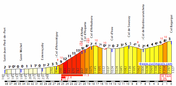
2u580gp.png


oqyhbq.png


GPM:
Alto de La Mairena (cat.2) 5,2km @ 7,1%
Alto de Mijas (cat.2) 5,0km @ 7,1%
Puerto del León (cat.1) 16,3km @ 5,6%
Alto de La Mina (cat.1) 7,3km @ 7,8%

There are only a couple of stages in this Vuelta that Javier Guillén would like, and even then they don't quite fit his template. This is one of them, with the steep stuff late on. But I've thrown in a lot more in the way of earlier climbing than he'd like...

ronda-04.jpg


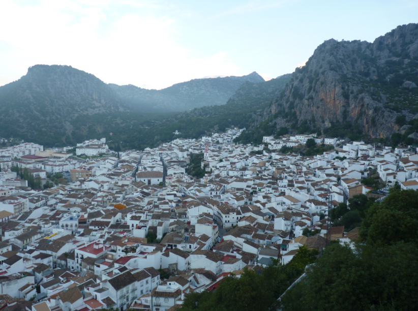
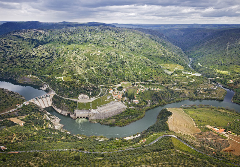
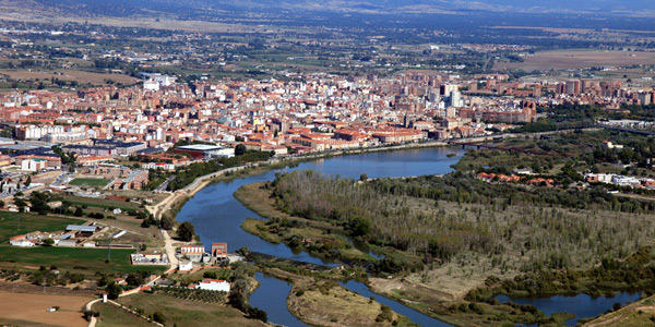
We start our second weekend in the incredibly dramatically located city of Ronda, perched on a clifftop atop a huge gorge in the Sierra de Grazalema, so only a shortish transfer from Ubrique yesterday. This massively historical city spent a brief time as the centre of an Islamic independent republic after the downfall of al-Andalus and the Córdoba caliphate, and in latter years has provided inspiration to a host of literary, artistic and cinematic names, most notably Ernest Hemingway, for whom after Pamplona it is perhaps the Spanish site par excellence, and Rainer Maria Rilke, whose hotel room has remained untouched since the great poet's death in 1926. We cannot dwell on such historical connections though, for we have racing to do. Ronda featured as a stage finish in my last Vuelta, but this time it is a stage start only.

The stage starts with a rumbling stretch as we head towards the Mediterranean coast where we will be spending much of the day's racing. The northern side of the Puerto del Madroño is not categorization worthy, with an average of only 1,3% - that first stretch including around 5km at 5,0% is probably cat.3, but when stretched out over the whole thing, I really didn't feel it worth it. It will however give a chance for a strongish break to form before the long, drawn out descent to the water's edge; the road is wide and the descent at a manageable and consistent gradient without many stern technical tests, so this should be no difficulty for the riders before they interrupt some tourists' Saturday afternoon on the Costa del Sol.

Gran-Marbella-West-to-East.jpg


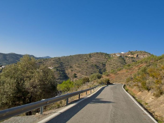
This will be much of the order of the day for this part of the stage - searing heat cooled by the sea, wide open roads through resort towns, punctuated by mountain climbing. Marbella there is but the first of a few such cities we'll be seeing, so there'll be a bit more urban racing than you might normally expect in the Vuelta. On the plus side, once you leave the coast in this region, it immediately jumps up into hilly and mountainous settlements. The first we visit is La Mairena, accessed via a steep and twisty route. With 5,2km @ 7,1% including a steep section of 2km at 10,3% in the middle of the climb, it's a nice cat.2 to warm the legs up (not that they'll need warming in this heat, mind you, it's August in Andalucía at sea level) for the stage to come before we descend towards Fuengirola, our next city of sun-loungers, beach-front high-rises and so on, like much of the coast. Our next stop, Mijas, is a hillside town facing south for maximum sunlight but elevated above the coastline; it is a climb well known to the Vuelta, featuring early in stage 3 of last year's race.

blog589.jpg


With 3km at 8,7% in the middle of the climb from the side we're using (there are many) and a max of 18% it is not to be sniffed at and is another useful cat.2; it matches up to the first 5km of this profile. The descent takes us into another famous resort city, Torremolinos (which in the form of 3 Molinos Resort, used to sponsor a Spanish continental team about ten years ago, Jan Hruška and Santos González being their most well-known riders), and then we head on to Málaga, the most famous of the Costa del Sol cities and also a city that's been on the Vuelta menu of late. It hosted the start of the race in 2000 and 2006, a flat stage finish in 2002 (and the start of the aforementioned Ubrique stage) and 2004 (and the start of the following stage, to Granada and the first stage win of Santi Pérez's awesomely hilarious breakout) as well as the much more interesting 2010 stage finishing at the Castello del Gibralfaro, which was won by Philippe Gilbert and which I copied wholesale for the first Spanish stage of my fourth Vuelta, which started in Morocco. The original stage design in fact included the Puerto del León twice, so was much more challenging.

3531683.jpg


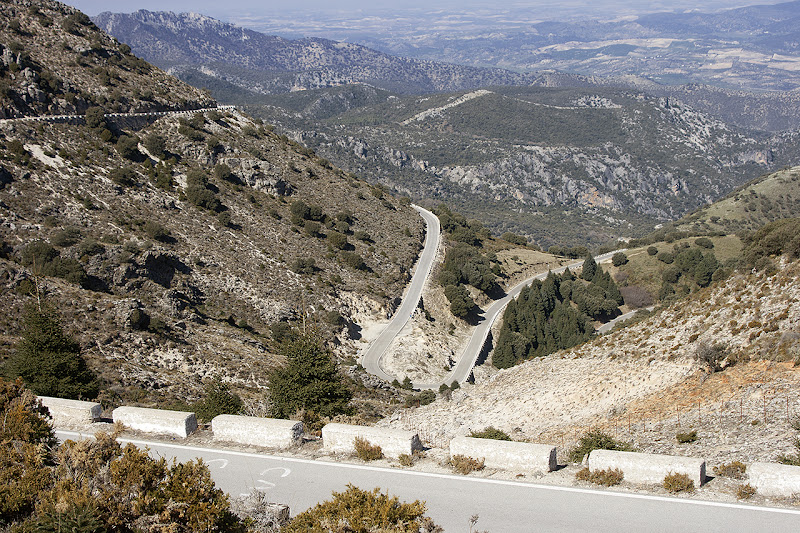
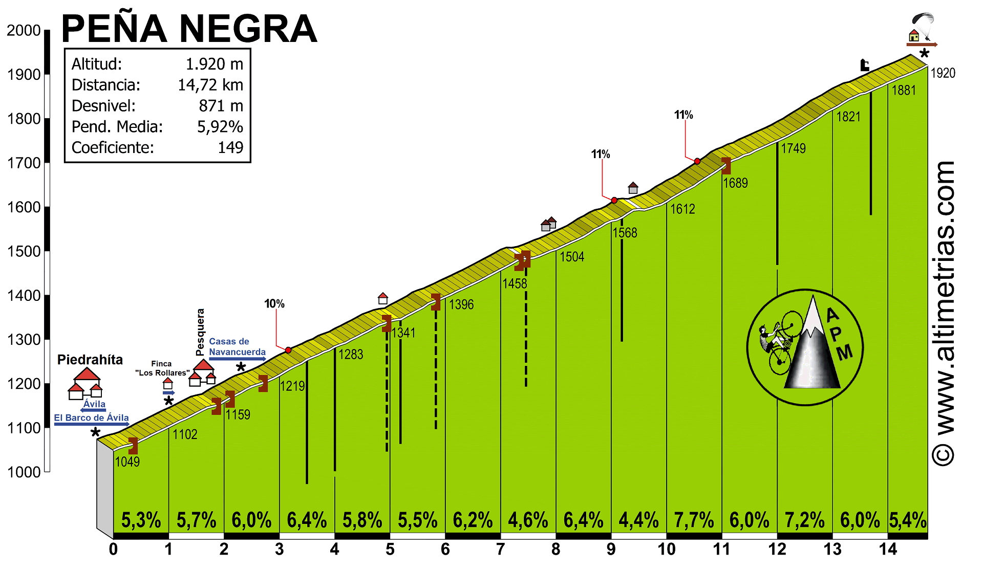
This climb is nice and wide, open to the elements, and pretty regular, however it is also pretty long so the upping of the pace here ought to have an impact eventually. The profile shows that this is a consistent climb, and it's really about setting tempo. The max is only 10%, and the steepest part is a couple of kilometres between 7 and 8% near the top, so if you're in the right rhythm you'll be fine unless you don't eat and drink enough (always a possibility in the south of Spain). Cresting just over 30km from the line, I don't expect anything other than the most speculative of attacks here; it's all burning off domestiques. There are about a dozen different sides of the climb, and this is the steepest but also the most consistent; we're descending via the Puerto del Santopitár, which entails the section of this profile from the top to the junction for Colmenar at the 8km mark, whereupon we have another few kilometres of sustained descent ahead of our final climb of the day, and the reason I've called this a Javier Guillén stage.

0c4c6b3c.jpg


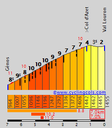
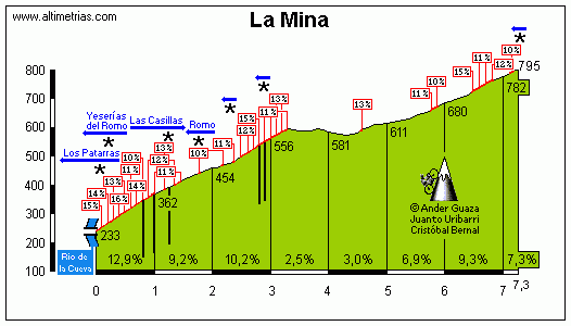
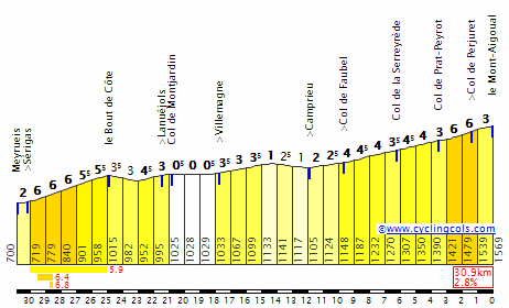
The final climb of the day averages under 8% and is just over 7km long. We know that Unipublic likes to over-categorize some climbs - the Alto del Cordal, Peña Cabarga and Mirador del Fito as cat.1 spring to mind immediately, for example - but this one is a cat.1 in my humble opinion. That's because this is very much unlike your usual Andalucían climb - this is a piece of Asturian or Basque hell transplanted to the south coast. And it crests just 3,8km from the finish, Xorret del Catí-style.

Mina1.gif


Is that 3,3km at 10,8% to start the climb? Why yes it is! Would you like no fewer than sixteen ramps of 10%+ in that, as a garnish? Why of course! Pile it on! Is that another 3km at 7% with endless ramps of 11 and 12% appended to the end? Indeed! And the best thing? It's totally ridable (photo taken from altimetrias.net as so often the case). This is the kind of climb Javier Guillén loves to bring in to the Vuelta, but trying to find a way to get it into a one-climb stage may make him upset, because it's hard to access without going over other ascents. This one should blow the field apart from the bottom, because it's essentially Montée Laurent Jalabert with another cat.3 climb stuck on the end of it. And since Croix-Neuve is a legit cat.2, this ought to be a cat.1.

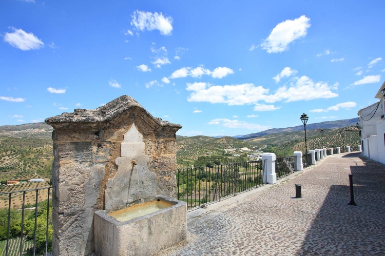
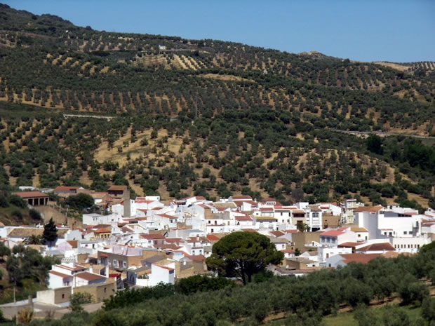
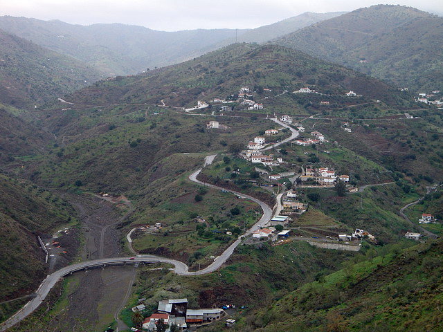
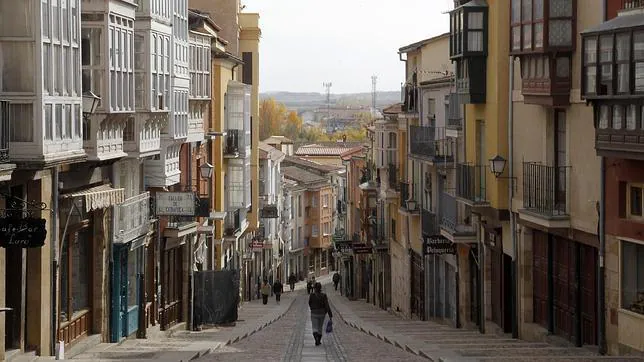
Once the riders are over the summit, they have a quite narrow but still plenty ridable (it's rather like Xorret del Catí) descent into the small town of Colmenar. The town is well known for its number of apiaries and honey production, and indeed the recently-opened Museo de la Miel is, along with the Ermita de la Candelaria, its most well-known attraction. The town is built into steep hillside, and therefore there are some extremely steep and narrow roads within its centre.

61_126.jpg


Having just come off a 7km at 8% climb, however, the riders probably don't want any of that, and in fairness it's very difficult to include any given how narrow they are - some of them make Valdepeñas de Jaén look like a highway. There are a couple of technical corners in the last kilometre of the descent, which takes us into the final kilometre, however there is then a nasty 350m repecho on this road:

p-calle_de_colmenar-robtcynvelez-23_09_08-cc301984.jpg


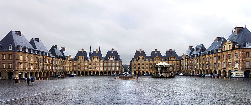
Then the final hundred metres or so is downhill to finish at this square.

All in all, a very tough Saturday stage, with the final climb being steep enough that riders don't have the choice of saving energy for Sunday...
 
Oct 4, 2015
417
1
3,030
Visit site
Tour de France Stage 19: Mont-de-Marsan - Bordeaux, 169km
2aglnbt.png

2qd1l61.png

Climbs: None

Next comes a flat transition stage starting from Mont-de-Marsan, then taking a small detour into the traditional winemaking region of Saint-Émilion before heading into Bordeaux. GC contenders still in the running will take this day to regroup before the final TT next day. If any sprinters managed to survive the brutal mountains of this Tour, they will find their rewards here (and in Paris, of course).
 
Oct 4, 2015
417
1
3,030
Visit site
Tour de France Stage 20: Disneyland Paris - Disneyland Paris, 34km (ITT)
1262ntk.png

t657q9.png

Climbs: None

After a long move from Bordeaux to Paris, we take on the final GC test of the race: a mid-length time trial starting and finishing in Disneyland Paris. The route is somewhat hilly, climbing up and down from the Grand Morin valley four times (all four climbs feature an elevation gain of 50-70m across 1-1,5km each). A last test of strength, and a last chance for good TTers to try and snatch the lead back... if they still have the legs for it.
 
Oct 4, 2015
417
1
3,030
Visit site
Tour de France Stage 21: Versailles - Paris, 135km
2e6epgz.png

10rk38i.png

Climbs: Orsay (2km 4,7%), Meudon (1,2km 9%)

The Tour finishes with the typical parade stage in Paris. Starting from Versailles (where one of the peace treaties that ended World War I was signed), the route then heads through the hills to the south and west of Paris (including two categorized climbs, Orsay and Meudon) before heading into the city and entering the usual Champs-Élysées circuit, with ten laps around the course. A last chance for the sprinters, and a parade for the overall winner.

Posting the race recap (including stage links) tomorrow.
 

TRENDING THREADS