• The Cycling News forum is looking to add some volunteer moderators with Red Rick's recent retirement. If you're interested in helping keep our discussions on track, send a direct message to @SHaines here on the forum, or use the Contact Us form to message the Community Team.

    In the meanwhile, please use the Report option if you see a post that doesn't fit within the forum rules.

    Thanks!

Race Design Thread

Page 213 - Get up to date with the latest news, scores & standings from the Cycling News Community.
Gigs_98 said:
Am I the only one who is too stupid to make a climb profile? I just don't get it. Whatever :eek:
Propably i'm more stupid as i sometimes do a climb profile by hand (or in this case by mouse) in style climbbybike uses and it can take like 2 to 3 hours. Here's an example:
railxmig said:
U0XPB4j.png

On 01.04 i've designed a race in France but i will wait with posting it until the storm here will settle down as in last 2 weeks it started to get crowdy here. Here's a small peek of it in form of another climb profile. This quite small col in a small massif might be known by some of users here.
LXI93jz.png
 
VUELTA A NAVARRA STAGE 3: OLITE-TAFALLA 204km

kLKUO9I.png

Gfi8r4S.jpg


Not the most interesting stage, unfortunately. Flat. Maybe there will be some wind, which is possible, but else it will be quite boring. As you can see from the map, we are in a massive plain. The Riber Ebro flows through this region, named the Ribera.

hpe0NYk.jpg


There is thinking behind having a stage for the sprinters. One is to make it more realistic: all 2.1 six-stage races which aren't based in Trentino or Pais Vasco will have a sprinters' stage. Another is so that attacks the previous stage are more likely to actually happen. If I had a monster stage today then yesterday's stage would've been softpedalled. Also, geographically I had a problem. I wanted to explore all of navarra, which meant I had to go to the Navarran version of the Po Valley also. Oh well. I also included a short excursion into La Rioja for a few kilometres, that is the only time we will be on non-Navarran soil. Our first Intermediate sprint is in Tudela, and our other in Cintruenigo. Then we have our stage finish very close to our stage start in Olite (where yesterday's stage ended) in Tafalla. It is less pretty than Olite too, but the main square is pretty nice
qvJWwDu.jpg

OQLJV6S.jpg

The centre pavilion is reminiscent of the Plaza del Castillo
 
Tour de France sans Alpes et Pyrenées, stage 5: Obernai - Lac Blanc/Col de Calvaire, 226.5km: medium mountains + MTF

After another short transfer the peloton arrives in one of the many picturesque Alsatian towns for the start of the fifth stage.

640px-Obernai_place_marche.JPG


This stage will be one of the longest of the whole tour and may even be considered as a queen stage, not only because of its length, but mainly because of the profile.

2hwz7t4.jpg


For the first 30km or so the course remains in the plain of the Rhine, with the Vosges looming on the right. The last 2km before the village of Saint-Hippolyte are already on an ascending false flat, but when leaving the village, the first climb of the day starts: the very regular Schaentzel. If a breakaway hasn't been rstablished by now, it sure will provide a launching platform.

jl56bl.jpg


The top of the climb offers some nice views on the nearby Château de Haut-Koenigsbourg.

640px-France_Haut-Koenigsbourg_aerial_view.jpg


The descent, sinuous in the first half, leads to Bergheim and then to Ribeauvillé, Zellenberg and Riquewihr, while riding through rolling vineyards. The course won't cross Riquewihr itself as the narrow, cobbled and climbing main street isn't really suited to host the caravan. Soon after Riquewihr the course enters a forest on a rather narrow but well maintained road and climbs to the mountain hamlet Ursprung. After the village ther's some false flat to the col de Fréland, the highest point of the road before the descent starts. That descent, however, only last for some kilometers before the third climb of the day starts. Its descent leads to Sainte-Marie aux Mine, where the fourth climb of the day immediately starts. First with a false flat of about 2km, but then some steep kilometers.

6r1wxz.gif


At the summit, there's still some 135km to go. But for a while, the profile eases off a bit, with only the shallow climb to the col de la Séboue and a little bump between the valleys of the Meurthe and the Petite Meurthe.
A few kilometers of valley floor lead to Le Vic, which marks the start of one of the hardest climbs of the day: the Col de la Tête des Porcs. A rather long descent to Gérardmer brings the peloton to the eighth climb of the day, the steep Côte de Goutteridos. Next on today's copious menu is an alternative approach to the Col de la Schlucht. The easy and wide descent of the Col de la Schlucht gives way to the Collet du Linge, with still 37 km to go at the summit. After the descent to Lapoutroie the steepest climb of the day kicks in: the Côte des Merelles.

jg195d.jpg


The descent of this little monster is shorter and less steep than the climb and goes through Orbey, to the foot of the Col de la Calvaire, which will be today's finish location. The line will be drawn near the Lac Blanc and the skiing school

593px-Lac_Blanc_et_Rocher_Hans_depuis_le_chaos_de_pierres.jpg


Climbs:
Le Schaentzel: km36.5; 4.9km @ 6.9%; 2nd cat
Col d'Ursprung: km 61.5; 7.2km @ 6%; 2nd cat
Col Haut de Ribeauvillé: km 77; 3.8km @ 6.3%; 3rd cat
Col de Sainte Marie: km 90.5; 5.6km @ 6.9%; 2nd cat
Col de la Séboue: km 111; 8.6km @ 3.7%; 3rd cat
Côte de Rovémont: km 120.5; 1.5km @ 7.9%; 4th cat
Col de la Tête des Porcs: km131.5; 6.4 km @ 8.8%; 1st cat
Côte de Goutteridos: km148; 3.8km @ 8.3%; 2nd cat
Le Collet: km162; 4.2km @ 7.3%; 2nd cat
Collet du Linge: km 189; 8.8km @ 6.3%; 2nd cat
Côte des Merelles: km 211.5; 4km @ 10.5%; 1st cat
Col du Calvaire: km 226.5; 10.2km @ 6.2%; 2nd cat
 
That Vosges stage is a monster!

Stage 17: Andorra la Vella - Estación de Esquí Aramón-Cerler, 191km

2cy662a.png


6iqhdg.png


GPM:
Port del Cantò (cat.1) 25,6km @ 4,2%
Coll de Bretui (cat.2) 9,6km @ 4,8%
Coll de la Creu de Perves (cat.2) 13,6km @ 4,4%
Coll d'Espina (cat.2) 6,3km @ 6,5%
Alto de Ramastué (cat.2) 5,0km @ 7,9%
Estación de Esquí Aramón-Cerler (cat.1) 11,8km @ 6,1%

This is more of a "classic GT route" and more of an ASO-mould route as well than normal; a lot of the time the Vuelta, both in real life and in my designs, likes to have a big mountain stage on the penultimate day of the race; instead, this is the final chance for the climbers to make their mark on the race. And it's another classic.

itinerari-cultural-per-andorra-la-vella.jpg


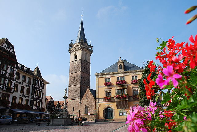
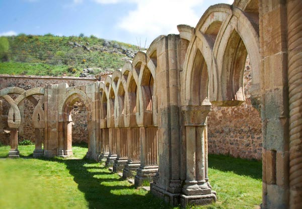
We're starting where we left off, in Andorra's capital, on a pretty traditional Vuelta trip that I've made a few amendments to to spice things up a little. The Vuelta has comparatively few traditional mountains; it did not have a mountaintop finish until the introduction of Aramón Formigal (another skiing resort run by the same organization as today's finish) in 1972, and then the first few MTFs were at places like Arrate and Urkiola which were off the menu from 1979 onwards due to the race avoiding País Vasco. It has quite the tradition of repetition in the parcours, especially in the 80s and the first half of the 90s, but since the move from April to September the route has become progressively more varied and new mountains are being sought. There are still a great many left to discover, and many I've used in my routes (and others in theirs) are undiscovered by Unipublic as yet, but the number of "long forgotten" summits is few (Formigal was dormant from 1977 until its return in 2013; Fuente del Chivo returned last year for the first time since 1993; Peña Cabarga went unused from 1979 to 2010 but has since become a regular. Perhaps the clearest one for reuse is Rasos de Peguera, used twice in the early 80s, dormant until 1999, then abandoned since) and those most supportive have been fixtures of the route with regularity (Lagos de Covadonga was used every year bar two from its introduction to the Vuelta in 1983 to 1997, for example). Considering how supportive and traditional it has been for the race, therefore, it is strange that it's now nine years since we last saw Cerler in the race. But we'll come back to that later.

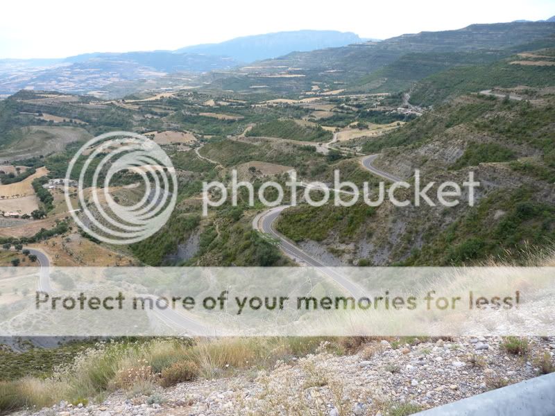
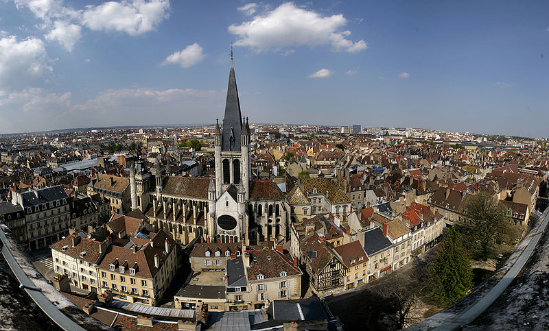
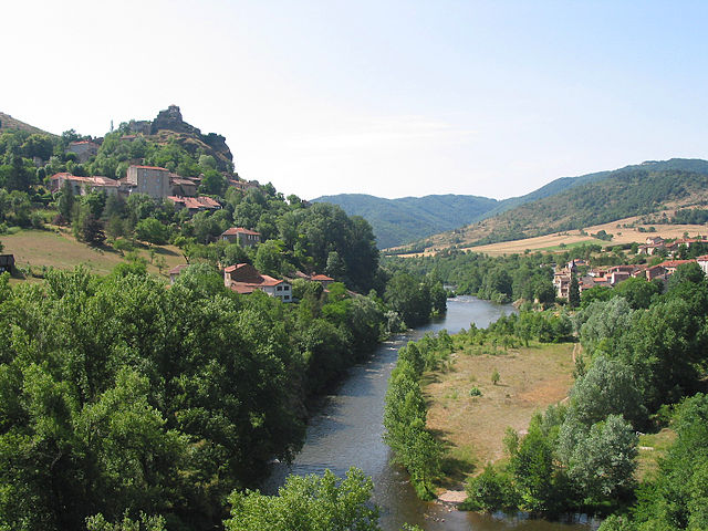
Just about the first thing we do in the stage is return to Spanish soil via La Seu d'Urgell, which was discussed previously in the Tàrrega-Andorra stage. We then take on one of the traditions of racing in this area, the monolithic, but not overly scary, Port del Cantò. As you can see from the profile, apart from that first 6km or so, there's not a great deal to truly fear in this ascent, which is wide and sweeping and is pretty well known to anybody who's raced in this part of the world, since like the Tourmalet to the northwest it's a difficult-to-avoid trunk road connecting supportive racing valleys.

2_zpsbd5bb667.jpg


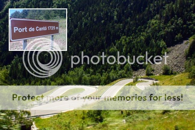
The side we descend is the tougher one, but both of them are fairly benign; it is their length and inconsistency that makes them frustrating. Nevertheless, it's a fixture of the Volta a Catalunya and also well known to the Vuelta and, when in the area, the Tour de France (which uses it in the Vielha-Arcalis stage in 2016... note to self: 7 Vueltas and you've done nothing in the Val d'Aran, surely you can find something more interesting than Pla de Beret '08 to do there?). The Port del Cantò is also the biggest climb we'll face today in terms of length and the biggest challenge until we get to the final climb - although we have four second category climbs to keep the riders busy and make sure some tired legs are in the bunch when we get to Benasque. The first of these is the Coll de Bretui, a two-stepped ascent which is sometimes omitted from Vuelta stages heading towards Cerler in this direction, but was used the last time this approach was taken, which was in 2005. That also followed an Arcalis MTF and therefore the stage shows more than a striking resemblance to mine - with this being an attempt at a more "classic" Vuelta with more normal gradients, however, that does mean some retro-looking stages which resemble old Vuelta moments, just amped up a little to do what we can to improve them if necessary (such as use the Andorran passes that weren't available at that time). Bretui consists of 4km at 7,5%, then a kilometre's descent, then another 4km or so at a more benign 5% type gradient. At the top, there's the scenic Estany de Montcortès.

apartaments-rurals-dscf0053-turime-montcortes.jpg


The descent into Senterada takes us onto our next second-category challenge, the gradual Coll de la Creu de Perves, a sweeping climb which consists of around 7km of false flat that gradually builds up to a final 6km at 6,5% over wide roads that, scenery-wise, skirt along the boundary between the Pyrenean heights and the sun-swept lands of the foothills below. It's always been used mid-stage and usually linking Cerler with Andorra, whether it be from this side (as in 1998 and 2005) or the opposite, two stepped side (as in 2007). Like Port del Cantò, it's an almost unavoidable trunk road when linking these two regions (as opposed to Bretui, which can be skirted around and ignored from the route if need be).

P1000038.jpg


After this, the riders get their biggest respite of the day, around 20km of more-or-less flat terrain tilted only slightly uphill, and including the intermediate sprint in Pont de Suert. This then leads on to another traditional ascent in the region, the double-headed summit of the Coll d'Espina (the eastern summit) and the Coll de Fadas (the western one). There are a few such summits around here (Boixols/Faidella, Tell/Jou, Serra-Seca) but this is possibly the most commonly-used one, although it hasn't been seen since the 2008 Vuelta when it was early in the break-favouring stage 9, a transitional stage won by Greg van Avermaet; David Moncoutié got into the break, having picked up the mountains jersey with his stage win at Pla de Beret the previous day and seeking to keep it. We only categorize the first 6,3km to the actual col, but there is some up-and-down after that to the village of Las Paules, as you can see on the profile. The Coll de Fadas is actually a slightly higher summit as you can see from that side of the climb - however it is here that I deviate slightly from the historic template used in 1998 and 2005 and add in my secret weapon.

ranastue.jpg


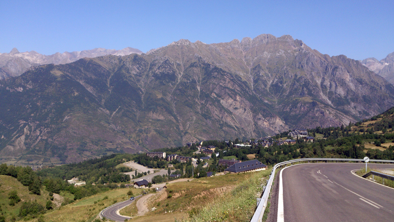
The small mountaintop village of Ramastué is one of the few ways (until that project to pave the Collado Sahún gets finished, if it ever does) that you can beef up a Cerler stage; it's nicely located backing directly from the Coll d'Espina (at the junction for Urmella on the profile of the Fadas side). Frustratingly, however, it's difficult to find a profile for. I can't actually find a profile for the side I'm using, so I've had to map it in cronoescalada. It's on streetview and looks to be absolutely fine, but in the event it's not we can always use the normal side of the climb anyway, which just lengthens the stage by 3km and adds a little bit of false flat into it. The summit at the village is 26km from home, and then the riders can look down in to the Valle Benasque beneath them and see the town of Benasque itself, from which things are about to get mean.

04_2.jpg


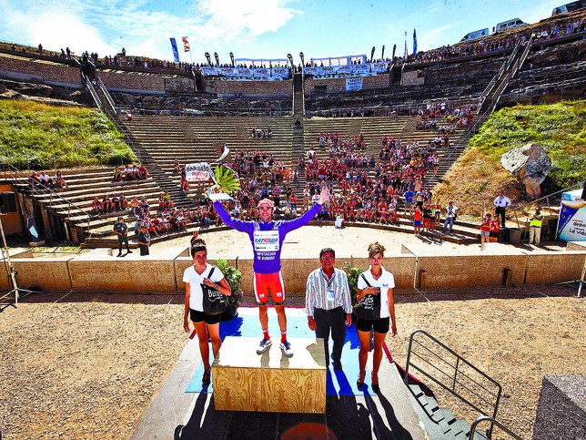
The Aramón-Cerler ski station (also known as Cerler-Ampriu, or the Alto del Ampriu) was first introduced to La Vuelta in 1987, when it came at the end of week 1. The stage was from La Seu d'Urgell and went over Port del Cantò, Creu de Perves and Espina and there are highlights here. The stage was won by the underrated mythical climber Laudelino Cubino, at the time comparatively unheralded; Lale as he was affectionately known was a classic pure climber; painfully inconsistent, prone to crashing out of races, losing bucketloads of time in the chrono...but on his day he could match anyone.

n_valencia_otros_deportes-16415.jpg


The climb returned the following year in an easier stage from Jacá, and this time Lale was in the leader's jersey. While he defended his lead, however, it was another great pure climber, Fabio Parra, who took the stage. A year later and it was Perico Delgado who took the win, the reigning Tour de France champion using it as a key weapon en route to taking the overall, and this time without the controversy of a few years earlier, although he couldn't take the time he needed on that particular day to overcome Omar "Zorro" Hernández. You know what I was saying earlier about how the Vuelta liked to repeat itself in that era? Yep, you got it - Cerler was back in 1990, fulfilling the role it does for me here - the final mountain test. And this time it was won in the king of the mountains jersey, by Colombian Martin Farfán - in this era the Colombians really added a great deal of spice to the mountains of the Vuelta following Lucho's win in 1987. In 1991's snow-affected stage it was those other exóticos of the Vuelta startlist at the time, the Soviet team, who took the win courtesy of mighty climber Ivan Ivanov, whose lopsided skillset meant he was of limited value in the rouleur races of the East, but led the Soviet attacks on the Vuelta in the mid-80s, with his most successful performance being 6th overall in 1989. He was allowed to escape because with the Andorra stage shortened and the Pla de Beret stage annulled by the weather, climbers were heavily disadvantaged against the time triallists; Miguel Indurain was being forced to race aggressively in the mountains to (unsuccessfully) wrest the jersey from the out-of-nowhere sensation Melchior Mauri who had stomped him in the time trials (!!!).

After a year out, the climb was back in 1993; the EPO era was in full effect by now, and Tony Rominger blasted his way to victory, taking the stage with a large assist from Colombian mountain goat Oliverio Rincón. Lale Cubino was still around, climbing with race leader Alex Zülle a minute down the mountain as the speed of ascents started to, well, climb. Rominger repeated his performance, this time in the leader's jersey, in 1994, his fourth of six stage wins as he became the last rider to wear the leader's jersey from start to finish in a Grand Tour. The climb was spared Jalabert fever in 1995, but in 1996 it was back - however with the EPO era at its worst, the triple-stepped ascent was no longer causing the same gaps to open up; despite this, victory on this mythical ascent was still the preserve of the great climbers, however behind Rincón's stage win a group of 9 came in together. In 1998 it was the third of four mountaintop stage victories (and second in a row) for José María Jiménez, wearing the mountains jersey as Farfán had, in the midst of his team dissension with both Olano and Jiménez racing to win.

At this point, however, the Vuelta started to branch out, and gone was the era of constant repetition. Monte Naranco, seen every year from 1990 to 1997, was gone until 2013. Sierra Nevada disappeared until 2002. Cruz de la Demanda took a five year hiatus, then disappeared for good after 2001. Even Lagos de Covadonga had a couple of years out as new summits like Angliru and Abantos came to the fore. And so Cerler was forgotten about in La Vuelta until 2005, when in a stage identical to this one bar my inclusion of Ramastué, Roberto Laiseka triumphed ahead of Sastre, Heras, Mancebo and Menchov. We last saw the climb in 2007, which I guess you could call the last "traditional" Vuelta with its use of a series of the historic ascents of the era - yes, Covadonga is very classic, but Cerler is a very 90s climb, Abantos became a tradition of the late 90s/early 00s era, and Arcalis reeks of late 90s/early 00s as well; only the storied Covadonga has returned to the race since. This stage saw Leonardo Piepoli show his greatness at cutting deals, working with Menchov with the Russian taking the leader's jersey, and shredding everyone en route to yet another mountaintop stage win, while the same surprise rider from the Arcalis TT I mentioned in 2005 became a surprise package in the Vuelta as Ezequiel Mosquera emerged at the business end of the results sheet.

VE07e09n011_490.jpg


So yes, I did just go through - with video links - each and every time the Vuelta has been to Cerler, which is 11 times. So I probably ought to say a bit about the climb itself. The all-important thing about Cerler is that, like other classic Vuelta climbs like Covadonga, it is inconsistent; 12km at 6% seems fair to middling really; however this is over three smaller ascents broken up by brief descents, and the last part of the climb is the easiest, making it harder to sit tight for the finale on.

arg1.png


So yes, that's about 4km at 8% into the scenic village of Cerler itself, then a flat-to-downhill kilometre, then the toughest wall of the climb, which is where the real moves tend to be made, 2km at 9,5% before it eases up a bit, then a downhill kilometre before a final 3km at 6% but with each section ending with its easiest gradients, it's not a climb you can wait to make your moves on. Which is part of why it was initially such a hit with pure climbers like Cubino and Parra, but also part of why it's fallen from favour as with the modern seeking-out of hell-slopes to guarantee time gaps in the more conservatively-raced current era, a climb which is inconsistent but for Javier Guillén's current philosophy has all its toughest stuff in the "wrong" areas and doesn't include too many serious ramps at all is not going to seem ideal. Nevertheless, this is quite simply a legendary ascent in the history of the Vuelta, it looks stunning and, with the current fad for resurrecting long-forgotten summits (in addition to those mentioned above - Naranco, Formigal, Fuente del Chivo - there's also Arrate which was seen in 1972 and then not again until 2012, and Valdezcaray which similarly was used every year from 1988 to 1991 before being superceded by its tougher brother, Cruz de la Demanda, from 1993 on, but was brought back in 2012) surely it can't be long before they acknowledge that they've got to pay Cerler a visit.

cer1.jpg


14102009164032.jpg
 
VEULTA A NAVARRA STAGE 4: ESTELLA - LEKUNBERRI 213km
vnZ57bl.png

eMj56yx.jpg

Welcome to the Queen Stage of the Vuelta a Navarra. It is a hard stage, with over 4000m of climbing, and long too: 213km. 6 categorised climbs fill the day, including the San Miguel de Aralar, twice. It is a day for the climbers, the first real day for them, unless you consider Stage 2 to Olite to have been a climbers' day, which I don't.

The day starts in Estella, where the GP Miguel Indurain is based. It is a pretty town, one of the largest in the region. We then head north into the basque-speaking part of the region, coincidentally also the nearest to the Basque country. As it is near the Basque country, the landscape changed completely from earlier on in the tour. We change fro the wide, open expanses of the Ribera and the hills of the Central zone to green hills, covered in trees and leaves. The verdant surroundings are like those of the Basque Country, and the riders who do well there should do ell today also.

The first climb is the Urbasa climb. It is not a difficult climb, averages just 5% over 7 or so kilometres, peaking at 12%. This should do no more than sort out the break. Up ehre we are in the Urbasa y Andia parque nacional, a beautiful area of of Spain, which will dominate the landscape today until we reach another national park, that of Aralar. Then we sweep near the border to Altsasu and then comes our first intermediate sprint in Etxarri.

e8tJapZ.jpg


Our second climb is Lizarriga, also very gentle and long. It is in fact the longest climb of the day, at over 10km. And then we have a long descent before another climb. Guembe, which is also not steep and the shortest of the day. We have 40km of flat before our next climb, the San Miguel de Aralar.

This was most recently in the 2014 Vuelta, when Aru outsprinted Froome to take victory. It was a fairly easy day, and the gap from Froome to the chasers was just 9 seconds. I am afraid no attacks are expected to happen here, as it i over 70km from the finish, but I hope some domestiques will be shunetd out of the group to make the final more interesting. We have another climb then flat before we rehit the climb.

ahbISlp.png


After a quick descent we finish. Sorry for the rushed write-up In have very little time.

800px-Malloetako_tontorrak.jpg
 
San Miguel de Aralar wasn't the stage where Aru and Froome went up the road. It's the one where Froome was haning out the back the entire way, Gesink did his trademark deadly snail attack, Aru overtook Navarro on his way to the win. Froome got 5th on that stage
 
Tour de France sans Alpes et Pyrenées n°2, stage 6: Gerardmer - Dijon, 195km: flat

It's already the 7th racing day and only now the pure sprinters get a second chance to fight for a victory.

nexhys.jpg


This stage starts in the winter sport town Gerardmer, that already hosted the Tour on a few occasions. Nested between a little lake and the foot of the Vosges, there are plentiful opportunities for outdoor activities.

640px-Gerardmer_vue_de_Merelle.jpg


The peloton, however, won't spent much time in the surroundings and head southwest to Burgundy. Today's course starts out with a gentle descent for about 20km. Then there's a small flat section, followed by a little less than 10km false flat uphill.
Another long downhill false flat leads to the plain of the river Saône, which won't be left for the 135 remaining kilometers of the stage, until the finish in Dijon.

800px-Tourphlebon-1.jpg
 
Tour de France sans Alpes et Pyrenées n°2, stage 7: Autun - Clermont-Ferrand, 217.5km: medium mountains

The first intermediate saturday of this Tour will offer the riders an appetizer for the following day. Although the stage is quite long to modern standards, it's an easy one for much of its total distance.

jb0cxg.jpg


After a transfer of about 85km, partially on a highway, so it should take about an hour, the caravan arrives in Autun, a town founded by the Romans about 2000 years ago. The city is dotted with remnants of its rich past.

2akl9q8.jpg


The peloton won't have any time for some sightseeing, as it heads in an almost straight line southwest, to the foothills of the Massif Central. Some minor climbs on the way won't pose much of a difficulty.


Climbs:
Côte des Dalbots: km 123.5, 1.4km @ 6%; 4th cat
Côte du Bois du Roi: km 133; 1.2km @ 5%; 4th cat
Col du Cratère: km 182.5; 5.8km @ 6.2%; 3rd cat
Col du Bancillon: km199.5; 1.8km @ 11.2%; 3rd cat
Col de la Baraque: km 209.5; 6km @ 6.6%; 2nd cat
 
Österreich Rundfahrt stage 5: Hallstatt - Bruck an der Mur (165 km)
eOI1dwU.png

yv2zNCd.png


Right after the queen stage of the race comes one of the easiest ones. This is one for the sprinters but at least the easy route should make action on stage 4 more likely.
The start is in the extremely beautiful city of Hallstatt, which is despite of its small size one of Austrias most famous sights, and honestly, thats not very surprising when you see pictures like these:
csm_hallstatt_6135c1a3c7.jpg

Untitled-31.jpg


Although the first 30 kilometers are probably the hardest ones since they are mostly up and down. Directly after the start the riders will climb the Koppenpass. No not the Koppenberg, we are not in Belgium but still this climb is equally steep. However the ascent is only slightly longer than one kilometer, so besides the fact that the break might form on this climb, these killer gradients unfortunately come very early (You could do a stage over this pass which finishes in Bad Aussee, but it wont be the case in this race.
2013-07-13%20Urlaub%20A-I%200063a%20Koppenpass.JPG


As you can think the riders will then ride through the beautiful city Bad Aussee, and then climb up the false flat climb Gschößl.
After a short descent the next 55 kilometers are really easy. Firstly the riders drive by the Kulm, one of the biggest ski jumping hills in the world, and another 20 kilometers later there will be an intermediate sprint in Liezen.

Then the race gets really hard for a few kilometers with the climb to Kaiserau. This is by far the hardest climb of the stage (still not extremely difficult though) and it will definitely make the race a bit harder for sprinters like Kittel. For every not completely one dimensional sprinter this really shouldnt be a problem though. I just put it in to make the race a little bit harder and because pan flat stages are simply boring ;)
IMG_0025_4.JPG


After the descent however the race gets as easy again as it was before. There isnt really something very interesting before the expected bunch sprint at the finish, besides an intermediate sprint in Leoben. The finish will then be in Bruck an der Mur, another very nice city.
blick_vom_schlossberg_auf_bruck_an_der_mur_copyright_tv_bruck_an_der_mur-steininger.jpeg


This will be a stage for the gc contenders to take a rest, since the next two stages will decide the general classification.
 
Stage 18: Huesca - Soria

oix07d.png


29gllbd.png


GPM:
Alto de la Sierra de Luna (cat.3) 5,4km @ 4,2%

Much as Gigs_98's Österreichrundfahrt is transitioning after a big GC challenge with an easier stage, this 18th stage is a much-needed respite for the tired legs of the riders, who have now had four consecutive mountain stages (broken up by a rest day between the second and third admittedly) and now need a chance to put a bit of life back into the legs and transition from the Pyrenees back towards the centre of the country.

ciudad_630_grande.jpg


The stage begins after a reasonably large transfer from the mountains to the northernmost provincial capital in Aragón, Huesca. With around 50.000 inhabitants, it's one of the smaller provincial capitals in the country, a measure of the comparatively sparsely populated and mountainous region; it is perhaps best known to a modern audience as the site of particularly brutal fighting during the Spanish Civil War, and because an optimistic prediction by a Republican general turned "having coffee in Huesca" into a running (at least partially gallows humour-influenced) joke in Spain, subsequently popularized among a worldwide audience when referenced by George Orwell; in my first Vuelta I had a stage which passed briefly through Aragón; just the mention of the Comunidad was enough to remind craig1985 of Orwell's reference to the joke. It's rare to see Huesca as a stage finish in the Vuelta but it's not infrequent in the same role as today - it was the start point for the 1999 stage to Pla de Beret, the 2003 stage to Cam Basque, the 2007 stage to Cerler, and most recently the rather featureless Motorland Aragón stage in 2012 which was won by John Degenkolb and gives a much better indication of today than the others...

While the stage is classified as a flat one, there is plenty of rolling terrain, and this isn't going to be so straightforward as to be one for Kittel (not that he'd have bothered to ride through the last four stages with so little remaining on the line for him). Only one categorized climb, which is the Sierra de Luna (to the south of the village of the same name), and the gradients remain low, but it's far from the only climbing in the stage.

1383665387-luna-zaragoza_1672.jpg


After this climb there's a very sustained slow descent and subsequent ascent on a dip formed in the plains with the town of Tauste sitting on a slight ridge at the bottom of it. Once we emerge from this part we arrive in fairly supportive Vuelta territory, the region around Tarazona, which historically formed the border between the rule of Aragón, Navarra and Castile. The city has become quite popular with the Vuelta in recent years, hosting the start of the 2012 stage to Jacá which was won by Joaquim Rodríguez, the 2013 contrarreloj which was won by Fabian Cancellara, and the finish of an interesting intermediate stage last year (although Beratón as 1st category is an absurd over-categorization even for the Vuelta) which was won solo by Nelson Oliveira ahead of an escape group of around 20. The nearby region also hosted the ITT in 2014 for good measure. But here, we're just passing through.

228001-tarazona-tarazona-en-fiestas-de-san-atilano.jpg


From here there's about 16km of climbing at 2,5% - the gradient is low so few should be dropped unless the heat is absolutely baking, but it's late in the race and so if this gets left to a large break group, here is where the chaff is likely to be shelled. There's then about 50km of rolling terrain before we arrive in our host city, Soria, the capital of the easternmost province of Castilla y León. While Huesca is one of the smallest provincial capitals in Spain, Soria at 40.000 is even smaller - only Teruel is a smaller capital. A remarkably historic city with Roman, Moorish and previously important strategic importance, it has some imposing city walls along with the well-preserved and much-loved Monastério de San Juan de Duero, which the riders pass at around 1km to go.

z_Arcos-de-San-Juan-Soria_152-z.jpg


The interesting part of this stage will be the rolling 12km circuit at the end; the riders cross the finishing line twice, so as to get a look at it. No real climbs but plenty to look out for on the end of a 220km stage in the midst of the third week of a Grand Tour. The final kilometre is uphill at around 6% but we're not talking a proper puncheur's climb here. This is no Mur de Huy; it's the usual "sort of uphill sprint but still really a sprint" that you get in a lot of races at various riverside and hilltop towns and cities in Spain and Portugal. In fact, this finish was seen in the 2004 Vuelta, when Alejandro Valverde triumphed in horrible weather as the pace of Paolini attacking late and Liberty Seguros' work late on meant that a group of around 20 opened up a gap on the rest of the bunch (helped immeasurably by a late puncture from Zabel which eliminated him from contention). This stage is also worth watching for the hilarious spectacle of Denis Menchov outsprinting Óscar Freire. I actually bring the finish closer to the uphill sector; the bridge at 16:00 to the crossroads at 18:30 is my run-in. For more recent comparisons, maybe the 2009 Tour stage to Montjuïc, where Thor Hushovd won ahead of Freire, Rojas and Ciolek, but Evans and Samu were up in the top 10, the 2012 Tour stage to Boulogne-sur-Mer where Sagan took 1" from a group with EBH, Velits and Cancellara the strongest, or the 2014 Vuelta stage to Arcos de la Frontera where Michael Matthews won, but ahead of Dan Martin and Purito. This stage should split things nicely between the durable and versatile sprint types (Sagan obviously, but also Lobato, Matthews and Bouhanni), the short-climb classics types (think Kwiatkowski, Pozzato and co) and the puncheurs with a faster finish (Valverde of course the most prominent). You can see the road ascended into town in the bottom right of the below.

CA-centro-de-soria.jpg
 
Tour de Suisse Stage 2: Lausanne - Aigle (154km) Medium Mountains

DdBXzcK.png


EMgzqtE.png


Climbs:
Col d'Alliaz (11.2km @ 5.7%) Cat 2
Col de la Croix (25.6 @ 4.9%) Cat HC

Sprints:
Montreux @ 87.4km
Aigle @ 101.9km

Feed zone:
Vervey @ 66.8km

Stage two of the Swiss national tour starts where we left off on stage one (Lausanne). The riders start by heading out on what can be described as rolling terrain, where they will get to the turn around point in Moudon. Here the route heads back towards Lake Geneva/Lac Leman. This is where the riders will head through Chexbresand into Vervey, at which the feed zone is at. Onwards and upwards, quite literally, as the riders will head for the hills. Although to be precise, the Col d'Alliaz.


The descent is rather narrow at times though. It is then onto Montreuxand Aigle. This is right at the foot of the big climb of the day. All 25.6km of it. However there is a section where the gradient eases off a bit to all most nothing, between Ormont Dessous and Ormont Dessus. Once at the top of the first Cat HC climb of the race, the riders only have 23.5km to the finish, of which most of it is descending.


The riders skirt round the edge of the town of Aigle before finishing right ouside the World Cycling Centre. This is of course home to the UCI. It includes a velodrome, where the Hour Record has been broken and a BMX trackthat has held the Supercross World Cup. Other events like the Cyclocross World Cup and the Swiss National Cyclocross champs have also taken place on the grounds of the World Cycling Centre. This year the EKZ Cross Tour comes to the UCI Headquarters in the winter. There is alot of room for Bus/Car/Press/Media in the area around the veldrome.

Lausanne:
Lausanne-Switzerland.jpg


Aigle:
Aigle-Castle.jpg
 
Stage 19: Soria - Ciudad Romana de Clunia, 186km

2vngi85.png


91gr9t.png


GPM:
Puerto de Piqueras (cat.2) 9,6km @ 4,5%
Puerto de las Viniegras (cat.2) 6,2km @ 5,9%
Lagunas de Neila-Pasil de Rozavientos (cat.2) 8,0km @ 6,9%

As a rare treat for the riders, given that we're deep into week 3 here, they get zero transfer, and start from the same city we finished in yesterday. You know how, in the Mont Carò stage, I talked about the Sistema Ibérico and how much of it doesn't get used, with only the very northwestern part producing serious cycling interest, in Burgos and La Rioja? Here we are using the region, albeit not to its fullest since we've already had the climbers' days to shine, and we're now working our way back towards Madrid for the finale of the race. That means a decently-sized stage designed for the escape; this should definitely be one for the break but if not it will at least have an interesting run-in for those still here prepping for the Worlds (by stage 19 many of the Worlds prep riders will likely have gone home).

As a starter, the stage takes a few cues from the 1998 Lagunas de Neila stage which also headed through this mountain range from Soria and was the last of the race's four stages won by Chava, who, since this edition of Libertine's Vueltas has tried to go with some more traditional summits and that has meant quite a few of those iconic climbs of the 90s, has had more than his fair share of mentions so far.

IMG_0018.jpg


After leaving Soria we head north directly to the Puerto de Piqueras. With the upper stretches of the road long since rendered obsolete by a tunnel, its less than imposing slopes are in surprisingly good condition. The gradients never get particularly brutal - the steepest kilometre is just 6% - and as a result it's never really been a favourite of the race even among the mostly rather tempo-grinding climbs of La Rioja; in fact the only time it had been climbed prior to that stage was forty years earlier, early in a stage from Soria to Vitoria-Gasteiz; the man to crest it first none other than the Eagle of Toledo himself, Federico Bahamontes.

After this we deviate from the 1998 stage, however; while the péloton of Olano's day turned to the south in Montenegro de Cameros to climb the Puerto de Santa Inés, we continue on our way to crest the less well-known Puerto de las Viniegras, a climb seemingly unknown to the Vuelta, although a staple of the Vuelta a La Rioja. It's mid-length and mid-steepness and is cat.2 as a result, although it also gains from the false flat before it as it is undoubtedly easier than the last climb of the day despite the same categorization. After a period of plateau we leave La Rioja and re-enter Castilla y León, this time in the Provincia de Burgos, and since we're in Burgos and in the Picos de Urbión, that can only mean one thing... Neila.

12221202BQ.jpg


The mighty glacial lakes above Neila have become a Spanish cycling staple, as the climb here, though only once ascended in the Vuelta as mentioned before, have become an important part of the calendar, as the all-important summit finish in the Vuelta a Burgos, which since the move in the calendar for the Spanish GT has been its traditional warmup. However, there are multiple sides to climb this fabled ascent; only the last couple of kilometres, after the Pasil de Rozavientos crossing, is shared by all. The side climbed by the Vuelta is the easiest to find the profile of, from Quintanar de la Sierra to the Puerto del Collado then turning left and up the steep ascent; however there is a parallel ascent from Quintanar de la Sierra which is more consistent and is usually descended between the Rozavientos climb and the MTF in the Vuelta a Burgos. Then there is the route from Neila via the Puerto del Collado (the section to the Puerto is descended in Burgos, which normally climbs Collado, then descends into Neila, then climbs the "other" Neila side; after Collado it's the same as the '98 Vuelta side) and then the Neila/Huerta de Arriba side, both of which hook up with one another early then have the brutal final stretches; this is the side used in the Vuelta a Burgos, and the side we are using. It is basically this profile until the junction for Quintanar de la Sierra at the 19km mark, although we're only categorizing it from Neila onward. After this we descend via the easier Quintanar side (that from right to left from the El Portón sign onward) to our first intermediate in Quintanar de la Sierra.

72925360.jpg


And that's it, the climbing is done! No more climbs for the stage (categorized at least). There's nearly 70km left at the summit of Pasil de Rozavientos; the idea is that the large amount of early climbing should ensure a strong breakaway, and given the race layout this one is likely to go to the break, so we need plenty of riders in it to duke out the stage.

Although there are no more categorized climbs, however, there are still challenges as there's little true flat here. We have the uncategorized Collado del Vilviestre but for the most part we're in exposed plains roads here, although several are relatively narrow; if it is super hot this could be a challenge, but otherwise the break will be trying to size each other up. Then there's a slight sting in the tail just in case it threatened to get boring: the finish is a little more complex than you might have thought. Even in the Vuelta a Burgos it doesn't get categorized, but there's a little ramp into the finish at the remains of the old Roman town at Clunia are on top of a small hill. It's even opened up some gaps before; by the time we got to the 2015 stage the climb was kind of known and the gaps are minimized, but given we are likely to see at least some of a breakaway duking this out and riders have three weeks of racing behind them, time gaps are more likely to be like the 2012 edition when a depleted field shredded by the oppressive heat meant the bunch was very small coming in and Paul Martens took advantage of the badly organized group with a canny attack from the base. If the break does get reeled back then we can expect some 2015 finish style. The other winners there are Samuel Sánchez (in 2011) and Jens Keukeleire (in 2013) for those interested.

But either way, let's face it, holding the presentations inside the Roman amphitheatre (as they did at Burgos) will be awesome.

48FC183E-C989-E7A7-E5274FB7D5404CBF.JPG


penalbadecastro_07_300.jpg
 
Stage 20: Riaza - Sepúlveda-Hoces del Río Duratón, 52,9km (CRI)

2jcwpwj.png


2wr2ft2.png


Yes, on the penultimate day it's the long ITT, rather than a Sierra de Madrid mountain stage as is so often the case in La Vuelta! Although it's on the penultimate rather than the final day, and this TT is very lumpy indeed (cronoescalada records 481m of elevation gain, which considering we finish over 200 altitude metres below where we start is something), the restoration of classic Vuelta climbs like Cerler to the race along with the suffering over more consistent gradients than the maniacal slopes of my last couple of Vueltas, patterned after doing the best we can with Guillén's vision, this route is therefore something that harks back more to the era when Ángel Casero and THE AITORMINATOR© won the Vuelta; in fact, with this, we now take the CRI mileage to 114km - though to be fair 17,4 of them were the MTT to Arcalis.

riaza2.jpg


The long ITT, which links two of the smaller stage towns in the race, takes place in the Provincia de Segovia, and commences in Riaza, a small scenic town at the northeastern tip of the Sistema Central. It made its Vuelta debut last year in a late race intermediate stage which was won by Nicolas Roche in a two-up sprint with, of all people, Haimar Zubeldia, with Zé Gonçalves trapped in the gap between the duo and the bunch, trimmed down repeatedly on the Puerto de la Quesera by Aru's attempts to win that jersey back from Tom Dumoulin. However, rather than head for the mountains, we are instead heading across the plains on what will be a very fast first half of the ITT, dropping around 300 altitude metres on some wide open and fast plains roads.

The second half of the TT will prove more difficult however. We arrive on the outskirts of the small town of Sepúlveda, and then we will take a loop around the Parque Natural Hoces del Río Duratón; the name referring to the breathtakingly scenic 100m high gorges carved into the hillside by the meandering of the Duratón; this is a particular area of outstanding natural beauty, and so we come full circle, after the Arribes del Duero national park at the start of the race, to finishing with the ITT around here. It is perhaps the Vuelta's potential answer to the Gorges du Tarn.

foto_texto1.jpg


224IXHocesfoto1.jpg


There are a couple of quite sustained climbs in the TT; the first, into Castrillo de Sepúlveda, is around 5km @ 4,5% including a kilometre at 7% in the middle, and the second being around 3km @ 5%. The final kilometre or so is also a tricky little uphill, but given how much time the power engines can make over the first half of the stage, this will be a real solid tester for the riders. The finish in Sepúlveda is quite technical, but should provide a pretty scenic finish as well, worthy of a stage that has been snaking through such beautiful scenery. And if the GC battle is a damp squib, at least the helicam footage should be amazing.

panoramica%2Bsepulveda.jpg


And this is where the stage finish will be:

plaza-espana-sepulveda-foto01.jpg
 
Stage 21: Soto del Real - Madrid, 119km

2ufrn8y.png


2vn2dc5.png


Although I've experimented with alternative endings - the fourth Vuelta finishing in Catalunya with a 30km ITT in Barcelona, and the fifth with a circuit race on the Madrid 2005 World Championships circuit, and the real Vuelta used to have a final day TT as alluded to above with the final day victories for Casero and González in back to back editions (with the penultimate day Abantos MTT settling it a year later, with a sprint in Madrid on the final day), this time it's the straightforward, traditional Paseo del Prado sprint. I will have other experimental ideas to use on the last day in future I'm sure, as there's still more that can be done, but this one's just a straightforward one. The day's suburb to start the stage is Soto del Real, until the 50s known as Chozas de la Sierra, and famous for its prison beneath the mountains.

36500571.jpg


After all, this is a more traditional (in ways) Vuelta, so here's a more traditional finale.

paseo+del+prado+en+bici.jpg
 
Tour de France sans Alpes et Pyrenées n°2, stage 8: Issoire - Allanche: 190km, medium mountains

The start of the 8th stage of this Tour is given in Issoire, a medium sized town some 35km south of Clermont-Ferrand. So no long transfers and since both towns have a decent amount of hotels, all teams can stay in the immediate surroundings overnight. Although Issoire was founded during the pre-roman era, it never played an important role, as even in the region it was eclipsed by cities as Clermont-Ferrand, Riom or Le Puy.

640px-Issoire_depuis_la_Tour_de_l'Horloge.jpg


For 15km the course stays in the Plain of the Allier and its tributaries, only to make a small excursion to the hills around Ardes.

33w7cap.jpg


Next on the course is an easier part - the last one today - that starts with the long downhill from the Côte Chauzat and contains some small hills before the town Brioude is crossed. Once again the course follows the river Allier for about 15km, only to climb to the heights above Saint-Ilpize

640px-01_Allier_-_Villages_de_St-Ilpize_et_Villeneuve-d'Allier_-_JPG1.jpg


The descent of these climbs is followed by another stretch of following the Allier, now for about 10km. When the peloton reaches Lavoûte-Chilhac, it leaves the Allier for good and climbing starts in earnest. The descent to Massiac is followed by some false flat and after that it's either up or down for the next 57km, until the finish in Allanche.

espw15.jpg


I know Allanche is far too small to realistically host the Tour (although Jausiers, which hosted a stage finish in 2008, isn't that much bigger) and my original stage design went straight from Issoire to Massiac, then had the mountains before Allanche and then went further to Bort-les-Orgues. That meant the hardest part of the stage finished with about 60km to go, and only featured some smaller 3rd category climbs after that (still enough to break up the peloton, though). Since it's the second sunday of the race, I though some meaningful gc action should be encouraged and so decided to give the mountainous part a more prominent place in the stage design.

Maps & Profile:
5p55sg.jpg


34i4lg0.jpg


Climbs:
Col du Fromental: km 20; 5.5km @ 6.3%; 3rd cat
Col de Côte Chauzat: km 29; 3.1km @ 9.2%; 3rd cat
Côte de Léotoing: km 44; 1.4km @ 8.1%; 4th cat
Côte de Manvagnat: km 75.5; 3.6km @ 7.3%; 3rd cat
Côte de ladignat: km 82.5; 2.5km @ 5.6%; 4th cat
Col de la Baraque de Mine: km 104; 6.4km @ 7.9%; 2nd cat
Côte de la Chapelle-Laurent: km 117; 1.6km @ 5.7%; 4th cat
Col de Lac de Sagnal: km138.5; 5.2km @ 6.2%; 3rd cat
Col de Puech Chaud: km 147.5; 4.2 km @ 9.2%; 2nd cat
Col de la Coharde: km 162; 6.9km @ 7.7%; 2nd cat
Côte de Vèze: km 176; 2.7km @ 6.8%; 4th cat
Côte de la Jarrigue: km 180; 2.6km @ 9.3%; 3rd cat
 
Österreich Rundfahrt stage 6: Frohnleiten - Graz (35 km ITT)
88RLons.png

XrLCiYr.jpg


Not very surprising but of course there is an ITT, everything else would be pretty bad. This stage should put pressure on the pure climbers because they have to attack if they want to win the gc. Nevertheless this is not the last gc relevant stage and there will be some more climbing tomorrow so nothing is lost yet if you have a disadvantage after this day. The route is generally very flat so it really favors pure TT'ers and climbing specialists can't simply minimize the damage because half of the route goes up and down anyway.
With 35 kilometers its a medium length TT. Not super long but also not too short so it doesnt affect the rest of the race anyway. I also didnt want to make it much longer because there aren't any mtf's where you can gain 2 minutes on one climb so I didnt want to favor TT specialists too much. At the end there will be 4 stages where you can gain time on a climb with stage 1, 2, 4 and 7 but only one of these stages has a real mtf (which also isnt that difficult) and in stage 2 and 7 the final climb will only be 2nd category so it wont be very easy to drop your rivals there.

Now to the route. The stage starts in Frohnleiten.
JOK_8322-Optimized-1170x400.jpg


After 3 time checks the finish is in Graz, the beautiful capital of Styria. The last kilometers are very technical because the riders cycle through the centre of the town, so there will be some very small streets and sharp corners. The finish line will be on the Grazer Hauptplatz on the bottom of the Schloßberg mainly known for the Grazer Uhrturm, the most famous sight of the town.
hauptplatz-10.jpeg

Btw, the riders will cross the railway tracks once, but I think you can just fix the problem by using these boards, which were used for the tdf 2010
uhrturm-16-graz-tourismus-harry-schiffer_1.jpg
 
fauniera said:
Gigs_98 said:
Btw, the riders will cross the railway tracks once, but I think you can just fix the problem by using these boards, which were used for the tdf 2010.

Since every single tramway line in Graz runs through Hauptplatz, the entire public transport system will come to a standstill. ;)

Better to finish at the Opera.
Oh well. The public stuck in the Hauptplatz will have to watch the cycling!
 

TRENDING THREADS