• The Cycling News forum is looking to add some volunteer moderators with Red Rick's recent retirement. If you're interested in helping keep our discussions on track, send a direct message to @SHaines here on the forum, or use the Contact Us form to message the Community Team.

    In the meanwhile, please use the Report option if you see a post that doesn't fit within the forum rules.

    Thanks!

Race Design Thread

Page 220 - Get up to date with the latest news, scores & standings from the Cycling News Community.
To try to break up my stream of GTs (I have a Tour in the works, or rather actually complete but not feeling like starting) I've decided on a couple of short stage races in the break.

This is an attempt at a short stage rage which would be actually achievable as a .1 or .2 race; not super difficult but enough for the kind of field it draws; not using the absolute toughest racing terrain of its homeland but staying close enough to population centres to be realistically achievable, and somewhere where there is interesting enough terrain that there could reasonably be good reason to want to see racing there.

Much as with the recent Tour of Cambodia I have turned to the much-maligned Asia Tour for ideas, and following the recent Tour d'Azerbaïdjan I've decided to put a race in their near neighbours, that most maligned of countries, Armenia. Given its terrain and its proximity to some areas that enjoy cycling (the northwestern corner of Iran is the Iranian Azerbaijan region that serves as the country's main hub of the sport) it is perhaps surprising how little the country has contributed to cycling; a legacy even during the Soviet era eludes them. Perhaps it's to do with a limited road infrastructure, perhaps to do with the constant antagonism with neighbouring countries (the border between Armenia and Azerbaijan remains closed to this day, there is of course the Nagorno-Karabakh question, and the country's relationship with Turkey remains clouded by the infamous Armenian genocide of a century ago, a major point of importance in the turbulent history of the oldest Christian nation, as well as that the great Armenian national symbol, Mount Ararat, lies on Turkish territory.

My race is designed as a difficult 2.2 race; although it had the registration of the CKT-Champion System team a few years ago, Armenian cycling is still in its developing stages. Despite the national disputes, I would expect to see Synergy Baku and Törku probably turn up to this race, along with a few of the Russian and Ukrainian development teams, Astana City, the Iranian motorbikes, and some national squads from the region. If we're lucky maybe some of the Arabian Peninsula teams could bring some star value, otherwise it may be the likes of SP Tableware, Cycling Club Bourgas and Tusnad that are called upon to make up the lineup. Placing it between the Tour of Azerbaijan and the Tour of Iran may be best, so around this time of year, to try to get as large a participation as possible. The Armenian national squad took on the Tour of Iran last year, so cycling can transcend the political/religious boundaries. I have tried to stay close to sizable urban centres, use good roads (sadly this means no Aragats climb, as the road is almost unusably narrow) and keep away from contentious border disputes so as to make this an actually achievable race. Therefore it is not a "the best of what roads in Armenia could offer for cycling" route as much as an "I genuinely think cycling could develop here, and this is a route I think could be feasible to help with that" route. It is, like a few of the Iranian races, a six day race, which starts and ends in the capital, Yerevan.

Tour of Armenia

Stage 1: Yerevan - Gyumri, 150km


30vdava.png


2m4ycus.png


The opening stage of the Tour of Armenia is a relatively benign one, although while it ends in a lengthy period of flat, not all sprinters will last the distance here, especially in the relatively mixed fields you often find on the Asia Tour.

hamalir-karen-demirchyan.jpg


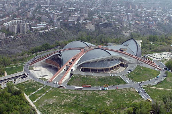
The race begins at the Karen Demirchyan Sports and Music Complex (or simply "Hamalir" ("Complex") in Armenian), a large cultural centre and sporting venue opened in the 1980s and renamed after former parliament speaker Karen Demirchyan, one of those assassinated in the parliament shootings in 1999. The pre-race can therefore include an acknowledgement at the nearby Armenian Genocide Memorial if desired.

mount-aragats-armenia.jpg


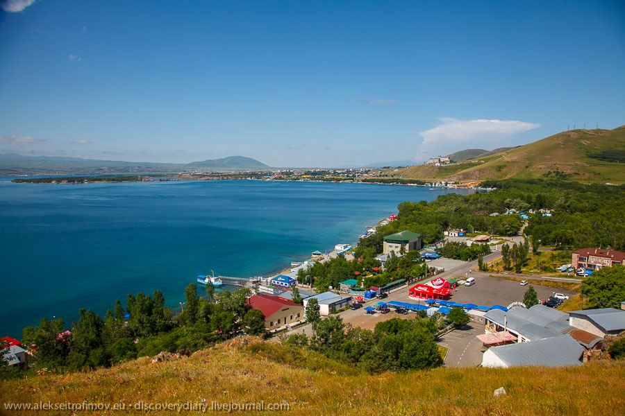
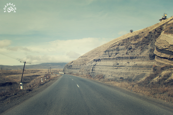
The actual stage sees the riders head around the southern and western base of Mount Aragats, the highest point in modern Armenia. This colossus overlooks Yerevan from the north, and was therefore part of one of the toughest stages of Steven Roots' Silk Road Tour. Here we bypass it, instead heading along the plateau (around 900-1000m above sea level) through towns like Armavir before transitioning to the higher plateau (around 1500-1600m above sea level) where we're finishing by way of two gradual climbs, the first being significantly longer and therefore garnering the higher categorization. There are some dramatic sights here, such as the remains of the 10th-century Dashtadem Fortress, but once we're done with the uphill, there's nearly 50km still remaining and with none of the climbing really having got up above 5-6%, this will be more about attrition than really putting the hurt on. Nevertheless, altitude can play a role; we're not used to flat stages this high up, although we certainly won't be seeing the kind of effect that you see in Qinghai Lake or Colorado.

01d61223270775.56321bf3ad4e4.jpg


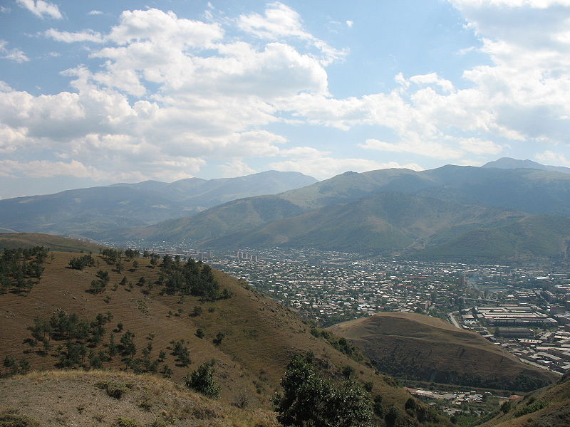
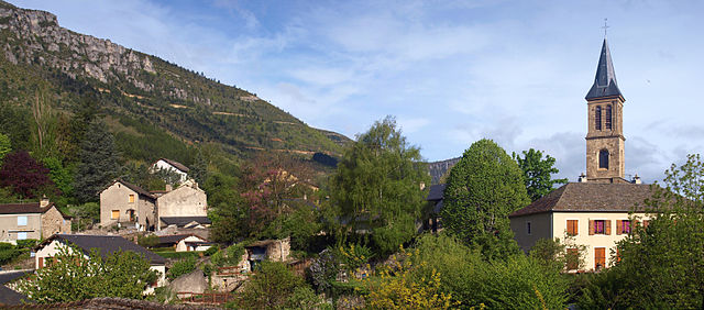
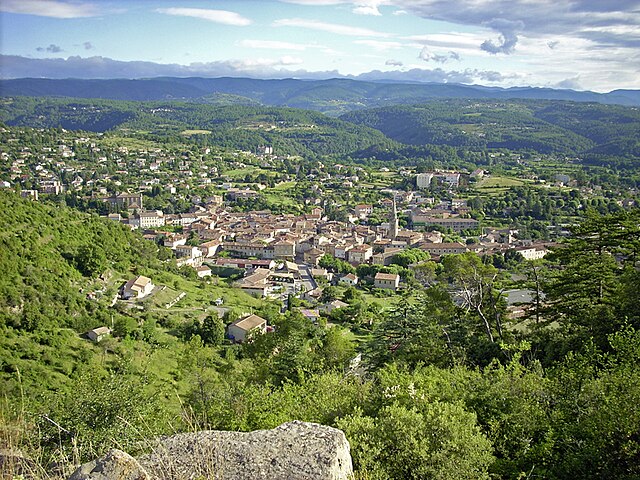
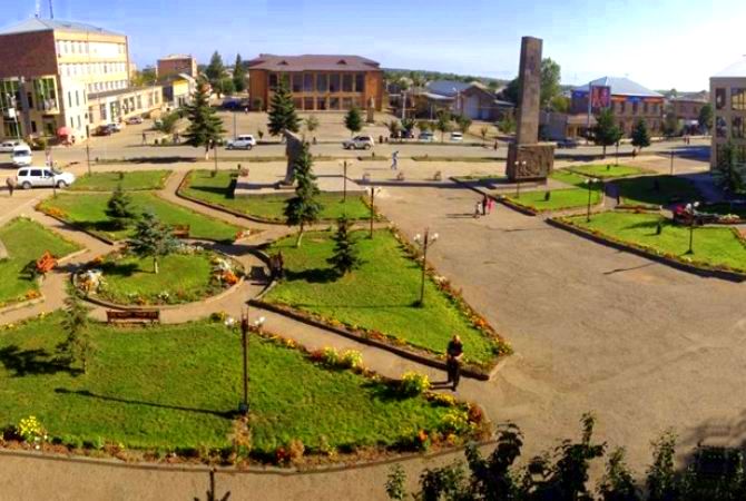
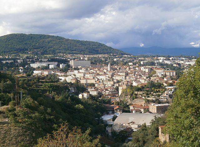
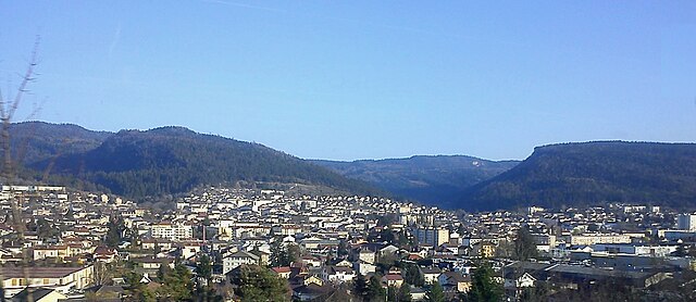
The stage finish comes in the city of Gyumri, the second largest city in the country with a population of 120.000. It is also the hometown of perhaps the one famous cyclist Armenia has produced, although he elected to represent Russia after the fall of the Soviet Union - Vyacheslav Djavanian. Djavanian was born in Gyumri in 1969 and went on to moderate success in the 90s with Sputnik, Roslotto and eventually Big Mat-Auber '93. His greatest triumph was the overall win at the 1996 Tour de Pologne, but he also managed 2nd (behind Tonkov) in the Settimana Bergamasca, an overall GC win at the Vuelta a Uruguay, and entered five GTs (two Giri, two Tours and a Vuelta) albeit without success. Djavanian's strength was from somewhat reduced groups, so hopefully he'll be on hand to watch the same thing pan out here as we finish with a fast city centre circuit taking in the sights of the city before finishing at Vartanants Square (the finish will be on the top right corner of the square as per below:

VardanantsSquareGyumri.jpg
 
So far I've created 2 versions of the Giro, a Paris-Nice and a Tour de Suisse.

My next project will either be a version of Criterium Dauphine or perhaps a Deutschland Rundfahrt. I have thought about the latter for quite some time, but there have been so many versions of this race the last year, so I've put it on ice for a time. Maybe now the time has come.
 
Stage 2: Gyumri - Vanadzor, 140km

2nanviv.png


5v0k1g.png


Zero transfer for the riders today, and it should sort out the general GC order for the most part here. Altitude is starting to come into it (we get up over 2000m) but since this is an Asia Tour .2 race, it's a pretty short stage. We should be in teams of six here as well as this will help keep it difficult to control; we should also get a strongish break as we immediately get our first climb, the Lusaghbyur pass.

94780990.jpg


After this there is a long slightly downhill run which will enable the break to consolidate its advantage and also allow the group to get a first view of the finish town of Vanadzor and an intermediate sprint after just 60km. This then leads to our low point of the stage, around 900m above sea level in a scenic and attractive river gorge.

alaverdi-3-1.jpg


We then see a double-header of short, sharp puncheur ascents (this is the start of the first), before the false flat starts to ascend again; this eventually leads into the main climb of the day, a 12km tempo-grinder at just over 5%, which is mostly at a consistent gradient, which finishes just over 20km from the finish. This climb is not going to destroy everybody, especially with its lack of tougher ramps, but it will sort out the group of people who will be competing for the victory overall at least. It passes by the Stepanavan Dendropark, a scenic arboretum, and up a winding road over the final climb, and then the descent to the line starts off technical and then opens out.

Armenia-Vanadzor-2.jpg


The finishing city of the day, Vanadzor, is the third largest city in Armenia, although its population is in relatively rapid decline, with the population hæmorrhaging towards Yerevan and overseas. Originally named Gharakilisa (Karakilisa to Russians), it was renamed Kirovakan after a prominent Bolshevik, Sergey Kirov, with an Armenian suffix, during the Soviet period, but was renamed to its present name shortly after the fall of the USSR. With a population of 90.000 and a scenic valley setting, this should be good.
 
Phew, my second tour without Alps and Pyrenees is taking me waaaay longer to publish than I anticipated.

We're on the second friday of the race and entering a tryptich in the Massif Central. The first stage will be the most difficult of the three, because I think if you finish with the most difficult, the easier preceding stages will be softpedalled.
So, let's take a look...

Tour de France sans Alpes et Pyrenées n°2, stage 12: Albi - Millau/Le Cade: 222.5km, medium mountains + MTF

This stage starts in the finishtown of stage 10. After the official start the peloton will follow the course of the river Tarn upstream for slightly less than fifty flat km. This stretch of the river is already past the famous Gorges du Tarn, who are more upstream, but villages like Ambialet, after 25km, are still located in a picturesque setting.
640px-Ambialet_vue2.JPG

The surrounding hills are towering ever more above the river banks, the hills become steeper and after 49km the stage turns left, following the D534, past Connac and to the Puech des Mothes, the first climb of the day. After a few kilometres on a plateau, the road plunges back to the banks of the Tarn. After a river crossing and some flat, the stage now climbs some hills on the left bank and once again loops back to the valley.
Another river crossing leads to the fourth climb of the day and another descent to the river a bit after the halfway point. The small village of Le Truel marks the start of the steepest climb of the day. Although only 4.6km long, the Puech de la Selle narrowly gets a double digit average gradient.
The pattern of climbing the hills on one side of the river, crossing it and then climb the other side remains the same, but while climbing the col de la Vernhette, the course diverges way further from the Tarn than before. Not surprisingly, this is the longest climb of the day and also has the highest elevation gain.
This is the last climb before the peloton reaches Millau, today's finish location.

640px-MILLAU_%2Cvue_g%C3%A9n%C3%A9rale.jpg


The stage won't finish in the town center, however. Before the final climb, there will be a loop south of Millau, climbing the Col de Brunas, short but rather steep. Then, after 215km up and down, with already more than 4000m elevation gain the final difficulty of the day awaits the peloton.

14uv120.gif


The climb to Le Cade featured in the 1987 Tour de France, as the finish of stage 16. That stage was won by Régis Clère after a long breakaway, while the favorites watched each other and only attacked in the final kilometres.

Map & Profile:
1zmf815.jpg


Climbs:
Le Puech des Mothes: km56; 6.1km @ 6%; 3rd cat
Côte de Cazelles: km76; 4.8km @ 6.8%; 3rd cat
Côte de Fontanilles: km82.5; 1.8km @ 5%; 4th cat
Le Puech d'Oulivas: km99.5; 6.6km @ 5.5%; 3rd cat
Le Puech de la Selle: km118.5; 4.6km @ 10%; 2nd cat
Col de la Baraque: km135; 5km @ 6.5%; 3rd cat
Col de la Vernhette: km166.5; 10.8km @ 6%; 2nd cat
Côte du Vergnnou: km183; 2.8km @ 5.1%; 4th cat
Col de Brunas: km202.5; 4km @ 8.1%; 2nd cat
Le Cade: km222; 7.4km @ 6.4%; 2nd cat
 
Stage 3: Sevan - Sevan, 210km

33ljscg.png


2zstus1.png


The longest stage of the Tour of Armenia is also the flattest; very little really to say about this one from a parcours obstacles perspective; the biggest issue for the péloton will be that this flat stage takes place at just under 2000m altitude; this is perhaps not likely to have the same kind of effect as the similar type of stage that we see in the Tour of Qinghai Lake or in flatter stages of the USA Pro Cycling Challenge, but given the lesser depth of the péloton we could still see greater attrition than you might expect in this kind of stage. The stage circles Lake Sevan, the largest lake in Armenia, and should ensure some beautiful scenery for the bunch while they enjoy a humid but mountainless day in the saddle.

lake_sevan_894x540_g66-jpg.jpg


Travelling between the M14 highway - which we use along the northern shores of the lake - and the Azerbaijani border can be troublesome at times owing to the strained relationship between the two countries, but sticking to the main roads themselves will cause no problems. The lake is an attractive natural beauty spot that holds many spa towns and resorts for Armenians, so this will be at least a pleasant spot for helicam footage and action shots of the bunch along the lakeside. The city of Sevan itself, which hosts the start and finish of the stage, is one of the country's most popular resorts, a small spa town of around 20.000 inhabitants.

IMG_34653-LAKE-SEVAN.JPG


With races like my Vuelta a Bariloche and in the Tour of Finland it will no doubt be clear by now that I love the tranquility and scenery of lakeland, so to place a stage around the natural park setting here is perhaps one of the only ways to satisfactorily crowbar a flat stage into the race, even if it has to be over 200km in length, uncommon for .2 races.

flying-home-003.jpg
 
Back again with the Tour de Suisse. This is taking longer than expected, due to day to day life.

Tour de Suisse Stage 5: Aarau - Luzern (159km) (Medium Mountains)


Climbs:
Walhus (6.5km @ 3.7%) Cat 3 (@ 33.5km)
Michealskreuz (3.6km @ 9.2%) Cat 2 (@ 57.8km, 86.7km, 115.7km, 144.6km)

Sprints:
Luzern @ 101.6km
Luzern @ 129.6km

Feed zone:
Luzern @ 72.5km

Today we start in Aaraufor the fifth stage of the swiss national tour. The riders will head south towards Reinach. This is where the riders start the Waldhus climb. Not the most difficult, nor long, so if the break hasn't gone yet, it will most likely start here.

The riders keep ploughing in the south east direction towards Root. The riders then head up the next climb for the first time of the day. This is the Michealskreuz. At 3.6km long, it most certainly isn't the longest climb in the world. Plus at 9.2% average, it isn't the steepest. But climbed four times and the last time up coming 14kms from the finish, this and the rolling downhill will definitely decide the day's winner.


A fight for positioning will most likely happen on at least the final three times up there, as this image in the hyperlink here shows the different widths of roads. The two primes and the feed zone take place just after crossing the finish line on the laps that they feature on, in Luzern/Lucerne.


Aarau:
aarau.jpg


Luzern:
cityscape-lake-lucerne-lucerne-switzerland_main.jpg
 
Jun 25, 2015
62
0
0
Visit site
I'm really enjoying the recent Tours. After designing the Tour of Cambodia I was keen to find another country in Asia that could hold a 2.2 stage race. My initial idea was to stay in the Far East and I had my heart set on a tour of Jeju, an island which sits roughly between South Korea and Japan. However, Croneoscalada wouldn't track the roads on the island so I decided to head towards Libertine and do the Tour of Issyk Kul.
Issyk Kul is the second largest mountain lake in the world, by volume, after Lake Titikaka. Its located in Kyrgyzstan, but closely borders both Kazakhstan and China. It's one of the biggest tourist destinations in Kyrgyzstan so there's plenty of decent hotels and accommodation on the northern coast of the lake.
In terms of date, the height of Issyk Kul at above 1,000m, means that the race can only really be run between May and August.
May: A May race would need to be held towards the end of the month and that puts us in direct competition with the Tour of Iran and Tour of Japan. Tour of Japan is less of a threat but we would expect the same teams that would race in Iran to race here so May doesn't work.
June: June looks more promising. There's only two races this month and they finish on the 19th of June. After that, it's almost a month until the Tour of Qinghai Lake begins. A date at the end of June, creeping into July, might well be best.
July: July is mostly taken up with the Tour of Qinghai Lake and we don't want to compete against that. That really only leaves the start of the month which is what we considered above.
August: The Tour of Singkarak and Tour of Borneo take up 14 days of the month. The end of the month, creeping into September, will leave us at the whim of the weather so earlier suits us better. However, there's not much time at the start of the month to fit the race in without competing against another race in the Asian Tour so August probably isn't workable either.

Date - I've decided to go for the 29th of June as a start date running into early July.

Stage 1 - Bishkek - Bishkek - 97.9km

Screen Shot 2016-05-11 at 2.54.20 PM by Sam Larner, on Flickr

Screen Shot 2016-05-11 at 2.57.17 PM by Sam Larner, on Flickr

A lovely easy stage to start the race. We're in Bishkek, which isn't really that close to Issyk Kul, but for commercial reasons it makes sense to begin in the largest city. The route will take the riders north past the US Airforce base in Manas, where the first sprint will be, and continue north towards Uspenovka. The long road north is cut short though by a turn to the east towards the west bank of the Chu river. The Chu acts as the natural boarder between Kyrgyzstan and Kazakhstan. The riders will be able to look across and into Kazakhstan but they won't need their passports until tomorrow. The second half of the stage takes the riders back into Bishkek for two laps of a rolling finishing circuit. The last 50km are almost entirely uphill but not steep enough that you would actually notice.

Stage 2 - Bishkek - Balykchy - 198.6km

Screen Shot 2016-05-11 at 2.54.56 PM by Sam Larner, on Flickr

Screen Shot 2016-05-11 at 2.57.44 PM by Sam Larner, on Flickr

There's no climbs again today but the finish line sits 867m higher than the start. The day is dominated by the Chu river. The riders will head east out of Bishkek and cross over the Chu and into Kazakhstan shortly after the start of the stage. They will stay in Kazakhstan until 80km from the start when they will again cross the Chu at Tokmok and carry on south east on the west bank of the river. Shortly before the second intermediate sprint, Krasnyy Most, they will say goodbye to the river as it heads east to find it's source. The riders will continue their upwards plod towards the lake. The final few kilometers are the only flat ones of the race and they will take the peloton to the finish in Balykchy on the west end of the lake.
 
Jun 25, 2015
62
0
0
Visit site
Stage 3 - Balykchy - Pereval Ozernyy - 128.4km

Screen Shot 2016-05-11 at 2.55.48 PM by Sam Larner, on Flickr

Screen Shot 2016-05-11 at 2.58.13 PM by Sam Larner, on Flickr

This is the Queen stage and an absolutely brutal few hours on the bike. The first 60km are pan flat but, they're still well above 1,000m, the next 68km though are cruel and painful. The riders will turn off the main road onto a gravel strewn strip of dusty mud for the climb towards Pereval Kok. The climb, at 28.7km and 7.4% is virtually the Col de la Bonnette but on dirt roads and another 900m higher. A delicate descent follows before the final climb to Pereval Ozernyy. The climb is much steadier and shorter than the preceding one but the suffering will have added up as they grind towards the Kazakh border. Whoever is in yellow at the top of this climb will probably still be in yellow when the race finishes.

Stage 4 - Cholpon Ata - Karakol - 139.1km

Screen Shot 2016-05-11 at 2.56.17 PM by Sam Larner, on Flickr

Screen Shot 2016-05-11 at 2.58.44 PM by Sam Larner, on Flickr

This will feel like an easy stage for the riders, we're heading east around the lake to the far eastern shoreline. The stage is virtually flat with just gradual rolling sections, including the final uphill drag to the line. The wind is liable to pick up around the lake so there could be an opportunity to split the peloton. It's probably going to be one for the sprinters though.

Stage 5 - Kyzyl Suu - Balykchy - 187.7km

Screen Shot 2016-05-11 at 2.56.43 PM by Sam Larner, on Flickr

Screen Shot 2016-05-11 at 2.59.03 PM by Sam Larner, on Flickr

We're continuing our circumnavigation of the lake with this final stage. We're starting on the south bank and heading back round to Balykchy, the second time a stage will finish in this town. The mid section of the stage features long climbs, as the road turns away from the lake, but they shouldn't cause too much difficulty. The view will be stunning all day though as the Tian Shen mountains will stay on their right hand side for the entire stage. They might not be much comfort though if the pace or wind increases. Whoever takes yellow after this stage will be a fully deserving victor of this very tough race.
 
Tour de France sans Alpes et Pyrenées n°2, stage 13: Millau - Les Vans: 183km, medium mountains

From yesterday's finish town, Millau, the peloton will follow the course of the Tarn and later the Jonte, where it will have time to admire the Gorges de la Jonte for a while.

640px-Gorges_de_la_Jonte.JPG


After 25km the gentle climb to the Causse Méjean, a deserted highland, bordered by the canyons of the Tarn the Jonte and the Tarnon, will start. The riders can enjoy the scenery for about 25km before they descend to Florac, after which the long uphill drag to the Col de la Croix de Berthel will start.

640px-Florac-panorama-2.jpg


The long descent to Genolhac, first rather steep and later rolling, will give way to the start of the Col du Pré de la Dame. This little known climb is one of the most difficult of the Massif Central, along with the Puy de Dome and Col de la Luzette (but more regular and less steep than those two climbs). This is a real 1st category climb, that would have an impact on any mountain stage.

16h7zma.gif


The descent lasts for 25km, first similar to the ascent until a small bump in Villefort and later flattening out to the start of the final climb of the day: the two stepped Col des Remises de Serre. The first part of a bit more than 2km at 6.2% is followed by a slowly descending kilometer, before the final and steepest part of the climb resumes: 3.8km @ 7.9%. An easy descent ends in the Small town of Les Vans.

640px-Les_Vans_08.JPG


Map & Profile:
qyfldv.jpg


Climbs:
Côte de la Borie: km36; 10.4km @ 4.7%; 3rd cat
Côte du Tourelle: km44.5; 2km @ 5.2%; 4th cat
Col du Pré de la Dame: km135; 15km @ 6.4%; 1st cat
Col des Remises de Serre: km166; 7.1km @ 6.1%; 2nd cat
 
The scale in Issyk-Kul is slightly confusing, makes the climbs at 3% look like monsters, but Pereval Kok at that kind of severity even on perfect Tour of California tarmac would be a beast. Closer to traditional cycling heartlands, I've always liked Pré de la Dame.

Stage 4: Hrazdan - Tsaghkadzor, 19,8km (ITT)

15heoht.png


30keznt.png


Tests against the clock are fairly infrequent on the Asia Tour. In fact, outside of regional, continental and national championships last year, this is the full list of UCI Asia Tour races with time trials:
- Tour of Qatar
- Tour of Japan (prologue only)
- Tour of Kumano
- Tour of China I
- Tour of Borneo
- Jelajah Malaysia (team time trial)
- Tour of al-Zubairah (prologue only)

The Tour of Borneo TT, at 27km, was by far the longest.

But how are the riders on this circuit to improve if they never get the chance to race them? After all, we've seen riders like David McCann and Eugen Wacker stomping Asia Tour time trials for countless years, and now they're in their 40s and for the most part gone, that's seemingly that for an entire breed of cyclist unless they are lucky enough to make it in Europe or get signed to race in North America.

Not that my time trial here in Armenia is a pure time triallists' race, but it is helped by the location of the M4 motorway slightly away from the town of Hrazdan, connecting Yerevan with Lake Sevan but bypassing the town slightly, leaving us with the access roads around Hrazdan to use in the time trial with the minimum of disruption, which is nice.

29872890.jpg


Hrazdan, named after the river of the same name which flows through the area between Lake Sevan and the scenic gorge which divides Yerevan, is a city of around 40.000 inhabitants divided into two distinct halves, separated by a line made up of hills to the southeast and a reservoir to the northwest. The city's most notable feature is probably the thermal power plant which has been in construction for many years and launched recently.

5923FDE2-A0C8-41BF-9C69-18CF249E59AB_mw800_mh600_s.jpg


We start in the northwestern part of town and so the first few kilometres of the ITT are uphill at a fairly constant drag of just under 4%. After this we descend down to cross the isthmus of the Hrazdan reservoir.

31902656.jpg


Returning almost to where we started, the riders then finish the time trial with an uphill climb of around 4,5km at an average of 5%, which is mostly around 5,5% with a bit of an easing off through the village of Tsaghkadzor itself before ramping up briefly to around 7%; Tsaghkadzor is a popular spa town in the mountains which also functions as the country's main ski resort. Formerly known as Kecharyuk from the building in the 11th century of the famous Kecharis Monastery until 1947, the mountain village was developed into a resort town in the Soviet era, and now provides Armenia's foremost wintersports facilities, although granted given the country's marginal position in those sports that doesn't exactly lend it a comparison with, say, Holmenkollen or Garmisch-Partenkirchen.

Marriott.png


Nevertheless, one of the main factors in this time trial will be the fact that it's taking place between 1700 and 2000m above sea level, which is fairly uncommon, and that the field will likely not include many specialists. This should be pretty interesting ahead of the weekend's closing stages.
 
Tour de France sans Alpes et Pyrenées n°2, stage 14: Vallon Pont-d'Arc - Privas:195 km, medium mountains

After a short transfer from Les Vans to Vallon Pont-d'Arc the peloton can take of for the 14th stage. It is raced on the 3rd sunday of this tour, and right before a restday. So, one might expect some extra efforts from the heads of state, if the terrain allows it. It won't be the most difficult stage of this tour, but it has a quite tricky final, often raced on sinuous, narrow roads with a fair share of climbs.

Vallon Pont-d'Arc got its name from a natural rock arch spanning the Ardèche and is known for the many prehistoric caves on its territory, one of them having the oldest cave paintings known. The town will also host the finish of stage 13 of the 2016 TdF, a 37km long TT.


Map & Profile

ej2j7.jpg

nh105d.jpg


Climbs:
Col de la Croix Millet: km32.5; 6.6km @ 6.1%; 3rd cat
Col de Gabriélou: km 72; 14km @ 5.1%; 2nd cat
Col de Joux: km99; 3.6km @ 6.3%; 3rd cat
Col de Serre Don: km123; 6km @ 8.8%; 1st cat
Col des Fourches: km132.5; 5.4km @ 5.4%; 3rd cat
Col de Serre des Arches: km 149.5; 4.8km @ 5.2%; 3rd cat
Col de la Croix de Ferrières: km 163; 4.6km @ 6.8%; 3rd cat
Côte de Cordon Blanc: km 181; 3.5km @ 9.7%; 2nd cat
 
Rundfahrt Tirol/Giro del Tirolo Stage 6: Bolzano - Brunico 216.2km

vv2xplh.png


Straight after the flat, open TT, we have a massive mountain day. Over 6000m climbed over more than 200km with 6 cols, all very hard, and climbing straight from the go. There is very little flat throughout the stage, only a bit after the final climb and some false flats between or during other climbs.

The riders will roll out of Bolzano straight ontothe Obergummer, arguably the hardest climb of the day. This will immediately create a gruppetto and a very strong break. After cresting that, the riders head downhill(ish) for a bit before encountering the second half of Passo Costalunga, a climb steeped in Giro history. It was meant to be used in 2013, but was cancelled, so the most recent time it was used was 2005, in the same stage that Passo delle Erbe was last used (albeit from the other, harder side). It was the start of Basso's downfall that year.

dwnvdMV.jpg


After a shallow and long descent we start the climb up to Compatsch. The whole climb was used back in 2009, in an unusual stage, very short, won by Menchov. This is year the MTT in this year's Giro will take place, just a much shorter version. It is a tremendously beautiful plateau at the top, with the Sciliar just next to the riders, the Sassolungo range right in front and the Catinaccio range in between. There is a steep, technical downhill with a bump in the middle that explains the massive peak halfway down in the profile. The San Pietro climb is next, and is pretty hard, and will make the group even more select.

5no0MSI.jpg


Then comes Passo delle Erbe. Here the stage should start proper. Unfortunately, the climb is the easier side, so attcks an only come in the middle section, which is about 6km at 9%, which is hard. But, then comes a long false flat. The descent is very steep and technical. The little kick up shouldn't be any problem, it's only about 6%. Then comes the final climb of the day: Passo di Furcia. I only gave it a Cat 2, but it is a seriously hard climb. Last used in the Giro 10 years ago, where it came just before Plan de Corones (how this stage was initially planned to go), it has three kilometres that average 1975, maxing at almost 15%. In an easy stage, it should be hard enough to create a selection and gaps of about 20" at the top. Today, I'm hoping for bigger gaps, that are only extended by the descent and flat to Brunico.

FurciaW.gif

B-3546-bruneck-brunico.jpg
 
rghysens said:
Tour de France sans Alpes et Pyrenées n°2, stage 13: Millau - Les Vans: 183km, medium mountains


The descent lasts for 25km, first similar to the ascent until a small bump in Villefort and later flattening out to the start of the final climb of the day: the two stepped Col des Remises de Serre. The first part of a bit more than 2km at 6.2% is followed by a slowly descending kilometer, before the final and steepest part of the climb resumes: 3.8km @ 7.9%. An easy descent ends in the Small town of Les Vans.

Map & Profile:
qyfldv.jpg


Climbs:
Côte de la Borie: km36; 10.4km @ 4.7%; 3rd cat
Côte du Tourelle: km44.5; 2km @ 5.2%; 4th cat
Col du Pré de la Dame: km135; 15km @ 6.4%; 1st cat
Col des Remises de Serre: km166; 7.1km @ 6.1%; 2nd cat

Nice stage. I know the area around Villefort and Les Vans. Les Vans is a very small town, and personally I don't think the roads are wide enough for the Tour de France. Having said that, the giro finish in Arezzo is on a very narrow road (And today, but today was an ITT). Arezzo is better for a stage finish than Les Vans as it is slightly uphill so the slower pace. However the speed the riders will come of the Col des Remises de Serre/Col de Mas de l'Ayre, will be pretty high.

Villefort has a more of a main road rather than a oneway system in the town square, so you could possibly head through Villefort, up the Col des Remises de Serre, on towards the false flat to the top of the Col de Mas de l'Ayre, and down into Villefort for the finish. If you wanted an uphill finish, then you could do that loop, then head out to the Lac de Villefort and finish around the Plage de Villefort, just before the hairpin on the road to Le Bastide Puylaurent.
 
Stage 5: Yerevan - Martuni, 183km

25gyuqb.png


6gaeyh.png


We return to the capital of Armenia, which, just as in stage 1, serves as the start of the stage. This penultimate stage is the queen stage of the race, featuring the most serious climbing and therefore the most realistic opportunity for Mirsamad Pourseyedi to put three minutes on the field. There are some much more difficult climbs in Armenia, but these either feature roads that are far too narrow to be viable, or are in areas too isolated from large enough urban centres to host the race and/or are close to disputed border areas that make them very risky to include in a race (then again, I included a stage way back when climbing to the Mount Hermon Ski Resort...). Therefore we settle for these two more than solid climbs to break the bunch apart after yesterday's time trial.

An early hill up to the Yerevan suburb of Nubarashen (formerly an independent town which has now been swallowed by the capital) - around 2km at 6% - should allow a strongish break, but really, the main early part of the stage is about following the roads southeastward close to the Turkish border, keeping in clear view that great Armenian national symbol that presently lies across the border in Turkey, the fabled Mount Ararat.

mount-ararat_1.jpg


The riders can thank their lucky stars they're not climbing THAT on their travels today, but the ease of this early part of the stage ends quickly. Shortly before the town of Ararat, named, obviously, after the mountain, the road turns to uphill false flat which gradually increases in steepness; after the town of Urtsadzor, which offers a brief respite into which I have inserted the first intermediate sprint, this becomes a full-blown climb, the Lanjar Pass, which is 20km long at an average of 5%, with its steepest section, in the second half, being 8km at a little under 7% and with a steepest kilometre at just over 8%

308ir5y.png


832180.jpg


This climb will shell a lot of the chaff in a mixed-level péloton, and then a long and two stepped descent will ensure. The second climb of the day is the important one. With its final 13km at 6%, the Vardenyats Pass is one of the most famous in Armenia, albeit still mainly known by its previous informal name of Selim. As a climb it's almost 30km long although large amounts of false flat mean that its overall gradient is only 4,4% - don't be fooled however, as that second half is definitely serious enough to break things apart, especially given the altitude as we reach 2400m in the stage. At the top of the pass lies Orbelian Caravanserai, the most well-preserved of all of Armenia's caravanserais, and a reason I considered a mountaintop finish.

imgp0574.800.jpg


b5BZU4hja_M.jpg


With its dramatic switchbacks and scenery, this is a proper cycling-style mountain pass, tricky but not with the kind of slaughterhouse gradients we've grown familiar with; long and winding, this road will settle the GC, since it ceases just 24 kilometres of gentle downhill from the line. Knowing the way the race breaks up in the Asia Tour, this will be a key stage even without the MTF; yesterday's time trial will only exacerbate the gaps needed to make this one work.

zx9rvl.png


The city of Martuni, where we finish, is close to the southern tip of Lake Sevan, so serves as a resort town of enough size to host the finish trappings before the riders return to Yerevan (I wanted to keep the transport down to keep costs down and make the race more viable).

Martuni_central_square%2C_Armenia.jpg
 
Tour de France sans Alpes et Pyrenées n°2, stage 15: Aubenas - Carpentras: 123.5km, flat

After a well deserved restday in the scenic Ardèche region and a short transfer, the peloton will start the final week of this Tour in Aubenas.

800px-Aubenas_profil.JPG


From there it heads south to Vallon Pont d'Arc and will cover a port of the first itt of the 2016 TdF in the opposite direction, including the steep climb to the Belverdère du Serre de Tourre.

2iazuo3.jpg


The next 30km are on the sinuous and rolling road above the gorges de l'Ardèche, followed by a gentle descent to the Rhône valley and the final dash to Carpentras, in the vicinity of the Mont Ventoux.

Map & profile:
2qv6u8n.jpg


Climbs
Côte du Serre de Tourre: km35; 2.8km @ 8%; 3rd cat
 
Tour de France sans ALpes et Pyrenées n°2, stage 16: Orange - Tournon-sur-Rhône: 163km, hilly

The 16th stage of this Tour starts in Orange, a city with a rich Roman heritage and home to the Dutch royal family.
640px-ORANGE-centreville_aerienne.jpg


The course heads to Valréas and then to the Rhône, which is followed upstream to today's finish location, Tournon-sur-Rhône. The finishline is crossed for a first time after 139km, but then a nasty circuit of 24km in the hills west of town awaits the peloton before the conclusion on the quai Marc Segain.

640px-Tournon-sur-Rh%C3%B4ne_-_Ard%C3%A8che.JPG


Map & Profile
2ci7dc1.jpg

2hp7skg.jpg


Climbs:
Côte de Bary: km143.5; 2km @ 11%; 3rd cat
Côte de Meyras: km154.5; 3.8km @ 7.8%; 3rd cat
 
Tour de France sans Alpes et Pyrenées n°2, stage 17: Annonay-Davézieux - Tarare: 179km, medium mountains

The most populated town of the Ardèche region (although counting only 16000 inhabitants) will be the start of the 17th stage.

640px-Annonay%2C_vue_g%C3%A9n%C3%A9rale_depuis_Vissenty.JPG


From Annonay this stage goes north to cross the regional natural park of the Pilat, named after the culminating point of the area. Although there are some well-known climbs to tackle like the Col de la Republique, the Crêt d'Oeillon or the Croix de Chaubouret, this stage will remain on the lower slopes of the mountains.From the Collet de Doizieu, the highest point of the stage, the peloton will descend to the river Gier and cross it, to enter the rugged Monts du Lyonnais.

rj4hvb.jpg


This is a very hilly to mountainous region west of Lyon, with summits around 800-900m above sea level and valley floors around 300-400 asl. The remainder of the stage the course will criss-cross this region, generally heading north to Tarare, the finish town of today. The roads are often quite narrow, but of decent (not superb) quality.

Map & Profile
9hnm6p.jpg


Climbs:
Côte des Sagnes: km7; 6.4km @ 3.5%; 4th cat
Côte de Bassin: km31; 5.2km @ 6.9%; 2nd cat
Collet de Doizieu: km45; 7.1km @ 6.1%; 2nd cat
Côte de Cellieu: km68; 4.4km @ 5.4%; 3rd cat
Col de Fontagneux: km80; 6.2km @ 8.2% (final of 3km @ 11.3%); 1st cat
Côte de Saint-André-la-Côte: km97.5; 4.8km @ 6.1%; 3rd cat
Côte d'Yzeron: km116.5; 5.8km @ 6.4%; 2nd cat
Côte des Avergues: km134; 3.8km @ 8.7%; 2nd cat
Côte de Brussieu: km145; 1km @ 11%; 3rd cat
Côte de Jussieu: km150; 1.2km @ 8.4%; 4th cat
Le Crêt Montmain: km155; 3.3km @ 8.1%; 3rd cat
Côte de la Brigadière: km162; 3km @ 11.3%; 2nd cat
Côte du Ruy: km 173: 1.2km @ 12%; 3rd cat


Next two stages will be in the French Jura.
 
Aug 21, 2015
380
0
0
Visit site
College is done for the semester so I am going to start pumping out Tour of California stages here soon. Will post a recap of the first 2 stages when I do so as it has been quite a while.

Been busy with other potential projects as well including a couple stages in the Death Valley Las Vegas area, a New England stage race, and a Giro is taking shape in the distance.
 
Tour de France sans Alpes et Pyrenées n°2, stage 18: Ambérieu-en-Bugey - Oyonnax: 201km, medium mountains

After a quite long transfer (almost 100km, but mainly on highways), the race caravan arrives in Ambérieu-en-Bugey, a small town between the Ain and Rhône, and at the foot of the Jura. A direct way between today's start and finish will only take some 55 flat to rolling kilometres, but the riders won't take the direct road. Not at all.
The first 10km of the race are still benign, but after that the road starts to climb and for much of the stage it's either uphill or downhill, until the finish in Oyonnax.

640px-Oyonnax_01.jpg


Map & profile:
2cy4as2.jpg


Climbs:
Colline des Moutons: km16; 4.8km @ 8.1%; 2nd cat
Col du Sappel: km41; 8km @ 5.9%; 2nd cat
Côte de Meyriat: km58; 7km @ 4.6%; 3rd cat
Col de Richmond: km78.5; 6.4km @ 5%; 3rd cat
Col de Cuvery: km104; 9.4km @ 6.4%; 1st cat
Côte de Montanges: km130; 2.6km @ 4.6%; 4th cat
Col de Menthières: km144; 9.4km @ 6.2%; 1st cat
Col de l'Auger: km164; 5.2km @ 10.3%; 1st cat
Col du Sentier: km189.5; 5.8km @ 6.7%; 2nd cat
 
Tour de France sans Alpes et Pyrenées n°2, stage 19: Oyonnax - Divonne-les-Bains: 201km, medium mountains

No transfers between stages 18 and 19, the riders will be spared of that extra hassle.
The first half of the stage covers more or less the same area as the previous one (albeit on different roads), while the second half will venture more northeast, finding its way more or less parallel with the French/Swiss border. There's a bit more flat in between climbs in this stage, but the two last climbs are come rather quick after eachother. That means there's not too much time to recover a bit.
Divonne-les-Bains hosted the Tour several times (both as finish and start for stages) in the late 1960's and early 1970's, but has never received the Tour since that time.

Map & Profile:
9qh8oy.jpg


Climbs:
Col du Berthiand: km 39.5; 6.5km @ 7.5%; 2nd cat
Côte de Métral: km82.5; 6.2km @ 6%; 3rd cat
Col de la Rasse: km106.5; 8.8km @ 6.9%; 1st cat
Côte de Mont Chanais: km136.5; 6.8km @ 6.5%; 2nd cat
Col de Combe Blanche: km 164; 11.4km @ 6.9%; 1st cat
Col de Majorat: km 190.5; 4km @ 10.9%; 1st cat


Stage 20: the usual parade on the Champs Elysées: about 100-125km long, flat

From Divonne to Genève with busses, than a tgv to Paris. Than an evening criterium.
 
Mayomaniac said:
I'm ok with that I like the idea of a less backloaded Giro, but then I want a few really hard mountain stages (mosty medium mountains) durning the first week. The idea behind the 2009 Giro was interesting, even if the actual route was pretty poor. You could find a way to have the Dolomites in the first week, there are lots of great climbs that finish below 2000m.
Even if it's not the Dolomites in the first week, just give us really hard medium mountain stages that have the potential to be total carnage.
This was posted by Mayomaniac on the thread for todays giro stage and I just wanted to repost it because I found it very ironic that exactly when I decide to post a giro which starts in the Alps someone posts this.

I got the idea of doing such a giro because of a few reasons.
-I wanted to do a giro a bit like in 2009 route but good :D
-Secondly I liked the idea to make a hard first week so we already have an idea of how the gc might look at the end but it's still very open since the riders have basically two weeks left to attack the leader and because the shape might change. (take this years giro for example. Nibali might have lost a lot of time to some other riders who seemed to be in better shape in the first week, but there never was a really big gc battle so he is still in a very good situation)
-Thirdly I really like medium mountain stages but they usually only lead to decent time gaps in the first week because later in the race the gc riders usually have better chances to gain time than a few 3rd category climbs. Of course I will still make a few mountain stages in the southern part of italy too though, which already leads me to the next reason.
-The gc gets decided on different climbs. There are many famous climbs in the south of italy, but just none of them are as famous as climbs like Mortirolo/Zoncolan/Stelvio/Giau/Fed...nah, that one isnt so great. However Lanciano/Sella di Leonessa/... are harder than many legendary ascents in the alps but in the last years never were crucial for the gc of a giro, which in my opinion should change. IMO passes like that deserve to be legendary just like so many passes in the alps and as we have seen with climbs like Finestre or Zoncolan a climb doesnt need to be included since ages to become famous.
-I wanted to start a giro in Austria. Quite a simple reason but seeing the 100th gt start in the Netherlands just made me want a start in my home country once again.

Okay, I will post my first stage tomorrow, it's just too late already to do the write up for stage one. I was watching the presidential election debate in Austria so I didnt have tim this evening although I now think just sitting on my bed would have been a better activity. Oh well, maybe the debate would have been better if I hadnt watched it. :eek:
 
@Gigs_98, sorry but i will interfere with you. I prefer to not wait as i don't know when or if LS will post his 2nd Tour de France and which such event beter not interfere.

Tour de Pologne by railxmig - opening post.

In my last design post i wrote about making Tour de Pologne so here's it i guess. I went a bit alongside Libertine Seguros idea of incorporating difficult surface roads of northern Poland and then, after a flat transition to end it with hilly stages in southern Poland. But when Libertine was more interested in western Poland, especially Karkonosze Mountains i went the other way and incorporated the south-east polish mountain ranges of Beskidy and Bieszczady.

I did some similarities to Libertine in incorporating dirt and plattenwagen roads in the Baltic coastline and to Tour de Pologne with some of the start/finish places. I did however alternate these additions a bit like combining Libertine's difficult roads (even a small cobbled section resembling Oude Kwaremont) with an old Tour de Pologne finish in Koszalin via Góra Chełmska, finishing in Kielce or Toruń rather than starting in it or finishing in Nowy Sącz from the east side without useless laps but there are some familiarities left like the last TT in Kraków.

What i did new is the general direction of the route from north-west to south-east, grand depart in Świnioujście on the northwest tip of Poland and a stage to Przemyśl on the south-east tip. to then turn west to Kraków for the remaining two stages. I included a much better than Orlinek hilltop finish in Przemyśl which could compare with Mur de Huy, a possible second Gliczarów Górny wall and a couple of cities which could potentialy host Tour de Pologne in real life. The most important new feature is propably unrealism of this race. At times i went bonkers with design but at times i was my old me leaving clunky designes just to have the hills i wanted and had in kind of reach while not intersecting with important, traffic-heavy roads.

While close to the end of designing process i encountered an obstacle which resulted in an alternative version becoming the official one. The difference is in stages 4 and 5 which i will present in their respective posts. I limited the usage of laps in Tour de Pologne (which it loves) to just one pseudo-lap only because the design of this stage is so clunky the last 50km look almost like a lap even if technically it isn't.

Now about the race itself. It begins in Świnioujście and ends in Kraków after 7 stages (days). There will be two flat time trails of 20 and 25km – combined 45km. Because Poland is a relatively big country which i need to cover from north-west to south-east (longer diagonal) the stages in this race are long. By long i mean only one road stage is under 200km but no stage is over 211km. Tour de Pologne likes longish flat stages up to even 240km but i wasn't favouring any particular terrain so the irrelevant and relevant stages have over 200km. I tried to not force any long distance transfers, most of them besides one are under 100km long. The longest one from Toruń to Łódź has roughly 160km. No finish in this Tour will host the start of next stage.

From Świnioujście first stage wanders around the city, second stage goes west to Koszalin, next 3 stages goes south-east as far as Przemyśl where the general direction changes into west to reach Kraków for the last two remaining stages. On the first stage there will be a short detour into Germany for roughly 15km. This detour will be entirely on the Uznam island.

Some trivia:
Overall length: 1050km
Average stage length: 150km
Average stage length without TTs: 201km
Number of flat road stages: 3
Number of hilly road stages: 2
Number of ITT stages: 2
Number of ITT kms: 45km
Combined uphill meters: ~3550m
Number of categorised climbs: 22

List of stages with their type and difficulty (the more difficult/important the more stars it gets):
Świnioujście ITT, 20km, flat ****
Kamień Pomorski - Koszalin, 176km, flat (cobbles/sterrato) *****
Bytów - Toruń, 202km, flat *
Łódź - Kielce, 203km, flat **
Sandomierz - Przemyśl, 211km, hilly (HTF) ****
Sanok - Nowy Sącz 213km, hilly *****
Krakow ITT, 25km, flat ***

Profiles:
Stage 1:
qRHH1Ol.png

Stage 2:
Pn34gmN.png

Stage 3:
dvtamOA.png

Stage 4:
CudmIkt.png

Stage 5:
188Elo5.png

Stage 6:
ZXwtIVp.png

Stage 7:
IlfpkSV.jpg


Every of the various competitions are untuched. There's practically only one stage on difficult roads so there's no sense to make it a new competition. I don't plan any changes to points and climbers competition but i've added 10s to each of intermediate sprints and 20s on the finish line like in the older days of the 90s and early 00s. I did however stabilize the amount of intermediate sprints in each stage to 2 as in Tour de Pologne these sprints can vary from 1 on stage to even 3. With climbers competition i tried to have bigger amount of cat. 3 hills to cat. 2 and 1 as Tour de Pologne likes to overdid with cat. 2 and 1 while leaving the least important cat. 3 rather elusive.

Number of rated climbs:
cat. 1 – 6 climbs,
cat. 2 – 6 climbs,
cat. 3 – 10 climbs.

This race seems a bit similar to Eneco Tour which happens at the same time so there can be a bit of a problem with the roster. Normally Pologne is very good for time trialists who can handle on hills like Izaguirre, Intxausti, Jungels or Van Den Broeck (in this forum he seems to be known as VDB2) while Eneco has more classics guys, especially belgians. Now that i've introduced very important (propably the most important stage of the race) dirt/cobble stage some of the regulars visiting Pologne may not want to go here while most of north classics specialists will be more interested in Eneco unless they won't insert any difficult surface stages.

Maybe somebody like Tony Martin might want to battle it out with Kwiatkowski and maybe someone non Benelux classic specialist. I'm unsure if there will be some guys wanting to get into form to Vuelta. Stages 5 and 6 do have punchy hills with big percentages (even over 20%) which Vuelta loves but i guess San Sebastian and Burgos will be a better preparation route. It seems like the real life Tour de Pologne has some sort of a niche to it as the route they now use is kind of similar to the older routes ending in Karpacz while my route kills this niche. Still i decided to publicize this propably objectively abysmal route because i like the profiles i've got ;).

In the end i still think my last design (the Grenoble – Albertville race) is my best design i ever made but i'm not ashamed of this Tour de Pologne.
 

TRENDING THREADS