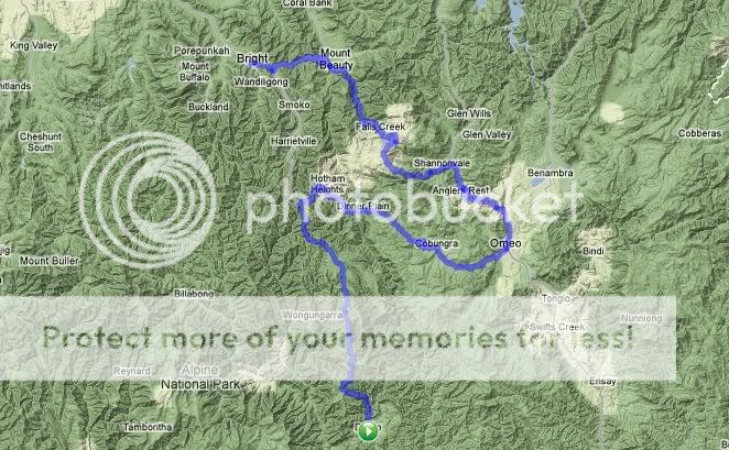
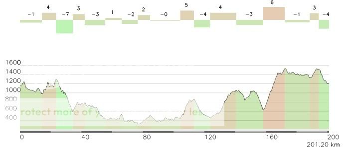
Tour of the Victorian Alps - Stage 5 Metung to Mount Beauty
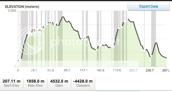
Route and Profile. 229km.
Categorized climbs: Big Creek Road 3.6km @5.5% cat 4.
Omeo plateau: ~7km@5.2% cat 3
Raspberry Hill: 12km@5.5% cat 1
OK, no more Mr. Nice Guy. Today it’s sea to summit, and a furious chase down again. A very long, very hard stage through Victoria’s isolated, but stunning High Country.
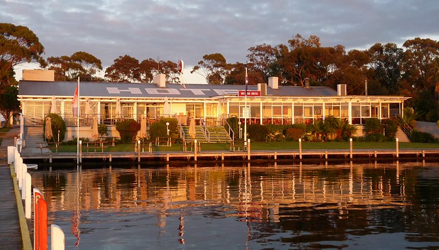
We start at the waterfront, at the Metung Hotel:
Immediately, we head north, joining the Great Alpine Road near
Bruthen. I can’t comment on the quality of the
Bullant Brewery; I can however recommend that any and all spectators avoid the nests of
insect that it is named after. More relaxed riders can also reach Bruthen via the East Gippsland Rail Trail, which runs 100 kilometre west to east from Bairnsdale to Orbost.
But none of those follies for the peloton, who leave the flat Tambo valley farmlands behind and start a gentle climb into the foothills of the High Country. Kilometre after kilometre of open stringybark forest, with only each other and
Mr. Stringy for company. He’s probably painted as somebody other than Cadel Evans by now. But you never know!
The climb into
Omeo, 113 km into the stage, is fairly steady - if you were feeling malicious, the alternative Swifts Creek-Omeo road has a real kick in the last 2 km. This isolated little town was originally a sleepy support base to the mountain cattlemen who take advantage of the natural grasslands, and latterly a tourist waystation. We could continue on the Great Alpine Road towards Mount Hotham and Bright from here, but recent road sealing works have offered an even more interesting option for racing.
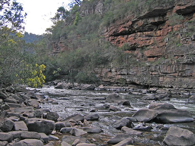
From Omeo to Angler’s Rest, the road becomes more benign, but the scenery is great. The upper reaches of the Mitta Mitta River, visible from the road, are
great for white-water rafting . And, then, at kilometre 162, they meet an intersection and
"WTF Corner".
While the raw stats of the Raspberry Hill climb aren’t all that impressive, it disguises the vicious first 6 km or so. I haven’t done the climb, but by all reports immediately after the left turn, the road kicks up to 13-14% or so for a km or so, and is nasty for the next five. Far better riders than I attest to its difficulty. The road surface is dead, and riders would be well-advised to run Gatorskins, or at the very least pump their tubulars with sealant; the road material is apparently littered with hard quartz shards which shredded the tyres of the many bedraggled amateurs completing one of the annual challenge rides which uses this climb.
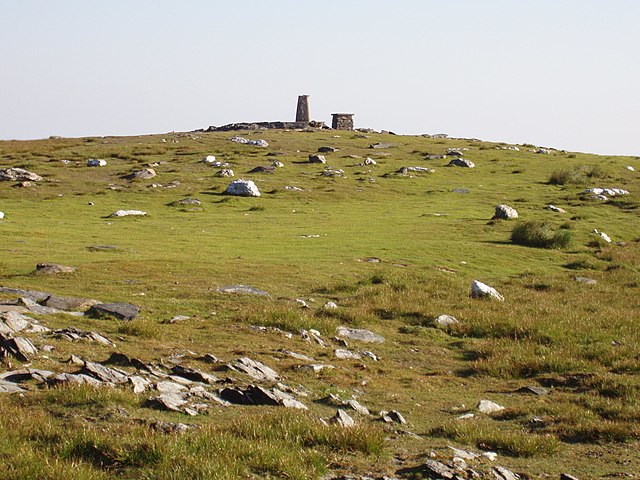
As I understand it, the climb, rather than a well-defined summit, gradually peters out to the Bogong High Plains. This alpine grassland was used to graze cattle in the summer for nearly 150 years, and the reinstatement of cattle to the area is currently a bone of contention between the state and federal governments. Cattlemen’s huts dot the region, their lifestyle romanticized by The Man From Snowy River. They're now either ruins or used by bushwalkers:
Some false flat and some short climbs later, at km 190 or so the riders finally reach the high point of the day of around 1700 metres at the Rocky Valley Dam, and descend through the ski resort of Falls Creek very soon after. The road is wide, and the descent not overly steep (though quite technical in parts). The race to the bottom will be on - I hope the lightweight climbers have been practicing their tuck, because the big guys will be coming! Parts of the descent are also through regenerating alpine forest, the
dead white snow gums and alpine ash giving an eerie aspect to the views.
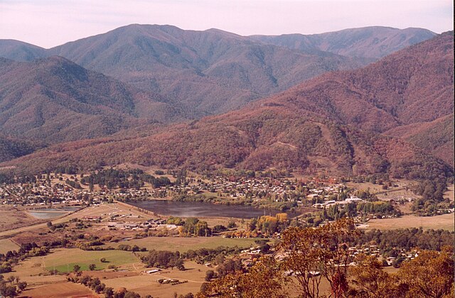
The descent to the township of Mount Beauty has a couple of rolls in it near Bogong Village - not large, but enough to prompt a final selection, or to impede a breakaway. But once over those, it’s downhill all the way to the finish line. No “let’s ride another 50 km to Pau” stages here! Mount Beauty itself serves mainly to support the alpine tourist industry.
228.6 kilometres later, the riders might want to consider a dip in the
Kiewa River.. They’ve earned it!
This
article follows the part of this route from Omeo to Mount Beauty (and part of stage 6).


")