• The Cycling News forum is looking to add some volunteer moderators with Red Rick's recent retirement. If you're interested in helping keep our discussions on track, send a direct message to @SHaines here on the forum, or use the Contact Us form to message the Community Team.

    In the meanwhile, please use the Report option if you see a post that doesn't fit within the forum rules.

    Thanks!

Race Design Thread

Page 50 - Get up to date with the latest news, scores & standings from the Cycling News Community.
Dec 16, 2011
345
0
0
Visit site
I couldn't help adding a last change to the route. I was not really satisfied with the last mountain stage (Including the Souloir, Tourmalet, Lançon, Azet and Peyragudes). The last climbs were hard, but I was not sure whether they were hard enough to create huge differences. Which in my opinion is necessary in the last mountain stage. Therefore I've replaced the Souloir and the Lançon with the Col du Portet. You don't need to look back, because here I've copied the stage description:

Another_Dutch_Guy said:
Stage 18: Pau - Peyragudes (204 KM)

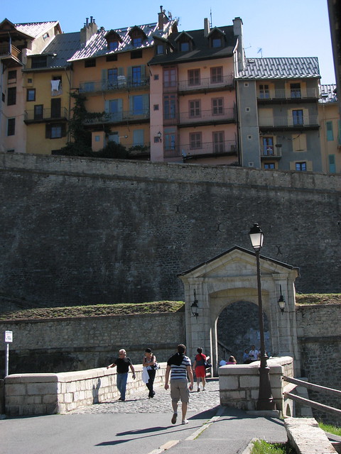
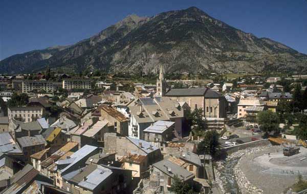
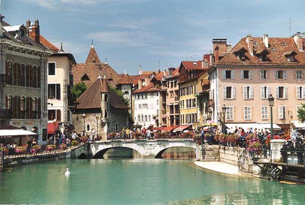
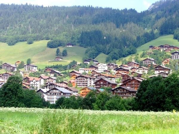
This is the last change for the climbers to gain some time. And what a change; Not less than 5 climbs needs to be challenged this day! But that's not all; today is 'Strade Bianche" day. For the first time in the modern history the Tour de france riders will have to conquer an unpaved climb. After a flat first 50 kilometers the riders can use the Tourmalet and the Aspin as a warm up for the main difficulty of the day: the col du Portet. This climb is a real monster: 22 Kilometers over 6,5%, 10 kilometers over 9,5% and 5 kilometers on "Strade Bianche". Here are some pictures of the road. The lake at the background is "Lac de l'Oule"
colduportet.png


However, after the passage over the top still 45 kilometers are left. Luckily, the descent is on normal tarmac. After passing Saint Lary Soulan the fun starts again. First with the steep Col d'Azet, and thereafter with the finishing climb to Peyragudes. Just like the original tour stage I use the new road, leading to a finishing climb of 8 kilometers averaging 8%.

The stages to la Toussuire and Superbagneres were already hard, but this is the real queen stage of the Tour!
tourdefrancestage18.png

By the way, I'm very curious about the continuation of the West Coast Tour. I really like this project; it's probably the best shot of a possible grand tour outside Europe. Very good job!
 
I've done the clockwise version of the Tour, time to do the counterclockwise one.

P: Nantes 6km
1: Nantes-Poitiers
2: Chateroux-Circuit de Charade* (Mont Miel) http://tracks4bikers.com/tracks/show/95702
3: Riom-Station Mont-Dore (Saint-Anastaise) http://tracks4bikers.com/tracks/show/95636
4: Tulle-Cahors
5: Agen-Castelsarrasin ITT 53km
6: Blagnac-Dax
7: Bayonne-Arette Pierre St Martin (Otxondo, Ahusquy) http://tracks4bikers.com/tracks/show/95652
8: Pau-Arreau (Bales, Peyresourde, Azet, Ancizan, Aspin) http://tracks4bikers.com/tracks/show/95698
9: Tarbes-Limoux
10: Perpignan-Mazamet (Portal de Nore) http://tracks4bikers.com/tracks/show/95734
11: Narbonne-Nimes
12: Avignon-Gap (Manse) http://tracks4bikers.com/tracks/show/95735
13: Gap-Lac de Bellecombe (Montgenevre, Mont-Cenis) http://tracks4bikers.com/tracks/show/95657
14: Modane - Grenoble (Glandon, Luitel, Laffrey) http://tracks4bikers.com/tracks/show/95667
15: Grenoble - Mont Revard (Montaud, Mouilles, Marcieu, Granier) http://tracks4bikers.com/tracks/show/95693
16: Annecy - Pontarlier http://tracks4bikers.com/tracks/show/95737
17: Besancon-Cernay (Ballon d'Alsace, Grand Ballon) http://tracks4bikers.com/tracks/show/95701
18: Strasbourg-Metz http://tracks4bikers.com/tracks/show/95740
19: Metz-Thionville ITT 35km
20: Paris

Uphill or MTF

*2km downhill from the summit
 
Red Rick said:
I've got a question, how do you post profiles from mapmyride, cause i've some really brutal stages coming up
you can't post direct from there. I've just gone with print selection on screen (Cmd+Shift+4), then uploaded to tinypic.
roundabout said:
I've done the clockwise version of the Tour, time to do the counterclockwise one.

P: Nantes 6km
1: Nantes-Poitiers
2: Chateroux-Circuit de Charade* (Mont Miel) http://tracks4bikers.com/tracks/show/95702
3: Riom-Station Mont-Dore (Saint-Anastaise) http://tracks4bikers.com/tracks/show/95636
4: Tulle-Cahors
5: Agen-Castelsarrasin ITT 53km
6: Blagnac-Dax
7: Bayonne-Arette Pierre St Martin (Otxondo, Ahusquy) http://tracks4bikers.com/tracks/show/95652
8: Pau-Arreau (Bales, Peyresourde, Azet, Ancizan, Aspin) http://tracks4bikers.com/tracks/show/95698
9: Tarbes-Limoux
10: Perpignan-Mazamet (Portal de Nore) http://tracks4bikers.com/tracks/show/95734
11: Narbonne-Nimes
12: Avignon-Gap (Manse) http://tracks4bikers.com/tracks/show/95735
13: Gap-Lac de Bellecombe (Montgenevre, Mont-Cenis) http://tracks4bikers.com/tracks/show/95657
14: Modane - Grenoble (Glandon, Luitel, Laffrey) http://tracks4bikers.com/tracks/show/95667
15: Grenoble - Mont Revard (Montaud, Mouilles, Marcieu, Granier) http://tracks4bikers.com/tracks/show/95693
16: Annecy - Pontarlier http://tracks4bikers.com/tracks/show/95737
17: Besancon-Cernay (Ballon d'Alsace, Grand Ballon) http://tracks4bikers.com/tracks/show/95701
18: Strasbourg-Metz http://tracks4bikers.com/tracks/show/95740
19: Metz-Thionville ITT 35km
20: Paris

Uphill or MTF

*2km downhill from the summit
Very nice to see the Vosges get the headline treatment at the end of the race. I'm a sucker for the Circuit de Charade too - that was a great motor-racing circuit because of the gradients and twists and turns, and could be great for bike racing.
Red Rick said:
http://www.mapmyride.com/routes/view/91087121

Fantasy queen stage for the Vuelta. Whole bunch of climbs i don't know, with a finish on the weak side of Alto de Gamoniteiro

Alternative route for this stage
http://www.mapmyride.com/routes/view/91318687

With 2x cordal, Cobertoria a whole bunch of unknown stuff to me, and finish on the hard side of Alto de Gamoniteiro. More mountain's than in 3 normal Vuelta queen stages combined.
Can't view these, I'm afraid - you have your privacy settings so only your MMR friends can see the rides. But a Gamoniteiro finish sounds good in theory at least.
 
I'll continue with the transalp, slowly but surely.


Transalp stage 5: Bolzano - Davos (165km)

transalp15.jpg


2 climbs today:
Ofenpass: 25.8km @ 4.5%; 2149m; km 110; 1st category
Fluelapass: 12.8km @7.8%; 2383m; km 148; HC

Transalp stage 6: Chur - Grindelwald (186km)

transalp16.jpg


5 climbs:
Flims: 10.5km @4.6%; 1110m; km 20; 2nd category
Oberalppass: 20.4km @ 4.4%; 2044m; km 81; 1st category
Furkapass: 13km @ 7%; 2431m; km 112; HC
Grimselpass: 5.4km @ 7.3%; 2165m; km 128; 2nd category
Grosse Scheidegg: 16.4km @ 7.4%, 1962m; km 174; HC

Transalp stage 7: Spiez - Pila (225km)

transalp17.jpg

(first 25km aren't shown on the profile)

Again a day with five climbs:
Hohenegg: 7.9km @4.4%; 1275m; km 40; 3rd cat
Col des Mosses: 14km @3.7%; 1445m; km 71; 2nd cat
Col de Champex: 13.9km @7.2%; 1500m; km 135; 1st cat
Col de Grand Saint-Bernard: 24.2km @ 6.2%; 2469m; km 170; HC
Pila: 16km @ 7.7%; 1800m; km 225; HC

Transalp stage 8: Aosta - Rifugio Barbara Lowrie (199km)

transalp18.jpg


The stage with the least altitude gain and only one climb:

Rifugio di Barbara Lowrie: 9.3km @ 11.2%; 1753m; km 199; HC
 
I <3 Col de Braus.

I'm going to start another stage race here... after all, when the Dauphiné route was announced, I was scathing, perhaps even vitriolic, about how lopsided and unbalanced it was, and what an appalling use of the climbs it was considering how much ITT mileage there was. I was assured that this was no problem given that it is a Tour de France preparation race, so therefore it doesn't matter if the parcours is utter garbage as it is good preparation for the similarly dreadful Tour de France route.

This got me thinking, if the Dauphiné's parcours is decided partially by being designed to prepare people for the flavour of the Tour to come, what would the Dauphiné look like when designed to be a preparation race for my Tour de France? The one with long cobbled stages, a French Basque mountain stage with climbs averaging 12% in it, summit finishes at Mantet, Mont Faron, Méribel-Mottaret and Le Mont du Chat, and a brutal Alpes-Maritimes stage too?

Hence, here we have it: The Critérium du Dauphiné designed as a companion piece to my Tour de France. Similarly to my Tour, I've tried to use some less well known areas, whilst also including a few familiar spots to honour some of the traditions of racing.

And it is to one of these familiar spots that we head for the start.

Prologue: Briançon - Briançon (ITT), 4,0km

302p4is.png


1zwg07d.png


Climbs:
Briançon (Citadel)(cat.4) 1,4km @ 8,1%

A bit of a strange place to start the race, right in the middle of some of the area's most famous climbs, as of course we are not likely to tackle the Galibier or Izoard on stage 1. However, the city of Briançon has been tied to cycling for all of living memory, given its prime location amongst legendary passes. It is also one of the most popular stage towns around given its interesting, tricky finish in some stunning architecture.

The town was last used as a finish in a major race in the 2009 Dauphiné, which you can see here (skip to 1'15 in for Briançon itself). This allows you to see what we're dealing with. The first half of the TT is gradually downhill, but with few corners so it's not really a technical test, and the gradient isn't too extreme. It's the final third, after the time check, where the road turns skywards and you see what was shown in that video. A long, uphill straight drag followed by cobbles and narrow paved streets inside the fortifications mean that whoever is fastest from the timecheck to the line will win the first inverted polka dot jersey - it's approximately one and a half kilometres at around 8%, but the steepest 600m in the middle are at 11,5% - so this one won't be one for the typical prologue specialists.

The entrance to Vieille Ville Briançon with the streets we're about to be climbing above:
2817613329_897f6e6f1a_z.jpg


Briançon:
4507995945_5ffa752265_z.jpg


(bonus: if you didn't want to sift through old Dauphiné coverage, then click here for Grand Rue, which the riders will suffer their way up...)
 
Libertine Seguros said:
you can't post direct from there. I've just gone with print selection on screen (Cmd+Shift+4), then uploaded to tinypic.

Can't view these, I'm afraid - you have your privacy settings so only your MMR friends can see the rides. But a Gamoniteiro finish sounds good in theory at least.

I changed them to public, can you see them now?

BTW, i would like to announce i'm working on my own TdF too with two long tt's, 3 medium mountain stages and 7 high mountain stages, with attacking possibilities on all of them
 
Stage 1: Guillestre - Die, 180km

23jk84i.png


2zgbvhx.png


Climbs:
Puy Sanières (cat.3) 5,0km @ 5,9%
Le Longuet (cat.4) 2,6km @ 6,2%
Côte des Brès (cat.4) 2,6km @ 5,4%
Col de la Sentinelle (cat.3) 5,5km @ 5,5%
Côte de la Selle (cat.4) 4,4km @ 4,5%
Col de Cabré (cat.3) 5,4km @ 5,6%
Lesches-en-Diois (cat.3) 6,4km @ 4,2%

The first road stage is a taste of the Tour - my Méribel stage starts in Guillestre. We're heading back out of the heights of the Alps towards the Rhône valley, over a series of small, punchy climbs. None of these are particularly difficult, but there are enough of them to disorganise the chase, and we could well have an interesting break as a result. Pure sprinters will probably be cursing their showing up, while most cycling fans will look at the profile, then look at each other, and mouth the words "Peter Sagan". And indeed, with the final climb cresting 34km from the finish and not being especially steep, the chances that this one comes back together are high. The real question is, if a couple of teams really force the pace, how big will the péloton be at the end to duke out the sprint in the wonderfully-named town of Die?

Guillestre:
guillestre061b.jpg


Die:
die.jpg
 
Red Rick said:
I changed them to public, can you see them now?

BTW, i would like to announce i'm working on my own TdF too with two long tt's, 3 medium mountain stages and 7 high mountain stages, with attacking possibilities on all of them

Yup, can see them now.

Just a note - I'm not sure about all the climbs and the status of tarmac there - I can see that you're descending the Trobaniello side of the Puerto de la Ventana in the first version (the last climb before Gamoniteiro) - that's gravel. On the second version, you're climbing the gravel side and descending the tarmac side. Not sure why you've gone with four short circuits in the middle of the stage - can imagine that'll get confusing when you have an autobus created by four times up a short steep climb and the gravel side of Ventana several minutes down...
 
Libertine Seguros said:
Yup, can see them now.

Just a note - I'm not sure about all the climbs and the status of tarmac there - I can see that you're descending the Trobaniello side of the Puerto de la Ventana in the first version (the last climb before Gamoniteiro) - that's gravel. On the second version, you're climbing the gravel side and descending the tarmac side. Not sure why you've gone with four short circuits in the middle of the stage - can imagine that'll get confusing when you have an autobus created by four times up a short steep climb and the gravel side of Ventana several minutes down...

Yeah, i need to work on my logistics:D. But for stuff like the Gamoniteiro i assume they will resurface the road if they want to use it as a MTF
 
Sep 8, 2010
1,441
0
0
Visit site
Libertine Seguros said:
I'm going to start another stage race here... after all, when the Dauphiné route was announced, I was scathing, perhaps even vitriolic, about how lopsided and unbalanced it was, and what an appalling use of the climbs it was considering how much ITT mileage there was. I was assured that this was no problem given that it is a Tour de France preparation race, so therefore it doesn't matter if the parcours is utter garbage as it is good preparation for the similarly dreadful Tour de France route.

It got pretty bad, when ASO took this race. Same with Paris-Nice. Fignon, who organized P-N for a few years wrote about this in his book. He wanted to make a real exciting and difficult race, but was financially crushed by ASO. Dauphiné had great stages before that time. Also great hilly and moutaineous tt by the way.

Like your prologue. Reminds a bit of the Utah prologue last year.

I'm hoping for the scandalously overlooked Col Luitel.
 
Stage 2: Valence - Givors, 178km

snnbjo.png


azdi5d.png


Climbs:
Côte Sainte-Épine (cat.3) 3,2km @ 7,7%
Crus des Pins (cat.3) 3,0km @ 7,6%
Côte de Brunieux (cat.3) 3,2km @ 6,5%
Col d'Œillon (cat.1) 20,0km @ 5,4%
Croix du Planil (cat.3) 4,2km @ 5,4%

Now firmly outside the Alps, this second road stage heads north towards Lyon, mostly over a series of small climbs, but with one big climb to break the pack down. The Col d'Œillon is far from the toughest climb the world of cycling has ever seen, but at 20km in length it will be more than enough to trim the bunch down in a stage such as this. Its long, gradual drag was first conquered by Federico Bahamontes in 1956, and it has never been topped by a rider from anywhere other than Spain or Colombia (Lucho Herrera was the last to win the climb, in the 1985 Tour). Here, however, 70km from home, it isn't as likely to create any GC action, but the fight among the break could be entertaining.

Profile-wise, this could be another one for Sagan, as top sprinters are unlikely to have made it over the Œillon in the bunch, however, there are two uncategorised climbs around the village of Echalas on the way down into Givors, both cresting inside 15km to go, so this could be one for a puncheur or a well-timed attack, as the chase could suffer from a lack of cohesion on these slopes. I would expect the bunch to be fairly small at the finish.

Valence:
1.1267966968.more-valence.jpg


Givors:
1469822.jpg
 
Stage 3: Vaulx-en-Velin - Vaulx-en-Velin, 47,4km (ITT)

ojjrkp.png


212wtp3.png


Sometimes you have to stick to formula, and so here we have stage 3: a long ITT. Well, 47,4km isn't super-long, but given that this is a one-week race this is plenty long enough to create gaps big enough for what we're going to be doing. The TT starts in Vaulx-en-Velin, an excellently-named suburb of Lyon on an island created by a split in the river Rhône, and loops around the banks of the Rhône on the opposite side to the island for much of its distance. There are a few technical corners, but for the most part it's pan flat and all about power. It's a similar length to the Chalôn-sur-Saône ITT at the end of my Tour, so can be treated as a dress rehearsal for that.

There have been tougher, prettier and more exciting ITT parcours over time, but this serves its purpose in the race, ahead of the tougher tests to come. And at least there are the imposing views of the Alps in the background to remind us what's to come.

Vaulx-en-Velin:
Vaulx-en-Velin-et-les-Alpes.jpg
 
Stage 4: La Tour-du-Pin - Annecy, 196km

dnc8kp.png


2akjyic.png


Climbs:
Parvey (cat.3) 4,1km @ 6,2%
Ontex (cat.2) 6,8km @ 7,0%
Côte de Mionnaz (cat.4) 4,2km @ 4,5%
Coucy (cat.4) 4,6km @ 4,0%
Route des Machurettes (cat.3) 3,4km @ 7,4%
Col de Bluffy (cat.4) 2,5km @ 6,3%

The longest road stage of the Dauphiné is also probably the easiest; though there is a pretty tricky obstacle in the form of the climb up to Ontex, on the outcrop adjacent to Mont du Chat, the toughest climbs in the stage are confined to the first third - note how the vertical scale is just half that of previous stages. You could argue that this is more a transitional stage heading back towards the mountains, but I feel this is a decent chance for the sprinters - and unlike the first two stages, the climbs are far enough from the end that I feel that, though they will have had to work to get back, the main bunch sprinters will be able, if competent, to earn themselves the chance to compete for the victory. The last 60km or so are a loop around Lac d'Annecy, an extended version of the 2009 Tour de France ITT around the lake, with some rolling hillside after the Col de Bluffy (approached from an easier side than in that ITT). Annecy will also serve as the base of the climb of Le Semnoz, that will feature in the Tour's queen stage, so if riders want to take a visua after the stage and recce the climb they have that option. The final climb is 30km from the stripe so unless the break gets allowed to have a bit of rope I foresee this one coming back together in the beautiful lakeside city.

La Tour-du-Pin:
4202669.jpg


Annecy:
04gite-annecy.jpg
 
Stage 5: Bellegarde-sur-Valserine - Plateau de Solaison, 190km

k9dkwz.png


34hazab.png


Climbs:
Côte de Vovray (cat.4) 2,9km @ 5,2%
Ésery (cat.4) 3,0km @ 5,3%
Col de Saxel (cat.2) 8,3km @ 4,6%
Col de la Colombière (HC) 16,3km @ 6,8%
Plateau de Solaison (HC) 13,2km @ 8,0%

The Dauphiné's first day of the high mountains. Starting with a very short sortie into the Ain département, the first half of the stage is skirting the border with Switzerland around Annemasse and Geneva, with just a couple of short climbs to break it up. Just before the halfway point, however, we turn back towards the south and start to ramp up the climbing, as the GC battle will start to heat up today. The Col de Saxel is the first real challenge of the day. As you can see, it's not too tough, mostly fairly consistent around the 5% mark, which will give the diesels a bit of a chance to get warmed up. After the descent there is 20km of flat riding to take us to the base of the first HC climb of the race, the Scionzier (northern) side of the Col de la Colombière. This famous climb is extremely difficult in its second half, but the sights are pretty dramatic.

The Colombière tops out with 50km to go, so attacks on here aren't too likely, but the long descent could be interesting. The first part of this to Le-Grand-Bornand is the trickiest, before a period of downhill false flat into Bonneville. Here, however, we go to an unappreciated beast; a climb never seen in Le Tour, and I don't think the Dauphiné either. However, the Tour des Pays de Savoie is going to put a stage finish there in just two weeks' time, which I didn't know when I drew this stage up - that should be really good. Teams you may recognise there are Astana 2, Lotto-Belisol U23, Atlas Personal, Côtes d'Armor Marie Morin, CC Nogent-sur-Oise and Chambéry Cyclisme Formation (Ag2r's feeder). Anyhow, back to the climb.

The Plateau de Solaison sits where the village is, adjacent to the Col de Solaison. Its 13km of agony come straight out of the gate with five kilometres averaging 10%. There is a slight let-up through the village of Brizon, but after this it's back to the pain, with another 5km averaging around 8-9%. The last kilometre is fairly mundane, averaging just 3%, so attacks will need to take place before this if any real time is to be taken. The chances are that, with so much space between the summit of the Colombière and the base of Solaison, this stage will come down to the final climb; but with a couple of climbs already in the legs and the steep gradients of Solaison, this one should break apart far from the summit.

Bellegarde-sur-Valserine:
bellegvuegen.jpg


Plateau de Solaison:
Plateau_Solaison.jpg
 
Stage 6: Le Grand Bornand - Val Pelouse, 133km

21e88wl.png


123rwc7.png


Climbs:
Col des Aravis (cat.1), 12,0km @ 5,1%
Col du Vorger (cat.2) 4,1km @ 8,3%
Collet de Tamié (cat.1) 10,4km @ 5,9%
Col de Champ-Laurent (cat.1) 9,8km @ 8,2%
Val Pelouse (HC) 16,4km @ 8,4%

The undoubted queen stage of the race, this one has been kept short to try and keep some energy in the legs for the finale given the difficulty of several of the climbs in use, which range from the familiar and well-known to those little-heralded or unknown to racing.

The start of the race is in the common racing stop-off town of Le-Grand-Bornand, home of many a Tour stage in its time as well as the French round of the Biathlon World Cup (which actually has its finish on a temporary area around streets, sharing its finish line with the 2009 Tour stage, something unique in the sport), before we take on the easier side of the Col des Aravis. This is but a warm-up however, which will allow an interesting breakaway to form, and they will hope to consolidate and build their lead on the 30km downhill and flat run to Ugine before the tougher stuff begins. The Col du Vorger is the first warning shot; only 4km in length, but the gradient is unwelcoming, averaging over 8% on some less than perfectly smooth tarmac. It serves as a delicate hors d'œuvres before the inconsistent Collet de Tamié (that profile includes the short descent back down to the Col de Tamié nearby).

After descending the Tamié the riders have about 20km of flat valley roads to welcome them and rest up ahead of the closing double act, which will turn the last 45km into a bloodbath. The difficult lacets of the Col de Champ-Laurent come at a punishing 8,2% average gradient, with a couple of sections over 11% at the start and approaching the top; here, the pack ought to be trimmed down to the bare essentials ahead of the descent into La Rochette; the first section is pretty straight but fairly steep, then there's a short uphill dig (not enough to categorise) before a shallower, but far more technical, second half of the descent, which should be troublesome for the more suspect descenders out there ahead of our finishing climb.

Val Pelouse is an underappreciated monster of the French Alps. It sits next door to the Collet d'Allevard, a difficult climb we saw in the Dauphiné last year and questioned why the Tour didn't use its tricky slopes... but Val Pelouse is harder. The road is built for suffering, snaking its way to the sky over 16,4 kilometres of tortuous grind at 8,4%. Worse news for the riders; the first 4km are relatively benign, after that the final 12,4km average over 9% - and the last 10km never get below that figure, as you can see from the profile. There is plenty of time to be won and lost here to balance out the 50km of ITT we've already had, because Val Pelouse is a bit of a monster. There's a fairly small parkplace at the top, which has been extended a bit lately; it's not big enough to host the trappings of Le Tour, but with the roads continuing on a little bit further it could host the trappings of a smaller race, and for that reason it can be included here; it will be an excellent preparation for the riders planning to take on Mont du Chat, Signal de Bisanne, Errozate and Arnostegi in my Tour - long and steep climbs are not in short supply.

Le Grand Bornand:
Photo-018.jpg


Val Pelouse:
2cdu5na.png
 
Oct 30, 2011
2,639
0
0
Visit site
Lupetto said:
It got pretty bad, when ASO took this race. Same with Paris-Nice. Fignon, who organized P-N for a few years wrote about this in his book. He wanted to make a real exciting and difficult race, but was financially crushed by ASO. Dauphiné had great stages before that time. Also great hilly and moutaineous tt by the way.[/URL].

I finished reading We Were Young and Carefree a few days ago. He said that the organisers of the Tour used to threaten towns with being blacklisted if they got involved with Fignon. If they hosted a stage of P-N, they would be taken out of consideration from the Tour. Ridiculous.
 
Rick - a lot of climbs I just know, either from being familiar with the area or from various races.

Others show their names when you have Google maps set to 'terrain'; if not you could always try zooming in on the pass and looking at the titles of photos in the area. Some have villages or named hamlets at the summit (Lalouvesc, for example) and some, especially in Spain, are named after villages nearby (Alto del Tenebredo, for example), though there are some banana skins (the village at the top of the Santa Ageda climb is called Urdanpilleta, which is nothing to do with the climb's name even though you are climbing to Urdanpilleta).

A lot of them, however, I can find the name from dedicated climb-logging sites such as altimetrias.net or quäldich.de.

I shall now finish the Dauphiné with the final stage:

Stage 7: Grénoble - Grénoble, 186km

1q3h4p.png


110kw1c.png


Climbs:
Montagne du Mulet (cat.2) 8,6km @ 6,6%
Col de Clemencière (cat.2) 5,8km @ 7,0%
Col de Palaquit (cat.1) 14,6km @ 6,3%
Saint Nizier (cat.2) 9,5km @ 5,1%
Grand Lac de Laffrey (cat.1) 7,2km @ 8,8%
Champagnier (cat.4) 1,9km @ 5,5%

We finish off with an intermediate stage moving all around the city of Grénoble, while still not using its most famous neighbouring climbs. We start with a climb which stops at the Montagne du Mulet, just beneath Le Fournet. From there it's a flat circuit to the south of the city, re-entering it at Echirolles and crossing the finishing line for a second time after 50km.

The Col de Clemencière is a nice little leg-tester just outside of Grénoble, and this is part of our second circuit, just 24km long. Then we handle it again, only this time we continue straight past it, and after a couple of flatter kilometres, we ramp back up to go to the Col de Palaquit, the longest and probably toughest climb of the day. Its summit marks the halfway point.

After the descent we have the inconsistent climb up to Saint Nizier, consisting of some steep sections on the way to Revel, then some varying flat and climb to the summit. The descent takes us into Vizille, which will be the base for the last real climbing challenge of the race - and the last chance for anybody close enough after Solaison and Val Pelouse to make their move. It's only 7km long, but at 8,8% the climb to the shores of Grand Lac de Laffrey may look pretty, but it will certainly hurt those who are struggling in the bunch. The official summit is at 46km to go, but there is a short uncategorised uphill shortly afterward. The descent is fairly gradual, but the riders do still have one last obstacle - a category 4 climb 20km from home. After that it's just the same ride back into Grénoble from Echirolles that they did earlier in the day, then to the victor the spoils.

Grénoble:
grenoble.jpg


I've got another Vuelta in the works, plus a couple of other half-finished ideas. I may not have posted anything in here for a while but that doesn't mean I haven't been continuing to come up with ideas.
 

TRENDING THREADS