
Race Design Thread
Page 51 - Get up to date with the latest news, scores & standings from the Cycling News Community.
You are using an out of date browser. It may not display this or other websites correctly.
You should upgrade or use an alternative browser.
You should upgrade or use an alternative browser.
- Feb 20, 2010
- 33,254
- 15,788
- 28,180
Right - it's time for the Vuelta a España, take 2.
My previous route was a fairly conventional one, looping from Catalunya to the south of the country, then back north, featuring the key stages towards the end in the mountains of Asturias, and finishing heading towards the Basque Country and Navarre as per 2011, and taking in many common Vuelta stop-offs such as Cuenca, Ávila, Córdoba, Ponferrada, Ciudad Real and Talavera de la Reina. This time, however, I'm going for a more unusual route. There will be just over 100km of Individual Time Trial, 4 summit finishes, and a whopping 0km of Team Time Trial, because as you probably know, I hate that discipline. The route is probably mostly favourable to climbers, though the summit finishes generally aren't the hardest or longest climbs on offer, so they may need to work to generate their time gaps.
As the Vuelta's policy on mountain points is to give 3 categories, plus a special category for MTFs and a single trophy for the highest point in the race (which I campaign should be known as the Cima Fuente, though Ocaña, Jiménez, Bahamontes and Berrendero could all also be candidates for the ceremonial naming), I will include notable "no puntable" climbs as well, as I am being a bit more stingy with the allocation of 1st Category status than the Vuelta tends to be.
There will be some sops to tradition, however. Following on from putting the Briançon old town prologue in my Dauphiné, my new Vuelta will use a similar gimmick...
Stage 1: Ávila - Ávila, 4,1km (ITT)


Climbs:
Ávila (Parque San Vicente)(no puntable) 1,2km @ 5,8%
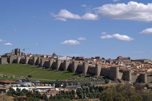
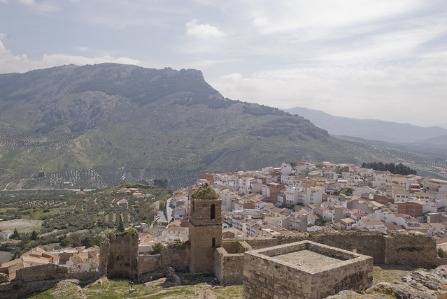
The first stage of the race is a short prologue in one of the race's most supportive homes. Ávila has hosted the Vuelta in 1999 (stages 19 & 20), 2000 (stages 19 & 20), 2002 (stages 19 & 20), 2004 (stages 18 & 19), 2005 (stage 18), 2007 (stages 18 & 19) and 2009 (stages 18 & 19). The current three year layoff is somewhat strange, in fact. As a result, I would expect you all to be familiar with the typical run through Ávila, the light uphill cobbled drag by the city walls, etc.
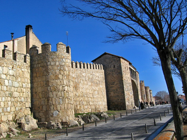
I haven't done that. Well, I have, but not the Carretera de la Ronda Vieja as is usually used. I have instead used the southern side of the city walls and climbed the Paseo del Rastro - including the pedestrianised section. On the road up to the city walls this reaches 11%, but for the most part it's an uphill drag on cobbles and then paving until we turn left at Plaza Santa Teresa; more cobbles follow on Calle de San Segundo until we reach Parque San Vicente, where we turn onto Avenida de Portugal and join the usual cobbled route. Where Avenida de Portugal meets Avenida de Madrid, we turn back on ourselves, and ride back down the hill on the tarmac adjacent to the usual climb into the city, finishing back at the base of the climb.
This is, as a result, a fairly technical prologue that will probably favour the strong classics men, given the large amount of riding on cobbled, gradual uphills. Whoever gets the Jersey Rojo here will have to have put a fair amount of power down.
Ávila (Paseo del Rastro):
Ávila (view from the start):
My previous route was a fairly conventional one, looping from Catalunya to the south of the country, then back north, featuring the key stages towards the end in the mountains of Asturias, and finishing heading towards the Basque Country and Navarre as per 2011, and taking in many common Vuelta stop-offs such as Cuenca, Ávila, Córdoba, Ponferrada, Ciudad Real and Talavera de la Reina. This time, however, I'm going for a more unusual route. There will be just over 100km of Individual Time Trial, 4 summit finishes, and a whopping 0km of Team Time Trial, because as you probably know, I hate that discipline. The route is probably mostly favourable to climbers, though the summit finishes generally aren't the hardest or longest climbs on offer, so they may need to work to generate their time gaps.
As the Vuelta's policy on mountain points is to give 3 categories, plus a special category for MTFs and a single trophy for the highest point in the race (which I campaign should be known as the Cima Fuente, though Ocaña, Jiménez, Bahamontes and Berrendero could all also be candidates for the ceremonial naming), I will include notable "no puntable" climbs as well, as I am being a bit more stingy with the allocation of 1st Category status than the Vuelta tends to be.
There will be some sops to tradition, however. Following on from putting the Briançon old town prologue in my Dauphiné, my new Vuelta will use a similar gimmick...
Stage 1: Ávila - Ávila, 4,1km (ITT)
Climbs:
Ávila (Parque San Vicente)(no puntable) 1,2km @ 5,8%
The first stage of the race is a short prologue in one of the race's most supportive homes. Ávila has hosted the Vuelta in 1999 (stages 19 & 20), 2000 (stages 19 & 20), 2002 (stages 19 & 20), 2004 (stages 18 & 19), 2005 (stage 18), 2007 (stages 18 & 19) and 2009 (stages 18 & 19). The current three year layoff is somewhat strange, in fact. As a result, I would expect you all to be familiar with the typical run through Ávila, the light uphill cobbled drag by the city walls, etc.
I haven't done that. Well, I have, but not the Carretera de la Ronda Vieja as is usually used. I have instead used the southern side of the city walls and climbed the Paseo del Rastro - including the pedestrianised section. On the road up to the city walls this reaches 11%, but for the most part it's an uphill drag on cobbles and then paving until we turn left at Plaza Santa Teresa; more cobbles follow on Calle de San Segundo until we reach Parque San Vicente, where we turn onto Avenida de Portugal and join the usual cobbled route. Where Avenida de Portugal meets Avenida de Madrid, we turn back on ourselves, and ride back down the hill on the tarmac adjacent to the usual climb into the city, finishing back at the base of the climb.
This is, as a result, a fairly technical prologue that will probably favour the strong classics men, given the large amount of riding on cobbled, gradual uphills. Whoever gets the Jersey Rojo here will have to have put a fair amount of power down.
Ávila (Paseo del Rastro):
Ávila (view from the start):
- Feb 20, 2010
- 33,254
- 15,788
- 28,180
Stage 2: Segovia - Burgos, 225km


Climbs:
Alto de Tejares (cat.3) 4,8km @ 4,0%
The first road stage of the Vuelta is a long, mostly flat drag through Castilla y León, beginning in the historic city of Segovia, formerly one of the key cities for the textile industry and home to a famous aqueduct and cathedral. It's a fairly straightforward stage, just the one climb at stake at about quarter distance to award the first wearer of the blue polka dots. After that it's nothing more than rolling, allowing the commentators to discuss the challengers, the days to come, and the break to get some TV time for their sponsors as, unless the wind really blows - always a possibility around here - this is going to be a bunch sprint.
The stage finishes with 3 loops of a 12km circuit in Burgos itself. This city should need no introduction to cycling fans; it has hosted the Vuelta most years, and hosts its own popular race - much as the Giro del Trentino is the Giro's traditional warmup race and the Dauphiné is the Tour's, the Vuelta a Burgos is now entrenched as the Vuelta preparation race par excellence. No climb up to the Castillo today like the 2011 Vuelta a Burgos though (I did that last time around), instead it will be a nice, wide open flat finish on the Avenida de los Reyes Católicos, so a sprinter who has been able to stay within 20 seconds on the prologue could have a chance to wear the leader's jersey.
For a day.
Segovia:

Burgos (Avenida de los Reyes Católicos):

Climbs:
Alto de Tejares (cat.3) 4,8km @ 4,0%
The first road stage of the Vuelta is a long, mostly flat drag through Castilla y León, beginning in the historic city of Segovia, formerly one of the key cities for the textile industry and home to a famous aqueduct and cathedral. It's a fairly straightforward stage, just the one climb at stake at about quarter distance to award the first wearer of the blue polka dots. After that it's nothing more than rolling, allowing the commentators to discuss the challengers, the days to come, and the break to get some TV time for their sponsors as, unless the wind really blows - always a possibility around here - this is going to be a bunch sprint.
The stage finishes with 3 loops of a 12km circuit in Burgos itself. This city should need no introduction to cycling fans; it has hosted the Vuelta most years, and hosts its own popular race - much as the Giro del Trentino is the Giro's traditional warmup race and the Dauphiné is the Tour's, the Vuelta a Burgos is now entrenched as the Vuelta preparation race par excellence. No climb up to the Castillo today like the 2011 Vuelta a Burgos though (I did that last time around), instead it will be a nice, wide open flat finish on the Avenida de los Reyes Católicos, so a sprinter who has been able to stay within 20 seconds on the prologue could have a chance to wear the leader's jersey.
For a day.
Segovia:
Burgos (Avenida de los Reyes Católicos):
- Feb 20, 2010
- 33,254
- 15,788
- 28,180
Stage 3: Burgos - Estación de Esquí Lunada, 158km


Climbs:
Puerto de Altotero(cat.2) 7,7km @ 5,8%
Alto de Bocos (no puntable) 4,0km @ 4,9%
Picón Blanco (cat.1) 8,5km @ 9,1%
Estación de Esquí Lunada (cat.MTF) 7,8km @ 5,3%
Due to the slightly unconventional route, the stages are going to be a bit more mixed up than normal in this Vuelta; you wouldn't normally expect a mountain stage in stage 3, for sure! However, I have taken care to make sure it isn't going to be all out Anglirú-type carnage from week 1 - there are still plenty of chances for sprinters to come, but it could well be that the heads of state are going to have to figure out what to do with the leader's jersey after a stage like this in the early running.
Heading off through the plains of Burgos, the riders' first challenge of the day comes in Pozo de la Sal, with the opening slopes of Altotero, which the APM guys have ridden so that you don't have to, allowing me to show you a couple of photos. Details of their ride here for those who want it. This is not often used by the Vuelta a Burgos in recent years, though back in 2004 it was the MTF of choice, with Alejandro Valverde running out the victor.
For the next 60km, however, there is little of note for the strongmen; the Alto de Bocos shows its face, but at under 5% it won't faze all but the worst climbers. The real fighting in this stage will come in the last 35km. Not least because, at that point, the riders start climbing one of Spain's unused killers - the savage Picón Blanco. It's only mid-length, like many northern Spanish climbs, but well, look at the profile! Entire kilometres averaging 11 and 12%! It's quite narrow, but eminently raceable - nice views too!
With Picón Blanco topping out at 24km to go, the descent, which is quite technical, via the Portillo de la Sía, is a place to recover oneself ahead of the final, somewhat easier climb to our summit finish at the Estación de Esquí Lunada - profile here (we're doing the last 8km or so of that). For the most part it's fairly gradual, but where it turns off the main road to the Portillo de Lunada, there is a short descent followed by two steeper kilometres that could well split things up if, god forbid, everybody comes in together at this point. I mean, I give you a 9% average climb topping out less than 25km from the finish, so if you're racing like a coward you deserve to lose a bit of time in the last 2km, no?
Carretera:
Estación de Esquí Lunada:
- Feb 20, 2010
- 33,254
- 15,788
- 28,180
Stage 4: Miranda de Ebro - Lagunas de Neila, 209km


Climbs:
Puerto de Herrera (cat.3) 6,0km @ 5,9%
Puerto de las Viniegras (cat.2) 19,0km @ 3,8%
Alto de Santa Inés (cat.2) 11,8km @ 5,0%
Puerto del Collado (cat.3) 10,0km @ 3,1%
Lagunas de Neila (cat.MTF) 8,0km @ 7,6%
Yes, I specified at the start of the race that there are four full summit finishes... and here we are, with the second of them already, on stage 4. Lots of potential banana skins early in this Vuelta, that's for sure.
We start off in the city of Miranda de Ebro, a city which normally hosts a stage of the Vuelta a Burgos annually (finishing on the climb of San Juan del Monte on the edges of the city). The riders will more or less start their day by crossing over into País Vasco, and tackling the first climb of the day, the Puerto de la Herrera. Shortly after this we swap the Basque Country for La Rioja, where the riders will face something like 50km of flattish uphill before the day's climbing starts for real.
The first major obstacle on the stage is the Puerto de las Viniegras. As you can see from the profile, it's long, but not overly complicated, with only the last 6km being any real challenge. It is followed, as we head back into Castilla y León, almost straight away by a second cat.2 climb, Santa Inés. However, there are still 70km to go, and this isn't especially complicated. It might cause some consternation among the break, but this is more about softening people up. Once arriving back on the CL-117, it's time to head back towards Burgos, at least until we hit Quintanar de la Sierra, where it's time for the final climb.
Lagunas de Neila is the current MTF of choice for the Vuelta a Burgos. It's easy to see why; it's steep enough to create gaps, but not long enough to be the only decisive stage. However, it nearly always creates some entertaining fireworks. Witness for yourself - there's Iban Mayo creating fireworks in 2006, Soler and Mosquera duelling for the stage in 2009, Sánchez, Mosquera, Nibali and Antón doing battle in 2010 and Mikel Landa's breakthrough in 2011. Frustratingly, almost every profile you can find for the climb assumes you will go direct from the Puerto del Collado to the summit, whereas I am using the Vuelta a Burgos route, which includes a short descent and a longer steep section - gradients get up as high as 17% on this little killer. This profile is the best I can give you - we will be turning onto this route at the first asterisk marked Quintanar de la Sierra; the last 8km are as shown. The climb has, strangely, only been included in the Vuelta once - in 1998, when the stage was won by José María Jiménez. I feel this is a terrible oversight given that the climb has more or less only ever provided us with good racing snaking through its wooded backdrop. It's long enough and hard enough to create some gaps, whilst still being short enough to keep those limited enough to keep the action interesting, bearing in mind that we're still only halfway through the first week. And it won't totally kill off all the sprinters either, who do still have their time to come.
Miranda de Ebro:

Lagunas de Neila:

Climbs:
Puerto de Herrera (cat.3) 6,0km @ 5,9%
Puerto de las Viniegras (cat.2) 19,0km @ 3,8%
Alto de Santa Inés (cat.2) 11,8km @ 5,0%
Puerto del Collado (cat.3) 10,0km @ 3,1%
Lagunas de Neila (cat.MTF) 8,0km @ 7,6%
Yes, I specified at the start of the race that there are four full summit finishes... and here we are, with the second of them already, on stage 4. Lots of potential banana skins early in this Vuelta, that's for sure.
We start off in the city of Miranda de Ebro, a city which normally hosts a stage of the Vuelta a Burgos annually (finishing on the climb of San Juan del Monte on the edges of the city). The riders will more or less start their day by crossing over into País Vasco, and tackling the first climb of the day, the Puerto de la Herrera. Shortly after this we swap the Basque Country for La Rioja, where the riders will face something like 50km of flattish uphill before the day's climbing starts for real.
The first major obstacle on the stage is the Puerto de las Viniegras. As you can see from the profile, it's long, but not overly complicated, with only the last 6km being any real challenge. It is followed, as we head back into Castilla y León, almost straight away by a second cat.2 climb, Santa Inés. However, there are still 70km to go, and this isn't especially complicated. It might cause some consternation among the break, but this is more about softening people up. Once arriving back on the CL-117, it's time to head back towards Burgos, at least until we hit Quintanar de la Sierra, where it's time for the final climb.
Lagunas de Neila is the current MTF of choice for the Vuelta a Burgos. It's easy to see why; it's steep enough to create gaps, but not long enough to be the only decisive stage. However, it nearly always creates some entertaining fireworks. Witness for yourself - there's Iban Mayo creating fireworks in 2006, Soler and Mosquera duelling for the stage in 2009, Sánchez, Mosquera, Nibali and Antón doing battle in 2010 and Mikel Landa's breakthrough in 2011. Frustratingly, almost every profile you can find for the climb assumes you will go direct from the Puerto del Collado to the summit, whereas I am using the Vuelta a Burgos route, which includes a short descent and a longer steep section - gradients get up as high as 17% on this little killer. This profile is the best I can give you - we will be turning onto this route at the first asterisk marked Quintanar de la Sierra; the last 8km are as shown. The climb has, strangely, only been included in the Vuelta once - in 1998, when the stage was won by José María Jiménez. I feel this is a terrible oversight given that the climb has more or less only ever provided us with good racing snaking through its wooded backdrop. It's long enough and hard enough to create some gaps, whilst still being short enough to keep those limited enough to keep the action interesting, bearing in mind that we're still only halfway through the first week. And it won't totally kill off all the sprinters either, who do still have their time to come.
Miranda de Ebro:
Lagunas de Neila:
- Feb 20, 2010
- 33,254
- 15,788
- 28,180
Stage 5: Soría - Zaragoza, 178km


Climbs:
Alto del Buste (cat.3) 4,8km @ 5,4%
After two difficult stages in a row, we head towards our (early) first rest day with a nice, comfortable flat stage, which will no doubt please the sprinters. Even more so that the stage is a net downhill, so nice and easy on the legs after the strains of Picón Blanco and Lagunas de Neila. The only categorised climb is eminently manageable (ignore the last spike on the profile - it doesn't exist). The only thing really is the nice wide roads to tackle in the last 50km - if the wind blows, it might be tricky, but more than likely this is destined for a big bunch sprint on a short urban circuit in Zaragoza. This will give the riders a chance to rest up and enjoy their day off tomorrow.
Soría:

Zaragoza:

Climbs:
Alto del Buste (cat.3) 4,8km @ 5,4%
After two difficult stages in a row, we head towards our (early) first rest day with a nice, comfortable flat stage, which will no doubt please the sprinters. Even more so that the stage is a net downhill, so nice and easy on the legs after the strains of Picón Blanco and Lagunas de Neila. The only categorised climb is eminently manageable (ignore the last spike on the profile - it doesn't exist). The only thing really is the nice wide roads to tackle in the last 50km - if the wind blows, it might be tricky, but more than likely this is destined for a big bunch sprint on a short urban circuit in Zaragoza. This will give the riders a chance to rest up and enjoy their day off tomorrow.
Soría:
Zaragoza:
- Feb 20, 2010
- 33,254
- 15,788
- 28,180
Stage 6: Ibiza - Ibiza, 173km


Climbs:
Pla de Santa Inés (cat.3) 4,5km @ 5,4%
Alt de Sant Joan de Labritja (no puntable), 2,4km @ 6,0%
Coll de Furnás (cat.3) 6,0km @ 4,8%
Can Furnet (no puntable) 2,5km @ 5,1%
I said that this was going to be a slightly unconventional route, and if the two MTFs in the first half of week 1 didn't draw any attention to that, then this should. The Vuelta has been to the Illes Balears a handful of times in its existence - the first time was for stage 12 of the 1975 edition, then the Grand Depart in 1986, then two stages of the 1991 edition and two more in 1998; since then they've been ignored.
In all of those occasions, Mallorca has hosted the race; this, therefore, is something completely new. The stage will start and finish in Vila d'Eivissa (Ibiza Town), the capital and largest city of the island; it is mostly rolling, with two categorised climbs and a couple of smaller ones as it circumnavigates the island, taking in a few of the sights on its way, plus heading through major tourist cities such as Sant Antoni de Portmany and Santa Eulària des Riu, which will probably be the hosts to the two intermediate sprints.
The relatively small size of Ibiza allows the race to cover most of its territory in the single stage; it will also enable the race to show off much of its UNESCO World Heritage Site landscape, and a side to the island's culture and history far removed from its reputation as a hedonistic party island (well, this is one way to attract Andy Schleck to start the Vuelta, anyway... surely he'll have come here straight away from the stage finish in Zaragoza to have two days of partying!). This is evidenced as the riders will cross the finishing line for the first time after 115km; two further laps of a 29km circuit between Ibiza Town and Santa Eulària complete the day's racing; given that so far we've had an ITT, two flat stages for sprinters and two climbing stages, this is more geared up for the puncheurs, though durable sprinters should still be able to contend if they can control the attacks - the final passage of the uncategorised climb to the junction below the Can Furnet complex crests with just 7,5km remaining - this climb isn't anything too special - a couple of kilometres at just over 5%, maxing at about double that - but it's enough to make for some interesting racing in the closing stages; the rest of the circuit is rolling as well - the finish is more or less at sea level, but there is a little hill in Ibiza Town that falls early in the circuit and the rolling hills from the town to Santa Eulàlia to allow for some difficult racing. Of course, as there have been early GC stages, a break could easily be given a lot of rope here, but the fight for the stage win should at least be pretty interesting. Definitely a good day to get on the attack for a lot of puncheurs and also some half decent climbers looking for a day or two in red should the break be allowed to go.
Then the race caravan can move on, and be gone by the time the streets fill with pilled-up clubbers. Chachi.
Vila d'Eivissa:

Vila d'Eivissa (Avenida de Ignacio Wallis, our finishing straight):
Climbs:
Pla de Santa Inés (cat.3) 4,5km @ 5,4%
Alt de Sant Joan de Labritja (no puntable), 2,4km @ 6,0%
Coll de Furnás (cat.3) 6,0km @ 4,8%
Can Furnet (no puntable) 2,5km @ 5,1%
I said that this was going to be a slightly unconventional route, and if the two MTFs in the first half of week 1 didn't draw any attention to that, then this should. The Vuelta has been to the Illes Balears a handful of times in its existence - the first time was for stage 12 of the 1975 edition, then the Grand Depart in 1986, then two stages of the 1991 edition and two more in 1998; since then they've been ignored.
In all of those occasions, Mallorca has hosted the race; this, therefore, is something completely new. The stage will start and finish in Vila d'Eivissa (Ibiza Town), the capital and largest city of the island; it is mostly rolling, with two categorised climbs and a couple of smaller ones as it circumnavigates the island, taking in a few of the sights on its way, plus heading through major tourist cities such as Sant Antoni de Portmany and Santa Eulària des Riu, which will probably be the hosts to the two intermediate sprints.
The relatively small size of Ibiza allows the race to cover most of its territory in the single stage; it will also enable the race to show off much of its UNESCO World Heritage Site landscape, and a side to the island's culture and history far removed from its reputation as a hedonistic party island (well, this is one way to attract Andy Schleck to start the Vuelta, anyway... surely he'll have come here straight away from the stage finish in Zaragoza to have two days of partying!). This is evidenced as the riders will cross the finishing line for the first time after 115km; two further laps of a 29km circuit between Ibiza Town and Santa Eulària complete the day's racing; given that so far we've had an ITT, two flat stages for sprinters and two climbing stages, this is more geared up for the puncheurs, though durable sprinters should still be able to contend if they can control the attacks - the final passage of the uncategorised climb to the junction below the Can Furnet complex crests with just 7,5km remaining - this climb isn't anything too special - a couple of kilometres at just over 5%, maxing at about double that - but it's enough to make for some interesting racing in the closing stages; the rest of the circuit is rolling as well - the finish is more or less at sea level, but there is a little hill in Ibiza Town that falls early in the circuit and the rolling hills from the town to Santa Eulàlia to allow for some difficult racing. Of course, as there have been early GC stages, a break could easily be given a lot of rope here, but the fight for the stage win should at least be pretty interesting. Definitely a good day to get on the attack for a lot of puncheurs and also some half decent climbers looking for a day or two in red should the break be allowed to go.
Then the race caravan can move on, and be gone by the time the streets fill with pilled-up clubbers. Chachi.
Vila d'Eivissa:
Vila d'Eivissa (Avenida de Ignacio Wallis, our finishing straight):
- Feb 20, 2010
- 33,254
- 15,788
- 28,180
Stage 7: Palma de Mallorca - Sollér, 178km


Climbs:
Coll de Sa Cremola (cat.3) 5,5km @ 4,6%
Coll de Claret (cat.3) 10,4km @ 3,5%
Puig Mayor (cat.1) 14,5km @ 5,9%
Coll d'Orient (cat.3) 5,7km @ 5,1%
Coll de Sollér (cat.3) 5,8km @ 5,2%
The second weekend starts with our second Balearic stage; I mentioned the history of the Illes Balears in the Vuelta in the Ibiza stage so I won't bore you with them again. Mallorca is the only Balearic island with any real racing tradition, probably because it has the best racing terrain of them as well as being the largest. These climbs will all be familiar to the péloton from the Iberostar Challenge Mallorca races in February; a nice tough stage. Nothing that's really going to kill the riders, but plenty of opportunities to make some time if the riders are prepared to look for them.
The first half of the stage is lumpy, but not truly mountainous; Sa Cremola is not super steep, and I have bunched Claret and Sa Bastida together since the ascent is pretty continuous, if gradual with the false flat between them. Approaching the halfway point in the stage, the riders cross the finish line for the first time, but there's no flat finishing circuit or puncheur finish here. Instead, the riders now look up at the longest climb in the race so far, the 14,5km grind up to the tunnel at Puig Mayor. This is a fairly consistent climb, its steepest kilometres being just over 7% in the second half. After the descent the riders will have what will probably be the last intermediate sprint of the day in the popular town of Inca, before a flat period that will allow groups to consolidate gaps, or dropped riders to chase back on. The last 35km have two climbs to mark them. Neither are super-strenuous, but neither are they especially easy, so we could see any outcome from a Peter Sagan-led reduced bunch sprint to a shattered péloton as the riders make their way over two 5-6km climbs, first the Coll d'Orient, and then the final climb of the day, the windy, snakelike Coll de Sollér. As this graphic shows, we are climbing the easier side of Sollér, so massive time gains for GC men aren't super-likely, but given that it crests only 10km from the finish, most of which are the descent, leaving only 2km encircling Sollér town to the finish, and with bonus seconds on the line, we could see some action for the stage win, as well as a bit of Pinerolo 2009-style GC action.
Palma de Mallorca:

Sollér:

Climbs:
Coll de Sa Cremola (cat.3) 5,5km @ 4,6%
Coll de Claret (cat.3) 10,4km @ 3,5%
Puig Mayor (cat.1) 14,5km @ 5,9%
Coll d'Orient (cat.3) 5,7km @ 5,1%
Coll de Sollér (cat.3) 5,8km @ 5,2%
The second weekend starts with our second Balearic stage; I mentioned the history of the Illes Balears in the Vuelta in the Ibiza stage so I won't bore you with them again. Mallorca is the only Balearic island with any real racing tradition, probably because it has the best racing terrain of them as well as being the largest. These climbs will all be familiar to the péloton from the Iberostar Challenge Mallorca races in February; a nice tough stage. Nothing that's really going to kill the riders, but plenty of opportunities to make some time if the riders are prepared to look for them.
The first half of the stage is lumpy, but not truly mountainous; Sa Cremola is not super steep, and I have bunched Claret and Sa Bastida together since the ascent is pretty continuous, if gradual with the false flat between them. Approaching the halfway point in the stage, the riders cross the finish line for the first time, but there's no flat finishing circuit or puncheur finish here. Instead, the riders now look up at the longest climb in the race so far, the 14,5km grind up to the tunnel at Puig Mayor. This is a fairly consistent climb, its steepest kilometres being just over 7% in the second half. After the descent the riders will have what will probably be the last intermediate sprint of the day in the popular town of Inca, before a flat period that will allow groups to consolidate gaps, or dropped riders to chase back on. The last 35km have two climbs to mark them. Neither are super-strenuous, but neither are they especially easy, so we could see any outcome from a Peter Sagan-led reduced bunch sprint to a shattered péloton as the riders make their way over two 5-6km climbs, first the Coll d'Orient, and then the final climb of the day, the windy, snakelike Coll de Sollér. As this graphic shows, we are climbing the easier side of Sollér, so massive time gains for GC men aren't super-likely, but given that it crests only 10km from the finish, most of which are the descent, leaving only 2km encircling Sollér town to the finish, and with bonus seconds on the line, we could see some action for the stage win, as well as a bit of Pinerolo 2009-style GC action.
Palma de Mallorca:
Sollér:
- Dec 16, 2011
- 345
- 0
- 0
Cool stuff Libertine! I'm very curious whether you will also visit the Canary Islands.
I'm going to add another event to the list: the Tour des Alpes Maritimes. This region is shamefully underused in the Tour the France, and unfortunately Paris Nice is just held to early to allow visiting the mountains there. The race can be hold somewhere during the Giro as preparation for the Tour the France.
With 4 days it will be a short race, but there will be enough spectacle. Each day will suit different riders, but overall the climbers are really favoured.
Stage 1: Nice - Observatoire du Nice (11,5 KM ITT)
As you might have expected, the race will start in the Capital of the department. And what is a better place to start than the famous Promenade des Anglais? Contenders for the overall should be sharp immediately, because this time trial will be very technical. The first 7 Kilometres along the coast should not provide problems, but after passing Villefrance sur Mer the troubles will start. Within only 2,5 kilometres the riders will gain 300 altitude meters to reach the the top of the Mont Vinaigrier. Luckily, the riders can have a small rest while descending to the Col du Quatre Chemins. They will need it, because the final ramp to the observatoire will be steep as well!
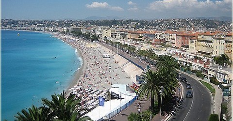
Promenade des Anglais, start location of the 'Tour'

The observatoire, finish location of the day

The route of the day!
I'm going to add another event to the list: the Tour des Alpes Maritimes. This region is shamefully underused in the Tour the France, and unfortunately Paris Nice is just held to early to allow visiting the mountains there. The race can be hold somewhere during the Giro as preparation for the Tour the France.
With 4 days it will be a short race, but there will be enough spectacle. Each day will suit different riders, but overall the climbers are really favoured.
Stage 1: Nice - Observatoire du Nice (11,5 KM ITT)
As you might have expected, the race will start in the Capital of the department. And what is a better place to start than the famous Promenade des Anglais? Contenders for the overall should be sharp immediately, because this time trial will be very technical. The first 7 Kilometres along the coast should not provide problems, but after passing Villefrance sur Mer the troubles will start. Within only 2,5 kilometres the riders will gain 300 altitude meters to reach the the top of the Mont Vinaigrier. Luckily, the riders can have a small rest while descending to the Col du Quatre Chemins. They will need it, because the final ramp to the observatoire will be steep as well!
Promenade des Anglais, start location of the 'Tour'
The observatoire, finish location of the day
The route of the day!
- Dec 16, 2011
- 345
- 0
- 0
Stage 2: Nice - Antibes (158 Km)
As a gift to the riders the first line stage will not be really difficult. The peloton can enjoy sightseeing while passing all the beautiful cities of the Departement: Nice, Cagnes sur Mer, Vence, Tourette sur Loup, Grasse, Mandelieu de Napoule, Cannes and the finishing place Antibes. Only the climbs of the Col du vence, Col du Gourdon, Col du Grand Duc and Col du Trayas could provide some troubles. Since no sprinter will be that crazy to even start in this race, this stage could have interesting outcomes.

The finish is located at the beautiful port of Antibes

The day's route!
As a gift to the riders the first line stage will not be really difficult. The peloton can enjoy sightseeing while passing all the beautiful cities of the Departement: Nice, Cagnes sur Mer, Vence, Tourette sur Loup, Grasse, Mandelieu de Napoule, Cannes and the finishing place Antibes. Only the climbs of the Col du vence, Col du Gourdon, Col du Grand Duc and Col du Trayas could provide some troubles. Since no sprinter will be that crazy to even start in this race, this stage could have interesting outcomes.
The finish is located at the beautiful port of Antibes
The day's route!
- Dec 16, 2011
- 345
- 0
- 0
Stage 3: Grasse - Madone de Fenestre (180,5 KM)
Ok, I admit it. The only reason that I've created this race was to show you this stage. I could have made a whole tour, but I was to lazy
Starting place Grasse is well known from the beautiful book & movie 'Perfume', but that doesn't count today. The same holds for the climbs of the Col du Ferrier, Col du Bleine, Col du Valberg and Col du Couillole; nice, but today it's all about the last 35 kilometres...
Forget the Alpe! Forget Mont Ventoux! The new legend of French cycling will be Madone de Fenestre. Like the Galibier, this climb consist of two parts, leading to a total elevation nearby 2000 meters! The Col Saint Martin will already make the riders suffer. However the real fun will await after just 8 Km of descent to Saint Martin Vesuble: Madone de Fenestre! This climb will mean 12 kilometres of suffering. The average gradient is not that high (8,5%), but the climb is as irregular as possible. Luckily, the finish will be at the 'holy' Chapel de Fenestre.
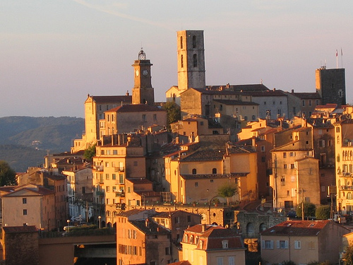
Grasse

Salvation is waiting at today's finishing place.

The route of the day!
Ok, I admit it. The only reason that I've created this race was to show you this stage. I could have made a whole tour, but I was to lazy
Starting place Grasse is well known from the beautiful book & movie 'Perfume', but that doesn't count today. The same holds for the climbs of the Col du Ferrier, Col du Bleine, Col du Valberg and Col du Couillole; nice, but today it's all about the last 35 kilometres...
Forget the Alpe! Forget Mont Ventoux! The new legend of French cycling will be Madone de Fenestre. Like the Galibier, this climb consist of two parts, leading to a total elevation nearby 2000 meters! The Col Saint Martin will already make the riders suffer. However the real fun will await after just 8 Km of descent to Saint Martin Vesuble: Madone de Fenestre! This climb will mean 12 kilometres of suffering. The average gradient is not that high (8,5%), but the climb is as irregular as possible. Luckily, the finish will be at the 'holy' Chapel de Fenestre.
Grasse
Salvation is waiting at today's finishing place.
The route of the day!
- Dec 16, 2011
- 345
- 0
- 0
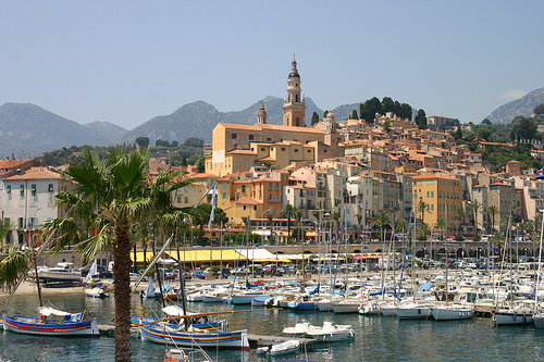
Stage 4: Saint Sauveur sur Tinee - Menton (160 KM)
Well, it's already time for the last stage of this Tour. We haven't seen a mountain stage with a downhill finish yet, so this will be the moment. The starting location is probably the smallest village of the department, but finish location Menton has a lot of grandeur! Meanwhile the peloton will have to overcome several climbs, like the Madone d'Utelle, Col du Turini and the Col du Madone. The last climb was the training area of Lance Armstrong, and therefore he renamed his bike to this climb. After passing the top, only a 15 KM descent awaits before the finish at the boulevard in Menton.

Saint Sauveur sur Tineé
The riders can go straight to the beach after the finish in Menton!

The route of the day!
Well, it's already time for the last stage of this Tour. We haven't seen a mountain stage with a downhill finish yet, so this will be the moment. The starting location is probably the smallest village of the department, but finish location Menton has a lot of grandeur! Meanwhile the peloton will have to overcome several climbs, like the Madone d'Utelle, Col du Turini and the Col du Madone. The last climb was the training area of Lance Armstrong, and therefore he renamed his bike to this climb. After passing the top, only a 15 KM descent awaits before the finish at the boulevard in Menton.
Saint Sauveur sur Tineé
The riders can go straight to the beach after the finish in Menton!
The route of the day!
- Feb 20, 2010
- 33,254
- 15,788
- 28,180
Don't apologise. I love Alpes-Maritimes, and consider the region shamefully underused (hence my Sospel-Barcelonnette stage in my Tour, with Cayolle, Couillole, Braus and Turini). Both of the last two stages are excellent, and I wholeheartedly approve. The last stage is like the now typical Paris-Nice closer, but beefed up a lot.
- Feb 20, 2010
- 33,254
- 15,788
- 28,180
After a short trip back to Palma and a boat ride, the Vuelta continues on the Sunday...
Stage 8: Dénia - Font de Partagas, 140km


Climbs:
Collado del Miserat (cat.2) 7,0km @ 7,9%
Alto del Tollos (cat.3) 3,2km @ 6,0%
Port de Tudons (cat.2) 7,2km @ 5,3%
Alto del Benimantell (cat.2) 8,3km @ 5,3%
Font de Partagas (cat.MTF) 7,2km @ 8,6%
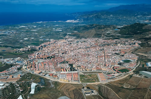
Back on the Spanish mainland, arriving at the smallest of the cities that provides regular boats out to Palma de Mallorca, we have another medium mountain stage and, in one of the more bizarre twists of race design, our third mountaintop finish of week 1 - out of only 4 in the whole race.
This is again not a real high mountain stage - those are yet to come - but with a lot of up and down in it, but given the travelling the riders will have done, the stage is fairly short, which may impede the creation of large time gaps.
There is a case to be made that the hardest climb of the day is, in fact, the first one; we are climbing the first 7km of this punishing ascent; after the first two kilometres of barely uphill, there are 5km at over 10% and a maximum of 24%. This could create a very interesting breakaway given the characteristics of the stage. After the tricky roads of the Miserat, however, it becomes a bit easier; Tollos and Tudons aren't too difficult. Tudons is a particularly regular Vuelta staple, being as it is both part of the usual run-in to Xorret del Catí and a halfway house on the road to the Alto de Aitana. Nothing so straightforward today however, and Tudons marks the stage's halfway point.
The next 40km feature descent and then flat around the area of the 2011 Grand Départ, Benidorm. The real important part of the stage is the last 30km; this is where the seconds will be won and lost today. The action starts in the village of Polop; from here the riders will take on the ascent to the small mountain town of Benimantell. Though the average gradient is unimposing, there are a few more difficult stretches in the climb, as shown on the profile - as you can see, that 5th km is especially nasty. This tops out at 20km to go, before a brief descent and a short flat period encircling the Embalse de Guadalest - you can see part of the road in that photo. This will take us to the base of the finishing climb.
Font de Partagas is an almost unknown killer. Yes, it's another of those mid-length climbs that this Vuelta has been all about - the three MTFs have been 7,8km, 8,0km and now 7,2km in length - but at an average of 8,6% this one could hurt. The climb could be good for the likes of Joaquím Rodríguez - he could go when it's steep at the bottom, but if that doesn't work out, wait while it's flattish around Benifato, then attack in the last 2-3 super steep km again. A maximum of over 20% says that this is going to put some of the heavier contenders out the back door, especially with 500m averaging 12,9% in the last kilometre. If they can drive up this thing with snow on the ground, it's plenty suitable for cycling in late August-early September, and it's a part of the Sierra de Aitana not really known to cyclists. This is a chance to rectify that, as well as providing a satisfactorily weekend stage. The stage is pretty short so gaps may be small, but also with less mileage in the legs, riders may be more aggressive than otherwise.
Dénia:

Font de Partagas:

Stage 8: Dénia - Font de Partagas, 140km
Climbs:
Collado del Miserat (cat.2) 7,0km @ 7,9%
Alto del Tollos (cat.3) 3,2km @ 6,0%
Port de Tudons (cat.2) 7,2km @ 5,3%
Alto del Benimantell (cat.2) 8,3km @ 5,3%
Font de Partagas (cat.MTF) 7,2km @ 8,6%
Back on the Spanish mainland, arriving at the smallest of the cities that provides regular boats out to Palma de Mallorca, we have another medium mountain stage and, in one of the more bizarre twists of race design, our third mountaintop finish of week 1 - out of only 4 in the whole race.
This is again not a real high mountain stage - those are yet to come - but with a lot of up and down in it, but given the travelling the riders will have done, the stage is fairly short, which may impede the creation of large time gaps.
There is a case to be made that the hardest climb of the day is, in fact, the first one; we are climbing the first 7km of this punishing ascent; after the first two kilometres of barely uphill, there are 5km at over 10% and a maximum of 24%. This could create a very interesting breakaway given the characteristics of the stage. After the tricky roads of the Miserat, however, it becomes a bit easier; Tollos and Tudons aren't too difficult. Tudons is a particularly regular Vuelta staple, being as it is both part of the usual run-in to Xorret del Catí and a halfway house on the road to the Alto de Aitana. Nothing so straightforward today however, and Tudons marks the stage's halfway point.
The next 40km feature descent and then flat around the area of the 2011 Grand Départ, Benidorm. The real important part of the stage is the last 30km; this is where the seconds will be won and lost today. The action starts in the village of Polop; from here the riders will take on the ascent to the small mountain town of Benimantell. Though the average gradient is unimposing, there are a few more difficult stretches in the climb, as shown on the profile - as you can see, that 5th km is especially nasty. This tops out at 20km to go, before a brief descent and a short flat period encircling the Embalse de Guadalest - you can see part of the road in that photo. This will take us to the base of the finishing climb.
Font de Partagas is an almost unknown killer. Yes, it's another of those mid-length climbs that this Vuelta has been all about - the three MTFs have been 7,8km, 8,0km and now 7,2km in length - but at an average of 8,6% this one could hurt. The climb could be good for the likes of Joaquím Rodríguez - he could go when it's steep at the bottom, but if that doesn't work out, wait while it's flattish around Benifato, then attack in the last 2-3 super steep km again. A maximum of over 20% says that this is going to put some of the heavier contenders out the back door, especially with 500m averaging 12,9% in the last kilometre. If they can drive up this thing with snow on the ground, it's plenty suitable for cycling in late August-early September, and it's a part of the Sierra de Aitana not really known to cyclists. This is a chance to rectify that, as well as providing a satisfactorily weekend stage. The stage is pretty short so gaps may be small, but also with less mileage in the legs, riders may be more aggressive than otherwise.
Dénia:
Font de Partagas:
- Feb 20, 2010
- 33,254
- 15,788
- 28,180
Stage 9: Yecla - Villarrobledo, 166km


After the amount of travelling in the last few days, from the rest day to Ibiza, to Mallorca and then back onto the mainland, with some difficult climbing in between, it's time for one of "those" Vuelta stages, scorching hot through the flatlands of Castilla-La Mancha and with little respite in sight. The stage starts in our only expedition into the province of Murcía, a short run out of today's start town of Yecla. The riders will spend a while on a slightly elevated plateau until Chinchilla de Monte Aragón, upon which they will gradually drop into Albacete, and from there it is very straight and very flat. Getting into the break today will be a thankless task, so we can imagine it could well be one of those for one solitary rider on a Spanish continental team making his lonely, suffering way along the route.
The finish is in the city of Villarrobledo, in the heart of La Mancha. The area around the city is known for its vineyards and also for its difficult weather - there could well be 40º+ temperatures for the riders to deal with, with a gruño of shade to be found. The riders will circle the town a couple of times, but whichever way you look at it, this is a sprint. It's just how many riders are removed from the bunch by attrition in the heat.
Yecla:
Villarrobledo:
- Feb 20, 2010
- 33,254
- 15,788
- 28,180
Stage 10: Daimiel - Daimiel, 45,4km (ITT)


Our second consecutive stage without a single climb to mark it, this one is absolutely completely and utterly pan-flat. Which is good, because it's the first full length contra-relógio, and will allow the TT men to make up any time lost on the mid-length summits to date... and potentially then some. There isn't a great deal to say about this one; the riders go along the edges of, but not into, the Parque Nacional Tablas de Daimiel, allowing some nice views from the helicam. Daimiel is a middle-sized town in the Ciudad Real area, mostly known for the Martyrs of Daimiel, members of a Passionist monastery who were ritually executed during the Civil War; we are fairly close to Ciudad Real, where a similar 42km ITT took place in 2008, but I felt it better to try using some new towns in the route; Ciudad Real is, like Ávila, Talavera de la Reina, Córdoba or Burgos, a very 'safe' choice as a location, and as I've already used Ávila and Burgos I felt I should do something less predictable.
The TT itself is a simple route, split into three roads; one long curved one from Daimiel to Villarrubia de los Ojos, a smaller road linking Villarrubia to Manzanares, until reaching the N420, which we take back to Daimiel. This is one for the absolute ITT purists. I'd say Bavarianrider will be happy, but he'll argue that I could easily have put in another 14,5km.
Daimiel:

Las Tablas de Daimiel:

Our second consecutive stage without a single climb to mark it, this one is absolutely completely and utterly pan-flat. Which is good, because it's the first full length contra-relógio, and will allow the TT men to make up any time lost on the mid-length summits to date... and potentially then some. There isn't a great deal to say about this one; the riders go along the edges of, but not into, the Parque Nacional Tablas de Daimiel, allowing some nice views from the helicam. Daimiel is a middle-sized town in the Ciudad Real area, mostly known for the Martyrs of Daimiel, members of a Passionist monastery who were ritually executed during the Civil War; we are fairly close to Ciudad Real, where a similar 42km ITT took place in 2008, but I felt it better to try using some new towns in the route; Ciudad Real is, like Ávila, Talavera de la Reina, Córdoba or Burgos, a very 'safe' choice as a location, and as I've already used Ávila and Burgos I felt I should do something less predictable.
The TT itself is a simple route, split into three roads; one long curved one from Daimiel to Villarrubia de los Ojos, a smaller road linking Villarrubia to Manzanares, until reaching the N420, which we take back to Daimiel. This is one for the absolute ITT purists. I'd say Bavarianrider will be happy, but he'll argue that I could easily have put in another 14,5km.
Daimiel:
Las Tablas de Daimiel:
- Feb 20, 2010
- 33,254
- 15,788
- 28,180
Stage 11: Valdepeñas - La Guardia de Jaén, 220km


Climbs:
Santa Elena (no puntable) 3,6km @ 4,7%
Alto de Úbeda (cat.2) 12,7km @ 3,7%
Alto de Jodar (cat.2) 12,3km @ 3,4%
Puerto de Albánchez (cat.2) 16,2km @ 4,0%
Alto de la Guardia de Jaén (no puntable) 1,8km @ 8,2%
Alto de la Guardia de Jaén (no puntable) 1,8km @ 8,2%
A long, difficult stage from La Mancha into Andalucía, this stage is one that is tailor-made for the breakaway, but also offers plenty of opportunities for GC riders to make up some time; either by being daring on the many ups and downs of the day, or, more likely, by picking up a few seconds and maybe time bonuses on the tough uphill run-in.
The first half of the stage is easy enough, rolling terrain on a net downhill as the race heads south. We're nearly 100km in before the first real climb of the day begins, the gradual but decent length grind up to the town of Úbeda. After this it's a similarly gradual but inconsistent downhill, and then a similar inconsistent but ultimately fairly manageable gradual rise up to (just on the edge of the hills above) the town of Jodar. This is followed almost immediately by the toughest climb of the day, the 16km grind up past Albánchez to its eponymous mountain pass. This consists of about 7km at 4%, then a couple of downhill/false flat kilometres, and another 7 at around 5-5,5%.
The Puerto de Albánchez crests with 60km to go, and though no further climbs are categorised, that's pretty much it for flat for the day. A couple of digs around Mancha Real are followed by a descent from the Alto de Pegalajar, before a first visua at the stage's finish, the sometimes steep 1,8km rise into La Guardia de Jaén. After a loop, which includes another small hill in Jaén itself, there is about 7km of uphill false flat before they take on the climb to the finish in La Guardia de Jaén.
This climb was used to nice effect in the Ruta del Sol this year, and they have thoughtfully provided a profile here - you can see the video highlights of the stage, which was won by Daniel Moreno ahead of Alejandro Valverde (which should give you an idea of the type of finish it is) here. With 220km in the legs and, though no real tough obstacles, a hard day in the saddle with several small or long but shallow climbs before it, there is definitely the scope to open up some gaps here much like a Valdepeñas de Jaén or San Lorenzo de El Escorial styled stage.
Valdepeñas:

La Guardia de Jaén:
Climbs:
Santa Elena (no puntable) 3,6km @ 4,7%
Alto de Úbeda (cat.2) 12,7km @ 3,7%
Alto de Jodar (cat.2) 12,3km @ 3,4%
Puerto de Albánchez (cat.2) 16,2km @ 4,0%
Alto de la Guardia de Jaén (no puntable) 1,8km @ 8,2%
Alto de la Guardia de Jaén (no puntable) 1,8km @ 8,2%
A long, difficult stage from La Mancha into Andalucía, this stage is one that is tailor-made for the breakaway, but also offers plenty of opportunities for GC riders to make up some time; either by being daring on the many ups and downs of the day, or, more likely, by picking up a few seconds and maybe time bonuses on the tough uphill run-in.
The first half of the stage is easy enough, rolling terrain on a net downhill as the race heads south. We're nearly 100km in before the first real climb of the day begins, the gradual but decent length grind up to the town of Úbeda. After this it's a similarly gradual but inconsistent downhill, and then a similar inconsistent but ultimately fairly manageable gradual rise up to (just on the edge of the hills above) the town of Jodar. This is followed almost immediately by the toughest climb of the day, the 16km grind up past Albánchez to its eponymous mountain pass. This consists of about 7km at 4%, then a couple of downhill/false flat kilometres, and another 7 at around 5-5,5%.
The Puerto de Albánchez crests with 60km to go, and though no further climbs are categorised, that's pretty much it for flat for the day. A couple of digs around Mancha Real are followed by a descent from the Alto de Pegalajar, before a first visua at the stage's finish, the sometimes steep 1,8km rise into La Guardia de Jaén. After a loop, which includes another small hill in Jaén itself, there is about 7km of uphill false flat before they take on the climb to the finish in La Guardia de Jaén.
This climb was used to nice effect in the Ruta del Sol this year, and they have thoughtfully provided a profile here - you can see the video highlights of the stage, which was won by Daniel Moreno ahead of Alejandro Valverde (which should give you an idea of the type of finish it is) here. With 220km in the legs and, though no real tough obstacles, a hard day in the saddle with several small or long but shallow climbs before it, there is definitely the scope to open up some gaps here much like a Valdepeñas de Jaén or San Lorenzo de El Escorial styled stage.
Valdepeñas:
La Guardia de Jaén:
- Feb 20, 2010
- 33,254
- 15,788
- 28,180
EDIT (22 Jul 2012): I have just noticed in hunting images for my Gran Canaria stage that this stage is seemingly absolutely identical to this one posted on the APM forums by Visko in October 2011. Despite my frequenting of APM and Altimetrias, I don't tend to use their forums and was not aware of this post. I'm kind of happy to learn that my ideas aren't those of a lone nut though!
Stage 12: Granada - Motril, 191km


Climbs:
Alto de los Tablones (cat.3) 4,4km @ 5,9%
Collado de Canseco (cat.1) 19,2km @ 4,1%
Haza del Lino (cat.1) 18,0km @ 7,1%
Alto de Conjuros (cat.2) 10,0km @ 5,7%
The first real 'high' mountains day; we've had a lot of medium mountains thus far, but this is the first time the real long, painful stuff really rears its head. And again I disappoint those who love the Sierra Nevada, since we're heading to the coast again.
Starting off in the common Vuelta stop-off of Granada, this is a long and hard stage through the blazing heat of the south - the riders will be glad this comes over halfway through the race for sure. It's quite possible given cycling in 2012 that this will be a total anticlimax, but the course is there to give us a monstrous last 65km if the racing can match; hopefully the heat and difficulty of the race can reduce the bunch by attrition before then, creating isolated leaders and making for a more entertaining finish.
We start off with a rolling beginning, passing spots like Güejar Sierra and Monachil as we circumnavigate the southwest face of the Sierra Nevada. Plenty of up and even more down in the first 55km of the day, before the climbing is to begin in earnest. The low point of the early going is just after the town of Órgiva, base town of a great many Andalucían climbs. Tablones, our first climb, is one of the least threatening of these, rising from the banks of the Rio Guadalfeo for just 4km or so, before a return to the same rolling terrain as before on the way into Torvizcón.
After this, the climbing starts for real. Though its meagre average gradient may suggest otherwise, the Collado de Canseco is really tough - as you can see from the profile, that 7km at 8% early in the climb makes up for the periods of descent and flat elsewhere, and the difficult gradients come thick and fast - just look at this shot of the base of the climb, part of this series of photos taken by APM's Martín Cerván. The summit of Canseco, at 1358m, is as high as the stage will go, and leads into a 30km descent down to sea level through Albondón and Albuñol. This is followed by about 10-15km of flat riding along the Mediterranean coast before we arrive at that painful final 65km.
You may remember from my previous Vuelta that I had a summit finish at Haza del Lino, climbing from Rubite. It may come as no surprise to see this criminally underused climb appear in my plans once again, but this time we're handling the slightly shorter, but with a higher average gradient, Polopos side of the climb. If anything this is slightly easier (no stop-start sections jumping up past 15%), but with several km at 8 or 9% early in the climb, you can see attacks being made even before the town of Polopos itself - with the steepest gradients of 14% being reached just before it. The rest of the climb is less uniform but the gradients aren't as punishing. Nevertheless, this is a challenging and picturesque climb and the summit comes 47km from home; hopefully the group should be very small before the technical descent into Castell de Ferro.
The road doesn't stay flat for long, though. Almost immediately the riders turn back inland to face another climb. Though this one isn't as difficult, isolated riders and attrition after Canseco and Haza del Lino should render the cat.2 slopes of Conjuros rife for attacks. The maximum gradient is 11%, and the average 5,7%, but lasting 10km on the back of the legbreakers already gone should mean that we see fireworks; it's also easy enough that it might tempt a desperate attacker to proceed from Haza del Lino if need be. Again we're overlooking the Mediterranean, and the altitude is lower here as well so the heat will become a factor again as we head through Gualchos up the barren mountainside. The summit of the Alto de Conjuros is 13km from the finish; the majority of the remainder of the stage is a frenetic descent into El Puntal, before a final, flat 3km into Motril to finish the stage.
The riders have had a lot of chances to animate the race in today's stage, so if we get a bunch of all the heads of state riding together into Motril, you will know that the Giro 2012 disease is spreading. Luckily, I've planned ahead for that eventuality.
Granada:
Motril:
Stage 12: Granada - Motril, 191km
Climbs:
Alto de los Tablones (cat.3) 4,4km @ 5,9%
Collado de Canseco (cat.1) 19,2km @ 4,1%
Haza del Lino (cat.1) 18,0km @ 7,1%
Alto de Conjuros (cat.2) 10,0km @ 5,7%
The first real 'high' mountains day; we've had a lot of medium mountains thus far, but this is the first time the real long, painful stuff really rears its head. And again I disappoint those who love the Sierra Nevada, since we're heading to the coast again.
Starting off in the common Vuelta stop-off of Granada, this is a long and hard stage through the blazing heat of the south - the riders will be glad this comes over halfway through the race for sure. It's quite possible given cycling in 2012 that this will be a total anticlimax, but the course is there to give us a monstrous last 65km if the racing can match; hopefully the heat and difficulty of the race can reduce the bunch by attrition before then, creating isolated leaders and making for a more entertaining finish.
We start off with a rolling beginning, passing spots like Güejar Sierra and Monachil as we circumnavigate the southwest face of the Sierra Nevada. Plenty of up and even more down in the first 55km of the day, before the climbing is to begin in earnest. The low point of the early going is just after the town of Órgiva, base town of a great many Andalucían climbs. Tablones, our first climb, is one of the least threatening of these, rising from the banks of the Rio Guadalfeo for just 4km or so, before a return to the same rolling terrain as before on the way into Torvizcón.
After this, the climbing starts for real. Though its meagre average gradient may suggest otherwise, the Collado de Canseco is really tough - as you can see from the profile, that 7km at 8% early in the climb makes up for the periods of descent and flat elsewhere, and the difficult gradients come thick and fast - just look at this shot of the base of the climb, part of this series of photos taken by APM's Martín Cerván. The summit of Canseco, at 1358m, is as high as the stage will go, and leads into a 30km descent down to sea level through Albondón and Albuñol. This is followed by about 10-15km of flat riding along the Mediterranean coast before we arrive at that painful final 65km.
You may remember from my previous Vuelta that I had a summit finish at Haza del Lino, climbing from Rubite. It may come as no surprise to see this criminally underused climb appear in my plans once again, but this time we're handling the slightly shorter, but with a higher average gradient, Polopos side of the climb. If anything this is slightly easier (no stop-start sections jumping up past 15%), but with several km at 8 or 9% early in the climb, you can see attacks being made even before the town of Polopos itself - with the steepest gradients of 14% being reached just before it. The rest of the climb is less uniform but the gradients aren't as punishing. Nevertheless, this is a challenging and picturesque climb and the summit comes 47km from home; hopefully the group should be very small before the technical descent into Castell de Ferro.
The road doesn't stay flat for long, though. Almost immediately the riders turn back inland to face another climb. Though this one isn't as difficult, isolated riders and attrition after Canseco and Haza del Lino should render the cat.2 slopes of Conjuros rife for attacks. The maximum gradient is 11%, and the average 5,7%, but lasting 10km on the back of the legbreakers already gone should mean that we see fireworks; it's also easy enough that it might tempt a desperate attacker to proceed from Haza del Lino if need be. Again we're overlooking the Mediterranean, and the altitude is lower here as well so the heat will become a factor again as we head through Gualchos up the barren mountainside. The summit of the Alto de Conjuros is 13km from the finish; the majority of the remainder of the stage is a frenetic descent into El Puntal, before a final, flat 3km into Motril to finish the stage.
The riders have had a lot of chances to animate the race in today's stage, so if we get a bunch of all the heads of state riding together into Motril, you will know that the Giro 2012 disease is spreading. Luckily, I've planned ahead for that eventuality.
Granada:
Motril:
- Jun 28, 2012
- 798
- 0
- 0
http://www.mapmyride.com/routes/view/108805923
If somebody could edit this thing to make it visible within this page, please do. (it's a stage that includes both Mont Ventoux and Alpe d'Huez...would require a waiver from the UCI, as it's over their 240 km maximum)
If somebody could edit this thing to make it visible within this page, please do. (it's a stage that includes both Mont Ventoux and Alpe d'Huez...would require a waiver from the UCI, as it's over their 240 km maximum)
- Jun 28, 2012
- 798
- 0
- 0
Here's another one, this one for the Giro d'Italia. Includes the Passo Stelvio (twice, once from each side, with the Bormio side being climbed at the conclusion), Mortirolo, and Gavia.
http://www.mapmyride.com/routes/view/110249259
http://www.mapmyride.com/routes/view/110249259
- Jun 28, 2012
- 798
- 0
- 0
Ferminal said:You're allowed two stages >240km in a GT.
As opposed to doing Stelvio twice, you could instead do Bormio 2000 after Gavia.
Thanks for the thought, although I think I prefer the Bormio-side Stelvio as the finishing climb.
BTW, I can't seem to get it to work in viewer mode...any chance you could identify the two category-one climbs on the Mont Ventoux-Alpe d'Huez combination stage?
TRENDING THREADS
-
 Paris-Roubaix 2026, one day monument, April 12
- Started by Lequack
- Replies: 2K
-
 Itzulia Basque Country 2026, April 6-11
- Started by Dazed and Confused
- Replies: 2K
-

-
 Ronde van Vlaanderen 2026, monument, April 5 (men's)
- Started by Krzysztof_O
- Replies: 1K
-

-
 Liège - Bastogne - Liège 2026, one-day monument, 26th April
- Started by Krzysztof_O
- Replies: 167
-

Cyclingnews is part of Future plc, an international media group and leading digital publisher. Visit our corporate site.
© Future Publishing Limited Quay House, The Ambury, Bath BA1 1UA. All rights reserved. England and Wales company registration number 2008885.