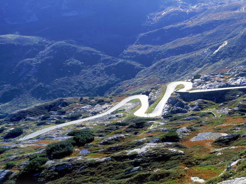
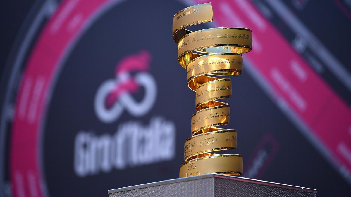
Here we are again, after only six months. The 104th Giro d’Italia. In my opinion, the 2021 route is a step backwards with respect to the last two editions, due to the lack of a mid-race time trial and the overuse of hard mountain top finishes. That is not to say all is bad though. The biggest redeeming quality of this Giro, by far, is the return of a proper sterrato stage, which if we are lucky will produce the same kind of gaps that a long time trial would. It is also a bit less backloaded than usual, with several stages in the first half that should see GC action, albeit only in the final kilometers. Despite the virus, the route will (at least in theory) enter Slovenia and Switzerland, although all start and finish locations are in Italian soil. Hopefully that will not cause any issue. This year we will also avoid high altitude climbs, so the risk of stage alterations should be minimal, and we will probably be free to hope for bad weather, for once.
On the other hand, the field looks pretty good on paper, even though many favorites have a question mark regarding their form. A question mark that should dissipate fairly quickly, as already in the first week the GC guys will have to show themselves. We'll see. Less than ten days left")

STAGES
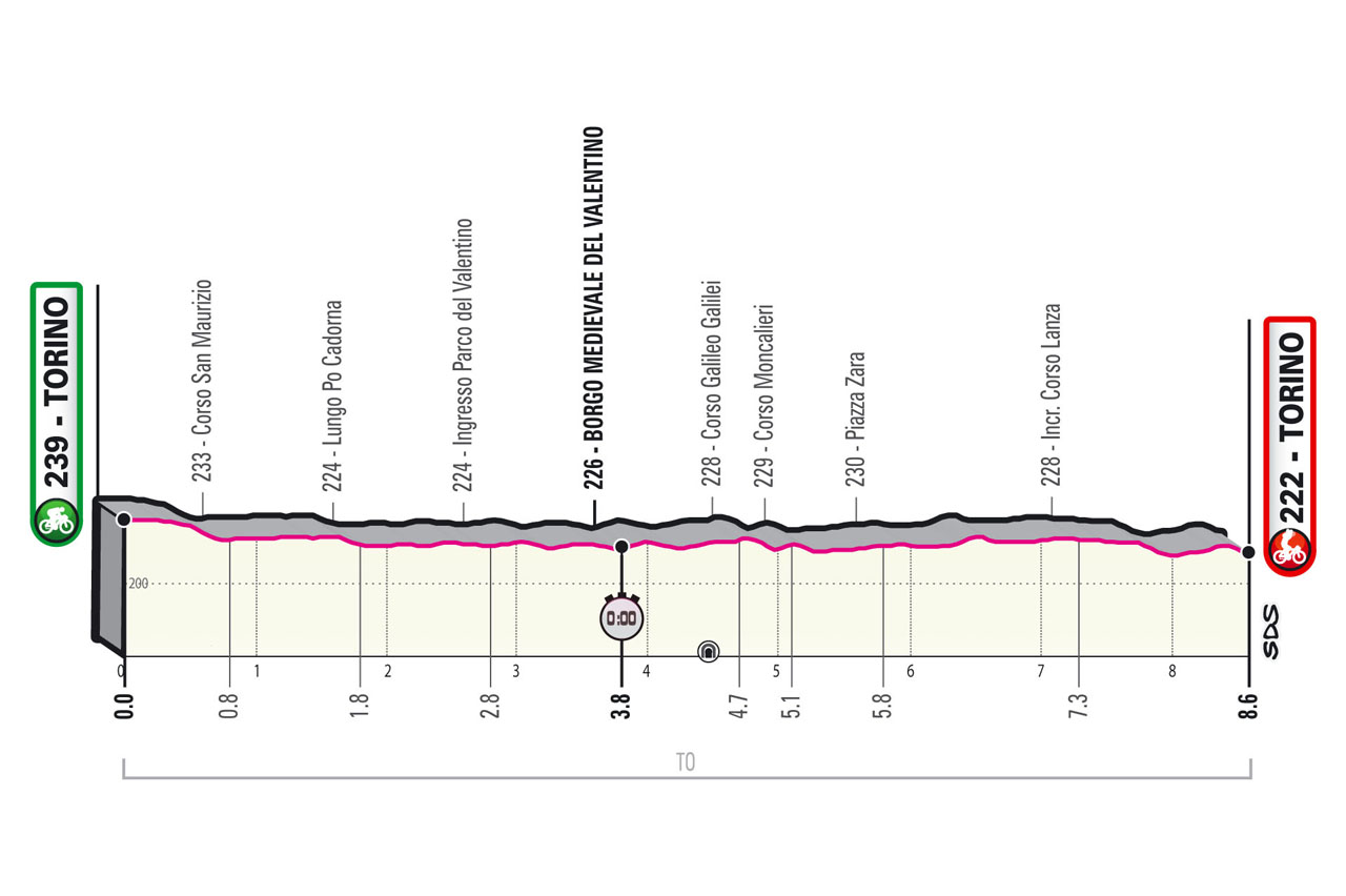
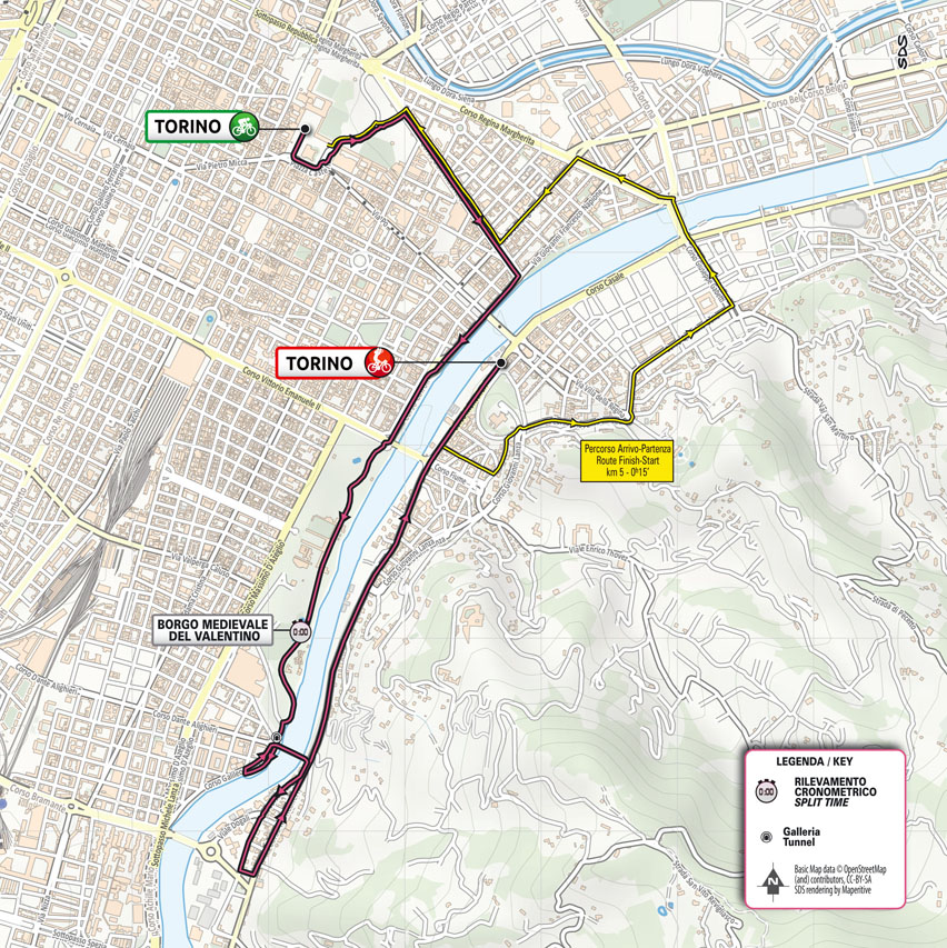
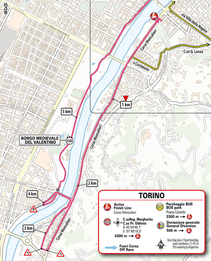
Stage 1: Torino - Torino 8.6 km ITT
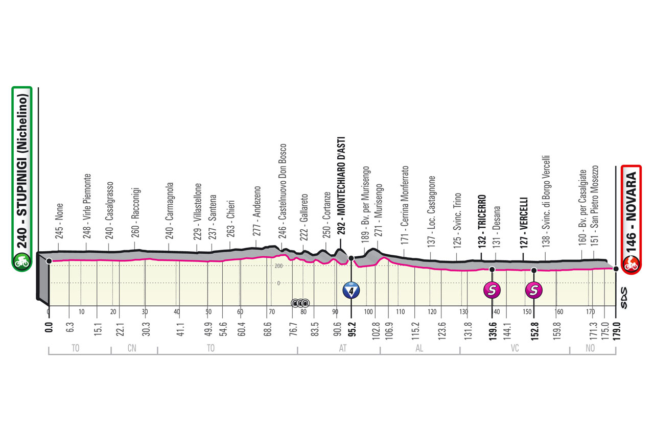
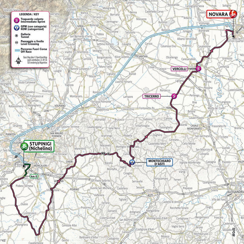
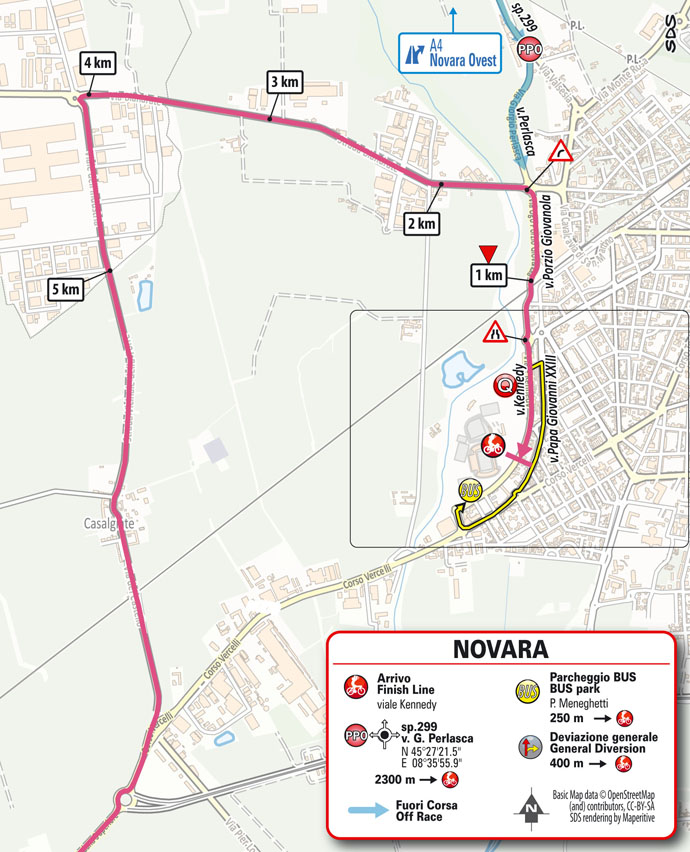
Stage 2: Stupinigi - Novara 179 km
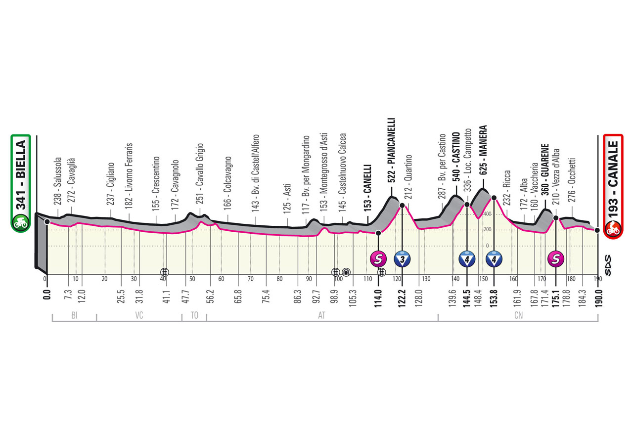
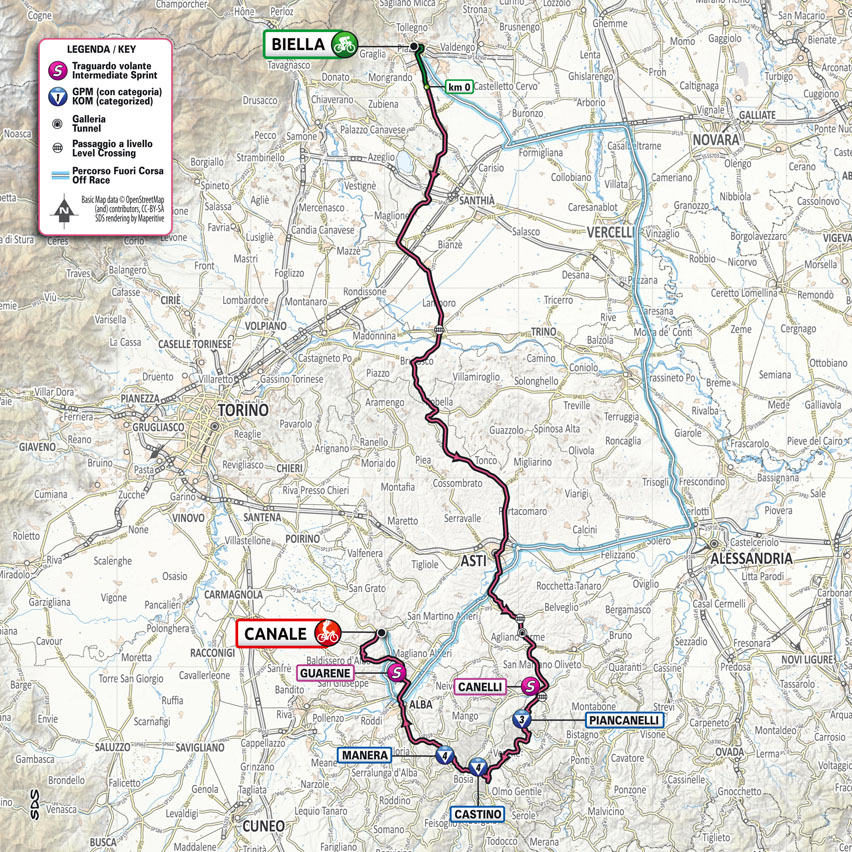
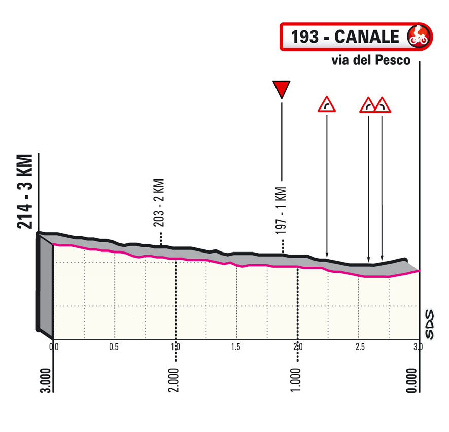
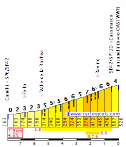
Stage 3: Biella - Canale 190 km
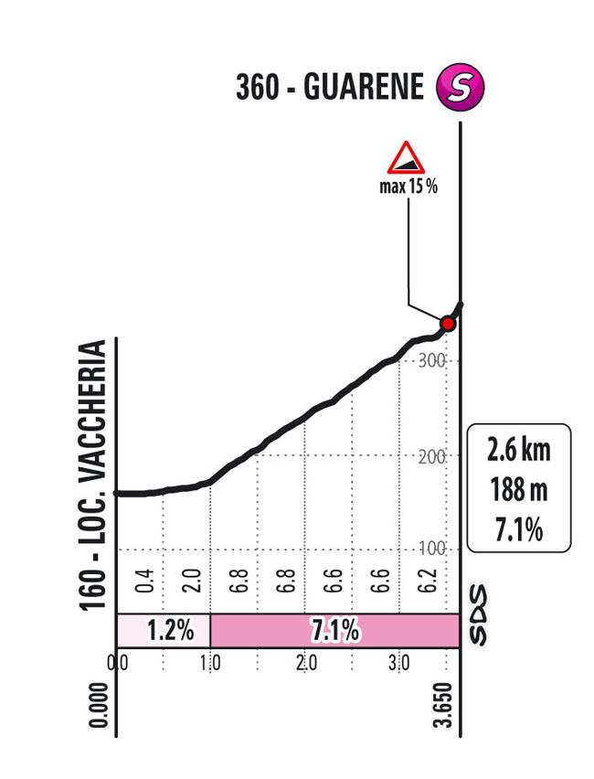
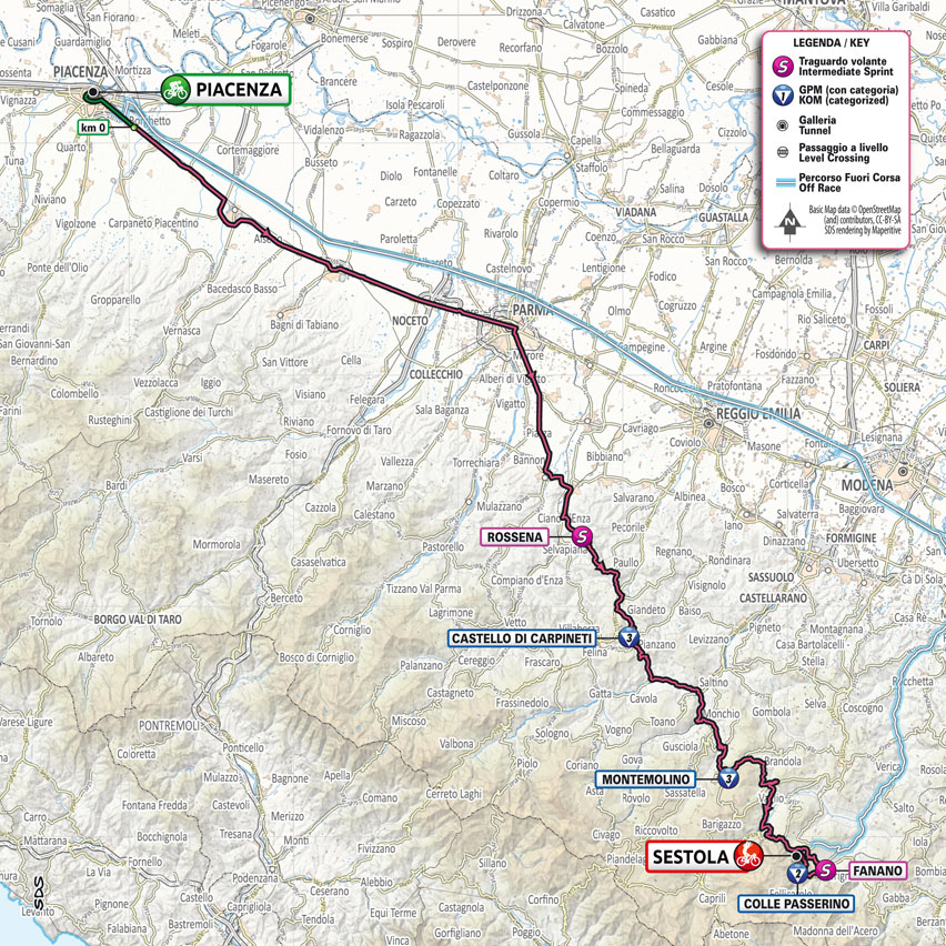
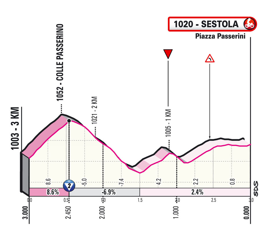
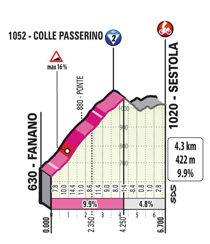
Stage 4: Piacenza - Sestola 187 km
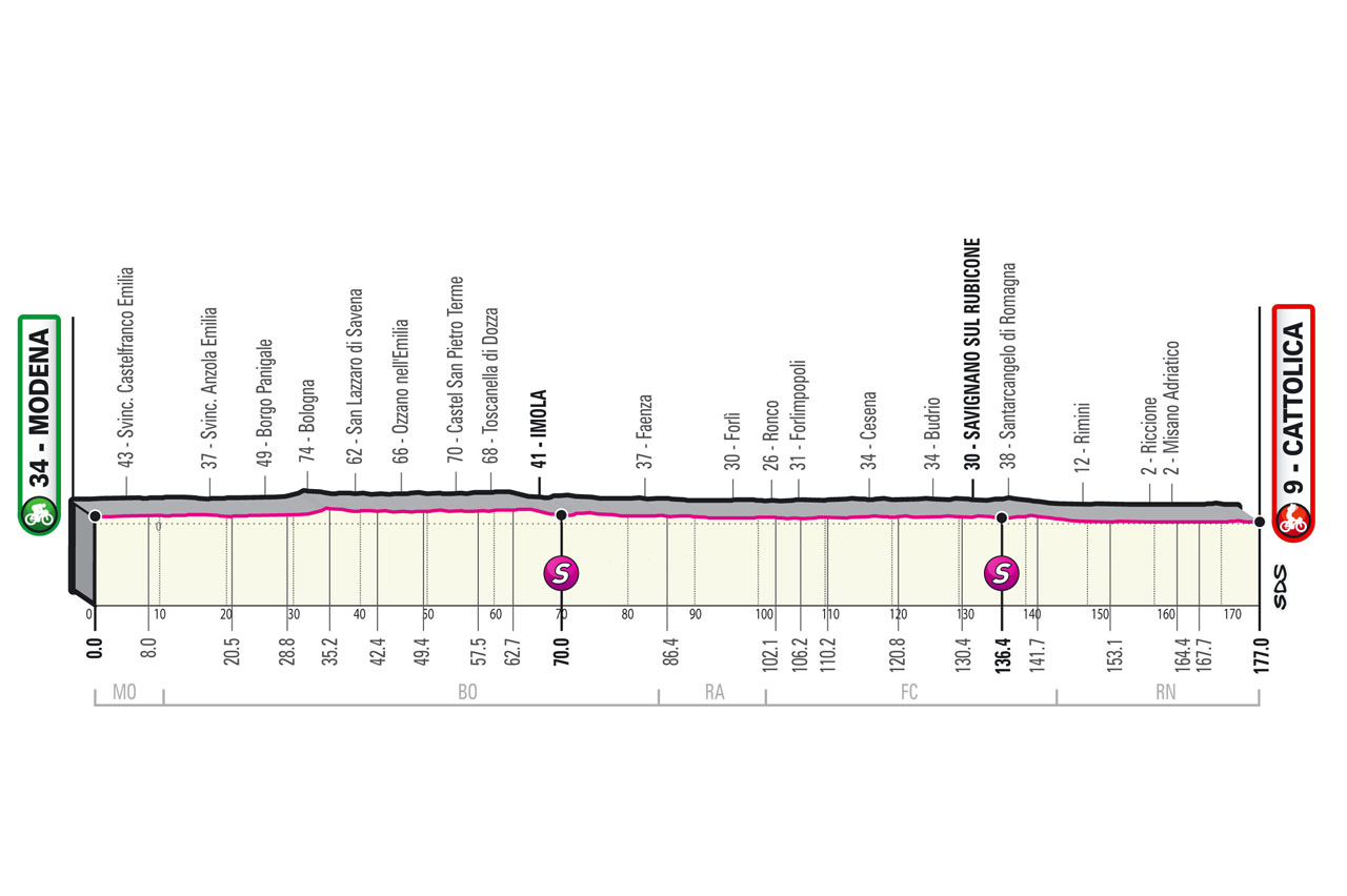
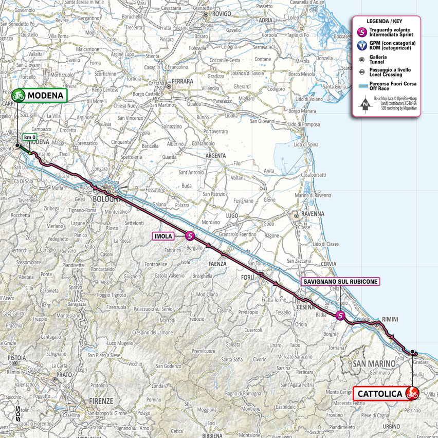
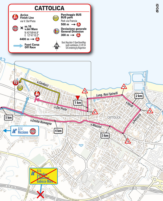
Stage 5: Modena - Cattolica 177 km
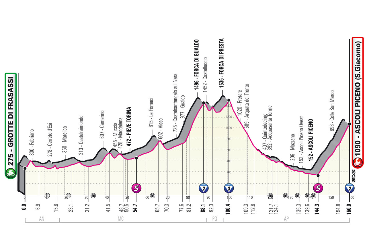
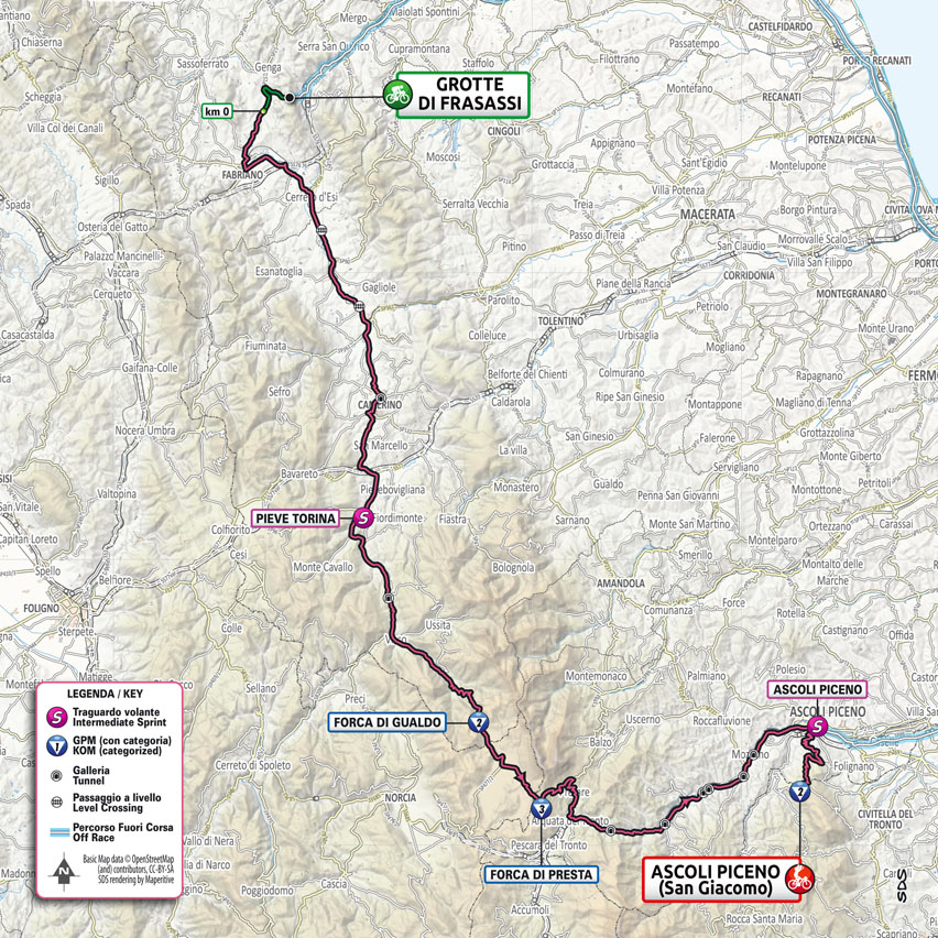
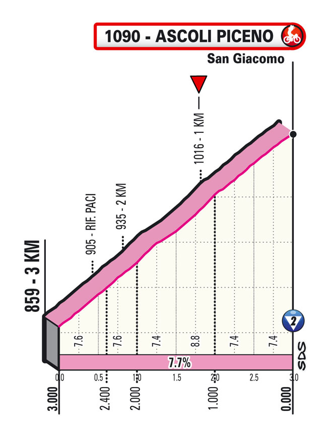
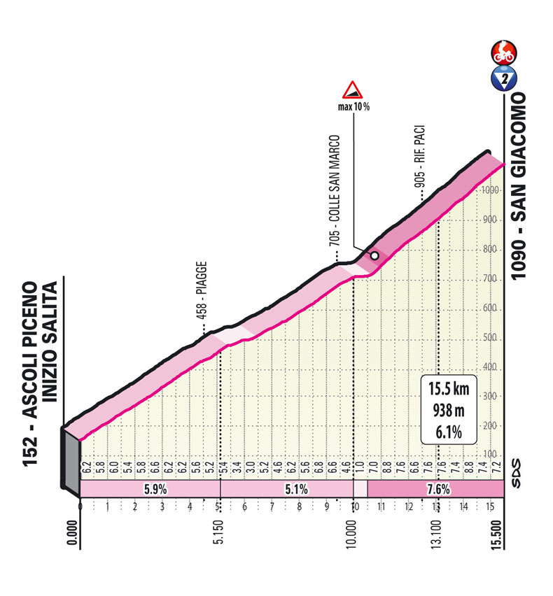
Stage 6: Grotte di Frasassi – Ascoli Piceno (S.Giacomo) 160 km
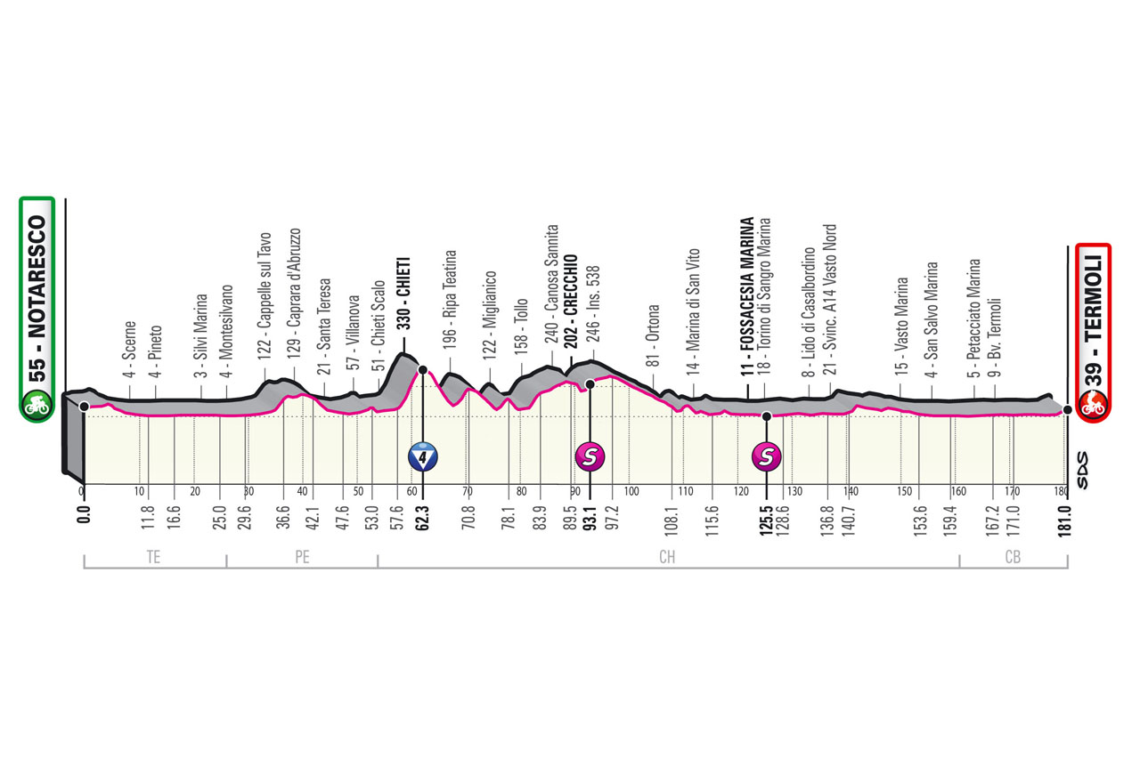
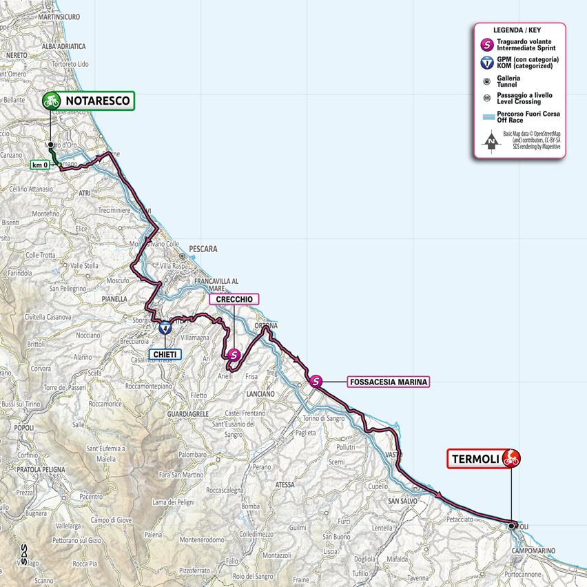
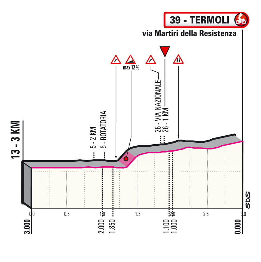
Stage 7: Notaresco – Termoli 181 km
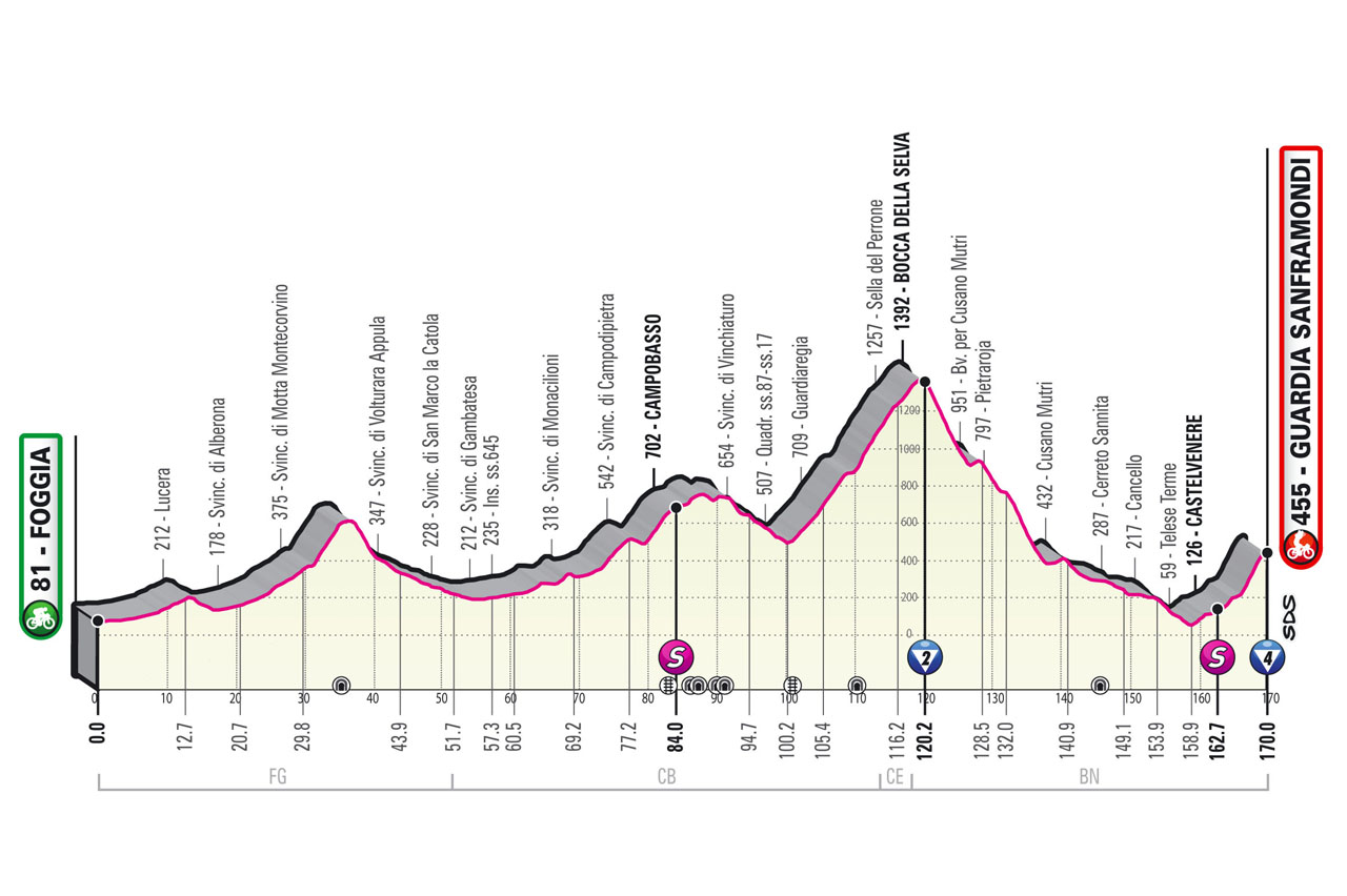
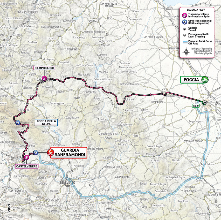
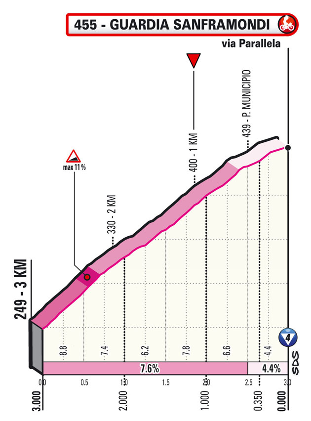
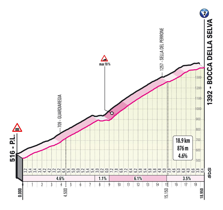
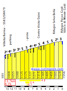
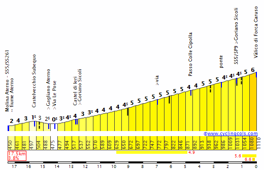
Stage 8: Foggia – Guardia Sanframondi 170 km
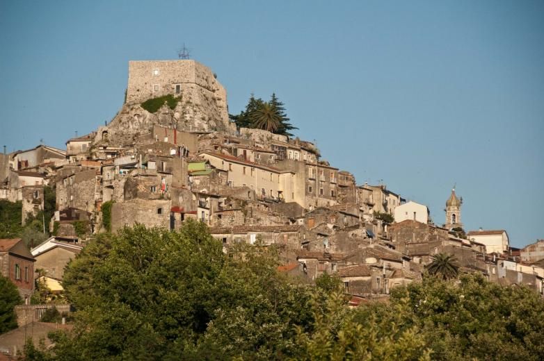
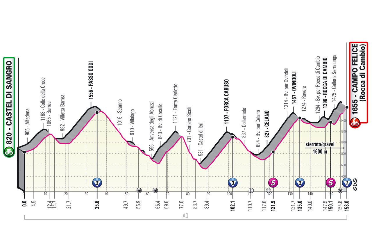
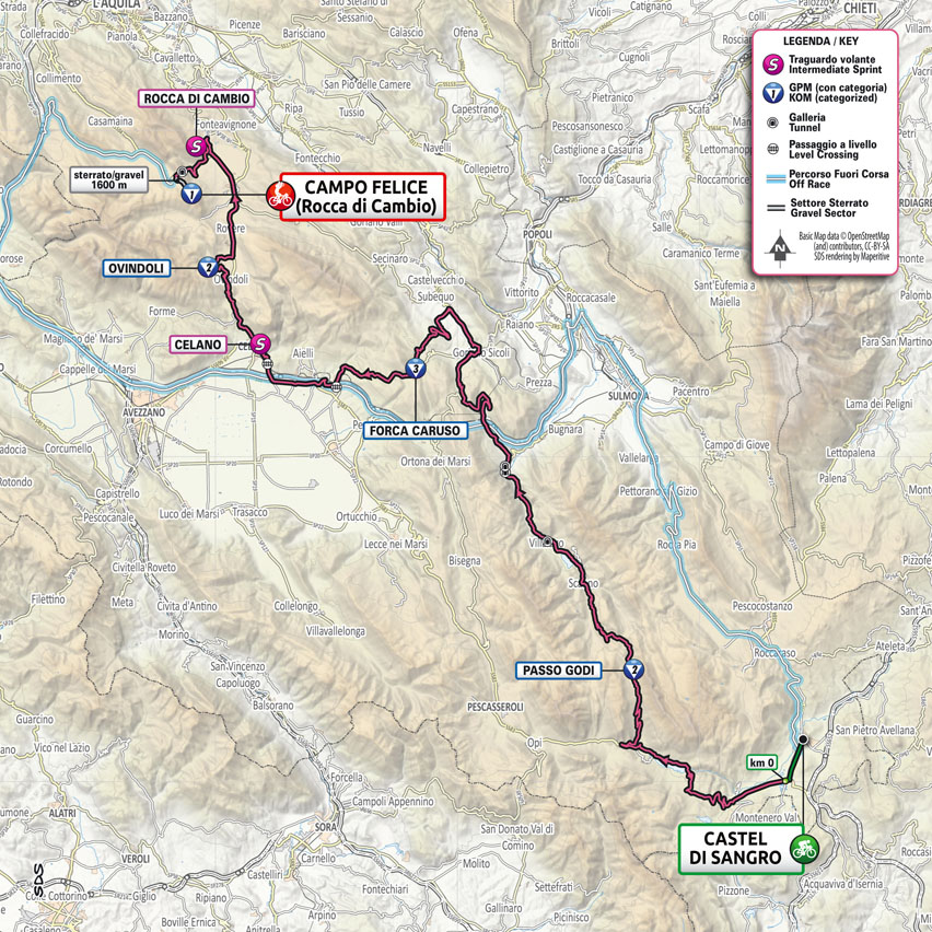
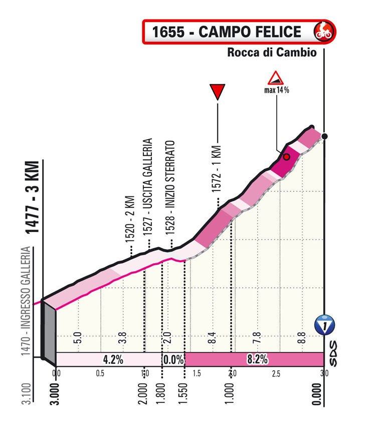
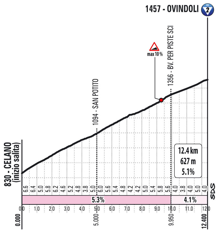
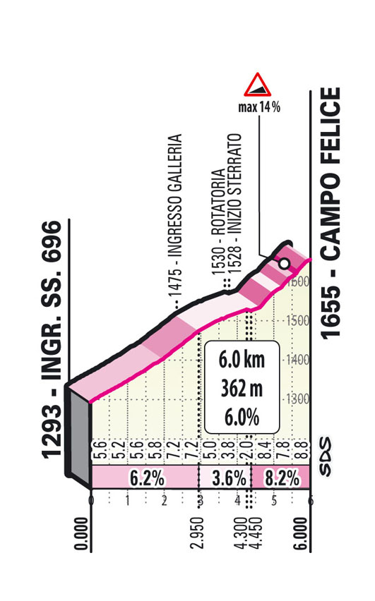
Stage 9: Castel di Sangro – Campo Felice 158 km
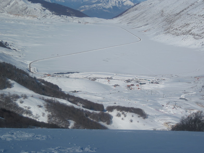
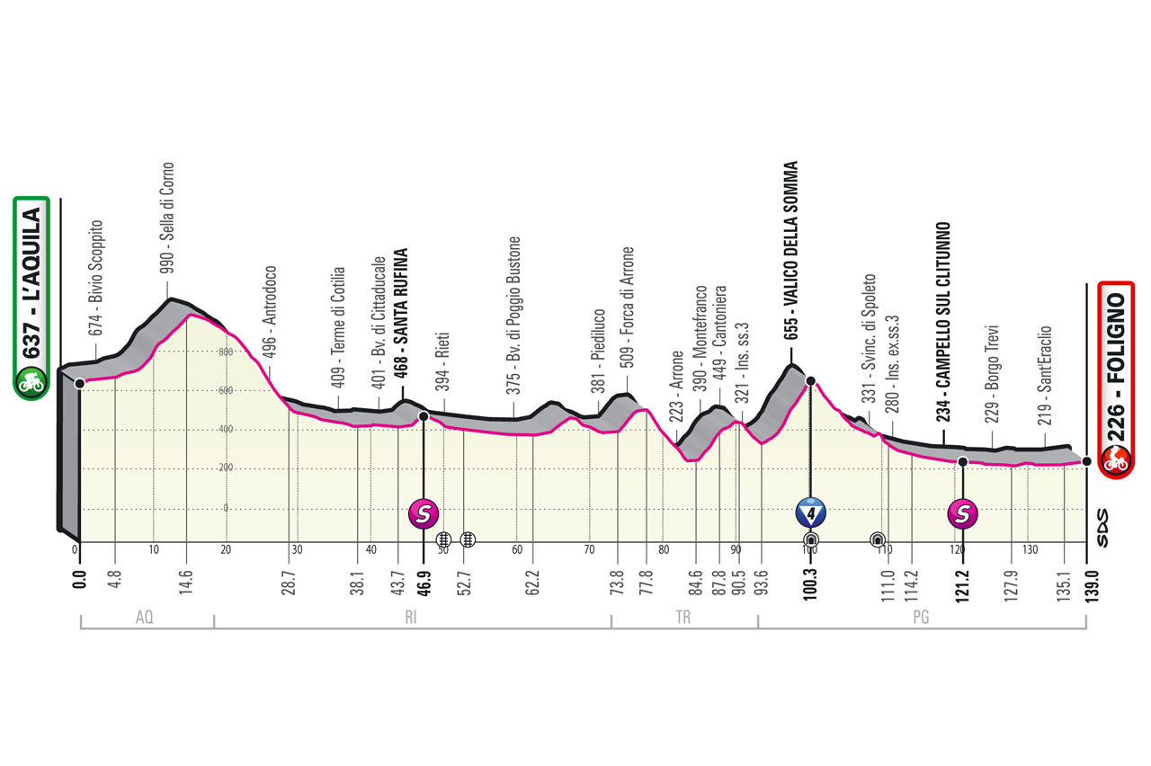
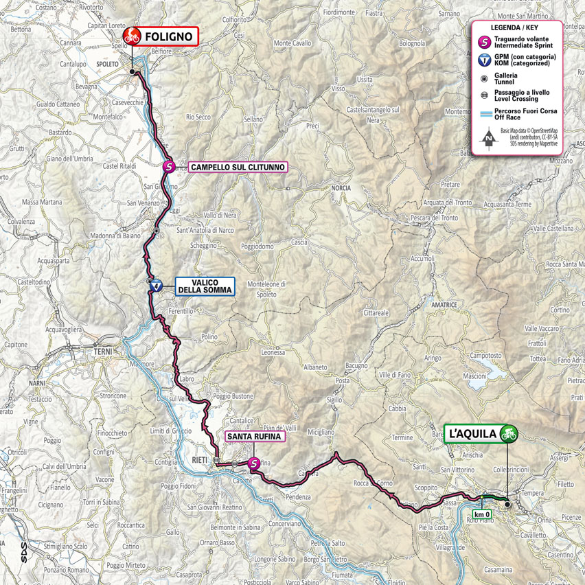
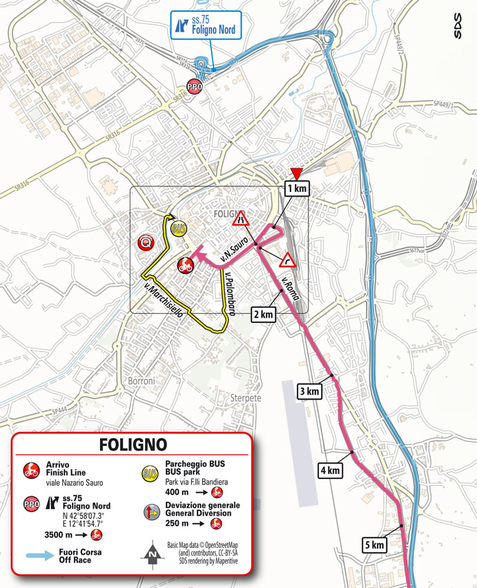
Stage 10: L’Aquila – Foligno 139 km
Rest
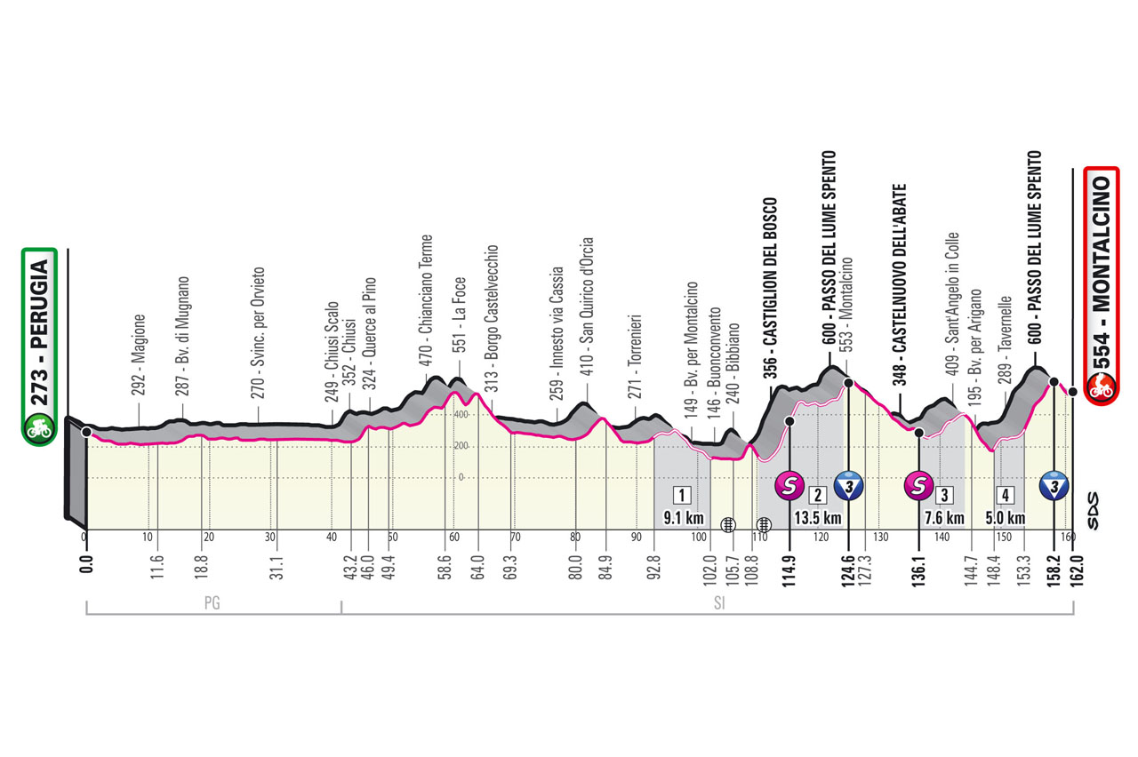
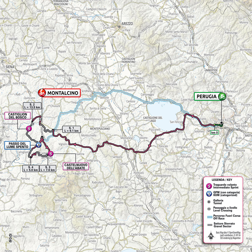
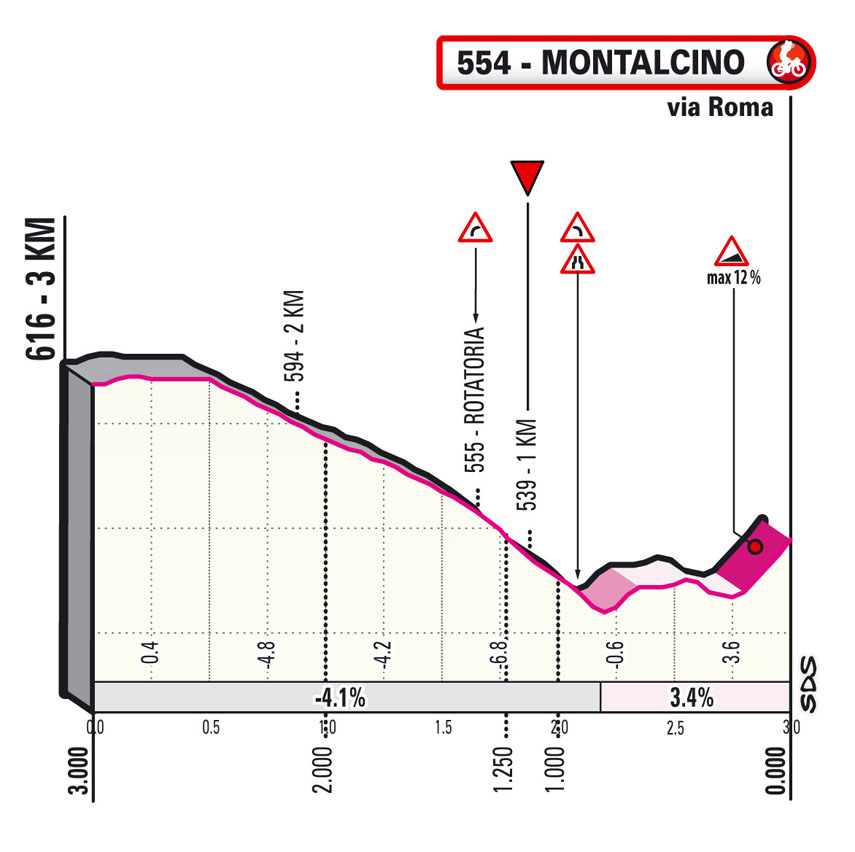
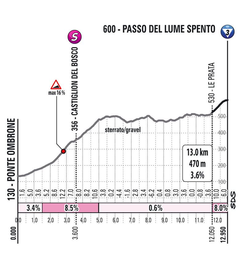
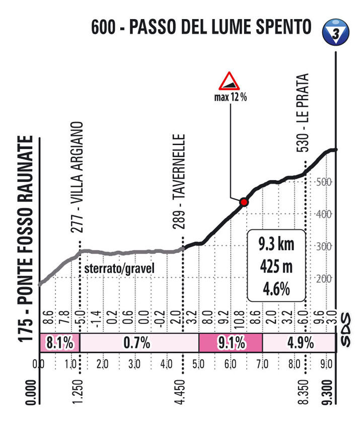
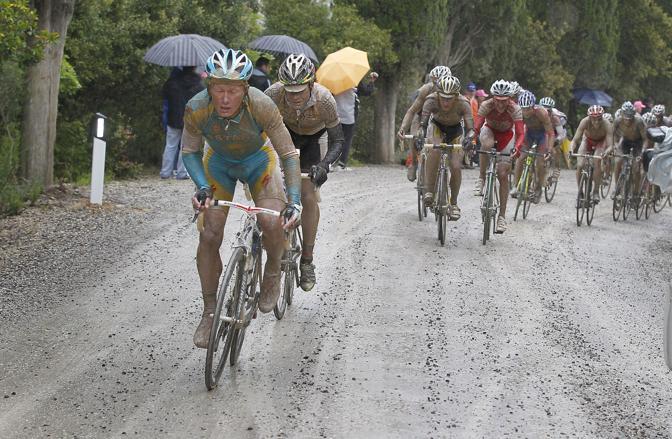
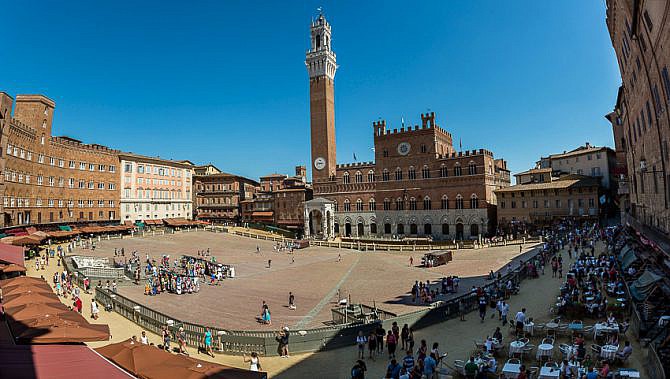
Stage 11: Perugia – Montalcino 162 km
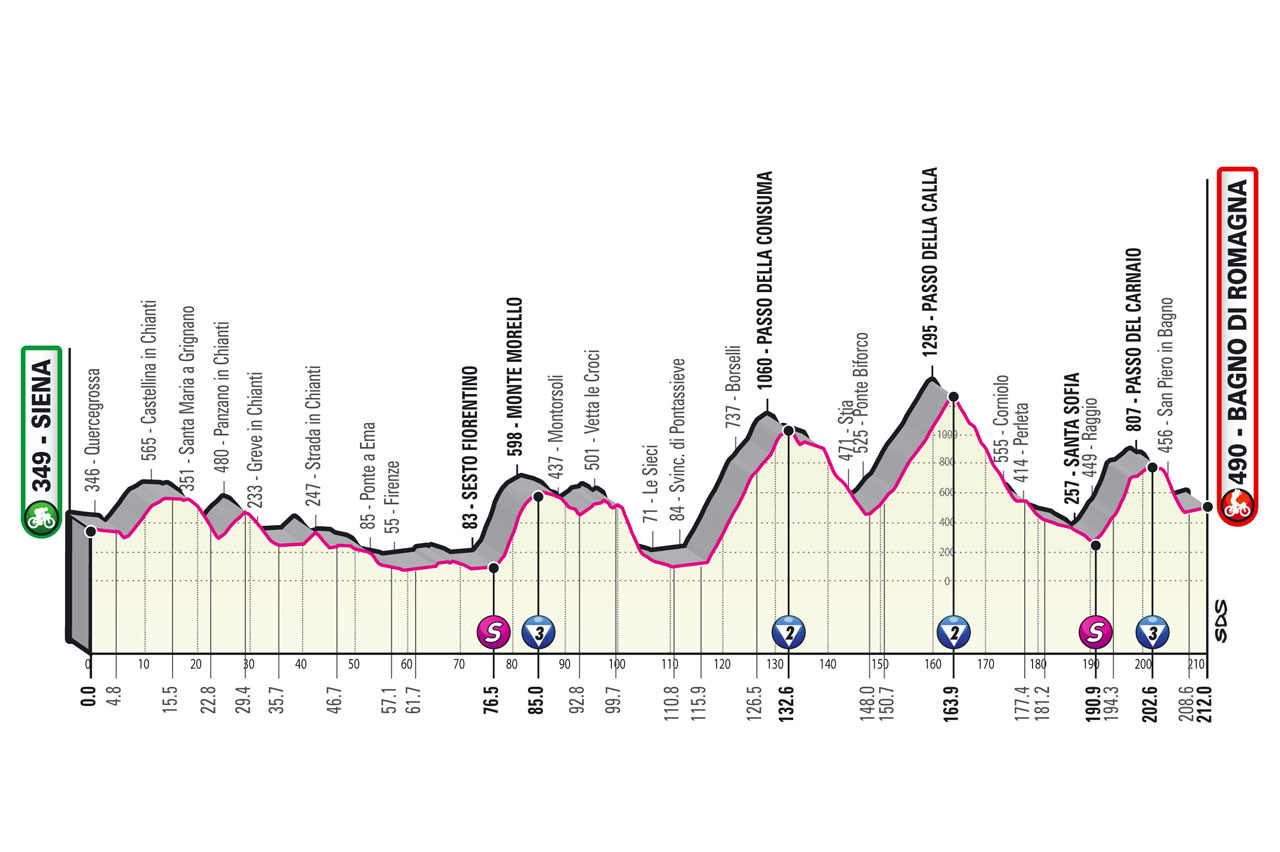
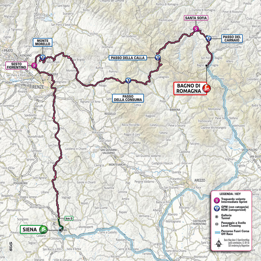
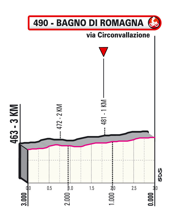
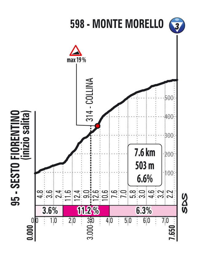
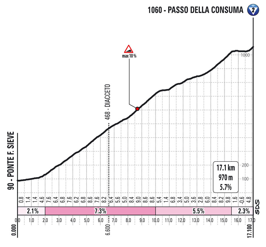
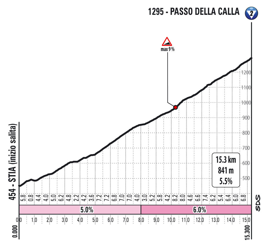
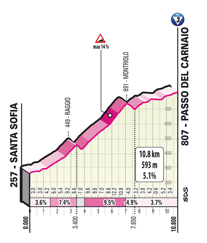
Stage 12: Siena – Bagno di Romagna 212 km
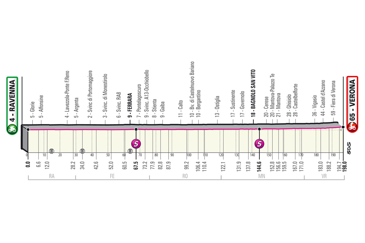
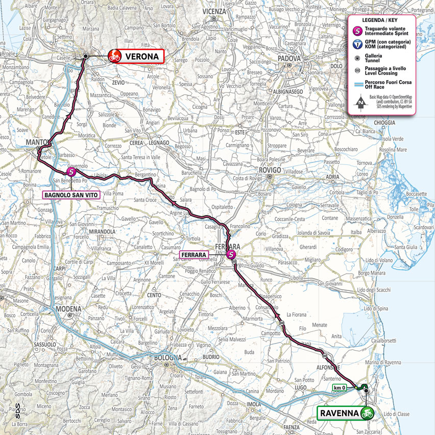
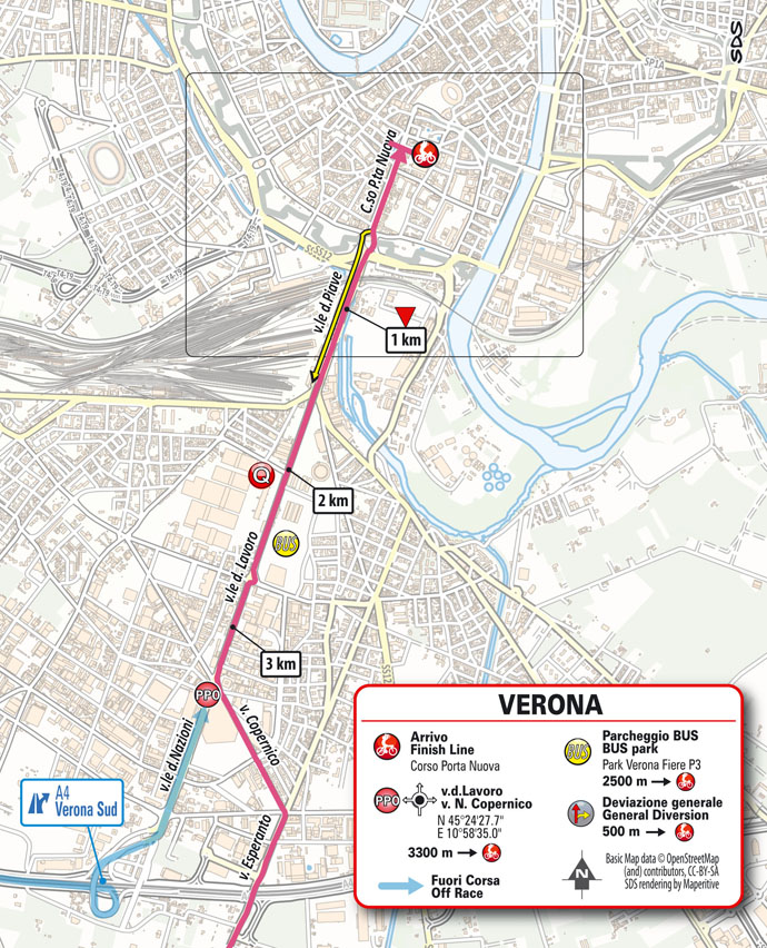
Stage 13: Ravenna – Verona 198 km
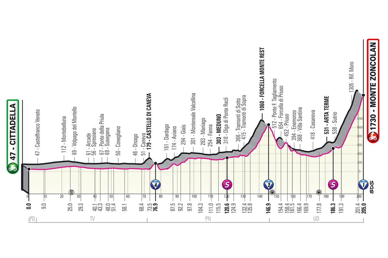
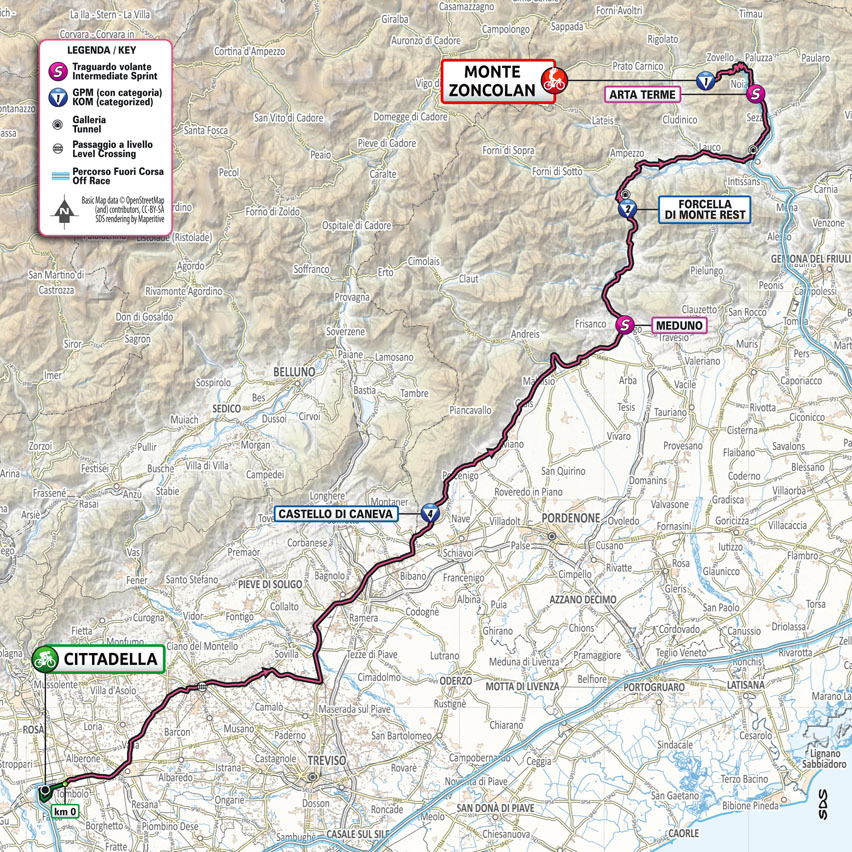
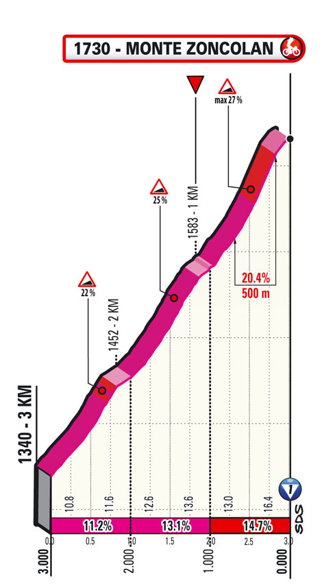
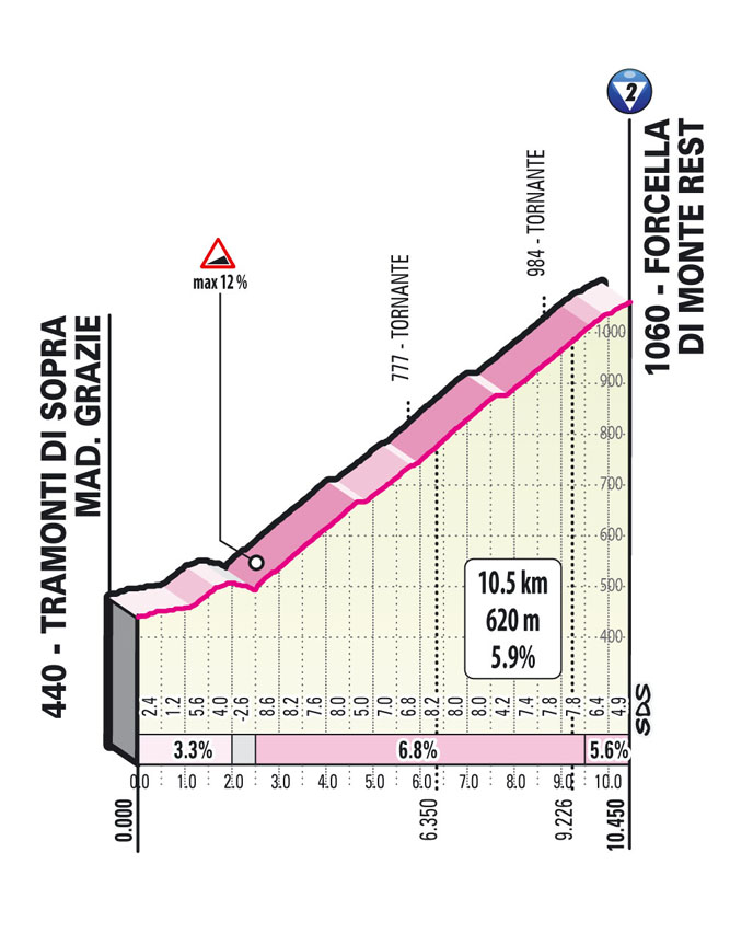
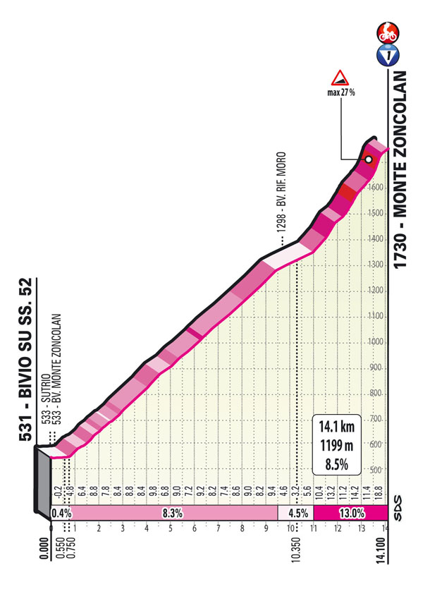
Stage 14: Cittadella – Monte Zoncolan 204 km
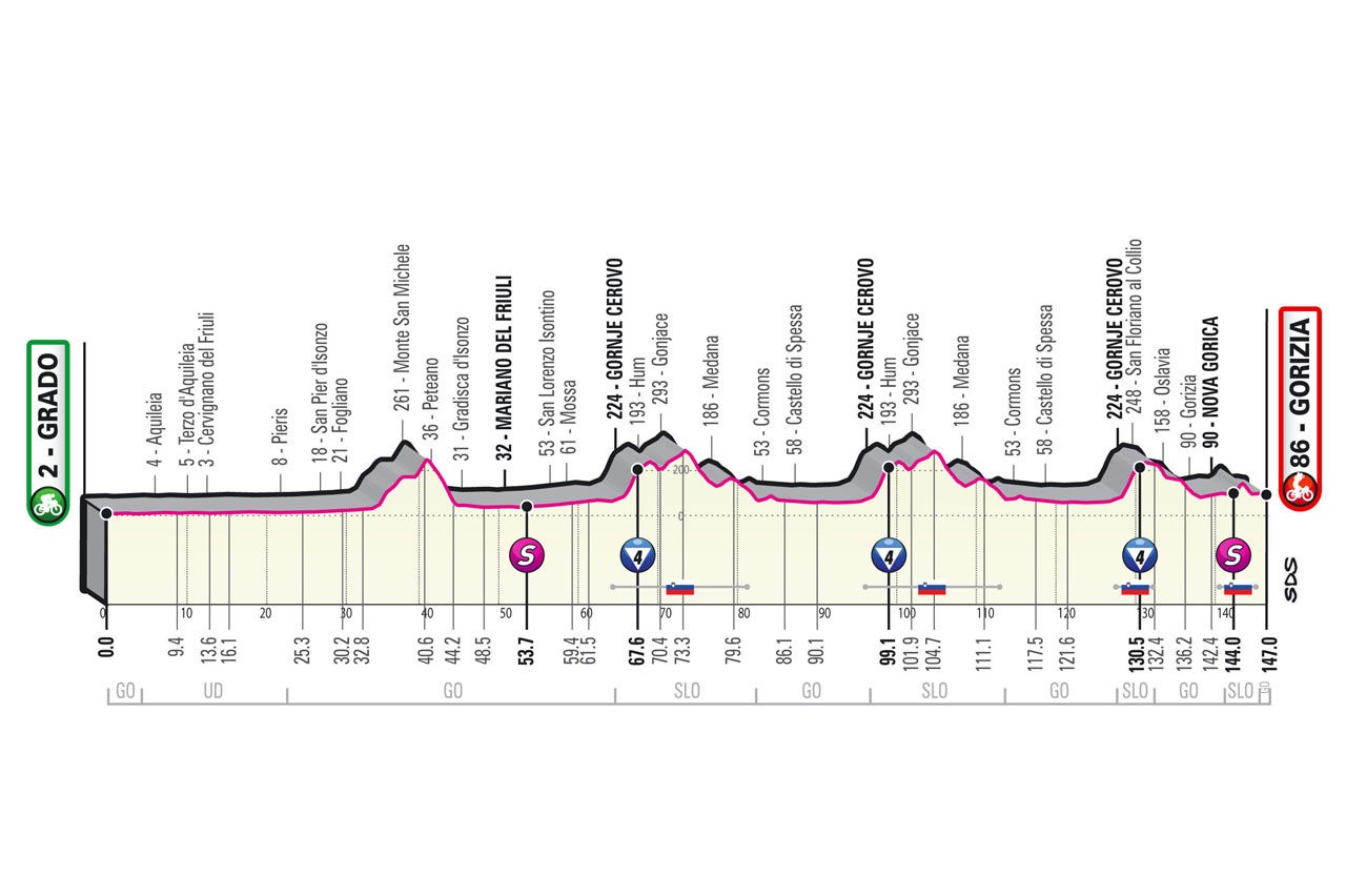
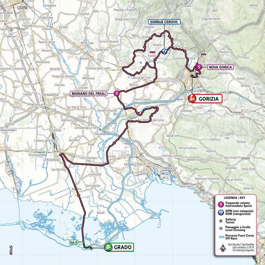
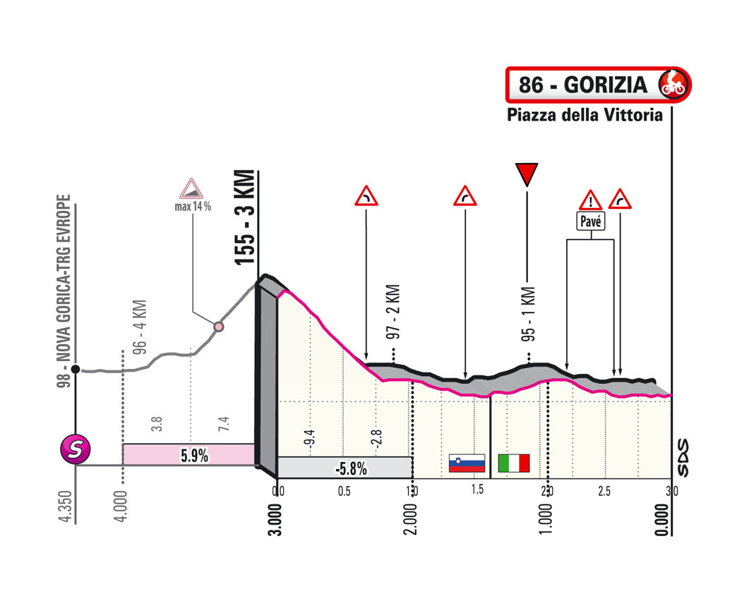
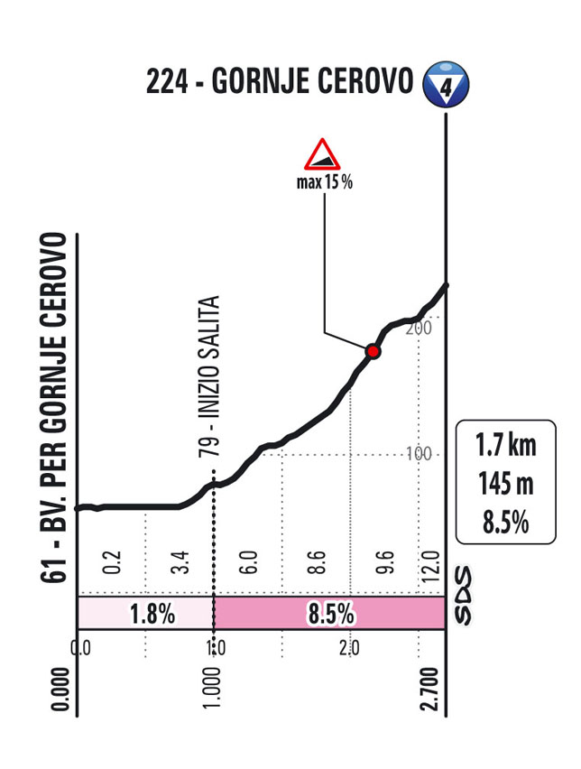
Stage 15: Grado – Gorizia 147 km
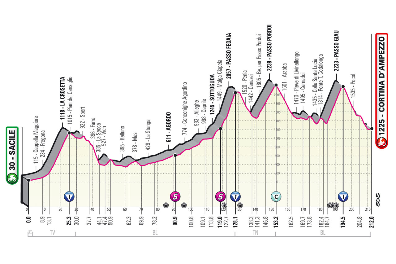
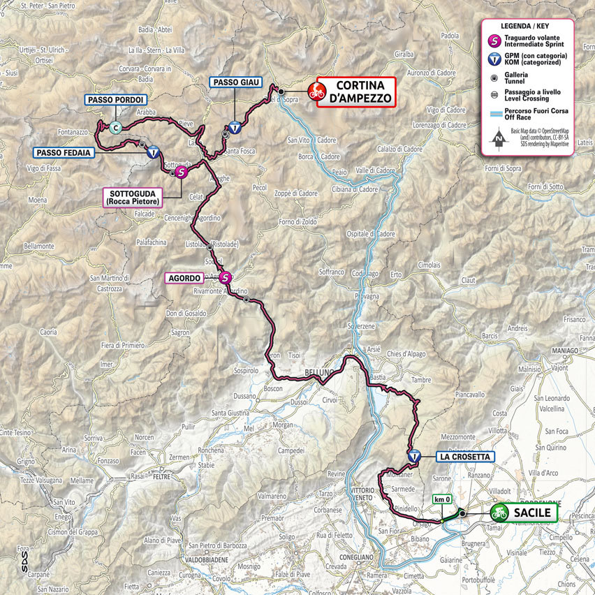
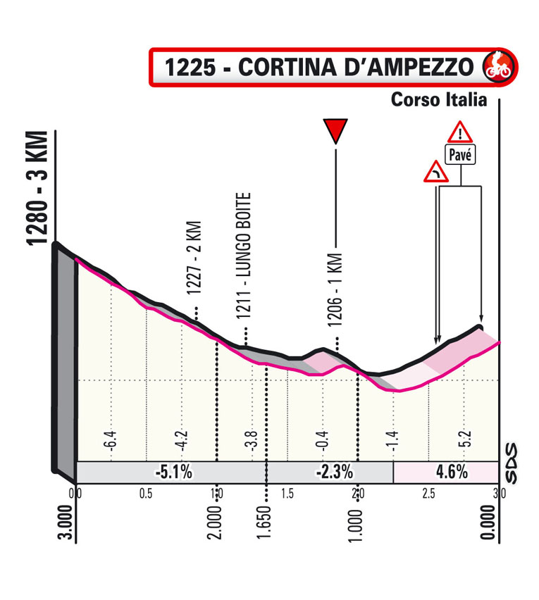
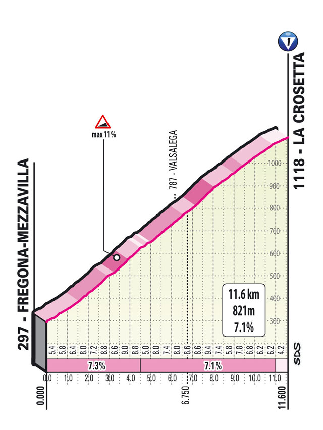
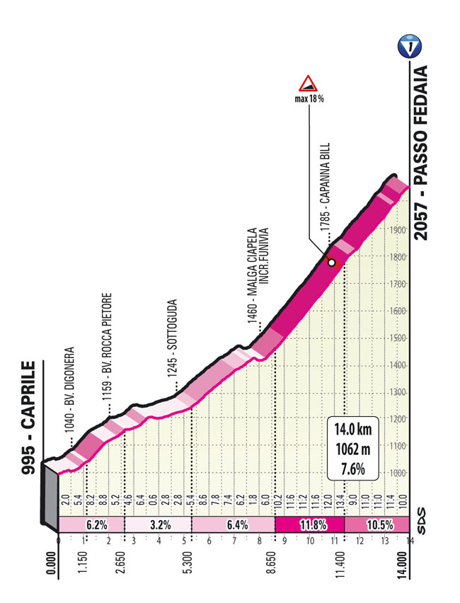
Stage 16: Sacile – Cortina d’Ampezzo 212 km
Rest
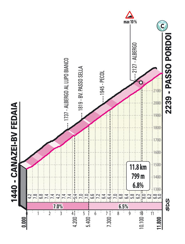
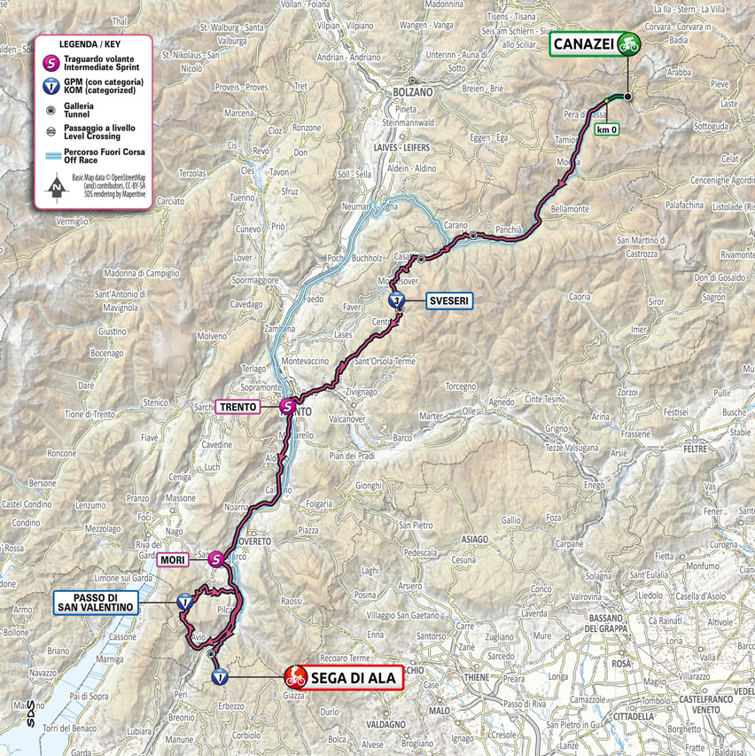
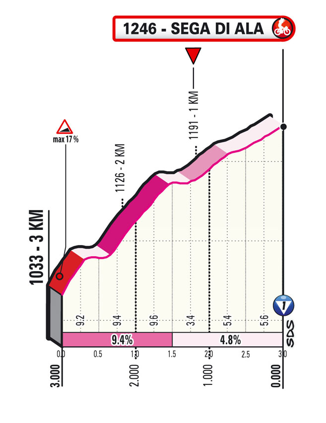
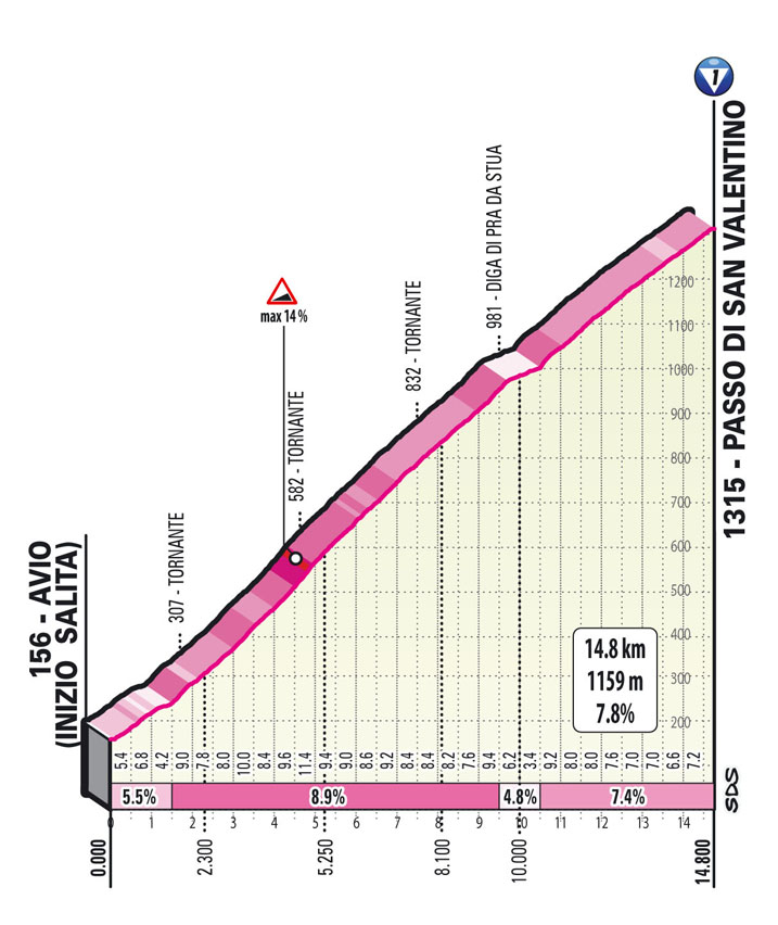
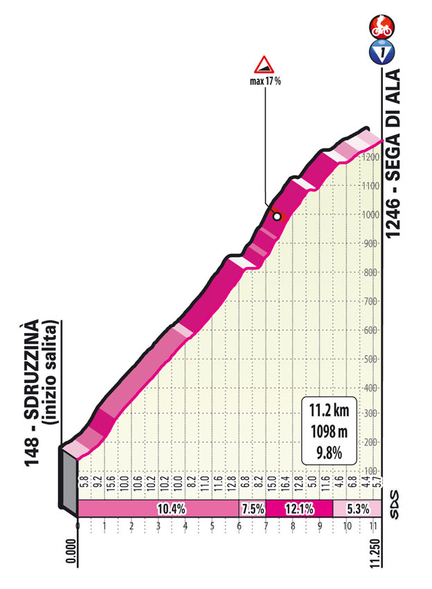
Stage 17: Canazei – Sega di Ala 193 km
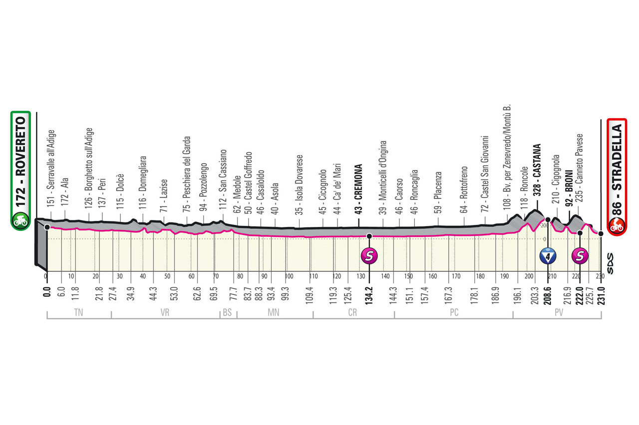
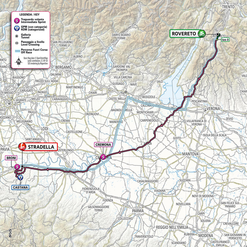
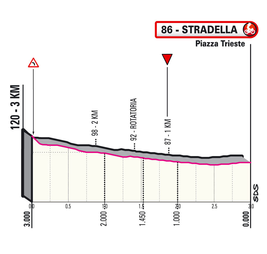
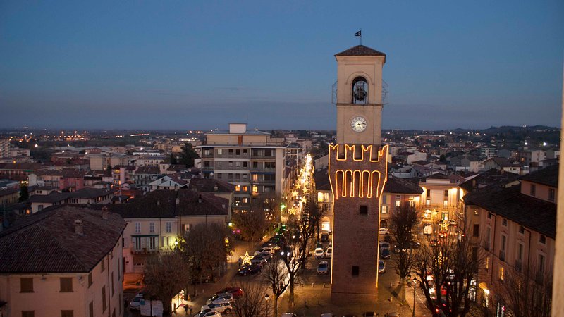
Stage 18: Rovereto – Stradella 232 km
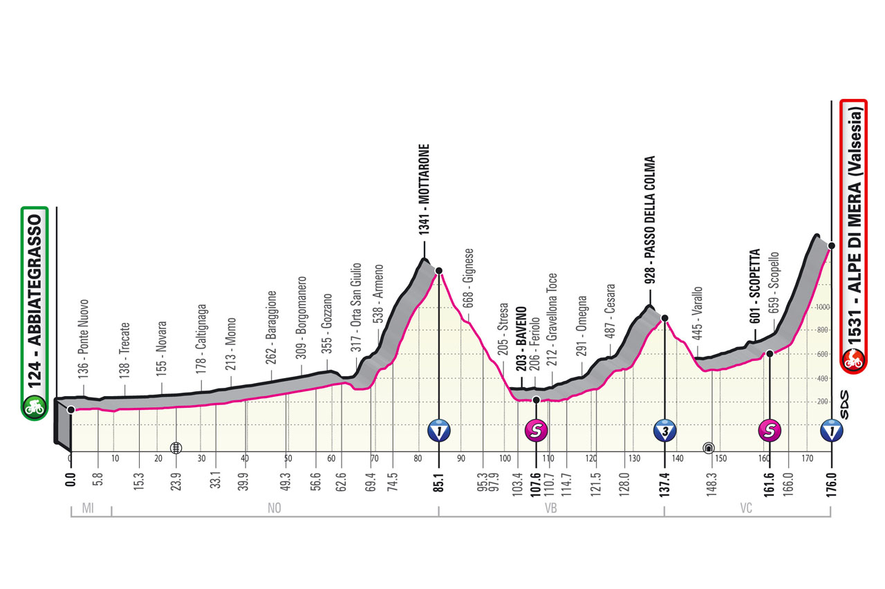
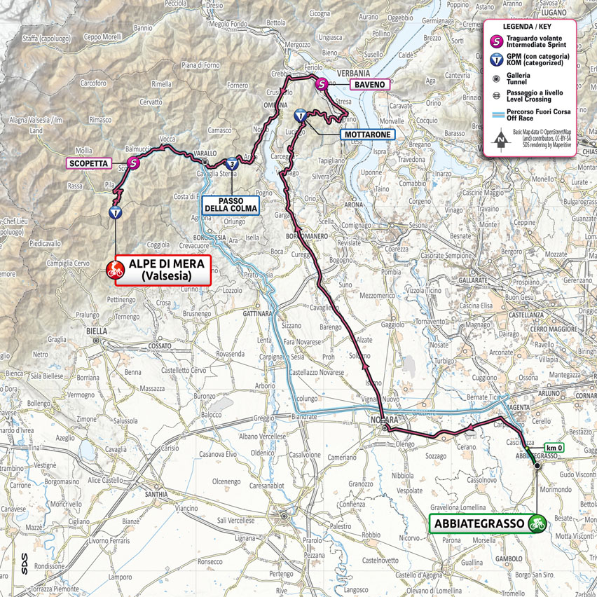
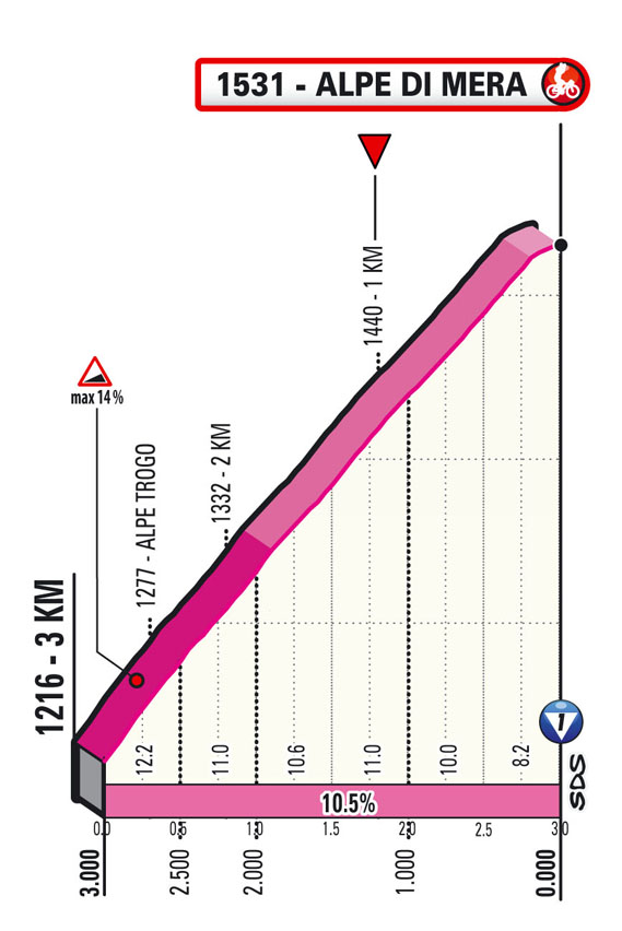
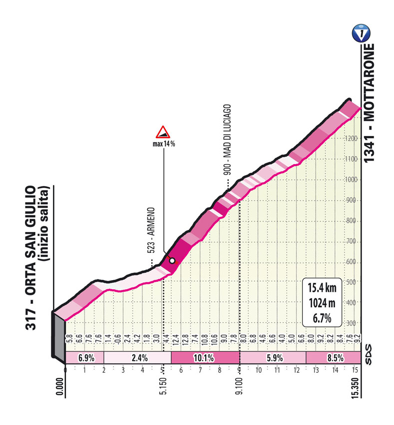
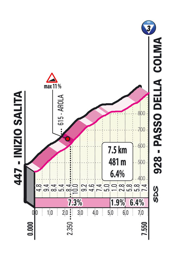
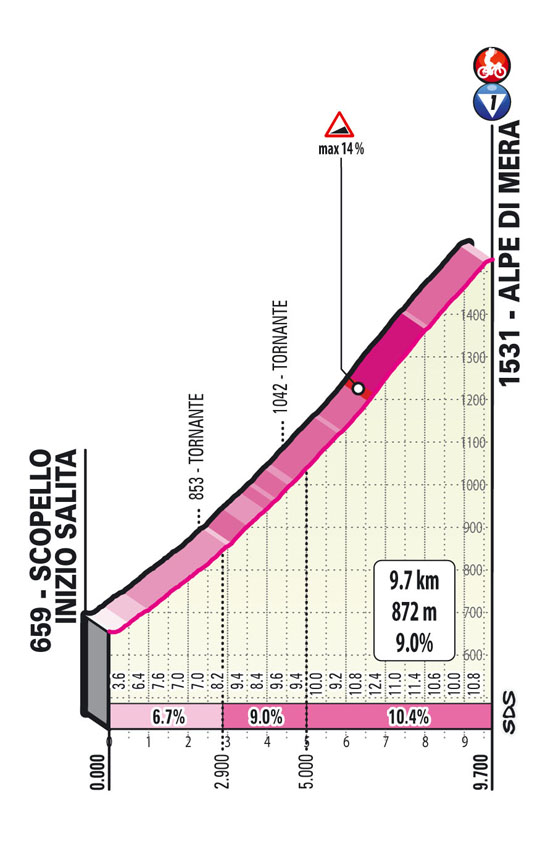
Stage 19: Abbiategrasso – Alpe di Mera 176 km
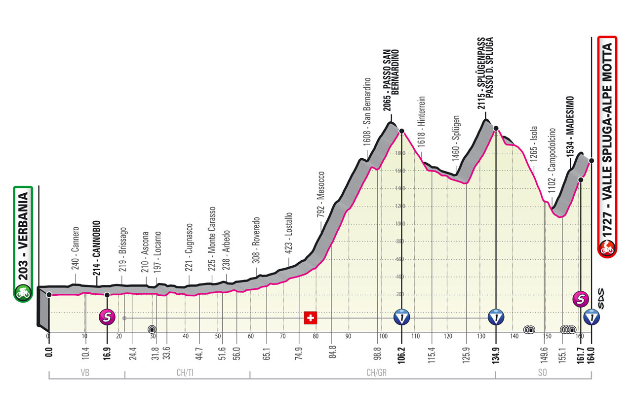
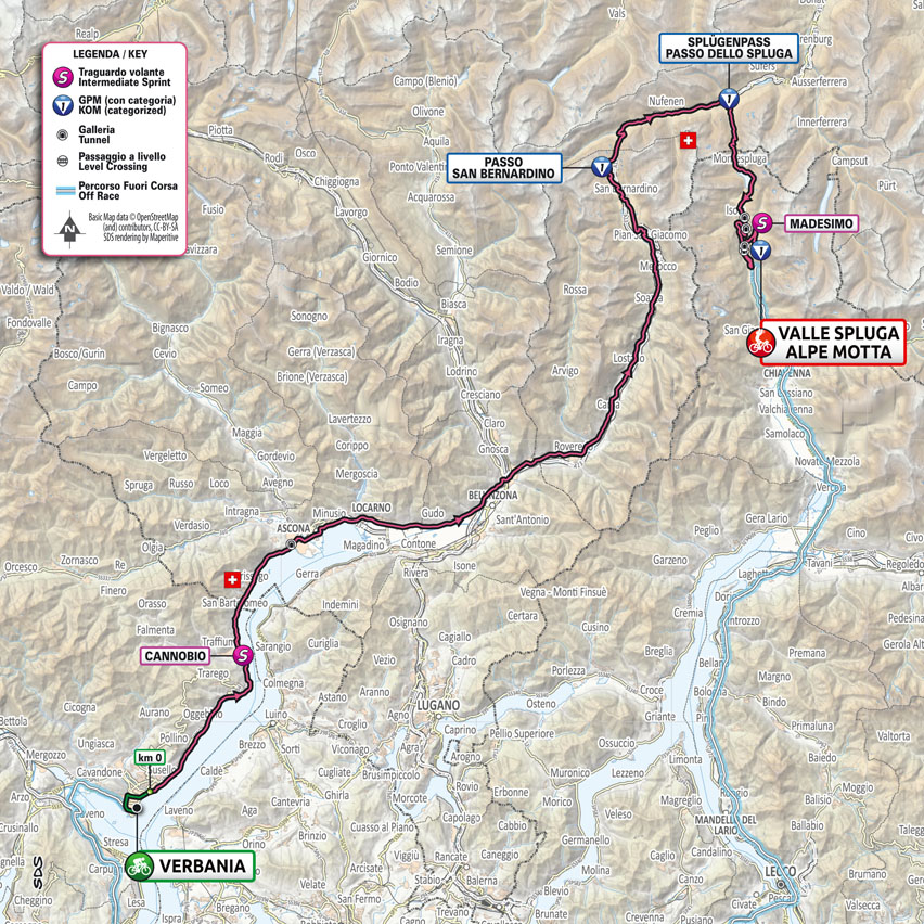
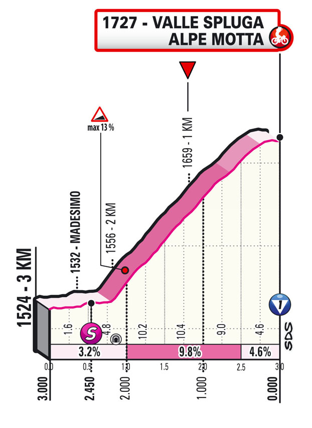
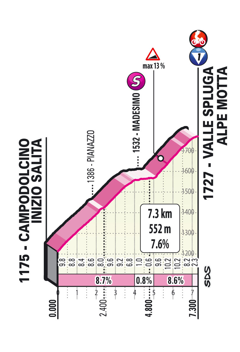
Stage 20: Verbania – Alpe Motta 165 km
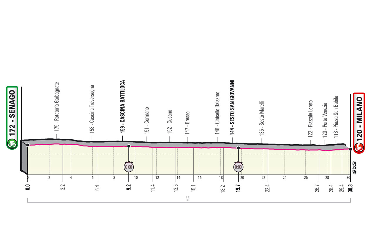
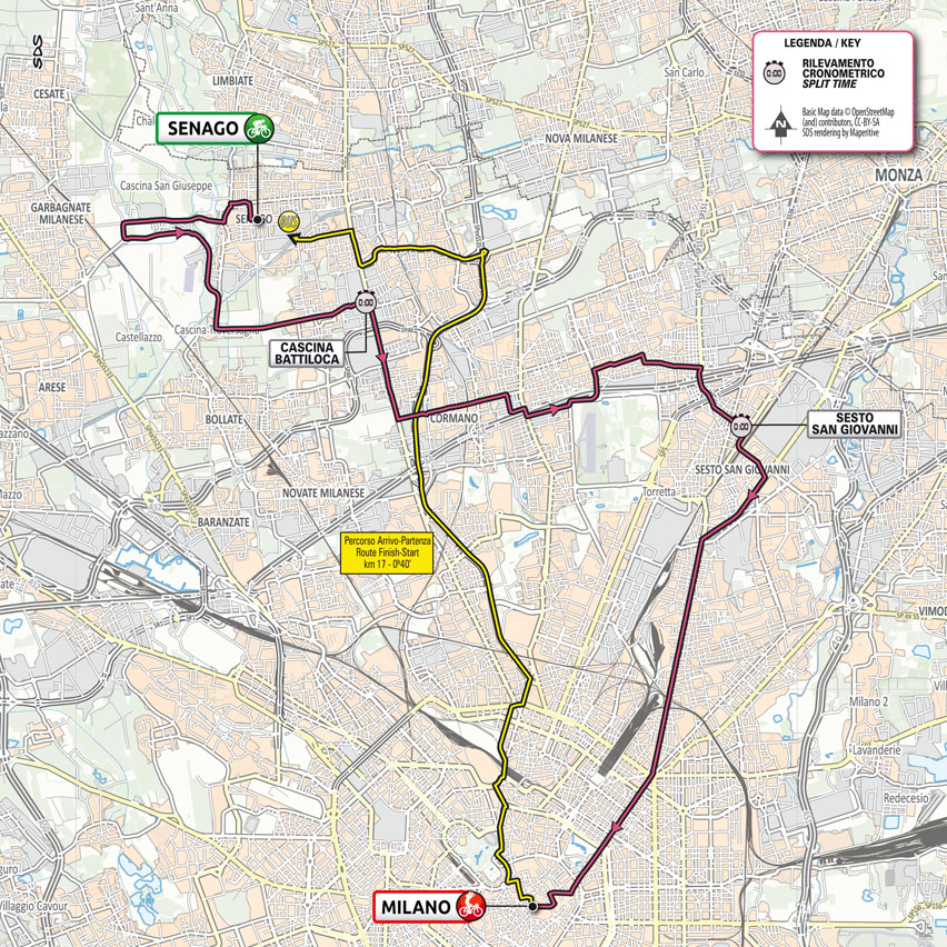
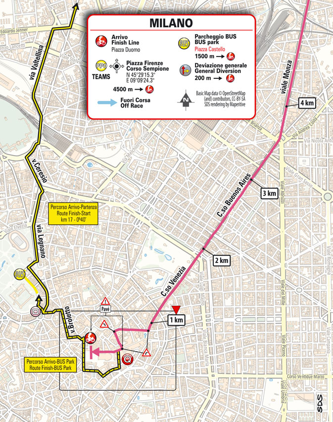
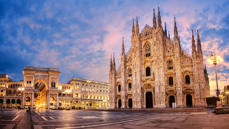
Stage 21: Senago – Milano 30.3 km ITT
On the other hand, the field looks pretty good on paper, even though many favorites have a question mark regarding their form. A question mark that should dissipate fairly quickly, as already in the first week the GC guys will have to show themselves. We'll see. Less than ten days left
STAGES
Stage 1: Torino - Torino 8.6 km ITT
Stage 2: Stupinigi - Novara 179 km
Stage 3: Biella - Canale 190 km
Stage 4: Piacenza - Sestola 187 km
Stage 5: Modena - Cattolica 177 km
Stage 6: Grotte di Frasassi – Ascoli Piceno (S.Giacomo) 160 km
Stage 7: Notaresco – Termoli 181 km
Stage 8: Foggia – Guardia Sanframondi 170 km
Stage 9: Castel di Sangro – Campo Felice 158 km
Stage 10: L’Aquila – Foligno 139 km
Rest
Stage 11: Perugia – Montalcino 162 km
Stage 12: Siena – Bagno di Romagna 212 km
Stage 13: Ravenna – Verona 198 km
Stage 14: Cittadella – Monte Zoncolan 204 km
Stage 15: Grado – Gorizia 147 km
Stage 16: Sacile – Cortina d’Ampezzo 212 km
Rest
Stage 17: Canazei – Sega di Ala 193 km
Stage 18: Rovereto – Stradella 232 km
Stage 19: Abbiategrasso – Alpe di Mera 176 km
Stage 20: Verbania – Alpe Motta 165 km
Stage 21: Senago – Milano 30.3 km ITT
Last edited: