I actually had this idea, Netserk ^^ I think I'm gonna exchange one image for the map. What website do you use? And can we use the Terrain view?
Anyway, here's the climb of the day. Be careful, that's something that might be surprising.
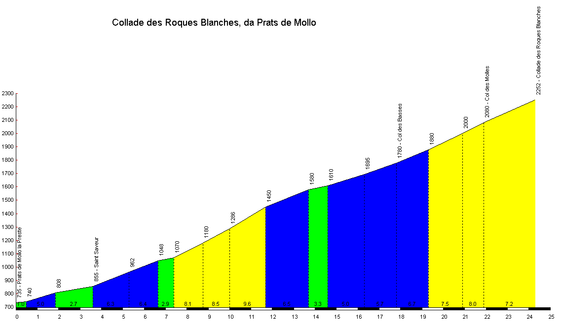
#25: Collade des Roques Blanches (Pyrénées-Orientales)
The protected connection
Before talking about this climb, I'd like to talk about the world all around us. The wilderness and the nature that surround us every day. It might be subtle or gigantic, depending on where we're living. There are places in this world where mankind have assumed control and built massive structures and huge cities to fulfill its ever-expanding needs. And there are places that will probably be forever untouched, as the nature has proven to be too harsh for the will of men to tame them. As I'm writing these lines,
I'm sitting in front of a scenery that kinda mixes the two universes: the old and fairly new buildings of the city of Marseille, that suddenly get overwhelmed by the mountains all around the city. I could have got a better view, facing the sea and the beautiful areas of the third biggest metropolitan area in France, but well, sometimes you can't get what you want. That's probably the point of the presence of this climb here, also.
After people realized that men was killing more and more vegetal and animal species, they decided to take a stand, and establish protected zones free of civilization, leaving only Mother Nature do her job like she done it for over 4 billion years. However, there are some trails that traverse them, so some people can admire and explore the perfection of the world. Most of them use only their feet and legs, while some others dare to bring their bike.
So why I'm talking about all this? We're here to talk about climbs, not about WWF X Greenpeace messages. But it's because the climb I'm going to talk about is probably the most controversial of the list. I even hesitated to include it, but in the end, I let it simply because this thread is about pushing the limits, discovering hidden gems and well, even if the objective of the thread is to tell ASO there's other things that the usual
Tourmalet in the Pyrénées, there are actually roads that could get a macadam treatment not only for the sake of climbing it for the race, but because they could be useful everyday.
During my Google Maps explorations in search for new climbs for my fictional Tours, I quickly noticed a road that was connecting two valleys in the eastern Pyrénées. A road where the Google Street View Car went, but not entirely. A road that connected the Tech (not like “Tech”nology but more like “Teh-sh”)
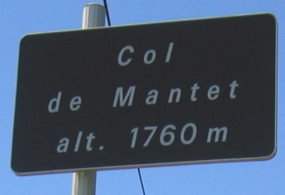
valley, and the Rotja valley, with a descent towards col de Mantet, opening new possibilities. This would create a new connection, a faster and more photogenic way towards Cerdanya. And even though this road is not paved when it goes through
two natural reserves, I think it would be a discovery to share here just for the sake of pushing the limits. But honestly, don't expect any other climb like this that simply goes over the “natural selection” like this. My only regret is that this road hasn't been paved much earlier, like in the 60-70s when the great passes were paved for the cars (and also for the Tour de France).
Enjoy your wild trip to the Collade des Roques Blanches.
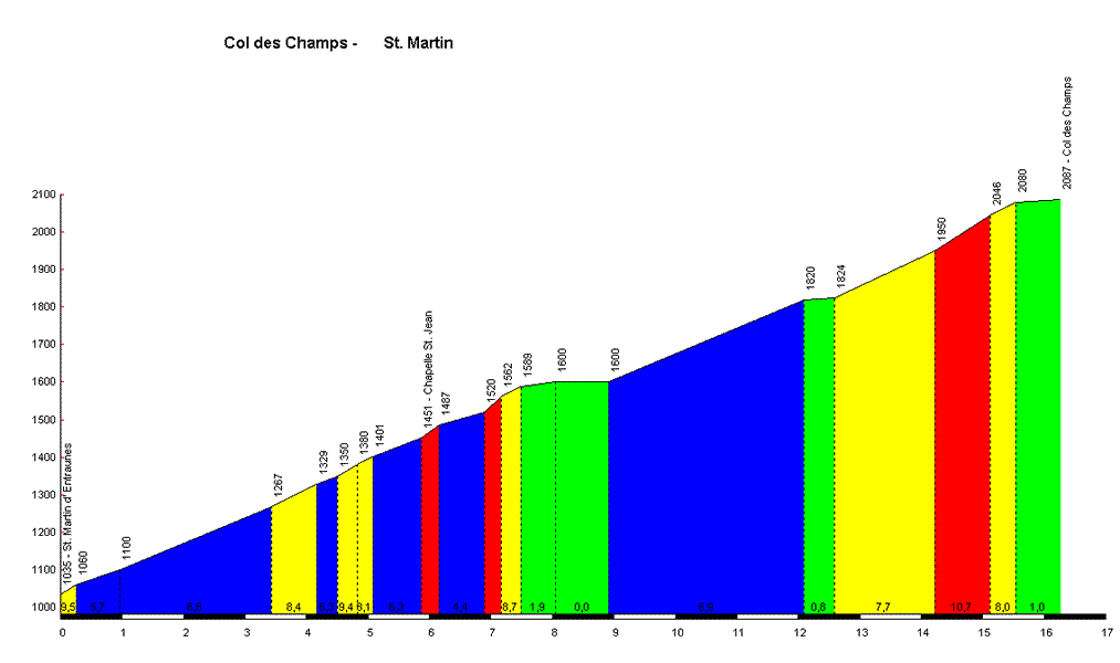
Top: 2252 m
Length: 24.3 km
Ascent: 1517 m
Average gradient: 6.2 %
Climbbybike Difficulty score: 144
The name of this climb is a rough translation of the original catalan “Collada del Rocas Blancas” (Pass of the white rocks). Located in the département of Pyrénées-Orientales, it is 25 kilometers east of the
Cerdanya region, and 50 kilometers south-west of the biggest city in the area,
Perpignan. As said just before, it links the Tech and Rotja valleys. It offers quite a challenge, offeing a similar difficulty to some mythical climbs like the north side of the col de la Madeleine or the cime de la Bonette. It also tops at 2252 meters, which is one of the highest passes in the Pyrénées – even though it doesn't really count as it's not paved.
It starts quite easily in the village of
Prats-de-Mollo-la-Preste, with slopes that doesn't go above 7 % in the first quarter of the climb. You then reach the thermal station of
La-Preste-les-Bains, which is the last building you'll see until you descend on the other side, and this is where the climb starts to be tough. Offering a 4-kilometer section at over 8.5 % average, this bumps up the difficulty quite a bit, requiring more effort. The road then tightens and gets in a less optimal condition up to the col des Besses, with 6 more kilometers
averaging 5.5 %. And then, that's the place you'll probably need to change your bike.
As the final 6 kilometers are, as I said it, unpaved,
with sections that probably wouldn't let pass a road bike. Honestly, that's kinda why I didn't want to include this particular climb into the list, but it offers
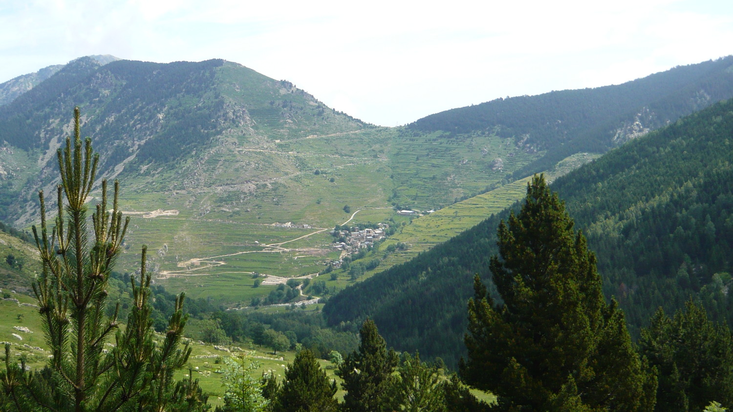
wonderful sceneries through the way, which could be a definitive heaven for the people who would like to change their habits for a time. Nature and you for a few kilometers. And of course, some exercise for your legs with a final part averaging 7.5 with 11-12 % short stretches.
On dirt and rocks, of course, which add to the difficulty. And don't forget the altitude, over 2000 meters, there's less oxygen in the air that will go towards the blood and muscles, so the effort needed will be higher.
To descend, there are actually two ways: one way west towards the Col de Mantet, and one way north towards the col de Jou (not to be confused with col de Jau). They both feature over 14 kilometers of unpaved road. So in order for the climb to be truly usable, over 20 kilometers of macadam would have to recover the road. Which is basically near impossible due to the natural reserves. It's a roadwork similar to the
Port de Balès, paved in 2007. So we can always hope for this to happen, but well.
To precede this climb, two choices: either you come from France and you can go, starting from
Arles-sur-Tech, to
Montferrer (8.1 km @ 6.2 %) and descend on the other side, or you come from Spain and your only option is to climb the Col d'Ares (6.9 km @ 5.2 %). “Tiny” second category climbs to heat the legs up for the real deal. But honestly, we don't think a peloton will ever ride this, unless a road gets done properly. Man vs. Wild. So this was kind of an exception for the list, and it's now time to come back on macadam.
We'll keep exploring the Pyrénées, but this time, we'll go west. On a fully paved climb with a descent!
Tomorrow, in 21 HC climbs Volume II:
The other big basque station
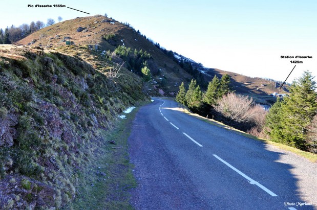
") I've done some GIMPing on the picture, die some hue/saturation (making the green greener - maybe that explains the fact that people believed it was a Basque climb?), added some texts and effects, and tada.
I've done some GIMPing on the picture, die some hue/saturation (making the green greener - maybe that explains the fact that people believed it was a Basque climb?), added some texts and effects, and tada.