- Sep 26, 2020
- 26,717
- 29,793
- 23,180
Fraustro Tour II
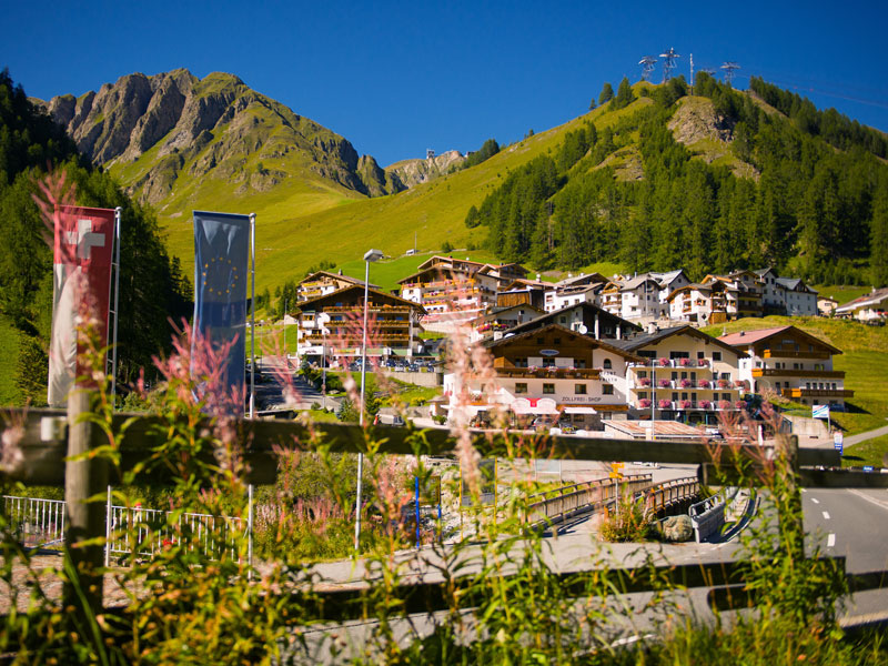
Stage 2: Bludenz - Landeck, 71 km
It's probably no surprise that we'll be leaving the region of Vorarlberg on day 2 and make our way towards Tirol. This stage is quite similar to my Felbertauern stage to Lienz from the first edition, in the way that it has a big climb early on and then some shorter bumps near the finish.

The ascent to the top of the Arlbergpass pretty much starts from km zero, but the first 22 km are mostly false flat. When the riders reach Klösterle, the last 11 km average over 6%. At almost 1800 m, the altitude will probably also play a role here.

38 km remain from the top. The first 6 km of the descend are about 7.5% downhill, so differences can be made here. Before the next 20 km of slight downhill begins, there'll be a bonus sprint in St. Anton. In Pians, we're leaving the Bundesstraße in order to climb to the town of Grins (approx. 1.8 km, 7.9%). After a 3 km descent, the riders will then tackle the last obstacle of the day.
When you're designing a stage to Landeck, it's very tempting to include the climb to Tobadill, but here I'm only using the first km of the eastern side, which averages about 8%. It is followed by a short descent before a flat finish next to the town hall.


Stage 2: Bludenz - Landeck, 71 km
It's probably no surprise that we'll be leaving the region of Vorarlberg on day 2 and make our way towards Tirol. This stage is quite similar to my Felbertauern stage to Lienz from the first edition, in the way that it has a big climb early on and then some shorter bumps near the finish.
The ascent to the top of the Arlbergpass pretty much starts from km zero, but the first 22 km are mostly false flat. When the riders reach Klösterle, the last 11 km average over 6%. At almost 1800 m, the altitude will probably also play a role here.
38 km remain from the top. The first 6 km of the descend are about 7.5% downhill, so differences can be made here. Before the next 20 km of slight downhill begins, there'll be a bonus sprint in St. Anton. In Pians, we're leaving the Bundesstraße in order to climb to the town of Grins (approx. 1.8 km, 7.9%). After a 3 km descent, the riders will then tackle the last obstacle of the day.
When you're designing a stage to Landeck, it's very tempting to include the climb to Tobadill, but here I'm only using the first km of the eastern side, which averages about 8%. It is followed by a short descent before a flat finish next to the town hall.