• The Cycling News forum is looking to add some volunteer moderators with Red Rick's recent retirement. If you're interested in helping keep our discussions on track, send a direct message to @SHaines here on the forum, or use the Contact Us form to message the Community Team.

    In the meanwhile, please use the Report option if you see a post that doesn't fit within the forum rules.

    Thanks!

Race Design Thread

Page 112 - Get up to date with the latest news, scores & standings from the Cycling News Community.
Tour de France

Stage 10: Oloron-Sainte-Marie - Saint-Jean-Pied-de-Port


alternative versions

I couldn't resist and played around with that stage a bit. I'm not going to change anything, just exploring some of the many possibilities there. One could for instance simply add two more steep climbs at the end, Col d'Urdanzia and a nasty little thing that might be called Munixta. That would result in a 224 km stage, which would be too hard, i guess. But when you drop one of the earlier climbs and change the first part of the stage a bit, the result is quite beautiful:


efimne4hhdeo.png


bsiw3noeatru.png


Col d'Ichère 5,1 km 6,1%
Col de Lie 2,5 km 8,4%
Col de Soudet (1.524m) 14 km 7,5%
Larrau 3 km 8,5%
Col Bagargui 10 km 8%
Errozate 6 km 7,1%
Irei 4,45 km 12%
Behicaro 4,1 km 12,2%
Col d'Urdanzia 7,1 km 9,6% (dossier with pictures)
Munixta 2,9 km 12,7%
 
BigMac said:
World Championship Road Race: Seattle, Washington.
[snipped for length]

2nd most interesting post on this thread. But "when you consider the source" it's not surprising. ;)


Though I'm not fond of these North-American big cities (save Quebec City), 4 climbs in a 15km loop is quite unusual. Great research! Not more than 1.5km and max 12% gr. and average 7%. As it should be !

By the way you could easily have added one lap. 248km is "a little short, young man"
 
Stage 13: Lugo - Vegadeo, 167km

2nw3ash.png


258zgbb.png


Puertos:
Cruz de Meira (821m) 4,8km @ 7,1% (cat.2) - km 37
Coto de Frades (949m) 20,3km @ 4,3% (cat.1) - km 89
Pozo de la Nieve (1050m) 12,7km @ 7,4% (cat.1) - km 129
Monte Pousadoiro (470m) 4,2km @ 9,7% (cat.2) - km 155

Metas Volantes:
Meira - km 31
A Pontenova - km 69

The first stage of a mountain trifecta sees us move from Galicia into Asturias in a shortish stage that nonetheless takes us over two serious climbs and two potential banana skins. The stage couldn't really be classed as an intermediate stage, but breakaway riders will fancy themselves as having a good chance in this one, so I would expect to see a strong breakaway making a bid for freedom here full of strong climbers and stagehunters, as well as a few domestiques for the big guns, because this is a stage where there is the possibility of trying something - I just fear that some of the stages to follow may restrict some of the ambition.

Beginning by the city walls in Lugo, the first part of the stage is fast and flat heading northeast towards the coast, until we get to the scenic town of Meira for an early intermediate sprint (there is precious little flat in the second half of the stage to put these). The first climb of the day, and possibly where the elastic will finally snap in terms of the break being formed, is the short and seemingly unassuming Cruz de Meira. Its fairly benign average hides that it really ramps up in the second half, with a large number of gradients between 10 and 15% and 2km averaging 11% on the way to the Parque Eólico at the summit. It is followed by a complex and technical descent on roads somewhat better than the ascent, then some rolling terrain along the banks of the Rio Eo.

The riders should really thank me at this point as I have elected to go all the way to A Pontenova and then take on the long and winding ascent of Coto de Frades, which as you can see is broken up into a couple of smaller ascents, with the last one, 11,5km @ 6,2%, being the toughest. Roads are good and views are pretty, but the real reason that the riders should be thanking me is that right next door to the Coto de Frades is a paved hell-slope called Cruz de Barreiros. This is the kind of thing that Javier Guillén loves at the moment, with 3,2km @ 12,8% in the middle, and a profile that resembles a slightly longer Tre Cime di Lavaredo (at much lower altitude though). Trust me, this is something that you may see in a race from me at some point but right now, I see little point in using it at this point of the stage. The road is in poor condition, although climbing it then having about 5km flat then descending Coto de Frades to finish in A Pontenova would make a good stage. Similarly also nearby there is the extremely steep A Barranca, 6,2km @ 10,4%, which could be inserted between Cruz de Meira and Coto de Frades.

The reason to go without here is to try to tempt attacking later on on this stage. With the stages to come, riders would just soft-pedal these brutes if used and it would be a waste of them. I have ideas of how to use these climbs, but I shan't be using them just yet. Coto de Frades is still tough enough to put some pain in the riders' legs when they come to the business end of the stage without throwing out carnival stuff.

After Coto de Frades, the riders have about 15km of rolling terrain along a mountain ridge to cool their heels before reaching the Puerto de la Garganta with its views down towards Ribadeo and Vegadeo, where we are headed. A fast descent which begins wide then narrows down part way, there are some technical corners to this one as the riders make their way into the small pueblo of Meredo, best known for the Mazo de Meredo... and for being the start of the following climb.

The Alto de la Bobia is one of Spain's underappreciated beasts. It has many sides, and the one from Meredo is one of the toughest. It clocks in at 13,7km @ 7,4%, however the profile shows how like many Spanish climbs the average gradient masks some dangerous inconsistencies, with the gradients getting up to ridiculous levels. There are 2,5km averaging 12,9% right in the middle of this monster. There are scenic views, narrow roads with switchbacks, hell-slopes and attractive scenery to mark it. It has nearly everything.

That's all well and good, you might say, but you quite clearly state up there that we're climbing Pozo de la Nieve, not Alto de la Bobia. And you would be right. The Pozo de la Nieve is exactly the same for the first 12km, then where La Bobia continues straight over a crossing, the Pozo turns to the left and climbs another 700m at only false flat kind of gradients. It is almost the same climb, and all of the important parts are included. It's only the summit which is slightly different. So the riders will have all had the full set of suffering when they crest the Pozo with 37km remaining. Because of the distance remaining I do not foresee that there will have been major GC moves on the climb, however the break will probably have shredded to pieces and the majority of riders will be without domestiques back in the bunch thanks to the slopes. They will then have to descend the painfully inconsistent Samagán/Penzol side of the climb (you can see the crest at 1050m a couple of kilometres from the end which is the Pozo de la Nieve), although at least the tarmac is in good condition.

No flat for the riders after this long descent though - Samagán leads us straight into the final climb of the day - and I mean straight into it. This is a real Vuelta climb up to Monte Pousadoiro, averaging nearly 10% for 4km. Views are stunning, either inland to the mountains or out to the ocean, although with tricky switchbacks and gradients like this cresting just 11km from the finish, riders will be forgiven for not thinking about the view. On the plus side, the descent towards Castropol, while quite steep, is not technical and features few real tests. After the descent there are just 6km of flat into Vegadeo, so I would anticipate that there could well be some moves on the final climb from the main GC contenders as well as the duking out of the stage win from the break if it stays away. This is an opening salvo for the penultimate weekend to come.

Lugo:
lugo_t2700419a.jpg_1306973099.jpg


Vegadeo:
2vsi5fk.png
 
Stage 14: Tapia de Casariego - Santuário del Acebo, 148km

2salauu.png


15xg7c.png


Puertos:
Alto de Penouta (885m) 14,5km @ 5,2% (cat.1) - km 32
Alto del Valdedo (434m) 12,0km @ 3,2% (cat.3) - km 57
Puerto de La Marta (1105m) 25,9km @ 3,9% (cat.ESP) - km 89
Alto del Cruce de Acebo (982m) 10,5km @ 6,3% (cat.1) - km 130
Santuário del Acebo (1186m) 8,0km @ 9,5% (cat.1) - km 148 (Meta)

Metas Volantes:
Pola de Allande - km 98
Cangas del Narcea - km 137

The first day of the penultimate weekend is another day through the less well-trodden terrain for the Vuelta that is Eastern Asturias, a wilderness of brutal climbing and less well-known ascents beloved to traceurs for the world of possibilities it offers. This is a short stage but five categorised climbs have been crammed into it, all but one cat.1 or ESP. Sort of (La Marta could be divided into several climbs if you so wished). There is another key GC stage tomorrow, so we are going to try to ensure that there are some gaps created on the first stage of the weekend by what is now becoming a traditional Vuelta method - a climb so steep gaps can't help but be created.

But we at least get there by an interesting method, the kind of thing the Vuelta is not known for in recent years. We begin in the coastal municipality of Tapia de Casariego, but the coast is not going to play a part today as we head straight inland into the valleys. It is not long at all before the climbing begins, as you might expect in a stage of sub-150km with five categorised climbs. The first climb is the Alto de Penouta, which gradually ramps up the gradients until we reach the Parque Eólico at the summit. It's not overly steep - averaging just over 5% - but it is long enough to be felt, and should ensure that we get a strong breakaway.

The technical descent into Boal is the next challenge for the riders, before a very gradual ascent to Valdedo. This is not really much of a climb - a few km at around 4-5% before a flattening out. There's just a small rise at the very summit to remind you it's a categorised climb before a fast and narrow descent to Villayón, where the real carnage begins.

The Puerto de la Marta is a very unusual climb in that the total number of metres ascended exceeds the total altitude of the climb (1455m vertical vs. 1105m at the summit), thanks to its status as arguably the most irregular climb in Spain - definitely the most irregular ESP climb the country has. I wrote about this monstrous ascent in the "ESP climbs the Vuelta should be using" thread, and that post is here. As a result of its irregularity - as seen in the climb profile it consists of up to six smaller climbs - it doesn't seem overly threatening, averaging under 4%. But this is no Lautaret or Aprica. This has a maximum gradient of 18% and some pretty genuine climbs hidden within its slopes. The first 7km average nearly 9%, which would make a cat.1 climb on their own! Scenery like this pummelling switchback or this dramatic mountainside will do its best to distract the riders from the agony of the climb, where getting into a rhythm will be nigh on impossible and with the stage being short, hopefully a strong pace will be able to be pushed here so that a lot of domestiques suffer and riders have to deal with few helpers in the stage to come. The toughest part of La Marta - the Sierra de Carondio which we meet at the Alto Bustantigo via some crazy tough roads, crests just after the halfway stage, though there's still some 10km to the summit. After this it's a fast descent into Pola de Allande which could be done directly, but I have chosen to break it up with a period of false flat, partly to get more climbing into the legs but partly to keep the up-and-down nature of the stage going so that there isn't a lengthy stretch of false downhill flat where the break can be kept on a leash and riders dislodged on La Marta will find it tougher to get back on.

A small uncategorised climb takes us to the village of Tebongo, where the final double-ascent of the day begins. It is here that the main players will start to really be seen, I think. In the heyday of the Vuelta a Asturias, it's traditional key climb was the challenging Alto del Acebo. At 10km @ 8% it was a pretty solid challenge that often produced good racing, such as the exhibition from Fabio Duarte in 2010 or Javi Moreno coming from behind to catch Zaballa, Brôco and Sousa in a rainstorm in 2011. There are a lot of ways to climb to the Santuário del Acebo, however, and this is but one. To climb this way would also add more false flat. Instead we are going to start the seemingly less brutal northernmost face of the climb, directly from Tebongo, to cut around 10km of flat out. The climb from Tebongo is 14,7km @ 6,2%, however we are not climbing all of it, instead at the crossing about 3-4km from the summit we will head downhill on the traditional ascent in order to take on a second route.

The opening part of the ascent from Tebongo is brutal - 2,5km @ 11% - however then it settles down to a relatively wide, scenic ascent. Nevertheless, a strong pace on the opening will dislodge most of those that struggled back on after Bustantigo/La Marta. The climb then spends another 8km alternating between ramps of 8-9% and false flats, so again a climbing rhythm will be hard to find. Only 18km remain at the summit too, just to add to the problems, so a long distance flyer is plausible, even if unlikely given the final climb. The descent into Cangas del Narcea lasts about 8km with a number of switchbacks but is on good roads, and there will be bonus seconds there for the taking at an intermediate sprint there (presumably they would also need to front the money for this stage finish). 10km remain.

From here, I had two options. Two routes to the Santuário del Acebo begin south of Cangas del Narcea, and meet up together. The first would feature just 2km of flat then 8km of very steep climbing including some hormigón, the second would feature a somewhat longer stretch of flat, then just under 7km of even steeper climbing including lots of hormigón. Javier Guillén would probably have picked the latter, the ungodly steep Villarino de Limés side of the climb (6,8km @ 11%, first 3,5km @ 13,7%!!!). However my opinion was that though it's almost certain the riders will leave it to the last climb, I would prefer to chain the climbs closer together and make the final climb a bit longer to try to ensure helpers who are distanced are not getting in the way, and went for the approach of turning off here and climbing the Castro de Limés side which is 8km averaging 9,5%, with the first 4,5km @ 10,6%. There are brutal switchbacks, more of the same and rough tarmac to deal with, and the steepness is such that gaps are going to be created regardless of whether riders go all out or try to save themselves for the coming days. I don't want any of that Giro 2012 "waiting for tomorrow" until the race is over behaviour when I put key GC stages back to back, so I'm going to make sure it's not possible by sticking in a serious mountaintop finish with even more serious gradients. And nice views so the TV can look at something while the riders grind along at tortoise pace.
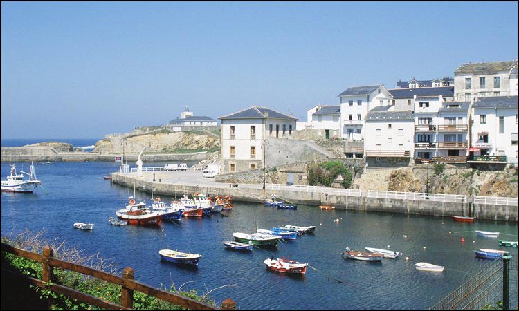
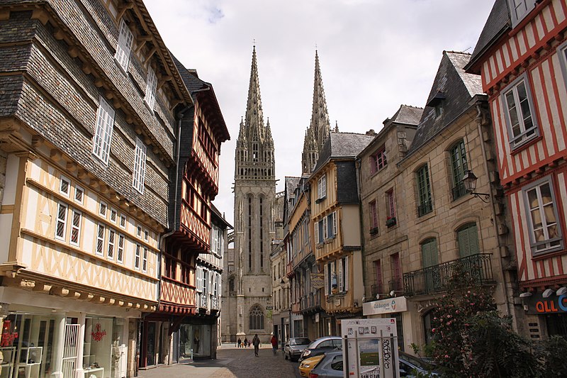
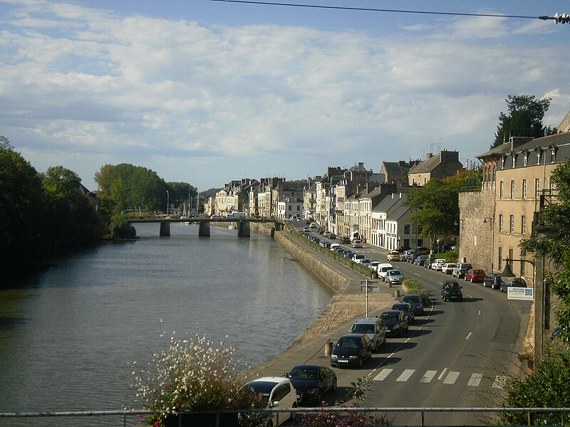
Tapia de Casariego:
pic_11g-A.jpg


Santuário del Acebo:
image_gallery
 
Stage 15: Cangas de Onis - Lagos de Covadonga, 21,8km (Contrarreloj Individual)

osbcli.jpg


kqfd0.png


Puertos:
Lagos de Covadonga (1135m) 14,0km @ 6,9% (cat.ESP) - 21,8km (Meta)

Yes, this is the third time trial in my Vuelta, something Unipublic would surely not go for (except in this context perhaps), although this is a pretty straightforward one. Yes, I have not used the Vuelta's most classic climb in any of my three previous Vuelta routes, so it's time for it to surface. As many of you will no doubt be aware, unlike many classic climbs, it's actually pretty difficult to link Lagos de Covadonga with many major climbs without at least some flat, although Mirador del Fito, Collada Llomena and Collado Moande/Moandi are at least close enough to have some kind of cumulative effect. So stages to Covadonga more or less are all about Covadonga. And while the climb does regularly produce some entertaining racing, a pattern is starting to develop there in recent years. In the 2007 stage it was won by Efimkin from the break with gaps among the main contenders being small. In 2010 the break decided it with Barredo triumphing and the main contenders fighting 2 minutes down the road. When Antonio Piedra triumphed in 2012 he was 9 minutes ahead of the main contenders, among whom the gaps were small. This year's stage was closer, with Niemiec only just holding on, but the gaps among the primary contenders were once again limited.

I like Lagos de Covadonga, and it is an iconic summit, however it could perhaps do with a few years' break from the race in order that it restore some of its magic. If they do insist on keeping it, I'd like there to be a way that we can ensure there are time gaps. Hence this - something I haven't used in the thread at all to this point: a mountain time trial.

It's not a "pure" mountain TT per se - the first 8km or so are flat-false flat, which should enable less pure climbers to limit losses somewhat. But when they enter the park, se armó un zapatiesto. Remember that the riders finished on 8 kilometres of 10% yesterday, and then send them against the clock up one of Spain's most legendary climbs. And the thing with Covadonga is that unlike the likes of Angliru, Camperona, even the Pan do Zarco side of Ancares, it's not about carnival slopes, but it's still a hard climb and with its 6km averaging 9,7% in the middle of the climb (a maximum of 15% during La Huesera) to be done without the benefit of being able to watch your opponents, there could be some marked time gaps opened up here. And the climb is used often enough that riders ought to all know the climb, so this should be, once the climb has begun (first time check will be at the entrance to the park, GPM will be awarded for time from this to the finish), a pure test of riders' climbing abilities.

As it is the Vuelta's most iconic climb, no self-respecting cycling fan should not know what Lagos de Covadonga looks like, even if it wouldn't be the same level of criminality as not recognizing, say, Trouée d'Arenberg or Madonna del Ghisallo. Cyclotourists pack it so pros have no excuse. However, this part of the Picos is quite nice to look at, so here's Santa Cueva de Covadonga, the stunning waterfall beneath it, the Santuário de Covadonga, the mountains in the mist, and some beautiful views across the Picos de Europa. The road itself is plenty scenic too, mind. I mean, look at it.

There's a rest day tomorrow, so no excuses for not going all out today.

Cangas de Onis:
aire1.jpeg


Lagos de Covadonga:
Sin-t%C3%ADtulo.jpg
 
Since this thread seems to be revived a bit, i'll join in the recent interest. I have a dauphiné libéré and two Tours de France with geographical constraints up my sleeves, which I plan to post the next days/weeks/months (who knows...).

We'll start with a Tour sans Alpes et Pyrenées. It has already bee done by Another Dutch Guy, but I'll be a bit more strict in my definition of Alps and Pyrenees. Every mountain south of the Garonne and Canal du Midi belongs to the Pyrenees, and every mountain on the left bank of the Rhône belongs to the Alps, except if it's in the départements of Bouche du Rhône or Vaucluse (little hint here ;) ). That doesn't mean I wont design stages on the other side of these borders, I just can't use mountains (2nd category or higher) in those areas.
Since there aren't that much (very) difficult climbs outside the Pyrenees and Alps, some of the climbs Another Dutch Guy used, will also feature in my Tour. But I think our designs will be different enough to share a second Tour sans Alpes et Pyrenées.

Not only there will be some identical moutain combinations, I'll even start in the same region: Brittany, also with a prologue.

Tour sans Alpes et Pyrenees - Prologue: Rennes, 6.4km, flat ITT
Situated in the centre of Brittany, and counting more than 200000 inhabitants, Rennes is the rightful capital of that region. Founded some centuries BC, it rose to prominence in the 15th cenutry when the dukes of Brittany made it their residence.
The race will start at the Place Place de la République and will mainly follow some wide quays and boulevards in a clockwise direction, with a brief detour to the medieval city centre to pay a visit to some touristic highlights, mainly the Palais du parlement de Bretagne.

9s4huf.jpg


The course is entirely flat, and because of the long, straight stretches favours the pure tt'ers.
 
I always like to see this thread so I decided to do my first fantasy parcours. I will start with a World Championship in my hometown, Coimbra.

For those of you who don't know, Coimbra is one of the biggest cities of Portugal. Located in the middle of the continental territory, it's home for one of the most famous universities of Europe, Universidade de Coimbra. Located in the margins of the river Mondego, Coimbra has several centuries of history and the topography offers some opportunies for a challenging course.

I will start to show you the Individual Time Trial and then I will post the parcours of the road race.

World Championship I.T.T.: Figueira da Foz - Coimbra:

Y2K6W7T.png


DuMPbtx.png


The startline is located in Figueira da Foz, the coastal town of the administrative district of Coimbra. The riders start their 60 km effort on the marginal, right by the beach and head directly to Serra da Boa Viagem, a short climb with beautiful sea views (which you can see in the pics under this text). With 4100 metres and a median slope of 5,9% it offers a opportunity to challenge the riders in climbing mode. After reaching the top of this climb the riders go back to Figueira da Foz and enter the A14 highway towards Montemor-o-Velho. Don't think that the parcours is flat just because they are in a highway. There are lots of small bumps in the approximately 14 km's of this road. Shortly after passing Montemor-o-Velho, a town known by his imponent castle, the riders turn right towards the rice fields that surround the river Mondego. From now until Coimbra the riders travel right beside the river, in narrow roads used by the agricultors to access their fields. Expect some wind and a fast route that favors the rouleurs. In Coimbra, the riders travel along the railway until arriving at Portagem (in the old days, this part of the town used to be a toll in which people who arrived at the city must pay a fee). We are in the closing stages of the competition. The riders only have to go now through Couraça de Lisboa, a short but very steep climb in cobbles. In this 600m, there is a median slope of 13,5% and sections above 23%. This is one of the most beautiful parts of this course, with view to the River Mondego on the start of the climb. When the riders reach the end of this zone they are in Pólo I, the headquarters of the University and home for the finish of all the races of this World Championships. The finish line is located in Rua Larga, and the riders will arrive framed with Porta Férrea, one of the most iconic places of Coimbra.

START LINE:

apartamento_t2_a_venda_em_s_o_juli_o_figueira_da_foz_concelho_de_figueira_da_foz_coimbra_portugal_99329249533626395.jpg


MAIN CHALLENGES:

Serra da Boa Viagem - 4100m at 5,9%

http://i.imgur.com/1M06UI4.png

https://www.google.pt/maps/place/Se...4m2!3m1!1s0xd223643c52dc24d:0xa00ebc04f7fd9e0.

https://www.google.pt/maps/place/Se...4m2!3m1!1s0xd223643c52dc24d:0xa00ebc04f7fd9e0

Estrada do Rio

https://www.google.pt/maps/@40.2143...ata=!3m4!1e1!3m2!1sNjmoKLP0fqLGfs7Lc54rHg!2e0

Couraça de Lisboa - 600m at 13,5%

http://i.imgur.com/0smDjqL.png

https://www.google.pt/maps/place/Tr...m2!3m1!1s0xd22f9083fbfd2af:0xe3da11052e1899bb

https://www.google.pt/maps/@40.2066...ata=!3m4!1e1!3m2!1sgYD3mjExO3Zxa9Z0QdYMzg!2e0

FINISH LINE:

640px-Rua_Larga_at_Coimbra_University.jpg


Say your opinion and give your remarks about my first presentation. And sorry for my not so good english.
 
McLovin said:
Is it possible to put a ITT there? Are there two distinct roads?

There's plenty of space at the summit as there are two separate car parks (the main one they use in the race at Lago de Enol, and another one slightly further up at Lago de la Encina). If there are any problems they could do it in waves, like they do in the Plan de Corones TTs in the Giro - there's a lot more space at Covadonga than there is at Kronplatz, so we'll just have to get Zomegnan to clarify the logistics for us :)
 
Ricco' said:
I always like to see this thread so I decided to do my first fantasy parcours. I will start with a World Championship in my hometown, Coimbra.

For those of you who don't know, Coimbra is one of the biggest cities of Portugal. Located in the middle of the continental territory, it's home for one of the most famous universities of Europe, Universidade de Coimbra. Located in the margins of the river Mondego, Coimbra has several centuries of history and the topography offers some opportunies for a challenging course.

I will start to show you the Individual Time Trial and then I will post the parcours of the road race.

World Championship I.T.T.: Figueira da Foz - Coimbra:

Y2K6W7T.png


DuMPbtx.png


The startline is located in Figueira da Foz, the coastal town of the administrative district of Coimbra. The riders start their 60 km effort on the marginal, right by the beach and head directly to Serra da Boa Viagem, a short climb with beautiful sea views (which you can see in the pics under this text). With 4100 metres and a median slope of 5,9% it offers a opportunity to challenge the riders in climbing mode. After reaching the top of this climb the riders go back to Figueira da Foz and enter the A14 highway towards Montemor-o-Velho. Don't think that the parcours is flat just because they are in a highway. There are lots of small bumps in the approximately 14 km's of this road. Shortly after passing Montemor-o-Velho, a town known by his imponent castle, the riders turn right towards the rice fields that surround the river Mondego. From now until Coimbra the riders travel right beside the river, in narrow roads used by the agricultors to access their fields. Expect some wind and a fast route that favors the rouleurs. In Coimbra, the riders travel along the railway until arriving at Portagem (in the old days, this part of the town used to be a toll in which people who arrived at the city must pay a fee). We are in the closing stages of the competition. The riders only have to go now through Couraça de Lisboa, a short but very steep climb in cobbles. In this 600m, there is a median slope of 13,5% and sections above 23%. This is one of the most beautiful parts of this course, with view to the River Mondego on the start of the climb. When the riders reach the end of this zone they are in Pólo I, the headquarters of the University and home for the finish of all the races of this World Championships. The finish line is located in Rua Larga, and the riders will arrive framed with Porta Férrea, one of the most iconic places of Coimbra.

START LINE:

apartamento_t2_a_venda_em_s_o_juli_o_figueira_da_foz_concelho_de_figueira_da_foz_coimbra_portugal_99329249533626395.jpg


MAIN CHALLENGES:

Serra da Boa Viagem - 4100m at 5,9%

http://i.imgur.com/1M06UI4.png

https://www.google.pt/maps/place/Se...4m2!3m1!1s0xd223643c52dc24d:0xa00ebc04f7fd9e0.

https://www.google.pt/maps/place/Se...4m2!3m1!1s0xd223643c52dc24d:0xa00ebc04f7fd9e0

Estrada do Rio

https://www.google.pt/maps/@40.2143...ata=!3m4!1e1!3m2!1sNjmoKLP0fqLGfs7Lc54rHg!2e0

Couraça de Lisboa - 600m at 13,5%

http://i.imgur.com/0smDjqL.png

https://www.google.pt/maps/place/Tr...m2!3m1!1s0xd22f9083fbfd2af:0xe3da11052e1899bb

https://www.google.pt/maps/@40.2066...ata=!3m4!1e1!3m2!1sgYD3mjExO3Zxa9Z0QdYMzg!2e0

FINISH LINE:

640px-Rua_Larga_at_Coimbra_University.jpg


Say your opinion and give your remarks about my first presentation. And sorry for my not so good english.
That's a sick final climb I have to say. Should be a fast TT with cross to tailwind
 
World Championships - Coimbra R.R. (15 laps):

Coimbra Cycling Classic - Unesco World Heritage (15 laps):

qRuRNdM.png


p4OHeBF.png


After the time trial, it's time to show the parcous of the Road Race. We start in the same place of the finish line (Rua Larga / Largo Dom Dinis) and afterwards the cyclists have a fast descent towards Arcos do Jardim (one of the most beautiful monuments you can see in Coimbra) and Praça da República (the spot where most of the students hang around in their free time). Turning right, we have the first uphill section in Rua Lourenço de Almeida Azevedo, where the cyclists climb 700m at 6.6%. It's a long straight, running parallel to Jardim da Sereia and a football field. When we reach Celas the climb is over and we have a fast descent where we approach again Praça da República and we head to Manutenção Militar. A right turn and the riders climb to Conchada, another urban paved climb with 500m at 8.4%. After this it's one of the easiest parts of the course, with a descent towards Estação-B train station and a river crossing in Ponte do Açude. After passing by the municipal bus depot we have the third climb of the day in Rua Coelho da Rocha, 900m at 5.4%, but where the main difficulty it's the narrow road. When we reach the top we turn towards Forum Coimbra, the biggest and most recent shopping mall of the town and we return to Guarda Inglesa and pass by the bus depot for another road. Now we are getting to the hardest points and we climb Calçada de Santa Isabel, 500m at 10.8% but with the first 300m at slopes that usually go beyond 15% and in irregular cobbles. One of the great opportunies to an attack that can hurt the others chances. The climb is right followed to a fast descent to Ladeira Vale do Inferno (Muur of the Valley of the Hell in english), a section with some small bumps and a sinuous road that makes it difficult to chase. We go then to some wide roads and we cross again the river in Ponte Rainha Santa Isabel and go to Rua do Brazil, from where we enter to climb to Sé Velha. This is the most brutal part of the circuit, with a climb of more than 1.1 km of cobbles (I don't have the numbers for the entire length because Strava is messing something in the first part) but the last 600m are done with a slope of 13,5%. Very narrow road too, with some parts where 4/5 cyclists side-by-side are impossible. From there we are at Rua Larga, where the finish line is once again located.

Main Challenges:

Rua Lourenço de Almeida Azevedo - 700m at 6,6%

http://i.imgur.com/HfAAETD.png

https://www.google.pt/maps/place/Pr...m2!3m1!1s0xd22f90b1124daef:0xf1c8199a84ecc6a4

Conchada - 500m at 8,4%

http://i.imgur.com/AjqK6xu.png

https://www.google.pt/maps/search/c...ata=!3m4!1e1!3m2!1sR-ImVf8lF8ExNreVRBsxhg!2e0

https://www.google.pt/maps/search/c...ata=!3m4!1e1!3m2!1si7FsaiywJ5d1JOiOBnreMQ!2e0

Rua Coelho da Rocha - 900m at 5,4%

http://i.imgur.com/h1K2c0j.png

https://www.google.pt/maps/place/Ru...m2!3m1!1s0xd22f90005418eb3:0xcb7e7fbd72aee191

Calçada Santa Isabel - 500m at 10,8% - COBBLES (300m)

http://i.imgur.com/fmDrsGA.png

https://www.google.pt/maps/place/Ru...m2!3m1!1s0xd22f90005418eb3:0xcb7e7fbd72aee191

Sé Velha - 600m at 12,3% with 500m of uncategorized climb before - COBBLES - ENDS AT THE FINISH

http://i.imgur.com/xwV2MWB.png

https://www.google.pt/maps/place/Pr...m2!3m1!1s0xd22f90b1124daef:0xf1c8199a84ecc6a4

https://www.google.pt/maps/place/Pr...m2!3m1!1s0xd22f90b1124daef:0xf1c8199a84ecc6a4

https://www.google.pt/maps/place/Pr...m2!3m1!1s0xd22f90b1124daef:0xf1c8199a84ecc6a4

https://www.google.pt/maps/place/Pr...m2!3m1!1s0xd22f90b1124daef:0xf1c8199a84ecc6a4

https://www.google.pt/maps/@40.2088...ata=!3m4!1e1!3m2!1silRinbPdxD_ggamdmJ_yIA!2e0

FINISH LINE:

640px-Rua_Larga_at_Coimbra_University.jpg
 
However the last climb from the TT is wide enough, offers some space to the fans and could be used as a substitute for the Sé Velha climb if needed/if there were any problems faced in trying to do such a narrow road in the Worlds - the circuit would still be tough and would have some cobbles at steep gradients too.
 
Yeah, the last climb has parts where the police would need to stop the fans from going there, but in the zone of the Sé Velha cathedral there his plenty of room for everyone. The first cobbled climb has a lot of space. For exemple, every two years there are some religious festivities where a procession descends that part and 10/15 people can be put side by side and two cars can cross in opposite directions without problem.

I'm working now in a alternate parcous to a Volta a Portugal, hope I can start post soon, right now I'm halfway through the 11 stages.
 
Stage 1: Saint-Brieuc - Crozon: 214.5km, hilly

After the prologue in the département Ille-et-Vilaine, todays stage will cross the other three Breton departements. Although it will venture just briefly in Morbihan.
The start is about 100km nortwest of yesterdays Grand Départ, in the coastal town of Saint-Brieuc. The peloton will head west, towards the small town of Gourin, where it will make some loops across the pretty countryside known as the Montagnes Noires (black mountains), a hilly region on the left bank of the Aulne river. The next 50km 5 hills have to be climbed. They are, however, nearly not difficult enough to break up the peloton. But one can expect the battle for the first KOM jersey will have an impact on the race development.
An easier interlude brings us to the town of Châteaulin, a name that must ring a bell with many cycling fans. From 1931 to 1998 a famous criterium was almost annually held in town, including he biggest names in cycling as winners. Later it became a regular race, contested on a hilly circuit. Todays stage will also feature the main obstacle of that race: the climb to Menez Quelc'h with 50km to go. One can expect huge crowds in this cycling-mad part of France.
Once again a climb is followed by a some easier roads that bring us to the picturesque Baie de Douarnenez. The coastal road is soon left for a climb two thirds up the Menez Hom, one of the highest point of Brittany. The summit offers some beautiful vistas on the surrounding countryside, the Douarnenez Bay, and the Aulne river. But with only 27km to go, few riders will take a look around and enjoy the scenery.
A gentle descent, first on a wide departemental road, but later using local, more narrow roads brings us once again to the coastline. At this point, there's only a bit more than 13km left. Although the finish is nearing, there are some nasty surprise left for the peloton. In the remaining kilometres there are 3 more climbs to tackle. Although they are mere 4th category bumps, their quick succession and proximity to the finishline is bound to create some gaps in the peloton. Maybe the difficulty won't be high enough to let the bunch completely explode, but with a finish more or less comparable to the current finish of the Amstel Gold Race, a good puncher can certainly distance his rivals in the closing kilometres.
Even if the show on the road would be somehow lacklustre, the coastline of the Crozon peninsula, with marine caves, natural arches and sharp cliffs will offer a spectacular background.

Map & Profile

2j5i7mw.jpg


Climbs:
Côte de Ty Coz: km85; 3,6km @ 4.7%; 4th cat
Côte de Roc’h Toullaëron: km94.5 ; 3.9km @ 4,3% ; 4th cat
Côte de Boulven : km121 ; 1.1km @ 6% ; 4th cat
Côte de Kerverger : km129.5 ; 3.2km @ 5.2% ; 3rd cat
Côte de Menez Quelc’h: km164; 3km @ 6.4% ; 3rd cat
Côte de Menez Hom : km187 ; 3.4km @ 5.3% ; 3rd cat
Côte de Menez Caon : km202.5 ; 1.9km @ 5.8% ; 4th cat
Côte de Trélannec : km209 ; 1.4km @ 5.7% ; 4th cat
Côte de Kervéron: km 213; 1.2km @ 6.7%; 4th cat
 
Tour sans Alpes et Pyrenées stage 2: Quimper - Redon: 190km, flat

Since large chunks of France are omitted from the race, others will get a fair deal more of attention. That's why for the third consecutive day Brittany will host a stage. Since yesterdays stage finished almost at the westernmost point of the elongated Breton peninsula and it's time to leave it, todays stage is one (not so) long journey east.

Before the start (or the evening before), there will be a transfer from about 50km from Crozon to the pretty town of Quimper. The first part of the stage will be a small detour north, to cross one of the most famous towns of Brittany, at least cycling-wise: Plouay. The centerpiece of the yearly GP de Ouest France, the côte de Ty marrec will also feature in this stage, as the only categorized climb of the day.
The remaining 130km will be more or less parallel to the coast, while evading bigger towns as Vannes or Lorient as to not disrupt the traffic in those cities. If the wind blows hard enough, we can expect echelons and nervous racing behaviour of those favourites who feel uncomfortable in these circumstances.

Not only the racing will probably be a bit more dull, also the scenery will be rather bland compared to yesterday. This stage wasn't meant to be a touristic commercial for the region, and chances are rather small people will change their holiday plans while watching it.
Despite the possibility of echelons, it is still possible that an almost compact peloton will storm to the finishline. The only thing left that can spoil the sprinters' party is the finishing straight of the Avenue de Beaumont, with a gentle climb of 1km @ 4.5% that tops out with 300m to go. That might prove just a bit too difficult for the pure sprinters, although any sprinter in top form should not suffer too much on these kind of climbs.

r6wbb4.jpg


Climbs:
Côte de Ty Marrec: km59.5; 1.5km @ 5.3%; 4th cat


Quimper:
800px-Quimper_Cath%C3%A9drale_St._Corentin_2010.JPG


Redon:
800px-La_Vilaine_redon.JPG
 
Tour de France

Stage 14: Auron - Cuneo, 153 km

65yygxy8y4nj.png


hnrr2k9koxuu.png


Time to resume my Tour. This is the third Sunday of the race, we have had mountain stages on Friday and Saturday, we have another one today. Two HC climbs are on the program, first Lombarda, then Fauniera, officially the best climb in the world. The Demonte side is not as hard as the Pradleves side, but hard enough. It's 24,7 km at 7% in average, but the second half includes 10 km at 8,9%. It's not super steep, but the combination of the enormous length and the relentless gradients around 9% for sure will have an effect. The scenery is outstanding, too. I don't think the Demonte side has ever been used as an ascent in a race, but i could be wrong. The descent to Pradleves again is an opportunity for good descenders. The road is narrow, steep and difficult. Savoldelli's magical descent 1999 of course happened on the Demonte side. After the descent 40 km are left to ride, including the steep little climb to the tiny village of Piatta. It's a small road, mostly through the woods, 4,6 km long and in average 10% steep. The descent via Montemale is on a bigger road; the final 18 km are flat. The finishing line is at the impressive Corso Nizza, just before Piazza Galimberti. Monday is a rest day.

climbs:
Col de la Lombarde (2.350m) 20,2 km 7,3%
Colle della Fauniera (2.511m) 24,7 km 7%
Piatta (1.137m) 4,6 km 10%


Auron
234_0_50055a4334bb8_750_750_1364393345.jpg


Cuneo
35711.jpg
 
Tour sans Alpes et Pyrenées stage 3: Redon - Saumur: 186.5km, flat

No transfer after yesterdays stage or before todays start. This stage starts where the preceding ended. This stage is quite straightforward: it heads in a generally eastern direction, without big detours or changes of direction.

From Redon it goes through Nozay and Nort-sur-Erdre to Ancenis, where the peloton crosses the Loire river by the Pont Bretagne-Anjou. Like so many other places along the Loire river, Ancenis was founded around a castle, of wich some remnants still can be seen. But unlike many of these towns and villages, the castle never evolved into a residential renaissance château, which make the Loire valley so famous.

This stage closely follows the course of the Loire on its left bank, crossing villages as Chalonnes-sur-Loire and Mûrs-Erigné, meanwhile enjoying the sights from the so-called Corniche Angevine. When leaving Mûrs-Erigné behind the peloton takes a gentle bend to the right, choosing a southeastern direction. From here there's only 35km left, in a more or less straight line. The finish on the Quai Mayaud comes after a straight line of 900m, with the last difficulty of the stage being a series of sharp turns with 2km to go. This seems ideal for a royal sprint, even more so because there are absolutely no climbs during the stage.

Map & Profile:
24qj18y.jpg


Saumur:
w1py0p.jpg
 
Tour sans Alpes et Pyrenées stage 4: Chinon - Bourges: 185km, flat

A short transfer brings the race caravan to Chinon, where Joan of Arc started her campaigns to liberate France from the English in the 15th century. The place is still dominated by the medieval castle.

Once again it is a fairly straightforward stage heading east, crossing the Loire valley while passing some picturesque towns like Loches and Valençay, famous for its Château. Apart from these highpoints of french architectural and historical heritage, the scenery hasn't much on offer. One can hope for a spectacular race as a compensation, but with the pan flat terrain in mind, that's not very likely. The only possibility for a bit of excitement is echelon forming, should the wind blow hard enough, like it did during stage 13 of the 2013 tour de France.

The finish on the Boulevard de la République is preceded by a last straight line of around 1500m.

Map & Profile:
2ccx7r6.jpg


Bourges:
800px-Bourges_2.JPG
 
Tour de France sans Alpes et Pyrenées stage 5: Bourges - Le Creusot: 224km, hilly

After three consecutive flat stages it is time for a change. But these changes won't come immediate. After the start in yesterdays finishing location, the first half of this stage continues the same course as the previous two stages: easternbound and crossing the plains of the river Loire.

Only after about 125km these changes are to be felt, when the peloton enters the regional nature park of the Morvan, a hilly region in central Burgundy. The next 100km 8 hills have to be climbed, in two groups of 4 climbs each, with 25km in between.

One can expect the peloton will break apart on the first four climbs, like happened on a similar, but easier, stage to Autun in 2007. That is, however, no given fact. If the action is a bit underwhelming in this part of the stage, there's still a hilly final left when leaving the aforementioned town of Autun with 40km to go. The côte de la Croix de Libération, in 2007 climbed from its easier west side is difficult enough to get rid of the sprinters and a good deal of domestiques. The fast descent is followed by a rather rolling climb, well suited to drain some more powers of those who can barely hang on the front group. The final blow is likely to be dealt by the steep Côte d'Uchon with less than 20km to go. The final bump after Le Sautot can be an ideal jumping platform for any puncher who needs to get rid of some remaining faster men. But there will be no sign of any of the pure sprinters.


Map & Profile:
2ijqalg.jpg


Climbs:
Côte de la Veille Montagne : km 130.5 ; 3.6km @ 6.2% ; 3rd cat
Côte du Mont Preneley : km 146 ; 7.5km @ 4.7% ; 3rd cat
Côte de la Grande Vente : km150.5 ; 2.6km @ 4.2% ; 4th cat
Le Mont Beuvray : km158 ; 3.8km @ 6.6% ; 3rd cat
Côte de la Croix de Libération : km188 ; 4.2km @ 6% ; 3rd cat
Côte de La Chapelle-sous-Uchon : km203 ; 4.2km @ 4.1% ; 4th cat
Côte d’Uchon : km205.5 ; 1.9km @ 10.4% ; 3rd cat
Côte du Sautot: km215.5; 2.6km @ 5% ; 4th cat
 
Tour de France

Stage 15: Cuneo - Gap, 187 km

rinxdiwi3m5b.png


The peloton returns to France via the long but gentle climb of Col de Larche (1.991m 30,6 km 3,6%). After the equally gentle descent there is a long flat part in the Ubaye vally, before things get more interesting with Col des Fillys (1.322m 12,5 km 5,2%) at km 140. The stage might get decided on the well known Col de la Sentinelle (5,2 km 5,6%), which tops out at 9 km to go. This should be one for a breakaway.


Gap
78_1_20130812181204.jpg
 
Tour de France sans Alpes et Pyrenées stage 6: Autun - La Loge des Gardes: 213km, medium mountains + MTF

The peloton has been going east since the second stage, so one might expect that it would continue that way to the Vosges or Jura. But no, I'll keep these ranges for later. From Burgundy it goes south to the northern part of the Massif Central.

The start is in a town that heralded the beginning of the final the day before: Autun. This city was founded about 2000 years ago and has a very rich historical heritage, ranging from Roman temples and city gates over a medieval cathedral to a 19th century covered shopping passage. Anyway, enough touristic information.

After the départ réel the peloton follows the course of the Arroux river downstream, crossing little town as Gueugnon and Digoin, where it debouches into the Loire river. Once again the peloton will follow the Loire, but only for a few dozens of kilometres. In Marcigny the peloton will cross the Loire and head for the mountains looming on the horizon.

The first climb starts after almost 120km, isn't very steep and tops out in a forrested area. It is followed by a smooth descent, passing two artificial lakes on the way to Renaison, a town on the edge of the Loire plain, at the feet of the Massif Central. For a bit more than 5km the course skirts the foot of the mountains, before it turns west and goes uphill once again. The start of the Col de la Croix Trevingt marks the beginning of a relentless series of five climbs of varying difficulty. The first two of them are not very steep, although the Col de la Croix Trevingt is long enough to deserve a 2nd category rating. The third in line is a quite steep, but rather short, resulting in a 4th category label. The Col de Saint-Thomas is on the verge between 3rd and 2nd category, but despite offering some steep gradients; rather belongs to the former category. The last climb in this line of five also crests at the highest elevation today. 1120m Is not a breathtaking altitude, but to get there, the peloton must climb 8.5km at a steady 5.9%, with some steeper sections. The descent is on a narrow forest road, but luckily for the rider not very sinuous. It soon joins the wider D495 towards Laprugne. The road keeps descending until a bridge over the Ruisseau de Lamiouze with 7km to go.
This point marks the start of the final climb of the day, to the small winter sport station of La Loge des Gardes. There are several different ways to get to the top, and the most difficult is dished up today. A bit less than 7km @ 7.4% isn't the most difficult one can imagine, but is the first real dificulty of the Tour. The accumulated fatigue of the previous climbs and the lenght of the stage should be enough to create some gaps between the favorites. It may be possible to create bigger gaps, but the best climbers should attack early on the climb, as the steepest pitches are between km 1 and km 4 of the climb.

Map & Profile:
1zbcgmp.jpg


Climbs:
Col de la Croix du Sud : km127.5 ; 8.8km @ 4.4% ; 2nd cat ; 763m
Col de la Croix Trevingt : km154.5 ; 8.8km @ 5.2% ; 2nd cat ;854m
Côte des Essarts : km164.5 ; 5.2km @ 4.9% ; 3rd cat
Côte de Saint-Just-en Chevalet : km 172. ; 1.6km @ 7.9% ; 4th cat
Col de Saint-Thomas : km179 ; 4km @ 7.4%; 3rd cat; 930m
Col de la Charme: km191; 8.5km @ 5.9% ; 2nd cat ; 1120m
Col de la Loge des Gardes : km213 ; 6.8km @ 7.4% ; 2nd cat ;1077m
 
Tour de France sans Alpes et Pyrenées stage 7: Vichy - La Banne d'Ordanche: 190km, medium mountains + MTF

description to follow later

Map & Profile:
11m93ph.jpg


Climbs:
Côte du Cratère : km48 ; 6.5km @ 5.7% ; 3rd cat
Col de Ceyssat : km70 ; 9.7km @ 5.7% ; 2nd cat ; 1078m
Col de la Moreno : km80 ; 4.2km @ 4.3% ; 4th cat ; 1065m
Côte de Gergovie : km102 ; 4.2km @ 5.7%; 3rd cat
Col de la Serre: km122; 8.4km @ 5.5% ; 2nd cat
Côte d’Olloix : km140 ; 6.3km @ 5.5% ; 3rd cat
Col de la Croix Saint-Robert : km168 ; 10km @ 5.6% ; 2nd cat ;1451m
Montée de la Banne d’Ordanche : km190 ; 7.2km @ 6.4% ; 2nd cat ; 1318m
 
Tour de France sans Alpes et Pyrenées stage 8: La Bourboule - Murat: 170km, medium mountains

description to follow later

Map & Profile:
2cog2nk.jpg


Climbs:
Côte de Méjanesse : km8 ; 3km @ 5% ; 4th cat
Côte des Quatre Vents : km19 ; 2.6km @ 5.6% ; 4th cat
Côte des Hurquets : km55.5 ; 2.4km @ 10.5% ; 3rd cat
Côte de Coindre : km71 ; 2.2km @ 7.5% ; 4th cat
Col d’Aulac : km102.5 ; 8.1km @ 3.2% ; 4th cat ; 1212m
Col de Neronne: km113; 4.1km @ 7.8%; 2nd cat ; 1242m
Pas de Peyrol: km124; 5.5km @ 7.9%; 2nd cat ;1588m
Col du Perthus: km140.5 ; 4.5km @ 8.4% ; 2nd cat ; 1309m
Col de Cère : km 152 ; 5.4km @ 5% ; 3rd cat ;1294m
Côte de la Bastide : km165 ; 2.2km @ 9.8% ; 3rd cat ; 1122m
 
Tour de France

Stage 16: Gap - Valence, 177 km

r75x4779o277.png


finale:
tgg3u6lbhvqy.png


Another transitional stage. The first 6 km are slightly uphill and should be raced from the gun, then there is Col de Cabre (1.180m) at km 51. The rest of the stage is flat whith the exception of of that steep little hill 10 km before the finish. This is Chemin de Toulaud, which provides nice views of Valence and is 1,5 km long and 10,3% steep. Some sections have more than 15%. Pure sprinters will struggle here, but more versatile sprinters might be able to hang on. From the top of the climb 9 km are left to race.


Valence (finish line)
rzdu9jhiorm.png
 

TRENDING THREADS