• The Cycling News forum is looking to add some volunteer moderators with Red Rick's recent retirement. If you're interested in helping keep our discussions on track, send a direct message to @SHaines here on the forum, or use the Contact Us form to message the Community Team.

    In the meanwhile, please use the Report option if you see a post that doesn't fit within the forum rules.

    Thanks!

Race Design Thread

Page 148 - Get up to date with the latest news, scores & standings from the Cycling News Community.
Tour Complet de France n°2, stage 11: Alençon - Les Andelys: 179.5km, hilly (Basse Normandie - Haute Normandie)

The peloton continues its journey through the entirety of France. The finishtown of the previous stage is quite close to two other regions, so that gives some opportunities. Logistically, it is wisest to choose for a stage start in Basse Normandie, the region with Caen as capital.

Surrounded by hills covered with forest on three sides, Alençon could very well be the finish of a hilly stage but today it will be the starting location. The beginning of the stage itself isn't hilly at all. The course goes east, and that's the one side where there are no hills. Instead this stage will stay on a plateau for about 25km and then gently climb towards the highest point of the day: the forest of Moulins-Bonmoulins after 42km.
From that point the course descends very slowly towards Évreux, where the intermediate sprint will be. The next 10km the roads will remain flat, but then the course quickly descends to Eure valley. The peloton follows the course of the Eure for some time and then climbs the watershed between the Eure and the Seine, a 3.5km long false flat. The descent towards the Seine is steeper, but by no means demanding.
The Seine crossing after 144km will probably be the turning point of this race, as for the next 35km the course will twist and turn on and off the steep banks of the Seine, wherever the steep chalk cliffs don't make it impossible to do so.
Five climbs have to be tackled in this hopefully exciting final. The last one, a narrow but very steep one way road to the ruins of Château Gaillard crests with only 3km to go. That descent is quite technical with some hairpin bends, so a good or daring descender can certainly close small gaps that have opened on the climb itself.
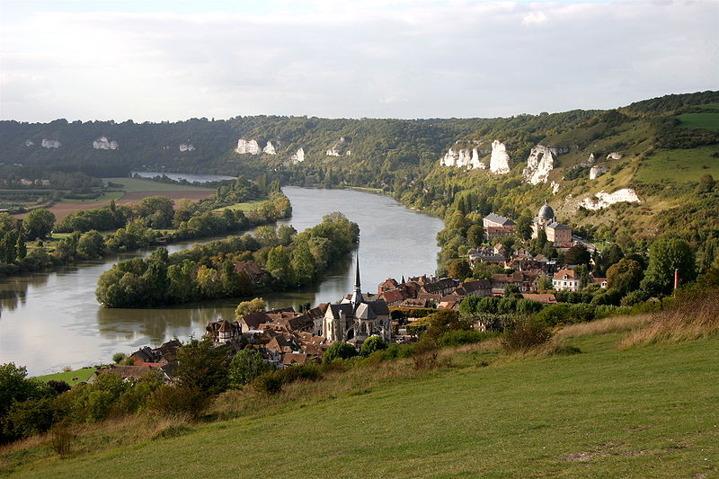
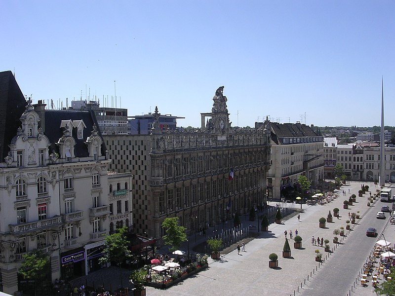
800px-Petit-andely-depuis-chateau-gaillard.jpg

Les Andelys

Map & Profile:
105unmp.jpg


Difficulty: **

Climbs:
Côte de Châteauneuf: km148.5; 2km @ 5.5%; 4th cat
Côte de Cléry: km157.5; 1.4km @ 8.1%; 4th cat
Côte de la Courcanne: km166; 1.3km @ 6.8%; 4th cat
Côte de Noyers: km170.5; 1.7km @ 5.2%; 4th cat
Côte de Château Gaillard: km176.5; 1.1km @ 11.8%; 3rd cat

Intermediate sprint:
Évreux: km114.5
 
Re:

lemon cheese cake said:
Tour des Alps? It's Tour of the Alps.

It would be Tour d'Alps if you call it that, as the french knock off the vowl (in this case an E) and put an apostrophe in between the Consenant and the first vowl of the second word. It applies to H aswell, as it's a vowl in French.
Well, as you might have guessed, I don't speek french :D
Okay, I will change it
 
Re: Re:

Gigs_98 said:
lemon cheese cake said:
Tour des Alps? It's Tour of the Alps.

It would be Tour d'Alps if you call it that, as the french knock off the vowl (in this case an E) and put an apostrophe in between the Consenant and the first vowl of the second word. It applies to H aswell, as it's a vowl in French.
Well, as you might have guessed, I don't speek french :D
Okay, I will change it
Doesn't matter! Although i'm not french, things like that do annoy me sometimes.
 
TransAlp stage 2: Cesana Torinese-Val d´Isere (176 km)
Stage two of my tour through the alps starts in Cesana Torinese, a town which would be passed after a descent from sestriere. The first climb of this stage starts directly after the start. It is the Col de Montgenevre, a second category climb which leads the riders to france. After the descent the peloton will pass the intermediate sprint in briancon and after a little bit more of descent the climb to the col du galibier starts. Although the galibier has a big name, this side isn't that difficult. In the tdf it always was HC but in fact it is a 1st category climb because only the last few kilometers are steep. The descent of the galibier is very very long and on the way down to Saint Michel de Maurienne the riders also have to pass the col du telegraph (which is a 1st category climb from the north side but from this side its hardly worth mentioning). The next 60 km´s are mostly false flat with some bumps and an intermediate sprint in modern after 104 kilometers. After this not very interesting section the climbing starts again. Exactly the highest pass of europe, the Col de I´Iseran (cime de la bonette isn't a real pass, the actual pass is the col de la bonette and that one isn't as high as the I´Iseran) If you watch the profile of the I´Iseran you might notice that it is a classical french climb, medium length, medium steepness --> 1st category climb. Directly after the descent the riders arrive in Val d´Isere, probably the only town in the world with 3 (!!!) downhill slopes and because my main goal for this tour was to finish every stage in a town with a famous alpine downhill slope I just had to use this one. Moreover there have been world championship and olympic races in Val d´Isere. The three slopes are: Face de Bellevarde (Here the olympic and World championship men downhills took place. It is very technical and extremely spectacular), solaise Rhone Alpes (the world championship slope for the women downhill in 2009) and finally the piste oreiller-killy (the classical slope which is normally used in world cup races)
iGYcZYjl.png

mnU1tq3l.png


Face de Bellevarde:
RNkWeZnl.jpg


Col du Galibier (profile):
1ft2M04l.gif


Col de I´Iseran (profile):
kADCxlXl.gif


climbs:
Col de Montgenevre (2nd cat.)
Col du Galibier (1st cat.)
Col de I´Iseran (1st cat.)
 
Tour Complet de France n°2, stage 12: Beauvais - Valenciennes: 190.5km, cobbled (Picardie - Nord/Pas-de-Calais)

After a transfer of about 65km the 12th stage will start in Beauvais, one of the bigger cities in Picardy and mainly famous for its cathedral. Picardy is the 12th region visited by this Tour, so we're exactly on the average of one region per day. The next few days, however, I'll have to increase that average to be able to spend some days in the Alps.

The first part of this stage is just your average flat first week stage (but in the second week), using bigger roads and crossing town centers left and right.
After 142km the peloton will cross the umpteenth town center, but this time its name will ring a bell by many riders: Troisvilles is the gateway to hell. For decades this nondescript town marks the beginning of the first cobblestone sector in Paris-Roubaix. This will be the case today, too. Even more so, for the next 39km the exact course of Paris-Roubaix 2015 will be used. That means until the cobbles from Quérénaing to Maing.
Then, while the course of Paris-Roubaix turns left, with just 11km to go, today's stage will turn right. There's only one cobblestone sector left, but it's one of the most difficult around. 2600m of uphill false flat cobbles that seem to be thrown out of a helicopter circling around. The five star sector of Aulnoy-lez-Valenciennes isn't used every year, mainly because it's a bit out of the way. But on this occasion it is certainly on it's place. When leaving this final sector, there's only 4 slightly descending kilometers to the finish in Valenciennes.

800px-Valenciennes.JPG

Valenciennes city center

Map:
2wrd8ig.jpg


Map of the final, including cobblestone sectors:
2m5m1x2.jpg


Difficulty: ***

Cobbles:
Troisvilles - Inchy: km143; 2200m; 3*
Viesly - Quiévy: km151; 1800m; 3*
Quiévy - Saint-Python: km153; 3700m; 4*
Saint-Python: km158; 1500m; 2*
Vertain - Saint-Martin-sur-Ecaillon: km165; 2300m; 3*
Verchain-Maugré - Quérénaing: km174; 1600m; 3*
Quérénaing - Maing: km177; 2500m; 3*
Aulnoy-lez-Valenciennes: km184; 2600m; 5*
 
KAKANIEN RUNDFAHRT

(Sun) stage 8: Sibiu - Brasov, 196 km

bs913pe3t9hs.png

9eobsey8lkg9.png


The last day in Romania links two of the biggest towns of Transylvania (Siebenbürgen): Sibiu (Hermannstadt) und Brasov (Kronstadt). It is a flat affair for the most part, but at the end there is a climb to Poiana Brasov, the most popular Romanian ski resort. It is 6 km at 5,5% (7,4% for the last 2 km), followed by a short descent and the final climb up to the resort (3 km 5%). The rest is downhill, as the road descends into Brasov at quite gentle 5%.

Monday is rest and transfer day.

Sibiu
sibiu.jpg


Brasov
Brasov_up.jpg
 
KAKANIEN RUNDFAHRT

(Tue) stage 9: Kotor - Kotor, 114 km

ouwjsnautjda.png

vabfnr32sa8k.png


The transfer leads us to the magnificent Bay of Kotor in Montenegro (via Tivat airport). The second week starts with a short but intense, and possibly the most beautiful stage of the race. At first the riders will get a better look at the fjord-like bay, as they circle the Lustica peninsula.

Then we head south to Budva, one of the oldest villages at the Adriatic coast. We are close to the southern edge of Kakanien now, and turn inland which means upwards. The climb to Seostik is 17 km long with an average gradient of 5%.

The road leads to Cetinje, the old capital of Montenegro, and continues on the Lovcen plateau with a 10 km climb at 4%. The stage ends with an 18 km descent back into Kotor with an average gradient of 5%. This descent is a bona fide switchback heaven.


Kotor
kn7nvvli1cyn.jpg


final descent
suy4xpvpqwv9.jpg
 
Jun 30, 2014
7,060
2
0
Visit site
The Kakadien Rundfahrt has inspired me to design a Giro del Regno di Sardegna within the borders that the Kingdom of Sardinia had before 1859.
italy_1848.gif

The race will start in Sardinia, we'll visit Nice, Ligura, Piemot, Aosta and Savoy, to me this looks like the perfect terrain for an awesome race.
I haven't decided jet if it will be a 2 week race or if it will be a race that consists of 9 stage + 1 restday (because of tho long transfer from Sardinia to Nice).
 
Re:

lemon cheese cake said:
Voted by popularity, I am doing a Worlds Course in San Fransisco. Thanks Togo 95!

I'm looking forward to it. I tried a few in the past but they always came short. Used to start somewhere south of SF, usually Santa Cruz and use the Redwoods National Park roads for some difficulty on the first half of the race. Then the scenic route 1 up north. The stressful part for me was always keeping it realistic inside San Fran because of all the tram lines and so on, the logistics of it are horrible. Not to mention the city's grid plan and the huge amount of intersections, it's traffic mayhem. Luckily enough, the steepest streets are all together.

Anyway, good luck. Can't wait to see how (if) you will use Filbert or Lombard.
 
TransAlp stage 3: Val d`Isere-Chamonix (165 km)
The first stage of my tour from skiing slope to skiing slope which is flat or lets say more flat than most of the other stages. The stage starts in Val d`Isere finish of stage 2. After a short flat section there is a pretty long descent to Bourg Saint Maurice, where the first intermediate sprint is located. After it the route goes westwards to Albertville, olympic town 1994, the year the alpine skiing events took place in Val d´Isere. Now the route becomes hilly. First there comes the Col de la Forclaz, a third category, IMO. After the descent on the more difficult north side the very long but also very flat ascent to the town Flumet starts. After Flumet the climbing is not over immediately but the next few kilometers are only slightly uphill. After the descent the next two climbs come directly after each other. Both have almost the same specifications but the first one to the Lac de Fins Soudans is a little bit easier and gets even easier near the top of the climb. The second climb up to Vaudagne is almost the opposite because it gets steeper and steeper. The descent of this town is very short and even hardly worth mentioning so you could also say that after Vaudagne the route is flat until the finish line in Chamonix. Chamonix itself is pretty famous because it is located submontane the Mont Blanc. However its also the location of the first winter olympic games. Surprisingly there were no alpine skiing events back in 1924 but there is also a pretty famous downhill slope in Chamonix. This one was used in 1937 and 1962 in Skiing World Championships. After this races there were some other World Cup downhill events in Chamonix but they didn't take place regularly.
VoglNj7m.png

jKRPhQVl.png


Chamonix:
c6p9oLQl.jpg


Finish of the downhill slope in Chamonix:
y4luwmtl.jpg


climbs:
Col de la Forclaz (3rd cat.)
Flumet (4th cat.)
Lac de Fins Soudans (4th cat.)
Vaudagne (3rd cat.)
 
I've never done a three week race before, but here goes:
GIRO D'ITALIA STAGE 1: 31.5km TTT - CALASETTA - SANT'ANTIOCO
The Giro starts off with what is a now traditional TTT. This TTT is around the 4th biggest island in Italy, off the SW of Sardinia. Wonderful island, with incredible blue seas and lovely little hills. Unfortunately, those little hills are almost accessible to a road bike, never mind a TT bike. There are little rises through out, but very small rises. One over Cala Lunga and the eastern side is especially nice.

The stage starts in Calasetta and some narrow roads in the town may give for a nervy start for the GC guys. The road is often exposed, and either high temperatures or high winds will make it tricky. A lovely excursion through the heart of the micro-island will be scenic, and accompanied by about 90% of the corners, all swooping and delicate. A small 200m rise at 5% presents a monster of a task climbing-wise for the teams :p into the village of Maladroxia, coincidentally the second time check. A run in on the coast leads to the main town of the island, Snat'Antioco. a difficult corner leads them onto the Lungomare and the finish. It is long, it ill be hot and so maybe time-gaps will be higher than expected. They should be about on par with the Verona TTT of 2012.

Profile
XdmTOvGl.png

Sant'Antioco
panoramasantantioco.jpg
 
Tour Complet de France n°2, stage 13: Maubeuge - Châlons-en-Champagne: 187km, flat (Nord/Pas-de-Calais - Champagne/Ardennes)

After the tricky stage through Normandy and the taste of hell the previous day the peloton will be happy that today's a quiet day. For only the fifth time this Tour the pure sprinters will be the favorites for the stage victory, and it will be the last day before Paris. So we'll probably see a doomed break cruising through the rolling agricultural landscape of northern France. Not much to say about this stage, actually.

Map & Profile:
2n0qbky.jpg


Difficulty: *

Hills: none
Intermediate Sprint: Rethel; km112
 
GIRO STAGE 2: 207.1 - CARBONIA - BUSACHI - FLAT STAGE
A tricky, but easy at the same time, stage comes straight away, 2 categorised climbs. The first one comes 27km in after we pass Iglesias. It reaches 15% and is 1.3km at 13.9% overall, so is an Ardennes-like climb. Once again, an incredibly scenic route. If you have never been to Sardinia then you are missing out. This part of Sardinia is exceptionally beautiful IMO, but the rest of it puts up a good fight too. Another GPM at Montecidro will test the sprinters a bit. A long flat section takes us into the heart of Sardinia, past Oristano. The final 20km are tricky. Any rider wishing to try their luck from here on in could well make. It will be difficult to control for the sprinters teams, as the irregular uncategorised climb may make for n exciting end. The final 3km has 2.5km of slight uphill at about 5% and then a the final 500m are descending for a fast finish into the town of Busachi. The final 3km will give another chance for attackers to have a go - and the fast descent will make for an uncertain end to the stage. The narrow roads won't help the sprinters either. I tried to make this harder than it seems, usually the second stage is always quite boring, hopefully this will bring a change. I'll be honest - this better not end as a sprint.

Profile:
32HEfNMl.png


Busachi
Busachi.jpg
 
GIRO D'ITALIA STAGE 3: 254.3km - ARITZO - ARITZO - MEDIUM MOUNTAIN
The fun starts. After seeing the success of this years medium Mountain stage in the Giro, I have included a few of my own :D. We are climbing straight away, up past a hill which looks down on Aritzo. A long descent follows which goes down to Nuoro, but not into it, and to the Golfo di Orosei, where a 25.4km climb starts, a climb into a national park looking over the luscious Tirreno. A long descent back to sea level and the second TV, before a more difficult GPM, borderline 1st category, which is 14km @ 6.1%. another limb soon follows, this time uncategorised. Then another climb follows continuing the succession of short, punchy climbs. 20km of very rolling terrain comes before the final climb of the day up to Ganoni, before a false flat and a descent back in Aritzo. This stage is designed for the likes of Gilbert, but if raced hard then it will be a first difficult test for the GC boys, like the stage to La Spezia. Expect it to be hot. Very hot.

Profile:
QfhOww2l.png


Aritzo
14086832.jpg
 
Re:

Libertine Seguros said:
I stopped doing my Giro after getting distracted by the doping draft and a holiday, so you're going to overtake me before long, I need to get it back on track!
:D I have finished my Giro, but exams and stuff kept me from posting it. My final exam is on Friday, so it will start being posted very quickly from now on.
 
Re: Re:

Brullnux said:
Libertine Seguros said:
I stopped doing my Giro after getting distracted by the doping draft and a holiday, so you're going to overtake me before long, I need to get it back on track!
:D I have finished my Giro, but exams and stuff kept me from posting it. My final exam is on Friday, so it will start being posted very quickly from now on.
Oh, I've finished the route, I just haven't done any posting of it for a while!
 
Tour Complet de France n°2, stage 14: Bar-le-Duc - Mont Sainte-Odile: 228km, medium mountains + mtf (Lorraine - Alsace)

After the easy previous one, the second longest stage of this tour awaits the peloton. But first there's a transfer of about 70km from yesterday's finish to Bar-le-Duc, with its lovely hilltop historical town center.
The stage will mainly cruise along the flattish Lorraine countryside, with only a few minor rises, passing south of Nancy. But with 45km to go that changes. First there's the Col du Hantz, which is a nice warm-up for things to come, not only today, but also the next days. Not particularly long nor steep, it will see only the worst climbers or least motivated be shelled out of the peloton. Its gentle and easy descent will lead to the foot of the next climb, the most difficult of the day. The Champ du Feu has quite an elevation gain for a medium mountain climb, but it's only moderately steep.
The first part of the descent is only a slowly descending false flat, on a straight road, the second part is more technical, with some switchbacks while speeding through the Obernai forest.
After 14km the descent abruptly comes to an end as the course takes a sharp right hand turn to the final climb of the day.
Le Mont Sainte-Odile is a Vosgian mountain topped by an abbey that acts as a pilgrimage site with more than 1 million visitors each year. No wonder there are some large enough carparks nearby that can host the logistics for a finish location. So, although the site isn't really a village itself, the region can cough up the necessary €€€ to host the only mtf of the whole tour.

Map & profile:
vpungw.jpg


Difficulty: ***

Climbs:
Côte de Void-Vacon: km47; 1.4km @ 6.6%; 4th cat
Col du Hantz: km187; 3.9km @ 4.6%; 4th cat
Le Champ du Feu: km207.5; 10.7km @ 6.5%; 1st cat; 1100m
Le Mont Sainte-Odile: 6.8km @ 6.1%; 2nd cat; 761m

Intermediate sprint:
Charmes; km 117
 
Jun 30, 2014
7,060
2
0
Visit site
Rund um Innsbruck; 200,8km
2syuzhg1mb2q.png

p9zu3enfgex6.png

I still have this one day race that I created a few months ago, but forgot to post.
The name is not very original but a good description for this race that takes place on a hilly circuit around Innsbruck, the riders will have to ride 2 laps.
The race starts on the Rennweg between the Hofburg and the Landestheater. The first 5km are mostly alongside the Inn and go through O-Dorf and Neu Rum, before the first climb starts, Rechenhof from Rum, 3,1km at 9,4% with 250m at 19%, a nasty short climb.
The following descent takes place on a narrow road, the we ride through Mühlau on a small road and after 6km of false flt th next climb starts, Hungerburg/Gramatstraße, 5,2km at 5,8% with a max. gradient of 10% and the first 200m of the climb go through the narrow Höttinger Gasse.
The following descent isn't very technical and after 11 we go acros a bridge near Zirl
, The the climb to Ranggen starts, 6,2km at 4% but the 3km in the middle of the climb of it are about 6,5% steep, then the climb eases off.
After a few km of false flat the next climb starts, Hinterburg, 4,4km at 5,5% with a max. gradient of 9%.
The following descent is a real high speed descen that lacks technical corners. The following 5,8km are false flat, then the climb to Götzens starts, 4km at 6,6% with a sections at 10%.
After Götzens we have 4km of false flat before the descent, that will bring the riders down to the main railway station will start, hopefully the riders won't have to deal with all the junkies that usually hang around in that area. ;)
After 2km of false flat the last climb of the circuit starts, 4,9km at 5,8% with a few 10% steep ramps, until we reach Igls.
The final climb of this circuit ends 11km away from the finish line, the first 1,7km after the final climb are false flat, then a short descent will bring the riderrs down to Innsbruck once again, the final 4km are flat and will bring the riders through Pradl before they reach the Rennweg once again.
The riders will have to ride 2 laps on this circuit, of course I'd like to have only 6 riders for each team in this race, that should make the race more exciting.