• The Cycling News forum is looking to add some volunteer moderators with Red Rick's recent retirement. If you're interested in helping keep our discussions on track, send a direct message to @SHaines here on the forum, or use the Contact Us form to message the Community Team.

    In the meanwhile, please use the Report option if you see a post that doesn't fit within the forum rules.

    Thanks!

Race Design Thread

Page 230 - Get up to date with the latest news, scores & standings from the Cycling News Community.
Giro d'Italia stage 19: Terracina - Madonna Pietraquaria (204 km)
csUFgx1.png

F7fluhX.jpg


The last two stages which could change the gc are a medium mountain stage on stage 19 and then a high mountain stage on stage 20. This might turn out to be the calm before the storm but if riders have to gain a lot of time this might also be very interesting.
The start is in Terracina a very scenic seaport with a beautiful beach and impressive roman buildings on the hills around the city.
105733_b.jpg


The first 150 kilometers are very hilly with four 3rd category climbs and generally hardly any flat besides two around 25 kilometers sections before and after the first pass. The crucial part starts after 4th of those relatively easy climbs because the Passo Serra Sant'Antonio, the hardest ascent of the day starts. This is also "only" a 2nd category climbs but it comes close to being 1st category. The pass has almost 100 kilometers of altitude difference but a short descent after the first few kilometers of climbing, so the average elevation gain is lower than 5%. However the real climb starts around 15 kilometers from the top and still has almost 900 meters of altitude difference and therefore an elevation gain of almost 6%. However the pass misses any really steep sections so I decided that 2nd category is probably more appropriate in a giro.
SerraSantAntonioW.gif

Meanwhile the riders ride through quite a scenic region
viglio.jpg


The descent is a bit steeper and very technical and since there is basically no flat before the finish this is also a very good place to attack without spending too much energy. And if there were attacks and there are numerous groups the action isn't over just yet, because there is still a 4th category climb to come where the stage will finish. This short ascent isn't very steep but it especially if there are small groups it will give riders a perfect opportunity to attack and for sure it will make the fight for the stage very interesting. Will anyone attack on the penultimate climb? Will anyone attack on the descent? Will the stage be fought out in a small group or will there maybe even be a reduced bunch sprint up there? All of those scenarios are possible and that makes the stage completely unpredictable. The finish line is located on a little hill besides a scenic monastery the Madonna di Petraquaria.
avezzanomdpietraquaria.jpg


This stage could be extremely entertaining...or extremely disappointing. Especially the fact that there is another mountain stage the next day might make the riders think if they really want to spend their energy already but I think that scenario isn't even that likely. There was a lot of time trialing and not a lot of stages where climbers could gain a lot of time in the last two weeks. Actually only the mountain stages to Leonessa and Vesuvio. Besides that there were medium mountain stages like the sterrato stage and a stage in Liguria but it's also always questionable if climbers are already willing to attack on stages which don't suit them perfectly, early in the race. But after the Vesuvio they know how much time they still have to make up and in some cases it will be difficult to get back all the time in only one stage, also because it at least won't be easy to gain time on stage 20.
 
Criterium Dauphine Stage 1: Macon- Annecy, 185 km

This race was supposed to be posted in the start of june, before this year's version of Criterium Dauphine, but better late than never. As always when I create races the main objective is to creat a tough, but realistic race, and preferably with many new or rarely used climbs.

The first stage is probably one of the two easiest stages in this Criterium, and takes the riders from Macon to Annecy. The three categorized climb are before halfway on the stage, but the rest of stage have several uncategorized climbs. The last 50 km are fairly easy, which makes it likely that the stage will end in a mass sprint.

Climbs:
56 km: Selignac: 4,3 km, 4,8 %
68 km: Col de la Brechette: 2,4 km, 6,8 %
75 km: Samognat: 3,2 km, 5.8 %

Profile:

0DO9XK5.jpg


Map:

rjBHofR.jpg
 
Criterium Dauphine Stage 2: Annecy - Plateau des Glieres, 141 km

Stage 2, the first mountain stage and an early queen stage. The stage starts in Annecy and is relatively short, only 140 km, but with 6 tough climbs and a killer last climb to Plateau des Glieres. From Annecy the riders heads southwest into Col de la Forclaz. The last couple of kms are fairly steep, 9 and 11 % respectively, but it's nothing compared to what awaits later in the stage.

After descending from Forclaz the riders continues south over the gentler Col de Tamie before turning northeast and heading through Albertville, the host city of the 1992 Winter Olympics. Just before halfway on the stage, the riders climbs another climb named Col de la Forclaz followed by a descent and a 10 km flat section and then the fourth climb of the day, to Col de l'Epine.

40 kms remains when the riders heads into the second last climb of the day, Col de la Croix de Fry. Last used in the Tour in 2013 when Rui Costa won the stage to Le Grand Bonard. The climb is fairly regular, mostly 7 % gradient, with a max km of 10 % and an easier last km of 5 % gradient. The long and fairly gentle descent to Le Petit Bonard makes it unlikely with a big attack at Croix de Fry. After about 134 km the last climb of the day, to Plataeu des Glieres, starts, and it's brutal! Several kms have a average gradient of over 12 % and a maxium of 16 %. The last 2 km from they reach the plateau and to the stage finish is easier, but this section is on gravel.

4443595462_66afdfc466.jpg


Climbs:
19 km: Col de la Forclaz-Montmin: 9,5 km, 6,8 %
41 km: Col de Tamie: 10,7 km, 3,8 %
68 km: Col de la Forclaz: 4,5 km, 6,6 %
89 km: Col de l'Epine: 6,6 km, 6,8 %
113 km: Col de la Croix de Fry: 10,5 km, 7,4 %
141 km: Plateau des Glieres: 6,2 km, 10,9 %

Profile:
DThER4f.jpg


Maps:
Fsx1xzt.jpg
 
Criterium Dauphine stage 3: Bonneville - Lons le Saunier, 187 km

Stage 3 starts in Bonneville, just north of the previous day's stage finish at Plateau Glieres. The first 85 kms of the stage is fairly easy heading west from Bonneville and then north, passing on the west side of Geneve, just within the French border to Switzerland. When reaching the small town of Gex, the peloton turns west into the Jura mountains and the Parc naturel regioal du Haut Jura. Here they will climb the two categorized climbs of the stage, first the main difficulty of Col de la Faucelle and then Mont Robert. After about 138 km the riders have passed the mountainous part of the stage, and the last part is relatively easy.

The stage is probably the most typical breakaway stage in this version of Criterium Dauphine. A couple of tough climbs, and especially Col de la Faucille about halfway on the stage, makes this a suitable stage for aggressive riders. 50 easy kms after the last climb gives the sprinter teams a chance to catch up with breakaways.

Climbs:
96 km: Col de la Faucille: 11 km, 6,4 %
138 km: Mont Robert: 7,8 km, 4,7 %

Profile:
HXZ2oFU.jpg


Map:
IswMriW.jpg
 
Criterium Dauphine stage 4: Lons le Saunier - St.Etienne, 213 km

An other stage that could end up either way, in a mass sprint or with a breakaway win. The riders starts in Lons le Saunier and rides in a southwestern direction the whole day. The first 160 kms of the stage is more or less flat, while there is two climbs in the last 50 km, one of which is categorized. The last uncategorized climb peaks after about 195 km, followed by a 8 km descent and a 10 km flat section to the stage finish in St.Etienne.

Climbs:
170 km: St.Martin en Haut, 6,2 km, 5 %

Profile:
JP2ciNh.jpg


Map:
kK7lA1r.jpg
 
Criterium Dauphine stage 5: St.Etienne-St.Etienne, 35 km ITT

Then it's time for the ITT of this Criterium. 35 kms with both start and finish in St.Etienne. The ITT moves in a clockwise direction north of St.Etienne. There is few flat sections and several shorter climbs and descents. There are 4 climbs of about 100, 70, 150 and 50 height meters respectively, and is by no means an ITT for the most typical TT riders. Good technichal TT riders which are also fairly good climbers shoud benefit from this.


Map and profile

n7erIo3.jpg
 
Jun 30, 2014
7,060
2
0
Visit site
@railxmig:
There's an even harder alternative for the first half of the Passo Nigra/Nigerpass before the false flat.
It's the secondary road to Breien/Brie, it features a few 24% steep ramps and 1km at 16%.
NigraW.gif

2_Beginn_der_zweiten_Rampe.jpg

3_Beginn_der_dritten_Rampe.jpg

4_Die_dritte_Rampe.jpg

It's a nasty legbreaker and I'd use it if Passo Nigra was the final climb, but your stage is already awesome and filled with hard climbs.
 
Criterium Dauphine stage 6: Valence - Chaillol 1600, 219 km

Stage 6, and now we're finished with the easy stages and only mountain stages remain. The riders starts in Valence and heads in a southeastern direction. The first 100 km is easy and features no climbs. Just before halfway on the stage, the first climbs to Col de Chabre starts. Both this and the two next climbs are fairly gentle, averaging typically 4-6 % and no more than about 8 km.

After Col de la Sentinelle, the route descends to Gap, often used as as stage finish in Tour de France, and usually in transition stages/medium mountain stages. On this stage on the other hand, the peloton just passes through Gap and starts the climb to Col de Manse. Here there should be a bigger chance of some action and attacks, but there is more probable that they will wait until the final climb to Chaillol. This starts after 212 km, and is a 7 km and 7 % climb to the small ski resort of Chaillol 1600 just north of Gap. Never before used in a big cycling race, it should be relatively unknown for the riders. The climb is not very steep or long, but could be just long and steep enough to force some action in the last few kms.

Climbs:
112 km: Col de Chabre: 8,3 km, 4,7 %
150 km: Col d'Espreaux: 4,6 km, 4,2 %
184 km: Col de la Sentinelle: 4,8 km, 5,6 %
202 km: Col de Manse: 9,9 km, 5,2 %
219 km: Chaillol 1600: 6,9 km, 7,1 %

Profile:
xzLIfbT.jpg


Map:
6szbuLA.jpg
 
Actually, Chaillol 1600 was used in the 1982 Tour stage to Orcières-Merlette, however the side you use has indeed never been used as far as I know; in 1982 they climbed from the other side (they descended the side you climb, before the Côte de Serre-Eyreaud and Orcières-Merlette back-to-back climbs to finish).

tour%201982%20(orcieres-merlette).png
 
Criterium Dauphine stage 7: Gap - Chamrousse, 170 km

The queen stage with 7 categorized climbs and a tough MTF to Chamrousse. The difficulties starts immediately after the start of the stage with the climb to Col Bayard. After a short descent and a few flat kms, the next obstacle is Col du Noyer where they reach the top after 28 km. A short descent is followed by an uncategorized climb and a long and gentle descent before the start of the next climb.

The three following climbs are somewhat easier, and after La Morte there is a long descent to the Romanche valley. Here they just crosses they valley and heads straight into the very steep Col Luitel. Over 9 % average gradient and steep and narrow roads. The riders reach the top of Luitel just before the road intersects with the southern slope to Chamrousse. But instead of climb the last part to the ski resort, the riders will have to descend to Uriage-les-Bains and climb the whole northern ascent to Chamrousse, almost 20 km and over 1300 height meters.

After 6 previous climbs on the stage including the brutal Luitel, the showdown on Chamrousse could be the deciding point of this Criterium. Here it's possible to lose several minutes if rider's legs are tired.

hX4W19A.jpg


UYNsC0B.jpg


Climbs:
8 km: Col Bayard: 7,9 km, 6,4 %
28 km: Col du Noyer: 7,3 km, 7,6 %
78 km: Col de Parquetot: 11,7 km, 3,9 %
98 km: Col de Malissol: 4,8 km, 5,5 %
114 km: La Morte: 4,2 km, 6,8 %
138 km: Col Luitel: 9,2 km, 9,4 %
170 km: Chamrousse: 19,7 km, 6,6 %

Profile:
UJusxTZ.jpg


Map:
ehHwl9M.jpg
 
Giro d'Italia stage 20: Avezzano - Guardiagrele (208 km)
gDLtu3v.png

yWG0xJH.png


The big finale of the giro starts in Avezzano a town in the north west of the Fucino, an in the 19th century dewatered lake which therefore is now a great position for agriculture. The route goes through the Fucino which means that the first few kilometers are completely flat.
avezzano-veduta.jpg


However after the riders leave this old lake the stage starts to become more and more brutal. The first climb, the Valico di Olmo di Bobbi, is still a relatively easy ascent since it has hardly any really steep gradients. After a long descent the next climb which starts after an intermediate sprint in Sulmona, is already a little bit more difficult though the Passo San Leonardo is also relatively flat but a very long climb. With over 20 kilometers of length even an average gradient of less than 5% will definitely hurt some riders and at a high pace bad climbers might already drop. But though this is a very interesting climb the crucial part hasn't really started yet.
DSC_0110.JPG


But the crucial part starts after the extremely long descent because the next pass starts immediately and it's an absolute monster, the Passo della Maielleta. This is basically the climb to the Blockhaus without the last 6 kilometers but still this is a 20 kilometers long climb at 7.7% average gradient, so basically Alp d'Huez just even 6 kilometers longer. This is where things are getting serious. This is the point where teams could put the hammer down and try to let the race explode and if a rider has a really big disadvantage he could already try an attack here. Another factor which makes this pass extremely difficult is the very technical descent which leads the riders to...the same climb again. Yes this ascent will be climbed twice in this stage but it's not really the same climb because the 2nd time the riders only climb to the Passo Lanciano. But before you think that means this isn't a hard climb anymore, believe me, it is because the hardest parts of the Passo della Maielleta stops when the Passo Lanciano is reached so the Passo Lanciano would still be a prober HC climb.
LancianoW.gif


The last time the Passo Lanciano was used in a big cycling race was in the Tirreno Adriatico 2014, when Alberto Contador completely destroyed Nairo Quintana there.
190-PIC443194659.jpg


The Passo Lanciano was actually used quite often in the Tirreno before 2014, like in 2012 and 2013 when the stage finished in Chieti. However in this giro I use the same finish as in 2014 and it's a brutal one.
After a technical descent and a short section of false flat there is the first little climb. However this first ascent isn't very steep and also not very long and is followed by another short descent. But then the Muro de Guardiagrele starts, probably one of the steepest climbs you can find in Italy. The first and most difficult part is actually only a little bit more than 600 meters long but those 600 meters have an average gradient of 22%. And after that it isn't even over yet since there is another short 12% ramp which leads the riders to the finish line.
stage-5-1km.jpg

tirreno-adriatico-2014-stage-5-alberto-contador-ta-website.jpg


If haven't seen the stage in the Tirreno 2014, watch it now. Even if you don't like Contador, this stage was simply impressive and the brutal climb to the finish is probably great to watch for anyone.
This stage definitely should be great to watch. The last 140 kilometers are basically always up and down, there are two super difficult climbs, directly after each other and to top it off, the stage finishes with one of the steepest Muros in the country, which is hard enough to cause even more action but short enough to not prevent any long range attacks. If a climber wants to make up time he will hardly find a better stage to do so than this.
And then the mountains of the giro are over and after an incredibly difficult first week including TT's, 3 mountain stages and medium mountain stages, a relatively easy 2nd week though with very hard weekend stages and a crucial 3rd week with 2 more mountain stages and a 3rd TT, we know the winner of this never existing giro.
 
Re:

Mayomaniac said:
@railxmig:
There's an even harder alternative for the first half of the Passo Nigra/Nigerpass before the false flat.
It's the secondary road to Breien/Brie, it features a few 24% steep ramps and 1km at 16%.
NigraW.gif

It's a nasty legbreaker and I'd use it if Passo Nigra was the final climb, but your stage is already awesome and filled with hard climbs.
Yes, i've seen this road but it's a bit too narrow for my liking, but maybe Trentino could pull it up. Still i'm quite rising with using Vetriolo Terme as a pass and i'm not sure about the availability of Monte Rovere. My goal was to create a bit more realistic approach to Giro del Trentino. Italy has too many great climbs as there seems to be a tradition to asphalt even the smallest of goat tracks so creating something crazy is very easy, but creating something more realistic is a good challenge.

Gigs_98 said:
Giro d'Italia stage 20: Avezzano - Guardiagrele (208 km)
gDLtu3v.png

yWG0xJH.png
Passo della Maielletta is a nice catch. I don't remeber it being used in this 2014 stage. There is a tunnel in Caramanico Terme but it's lightened so it should pose any problems. There is a sideroad to the village via San Nicolao if someone doesn't like tunnels. The only problem with this col may be it's positioning on the outskirts of a national park. It seems to be a perfect last stage but i'm not sure if you wouldn't need somebody like Contador to actually properly ride the stage. Lanciano and Guardiagrele, here additionaly spiced up with Maielletta surely is a very good and easy to pick up last stage.

I guess i will today end my Giro del Trentino with an uninspired stage. I didn't want it to be too selective as this is a medium mountain stage for climbers with good punch but there are places to try and gain some more time - descent from Predaia which is quite challenging. I tried to be with this one as brief as i can be.

Giro del Trentino - library: link

Giro del Trentino stage 4. Rovereto - Cles, 173km, ~3000m asc
qkJjH29.jpg

NOB42xP.png


Start: Rovereto, Piazza Achille Leoni
Km 0: Cornalé, Via Campotrentino, 4,2km from the start
Finish: Cles, Viale Alcide De Gasperi, 120m straight
Sprint: Riva del Garda, Viale Rovereto, 170m straight
Feed zone: Monclassico, Via Nazionale
Start – km 0: Piazza Achille Leoni - Via Follone - Via Dante Alighieri - Via Lungo Leno Destro - Via Halberr - Via Camillo Cavour - Via Pasubio - Via Adige - Cornalé, Via Cornalè - Cornalé, Via Campotrentino

Climbs:
Passo del Ballino - 15km, 4,4%, 2 cat. 764m
Passo Durone - 6,1km, 6,5%, 2 cat. 1037m
Passo Campo Carlo Magno - 16km, 5,7%, 2 cat. 1682m
Passo Predaia - 11km, 7%, 1 cat. 1250m

Last stage of this Giro del Trentino. It's mostly an easy tweak to what seems a newly traditional finish in Cles. I projected only one lap but it's lengthy and unlike the laps used in actual Trentino this one is crucial for this stage. The run-in is propably the easiest possible as it uses Campo Carlo Magno rather than Forcella di Brez or Fai della Paganella.

About Forcella di Brez. My first race ever (unfinished) was Giro d'Italia back in 2013 and it featured this climb, it was a new road back then. It was a crazy race as it had:
1. A 32km TT from Valdobbiadene to Feltre with a small hill to Tomo.
2. A stage from Borgo Valsugana to Arabba with Brocon, Cereda, Duran, Staluanza, Fedaia and Pordoi.
3. A transitional stage from Cortina d'Ampezzo to Cles with Varparola, Gardena, Mendola and Forcella di Brez. Yes, you read it right, it's only a transitional stage.
4. Stage to Aprica via Gavia, Mortirolo and Padrio. Right now i would propably go with Stelvio, Mortirolo and then Gavia to end with a descent to Bormio. It could be even more brutal than the regular Mortirolo – Aprica combo.
5. Transitional stage to Lecco and a flat stage from Monza to Bra.
6. Stage from Cuneo to Vinadio (like this year's Giro d'Italia) via Maddalena, Bonette and Lombardia.
7. Transitional stage to Pinerolo on the foothills and a stage from Pinerolo to Sestriere via Sestriere, Moncenisio and Finestre to end up with a short stage to Milano.

Now back to the stage. It's kind of crazy that Riva del Garda doesn't host a stage in my Trentino while featuring in the real race basically every year. But after the last stage finished in Lavarone Rovereto is much closer than Riva del Garda. Rovereto, known as "Athens of Trentino" is like a gate to the Dolimites. It's the first bigger city in the Brennero route (Trento, Bolzano, Bressanone, Innsbruck). Thanks to its location for most of the history it was a stronghold on the border of Trento and Venice and later Italy and Austro-Hungarian Empire.

bHK2GTS.jpg


NiM3VDg.jpg

Rovereto from Adige.

xNRW6c1.jpg

Castello di Rovereto from XIV c.

This time Riva del Garda will only have a sprint. It's 18km into the stage and most of this part is either flat or downhill so this could lead to a very high pace. Not sure how big differences will be before this stage (Trento ITT and Corno Renon should generate at least small ones) but those seconds in the sprint could be important though.

kvMrsw1.jpg

Grotta Cascata Varone near Riva del Garda.

mSuKDqj.jpg

Bastione di Riva del Garda – a Venetian fort southwest of Riva del Garda.

After Riva del Garda the first climb of the day begins and it's Passo del Ballino. It's a long but shallow climb with only 1km at 7%. It's 15km at 4,4% and it's cat. 2. It shouldn't pose any problems and is on this stage only because it's on the main road (SS421) to Pinzolo.

GuxTwfM.gif

Profile of Passo del Ballino.

Next obstacle is well known Passo Durone which is one of the two roads linking Valle del Sarca with Valli Giudicarie. From Fiavè it's 6,1km at 6,5% which makes it a cat. 2 climb. It's asking to combine Durone with Daone but Daone is rather technically difficult and because of the placement it wouldn't have any particular puropse beside an annoyance. It's a preparatory race and it had a good amount of difficult descents to train on already (Vetriolo Terme).

fcghNzg.gif

Profile of Passo Durone. Only last 5km from this profile are used in the stage.

Only after the transition to Val di Sole via Passo Campo Carlo Magno (borderline cat. 1/2) is a feed zone. It's quite late into the race because of Campo Carlo Magno's central position but i think it is possible to have it in Madonna di Campiglio.

yr7CKT2.gif

Profile of Passo Campo Carlo Magno

There will be only one lap in Cles but it's a lengthy one and it's not just a waste of time. It's a very easy lap to make as it uses first SP73 via Tuenno and then after a short descent to Noce river SS43 to Mollaro and then SP13 up to Passo Predaia to end up with a descent to Dermulo and an uphill finish in Cles.

6tVx6p7.jpg


This time Passo Predaia is not a mild interruption like it was two years ago, now it's the pivotal part of this stage. If someone wants to fight for the GC he can use Predaia and a quite technical descent to give himself a chance. Predaia is 11km at 7% (max 14%) and it's a cat. 1 climb. It's a rather regular climb but it has easier (6% in the middle) and harder parts. The hardest part is 3km at roughly 9,5% with 1km at 10% up to Rifugio Sores 2km from the top. It's definitely a climb when a difference can be made and the descent should help out to keep or increase the gap.

9cYaYWm.gif

Profile of Passo Predaia.

The road up and down the climb is roughly 1,5-lane on what seems a fine surface. Descent is quite difficult as the road isn't the widest and there are a lot of turns (which of none can be classified as a serpentine) and a pass through Coredo village. From the bottom there are around 5km left to Cles which are mostly uphill with first 2km at 5-6%.

ORWEEir.jpg


HSWN0Qr.jpg

Lago di Santa Giustina east of Cles.

9WpgsrY.jpg

Rail bridge and a dam on Lago di Santa Giustina.

This stage is all about the last lap and Passo Predaia. If the differences in GC and willingness to risk before Giro d'Italia will be right then this stage can be very interesting. Otherwise it's more like a transitional medium-mountain stage designed for a breakaway or a reduced bunch sprint (20-man group). A random trivia – on the profile the combination of Predaia and Cles looks like a mini version of Mortirolo and Aprica.

I guess i'll now do a small recap:
railxmig said:
Trento ITT:
r6rdpzL.png

Trento - Corno Renon:
HHfeH6X.png

Siusi - Bertoldi:
rSXFG0B.png

Rovereto - Cles:
NOB42xP.png
 
Giro d'Italia stage 21: Tivoli - Roma (113 km)
EeC0ZU0.png


Don't be surprised that there is no profile. It would simply be useless since the stage is pan flat and it would be horrible to make the profile since there are 10 laps I'd have to make. It's a classical parade on the last day of a gt, in this case in Rome, with the finish line like besides the Foro Romano with the Colosseo in the background just like in Roma Maxima.
tumblr_mj3e8p4fm11qacyk6o1_1280.jpg
 
Criterium Dauphine stage 8: Grenoble-Grenoble, 174 km

Last stage which both starts and finishes in Grenoble. The climbing starts more or less immediately with a long and difficult climb to St.Nizier du Moucheroutte just southwest of Grenoble. After descending, the riders move back towards Grenoble, through the city and in a northeastern direction along the Isere river.

But the riders won't spend too much time along the valley floor. At Brignoud after about 62 km the peloton turns off the main road, crosses the Isere river and start the climb to Col du Rousset, a climb of medium length and steepness. After the top of Rousset there is a short descent, followed by an about 10 km fairly flat section and a longer descent back down to the Gresivaudan valley where they immediately start the third climb of the day; to Col du Lautaret. The climb is much shorter than it's more famous namesake at the slopes of Galibier, but also somewhat steeper.

After descending to the valley floor againg, the riders crosses the valley and heads into the Chartreuse Massif. The real test of the stage starts after 123 km with the 12 km and 9 % climb to Col du Coq. Since the rest of the stage is fairly easy, a rider who has to gain time may have to attack in this climb. After the top of Col du Coq there is a short descent followed by a few flat kms and a short climb to Col de Porte. From the top of Porte there is a longer descent of about 17-18 kms and then about 5 flat kms to the stage finish in Grenoble.

Climbs:
17 km: St.Nizier du Moucherotte: 13,5 km, 6,8 %
72 km: Col du Rousset: 9,2 km, 6,6 %
102 km: Col du Lautaret: 8,6 km, 7,8 %
135 km: Col du Coq, 11,9 km, 9 %
152 km: Col de Porte: 4,8 km, 7,5 %

Profile:

tXsdlNr.jpg


Map:
Cm3Ytt4.jpg


Summary Crierium Dauphine:

Stage 1: Macon- Annecy, 185 km
Annecy - Plateau des Glieres, 141 km
Stage 3: Bonneville - Lons le Saunier, 187 km
Stage 4: Lons le Saunier - St.Etienne, 213 km
Stage 5: St.Etienne-St.Etienne, 35 km ITT
Stage 6: Valence - Chaillol 1600, 219 km
Stage 7: Gap - Chamrousse, 170 km
Stage 8: Grenoble-Grenoble, 174 km

Total: 1316 km

3 MTFs (Plateau Gliers, Chaillol 1600 and Chamrousse)
1 mountain stage with downhill finish (Grenoble-Grenoble)
1 hilly stage
2 flat/mostly flat stages
1 ITT

8 cat. 1 and HC climbs (Croix-Fry, Faucille, Glieres, Luitel, Chamrousse, Moucherotte, Lautaret and Coq) and 11 cat. 2 climbs
 
Re:

Libertine Seguros said:
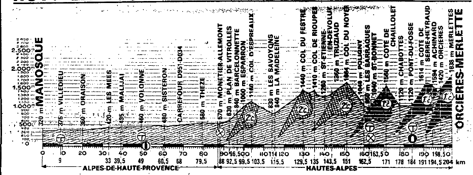
Stage 17: Gex - La Chaux-de-Fonds, 189km

1ze9ys1.png


2s7ghma.png


GPM:
Côte de Saint-Georges (cat.2) 12,3km @ 4,0%
Côte de La Praz (cat.3) 5,2km @ 5,3%
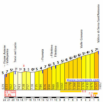
Côte de Mauborget (cat.1) 10,5km @ 6,8%
Côte de Chaumont (cat.1) 9,9km @ 7,4%
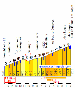
La Vue-des-Alpes (cat.1) 10,1km @ 6,3%

Yes, that's right: only one Pyrenean mountain stage in my Tour, and only two Alpine stages, with no mountaintop finishes either. The toughest of mountain stages are over, but that's not to say there aren't opportunities for the climbers to come, they just need to work harder to take advantage of them as we've moved away from the Alps and into the Jura for a stage which takes place almost entirely on Swiss territory. In fact, we cross the border after just seven kilometres of racing, and never re-enter France on the day. This might seem odd, but we do see stages like this in the GTs, if not frequently then at least far from unprecedentedly. Take the 1992 Vuelta stage to Luz Ardiden which crossed to France over the first climb of the day and stayed there, or the 2009 Verbier stage which crossed almost immediately into Switzerland and stayed there. Perhaps the most extreme example is the forthcoming 2016 Vuelta stage to the Col d'Aubisque, which starts in a border town and crosses into France just 1km into the stage never to return; likewise the 2015 Vuelta a Castilla y León had a stage that was entirely in Portugal save for the final 900m. This will enable me to use some nice medium mountain and upper-medium mountain terrain known from the Tour de Romandie, which is far from my favourite World Tour race but does give some nice opportunities for the Tour to utilize some of its terrain without going the predictable route of producing a monster Valais stage or finishing at the rather tame Verbier. This was one of the toughest stages for me to decide on as a variety of options had been tried out based on the flow of stages, including a Mont-Noir MTF in a stage that was mostly in Switzerland but finished in France, a stage finishing after Le Chasseral, a stage to Pontarlier via Mauborget and Col de l'Aigüillon but with a tame final 30km, but eventually I settled on this.

96df20922407896e62edaedf52e76d26.jpg


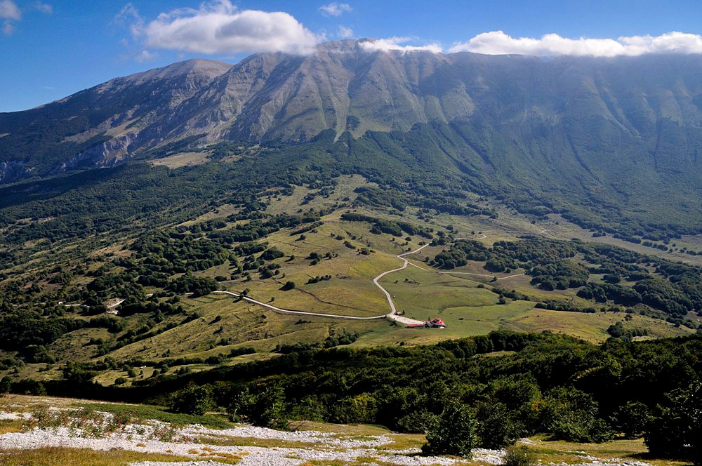
The town of Gex has around 11.000 inhabitants and sits to the north of Geneva, close to the Swiss border in the Ain département. It is the main town of the Pays de Gex historic region, and has an enduring cycling connection as it sits at the southern edge of the Col de la Faucille, a historic climb - one of the most used in the Jura - which has been used more than 40 times in the Tour de France and still fulfils a role as one of the key climbs of the Tour de l'Ain. It was especially commonly-used in the interwar period, but was last seen in 2004 as a mid-stage climb in a week 3 transitional stage. We're not using the climb today, however, which is a rarity among Tour visits to Gex, although in fairness this would be its first time as a legit stage town.

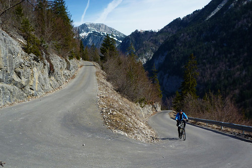
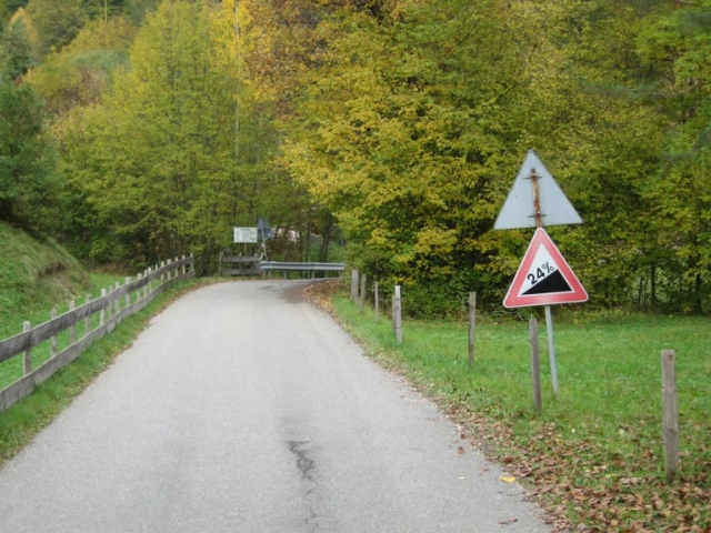
Instead, we head across the border into Switzerland and ride along the lower edge of the Jura Vaudois, through Nyon before taking on our first climb of the day, the relatively long but uncomplicated Côte de Saint-Georges, which amounts to roughly the same as the first 15km of the southern side of the Col de Marchairuz. As you can see, a few kilometres at 5 or 6%, but nothing here is going to really cause difficulty and it's more about allowing a break of decent strength to go as I suspect this stage may be one that is best suited to the break as, though there's likely to be at least a bit of action behind, with no time bonuses and with tough stages preceding and succeeding it the first part of the stage may well be soft-pedalled by the maillot jaune's team. Then again, I thought that about Fuente Dé, so we'll see. The péloton will ride along the shoulder of Mont Tendre for a while before taking on a third category climb to the Côte de La Praz, a stop-off on the way to the better-known Col de Mollendruz, after which they will descend through the scenic Orbe into the more well-known Yverdon-les-Bains.

409922


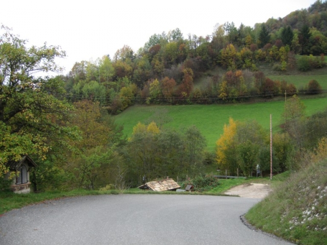
From Yverdon-les-Bains we head around the north edge of the Lac de Neuchâtel in order to take on some of the neighbouring climbs. There are a few here; the toughest is the narrow, tricky Col de l'Aigüillon, the most well-known is the Col des Étroits that was used in the 2009 Verbier stage, but the climb I've chosen is the difficult-but-not-too-difficult Côte de Mauborget, a tricky climb into a beautiful mountain village on the way to Mont-Aubert which is very popular for hang-gliding owing to its brief plateau on an attractive rolling mountainside. We actually climb all of this profile but I'm putting the categorization points at the junction for Sainte-Croix, at the end of the 'real' climbing.

1098309_10151613776208915_175963273_n.jpg


The climb to Mauborget was in fact the decisive climb in the queen stage of the 2009 Tour de Romandie, which you can watch here; Roman Kreuziger, the eventual GC winner, outsprinted Rein Taaramäe from a two-up of sorts with Vlad Karpets just behind and Fredrik Kessiakoff following; behind, the rest of the elites came in at +51". This shows you the climb, although obviously it will be less decisive here as a mid-stage ascent before a rolling stretch and an uncategorized climb to Rougemonne before a long and tough descent that takes us back to the edges of Lake Neuchâtel, where we then ride along rolling terrain until we arrive in the city itself which hosts our intermediate sprint.

neuchatel-1.jpg


Neuchâtel last saw Le Tour in 1998, when Tom Steels won a sprint stage late in the race as they transitioned back toward Paris, but it has hosted its more local Tour, Romandie, three times since. In 2000 it was just a stage start, but it hosted a stage won by Vino in 2011, and the decisive ITT in 2014 which was won by Chris Froome by under a second ahead of Tony Martin, enabling the controversial Kenyan-born Briton with his spider-legs technique to overhaul Romandie specialist Simon Špilak on the final day to take the GC. Here, it will signal the end of the phony war and the beginning of the part of the stage that could prove relevant for the GC, because it's also the foot of the first of the two back-to-back climbs that end the stage, the Côte de Chaumont. With 
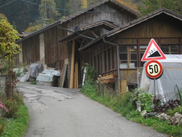
3km @ 10% right in the middle this climb, which crests just inside 30km from the line, is a surprisingly little-heralded one, but trust me, it's tough. At just under 10km at 7,5% with some inconsistent ramps, this could surprise a few as it looks less threatening than it is, but it has some nice features, such as this waterfall and an observation tower that offers some spectacular views.

Aussichtsturm_Chaumont_Neuenburg.jpg


The descent of Chaumont's northern side is stupendously fast too; Andy Schleck would definitely have a complaint to make about it, as there are a couple of kilometres at no less than 12% - however these are almost ramrod straight with no technical challenges, so he can do one; the part of the descent with the twists and turns is much less fast and steep and on wider roads than at the top, so it shouldn't cause major difficulties.

And then, directly off the back of the descent, we have the final climb of the day. I don't really know why, but I really like the climb of La Vue-des-Alpes. It's not an especially difficult climb, around 10km at just over 6%, it's not at particularly high altitude, and it is fairly wide and doesn't provide a stiff technical challenge from the descent. It's lopsided with its southeastern face being much tougher than its northwestern counterpart, and although I've given it cat.1 status owing to its key position in the stage, in the Tour de Romandie the last time it was used it was only cat.2, in the 2015 Saint-Imier stage where the group was trimmed to under 50 but we still saw a reduced sprint which was unfortunately won by Michael Albasini, a rider known for his tolerance and civil rights activism (citation needed). I think a lot of the reason that I like it is the panorama; it has one of the best views from the summit of any climb, as looking south you can see over Chaumont to Lac Neuchâtel with the Alps rising from the Fribourgois lowlands to the south. The Tour de France has been to La Vue-des-Alpes, although it hasn't been back in nearly 40 years now. The first time was in the Lausanne-Mulhouse stage in 1948, when Gino Bartali was first over the summit, while he was wearing the maillot jaune and, because he's Gino Bartali and he's just that awesome, preventing civil war in Italy. The following year it returned in another stupendously long stage from Lausanne to Colmar, this time with Raphaël Géminiani winning the climb en route to a long escape that took him to the line. It was last seen in 1979, from its easier northern side, in the middle of a long transitional stage between the Vosges and the Alps; since then, the Tour has rather forgotten about the climb.

VueDesAlpesS.gif

(We're only doing the last 10,3km from Valangin, due to the inclusion of Chaumont)

17_vuedesalpes.jpg


The summit at La Vue-des-Alpes is wide and scenic and originally I thought about an MTF here, but instead I preferred a descent, not into Saint-Imier like in Romandie 2015, but a shorter descent into the historic city of La Chaux-de-Fonds. I have got tougher climbs preceding Vue-des-Alpes than in that Romandie stage, but also by bringing the stage finish closer to the summit it should give less opportunity for things to come back together. I do definitely think that unless some riders take some crazy risks on Chaumont or somebody's really having a bad day recovering from the Le Grand-Bornand stage we are likely to see the top few riders finish together in this stage, but nevertheless, this should be a frantic finish - plus, if the break takes it as I imagine they might, we could well see some fireworks for the stage win as many second-tier climbers or those whose GC has been disrupted could well want to salvage the race, I'm thinking a lot like the 2013 escapades of Rui Costa or the 2015 performances by Rubén Plaza. The Alaphilippes, Albasinis and Špilaks of the world are those who may well be in the running for this stage as well as those aforementioned, as well as, if their GC bids have fallen by the wayside, the likes of Zakarin.

The descent into La Chaux-de-Fonds is short and fairly straightforward, and the summit is just 8,4km from the line; I have a final 1200m loop around the city which includes a 200m ramp up a fairly steep but wide and totally straight road, then back down and then the final 700m is ramrod straight on a central thoroughfare. The city has been chosen as a finish owing to its historic nature; it is the most important watch-making city in Switzerland (which is saying something since the country is of course particularly famous for this purpose), and unique among Swiss cities in that it has been built on a North American-style grid system following the original city centre being destroyed by a fire in the 18th Century. Because of its dependence on a division of labour in the city's specialist industry and the way the grid system facilitated a fast transition from small specialist processes to large industrial concerns, it drew particular attention from Marx in Das Kapital as a "Stadtfabrik". Owing to its historic significance the city was awarded UNESCO World Heritage Site status. The city's most famous children are the architect known by his professional name Le Corbusier, and Louis Chevrolet, founder of the eponymous automotive firm, best known in the USA and now part of General Motors.

La Chaux-de-Fonds does have plenty of cycling history too, though. It hosted the Tour in 1998 as the start of the stage which followed the one to Neuchâtel mentioned above; the stage was the same one mentioned during stage 13 in fact - won by Magnus Bäckstedt from the break in Autun. Since then it has hosted its home race several times; Romandie passes through here regularly. Most recently, in fact, just a couple of months ago, as the 2016 edition began with a prologue through the town which was won by Ion Izagirre (depending on Movistar's GC ambitions, he may also be a contender for this stage actually). It last hosted a road stage in 2012, which was hilly but led to the almost absurd sight of Bradley Wiggins, in the midst of his T-1000 unbeatable phase, winning the stage in a sprint. No, really. This actually happened. If a GC man wins here today, however, it will likely be from a select group as mentioned before. This one isn't going to be easy but it simultaneously isn't a high mountain stage; it's more a transitional one, so it could be very open, however there are plenty of opportunities for riders whose form is not where it should be to lose out if fatigue is getting to them. The bookending of the race with mountain stages to prevent the usual "week 3 peak!" situation à la Ugrumov 1994 may start to play havoc with riders' form curves at this point, so this could be more intriguing than it looks, and if it isn't it should still be moderately selective, have an effect in the days to come, and produce a good fight from the break.

04_cdfll.jpg
Why not a Le Chasseral-Vue des Alpes combo with finishing at La Chaux des Fonds?
 
I am aware of yesterday's stage could have been designed better, but considering probably the 2 most hyped stages from the Giro and the Tour (Cividale + Culoz) have turned out pretty meh, is it time to consider and/or debate how pro cycling has changed and how stage designs should change in order to help that?
 
Feb 6, 2016
1,213
0
0
Visit site
Re:

Valv.Piti said:
I am aware of yesterday's stage could have been designed better, but considering probably the 2 most hyped stages from the Giro and the Tour (Cividale + Culoz) have turned out pretty meh, is it time to consider and/or debate how pro cycling has changed and how stage designs should change in order to help that?

If I remember rightly, even at the time of unveiling Cividale was criticised for its terrible placement within the race. That's a longstanding problem, one identified here for many separate races; it doesn't invalidate the merits of the design in itself. Stage placement failing is a pretty simple mistake, not connected to pro cycling changing, and it's one that all race directors should be able to rectify. Culoz is a more interesting example, but I suspect the commercial juggernaut that is the Tour is now completely resistant to good racing even if the designs are made by some of the better traceurs on this, let alone for Prudhomme.
 
Culoz pretty much delivered as expected. Excellent stage for the break with a very nice fight for the win. They took the easy route up GC, so not surprising more didn't happen, and the descent was chosen as to have 9km of flat after it. It was raced hard and one of the contenders lost time. Several others did try somewhat, Sky just simply locked it.
 
Aug 21, 2015
380
0
0
Visit site
Yeah the Giro stage being right before the queen stage was pretty terrible in terms of placement. As for the Tour, stronger teams make it harder to design a stage where you get GC action from far out. I think figuring out ways to get more action earlier is something that is open to discussion.
 
If he can take over the Volta a Catalunya it would be ideal, that's had some anæmic designs in recent years that it could be so much better than.

Anyway, yes, the problem with Culoz and Cividale was not with the stages but with the placement. The 2009 Vuelta is the perfect example of this; the Velefique and Sierra Nevada stages were way tougher than the La Pandera MTF, but as the latter was so steep riders were afraid to gamble more than a few km from the end. Funny how now, however, we would think the distances from which Gesink and Mosquera were going weren't too bad, but then it felt really tame.
 

TRENDING THREADS