Stage 17: Sarajevo - Sarajevo, 144km
GPM:
Hambina Carina (cat.2) 2,9km @ 8,6%
Zmajevac (cat.3) 3,0km @ 6,6%
x6
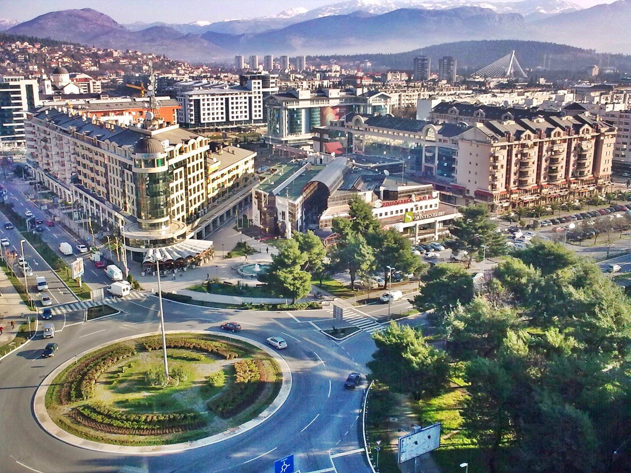
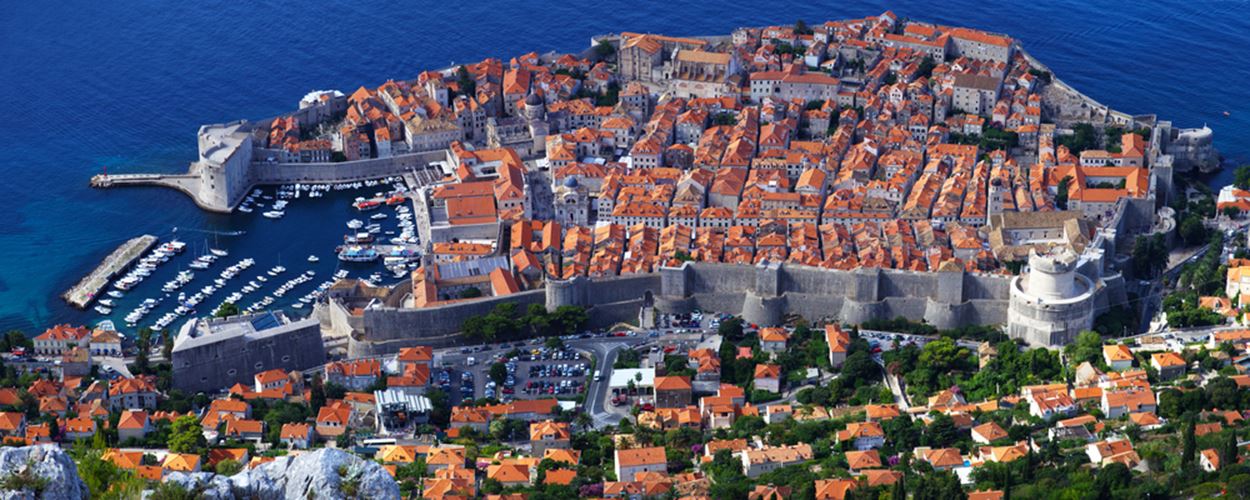
And so, eventually, after two and a half weeks and seven countries, we've come to the end of our trip around the former Yugoslavia. But there's no simple parade available for the riders, I'm afraid, as the final stage is potentially dangerous, although not as dangerous as its host. The course consists of two overlapping circuits around the city of Sarajevo, each with a climb on it, and alternating between the southern and northern loops in order to offer both challenging terrain and take in a lot of what the city has to offer, which is a lot, as Sarajevo is a fascinating place which is rediscovering its identity both as a national capital and as a tourist destination and which has played an important role in history in recent years.
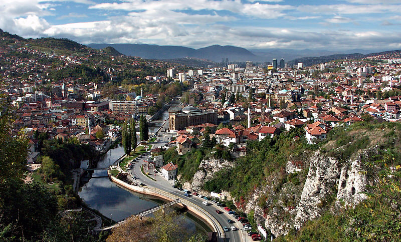
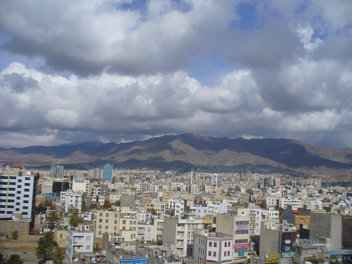
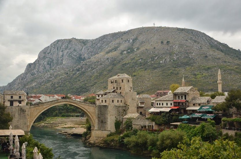
Sarajevo itself has around 275.000 inhabitants, but when the entire metropolitan area that sits in the Miljacka valley is incorporated, including Istočno Sarajevo, this figure is doubled. Although settled since Illyrian times, there is no single Roman settlement to which the city can trace itself and so the city's accepted history begins with the Ottomans, arising as a stronghold of Turkish Europe in the 15th Century. Owing to this historic religious diversity, the city has occasionally been dubbed 'the Jerusalem of the Balkans' and is unique among European cities in including both Catholic and Orthodox cathedrals, a synagogue and a mosque within the same neighbourhood. With the Ottoman conquest of the region, the regional governor Isa-Beg Ishaković set up his capital here, with the central mansion for travellers' stays and the governors' palatial grounds - or "saray" - giving rise to the city's name, originally Bosna-Saraj in Ottoman Turkish (now Saraybosna in the modern language) but as Slavic languages were dominant in the area and few cities in the Ottoman Balkans had, or referred by name, to a saray, the need to specify Bosna became limited and a suffix, disputed in origin between Slavic locatives -ovo and -evo and the Turkish -ova "field". The city also became a centre for Sephardic Jewish culture in Europe in this period, as they were welcomed by the Ottomans and therefore following their expulsion from Spain they formed a significant minority, joining the Catholic and Orthodox Slavic populations with the Ottoman Turks and the large numbers of Bosnians who either adopted or had already adopted the Islamic faith.
The great progenitor of Sarajevo, however, is its second governor, Gazi Husrev Beg. Born of a Bosnian muslim father and an Ottoman Turkish mother (who just happened to be a sultan's daughter), he was a great military leader of his time and a Bosnian national hero. His urban improvements included a madrasa which remained a great seat of learning for hundreds of years, a caravansaray for travellers, a bazaar for traders, and one of Sarajevo's greatest attractions, the iconic Gazi Husrev Beg mosque, next to which his Türbe lies for visitors to pay their respects to this day. His vakuf accounted for a lot of the urban development and maintenance of the city all the way into the 20th Century, and his legend looms large over the city, quite literally as the minaret of the Gazi Husrev Beg mosque stands tall over the central Baščaršija district, the old Ottoman town.

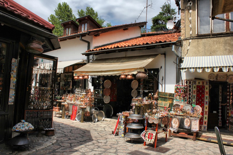
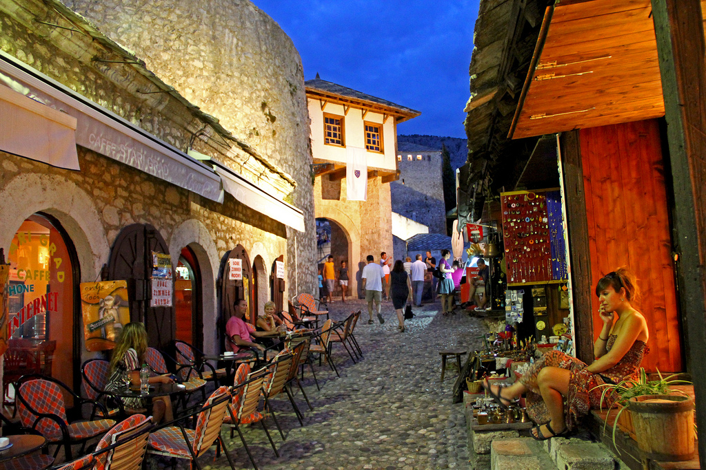
Old town Sarajevo is a marvellous synthesis of east and west, with the Ottoman architecture, trinket stalls, coffee shops and čevabdžinici also combining with a laid back atmosphere and far less aggressive sales and hawkers than you might expect from a similar bazaar in tourist hotspots of the eastern Mediterranean such as, say, Egypt or Turkey. Restaurants are bountiful and it's always easy to find somewhere to drink a Bosnian coffee and eat baklava. But the city isn't just a relic of Ottoman times, and an island of the Middle East in the Balkans. Instead, there's a literal line drawn in the ground to show you where east meets west, just to the west of the Gazi Husrev Beg roofed bazaar and the
Tašlihan ruins, where the old Ottoman town meets the urban planning from the late 19th Century, when Austria-Hungary took over control of the city from the ailing Turkish imperial rulers, and classical
Viennese architecture characterizes this side of the centre of the city, with wide open streets and classicist trim replacing narrow alleys and externally-hung wares. It wasn't the first time the Austrians had had designs on the region - in the late 17th Century they had attacked the region during the Great Turkish War and razed Sarajevo, which like other cities in the era was then left plague-infested and in ruins, but upon reasserting their authority the Turks restored the city to its former glories, if not its former population levels. Occupating in 1878 was followed 30 years later by annexation, which became a major source of conflict between the Austro-Hungarian ruling forces and the neighbouring Serbian state, who had under the auspices of pan-Slavism designs on the region with its large south Slavic in general, and Serbian in particular, populace. Pan-Slavic and Pan-Serbian groups sprung up, with the most notorious being the group known as Young Bosnia, of which the most famous member is of course Gavrilo Princip, who was the one who carried out the final and most important act of a group plot to assassinate Archduke Franz Ferdinand, the heir to the Austrian throne, which set in motion the chain of events that became World War I.
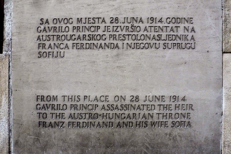
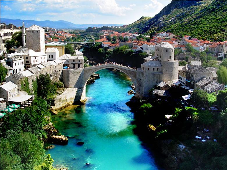
On that corner there was a monument erected in the aftermath of WWI, however when the area was annexed by the Axis puppet state of Croatia, this was torn down and presented to Hitler as a gift - a perspex sheet decorated with the outline of this monument stands on the opposite corner, by the Latinska ćuprija (Latin Bridge), while the Museum of the Assassination includes a lengthy presentation of the event and important artefacts including the very weapon used in the assassination and Princip's photofit.
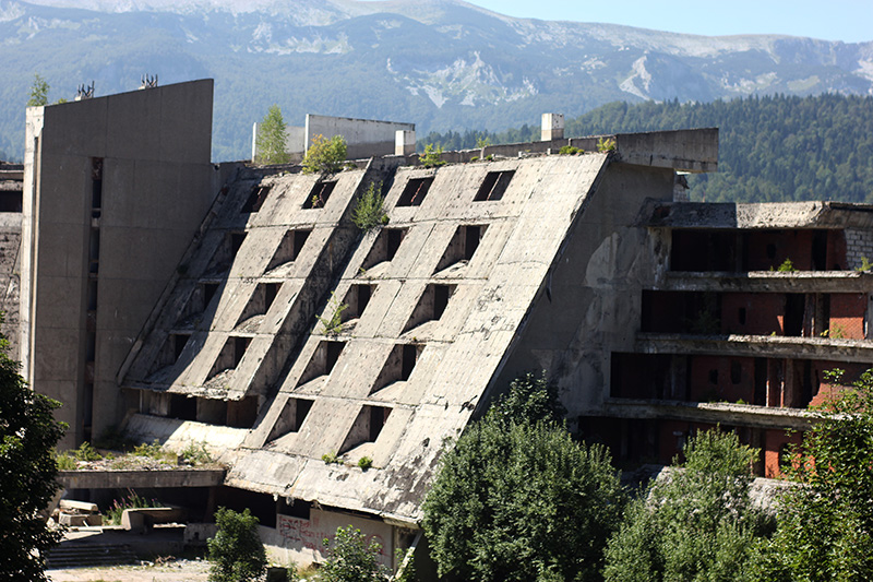
After the war, as a symbol of the unified cross-cultural nature of Yugoslavia and as a mark of the impact they had had on the city, a new and ornate synagogue was erected for the Sephardic community. Unfortunately it was destroyed during the war, since when the much smaller Ashkenazic synagogue has served as the communal worshipping grounds for all of the city's Jews, which for obvious reasons greatly diminished. Bosnia was greatly divided during the second World War, but generally the upper echelons of Bosniak society opposed the Ustaše, though this didn't stop the city from coming under heavy fire in the latter days of the war, after which an eternal flame was set up in the Austrian part of town, while appalling post-war conditions and devastation in rural and mountainous areas led to an enormous swelling of Sarajevo's population, and the city grew far wider into the surrounding hills and mountains, resulting in a hastily built network of cobbled and ill-paved steep roads on the various hills, which serve as the backdrop for today's cycling. High investment led to the Winter Olympic bid previously mentioned - the city became the first Socialist host of a Winter Olympics, and the events are still a source of great pride for the Bosnian people today. The Games were considered at the time one of the greatest there had ever been, and were a great example of Yugoslavian pride and unity.
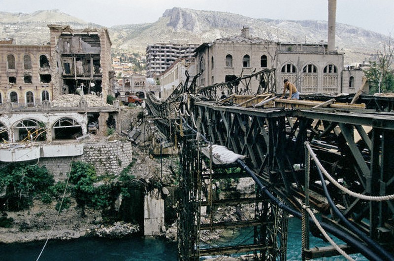
Eight years later, the city lay ruined.

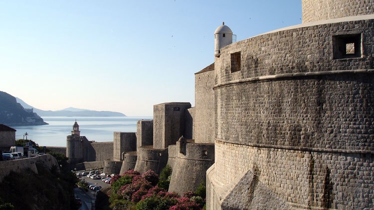
No city suffered more than the people of Sarajevo in the conflicts that came out of the downfall of Yugoslavia. The city was besieged for no fewer than 46 months, with the Serbs successfully blockading the city as early as May 1992, while bombarding the city from the surrounding mountains. 18.000 men from the JNA and the Bosnian Serb forces surrounded the city from elevated vantage points and launched a prolonged assault on the city, killing 11.500 people and injuring a further 56.000 while others were housebound for months on end and reliant entirely on external help. Entire parts of the city were off-limits, while the entire west-bound highway from the centre of the city through Zmaja od Bosne and past the Olympic village became dubbed "Sniper Alley", with the city defence forces and the Serbian-led aggressors camping out in various high-rises and launching a deadly game of cat and mouse, while consistent shellings of the city have led to marks being painted in red on the pavements beneath as permanent reminders of the destruction, dubbed "the Sarajevo rose" - dozens of these markings criss-cross the city, illustrating the indiscriminate nature of the violence.
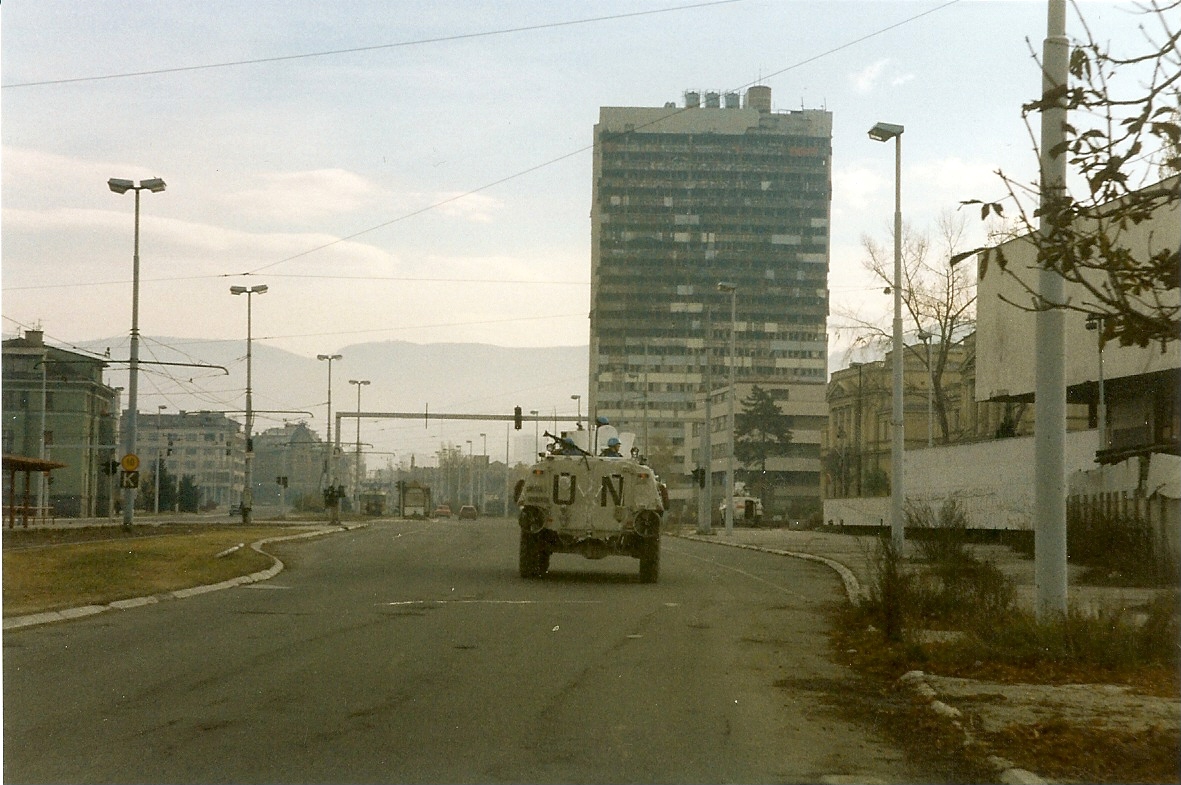
The city was defended as best as it could be by the defence forces - and in fairness we must also be clear that the Sarajevan defences also included a great many Bosnian Serbs opposed to Karadžić and his supporters - with the help of the UN, at first over the dangerous forested Igman path and later through the 800m tunnel under the airport that was for several months the only way by which much-needed supplies could be ferreted into the city. Tunel Spasa ("Tunnel of Hope") is now only partially open while the strafed, bullet-ridden house that served as its beginning point has been converted into a museum.

They couldn't protect from the shelling, however, and many landmarks were horrendously damaged, including the Baščaršija square, on which the iconic Ottoman fountain Šebilj stands, and of course the Gazi Husrev Beg Mosque, not only the most prominent piece of architecture in Stari Grad but also emblematic of the Muslim population of the city, therefore a prime target to the Orthodox Bosnian Serb forces for psychological and symbolic reasons. While the city remains divided (although of course the Federation has all the central parts, Istočno Sarajevo mainly consists of suburbs), there has been a huge reconstruction project that has restored a lot of the city's former glories, as well as instating modern skyscrapers and shopping precincts to the west of the city (geographical concerns regarding the hills and mountains allied with an insistence on protecting the cultural heritage of the old town preclude building these in the centre), though you can still see the effects of the war all over the city, with charred and broken brickwork, bullet-ridden buildings and damaged roads still bearing the scars.
And so it is the most apt place for the Trka Kroz Bivšu Jugoslaviju to finish; we began at the place the country was first proclaimed, and we end at the place it most spectacularly disintegrated into chaos and hatred, a conflict marred by genocide and brutality. A place which gave birth, indirectly, to Yugoslavia through the assassination of Franz Ferdinand, and a place which suffered most for its fall - and given this was the city that was most touched by war, it is the perfect place to complete a race of peace.
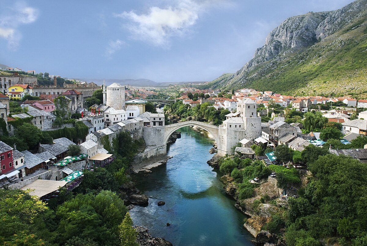
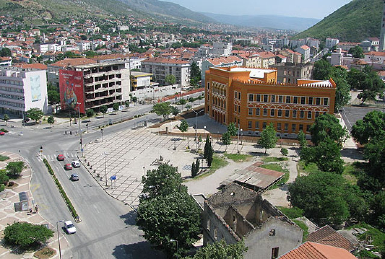
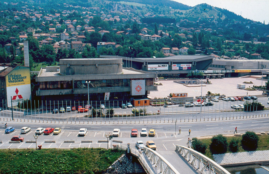
The start/finish area is in the Skenderija part of town, opposite the old Olympic hall, and at the easternmost end of Sniper Alley. We include Sniper Alley, or at least part of it, in the southern circuit, but the northern circuit bypasses this for the most part. Both circuits continue along the banks of the river until the spot where Franz Ferdinand was shot. At this point, outside the National Library, an iconic imperial building
destroyed by shelling in the conflict, the northern circuit continues along while the southern circuit switches to the south of the river and begins to climb on a horrible little ascent called Hambina Carina after the road which forms the main body of the ascent.
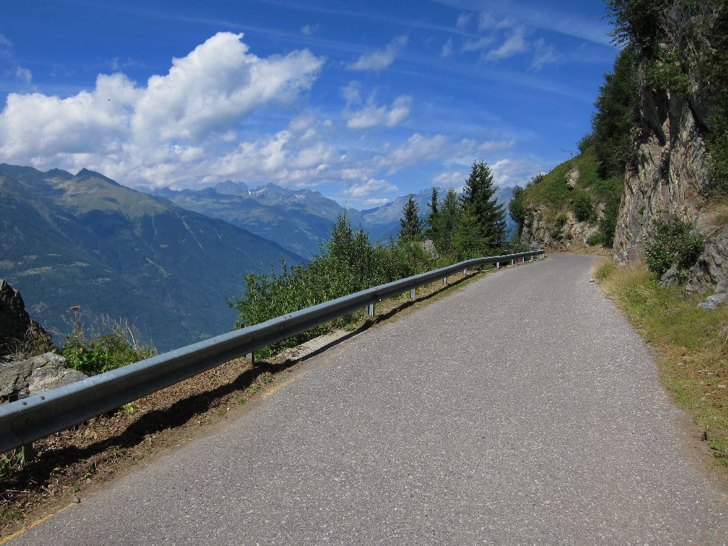
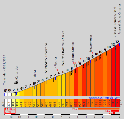
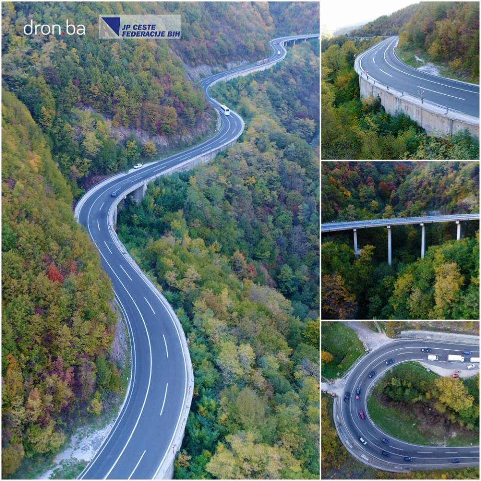
This is a horrific little climb when you consider the riders will take it on six times. It consists of a narrow and inconsistent 750m at 7,3% beginning at the Careva Džamija, or Emperor's Mosque (actually older than the Gazi Husrev Beg Mosque). This leads to a sweeping left that raises us onto a major road which is flat for 500m or so, before a left turn onto Ulica Hambina Carina, where it gets really, really nasty.
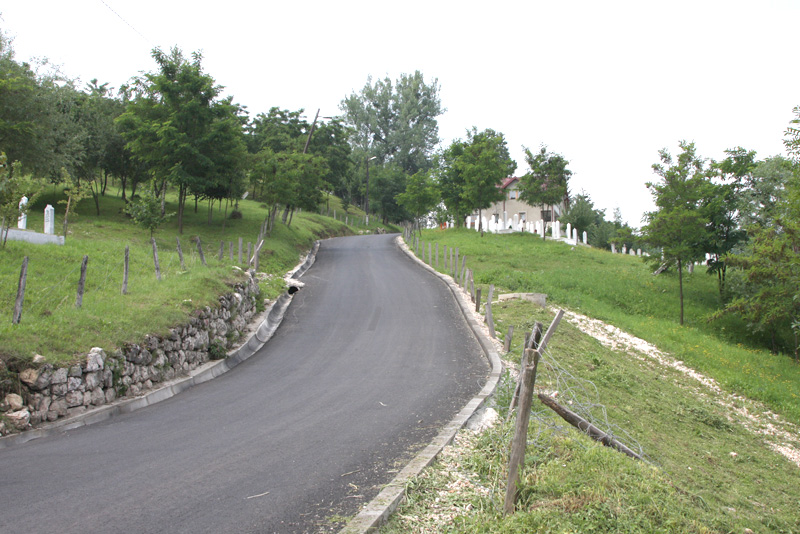
The first part of this road is narrow and cobbled for around 300m before we get out of the urban area and into the newly asphalted roads - they also serve as a potentially terrifying little rat run for those travelling into the city's eastern quarters from the airport but wanting to avoid the difficult traffic around the old Olympic village. Even after the road transitions back to tarmac, it doesn't get any easier for the first 600m of this section of the road average no less than 15% - max 24% - and even once there's some respite it ramps back up again so that the last 1400m of the climb - which is less than 3km in length but given cat.2 because of this - average 11,7% with over 10 ramps above 20%. This is an Alto de Aia, a Mirador de Ézaro, a Montelupone. This is a muro.

As both circuits are 12km in length - almost exactly - this means we will face this beast almost immediately from the start, and the final time we see it is 20km from the finish - so it's also at 44km, 68km, 92km, 116km and 140km from home. The summit of the climb is when the road joins the climb up to Trebević that we undertook yesterday, at the SunnyLand theme park, at which point we turn right and descend yesterday's final climb for a couple of kilometres before taking a right that sweeps us back toward the city. A couple of switchbacks later, and we turn right onto Sniper Alley at
the University of Sarajevo before a wide open straight of over a kilometre that takes us past the national museum and the colourful
Sarajevo City Center mall back to the start/finish.
The second loop (even numbered laps) continues past the national library and climbs up past Žuta Tabija (aka the
yellow fortress), one of the medieval fortifications of the city, and up to one of the city's most beloved landmarks, the remains of Bijela Tabija, the white fortress. This former fortification is a popular tourist spot because it offers the best views over the whole city, and it's pretty scenic itself.
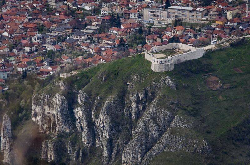
Ascending to the fortress, however, takes us past a couple of sobering reminders of the city - first we pass one of the main city cemeteries, in honour of the Bosnian Armed Forces, where line upon line of graves marks hundreds of dead, mostly young Muslim men who almost all died in 1992. And a little further up, the fire station, with its monument outside to the dozens of firefighters who also lost their lives trying to save others during that difficult time. Against such a backdrop, the statistics of the climb seem meaningless as the suffering of the cyclists is pretty irrelevant, but it's essentially 2km at 7,5% before it flattens out after the fortress to the summit at Zmajevac, where there is a restaurant with the best views in the city, and another enormous cemetery to mark the horrors of war.
The last time we crest
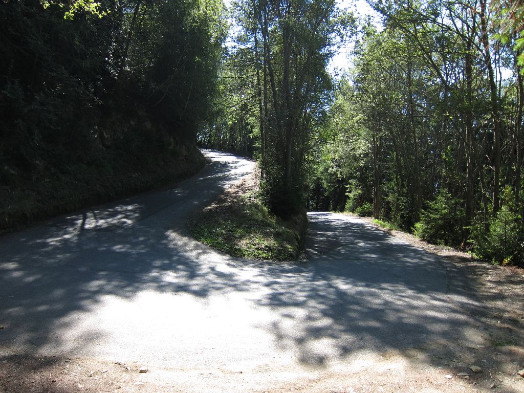
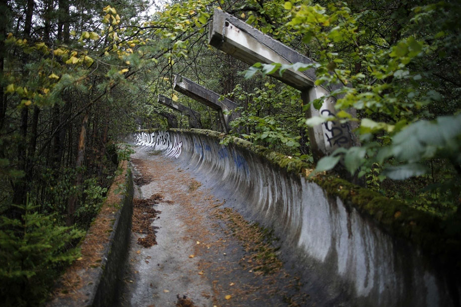
this ascent will be at 8,5km from the line, so by extension we also see it at 32,5km, 56,5km, 80,5km, 104,5km and 128,5km out. There is then a long and twisting descent through the Sedrenik district to the old Olympic stadium, which hosted outdoor - the last time this happened - speed skating, along with the other olympic venues for stadium and arena sports such as figure skating - it was here that the first 'perfect score' was ever achieved in the sport, by Great Britain's Jayne Torvill and Christopher Dean - ice hockey and so forth. The national outdoor stadium is also next door, so we traverse between the athletics/football stadium and the wintersport halls, pausing briefly to note the former short track which has been converted into a cemetery. The scars of war hang heavy over everywhere in Sarajevo.
After passing the battle-scarred Olympic venues, we head directly southwards for a flat final couple of kilometres, hanging a right at the
Ali Paša Mosque onto Ulica Maršala Tita, our final shout-out to the man who embodied the country the race is all about, and who is of course a divisive figure in both the east and the west to this day. As with Gavrilo Princip, Sarajevan souvenir stalls will sell you Tito paraphernalia to this day, and many who lived through the war and its rebuilding will still hark back to those days nostalgically. The boulevard runs all the way into the eastern end of town, becoming Mula Mustafe Bašeskije at the eternal flame, but we are headed westward on it for around 200-250m before hanging a sharp left at the Marijin Dvor district, between the Sarajevo City Center mall previously mentioned and the UNITIC twin towers, known colloquially as Momo and Uzeir after a local comedy duo, one being Bosnian Serb and the other Bosniak, and whose location at one end of Sniper Alley and with the names representing humour and good relations between the two embittered ethnicities in the city made them into a symbol of strength and resistance for the people of Sarajevo. Here you can see them as they were then, and now:

The final corner is essentially a hairpin, a double 90-degree left crossing a boulevard, with then around 300-350m to the finishing line, with a gentle left around 50m out. But let's face it: it's the final day of a two and a half week stage race, and the riders are going over 12 climbs today... it won't be a sprint, so we don't have to fear too much. And bonkers stage design was a feature of racing in the old amateur east, such as that Peace Race stage won by Zdzisław Wrona which featured a 2km drag race down a wide open highway, before a tight and tricky pinch point of a hairpin 150m from the line.
This will be the final battleplace of the race, and while it's not a massive mountain stage and it's not especially long, there's more than enough to throw caution to the wind in hunt of a victory, and plenty of opportunity to blow it from a position of strength too. Sarajevo is a fascinating and vibrant city which is putting its past behind it and rediscovering itself, and I love it; it's a remarkable synthesis of cultures which has led to its vibrant history but also at times threatened to destroy it. It is a melting pot in all of its connotations. Lovingly crafted architecture of centuries gone by and pristinely-kept religious artefacts and historic monuments sit next to charred, burnt remains of socialist era brutalism, which in turn sit next to Imperial Austrian ornate terraces and boulevards and narrow cobbled Turkish paths. It's a city of contrasts, of cultures, of joy and of sorrow. And it's the perfect place for us to end our race.


") .
.


 Ljubljana -


 Zagreb, 168km
 Novi Sad, 99km
 Kumanovo, 169km
 Priština, 234km
 Kolašin, 188km
 Kravica -