• The Cycling News forum is looking to add some volunteer moderators with Red Rick's recent retirement. If you're interested in helping keep our discussions on track, send a direct message to @SHaines here on the forum, or use the Contact Us form to message the Community Team.

    In the meanwhile, please use the Report option if you see a post that doesn't fit within the forum rules.

    Thanks!

Race Design Thread

Page 102 - Get up to date with the latest news, scores & standings from the Cycling News Community.
Jun 28, 2012
798
0
0
Visit site
jsem94 said:
That ITT. What a beast of an ITT. How is that descent btw? Making riders take crazy risks on a descent isn't too wise imo.
So you must have DESPISED my earlier Stage 1 where the opening stage was a descent of Mont Ventoux (as an ITT, and as the entire stage).
 
fauniera said:
Why not move the finish to Auron? The climb is a bit easier than Isola 2000 but much closer to Bonette. There would be 2 km of flat after Bonette compared to 15 km flat to Isola. This would nearly guarantee action on Bonette, don't you think?

I'm doing preliminary work on another Tour with precisely that finish. At the moment there aren't any cat.1 or HC MTFs until stage 17, mind, which is pushing it even for ASO.
 
OK, after a few days out time to return to my Giro, which you may remember had just come off two back to back mountain stages, the first to Mangàrt, the second over five mountains, the last of which was Fedaia (Fedaia!!!) and included the Cima Coppi.

Stage 14: Bolzano-Bozan - Merano 2000, 215km

2vi0dc5.png


rbflt3.png


Climbs:
Alpe di Siusi (cat.1) 24,9km @ 6,1%
Alpe di Rodengo (cat.1) 10,8km @ 8,2%
Passo di Monte Giovo (cat.1) 15,0km @ 7,5%
Merano 2000 (cat.1) 16,0km @ 8,2%

Yes, here's the final stages of our trip through the Dolomites, and the last day before the second rest day. It's a Sunday, so a big stage is expected. I did mention that I was aware three consecutive big mountain stages would likely result in conservative racing earlier by riders unwilling to chance too much ahead of the last of these, but that was why I made the first of the three a fairly uncomplicated stage with a monolithic final climb that would open up gaps on its own, and the second of the three with the Cima Coppi as a prestigious prize ensuring racing ahead of the final climb, and with the final climb being Fedaia with its final 5km at over 11% meaning there's a perfect springboard for attacking. Today, we finish it off with another monster MTF.

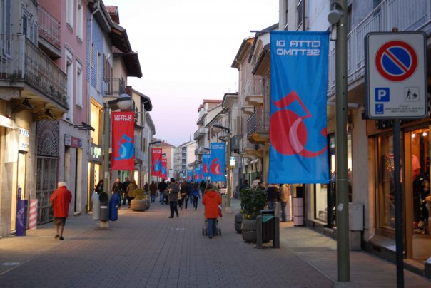
The day's action starts in Bolzano/Bozen, the capital of Südtirol and - due mostly to migration of Italian workers in the 1920s and 1930s - one of very few Südtirol municipalities where Italian is the dominant language. It is (thanks wikipedia!) the city ranked as having the highest quality of life in Italy. But then, if you can guarantee the Giro nearby every May, and the XC skiing and biathlon World Cups nearby every winter along with literally hundreds of options for both cycling and cross-country skiing nearby, you can understand the reasons for this.

The riders are almost immediately sent into the first climb of the day (the start of it is cut off by tracks4bikers). Alpe di Siusi is famed for its cross-country skiing facilities, and it is only recently that the venue has branched out into cycling, hosting a mountaintop finish in the 2009 Giro. That was in a short stage where the climb was the only major one of the day and so its GC impact was limited. It's a two-stepped climb with a long period of false flat in the middle, however the final few kilometres average 8%, so we will likely see a strong break get away.

In comparison to yesterday's stage, however, the climbs are quite spread out today, with sizable gaps between them to enable the break to consolidate or for the peloton to apply pressure to the fugitives. The descent from Siusi is very, very long and gradual (over 30km), then there's a brief period of flat, then a small climb that would probably be categorised in a flatter stage (it's actually about 5km at 5-6%) that leads us in to the next climb. Rodenecker Alm, known in Italian as Alpe di Rodengo, is another Langlaufgebiet which is little known to the Giro. Its northern side is 11km @ 8,8%, which is a pretty damn brutal climb. But we're not climbing this, no. We're climbing the southern side, which at 10,8km @ 8,2% you may consider seems by the numbers to be slightly weaker. But the numbers lie. You see, from Lüsen, the climb is a three-stepped monster with two summits, although unlike other double-summit climbs like Fumanya-Pradell in Spain or Peyresourde-Peyragudes in France this time the second climb is easier. Here's the profile which, unlike the climbbybike profile of this side, actually goes all the way to the summit at Parkplatz Zumis rather than stopping at the second flat. For those of you wondering, that first 6km is at 10,6%.

After this, the descent is steep and technical (you've seen the profile), back into the Pustertal before we head into some valley roads (about 30km of them) before the intermediate sprint in Vipiteno-Sterzing. Here, the action ramps up properly, because this time if there are attacks, I don't think that the big guns will be able to afford to rely on teammates coming back and pacing them in the valley roads. Passo di Monte Giovo (Jaufenpass) is one of those classic, sweepingmountain roads, switchback after switchback punishing the riders over 15km at 7,5%. The summit here is with 54km remaining, and then there's an even longer, steep and technical descent (although the roads are wider and more comfortable than the Rodengo descent). There are a few kilometres of valley roads, but these are downhill false flat into the city of Meran/Merano, where we start the final ascent.

Merano 2000 is a famous ski resort that overlooks Meran, and is mostly connected to it by a cable car. It is also linked to it by a long, winding and very steep road (as you can see from the profile, it's an absolute brute, especially when you consider almost all of that yellow is at 9 or 10%!!!), which has bizarrely only been used in Il Giro once - all the way back in 1988, the day after the infamous Bormio stage over the Gavia in a snowstorm when Andy Hampsten put in the performance that won the Giro - they climbed the Stelvio early, but then it was a long and flat run in before the one-climb finish at Meran 2000. Now, admittedly, this climb is tough enough that it could stand alone as a Unipublic stage, but as you are probably well aware by now, I am not Javier Guillén. So the riders have a well-earnt rest day tomorrow, they can have their pick of Bolzano, Trento, Merano, Vicenza or Verona, because there's a week still to go and they need to rest up after three straight mountain stages.

Bolzano:
url


Merano 2000:
D-Skigebiet-Meran2000-8896.JPG
 
Stage 15: Verona - Bologna, 224km

2iu6kba.png


2nut107.png


Climbs:
Monzuno-La Trappola (cat.2) 6,7km @ 8,2%
Loiano (cat.3) 5,5km @ 6,5%

The first day after the second rest sees us heading back south again with a long stage which is tailor-made for the breakaway, linking two major cities. The riders will enjoy the chance to rest up before this stage, and when it comes we ease them in to the day's proceedings with a long and entirely flat stretch across the Po Valley before heading into the lighter Apennines to finish.

The double-climb of Monzuno and Loiano is a classic cycling double-punch often seen in races; from earlier classic routes of the Giro dell'Emilia and the Settimana Coppi e Bartali. Here we have a slightly tougher version of the former climb, but the latter is all present and correct.

The climbing is over with 40km remaining, and after gradual descent the rest of the route is flat once more, so either the breakaway is allowed to go on the climbs or the durable sprinters who are able to hold on over the two climbs, and have enough teammates in tow to pull back attackers, will take this. For me, I see this as the kind of stage where somebody like a Giovanni Visconti or a Sylvain Chavanel wins this by being the strongest of a small group allowed to get away. No, no San Luca this year - didn't want to labour the point after three straight high mountain stages. Give the péloton a bit of a chance to recuperate.

Verona:
Piazza_Bra.jpg


Bologna:
bol_3-900x0.jpg
 
Stage 16: Fiorenzuola d'Arda - Novi Ligure, 164km

2cdwv0k.png


20f72xg.png


After a transfer on the autostrada from Bologna, this is a pure transitional stage and the last chance for the sprinters, so if the points jersey is still up for grabs, this will be an important moment for them. No categorised climbs at all today, although there is a small rise early on. Nothing that will cause any hassle to any but the most absolutely chronic climbers though, as there is so much time left that anybody who can't get back on must be hurt, as it would be a veritable miracle to survive Mangart, Pura-Razzo-Tre Croci-Giau-Fedaia and Meran 2000 and not be able to survive this.

The stage is comparatively short, but also has two laps of a circuit around the destination city. This circuit is rolling at most and should not prevent a bunch sprint in this historic landmark city for the history of the sport of cycling; as well as being the birthplace and hometown of Costante Girardengo, his subsequent teams were based out of here, and legends such as Fausto Coppi and his squadron of gregarios were based out of Novi Ligure. As a result it seems only fitting that we should pay tribute to cycling's glorious past in Italy with a stage here, before the final showdown begins.

Fiorenzuola d'Arda:
34785703-1-terreno-in-vendita-a-fiorenzuola-d-arda.jpg


Novi Ligure:
novi-ligure9.jpg
 
Stage 17: Novi Ligure - Cesana-Sansicario Alto, 218km

n2zhcp.png


9s9r41.png


Climbs:
Colle di Pramartino (cat.2) 7,1km @ 7,5%
Sestrières (cat.1) 37,9km @ 3,8%
Sansicario Alto (cat.3) 5,7km @ 6,2%

We have another long stage here as the Giro moves westwards and re-enters the mountains ahead of the climactic stages to come. This is a difficult and long stage, but it's not intended to be an extremely decisive GC stage with the ensuing stages to be more impactful. Instead, this is one to put some suffering in the legs but finish with an easy climb; it is more than likely to be won from the break and GC gaps will be small, however there is the chance to steal a march on fellow GC contenders in the late goings. I see this as a spiritual successor to stages such as Stage 17 in 2011 or its 2010 equivalent to Peio Terme - stages which include some big mountains (here Tonale/Aprica and Palade, for me Sestrières) but where the run-in is simple. However here the length may mean we still see some activity as there will be some tired legs by the end. From the stage design you could also argue it bears more than a passing resemblance to 2009's re-designed stage 10, albeit from the opposite direction.

The first 140km from Novi Ligure to regular Giro host Pinerolo are absolutely flat. Then, things start to get interesting. First, we have the Colle Pramartino, whose notorious descent is now to be climbed, for it is notably steeper than the side climbed in the 2009 Giro and 2011 Tour stages. I hesitated on whether to give this cat.2 or 3 status, as though the overall figures are unspectacular, the first 2,5km average under 3%, and the last 4,5km average well over 10%, which makes this a pretty serious introduction to the climbing and a wakeup call to riders for whom 140km of pan flat cycling may have been a bit too tedious.

Then, we start the neverending classic ascent of Sestrières/Colle del Sestriere. This is a classic climb of both the Giro and the Tour, but was last climbed from this side in full many moons ago now. The latter third has been climbed in 2005 and 2011 off the back of Finestre (the 2005 stage also included the full ascent from this side before descending down to Susa for Finestre), and the climb was scheduled for the 2013 Giro however adverse weather conditions led to its removal from the Jafferau stage. The ascent is ungodly long - nearly 40 kilometres of it - however roads are very good and while the pass, its alpine slopes and its Olympic village may be iconic sights, the main differences on this climb will be made by attrition as less than 7 of those 38 kilometres average over 5%. 40 kilometres of climbing straight off the back of the steep Pramartino ascent will probably see plenty of attrition, however, and unless we see a lot of soft-pedalling (certainly a possibility given bigger stages to come) few domestiques will be there at the top, so the bunch should be small. Pressure could certainly be applied and maybe some peripheral contenders could struggle seeing as the summit is just 20km from the finish as well.

The riders will then descend the more common Cesana side of Sestrières into another 2006 Torino Olympics site, the resort town of Cesana Torinese. This served as the base from which the bobsleigh/luge/skeleton course at Pariol and the women's downhill course at Fraiteve were accessed along with today's destination, the Olympic biathlon venue of Sansicario Alto. After the Olympics the venue floundered somewhat; biathlon's popularity in Italy is fairly regional, with most of the interest being in Trentino, Veneto and Lombardia, along with the Valle d'Aosta. As a result the venue was unable to compete for the World Cup berth with Antholz, an established venue also easily accessible from the biathlon heartlands of Germany and Austria, while cheaper venues such as Forni Avoltri, Martell, Ridnaun-Val Ridanna and across the border in France, Bessans-Haute-Maurienne got the IBU Cup stages. However, with French and Italian interest in the sport beginning to gather momentum, the venue has been purchased and is in the process of renovation at present, with the expectations of reopening as a world class facility in 2014-15. And what better way to draw attention to the completion of this work than to pay to have the Giro come and illustrate to the world the work that you've done, so that the FIS, IBU and the spectators can see ahead of the planning of the winter season?

The climb from Cesana to Sansicario Alto is short and fast, mostly hovering around the 7% mark with a few ramps of 9-10%. There is a brief moment around 1700m from the line where it jumps up to a Purito-tastic 17%, where if there are to be GC moves, they will be made. However, the last 700m are almost flat, so anticipate a small sprint among the GC men a few minutes after the break have decided the stage; there are seconds to be won and lost here, but it's a short climb on a stage which is likely to be raced quite conservatively in view of what is to come, so this stage is more about its cumulative effect in the days to come.

There is a contingency plan for if Sansicario Alto is not ready in time, and it is to climb the Colle di Monginevro as far as Clavière, for a similar small, cat.3 MTF to create a similar form of race.

You can probably guess what's coming next.

Sestrières:
Sestriere-Olimpica-con-telecabina.jpg


Sansicario Alto:
borgat10_800x600.jpg
 
Giro d'Italia

Stage 18: Pontremoli - Abetone, 198 km

grx9lh6yx2ew.jpg


qfg1ejebd44c.jpg


I also have a Giro to continue, mine is in the final week as well. Monday was a rest day, Tuesday a flat stage and Wednesday a 104 km mountain stage. Thursday sees the last proper mountain stage and it takes place in the Apennines. There are 8 categorized climbs and 5.800 vertical meters with little respite in between. The second to last climb is the mythical San Pellegrino in Alpe. It's 17 km long, the first 3 km are easy, the next 8,7 km have 8,8%. After a short descent and 1 km at 8,7% the hard part follows: 2 km at 14%. This includes a stretch of 550 m at 18,7%! San Pellegrino in Alpe is now reached, there is one more km at 6,4% to go to Passo di Pradaccio. There are 27 km left to race at that point; a 16 km descent and the final 11 km climb to Abetone at 5,4%. The final resembles the Mortirolo-Aprica combo.

The last time the Giro visited San Pellegrino in Alpe was in 2000, when Francesco Casagrande destroyed the opposition, just to fade in the final week and lose the Giro to Garzelli. The stage in 2000 was only 138 km long and had a much easier profile, still the time gaps were enormous.

Passo del Cirone
Passo di Ticchiano
Passo di Lagastrello (first 8 km)
Passo della Scalucchia
Passo di Pradarena
Passo dell'Orecchiella
San Pellegrino in Alpe
Abetone

Pontremoli:
Piagnaro%20e%20Pontremoli%20(3).JPG


Abetone:
b2cca3965997cd53a4d03ed680efa8.jpg
 
SetonHallPirate said:
FYI, Libertine, the Cesana Pariol bobsled/luge/skeleton track is now closed and has been dismantled.

Sansicario's still there though, so all's well on that front. It was more about what Cesana used to be the base for. Typical Olympic white elephants though, all the interest in bob/luge in Italy is over the other side of the country. Similar for biathlon really, except for Valle d'Aosta, where they have the Brusson facilities anyway, so there's not a great deal of call for Sansicario.
 
Netserk, one has to be wary of the weather, especially after the 2013 Giro. And besides, I already noted that the Passo Giau was the Cima Coppi, so I can't really then send the riders over a pass nearly 600m higher!

No, I'm going the other way.

Stage 18: Settimo Torinese - Châtillon, 157km

vo1rag.png


2cibs6p.png


Climbs:
Col Tze Core (cat.1) 16,2km @ 7,5%
Col du Saint-Pantaléon (cat.1) 17,1km @ 6,5%

I do have a bit of a thing for the Valle d'Aosta region. It is a region where it's almost impossible to create a fully flat stage and where you have a large number of climbs in a small area. When the 2012 stage to Cervinia was announced, there was a deal of anticipation of what the stage could be, unfortunately they went with the easier side of the Col de Joux as the only lead-in climb, perhaps the most disappointing option this side of a Unipublic one-climb stage. Considering the climbs - and the quality of them - in Valle d'Aosta, it is perhaps surprising that trips to the Arpitan province are comparatively rare. This stage is my paean to what the 2012 Cervinia stage should have been.

To minimise the transfer distance after yesterday's stage we start on the outskirts of Turin, meaning we have a decent length run-in before the climbing starts. This is broken up by a couple of uncategorised ascents and an intermediate sprint in Ivrea before we enter the smallest Italian region with bloody murder on our minds. The scenery of the region is wonderful, as we enter via Pont-Saint-Martin and view the mind-boggling Forte di Bard before reaching the mountain-foot settlement of Verrès. And now, things get nasty. And by nasty, I mean nice.

The road through the Val d'Ayas is used for a number of climbs; it can be the beginning of the Col d'Arlaz if you turn off early, or if you continue on as far as Brusson (which previous posts will tell you has an esteemed biathlon and cross-country skiing centre) you have the choice of the flatter straight ahead road to Champoluc, the right turn onto the steeper short dead end road to the ski facilities at Brusson-Estoul, or the left turn onto the famed Col de Joux. Here, we're turning off before Brusson, however, and taking on an underrated and underappreciated beast.

The Col Tze Core is one of my absolute favourite climbs. I mean, it's no Fedaia, but what is? Tze Core belongs on a select list of "next best things" for me, along with Errozate, Haza del Lino, Col de la Gueulaz, the Coll de Pal and the other ones you'll have heard me waxing lyrical about non-stop on here. I adore this climb, as it takes on the lower part of the Verrès to Brusson road, but where it flattens out if you continue on the main road, Tze Core instead hits you with 2,5km at nearly 12%. Like Fedaia, its average gradient is 7,5% yet that doesn't tell you how hard it is. Like Fedaia, it has a gorgeous waterfall. The scenery is not a Serrai di Sottoguda-beater, but then what is? The scenery here on Tze Core is still pretty breathtaking. There are 57km remaining at the summit of this killer, which would probably be HC in the Tour. This leads to a technical and challenging descent which links up halfway down with the descent from the Col de Joux that we saw in the 2012 Giro, before arriving in Saint-Vincent, which swiftly gives way to Châtillon, where we cross our finishing line for the first time for the second intermediate sprint.

Then it's time for the second big brute of the day, snaking over more mountainside around scenic switchbacks on our way to the Col de Saint-Pantaléon, last memorably seen in the Giro back in 1992 in this tough stage from Saluzzo to Pila over Saint Pantaléon, the very steep Champremier and then with an MTF (edit: actually 1997. Oops!). This climb is slightly longer than Tze Core and not as steep, but it's still plenty tough enough to make a big difference to the GC. While it eases up a bit towards the end there are more than enough sections at 9 or 10% to give platforms to attack from, especially given that there will be just 21km remaining at the summit, almost all of which will be descent. This descent is very technical and also takes us past the Castello Saint-Dény to Chambave over some tricky gradients. This descent ends with just under 5km to go, whereupon a slight uphill false flat back into the city of Châtillon begins, which may catch a couple of people out in the unlikely event that as late as stage 19 of the Giro conservative racing is still breaking out.

You may note some similarities between my stage here and a very enjoyable Giro delle Valle d'Aosta stage from 2011, where they did the same glorious Tze Core-Saint-Pantaléon combination, but followed it with another climb into Torgnon, a small resort town about 3/4 the way up the Col de Saint-Pantaléon. That stage splintered the field all over the place... I'm hoping to do the same with the riders having nearly 3 weeks' racing already in their legs. And where better than the Valle d'Aosta?

Settimo Torinese:
commercio.jpg


Châtillon:
03-chatillon-aosta.jpg
 
Libertine Seguros said:
Then it's time for the second big brute of the day, snaking over more mountainside around scenic switchbacks on our way to the Col de Saint-Pantaléon, last memorably seen in the Giro back in 1992 in this tough stage from Saluzzo to Pila over Saint Pantaléon, the very steep Champremier and then with an MTF.
Wasn't the Saint-Pantaléon climbed also in 1999 iirc, in the stage to Cervinia, with Gotti attacking there and winning?
edit: beaten and wrong date :eek:
edit#2: How could I possibly write 1999 is beyond me.
 
Really nice climb this Tze Core. (Not quite as nice as Fauniera!!!, but which climb is? ;))

One more mountain stage to come on Saturday? With a bit of transfer it could be in Lombardia. Good old Mortirolo, perhaps?

Edit: Or another stage in Aosta, of course.
 
Northern Thailand Tour - 2

Stage 2: Chiang Rai - Doi Pha Tang; 136 km

ru8o7t.png


image.png


Second stage already reveals what this race is all about - climbs.
Steep climbs to be precise (and some treacherous descents too, fortunately on good road mostly). It starts mildly, first half of the stage is almost panflat, apart from one short hill. But as we enter Khun Tan mountain range things are about to get nasty. First on the menu is insanely steep Ban Phaya. The average gradient here reaches 14% and there are only 57 kms remaining from the top. Descent is very interesting too, with long streches of over 15% and curves coming in short succession can create some gaps as well, especially if it's raining. Next ascent comes shortly after first major one, but route doesn't go to the very top, that is a dead end, but turns left to a bit older road (still in very good condition though). After another 15 "flat" kms through main valley in Khun Tan (which are anything but flat really, it is basically up and down all the time) riders turn right towards Laos border once again, but this time they reach it at Doi Pha Tang viewpoint at 1 500 m.a.s.l. This last climb is very irregular and the 8.6% doesn't tell the whole story. So this is where the first differences should be made, but nothin is decided, there is still long way to go.

KOM:
KOM #1 (cat. 3) - 2.7 km; 7.5%
Ban Phaya (cat. 1) - 5.2 km; 14%
Phu Chi Fa (cat. 1) - 5.9 km; 10.2%
Doi Pha Tang (cat. 1) - 12 km; 8.6%

Photos:
Riders can enjoy views like this on the flat section - 1
On top of Ban Phaya - 1
Descent from Ban Phaya - 1
Khun Tan mountains - 1, 2, 3
On top of Phu Chi Fa climb - 1
Doi Pha Tang ascent - 1, 2, 3, 4

Edit: btw, all roads I use are available on streetview, so you can check them out ;)
 
Northern Thailand Tour - 3

Stage 3: Chiang Rai - Mae Sai; 144 km

15i2gjk.png


image.png


Another tricky stage with loads of short hills in the middle section, and then two steep ascents that take riders to Myanmar border this time. 20 km of one of the most dangerous descents in the race remain after the last climb to Doi Tung. It contains some flat and even short uphill sections and fortunately the lower half is on wider and smoother road.

KOM:
KOM #2 (cat. 2) - 9.8 km; 5.3%
Mae Salong (cat. 2) - 3.6 km; 10.3%
KOM #3 (cat. 3) - 2.1 km; 7%
Doi Saen Chai (cat. 3) - 2.4 km; 6.5%
Mae Fah Luang Garden (cat. 1) - 5.1 km; 9.5%
Doi Tung (cat. 1) - 5.4 km; 10.4%

Photos:
Mae Salong and surroundings - 1, 2, 3, 4, 5, 6, 7
Doi Tung and surroundings - 1, 2, 3, 4, 5, 6, 7
Mae Sai - 1, 2
 
Northern Thailand Tour - 4

Stage 4: Mae Suai - Doi Ang Khang; 177 km

2yvp2y0.jpg


i2ueqc.png


Another stage near Myanmar border and another mountainous one. With two main climbs, which are both very challenging (with some not too short parts over 20%) and lots of short steep ramps, this is yet another day to shuffle the GC. Last rise to finish pales in comparison to previous ascents to Doi Ang Khan, but with maximum 19% (for 0.4 km) 1.5 km before the line, there is possibility to make difference, particularly after such hard stage.

KOM:
Pa Daet (cat. 3) - 6 km; 5.4%
Doi Ang Khang - northern side (cat. 1) - 14.9 km; 7.2%
igjera.jpg

Nong Bua (cat. 3) - 3.3 km; 6.6%
Doi Ang Khang - eastern side (cat. 1) - 10.6 km; 10.2%
34sknxi.png

Doi Ang Khang - northern side (cat. 3) - 3.7 km; 7.6%

Photos:
Pa Daet - 1
Doi Ang Khang - pagoda at the top, viewpoint, northern side (climbed first), 4, 5, top of Doi Ang Khang, 7, eastern side, 9, 10, 11, 12, 13, 14, scenery from the valley below
 
Oct 23, 2011
3,846
2
0
Visit site
Geraint Too Fast said:
I'm looking forward to seeing what you do with this one togo. I was playing around with ridewithgps in that area only yesterday, so I think I know what the queen stage will involve. ;)

I had the exact same experience a few weeks ago. :)

Looks pretty crazy so far and I guess the second half will be even worse. :cool:
 
Northern Thailand Tour - 6

Stage 6: Chiang Mai - Doi Suthep

image.png


image.png


Long ITT for a week stage race, but there are many stages for pure climbers to take time back so there is no way one could win just because of it. First part is panflat, on wide road and with almost no turns untill 17-th kilometer, where the climb to Doi Suthep starts. Riders don't have to climb it all the way to the top, only half of it (in terms of elevation), but it is still no easy climb, fairly different from the ones we had before too. It is again wide and smooth road with few steep parts, but overall quite regular climb.

KOM:
Doi Suthep (Wai Phra That) (cat. 2) - 11.4 km; 5.6%

Photos:
Chiang Mai - 1
Doi Suthep - 1, 2, 3
 

TRENDING THREADS