TIRRENO - ADRIATICO
stage 5: Castiglione del Lago - Treia, 229 km
final 70 km:
(white lines indicate sterrato)
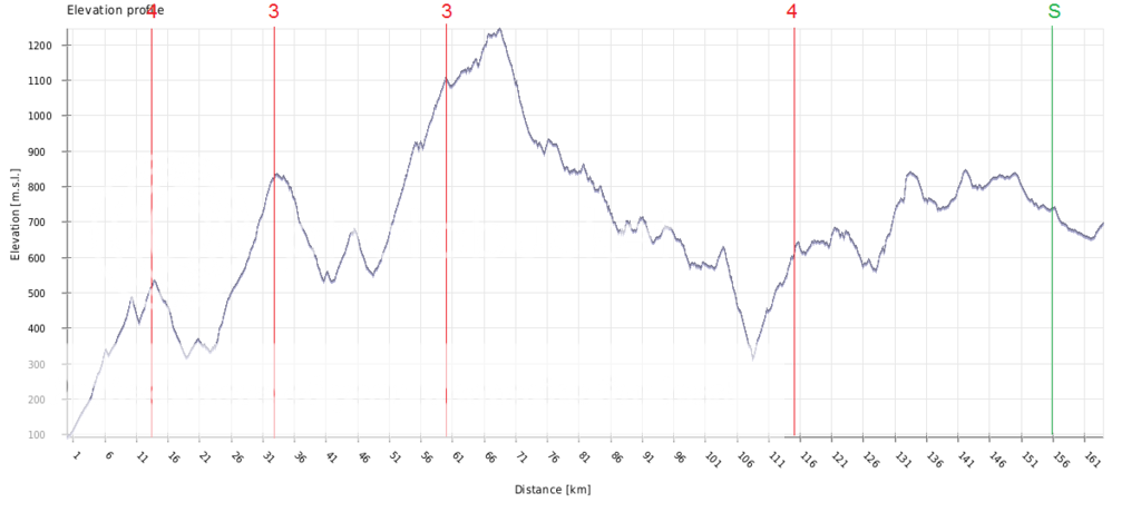
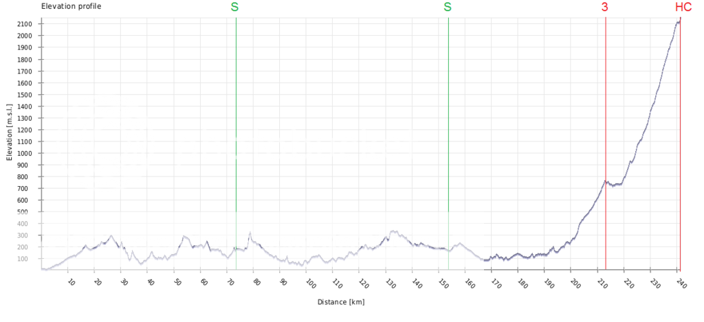
Sunday sees the longest stage of the race, and one of the hardest, with over 4.200 meters of climbing. It leads the riders from Umbria to Marche. The first 80 km are rather easy, but then one climb follows the other, and that won't really stop until the finish. With 70 km to go the riders will tackle the
Poggio San Romualdo (10,6 km 6,6%). This climb featured at the 2015 Tirreno, but then they immediately descended from the Poggio after cresting it. We won't do that, or will only descend 4 km, before tackling a 7 km long section of sterrato. This section is mostly gently uphill with an average gradient of 4% (see
map and profil). There is a
steeper bit at the beginning, but then
flattens out (that's Monte San Vicino in the background). The combination of the Poggio San Romualdo and this sterrato section might spark some attacks, in any case it should help thinning out the field.
We then descend for good and cross
Lago di Cingoli, before we tackle the second of three sectors of sterrato. This one is 5,5 km long and undulating (
map and profile). There is a
steep bit at the beginning, then a
descent, followed by another
climb. In short, it's a demanding sector, and that includes bike handling skills.
The next 12 km are quite easy, then a short climb (1,5 km 10%) brings us to the foot of the hardest climb of the day,
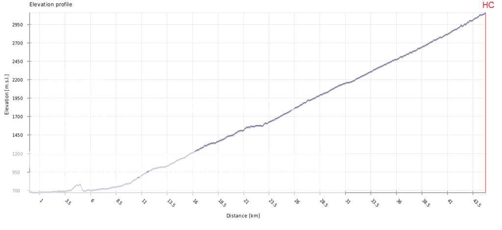
Passo della Cappella (4,45 km at 8%). As you can see from the profile, it is an irregular climb, with
double digit sections in the middle. And most of that middle section is on
sterrato, too (
map and profile). It's a nasty climb, and even after the sterrato ends, the gradient stays high and riders will
suffer. From the top of Passo della Cappella there are only 12 km left to race, so i expect decisive attacks to be made (or at least tried) here.
The riders will approach the walled city of Treia from the west, which includes this nice little
ramp. Then they will ride along the city walls, descend and climb up again from the east. This is the
last muro of the day (1,4 km 10%). The riders will enter the town through
Porta Vallesacco, then have to tackle a
steep cobbled section, before riding along the
city walls to the
finish.
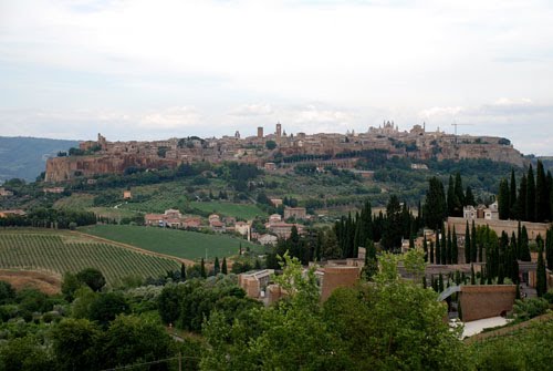
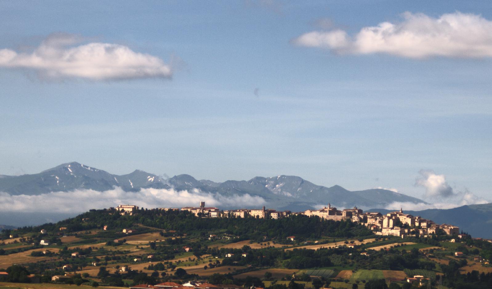
Treia
Passo della Cappella


 ). The problem is the last 200m drag. It's ridiculously steep and yet tarmac quality is pretty bad. That's why this part of climb has never been used in any serious racing. If I had power to do this, I would paved that 200m