Race Design Thread

Page 225 - Get up to date with the latest news, scores & standings from the Cycling News Community.
Broken_Leg said:
Stage 6 [Thursday] : Macon – Lyon
225 km – Hilly

Climbing : 4471 m

227439routestg06min.png

765029tdfv1stg06.png
That looks like a one day race!
 
Giro d'Italia stage 7: Trento - Riva del Garda (41 km ITT)
0d1CfpN.png

wclJrIq.png


First of all, tbh when I said that the next stages will be mountain stages I wrote nonsense, but hey the stage will be gc relevant and very important.
The start is still located in Trento, where stage 6 finished.
Panorama%20aereo%20Piazza%20Duomo%20-%20Archivio%20APT%20Trento%20-%20foto%20D.%20Mosna.jpg


Right after the start the road starts to go uphill, but while the first 6 kilometers are almost never flat, the climb is still not super hard, and afterwards the stage will only get easier. Btw, this climbing is also the beginning of the much more famous Monte Bondone, which might be included in another stage :rolleyes: .
And just like it's probably the best in an ITT, the descent of the climb will also be relatively easy which makes gc contenders crashing out before the race even really started, a little bit less likely. The riders ride through the beautiful landscape of the south of Trentino, and directly after the downhill part there will be a first time check in the extremely scenic town Padergnone
B-0657-pagdernonone-e-lago-di-toblino.jpg


After about 10 panflat kilometers there is another slightly descending section which leads the riders to the last time check in Dro.
1268344909_D-0742-dro-e-dintorni.jpg

From there on the route gets completely flat again and moreover the roads are always wide and there are hardly any sharp turns, so this TT should be 100% about who has the best legs. The finish is located in Riva del Garda the city in the north of the Lago di Garda. In Austria this town is mainly known for tourism since it's the most northern tow on the coast of the lake, and of course also because this part of italy is probably one of the most beautiful ones. Still in the alps, surrounded by high mountains, but located at a big lake where you almost have sea flair.
PscOPAq.jpg


This stage will certainly already cause some pretty big gaps and thats exactly what I want. If there are no time gaps between gc contenders yet the next two stages could become a borefest, but after over 40 kilometers of rather easy TTing and another ITT to come, climbers should already have enough reason to try to get some time on their rivals.
 
My Tour de Suisse, probably the first stage race I've ever finished designing. I'm a bit lazy and not very good at this. Sorry for no text. And yes, it is missing one race day; imagine a flat stage or something.

Zr75bw9.png

dv9HY8h.png

MTOIFco.png

rTw7NRx.png

o9cER2e.png

WLbG0RH.png

d2qV8yk.png

88Qrk2N.png

*Vercorin should be a 2nd cat.
**Actually there are lots of mess-ups, I don't know how to categorize climbs, ignore.
 
Gigs_98 said:
Giro d'Italia stage 7: Trento - Riva del Garda (41 km ITT)
0d1CfpN.png
There are tons of tunels on this route but thankfully all of them are lighten. Personally i would not use Monte Bondone, it's just too easy of a choice. I would maybe... there's too many variants and most of them seems to be plausible. Something like Passo Santa Barbara - Passo Coe and then either east heading into Grappa or west into Passo Xomo (unrealistic choice if you're looking at realism) and an eventual MTF in Lessina (there seems to be a couple to choose). I'm unsure if Arsiero has enough space to have a Giro finish. Thiene (~20km from Arsiero) or Piovene Rocchette (~10km from Arsiero) are a bit too far from Passo Coe and Giri's from the Sarroni-Moser era were one of the worst designed in history but maybe it could host a start of the next stage.

Actually a finish in Piovene Rocchette might not be bad of an idea, but it would need some tweaks. From Arsiero i would use SP80 rather than main SS350 and beef it up with small hills up to Costa di Sopra and Crosare. It would made a rather bouncy last 10km and rather twisting and varied quality road could prove to be tricky if the next stage will be a flat one in the Po valley.
1dkhc4Y.jpg


I'm now workng on Giro del Trentino which has a stage from Trento using SS45 but i decided to use Candriai (halfway up Bondone) and then down to the Riva del Garda road via Sopramonte. From Ponte San Lorenzo in Trento it's roughly 10,5km at 7,4%. Then it continues with your stage on SS45 as far as Sarche when my stage goes to Ponte Arche (SS237) and then north to Andalo (SS421).
 
@railxmig
As far as I know there is only one tunnel which is on the first climb :confused:
And about bondone, I will only use it early in the stage before the route goes northwards, the finish will still not be very innovative though.
 
Gigs_98 said:
@railxmig
As far as I know there is only one tunnel which is on the first climb :confused:
And about bondone, I will only use it early in the stage before the route goes northwards, the finish will still not be very innovative though.
I think there are a couple of very short ones too. I've mistaken a roughly 3km tunnel which is en route to Ponte Arche which isn't part of your stage but mine so sorry for eventual confusion. I hope my previous post explains enough why i don't like designing stages in Italy and why even a small race like Giro del Trentino is difficult for me.
 
Oct 27, 2015
86
0
0
Stage 7 [Friday] : Lyon – Vienne
TTT – 38 km

Climbing : 394m

510654tdfv1stg07.png


Today the riders will continue to move South, but on a far shorter distance, as this will be a Team Time Trial.
The 38 km between Lyon and Vienne are mostly flat, with just one short bump at Sérézin (1.3 km @ 6%), and thus it’ll be a stage for big engines.
I known many don’t like the TTTs, but I feel it adds a dimension in a Tour. Here we have a mountainous Tour, which could lead the teams to bring 1 leader, one guy to lead the peloton on the flat and the rest is all mountain goats. Well, with a 38 km TTT, it won’t work. The point is therefore to (somewhat) re-balance a Tour which was slightly unbalanced towards mountainous terrain.
We will probably see another showdown between the teams of the favourites, and over 38 km, gaps could be relevant for the final GC.
1509.jpg


Wine of the Day :
Today we arrive in Vienne. Just on the other bank of the Rhône lay the northernmost vineyards of the Côte du Rhône, with some of the most renowned names. The area produces both reds (Syrah grapes) and whites (Viognier).
The reds are known under the appellation Côte Rôtie (“roasted slope”) and have strong personality and quite a spiced taste.
For today, the wine of the day will be the wines of the day : the three top Côte Rôtie : La Landonne, La Mouline & La Turque :
cv-cr-019_1.jpg

(the price tags for those wines are quite high : each of the three bottles above is 200-300 €/bottle, and it’s difficult to find good Côte Rôtie under 40-50 €)
 

Attachments

  • route_stg07-min.png
    route_stg07-min.png
    17.7 KB · Views: 1,822
Re: Stage 3

My 2 week unrealistic Tour of California is back. It has been a while so I will post a link to my previous 2 stages below before we get on with stage 3. Been busy with classes this spring but the semester is now over so we are finally ready to continue my Tour of California.

Previous Stages:

Stage 1: viewtopic.php?p=1859980#p1859980

Stage 2: viewtopic.php?p=1860375#p1860375


Tour of California Stage 3: San Bernardino - Ridgecrest 218.7 km

TOC%2BStage%2B3.png


Stage%2B3.png


The stage today departs San Bernandino after a short transfer before getting to the major climb of the day, the Rim of the World Highway. The climb is fairly long but it is steady for most of the way up and besides making for a strong break, it should not have a huge effect. I tried to find a profile for the climb but was unable to find anything. I should add that you can cut through a part of the climb via Old Waterman Canyon Road which averages almost 9 percent for 3 miles before you resume the climb via Rim of the World Highway but it wouldn't benefit me to do that at this point in the stage. Worth a mention though in case anyone is designing a stage in the area.

After the climb and descent we travel through the desert to Ridgecrest. The terrain is flat but it should be exposed for most of the remainder of the stage and the wind could play a factor in this stage. There really isn't much out here to block the wind so it can ramp up a good amount in the area. It is something that catches you off guard if you aren't familiar with it. Depends on the day however but if it is blowing, it could catch some GC men off guard who are trying to save energy for tomorrow. This could very well be one for the break as a strong one should be out there although the sprinters teams may have something to say about that, especially if the wind stays calm.

The finish for the stage is in Ridgecrest and should be a fairly standard sprint finish either among the members of the break or the peloton.

ridgecrest-oasis--492x269-.jpg


What makes this stage unrealistic?

This stage is another one that should be realistic for the most part. The biggest road block here would be Ridgecrest being a bit on the smaller side and a bit isolated. The city does have a population of around 27,000 however so it should be able to handle the finish just fine, there just likely won't be too many people along the side of the road on the way there which will become a bit of a common theme.

We stay in Ridgecrest for the night with the next stage being the first serious GC test up a monster. I'll take guesses on what climb this will be.
 
Oct 27, 2015
86
0
0
Stage 8 [Saturday] : Vienne – Tain l’Hermitage
188.7 km – Hilly

Climbing : 3271 m
334884routestg08min.png

615784tdfv1stg08.png


Côte de Condrieu (8.1 km @ 4.8%)
Col de l’Oeillon (15.2 km @ 5.7 %)
Col du Faux (10.8 km @ 5.5 %)
Col de Saint Genest (6.2 km @ 5%)
Col de Mayres (2.9 km @ 4.4 %)
Col de Gazareau (4.7 km @ 4%)


We start today where we ended yesterday, in Vienne. The finish will also be along the Rhône, but as Thursday, we won’t follow the easiest route.
Instead, the riders will go to the right bank of the Rhône, and after a dozen kilometers turn right at Condrieu towards the foothills of the Massif Central and start the first climb of the day. After a descent towards the Gier valley, they will start the more serious Col de l’Oeillon.

The descent will lead the bunch or what remains of it to Annonay where the intermediate sprint is located, before entering the Vivarais hilly area and climb the second big col of the day – the col du Faux.
20130821_Nouvelle_image10.png

Neither of these two climbs is tough enough or close enough to the finish to generate GC action, but they will provide perfect terrain for a strong breakaway (probably quite large at the beginning and then thinning out).
At the top of the Col du Faux, the riders will not descend immediately but first be on a flatish plateau for 15 km, before going down towards Lamastre in a fast descent. They will thereafter have to tackle three far easier climbs – at least on paper. It should be here that attacks within the break should occur.
Finally, the descent of the Col de Gazareau will bring the riders back to the Rhône valley. But instead of finishing right at the foot in Valence, they will turn North for 10 flat km to Tain L’Hermitage (just in front of today’s Dauphiné finish, on the other bank of the Rhône).
HermitageEtTainVueGenerale-224-MO.jpg

The reason for such a finish is to force the climbers to attack earlier and give a fast rider who can survive the climbs a chance to come back and win the sprint.


Wine of the day :

I also wanted to finish in Tain, because it’s a big name for wine amateurs – the main center of the Northern Côte du Rhône. The area produces a majority of reds (same Syrah grapes as yesterday) but the whites are of the Marsanne variety and not Viognier.
The main “appelations” are St Joseph, Cornas, Crozes-Hermitage and Hermitage. While St Joseph can be opened quite young (3-8 years), the others and especially Hermitage can age a lot (20+ years).
For today, I chose an Hermitage :
comp_hermitage_le_greal_2011.jpg
 
Re: Stage 4

Stage 4: Ridgecrest - Onion Valley Road 172.1 km

TOC%2BStage%2B4.png


Stage%2B4.png


I promised a monster climb at the end of this last stage and here it is as we enter the Owens Valley area which is a concentration of some of the hardest climbs in California.

Owens Valley falls between 2 big mountain ranges with the Eastern Sierras including the highest point in the continental U.S. in Mt. Whitney at over 14,000 feet (4250 meters) on one side and the White Mountains and Inyo Mountains with an elevation of more than 11,000 feet(3350 meters) on the other side. The floor of the valley is at about 4,000 feet(1200 meters). This all adds up to a lot of hard climbs up the mountains.

owens_valley.jpg


Almost all of the climbs go up the Sierra side of the valley to the west with the lone exception being the very challenging White Mountain climb which gains more than 6,000 feet(1800 meters) over 20 miles(32 kilometers) at a grade of about 6.3% average to over 10,000 feet(3050 meters). You can even continue to the summit at over 14,000 feet if you are good to climb on dirt roads. The climb is very irregular as well with some of the hardest climbing saved for the end. As an added bonus, the oldest living non clonal tree is in the area although the exact location of it has not been disclosed to the public.

owensvalley_map.jpg

Terrain Map of part of Owens Valley, Onion Valley Road starts in Independence which is just a bit north of where this image ends

Some other climbs in the valley include the Whitney Portal climb which takes you to the trail head for Mt. Whitney, South Lake and Sabrina Lake which are at the north end of the valley and take you to around 10,000 feet, and Horseshoe Meadows which is another hard one that takes you again over 10,000 feet with over 6,000 feet in elevation gain in 19.2 miles(30.9 kilometers) with an average grade of 6.5%. It also features an impressive set of switchbacks that can be seen from quite far away.

21203334370_7cd3f502c7_c.jpg

The switchbacks for Horseshoe Meadows

The climb the riders will have to tackle today is Onion Valley Road which is just under 21 kilometers long and averages about 8% in grade. The climb starts off slow like most of these climbs do but once you cross the desert and get into the foothills, things ramp up to 8-9% and really do not let up until just before the top at 9200 feet(2800 meters). The climb is fairly similar to the Col de la Madeleine from the south except about 800 meters higher, about 1.5 kms longer, and we finish higher than the Stelvio among other legendary climbs. It is fairly regular but features multiples sections that pass 10% that can launch attacks and it should wear riders down as well as it is a very long grind to the top with big gaps likely.

Onion%2BValley%2BProfile.png


CIMG9400.JPG


pic8.jpg


What makes this stage unrealistic?

There are a few things that are a bit unrealistic with a stage like this. There is not much out here so the amount of spectators would be a bit questionable although I am sure the TV audience would be pretty entertained with the stage and scenery. The stage also goes along U.S. route 395 for a large section which is the main road in the valley so there are potential traffic concerns for people passing through the area. The Onion Valley climb along with the other climbs listed all finish in Inyo national forest so the race would need their ok in order to finish there although they have finished at Mt. Baldy which is in Angeles National Forest.

After the stage, the riders will transfer down to Bishop which is about an hour to the north and we will hit the high point of the race tomorrow.
 
Re: Stage 5

Tour of California Stage 5: Bishop - Yosemite National Park 233 km

TOC%2BStage%2B5.png


Stage%2B5.png


Overall this should be a stage for the break that transitions us back to the Western side of the Sierra Nevada. I would love to hit the Tahoe area and have some fun there but we have business in the west this weekend to look forward to.

This is very likely going to be a stage for the break as the sprinters will more than likely not make it over the climbs but the climbs come too far out to put in a meaningful attack if you are going for the GC. I think the best chance we see action today will be if someone bonks out on one of the climbs as while there likely won't be a ton of action, this should be a very demanding stage on the riders. We are over 2000 meters for nearly 170 km in this stage and we hit our high point of the race at Tioga Pass at 9943 feet(3031 m). After the climb up Onion Valley Road yesterday, I would wager that the GC men are tired as is so staying at high altitude won't help things out. We also enter and finish in the beautiful Yosemite National Park so even if the race doesn't turn out too exciting today, there will be plenty of scenery to distract the television cameras.

We start in Bishop and have a few flat kms before a long grind up to about 2100 meters before we flatten out again for a few km. You could turn off at this point and continue up Rock Creek Road which is yet another monster climb in the area but I am sure the riders won't complain about flattening out.

The race then grinds up to Mammoth Lakes and has the sprint in the town itself a good chunk of the way up the climb. I would imagine all of the points end up going to the break here as I anticipate a strong one. Kinda odd to see a sprint point on a climb but there is not a ton of development in the area so it gives the people at the resort something to cheer for. After Mammoth Lake we go up Deadman Summit back on 395 before getting a quick feed before the main climb of the day.

yosemite-pic.jpg


I could not find a profile of Tioga Pass and I do not know how to make on one cronoescalada but as you can see on the profile, the climb starts and ends relatively easy while getting to a solid gradient(8% if the profile can be trusted) for about 7 kms. Overall this would not be considered a bad climb but the fact that we are up at 3000 meters(higher than anything in the grand tours unless the Vuelta decided to go all the way up to Pico Veleta) makes this quite demanding and there is a real potential that someone cracks pretty badly on the climb.

The rest of the stage race wise depends on if someone notable cracks on Tioga Pass and if so, whether the other GC men want to try to take advantage of the weakness. Tomorrow is for the sprinters and the GC riders will be able to shelter themselves if they are tired and recover. We are still over 100 km from the finish however so unless someone cracks pretty badly, I think the GC riders will ride this stage pretty conservatively and the real race will be ahead for the stage win and KOM points.

tuolumne-meadows-lembert-dome.jpg

Lembert Dome along with other domes and peaks should be visible to the riders

olmsted-pt-half-dome-720w.jpg

Able to look into Yosemite Valley from Olmsted Point. Clouds Rest and the famous Half Dome are visible.

But enough talk of the GC, we are entering Yosemite National Park and the scenery is beautiful as there are numerous peaks to look at as we descend into Yosemite. We do not just go straight down into Yosemite Valley as there are still numerous bumps in the road including the final climb of the day in Lukens Pass but things get a lot easier from here on out. Once we enter Yosemite Valley, the scenery gets even more spectacular.

02737_tunnelview_672x420.jpg

View of Yosemite Valley from Wawona Road. The riders will not be traveling along this road as they will take Portal road into the valley so they will miss out on this view but it is too good to not include.

OS-X-El-Capitan.jpg

El Capitan

47898.jpg

Cathedral Rocks

from_glacier_point2.jpg

The famous Half Dome, you can see why it has that name

There are plenty of other pictures I could show you but I don't want to spam you all more than I already have. This is a Tour of California stage we are talking about after all. The finish in Yosemite is flat so it could very well end up a sprint for the stage win but I would imagine we see numerous attacks from the breakaway to prevent things coming down to that. It could be a fun one for the stage hunters while the GC men more than likely just admire the scenery.

What makes this stage unrealistic?

The big elephant in the room when talking about this would be finishing in Yosemite National Park as the race would need their ok in order for it to happen. I don't think it ever happens as there would just be too much congestion but it is definitely a place worth checking out and showing off what California has to offer is my aim in making this race in the first place. That and exploring questions like this and what exactly a 2 week Tour of California may be able to accomplish.

Now somewhat more realistically, the Tour could have a stage go to Mammoth Lakes as it is a pretty big ski station that should be able to host the race no problem. You could even transfer there from Lake Sabrina, South Lake, or Rock Creek although I think it is a bit long for a transfer straight from Onion Valely Road. The race could then continue on over Sonora Pass which is a beast in it's own right in the next stage. You could then finish that stage at either Dodge Ski resort which is at the top of a small climb or at Pinecrest Lake. South Tahoe is reachable from June Lake as well which is not much further to the north although it is a bit long from Mammoth Lakes so that could be another potential option.


After this stage, the riders transfer down to Merced for a very realistic although not a terribly decisive stage.
 
OK, after much delay, it's finally time that I get around to posting my next Tour de France, otherwise the real one will be upon us and this will be buried as, as ever, the Race Design Thread tends to get a bit buried in the mire during the frantic July season (unless, like in 2012, the race is so boring we all collectively start dreaming of a better one).

This is a somewhat experimental Tour de France which takes some cues from some of the less well-designed Boucles of history, in an attempt to right the mistakes that were made in those events. My attempts at Le Tour thus far have all started in the north (the Fantasy Doping Draft route at the very north, but the other two in the north west) because, well, most French Tour de France starts ARE over there - Futuroscope in 1990 and 2000, Le Puy du Fou in 1999, Passage du Gois in 2011, Brest in 2008, Fromentine in 2005, and when doing the foreign starts these have typically been in countries to the north and thus re-entering the country at its top end - the British starts in 2007 and 2014, Luxembourg in 2002, Liège in 2003, Rotterdam in 2010 and Utrecht in 2015. This is to do with French geography of course, as unlike Italy and Spain the French nation's mountains are concentrated in fairly fixed areas, and locating the starts out far from the mountains enables them to go with what has become something of a Tour formula: early sprint stages, one mountain range in the middle, a flat stage on the penultimate weekend just to annoy me, then most of the final week in the second mountain range before a late time trial and then a big transfer for the Paris parade.

As a result of this formula, starting the race in the south of the country, or in countries that border France at its opposite end, have become somewhat rare. The Düsseldorf start in 2017 gives us an unusual opportunity for a legit mountain stage in the middle of week 1 to sort out the wheat from the chaff and make for less of a nervous péloton on those early stages, reducing the kind of crash-strewn demolition derby racing that we saw in 2011 before the last men standing finally got to the mountains to give us that final week show. But that's not the only way, of course. We've had southern starts before, but they've typically had two problems. They either only cover a fairly small part of the country (see the 2013 route, which began in Corsica), or they just flat out suck owing to either being reluctant to use much of the major mountain range close to the start, or doubling back on themselves. I think we all agree that complete backloading is not something we want to promote and we do want to see riders have to stay in form for three weeks, so as to prevent the kind of conservative, "wait for the race to develop" kind of racing that has resulted in farces like the 2012 Giro d'Italia. It has been shown in the past that using the mountains early CAN be done with success, the 1977 Tour de France being an example.

My race takes as its cues two of the absolute dirt worst Tour de France routes in living memory, both of which started close to the French border in the south of the country but on foreign soil, both of which saw very little in the way of action in the Pyrenées (although only one can really be blamed for this) and both of which produced pretty terrible GC races. They are:
- the 1992 Tour de France, the last Tour to begin in Spain, which started with two stages around San Sebastián, before an intermediate stage to Pau featuring the only Pyrenean climbs of the entire race: the Col d'Izpeguy and the Col de Marie-Blanque. After this a week of mostly flat stages led to the legendary 65km CLM in Luxembourg where Indurain utterly demolished the field; we then had just two real Alpine stages, the epic Chiapucci show in Sestrières and an Alpe d'Huez MTF, before a couple of intermediate stages in the Massif Central, with just the Croix de Chaubouret and the Col de la Croix-Morand as options to take time on Indurain before a second 60km+ time trial. The climbers never stood a chance. The course made them make it interesting but just didn't give them enough.
- the 2009 Tour de France, which began in Monaco and snuck along the south coast for a week before unleashing the most horrific misuse of the Pyrenées possibly in history (at least in 1992 the Pau stage was quite well designed for a week 1 climbing stage, they just didn't compensate enough in the Vosges or Massif Central for the lack of Pyrenean climbs) with an anæmic Arcalis stage, then two stages where they actively tried to make the climbs meaningless.

It's possible to keep the terrain varied in the Tour and keep things interesting whilst only minimally using the traditional ranges - we've seen people put together some pretty useful Tours without either the Alps OR the Pyrenées. I'm also going to throw a few bones to some of the less well-known but often interesting races that dot the calendar, and use some areas that have given a lot to the sport of cycling or that have a keen interest in it. Both in and out of France, because I'm starting in that most classic of cycling homelands, the Basque country.

Stage 1: Bilbao - Bilbao, 10,6km (CLM)

s1uk5e.png


oriljb.jpg


GPM:
Côte de Kobetamendi (cat.4) 1,8km @ 8,2%

The Tour has not started in Spain since 1992, as mentioned above, and given the way the Spanish economy has gone that's perhaps not surprising. In fact, the 1992 Tour was the first GT in many years to pass through this beloved cycling homeland, owing to the Vuelta's long-standing embargo on the region for security reasons. Barcelona has bid for the Grand Départ in recent times, however, and there has been a long-standing tradition of Basque fans at the Tour, along with stages into neighbouring terrain claimed by the Basques adherent to the zazpiak bat interpretation of Euskal Herria, such as Pamplona or Bayonne. Seeing as it's a completely cycling-mad area which has survived the economic downturn much better than much of the rest of Spain, and if we're starting a Tour to the south that takes an unorthodox route it gives us an interesting way to make the start, I've elected to go for Bilbao as the Grand Départ. I've used Bilbao a few times in the Race Design Thread before, obviously in my early oversized Vuelta al País Vasco of two weeks, along with a World Championships route and a monstrous hilly stage in my 5th Vuelta a España, although thanks to the magic of Basque terrain there are still climbs immediately overlooking the city which I have not used.

As a result, I take cues from the Monaco time trial that opened up the 2009 Tour. I've been similarly influenced by it before (my first Tour opened up with a Circuit de la Sarthe chrono) but this is more influenced by the actual route than that previous attempt which was simply an over-length prologue on a motor racing circuit. This time, it's about the format, although here, rather than a long, inconsistent drag of a climb, it's a short and sharp one in the middle of the time trial.

56-249224-guggenheim-bilbao.jpg


We start outside the Museo Guggenheim, a dramatic piece of modern architecture designed by Frank Gehry to house installations and exhibitions of modern art that was inaugurated in 1997 and has swiftly grown to become Bilbao's most famous landmark. The parkland outside has become a favourite spot for the people of the city to enjoy in the summer, and seeing it all bedecked in yellow for the Tour de France would be a glorious televisual sight. The early part of the chrono is on wide open roads which should be crammed with fans, and goes through two great squares, firstly Plaza Euskadi and then Plaza de Don Federico Moyua, the centrepiece of Bilbao's main thoroughfare, the imaginatively named Gran Vía. From this enormous square the grid layout of much of Bilbao's new town means that you can see all the way through the city to the mountains on several sides, which is part of the charm of the region; not even in the centre of its biggest metropole are you ever overwhelmed by urban planning, as the natural beauty is still close at hand.

Satellite


After this we ride down through further wide urban streets to Plaza Zabalburu, where we join Autonomia Kalea, the major thoroughfare to the south of the city centre. This will be a popular road for fans as there is a divider in the road, and so fans can watch the riders in both directions on this section of the course. There is a section near Termibus Bilbao, the city's long distance bus terminal, where the Euskotranbia (the tramway operated by the same company as the Euskotren narrow-gauge railway and the La Reineta funicular) appears on the road, but the riders will be kept off the tramlines themselves.

At Donostia Aita Plaza, however, we head off the wide open Calle Autonomia onto a narrower road briefly close to Autonomia train station (a small stop off on the Cercanías Bilbao network) before heading under the autovía into the suburbs, where the riders take on a categorized climb, a punchy and sometimes steep climb up to the Alto de Kobetamendi (re-dubbed a côte as this is the Tour de France).

kobetamendi18.gif


This tricky ascent should keep this from being a pure time triallists' feast, but isn't so difficult it will make this a 2016 Dauphiné chrono either. We aren't doing the final ramp there (the profile above goes right to the radio transmitter, we stay on the main road rather than turning off for the last bit, so we only go as far as the Zorrotz junction noted there). The timecheck will be at the 1,8km mark on that climb.

345197ADCA2C513A2F6B25513A255F.jpg


This mountaintop is well-known as the venue for the biggest music festival in the region, Bilbao BBK Live, during which thousands of music fans bumble their way up the mountainside to camp in a field and watch their favourite bands while looking down on the city and the estuary below.

kobetamendi-escenarios.jpg


The descent is somewhat more gradual (we don't do the first km of that profile, only going as far as the Alto de Kastrexana before turning onto another less steep main road back towards Bilbao), and for the most part very straight, so will benefit the more 'typical' TT specialist who can benefit from an aero position and still put the power down without so much trouble in the way of technical tests. Eventually they will find their way back onto Autonomia Kalea, which they follow in the opposite direction, before turning left onto Iparragirre Kalea, then left again onto Gran Vía to finish on the same finishing line as the 2011 Vuelta a España and 2015 Vuelta al País Vasco; although in a time trial it isn't likely to be a factor, the organizational level for the Tour de France will be such that, like the Vuelta, barriers will cover the whole of the latter part of the route, so no need to worry about a fiasco like that which occurred at the Itzulia, when the organizers didn't cordon off some metal bollards that keep cars from parking in recycling/dumpster bays because they hadn't thought they'd needed to until they realized that once those cars and dumpsters were removed they would be sticking out into the road... I think we can all agree though, any excuse to re-watch Igor Antón's victory in Bilbao in 2011 is a good one. And if you're particularly sadistic, you can re-watch Michael Matthews' victory amid the carnage from the 2015 Itzulia too.

gran-via.jpg


Though this wide, attractive tree-lined boulevard makes a pretty classic way to finish a Tour stage when the time triallists reach the end of their ride, judging by the current péloton the chances of a local winner are fairly limited. Even with the punchy climb in the middle of the stage. Most of the most prominent Basques in the current péloton are wispy climbers in the traditional sense, the Mikel Landas, Mikel Nieves, Igor Antóns and so on of this world. While some of these are pretty reasonable against the clock (Beñat Intxausti, for example), there are no real heirs to the Basque chrono machine legacy of the late 90s that emerged in the wake of Miguel Indurain - Abraham Olano, Aitor González (sorry, I mean THE AITORMINATOR©) and Igor González de Galdeano would be much more keen on this kind of route than any of their antecedents. The best bets for a local boy to pull on the maillot jaune would therefore likely be Jonathan Castroviejo, who's a strong time triallist but not elite; if he can contend you'd expect the classic time trial types like Martin to be able to do so as well and go better than him, or the all-rounder types like Ion Izagirre. Who might actually be a pretty reasonable shout to do something early in this race.

The GT contenders will therefore need to be on their guard. No, you can't lose a huge amount in 11km, but it's not a straightforward prologue, and also with those sustained gradients of over 14% from the base of the climb, it will also not be an ITT that favours the more diesel-climbing TT-heavy contender like a van Garderen either. On the other hand, strong rouleurs with a good punch will like it - somebody like Geraint Thomas has shown well enough on short steep climbs, for example, and Tom Dumoulin as well has shown well in País Vasco type TTs and in flat routes and could be a favourite to pull on the first maillot jaune.

Bilbao-deluxe1.jpg
 
Re: Stage 6

Tour of California Stage 6: Merced - Stockton 177.1 km

TOC%2BStage%2B6.png


Stage%2B6.png


Alright everyone, what we have here is a very tough stage for the riders today. We start up at 52 meters in Merced before a fast descent down to 30 meters in Gustine where the riders will receive a well deserved meal. After that the road continues it's descent to 27 meters where we have our intermediate sprint in the heart Modesto if any sprinters are able to hang around to this point. We then start the major climb of the day up to 47 meters in Oakdale where there is always the chance for an attack before a swift downhill finish in Stockton.

All kidding aside, this is the flattest stage in the race with the possible exception of the final parade stage. This stage is so flat that there is only one section where the grade registers at over 1% on the cronoescalada map. This day should be all about the sprinters and both the intermediate sprint through downtown Modesto and the finish in downtown Stockton will be straight run ins and may the best sprinter win. We finish right next to the Weber Point Events Center and pretty much take Center Street the entire way through town. Hopefully we get a fun sprint and no crashes.

2136b6c7-d13e-402b-a299-1cf8d4c7f005_768_432auto_s_c1.jpg

Weber Point Events Center

What makes this stage unrealistic?
Nothing

Tomorrow is a Saturday and I am putting my spin on a popular climb.
 
URLs fixed now.

Stage 2: Bilbao - Vitória-Gasteiz, 167km

b5lcu1.png


k4tifs.png


GPM:
Col de Sollube (cat.3) 3,2km @ 8,2%
Col d'Autzagane (cat.4) 4,4km @ 4,2%
Col d'Urkiola (cat.2) 5,7km @ 9,2%
Col de Vitoria (cat.4) 6,9km @ 3,2%
Col de Zaldiarán (cat.4) 8,4km @ 3,4%

The first road stage of the Tour links the economic centre of País Vasco with its administrative capital, a city which hasn't featured on the route of Le Tour since the aforementioned 1977 Tour, when José Nazabal took a solo win in a lengthy transitional stage from Oloron-Sainte-Marie some five minutes ahead of the main group, having been allowed to go after losing time on the preceding stage over the Aspin, Tourmalet and Aubisque. Did I mention that the stage to Vitória was stage 3? Anyhow, this is a stage which takes into account a few classic cycling spots as well as what's now become a traditional finish in the Vuelta al País Vasco (hence wasn't used in my Itzulia that I just finished!). It's often the nearest thing to a sprinter's stage that the race has, however for obvious reasons of being in early April and, well, taking place in the Basque Country, the field of rouleurs and sprinters that we see in the Itzulia is pretty limited. As such, it would be interesting to see how the élite durable sprinters of the bunch fared on a course like this.

After setting off from Bilbao, one of our first stop-offs is the estuary suburb of Getxo, home of the Circuito de Getxo, since 2001 also known as the Memorial Ricardo Otxoa, a long-standing one-day race (first run in the 1920s) and one of the few established sprinters' races in the history of Spanish cycling still to be extant, although the fields drawn nowadays have become pretty troublingly small and have threatened the viability of the race in the long term. Its proximity to the Prueba Villafranca de Ordizia and the Clásica San Sebastián help to some extent, as does the interest of Cofidis in Spanish cycling, in ensuring a bit more competition for the usual Movistar-Caja Rural duel that Spanish national races have often become. The most recent winner is Nacer Bouhanni, who took a tight sprint ahead of Juan José Lobato and defending champion Carlos Barbero. As we work around the northern parts of Bizkaia, our next cycling stop-off is Mungia, where French women's cycling star (and the best French cyclist of the modern era hands down) Pauline Ferrand-Prévot took an epic solo win from long distance to win the Emakumeen Bira in 2014. This then leads us on to our first climb of the day, a historic ascent in Spanish cycling, the Puerto de Sollube.

1000px-Mundaka1,_Euskal_Herria.jpg


Monte Sollube is the mountain in the background above; here we are climbing from its opposite side and so we will be descending into the towns you can see here. We are climbing this profile but only as far as the Puerto, and therefore I have put the categorization points at the end of that first 3km of serious climbing with the 2km over 9%; after that it's just rolling slightly uphill false flat. Descending into the Urdaibai estuary (aupa Urdaibai!) the next stretch is flat along the coast and then inland through the surf town of Mundaka to the legendary city of Gernika.

6272720.jpg


Gernika is already a historic and evocative enough city for the Basques (as mentioned during my Itzulia) for its position as a symbol of Bizkaian self-rule through the famous Árbol de Guernica (Tree of Gernika), which stands proudly in the city (along with the petrified remains of its oldest recoverable relative; all of them are grown from the acorns of the last), but of course the city obtained a greater cultural significance through the devastation wrought by the Luftwaffe during the Spanish Civil War, one of the greatest accumulations of civilian losses by any air attack ever, and which will remain forever kept in memory thanks to the iconic painting by Picasso. A Tour start designed as a celebration of the Basque Country would be incomplete without passing through Gernika. It's also the hometown of Roberto Laiseka, the last Basque winner on the "Basque mountain" (i.e. Luz Ardiden) in the Tour (although of course the Basques claim the 2011 victory by Samuel Sánchez in the mighty orange of Euskaltel) and Joane Somarriba, the greatest Spanish female cyclist ever and a three time winner of the Grand Boucle Féminin.

After this we head to Amorebieta, hometown of Beñat Intxausti, via its easier northern side. The opposite side is one of the main climbs of the Klasika Primavera Amorebieta, another of those small Basque one-day races (there are lots of homages to these one-day races all over my race, not just in País Vasco but all over France as well) which was most recently won by Giovanni Visconti. From here we stay in the valleys as far as the feed-station, which takes place in Durango, which is home of the Emakumeen Saria (the one-day race which precedes the Emakumeen Bira, which is based out of Iurreta, a small town which has effectively been swallowed up by Durango) and is one of the more fiercely nationalist towns out of the sizable towns in Bizkaia. It also serves as a window to everyone's favourite Basque climb (or at least what should be everyone's favourite Basque climb), the Puerto de Urkiola.

parque-natural-urkiola.jpg


Situated in a natural park of the same name, the Santuário de Urkiola is one of the most holy sites in the Basque Country, and the mountain pass that crests just a few hundred metres below it has swiftly become the most holy site in Basque cycling, known as the "Grand Cathedral". Despite its short length, due to its steepness and ferocity it quickly became a key climb in Spanish cycling, to this day given cat.1 status. The type of riders who won the one-day race here continue to display its credentials as a historic climb - Julio Jiménez, Delgado, Lejarreta, Hampsten, Chava Jiménez, Chiapucci, Rominger, Purito Rodríguez, Iban Mayo and record winner Leonardo Piepoli. When the Vuelta returned to País Vasco after a 32-year absence in 2011, it was the final climb of a stage which finished in Vitória-Gasteiz as we do today. However, it was 47km from the line, because they took a rather pointless loop around the city, which is noticeably closer to the sanctuary than that. I have it even further from the finish - 71km, in fact, which is the main reason it only gets cat.2 status, along with that the Tour has the additional fourth category for climbs which the Vuelta does not - but unlike in the 2011 Vuelta it isn't the last climb of the day. Anyway, Carlos Barredo enlivened the race despite the unlikelihood of the climb proving decisive with a typically ebullient but ineffective attack (I miss Barredo).

We descend through Otxandiano, the hometown of early Spanish cycling pioneer and cult hero Jesús Loroño, the 1953 Tour King of the Mountains, whose exploits I already heralded during my Itzulia stage, but suffice to say I feel that he doesn't get the credit his career sometimes would suggest he deserved, mainly as he didn't translate as well to competing internationally as his long-time rival Bahamontes, and also because this was deep into the era when not only were the Vuelta's organizers trying to provide routes to suit foreign superstars in the hope to get them to line up for the race, but the Spanish teams were actively working against one another and sabotaging each other's chances.

32km after cresting the Urkiola, the riders pass by Vitória-Gasteiz, just nuzzling up against its eastern edge rather like the run-in to that 2011 stage, before embarking on a 40km loop which has become standard fare for the Vuelta al País Vasco, taking in two reasonably long, but gradual ascents that therefore shouldn't provide too much threat to the pack.

VitoriaN.gif
ZaldiaranS.gif


As you can see, neither of these have real sustained ramps that should cause major problems for any rider who can survive the Puerto de Urkiola, although a couple of kilometres at 5% on the Puerto de Zaldiarán offer a bit of opportunity for aggressive riders to try to get away while the sprinters' trains are organizing themselves, since there's only 10km from the summit of the final climb to the finish, most of which is downhill. Nevertheless, the kind of riders who've succeeded in the Vitória-Gasteiz stages in the Vuelta al País Vasco, which have followed the same run-in I'm using here, have been Michael Matthews, Daryl Impey, Fabio Felline - that type of rider. With the addition of those who normally are racing Classics season at this point so are not in Euskadi, we could well see an ineresting race emerge if this were to be taking place in Le Tour - the obvious candidate for the win becomes (unfortunately) Peter Sagan, since the climbs are likely to dislodge the Marcel Kittels and Mark Cavendishes of this world, but Alexander Kristoff may be still around; Nacer Bouhanni is almost certainly still going to be there to compete for the win, Edvald Boasson Hagen, Giacomo Nizzolo, and so on - that type of rider.

Either way, this should be a lot more interesting than your usual first road stage flat sprint and should thin out the bunch a little thanks to the tougher early climb which ought to make the run-in a bit safer for the GC candidates too.

Plaza_Virgen_Blanca_VITORIA-GASTEIZ_tras_reforma.JPG
 
Stage 3: Pampelune - Saint-Sébastien (Mont Igueldo), 173km

29masjo.png


2vabebl.png


GPM:
Col de Belate (cat.4) 6,0km @ 3,9%
Côte d'Urrizketa (cat.2) 4,8km @ 8,7%
Collet d'Atchuela (cat.3) 2,0km @ 7,8%
Col d'Otxondo (cat.2) 5,5km @ 6,5%
Port d'Agiña (cat.2) 7,5km @ 6,2%
Col d'Aritxulegi (cat.3) 3,5km @ 5,5%
Col de Jaizkibel (cat.2) 8,3km @ 5,3%
Mont Igueldo (cat.4) 2,0km @ 7,2%

plaza-del-castillo.jpg


For those outside of Spain, Pamplona is often one of the most instantly memorable Spanish cities, mainly for its annual Running of the Bulls and associated San Fermín festivities, or possibly because of its prominence to Ernest Hemingway. For cycling fans, Pamplona is of course the hometown of the legendary Tour champion Miguel Indurain, also known as Miguelón or "Big Mig", the 80kg time trialling behemoth who wreaked havoc throughout the early 90s, demolishing power records in the contre le montre and holding on to the coat tails of the goats through the mountains en route to five successive Tour de France victories and two Giri for good measure. A gentle giant in most senses of the word, Indurain's stoic unwillingness to become a classic "patrón" and rule the péloton the way the likes of Hinault had before him and Armstrong would subsequently meant he remained a popular figure even as he set the template for frustrating defensive tempo riding in the mountains of GTs; Chris Boardman once said that the most irritating thing about losing to Miguelón was that he was such a nice guy you couldn't even hate him for it. When he wanted to, though, Indurain could demolish them all in the mountains. Such as at La Plagne in 1995, when the word "attack" vanished from his vocabulary as he simply set such a monstrous tempo that nobody could respond, a real predecessor to Ullrich in Andorra of course.

The last time the Tour de France came to Pamplona, however, was Big Mig's downfall. The bigger they come, the harder they fall, and since Indurain was a big guy with a big reputation, when he failed, he really hit the wall. A stage intended as a celebration of his immortality as a champion became a spluttering, suffering reminder of his very mortal imperfection, and not long after this he waved goodbye to professional cycling for good. The city has more recently returned to the sport thanks to the end of the embargo on the Basque region in the Vuelta - though it periodically was involved during the period where the race avoided País Vasco, since large parts of Navarre have strong Basque sympathies and many consider themselves to be Basque (indeed, the adherents of zazpiak bat consider the region to be part of Euskal Herria); Pamplona is one of the five big Basque metropoles. Its last contribution to cycling was the Grand Départ of the 2012 Vuelta, which saw a tricky team time trial through its charming city streets won by Movistar.

Today's stage is inspired by the 1992 loop stage around San Sebastián, and the 2016 Vuelta stage to Dantxarinea. That 1992 stage came on day two, after the prologue, and so ASO were keen that it shouldn't be too brutal; the iconic Jaizkibel was the only serious climb of the day, and this enabled a heavily reduced bunch to contest the sprint, with Dominique Arnould triumphing ahead of Johan Bruyneel. The presence of a 22yo Richard Virenque in the top 5 shows you it wasn't a traditional sprint though, and also that Alex Zülle was able to use bonus seconds to pinch the maillot jaune from Indurain. The upcoming 2016 Vuelta stage includes many of today's climbs, albeit mainly from different directions.

The first climb of several in the stage is the extremely gradual Puerto de Belate from its easier southern side. The three kilometres at around 5% in the middle there are the toughest part, so it's just an easy way to warm up the legs. We then have a slightly more difficult version of those final three climbs (the middle one uncategorized) from the Dantxarinea stage in the near future, as coming from the north the first climb is a fairly short but very steep ascent to the Côte d'Urrizketa, with an especially difficult first kilometre, before easing off and a second shorter climb, before descending to take on a nasty ascent, the Puerto de Otxondo from its hardest side, which amounts to the first 5,5km of this profile. Yes, that's effectively Mende with a little bonus ramp, hence the cat.2 status despite the short length.

324C4390A2364C3A3BC8344C3A39A1.jpg


Despite its location, the Puerto de Otxondo has surprisingly not been seen in a GT since the 1996 Tour's Pamplona stage, and also the 2016 Vuelta will mark the first time this particularly tough side to the climb will be seen at this level. The riders will then descend the easier side of the climb into Dantxarinea before crossing the border and entering France - the country the race is supposed to be touring - for the first time in the race.

25850244.jpg


One of the first sights the riders will have in France is the village of Ainhoa, renowned as one of the most beautiful in the whole country (and by that I mean France, not just Iparralde, as the three small Basque provinces north of the border are collectively informally known (Iparralde meaning 'the north'). So beautiful in fact that it has become a relatively common Basque girls' name. It seems a fair description - the setting is almost impossibly stunning and this will look magnificent from helicam footage while we're still 90km from home or so. We then head through Sare, which is home to the Train de la Rhune, a small mountain rack-railway which links the Col Saint-Ignace with the mountains nearby and provides impossibly great views down over the Côte Basque and the Bay of Biscay beneath.

thumbnail.php


After an uncategorized climb to return across the border into Spain we arrive by the edges of the Bidasoa river, home of the Vuelta al Bidasoa, an important Spanish amateur race which has in the past been won by Txomin Perurena, Luís Ocaña, Abraham Olano, Chechu Rubiera, Unai Osa, Carlos Sastre and Koldo Gil. This takes us to the foot of our next climbs, the double-ascent of the Puerto de Agiña and the Collado de Aritxulegi; these are simply not climbable without one another as they are both part of the same road with no opportunities to take another route. The 2016 stage will take Aritxulegi first, which is more or less the easier route, we instead take Agiña first, which is 7,5km at 6% although it's mostly consistent at 7% with a couple of easier sections, then Aritxulegi afterwards, a fairly easy ascent from this side potentially over-categorized with cat.3, with the latter 50km from home. These twins were fairly common Vuelta fare in the mid-60s, but from 1968 they went unused until the 1992 stage from San Sebastián to Pau, where Richard Virenque was the first over the summit in a form that long predated that type of early attack to claim the mountains points becoming his modus operandi. The descent from Aritxulegi is quite tricky and leads us into the town of Oiartzun, a heavily nationalist town - one of those where most of the Spanish-language signage has been painted over leaving only the Basque - where Juan José Cobo won to capture the overall of the 2007 Itzulia.

16026892401_d7ea3465eb.jpg


An uncategorized bump out of Oiartzun takes us to Juanma Gárate's hometown of Irun, the most prominent border town on the Côte Basque. The Euskotren links the town to its French counterpart, Hendaia (Hendaye), and then past the small airport of San Sebastián to the town of Hondarribia, a beautiful coastal town with a preserved medieval walled centre and one of the best reputations in the entire region for gastronomy, with the quality of pintxos available hugely renowned. It also used to hold a national cyclocross course utilizing the cobbled streets of its centre and is a common stop-off for amateur races - here's Beñat Intxausti grinding his way through the streets back in his espoir days.

fuenterrabia--644x362.jpg


Hondarribia is also, of course, at the foot of another of the most mythical of Basque climbs, the almighty Jaizkibel. This mid-length cat.2 climb overlooking San Sebastián grew to prominence in the 1950s during the battles between Loroño and Federico Bahamontes, with the latter 'winning' the climb on three separate occasions during the era. It fell from favour after the mid-60s, but has been seen in the Tour since, in the aforementioned 1977 and 1992 races; in 1977 it was topped first by Jean-Pierre Danguillaume, a former Peace Race winner of course, and in 1992 Franco Chioccioli was the first over the summit on the San Sebastián loop stage described above.

The climb's main prominence of course comes as, until recently when a TERRIBLE route change robbed it of all of its importance and glory, the main climb of the Clásica San Sebastián. Two climbs of the mighty mountain have provided us with interesting races over the years, even though it's not the toughest climb in the world and it's some way from the finish. It's much closer to the finish in my Tour de France stage, however, because unlike in the Donostia-Donostiako Klasika, we're climbing the northeastern side of the climb, which is comparable in terms of overall stats to its more famous southwestern counterpart, with a slightly lower average, but features its steepest gradients in the middle, as you can see from the profile, and given this is an early stage in a Grand Tour and riders don't want to go super-deep too early, having the platforms for attacking slightly closer to the line (the summit is at 22km from home) may tempt a bit of movement, especially from riders who may see the possibility of a day in the maillot jaune open up in front of them if they show a bit of daring on this sharp rise directly out of the sea.

1294605599_850215_0000000000_sumario_normal.jpg


Descending the 'normal' side of Jaizkibel will take us close to the urban sprawl of San Sebastián, which you will all be familiar with from the old run-in to the Clásica, although we do extend it somewhat (and the early part prior to about 8km to go isn't there as we've arrived at the run-in via a different route thanks to climbing the opposite side of the mountain). What we do, however, is ride all the way along the seafront along the famous Kontxa beach (which hosts the Bandera de la Concha, the most legendary and prestigious of the estropadak competitions - aupa Urdaibai!) in the reverse direction to the new run-in from the Clásica.

20130516171011.jpg


This enables us to then take on our first uphill finish of the race, a puncheur's special. The riders can see it looming ahead of them as they ride along the beach, for we're finishing at the top of Monte Igeldo.

monte-igueldo-San-Sebastian-8.jpg


It's not a serious climb - a twisting road up to a luxury hotel and miniature theme park that has been superceded by a funicular - at just under 2km in length and an average of 7%. The final kilometre averages 8% so this should at least open up some time gaps if the riders have been conservative elsewhere in the stage. And with the coastline, the beauty of the Basque seafront and the mountains rising right out of them, with the warm and clear weather expected of July (even in País Vasco, although if it rains and sleets and is generally horrible, that will only serve to make the stage more difficult) this will look amazing from the helicams and hopefully give us a really nice day of racing, plus as a stage 3 medium mountain stage, it ought to sort the wheat from the chaff GC-wise and thus mean that, with some reappraisals of goals, we don't open the race with a series of stages where there are 15 teams trying to ride near the front to protect their leaders' GC ambitions with another 7 trying to ride at the front at a less comfortable pace in order to set up their sprinters, meaning with only so much room at the front of the bunch crashes ensue. An early medium mountain stage should readily solve that issue, plus this one will look beautiful as well. And tomorrow the French part of the journey begins...
 
Doping Draft parcours stages 1-10 and stages 11-21.

And now, something you may not have expected.

Stage 4: Bayonne - Luz Ardiden, 222km

15x041s.png


2j4o55i.png


GPM:
Côte de Lys (cat.3) 3,4km @ 5,5%
Col du Tourmalet (HC) 23,0km @ 6,3%
Luz Ardiden (HC) 13,9km @ 7,4%

While we may be leaving the Basque country behind after the initial Grand Départ, that's not to say we're leaving the people of the region behind, as the fourth stage of the race, and the first to be held entirely within France, remains a Basque affair. Having had four of the five main cities of the Basque region - Bilbao, Vitória-Gasteiz, Pamplona and San Sebastián - host the race over the first three days, it feels only right that we should start stage four in the fifth of these, the Bayonne-Anglet-Biarritz métropole (often abbreviated to BAB). And of these, Bayonne (Baiona to Basques) is the clear leading candidate. The French-Basque region hosts the Tour fairly infrequently, and the last time Bayonne itself was a stage host was 2003, in a transitional stage from Pau won by Tyler Hamilton in a solo break. In the opposite direction, a similarly transitional stage from Cambo-les-Bains to Pau took place in 2006, but never anything as GC-relevant as we're about to embark upon, as we travel from the de facto capital of the French-Basque regions to the de facto Basque Mountain, Luz Ardiden.

grand-bayonne.jpg


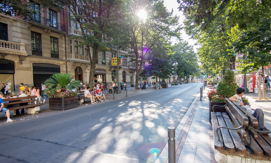
With its scenic old town, bridges over the Adour and dramatic cathedral, Bayonne is an attractive town just inland from the beach resort of Biarritz; the match between the two cities' teams is one of the biggest rivalry games in French rugby. We're not celebrating the big, beefy men of rugby here, however, as the stage is more designed for the wispy climbers, who will not be used to getting the chance to take such a major win and such a major amount of time so early in a Tour de France as they do today - however, this is the ONLY Pyrenean mountain stage, so they will need to make use of it better than the likes of Andy Schleck did in 2011. This is a long stage, but backloaded with some serious climbing, including my personal bête-noire of French cycling.

We traverse the whole of the Pyrenées-Atlantiques département from west to east in this stage, taking us through all three Iparraldean provinces, Lapurdi (Labourd), Nafarroa Beherea (Basse-Navarre) and Zuberoa (Soule) before heading into the more Occitan-aligned Béarn area centred around perennial Tour host Pau, through typical northern Basque scenery, a little less mountainous but no less charming than its Spanish counterpart, with similar white-and-red housing, traditional Basque fonts and of course, since this is the Tour de France, it wouldn't be complete without a château or two...

chateau20et20village.jpg


...or the occasional fortified medieval village, such as Navarrenx pictured here, along with Ainhoa that we passed through yesterday another of the protected 'plus beaux villages de France' group.

Navarrenx-vue-du-ciel.jpg


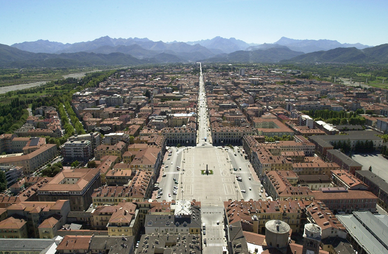
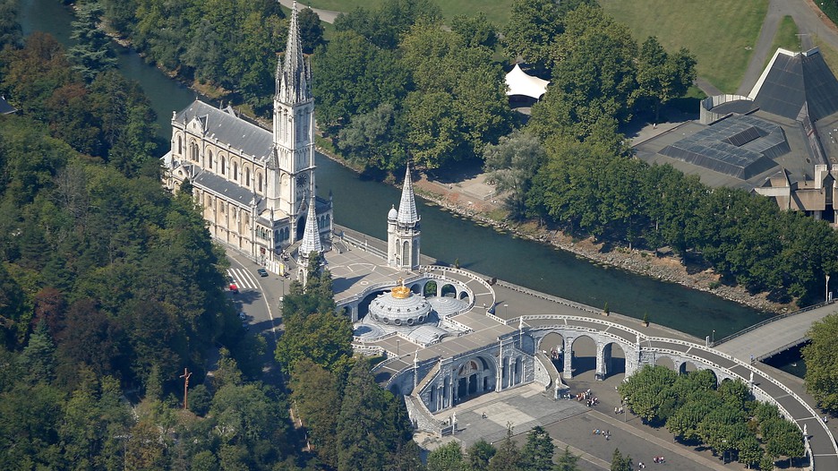
The 1992 Tour that I used as an inspiration for this design (or rather, producing something better than that was the inspiration) didn't have a single Pyrenean mountain stage, only using the Marie-Blanque when finishing a transitional stage in Pau; the 1977 Tour that also helped shape it had a long stage from Oloron-Sainte-Marie to Vitória-Gasteiz but no major early MTF like I have here; after passing through the start of that stage the riders will now be on familiar Pyrenean terrain as they're in the foothills; climbs like Larrau, Pierre-Saint-Martin, Soudet and Marie-Blanque, the westernmost climbs of the region that the Tour typically uses, are to our south (we've long passed those hell-slopes of Iparralde, so beloved of traceurs, such as Bagargui, Burdinkurutxeta, Arnostegi, Errozate and the now-being-discovered-by-the-Vuelta-but-possibly-still-too-narrow-for-Le-Tour Ahusquy) and Gan, Pau and eventually Tarbes will be to our north. After a brief opening salvo of the mountains with a cat.3 climb, the intermediate sprint will take place in the historic city of Lourdes, famous for its religious significance of course, but also very well known to cycling fans of course; it most recently hosted the Grand Boucle in 2011, in a bizarre mountain stage that enabled Thor Hushovd, in the rainbow jersey, to win after hunting down day-long fugitive Jérémy Roy on the final descent after the latter dropped his break companions on the Aubisque. Its position of importance as a pilgrimage site ensures its prominence as a tourist destination, and its position at the foot of the Pyrenées ensures a position of significance in the Tour, being situated close to traditional Tour climbs like the Aubisque, the Tourmalet and MTFs like Hautacam as well as to as-yet unused climbs like Spandelles. Here, it gives the maillot vert candidates something to get out of the stage, because the purest of sprinters haven't had their chance to shine yet, and the Bouhannis, Sagans and Coquards of this world who will have been favoured thus far will want the opportunity to take something from this type of stage as well as to potentially wrestle the jersey back from a hilly Classics type or GC rider depending on how the race has gone thus far.

Lourdes-28488.jpg


After a short uncategorized climb we turn right towards Bagnères-de-Bigorre, and from there it becomes as classic Tour de France Pyrenean stage as you can possibly get: the infernal, blasted, despised Col du Tourmalet. As sure as July comes around every year, so does the Col du Tourmalet. I'm sick of the sight of it, I'm bored of the repetitiousness of it, frustrated by the Tour's over-reliance on the crutches of well-known classic climbs and refusal to use different routes by which to get to its favourite mountaintops... but there does remain one problem: it is by far the hardest climb in the immediate vicinity of today's mountaintop finish, Luz Ardiden. The alternative would be either Aubisque or Spandelles which would leave a fair bit of false flat from Argèles-Gazost to Luz-Saint-Sauveur, and also it is still stage 4 of the race, so though I want to open up gaps with a proper mountain stage, we don't want to make them insurmountable if somebody is peaking for week 3 - they should feel they have the chance to get that time back. However, a bookended Tour route means that riders can't sleepwalk their way to the final week as we often see happening in recent years. Also, going via the Tourmalet means a 220km stage which will have an effect on riders' legs at the end hopefully.

Oh, and I probably ought to mention - the Tourmalet is the ceiling of the race. No climbs higher than this for the rest of the race. Lots of tough climbs, but none at any higher altitude.


vnu4z1ikg0kosowswc8oocg-tourmalet-tour-2009.jpg


So, the Tourmalet. Every cycling fan knows this monolith. You'd have to have been living under a rock and hiding away from the Tour de France to an extent Echoes can only dream of to not be aware of it. It was introduced to Le Tour all the way back in 1910 when it was one of those climbs that led to Octave Lapize's legendary shout of "vous êtes des assassins!" and the race has gone back to the well repeatedly since. It has been scaled by all of the greats, from the era of Lapize through Nicolas Frantz, to being one of the climbs won by the race's first King of the Mountains, the Spanish featherweight and template for generations of Spanish cyclists Vicente Trueba, to Coppi and Bartali, to the great era of Spanish climbers with Bahamontes and Julio Jiménez, who between them led over the summit for 5 consecutive editions in the mid 60s (only missing 1966, when the climb was not visited), Lucien van Impe, to being a favourite of Lale Cubino, a point-accumulating special for Virenque mk I in the mid-90s - in both the Tour and the Vuelta, which started using it in the era - to its more recent role as a mid-stage points-accumulator for GPM candidates such as Voeckler in 2012 and Majka in 2015, or as an attractive setting for a blossoming bromance as Andy Schleck and Alberto Contador embarrassed us all with a dismal display of mutual affection in 2010, or even worse than that, as a checkpoint in two of the most disgraceful mountain stages ever produced by Christian Prudhomme, the back to front breakaway stage in 2010 where Garmin strangled the break to prevent Horner and Plaza threatening Hesjedal's 10th place, Armstrong tried to get a final stage win only to launch one of the most pathetic sprints ever seen and be beaten in an incredibly cathartic manner by the highly-reputed Pierrick Fédrigo, and Carlos Barredo attempted a 45km flat solo at the end, and my absolute most despised stage design possibly of all time, the disgrace of 2009 when Grégory Rast led a bunch of 70+ over the summit, and Óscar Freire and José Joaquín Rojas would have been sprinting for the win if anybody had helped Caisse d'Épargne chase the two leaders who only just clung on.

Tourmalet2.gif


The eastern side of the climb which we are ascending crests a little over 30km from the line, and with the final 10km of this side averaging a more than considerable 8,9%, it's serious business. Entering this one cold at the start of a Tour could have interesting consequences. After all, it's taken some serious casualties before, such as in 2008 when Valverde and Andy Schleck both suffered (the latter due to hunger knock, the former due to the pace set by Jens Voigt of all people) in the Hautacam stage. After cresting the summit we have the long, hard and technical descent down into Luz-Saint-Sauveur before we take on the multiple hairpins up the Basque Mountain, to the ski resort at Luz-Ardiden.

7950666574_de31966dda.jpg


These dramatic switchbacks were introduced to the Tour in 1985, and the first man to triumph at the top was Perico Delgado, fresh from his controversial Vuelta win. The Tour has returned seven times since, and the Vuelta has visited twice as well for good measure - there were seven races to the summit in the first ten years after its introduction, with some very prominent victors. These included the 1990 Tour stage being won by Miguel Indurain, as he transitioned towards the dominant force he became in the coming years, and the 1995 Vuelta stage in a torrential downpour, where the absurdly dominant Laurent Jalabert (who I picked in round 2 of the doping draft for this very race) monitored everybody and then took them to the sword at the finish. The king of Luz Ardiden in this era, however, was the underrated climber Laudelino Cubino, whose exploits I have previously heralded in my Vuelta recaps; he won twice on the Basque Mountain, first in the 1988 Tour and secondly in the 1992 Vuelta, again in horrible weather, and which would prove to be his swansong as a major contender, as the wispy climbers of the 80s started to be phased out in favour of the tanks of the 90s.

Since then, however, its use has been more sparing. The Vuelta hasn't been back since 1995, and the Tour has only been back three times since, with Armstrong's victory in 2003 (now rescinded, of course) the most authoritative, with Mayo, Zubeldia and Ullrich trailing in behind, but the other two are much more beloved. After all, this is the Basque Mountain, the mountaintop finish that the orangemen made their own, with the Basques claiming this as theirs, filling the roads with ikurriñak, so the two victories by Euskaltel-Euskadi's marchers in orange are held in great esteem in the region. In the 2001 stage Roberto Laiseka, a typically inconsistent but capably excellent climber in the traditional mould, was able to hold off the big guns of the era, while in the more conservatively-raced 2011 stage, the last time the climb was seen in competition, Asturian adopted Basque Samuel Sánchez took advantage of the uncertainty among the major contenders to vault clear for a victory that set up his winning the polka dots that year.

LuzArdiden.gif


Luz Ardiden is actually rather a borderline case when it comes to HC categorization, being around the same kind of stats as Alpe d'Huez but slightly less steep (just under 7,5% as opposed to just under 8%) and, for a climb of that kind of categorization it is relatively straightforward. It's certainly not as hard a climb as the Col du Tourmalet. However, it IS a mountaintop finish, it IS borderline cat.1/HC and it has had the HC categorization in every edition of the Tour it has been featured in, so I go with that. This stage, even if raced conservatively in line with the not dissimilar 2011 profile, should result in time gaps and mean that there's something to protect. It should eliminate the pretenders from contention, and it should also mean that the big GC guns have to consider taking the maillot jaune early in the race, which may have an effect when they come to the final week, as they would likely rather not hold on to the jersey and expend too much effort defending it this early on; however, there are no more HC/cat.1 climbs for some time now, so they don't want to pass up the opportunity to take time on their rivals, especially as this is the ONLY Pyrenean stage, and the route is hardly swimming in Alps either (as you can probably guess from the fact there are no climbs higher than the Tourmalet in the race)...

gallery_265_1025_118916.jpg
 
Jul 24, 2014
150
0
0
Libertine rhapsodising about the Tourmalet for a paragraph... now I've truly seen everything! :p

I love the way your Tour is shaping up so far, in basing it off poor previous editions and transforming them with the special Libertine touch into something that I'd love to see in reality (just think how awesome a Basque start to the Tour done properly would be). Looking forward to the rest of it!
 
With the Tour de Suisse under way, I should probably get on with my version that I started a few weeks/months ago.

Tour de Suisse Stage 6: Zug - Schloß Vaduz (150km) (Rolling/Flat)


Climbs:
Kerenzerbergpass (5.4km @ 5.7%)

Sprints:
Sargans @ 131.1km
Vaduz @ 146.3km

Feed zone:
Rapperswil Jona @ 64.2km

So after a long break for me, that the riders won't have in their race, I am back to present this race. The stage starts in the city/town of Zug. The riders head uphill off the start line, before descending into the town of Baar, the host of the 'grand depart' (if you like) of this year's race. They then head over another lump at the begininng of the stage and reach the shores of Zürichsee. The riders head on loop round the edge of the lake passing the through the second most major city of switzerland(i believe?). This is of course Zurich, with Bern being the capital. The riders continue hugging the shores till they reach Rapperswil Jona for the feed zone. It's also home to the Ironman 70.3 switzerland. The race then crosses the causewaythat separates the Zurichsee and the Obersee.

After heading through the flatlands of the valley, the riders make their way to Mollis for the start of the only categorised climb today. It is theKerenzerbergpass. After a descent, the race is once again beside a lake: Walensee. The reasonably flat terrain continues throught the first prime of the day Sargans. This might be a clue to the type of winner on the stage. From here a riders hop into Liechtenstein for the finale of the stage. This includes a prime with 4km to go in the city centre of Vaduz (the capital of the principality). The riders will however ride straight throught the capital towards the north of the principality. If anyone that has gone for a prime but can't do uphill sprints, then they could have tried to get away just afterwards to get the 'headstart'. However, that will be difficult as 90 degree turn at 2.5km to go will make for a fast pace with lots of jostling for position. Then comes the climb to the finish. It starts with 1.2km to the line, is 6.7% average and has a maximum of 12% with 200m metres to go. To add insult to to injury, most of the climb is cobbled.


Schloss Vaduz (finish straight):
3-vaduz-castle.jpg

It may even look something like that on the day! ;)
 
Giro d'Italia

(Thu) stage 17: Voghera - Santo Stefano d'Aveto, 242 km
(Fri) stage 18: Santa Margherita Ligure - Acqui Terme, 135 km
(Sat) stage 19: Santo Stefano Belbo - Nizza Monferrato, 34 km ITT

(Sun) stage 20: Saluzzo - Cuneo, 175 km

0j5vGEM.png

gxqdDdl.png


Hard to believe, but we have finally reached the final stage. Took me only nine months, sorry for all the rest days.

Saluzzo
KDAaaxa.jpg


Colletta d'Isasca (km 13)
IsascaN.gif


The second climb of the day leads to the Santuario di Valmala. In 2014 the road between the Santuario and Lemma has been paved, since then it can be used as a pass. The Granfondo Fausto Coppi does just that, although in the other direction. We climb via the newly paved east side, which is quite steep at the top. I can't give you exact numbers, as the road is only partially visible through the woods and difficult to track. The whole climb should be about 9 km at 8%.

Next is Colle di Sampeyre (2.284 m), one of the best climbs in Italy, and criminally underused by the Giro. The north side has never been raced as an ascent, as far as i know (in the Giro that is).

SampeyreN.gif


This leads us to the Cima Coppi (plus Pantani statue) Colle della Fauniera (2.511 m) at km 115. The north side is not as hard as the east or south-east side, but it is still a mighty climb. And one of the most beautiful.

FaunieraN.gif


Colle-Fauniera.jpg

Colle-Fauniera-1.jpg


The descent is on the Demonte side, which of course was the place of the most remarkable downhill action in modern memory when Il Falco flew away from everyone in 1999.

IMG_6279-Version-2.jpg


The final climb of the day (and the race) is Madonna del Colletto.

CollettoN.gif


The final 18 km are flat. The Giro ends at the beautiful Piazza Galimberti in Cuneo.

35711.jpg