• The Cycling News forum is looking to add some volunteer moderators with Red Rick's recent retirement. If you're interested in helping keep our discussions on track, send a direct message to @SHaines here on the forum, or use the Contact Us form to message the Community Team.

    In the meanwhile, please use the Report option if you see a post that doesn't fit within the forum rules.

    Thanks!

Race Design Thread

Page 19 - Get up to date with the latest news, scores & standings from the Cycling News Community.
Feb 12, 2010
115
0
0
Visit site
18-Valve. (pithy) said:
something - Sognefjell - Juvasshytta would be better than the stage cartman proposed, in my opinion. While Sognefjell is an easier climb than Strynefjell, it's not quite THAT far from the final climb. Also, the scenery is even more spectacular, IMO.

Sure, but it's worth noting that I'm not trying to make an ''ultimate'' Tour of Norway, I'm trying to make a good stage race, with little transfers. Thus Stryn - Juvasshytta made sense to me. I'm aware that there's some distance between the climbs, but it Strynefjell should still sap some life out of somebodys legs. Plus I need some good stages in reserve for future tours ;)
 
Feb 12, 2010
115
0
0
Visit site
Libertine Seguros said:
Juvasshytta is enough to kill most people off on its own, without sticking another cat.1/HC climb in first! Seriously, the Strynefjell road looks amazing, and this would be an epic stage. I just wish some of these areas were closer to urban centres to make them more viable for racing, because it looks like an awesome cycling road. I suppose the problem is that obviously some of these roads are only available for a few months a year because of conditions so far north, so timing is an all important factor in creating a really good genuine Tour of Norway.

This photo is obviously a motorcycle tourist, but I think it showcases Juvasshytta's other benefit besides its insane 10% average gradients:

Yes, some of the good roads arn't that good early in the summer. While I believe Norway is very pretty late May/early June, this is probably not a feasible time to have the race. It should probably be in August.

Here's a picture of the road over Strynefjell in June.
 
After the ITT sets up the GC battle in earnest, it's time for us to move away from Argentina's first city, and towards its third, stopping short in the town of San Nicolás de los Arroyos. And yes, we're still moving through the Pampas, and yes, it's still flat.

Stage 5: Pilar - San Nicolás de los Arroyos, 208km

wslee9.png


This time a much longer sprint stage, heading along the banks of the Río Paraná, the second longest river in South America, racing through the country's Industrial Corridor. Much of the stage will be on Ruta Nacional 9, the main highway between Buenos Aires and Rosario, and as a result this will be fast, flat and very straight. Again there are no categorised climbs, so picking up the jersey in the hills of Tandil will ensure a rider keeps the jersey for at least a few days.

16jwqv.png


This one is probably for the sprinters, but there will once again be the possibility for echelon action, with very, very little shelter available for the riders on the route. We start in the affluent and rapidly-expanding Buenos Aires suburb of Pilar, which has become known as a retreat away from the inner city for many affluent families, and heads through the very north of Buenos Aires province before heading off the highway and spending a period of time in the run-in alongside the Paraná, finishing in the port city of San Nicolás de los Arroyos, at the convergence of three provinces, finally leaving Buenos Aires Province after a third of the race distance...

Pilar:
casa_en_venta_en_pilar_pilar_buenos_aires_93542136827738105.jpg


San Nicolás de los Arroyos:
1197695242_f.jpg
 
theyoungest said:
A beautiful finishing town indeed ;)

But what the hell, the LBL finish isn't much prettier.

I did say it was as salubrious as you could ever want!

There are quite a few towns around that part of the Buenos Aires urban sprawl you could finish in, so if the Argentines are concerned about the effect on tourism they can always finish in a different barrio. That's not the best shot in the world, but it is your typical industrial suburb, and not very pretty.
 
Jan 4, 2011
271
0
0
Visit site
Libertine Seguros said:
Stage 1: Mar del Plata - Mar del Plata (TTT), 23,2km

wiiiiiii, my hometown!

for some reason satelite maps exclude the altitude of avenida Colon, in fact it's a step hill (video here)

you're doing a pretty good job! :)

and don't forget the big climbs: Portezuelo (near Catamarca), Pampa de la Viuda (near La Rioja), Villavicencio (between Mendoza and Uspallata)...
 
Sofía_ said:
wiiiiiii, my hometown!

for some reason satelite maps exclude the altitude of avenida Colon, in fact it's a step hill (video here)

you're doing a pretty good job! :)

and don't forget the big climbs: Portezuelo (near Catamarca), Pampa de la Viuda (near La Rioja), Villavicencio (between Mendoza and Uspallata)...

I'm a long way from using all the big climbs I could, but a Vuelta a Argentina should realistically not be ending in about 5 or 6 MTFs in two weeks, much as I would love it. As a result it's kind of come out as a "one flat week, one mountainous/hilly week" parcours, and because of the problem of not wanting too many big transfers lots of areas are unused. I've also tried to be a realistic with the race possibilities, hence the flat stages, we'll see some circuits in some stages (much like the real-life Vuelta a la Argentina did) and so on, plus some fairly obvious, well-known territory. The race itself, when it existed, was mostly flat from the looks of things, a problem I'm trying to rectify at least in part. Of course, it does mean that there will be plenty of scope for variety in the course as well, with there never having to be a problem with repetition. Obviously you know the country better than I so you'll probably have more ideas of what I should have included/missed.
 
Mar 13, 2009
2,890
0
0
Visit site
Libertine Seguros said:
Juvasshytta is enough to kill most people off on its own, without sticking another cat.1/HC climb in first! Seriously, the Strynefjell road looks amazing, and this would be an epic stage. I just wish some of these areas were closer to urban centres to make them more viable for racing, because it looks like an awesome cycling road. I suppose the problem is that obviously some of these roads are only available for a few months a year because of conditions so far north, so timing is an all important factor in creating a really good genuine Tour of Norway.

I've been fooling around and trying to put together a 3 week tour of Australia, and this feature I think makes it almost completely unviable ever.
It comes down to Australia being huge, without many people, hence few large important towns, certainly none with the history and beauty that maybe offered by a castle etc. This leads to a lack of good finishing towns even lacking sufficient accomodation. Furthermore, without towns, there aren't too many roads travelling through good terrain, of which there isn't too much anyway, instead roads go around good terrain and these small towns are linked by bush tracks or something that doesn't link up which is ok for a MTF but not much else.
When I post, you'll see what I mean. Some of the profiles are ok, the country it travels through beautiful, but the start and finish town...WTF.
 
karlboss said:
I've been fooling around and trying to put together a 3 week tour of Australia, and this feature I think makes it almost completely unviable ever.
It comes down to Australia being huge, without many people, hence few large important towns, certainly none with the history and beauty that maybe offered by a castle etc. This leads to a lack of good finishing towns even lacking sufficient accomodation. Furthermore, without towns, there aren't too many roads travelling through good terrain, of which there isn't too much anyway, instead roads go around good terrain and these small towns are linked by bush tracks or something that doesn't link up which is ok for a MTF but not much else.
When I post, you'll see what I mean. Some of the profiles are ok, the country it travels through beautiful, but the start and finish town...WTF.
I had some of these problems with my Vuelta a la Argentina too - a lot of the roads are relatively modern and thus avoid obstacles, and the population is less dense than that of Europe, so there often aren't the close villages and towns each side of hills and mountains that need to be linked.
 
As I said at the outset: there will be something of nearly every skill a rider could be asked to have. And so we continue on with something that you probably never expected of me - a crit.

Stage 6: Rosario - Rosario, 80km (circuit race)

2ilyb07.png


No need to post a profile picture for this one. For the record, the top right hand corner with the roundabouts is at 4m higher altitude than the bottom left hand corner, but that is not enough to make any difference whatsoever. With sets of bonus seconds available, there is the incentive to race this one hard. The real Vuelta a la Argentina occasionally used crits to pad out distance and to encourage fans, and I don't consider this to be a bad option. It also allows for a shorter stage bringing the average distance down and giving the riders a bit of respite.

The course is essentially a four corner rectangle encasing Parque de la Indepdendencía and with the start/finish on Avenida Pellegrini. This will create a picturesque setting, and hopefully avoid the usual kind of dreary setting criterium racing can provide. The circuit length is almost exactly 4 kilometres, with two roundabouts near the end and the final straight about 400m in length. Parque Independencía is already a setting for some criterium racing in the Argentine domestic scene, so it's a tried and trusted setting. Also, a perhaps unexpected challenge in an Argentine stage race, but there are short stretches of cobbles for the riders to deal with, though realistically these shouldn't have too much of an effect.

Avenida Pellegrini:
barrancasavenidapellegrini301210.jpg


Aerial shot of Rosario, with Parque Independencía clearly visible, and the hippodrome dominating it:
parqueindeoy1.jpg
 
As we head to the end of week 1, it's time for us to have our final day on the Pampas and give the sprinters their last chance for a while.

Stage 7: Rosario - Paraná, 200km

2556hqh.png


Another long, hot, flat day greets the riders as they wrestle their way along the banks of the Paraná and the border between Santa Fé Province and Entre Rios.

Although the profile doesn't really show it, the last couple of kilometres are at a minor uphill, with the riders going through the Tunél Subfluvial as they cross the Paraná into the city of Paraná (please try not to get too confused). After a short stretch along the riverbanks, it's time to make our way to the finishing line, which results in something very unusual for Argentina: A cobbled climb. Realistically, it's not a big deal, certainly not by European standards, but it crests well inside the flamme rouge and could feasibly provide us with a finish either a bit like the Tropea stage of the Giro, or the Playas de Orihuela stage of the Vuelta, or provide a platform for any surviving escape to be settled.

28vpxrl.png


Climbs:
Paraná (Bajada Los Vascos)(cat.3) 400m @ 7,5% (max.14%)

It is kind of strange to categorise this the same as the difficult uphill finish in Tandil, but there is plenty of more extreme climbing to come. One of the benefits of finishing in Paraná is the presence of an airport, so a quick air transfer will follow this stage ready to start week 2.

Bajada Los Vascos:
73604.jpg


Paraná:
1.1270538929.parana-main-square.jpg
 
After transferring to the northwest, likely by air, it's time for us to see our first real trip into the mountains. We are still in circuits mode, but no more the hectic squabbling of the criterium; instead we're in climbing mode.

Stage 8: San Miguel de Tucumán - Cerro San Javier, 192km

2yv82ub.png


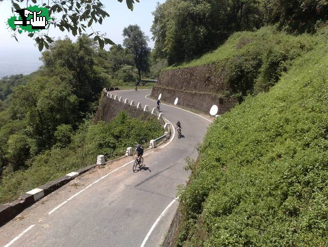
The first chance for the climbers to win back some of the time they will have lost in Buenos Aires is a simply-designed stage; three and a half laps of a 58km circuit around the important northwestern city of San Miguel de Tucumán. The riders head through the neighbouring city of Yerba Buena, after which the road heads distinctly uphill. Cerro San Javier is a rather famous mountain in the area. At the end of the first, hardest part of the climb, there is an abandoned university complex and an imposing statue of Christ; it is at the summit of this that the stage finish will be contested; after this, there is a much, much more gradual ascent towards Villa Nougués, before the riders descend back down for a flat period of run-in to Tucumán.

The stage will finish with the climb to the Mirador Cristo, where the riders will face a final 7km averaging no less than 8,9%, and sometimes reaching leg-punishing gradients on the way. The long periods of flat between circuits may discourage long-range attacking, but certainly this could well spell the end of the hopes for many, especially the more TT-minded.

10z4b47.png


Climbs:
Cerro San Javier (Mirador Cristo)(cat.1) 9,4km @ 7,8%
Villa Nougués (cat.2) 9,0km @ 2,5%
Cerro San Javier (Mirador Cristo)(cat.1) 9,4km @ 7,8%
Villa Nougués (cat.2) 9,0km @ 2,5%
Cerro San Javier (Mirador Cristo)(cat.1) 9,4km @ 7,8%
Villa Nougués (cat.2) 9,0km @ 2,5%
Cerro San Javier (Mirador Cristo)(cat.1) 9,4km @ 7,8%

As you can see, the previously dormant GPM will take off in earnest here, and the points gained in Tandil and Paraná are a pittance compared to what's available today. We're going into the second weekend in style.

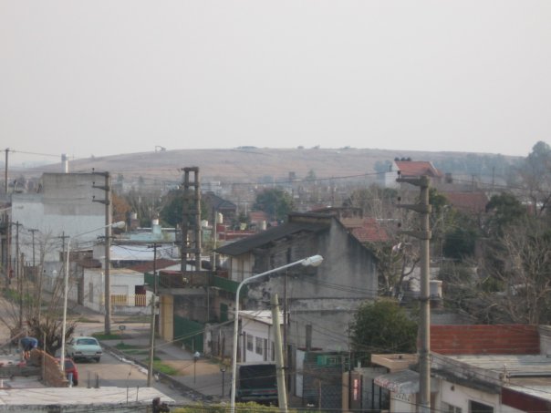
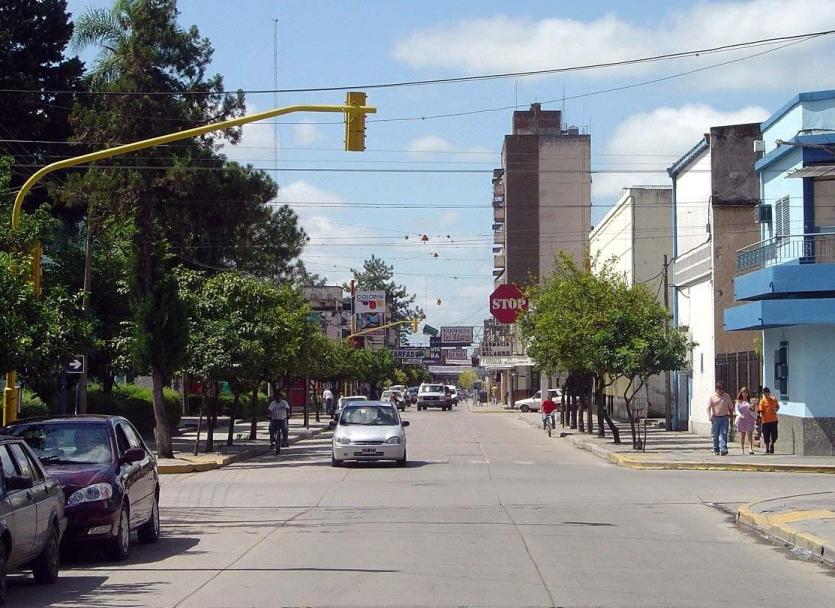
San Miguel de Tucumán:
40_big.jpg


Cerro San Javier:
1233041915_san_javier_tucuman.jpg
 
The second day of the second weekend sees us reaching the halfway point of our Vuelta a la Argentina, and our second summit finish in a row. This is a somewhat tougher climb than San Javier, but a less demanding stage.

Stage 9: Concepción - Portezuelo, 154km

wjc0vb.png


Starting in the bustling town of Concepción, to the south of San Miguel de Tucumán, this route follows Ruta Nacional 38 for most of its distance. The first half is entirely flat, before arriving at the long, but not especially strenuous climb of El Totoral, past the trio of tunnels known as the Tunels de la Merced, before a long period of gradual descent. Before we arrive at Catamarca, however, we turn left, away from the main road, and take the road to the skies. The climb of Portezuelo, just outside Catamarca, is one of Argentina's best known cycling roads, snaking out of the valley and up onto Tres Cerros. The riders will face a relatively short stage with only the one challenging climb preceding the final 18km. Please ignore the bizarre dips and troughs in the climb profile - from the start of the final climb all the way to the top is one connected climb. The gradient is not as steep as San Javier, but the length is doubled, and the time trial specialists will need to be on their guard in order to maintain their advantages here. The GC battle should be well and truly alive after this weekend's action.

f4hilx.png


Climbs:
Cuesta del Totoral (cat.1) 11,3km @ 4,6%
El Portezuelo (cat.E) 18,0km @ 6,1%

With the mountains taking their toll, the riders will head into Catamarca for some shut-eye ahead of a less stressful day tomorrow.

Concepción:
Concepci%C3%B3n_tucuman_sanmartin.JPG


Portezuelo summit:
19725992.jpg
 
Now time for our longest stage, before the belated rest day to allow us to transfer south.

Stage 10: Catamarca - La Rioja, 231km

2rdu3nt.png


Our longest stage runs mostly down the Ruta Nacional 38 once more, with a brief foray onto the 60. This is probably one made for the breakaway; the main climb of the day is the long but very gradual and easy climb up to La Cébila; after that it's a gradual descent and pretty much a totally flat run-in, until the péloton finally reaches La Rioja. The finish, outside the Autodrome, is at a slight uphill gradient; the last 2km are all at a gradual uphill, but it's the 600m at 6% that ends about 300m out that will make things interesting; it's not steep enough to dislodge the sprinters, but could result in some disrupted trains, and certainly could create an interesting shootout between breakaway companions if, as I anticipate, this is one for the breakaway.

au9pu1.png


Climbs:
La Cébila (cat.1) 20,5km @ 3,1%
Avenida Juan Ramírez de Velasco (cat.3) 1,3km @ 4,7%

After this long stage the riders will take a well earnt rest day, and then the race caravan will be transferred to Mendoza, probably by air. There's a packed itinerary for the last five days.

Catamarca:
argentina,catamarca,.jpg


La Rioja:
capital.jpg
 
Feb 12, 2010
115
0
0
Visit site
Stage 6 is a monster. Starting in the small village of Gaupne and ending in Aurlandsvangen (also a small village). From our starting point we bike along the fjord until Skjolden, where the road towards Sognefjell begins. We begin climbing up towards Sognefjell, but at roughly 850 metres above sea level we turn off the road and head over towards Øvre Årdal instead. After reaching Øvre Årdal continue up towards Tyin, a long shallow climb. After reaching E16, follow it down Lærdalen and down to Lærdalsøyri. Now begins our final ascent of the day when we go over the old road from Lærdalsøyri to Aurlandsvangen. The finish is straight after the descent from the mountain is done, so fast descenders might gain some additional time.

The first climb: 16.6 km at 7.4%
The second climb: 21.1 km at 5.1%
The third climb: 15.4 km at 7.7%

This is the route

We start in Gaupne

gaupne%20-%20kollhaug.jpg


View of Tyin

TellUs_944_307_large.jpg


The new viewing platform on FV 243 between Aurdalsvangen and Lærdalsøyri

128932.png


Aurlandsvangen seen from the platform

15aae035-20060524-3600-hs.jpg
 
That Tour of Norway queen stage is really one of the most beautiful things we've seen posted in here. Great climbs, breathtaking scenery, er... no, don't think we need much else!

I'm going back to the southern hemisphere, though... and after a nice rest day to recharge the bloodbatteries, we have our next major obstacle for the riders, as they circumnavigate the city of Mendoza.

Stage 11: Mendoza - Termas Villavicencio, 157km

9iqulx.png


The first stage after the rest day is an undulating stage. We start by heading south out of Mendoza, and up past Cacheuta Spa to the Embalse Potrerillos on a long loop to the southwest of the city, before returning. There is a long drag uphill, including two categorised climbs, but nothing too strenuous, before returning to Mendoza. After that the road turns to a very gradual uphill on the way to Termas Villavicencio.

The road turns gradually more and more uphill, but in reality this is a climb comparable to Pal or Crans Montana; this is likely to be a sprint from a small group, but anybody who isn't having a good day could see their GC aspirations go up in smoke. The breakaway could feel they have a good chance to make this one.

The mountain pass of Villavicencio is much bigger and longer than what we are actually climbing here; this is admittedly like stopping at the Passo Furcia with Kronplatz above us, or Passo Lanciano with Blockhaus to come. However, as most of the rest of the climb is unpaved, stopping at Termas Villavicencio seems logical; it also avoids the parcours being too obviously weighted to climbing. The climb also gradually becomes steeper as it moves closer to the finish; we will likely see the group contesting the race gradually thin out as the climb continues.

10rleeg.png


Climbs:
Embalse Potrerillos (cat.2) 3,8km @ 4,5%
Ruta Nacional 7 (Cordón del Plata)(cat.2) 5,5km @ 3,2%
Termas Villavicencio (cat.1) 11,3km @ 5,6%

Mendoza:
mendoza.jpg


Termas Villavicencio:
3252523.jpg


After the stage it's a trip down into Mendoza before a transfer to San Luís ready for the next stage...
 
Jul 27, 2009
496
0
0
Visit site
The Tour of the Victorian Alps - Stage 1

I've been waiting for ACF or somebody else to pop up with an Australian climber's stage race, but nothing so far. So here's my attempt - seven stages, three of which are mountain stages and two of which are MTFs.

I've tried to pick scenic routes, and particularly start and finish towns, where possible, and minimize transfers. However, it's not the most spectator-friendly race in the world; Victoria's best mountains are a long way from Melbourne - they're a long way from any large settlements and useful facilities like airports, as will be seen.

However, to give at least one opportunity for Australia's second-largest city to see the race, we start with a hilly ITT up Melbourne cycling's classic training climb, the 1 in 20:

the-1-in-20.jpg


The 1 in 20 is located in Melbourne's outer east, starting in The Basin and climbing through eucalypt and temperate rainforest to the tourist daytripper town of Sassafras. It is 6.75 km long and rises 285 metres, for an average gradient of 4.2%; it doesn't go much above that anywhere.

Most Melbourne-based "roadies" have a personal best time up here. Trent Lowe has done the fastest authenticated climb of 13:02.

Route and profile here.

Rest assured, there will be plenty more opportunities to make up time on GC!
 
cartman said:
Stage 6 is a monster. Starting in the small village of Gaupne and ending in Aurlandsvangen (also a small village). From our starting point we bike along the fjord until Skjolden, where the road towards Sognefjell begins. We begin climbing up towards Sognefjell, but at roughly 850 metres above sea level we turn off the road and head over towards Øvre Årdal instead. After reaching Øvre Årdal continue up towards Tyin, a long shallow climb. After reaching E16, follow it down Lærdalen and down to Lærdalsøyri. Now begins our final ascent of the day when we go over the old road from Lærdalsøyri to Aurlandsvangen. The finish is straight after the descent from the mountain is done, so fast descenders might gain some additional time.

The first climb: 16.6 km at 7.4%
The second climb: 21.1 km at 5.1%
The third climb: 15.4 km at 7.7%

This is the route

We start in Gaupne

Epic :eek:
 
Jun 16, 2009
19,654
2
0
Visit site
rgmerk said:
I've been waiting for ACF or somebody else to pop up with an Australian climber's stage race, but nothing so far. So here's my attempt - seven stages, three of which are mountain stages and two of which are MTFs.

I've been quite busy lately so you can take the honours of making the route. I'll make another tour around Vic or Aus at a later date.
 
May 6, 2009
8,522
1
0
Visit site
rgmerk said:
I've been waiting for ACF or somebody else to pop up with an Australian climber's stage race, but nothing so far. So here's my attempt - seven stages, three of which are mountain stages and two of which are MTFs.

I've tried to pick scenic routes, and particularly start and finish towns, where possible, and minimize transfers. However, it's not the most spectator-friendly race in the world; Victoria's best mountains are a long way from Melbourne - they're a long way from any large settlements and useful facilities like airports, as will be seen.

However, to give at least one opportunity for Australia's second-largest city to see the race, we start with a hilly ITT up Melbourne cycling's classic training climb, the 1 in 20:

the-1-in-20.jpg


The 1 in 20 is located in Melbourne's outer east, starting in The Basin and climbing through eucalypt and temperate rainforest to the tourist daytripper town of Sassafras. It is 6.75 km long and rises 285 metres, for an average gradient of 4.2%; it doesn't go much above that anywhere.

Most Melbourne-based "roadies" have a personal best time up here. Trent Lowe has done the fastest authenticated climb of 13:02.

Route and profile here.

Rest assured, there will be plenty more opportunities to make up time on GC!

That's extremely quick by Lowe.
 
Here's my new creation :)
THE GIRO OF THE MOUNTAINS :D
A Giro with 21 mountain stages across Alps and Appennines. Most of them are hard enough to be the gueen stage of any GT (especially the stages in the second half). It is structured as a stage race, but since it could never be raced actually, I'll drop any logistical issue (hence I won't mind if the roads are in bad conditions or the transfers are too long .... just like Zomegnan did :D)
It is more like a collection of indipendent mountain stages, arranged like they were in the same race.

It starts in Rome and finishes on the top of Zoncolan (the Giro has the awesome opportunity of not having a fixed finish place).

First week:
1 Roma - Terminillo 177 kms
2 L'Aquila - Blockhaus 184 kms
3 Sulmona - San Gregorio Matese 180 kms
4 Lauria - Cupone 186 kms
5 Lamezia Terme - San Lorenzo 233 kms
6 Messina - Etna 151 kms
REST (Transfer to Florence)

Profiles coming...
 

TRENDING THREADS