• The Cycling News forum is looking to add some volunteer moderators with Red Rick's recent retirement. If you're interested in helping keep our discussions on track, send a direct message to @SHaines here on the forum, or use the Contact Us form to message the Community Team.

    In the meanwhile, please use the Report option if you see a post that doesn't fit within the forum rules.

    Thanks!

Race Design Thread

Page 69 - Get up to date with the latest news, scores & standings from the Cycling News Community.
Stage 3: Laguardia-Biasteri - Durango (Alto de Garai), 158km

2mphs46.png


290wif4.png


Climbs:
Puerto de Herrera (cat.1) 5,6km @ 8,2%
Puerto de Vitoria (cat.3) 6,7km @ 3,2%
Alto de Karabieta (cat.2) 8,2km @ 5,2%
Alto de Ixua (cat.2) 5,2km @ 7,2%
Lekoitz-Gane (cat.3) 3,4km @ 7,7%
Monte Oiz (Ermita de San Kristobal)(cat.1) 6,4km @ 9,6%
Alto de Garai (cat.2) 4,0km @ 6,0%

The Basque Country is filled to bursting point with hills and mountains, and so it is perhaps a surprise that this is the only uphill finish in my Vuelta al País Vasco, especially given my reputation. However, this is a properly difficult stage nonetheless and should definitely see GC action from the penultimate climb at least.

The stage starts with climbing straight from the word go; the break of the day will likely be formed on the steepish slopes of the first climb of the day; the Puerto de Herrera has some really tough stretches, as the riders head back over the Sierra Álavesa into the plains by the hard way; also, at 1100m this functions as the highpoint of the race. After this there is a brief entry into the municipality of Treviño, a little sea of Burgos in the middle of Araba (which has been a bone of contention, though it features in the Vuelta al País Vasco often), from which we take the very gradual and non-threatening Puerto de Vitoria before heading straight through the capital on a long flat stretch through the plains of Araba. After passing through Arlaban, descent ensues, although it is fairly shallow. It is, however, quite technical, with a number of twists and turns. Even so, the rest of the first 90km are pretty much flat.

However, I have crammed five climbs into the last 60km, which will be endless suffering for those not accustomed to the mountains. First, a couple of familiar friends. The Alto de Karabieta is well-known, consisting first of a couple of flat kilometres before getting pretty steep on the way to the town of Elgeta; after this it is a slightly more manageable last 1,5km before a twisty descent in to Eibar. When they get to Eibar, it's straight back to the uphills; the Alto de Ixua will be familiar to you all even if you don't realise it - at the end of the steepest part of the Alto de Arrate (at approx 3km to go on stages to Arrate) there is a left hand turn, where it continues uphill briefly before descending down towards Markina. This is the Alto de Ixua, which manages to take in all of what makes Arrate tough without having the weird descending finish.

Descending into Markina, the home of another Basque sport, Jai Alai (before you get pedantic on me, the zesta punta/Jai Alai version of the game originates in Markina, I know there are several varieties of it), the riders get a brief bit of respite, in that the next climb, Lekoitz Gane, is pretty manageable. After cresting this, and descending a similarly comfortable route, a touch of false flat puts us at rider-killing point. That's because the next climb is a real destroyer.

I am forcing the riders to tackle the first 6,4km of this. Starting off with the Balcón de Bizkaia, the first half of the climb is unassuming enough, tarmacked nicely and at around 6-7%. Then all hell breaks loose. 3km at 12% of concreted horror, stretching out before the riders as they beg for mercy on slopes officially topping out at 21%. This is where the first really big moves for GC will take place, especially as the summit is just 18km from the finish, most of which is downhill. They will thank me, at least, that they stop at the Ermita de San Kristobal and descend, otherwise they would be dying out there. The long and fast descent takes us about 14km to complete, down into Iurreta, a village subsumed into the urban area of Durango, and the host of the annual women's stage race, the Emakumeen Bira, more or less a female version of the Euskal Bizikleta.

From here it's just a short rise up to the finish at the Alto de Garai, but it's not an easy one, as it rears up immediately. What we effectively have here are the first 4km of this route to Monte Oiz (the stretch from the sign for Goiuria to San Kristobal is part of the descent in fact) - so you can see that this is not an easy roll up to the finish despite 4km at 6% seeming pretty simple. Instead we have a kilometre mostly between 12 and 17%, a flattening out and some final steep ramps up to 16% inside the last kilometre, before a flattening to the finishing line in Garai. I foresee riders coming in alone or in small groups here. Lots of time to be won and lost for sure on this beast of a stage.

Monte Oiz (Ermita de San Kristobal):
204EC4D987204E67569E234E67511C.jpg


Alto de Garai:
47524609.jpg
 
Upon posting here my Vuelta route and discovering only Libertine (thanks for all the work!) and roundabout had ever posted Vuelta routes in here (good routes all three), I thought I'd give it a try and draw some more.

This one I don't even know how it's going to end, but first things first, here are the first four stages of my

Vuelta a España


Prologue - Barcelona ITT (5,4kms)

A short prologue with the Montjuic climb.

2di4snb.png


Climbs

Alt de Montjuic -3rd Cat (1,8kms at 8%)


Stage 1 - Barcelona -> Lleida (170kms)

Flat stage.

ixb779.png


Climbs

Alt de Masmolets - 3rd Cat (6kms at 4,6%)


Stage 2 - Lleida -> Morella (190kms)

Tricky stage with a climb near the end and an uphill finish. One for the break? Will the favourites give it a first go?

jj795h.png


Climbs

Alt de Morella - 3rd Cat (7kms at 5%)


Stage 3 - Benicassim -> Dénia (190kms)

Flat stage along the mediterranean coast. A slight chance for wind.

73o64w.png
 
actually the vuelta lacks in variety as much as this year's tour lacked in mountain finishes.

it gets boring watching the same few riders day in day out with almost exactly the same hierarchy each day.

GTs should always crown the best all round rider. i have no problem with the tour having two longish ITTs (in fact it is fair) but they then have to compensate with more mountains or massif central stages. this year's vuelta needed more variety, a flat ITT, less one mountain/climb stages/finishes, more stages like today with a succession of big mountain climbs. pretty epic seeing the way riders (apart from 2 or 3) were completely crushed at the end of the day...
 
Big Doopie said:
actually the vuelta lacks in variety as much as this year's tour lacked in mountain finishes.

it gets boring watching the same few riders day in day out with almost exactly the same hierarchy each day.

GTs should always crown the best all round rider. i have no problem with the tour having two longish ITTs (in fact it is fair) but they then have to compensate with more mountains or massif central stages. this year's vuelta needed more variety, a flat ITT, less one mountain/climb stages/finishes, more stages like today with a succession of big mountain climbs. pretty epic seeing the way riders (apart from 2 or 3) were completely crushed at the end of the day...

I obviously concur.
 
Eshnar said:
In the summary it appears shorter (dunno why) but if you edit it you'll see nothing wrong has happened ;)
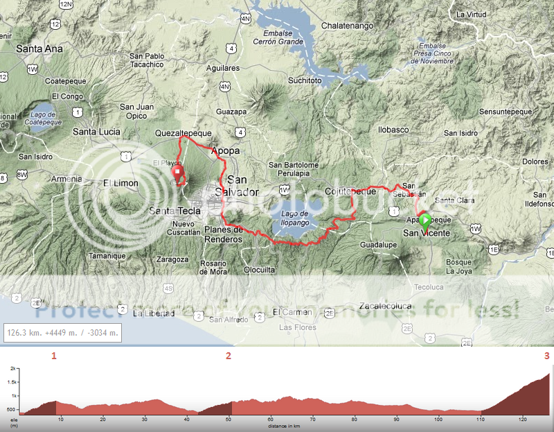
Now the second problem comes to Mr. 'Tracks4bikers-noob' (me), I have now uploaded a long track, so I open it and click on edit, and it shows just as it should. Almost. Now I wants to edit the labels on the track, which there is no problem with, but I can't save it, as the track is over 200 km :( :mad: :eek:
 
Netserk said:
Now the second problem comes to Mr. 'Tracks4bikers-noob' (me), I have now uploaded a long track, so I open it and click on edit, and it shows just as it should. Almost. Now I wants to edit the labels on the track, which there is no problem with, but I can't save it, as the track is over 200 km :( :mad: :eek:
indeed you can't (or at least I never solved the problem)
But what I generally do is to save a screenshot of the profile. That's all.
 
Eshnar said:
indeed you can't (or at least I never solved the problem)
But what I generally do is to save a screenshot of the profile. That's all.
Me too, but before I can see the new labels on the profile, I have to save it, but I can't do that, so it's impossible to have a picture of my 260 km long profile with the labels I want on it :(
 
Vuelta El Salvador U23 stage 3 Zacatecoluca - San Vincente ITT: 32km

VueltaelSalvadorstage3.png


(1) Cat. 1 6.7km, 8.3% Volcán de San Vincente

Stage 3 of this U23 race is an individual time trial, between the finish town of yesterday, Zacatecoluca, and San Vincente. While a point-to-point time trial is always a challenge logistically, we don't expect problems, because of the direct highway between the two places.

The time trial is relatively long for a six-day U23 race, and also very challenging, with a category 1 climb to conquer.

4386618164_c778f21ec9.jpg


Climbing along the Volcán de San Vincente, the climb tops out near the village of Santiago el Chie (no typo), one of the many villages profiting from the fertile soil often found near volcano's.

With an average gradient of 8.3%, the climb is not easy at all, and the little downhill in the middle means the uphill sections will be even steeper, topping out at over 12% near the top. The downhill is a lot less steep, so the riders who can still push a big gear after the climb can take more time here. Slowly the riders descent from 1047m to approximately 400 meter, to finish in San Vincente.

450px-Torre_San_Vicente_Centro.jpg


Famous for it's many festivities and some landmark buildings, such as the above tower, San Vincente will be the end of todays stage.
 
Vuelta a España

Due to time restrictions I'll only post the profiles of the main climbs from now on.


Stage 5 - Benidorm -> Petrer (193 kms)

The first truly hard stage features the well-known and incredibly steep Xorret del Catí, only this time not as a half-arsed MTF but as a proper mountain pass. The stage finishes 13kms later after a fast but not overly complicated descent.

33a5q1j.png


Climbs:

Alto de Xorret de Catí (4 kms at 11,3%)
http://www.cyclingcols.com/profiles/XorretDeCatiN.gif


Stage 6 - Orihuela -> Murcia ITT (42 kms)

First flat ITT. It will open the first important gaps among the GC contenders.

34t7bls.png


Stage 7 - Lorca -> El Ejido (198 kms)

Flat transition stage.

2hgd8uf.png


Stage 8 - Adra -> Collado Alguacil (206 kms, the first 34 kms not shown on profile)

Too hard for a first real mountain stage you say? So what! ;-)

These are two not-before-seen climbs that make for some grueling last 60kms of racing. The Collado de las Sabinas, through the new, hard road is 27kms long with an average gradient of 6,5% (18kms at 8% after the short descent!!), and the Collado Alguacil is another jaw-dropping col, with constant hard gradients for its last 9kms.

6ye2wx.png


Climbs:

Alto del Mirador de la Cabra Montés, 1st Cat (28kms at 4,3%)
http://www.cyclingcols.com/profiles/CabraMontesS.gif

Collado de las Sabinas, HC (27kms at 6,5%)
http://unavueltamejor.files.wordpress.com/2010/11/perfil-sabinas3.png

Collado Alguacil, HC (17kms at 6,7%)
http://unavueltamejor.files.wordpress.com/2009/02/cdo-alguacil.png
 
Stage 4: Durango - Zumaia, 165km

102jhhj.png


14v2xap.png


Climbs:
Puerto de Urkiola (cat.1) 5,7km @ 9,2%
Puerto de Krutzeta (cat.3) 2,8km @ 6,2%
Collado Elosua (cat.1) 7,3km @ 7,7%
Alto Endoia (cat.2) 5,8km @ 6,3%
Alto de Aia (cat.2) 1,4km @ 14,4%

After the gaps that I anticipate having opened up after yesterday's hard stage, this one is going to force people to act from some way out if they want to recover their lost time, and they will definitely have the chance to.

Starting from the beautiful Bizkaian town of Durango, this is the second stage in a row that comes right off the bat with a first category climb. And this time it's the great cathedral of Basque cycling, the legendary Urkiola. This mid-length climb has ascended to legendary status due to its painful ramps, its glorious views and the throngs of Basque fans that line it. It will allow the break to form, but its effect on the race will be fairly minor. It is followed by the easy Puerto de Krutzeta, which allows us to descend back down from the plains , now into Gipuzkoa. Downhill false flat takes the riders into Bergara, where they will be asked to tackle another well-known Basque climb, the Collado Elosua. This was used by La Vuelta in 2011 and features from at least one side in the Vuelta al País Vasco pretty much every year, and this is no different.

After descending from Elosua down into Azkoitia, the riders get a bit of respite in the form of some more downhill false flat, before being asked to climb up to Endoia. Officially the average is just 6,3%, but just look at that profile - it's almost ALL in the first half; after that it's flat, false flat and up-and-down; the first 3km is at over 10% of agony. Luckily for our riders, this is the last climb for 40km; they can roll down through Itziar to the finishing town of Zumaia, before rolling around the coast through towns like Getaria and Zarautz. Maybe at this point, the riders will get a sinking feeling, because they know what's coming.

Cue "O Fortuna".

It's Aia time. Also, the riders may hate me for this (no, they will hate me for this) but I couldn't be bothered with that double-mountain thing, doing the easier side then the brutal side. I just went with the brutal side, twice. I will never tire of this profile. On the plus side for the riders, I give them the full descent back down to Orio to recover from it, so it's not like they go over the climb twice in succession; they crest it first with 41km to go, then with 26km to go. This should be enough to either entice attacks, or force gaps by attrition, and give us a hectic last 30km as riders try to chase back what they've lost. There's also time for a bonus climb too - the uncategorised rise of Meaga. As you can see, it's easy - 3,9km at 3,5%. But gradients reach 7-8%, and this is plenty of challenge for legs with Urkiola, Elosua, Endoia and a double dose of the Alto de Aia in them, so gaps created on Aia could be compounded, consolidated or lost on these easy slopes, in that final rolling stretch before the finishing line in the pretty coastal town of Zumaia.

Durango:
57896127.jpg


Zumaia:
la-tranquilidad-de-zumaia.jpg
 
[Stages 1 - 5]

[Stages 6 - 10]

[Stages 11 - 15]

[Stages 16 - 18]

Apologies for not finishing this off earlier. I actually couldn't decide what to do with this stage, designers block as such. Coming back to it, I had it sorted in half a minute, and is now my favourite stage of the race.

Tour de France Stage 19: Grenoble - Barrage de Roselend 157km

tours19.jpg


94km Col des Cyclotouristes 12.8km @ 7.7%
123km Bisanne 12.4km @ 8.2%
153km Col du Pre 12.2km @ 7.9%

Tour de France Stage 20: Bourg-Saint-Maurice - Briancon 223km

tours20.png


48km Col de Iseran 48km @ 4.1%
88km Mont Cenis 9.8km @ 6.9%
137km Colle delle Finestre 18.6km @ 9.1%
165km Colle del Sestriere 15km @ 4.5%
187km Passo del Monginevro 8.3km @ 6.0%
213km Col de Granon 15.3km @ 6.6%

Doesn't look the prettiest, but takes the cake for difficulty.

Tour de France Stage 21: Briancon - Alpe d'Huez 79km

tours21.jpg


28km Col du Lautaret 27.8km @ 3.1%
79km Alpe d'Huez 14.2km @ 7.7%

Token ASO finish, the only place outside Paris where they would consider finishing in the near future. I'm only doing it as I was worried about transfers, it is possible to finish in Paris but I'd have to take a couple flat stages out of the middle and drop them at the end, meaning longer transfers throughout the race. As it stands almost all the transfers are very small, just the big one on Rest Day 1. Also just noticed it is 3540km all up, so would need to find 40km in the flat stages along the way, nothing serious.
 
[Stages 1 - 5]

[Stages 6 - 10]

[Stages 11 - 15]

[Stages 16 - 18]

[Stages 19 - 21]


Tour de France

Stage 1: Nice 13.3km ITT
Stage 2: Nice - Embrun 221km Mountain *****
Stage 3: Gap - Chambery 184km Flat
Stage 4: Annecy - Col du Bise 125km Mountain ***
Stage 5: Aigle (SUI) - Montbeliard 210km Flat
Stage 6: Belfort - Grand Ballon 145km Mountain ***
Stage 7: Colmar - Metz 184km Flat
Stage 8: Metz - Charleville-Mezieres 224km Hilly **
Stage 9: Charleville-Mezieres - Paris 235km Flat
Stage 10: Bordeaux 52km Flat ITT
Stage 11: Bordeaux - Mont-de-Marsan 184km Flat
Stage 12: Mont-de-Marsan - Artzamendi 149km Mountain **
Stage 13: Hendaye - Larrau 253km Mountain *****
Stage 14: Pau - Bagneres-du-Luchon 158km Flat
Stage 15: Bagneres-de-Luchon - Foix 227km Mountain *****
Stage 16: Carcassonne - Lodeve 229km Hilly ***
Stage 17: Ales 49.4km Hilly ITT
Stage 18: Avignon - Grenoble 239km Flat
Stage 19: Grenoble - Barrage de Roselend 157km Mountain ****
Stage 20: Bourg-Saint-Maurice - Briancon 223km Mountain *****
Stage 21: Tour de France Stage 21: Briancon - Alpe d'Huez 79km Mountain ***

Summary

3 ITTs (1 short, 1 flat, 1 hilly)
9 Mountain stages (4 MTFs)
2 Intermediate stages
7 Flat stages

At no point is there two consecutive flat stages. The biggest lull is around the first rest day, with 5 stages between two MTFs. In each week there is a >200km Queen (Stage 2, Stage 13/15, Stage 20). So in that sense I'm satisfied that my objectives have been met.

Looking back, I think I'd remove the final day in the Pyrenees. Drop the Alpe stage so you'd have Briancon - Lyon then the Paris finish. That would then be 7 mountain stages, eases the difficulty a bit.
 
Ferminal said:
Token ASO finish, the only place outside Paris where they would consider finishing in the near future. I'm only doing it as I was worried about transfers, it is possible to finish in Paris but I'd have to take a couple flat stages out of the middle and drop them at the end, meaning longer transfers throughout the race. As it stands almost all the transfers are very small, just the big one on Rest Day 1. Also just noticed it is 3540km all up, so would need to find 40km in the flat stages along the way, nothing serious.

The 2010 TdF was 3596 km, so I don't think that's a problem. :)

A nice Tour you have created, but I will wait before making my final judgement, until I have studied it closer.
 
And of course TdF and Paris will always finish in Paris, I don't see them changing that. Nice Tour though!

Vuelta El Salvador U23 Stage 4: San Vincente - El Boqueron

VueltaelSalvadorstage4.png


(1) Cat. 2 7.5km, 5.6% San Esteban Catarina
(2) Cat. 3 8.0km, 4,1% RN3E San Miguel Tepezontes
(3) Cat. HC 15.9km, 8.4% El Boqueron

Today is the fourth day of this Vuelta El Salvador U23 and things really begin to heat up, with a massive mountain top finish. The rest of the course is relatively easy, although some climbs shouldn't be underestimated.

We start in San Vincente, the finish of the time trial of yesterday. Almost immediately, the first test follows, the second-hardest climb of the day. Crossing the Pan-American highway, the riders climb towards the village of San Esteban Catarina, which is build on some sort of ridge. The road towards it is steep, averaging above 9% in the steepest kilometer. After passing the village, the climb is not over, but the gradients drop to a very manageable 4 or 5 percent. If a breakaway is to form here, it will consist of good climbers.

7937758.jpg


After the climb, we follow a provincial road, meandering through the landscape and small villages, such as above San Sebastian. Eventually the route returns to the main road, the Pan-American highway. There is no way to avoid this road for this stretch without making a big detour, but the riders will only use the highway for 7 kilometers. Reaching Cojutepeque, a city that once was the capital of the country, the riders leave the highway and continue southward, towards the hilly middle sector of the race.

Riding along the Lago de Ilopango, slowly climbing towards nearly thousand meters (coming from 400m). The first part of this ascent is a categorized climb, although the average percentage is only 4%. The road follows a former volcano, and aforementioned lake is the crater lake of a long dead fire mountain.

800px-Lgo_Ilopango_Stgo_Txacngs.jpg


Eventually the road descents towards the current capital, San Salvador. Crossing the largest city of the country, the riders emerge near Apopa, a city north of San Salvador. After another short stretch of 4 kilometers on a main highway, the riders once again turn southwards, for another ascent. This is the final one though, and it is a lot more difficult than anything the riders have faced till now.

With an average of 8.4%, this ascent will be a real test. The road climbs towards the top of the El Boqueron volcano, the volcano dominating the city of San Salvador.

San-Salvador-view.jpg


The climb is steep, but steady, the first 6 kilometers are on average all around 9.5%, without much deviations. After that, briefly an easier section follows, before the hardest part of the climb: a section of about 1 kilometer with an average of just under 12%, just after passing the halfway point of this climb. The road then smooths out, until we reach the village of Alvarez, a small village situated at an altitude of nearly 1600 meters. This is one of those villages benefiting from the fertile soil of an old volcano. It could've been an ideal finishing place, but instead the riders will have to turn right, towards the natural park El Boqueron. The road narrows somewhat, but the quality is still excellent, and after a further 2 kilometers of climbing at a steep gradient (9.8% average), the finish line lies just below 1800 meters, virtually the top of the volcano. Anyone who finishes in front here, can call himself a talented climber.
 
Looks like a brutal climb for an U23 race, that.

Stage 5: Zumaia - Hondarribia, 164km

300wf8z.png


27zkkua.png


Climbs:
Jaizkibel (cat.1) 8,2km @ 5,4%
Col d'Ibardin (cat.2) 4,5km @ 5,7%
Puerto de Agiña (cat.1) 7,7km @ 6,1%
Alto de Aritxulegi (cat.2) 3,5km @ 5,5%
Alto de Erlaitz (cat.1) 9,2km @ 5,2%

The last road stage of the Vuelta al País Vasco takes in not just País Vasco, but a detour into Navarre and into Iparralde as well, before finishing back by the Bidasoa estuary on the Txingudi bay. The stage starts with some rolling, coastal roads as we head along the Gipuzkoan coast, then following the Oria river through satellite towns of San Sebastián such as Usurbil, Hernani and Errenteria through the first 50km. For the last 114km, however, it's all about the climbs. You'll all be familiar with the first of these, of course - Jaizkibel is the Clasica San Sebastián's trademark climb. Descending from this, we arrive in the day's finishing town of Hondarribia, but there's still plenty on the menu for the day. We head from here into Irun, a border town that gave the world Juan Manuel Garate, before crossing over into French terrain. Some rolling terrain in the hills around Hendaye ensue, before the riders take on the northern face of Ibardin, the opposite side to the one they raced in País Vasco this year (also, without the steep final 700m). This side is slightly tougher than the Navarrese side, but still is not likely to be decisive, with three more climbs to come and the stage barely half done.

After descending into Lesaka, the riders now have the double act of Agiña and Aritxulegi to deal with. As you can see, Agiña is easily the tougher of the two, with some steep sections, but there's no respite in the two climbs, with the riders heading through the tunnel at Aritxulegi before descending away from the Peñas de Aia mountain range down into the strongly nationalistic town of Oiartzun. A similar route took place in 2007, in the stage that finished in Oiartzun, although they placed Jaizkibel after the Agiña/Aritxulegi double. They also did what I am about to do next, which is head to Irun again, and then return to the Peñas de Aia with the difficult climb of the Alto de Erlaitz, also known as Castillo del Inglés. Although 9km in length, the tough part of the climb is only really 4-5km long, mostly averaging around 10% for that part of the climb; most of the rest is false flat, although it ramps up and flattens out very inconsistently; here Juanjo Cobo was able to make good and put a minute into Samuel Sánchez to win the Vuelta outright back in 2007. Then, of course, finishing in Oiartzun, there were just 10km to the line; today there are just over 20. The descent back towards Irun accounts for most of that, though, so it is definitely an option for attacking the legs hurt from the multiple climbs and from the tricky stages to Garai and Zumaia.

After the descent finishes, the riders have the short trip from Irun to Hondarribia, past the diminutive San Sebastián Airport. When they get to Hondarribia, there's just a little surprise in store for them. Hondarribia is one of very few old fortified towns that still stand in the Basque country, and the riders are going to be asked to tackle the - uncategorised - narrow cobbled streets of the town, featuring a quite steep - but only about 3-400m in length - climb. This crests just inside the final kilometre, with the finish on the seafront, with a couple of twists and turns inside the final kilometre, so there are still ways to break the race up right until the end. And if you can't time trial, this is your only hope, so you'd better make the most of it!

Hondarribia:
parte-antigua-hondarribia.jpg


ketari-20071209220137.jpg
 
Despite earlier saying that I didn't want to create a GT, I have done anyway.

It started with my Pordoi stage, and from there the rest came along. BUT. I have one problem. I have already designed the last 18 stage, and also quite some more, but I simply can't decide what my 3 opening stages should be like. Or well I do partly, but I have created 6 (+1) stages, from which 1 is certain to be in this Giro.

I will now present the 6 (+1) stages, and the different combination of them, from which you recommend. Of course comments in general is great.

I'll start with the stage that will be certain:
5Bikx.png

As you can see the final is almost identical with the original Chieti stage in T-A this year, and the final 10 km is 100% identical to the last two times it was raced.

It will either be the second stage or the third stage. Originally I created the course so it would be the third, but I had second thoughts, as I also wants it to be a weekend stage.

There will either be one or two stages before that stage, and I originally designed it, so that this would be the opening ITT:

Picture of a Napoli ITT of 15 km

Followed by this:

6KwX7.png


But for the Chieti stage to be second stage, only one stage can come before it. That could be either of the former two stages, or it could be one of the following two stages:

Short ITT of 9 km with a hill and a technical descent:
RDu40.png


Or a stage road race stage starting close to Napoli, where the last 9 km will be those of the ITT above:

Picture of an opening road race stage of 177 km

As for the third stage if it isn't going to be the Chieti stage, it will either be an ITT of the first 11 km of the 14 km circuit below, or a road race of 13 laps: (The picture is of three laps)
TBVZJ.png


And now for the different combinations:

Number 1:

Saturday: The first ITT (15 km)
Sunday: Napoli - Cassino
Monday: Cassino - Chieti

Number 2:
Saturday: The first ITT (15 km)
Sunday: Napoli road stage
Monday: Cassino - Chieti

Number 3:
Saturday: The first ITT (15 km)
Sunday: Cassino - Chieti
Monday: Chieti road stage

Number 4:
Saturday: Napoli - Cassino
Sunday: Cassino - Chieti
Monday: Chieti ITT (11 km)

Number 5:
Saturday: The second ITT (9 km)
Sunday: Cassino - Chieti
Monday: Chieti road stage

Number 6:
Saturday: Napoli road stage
Sunday: Cassino - Chieti
Monday: Chieti ITT (11 km)

PS: @Libertine: You don't have to link this thread, as I later will make a library thread for my Giro, where this will be linked (-:

EDIT: so far my personal preference is number 5, but only by a bike throw.
 
Jul 2, 2012
343
0
0
Visit site
Has to be either three or five : I really like that classics-style road stage.
If you already have plenty of flat ITT in the rest of your race do five; if not I'm recommending three.

PS: I'm currently working on a huge project, that's why I haven't posted in a while. If everything goes right, I'll have it finished in a week or two (it's massive :D)
 
Progsprach said:
Has to be either three or five : I really like that classics-style road stage.
If you already have plenty of flat ITT in the rest of your race do five; if not I'm recommending three.

PS: I'm currently working on a huge project, that's why I haven't posted in a while. If everything goes right, I'll have it finished in a week or two (it's massive :D)
Lets just say that there will be over 100 km of ITT, but mountains enough for Abandy to win the race ;)