
Tour of California 17
Tour of California stage 17: Los Angeles - Lake Sherwood; 186 km


The third week could be considered easier at first sight with the highest point only 1190 meters high. However, the medium mountain and hilly stages placed in the last week are by no means easy and with the GC battle culminating they could prove to be legbreakers. First of these is stage 17 starting in Los Angeles and then heading through Holywood towards the Santa Monica mountains and finishing at Lake Sherwood near Thousand Oaks.
First serious climbing of the day starts after 40 km with the Tuna Canyon ascent. It starts nasty, averaging 11% over 3.5 km and then eases up. Similar profile has the next climb as well, the Saddle Peak. Latigo Canyon, the next climb starting from the town of Malibu is an easier one but the one after is again very steep. Most of the climb to Barley Knob is at around 10%. From the top there are nice views of the surrounding mountains.
After the descent there is a short section along the coast before we turn right to the hills again. This next ascent through Deer Creek is very painful, over its length of 3.5 km it never goes under 10% in gradient. It crests only 30 km before the finish so we could see the decisive moves happening here. The last climb up Triunfo Pass is not as hard but with the bunch likely to be shattered to pieces a lot could happen here too. From here there is 12 km of a double stepped descent and 3 km of flat before final 500 meters at 10%.
Los Angeles:

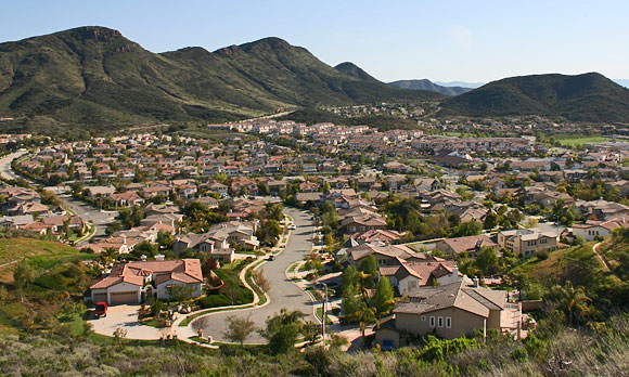
Lake Sherwood:

Tour of California stage 17: Los Angeles - Lake Sherwood; 186 km


The third week could be considered easier at first sight with the highest point only 1190 meters high. However, the medium mountain and hilly stages placed in the last week are by no means easy and with the GC battle culminating they could prove to be legbreakers. First of these is stage 17 starting in Los Angeles and then heading through Holywood towards the Santa Monica mountains and finishing at Lake Sherwood near Thousand Oaks.
First serious climbing of the day starts after 40 km with the Tuna Canyon ascent. It starts nasty, averaging 11% over 3.5 km and then eases up. Similar profile has the next climb as well, the Saddle Peak. Latigo Canyon, the next climb starting from the town of Malibu is an easier one but the one after is again very steep. Most of the climb to Barley Knob is at around 10%. From the top there are nice views of the surrounding mountains.
After the descent there is a short section along the coast before we turn right to the hills again. This next ascent through Deer Creek is very painful, over its length of 3.5 km it never goes under 10% in gradient. It crests only 30 km before the finish so we could see the decisive moves happening here. The last climb up Triunfo Pass is not as hard but with the bunch likely to be shattered to pieces a lot could happen here too. From here there is 12 km of a double stepped descent and 3 km of flat before final 500 meters at 10%.
Los Angeles:
Lake Sherwood:


")


