• The Cycling News forum is looking to add some volunteer moderators with Red Rick's recent retirement. If you're interested in helping keep our discussions on track, send a direct message to @SHaines here on the forum, or use the Contact Us form to message the Community Team.

    In the meanwhile, please use the Report option if you see a post that doesn't fit within the forum rules.

    Thanks!

Race Design Thread

Page 80 - Get up to date with the latest news, scores & standings from the Cycling News Community.
Stage 3, Rennerod - Heidelberg (Königstuhl)

We continue moving south and this time we'll visit Germany's most beautiful town: Heidelberg.

The college town of Heidelberg is one of the few German cities of more than 100,000 inhabitants that was spared from allied bombing in WWII, due to an agreement between Nazi Germany and the UK according to which the Germans would leave Oxford and Cambridge be if the allies didn't touch Heidelberg.

The Königstuhl overlooks the whole city, and it has three separate sides. In this stage, I climb the hardest side first, then an easier one later to finish on top.

afdm39.png


Königstuhl 1, 5kms at 9%.

Königstuhl 2, 10kms at 4%.

Rennerod

images


Heidelberg (Königstuhl)


heidelberg10.jpg


neckar-koenigstuhl-odenwald-P1000791_3.jpg
 
Interestingly, what I was working on when mapmyride decided to stop me from mapping the area was a GT-style Deutschlandtour. Maybe I'll get round to that one day.

Also, no Mangart in my Tour de Slovénie - it's only a four day race, so a climb of 16km at nearly 9% is a bit overkill. I have found a use for the climb though, which may become clear in a while.

Stage 2: Kočevje - Piran, 180km

1m5o6.png


2vd4cg4.png


Climbs:
Glažuta Sedlo (cat.2) 6,7km @ 6,3%
Leskova Dolina (cat.2) 4,7km @ 5,0%
Snežnik (cat.2) 12,0km @ 3,7%
Pregarje (cat.2) 11,1km @ 2,8%
Markovec (cat.3) 2,5km @ 5,3%
Predor Lucan (cat.3) 1,2km @ 7,2%
Šentjane (Beli Križ)(cat.3) 1,2km @ 6,8%

The second stage passes across the southern edges of Slovenia, finishing in Piran, a medieval town and port that was predominantly Italian until the mid-20th century and is one of Slovenia's main tourist attractions, with views from the hills above it into Italy and across the Adriatic.

The stage is a hilly one; no fewer than seven categorised climbs. The first four are all category 2, although only the first of these, over poorly maintained roads near Glažuta, is steep enough to cause much consternation among the bunch. The rest of it is gradual uphills and longer downhills until we get down towards sea level, close to the border with Italy (Trieste is visible from most of the final few climbs). The important climbs for the GC action in the stage are the three shorter, category 3 ascents, however, which are all inside the last 20km (just). From the port town of Koper, which will inevitably host an intermediate sprint, and usually hosts a stage start in the Tour, starts the gradual ascent of Markovec, which crests with 17,5km to go and could tempt our first key moves. The descent into another port town, Izola, is steeper and more technical than the ascent, which could help a rider get clear. Then, another short gradual rise and descent take us to 10km to go, when we face a short puncheur's rise of 1,2km at 7,2%, with a max of 13%, ending in this tunnel, which could lead to some real jostling for position, however the péloton have negotiated it before. The descent into Portorož is frenetic, then there's time for one last climb, up to Beli Križ, another short climb with a maximum of 15% and the steepest 500m section of the race (at over 10%) - cresting just 2,4km from the finish, with a fast descent into the coast road before the finish in the amazing peninsular walled town of Piran.

Kočevje:
959_Mestna_ploscad.jpg


Piran:
fotogalerija%2Fnove_2010%2Fpiran%2Fpiran-peninsula_01.jpg
 
Stage 3: Koper - Pokljuka, 193km

wvzxo6.png


35cpx50.png


Climbs:
Petrinje (cat.2) 8,0km @ 4,5%
Mala Lazna (cat.1) 13,1km @ 7,8%
Ozka Cesta (cat.3) 2,5km @ 6,2%
Davčo Sedlo-Črni Vrh (cat.1) 11,2km @ 6,0%
Bohinjsko Sedlo (cat.1) 13,3km @ 5,7%
Pokljuka (cat.1) 14,9km @ 5,8%

The undeniable queen stage of my Tour de Slovénie is this lengthy stage with no fewer than six categorised climbs, a lot of pain and a shout out to my other sporting obsession.

Starting in the port city of Koper that we visited yesterday, the race heads northwards now, into Slovenia's little corner of the Alps. As with yesterday, the early parts of the stage are characterised by rolling, gradual climbs and descents, with much gradual up and down in the first 70km but only one climb worthy of categorisation before the race passes through Ajdovščina.

From here, things get serious. The first major obstacle is Mala Lazna, a serious climb averaging nearly 8% for 13km after a shallow lead-in, like some Slovenian Alpe d'Huez (at least if Phil Liggett is covering the race). It will immediately tell us who isn't going to contend for the race in the later stages, as if they're struggling with the steep sections now they're not going to have much fun later. On the way down the descent is interrupted by another short climb, which includes some stretches of strade bianche just to add to the riders' woes.

From here it's 20km of flat valley roads before heading to the triple punch of our final three climbs of the day. Črni Vrh, the first of these, starts off fairly benign before ramping right up, with the last 4km averaging 9%. Cresting 54km from the finish it may be a bit too far for striking out for home, but it is constantly up and down from here on in, so it's possible. The first couple of kilometres of descent are technical but after that it's quite straight and suited to the power guys before we arrive in Zali Log. Then we have Bohinjsko Sedlo, a pass with two distinct steeper steps and a maximum of 22% on its mountain roads. The summit of the climb is 30km from the finish and from there it's a tricky descent into Bohinjska Bistrica before we set up the final ascent of the day.

Pokljuka is the name of a plateau in northern Slovenia, best known for its famous biathlon centre, a host of the World Cup most seasons and a former host of the World Championships. This venue will provide us with the facilities to host today's stage finish, because I am a sucker for biathlon, and also because it's one of the few places on the plateau with enough space to host said finish. There are a number of routes up to Pokljuka, but I have chosen the side via Podjelje, with narrow and difficult roads. This climb is crazily inconsistent, as you can see from the profile - an initial ascent flattens out, then we have 4,3 agonising kilometres into Podjelje averaging 10% and maxing out at 19%; a flattening out and gradual rise in Podjelje itself for a kilometre leads into the steepest kilometre of the race, averaging a brutal 13% and again maxing out at 19% before the climb becomes more gradual again heading into the hamlet of Goreljek. After this, the last 5km are flat, false flat, descent and gradual climb (maximum of 6%) as the riders turn off of the narrow lanes and onto the roads that lead to the finish at the biathlon centre. Therefore riders will need to go early in order to maximise the opportunities to take advantage of the climb, and we could be left with a chase situation on those final kilometres where it flattens out, with a pure climber trying to stay away from more all-round athletes looking to limit their loss.

Koper:
4168055775_e786c7da16_z.jpg


Pokljuka:
preview_0.jpg
 
A couple of months ago I already made a version of Paris-Nice, now I'll make a second one. This version has a more traditional layout, but it still is more difficult than what we are used to see.

Stage 1: Evry - Auxerre, 173.5km. A traditional flat stage, crossing the (hopefully) windswept plains of central France.

Stage 2: Montbard - Le Creusot, 168.5km. This stage crosses the hills of the Morvan before heading east. The last 25km look like this:

lecreusotm.jpg


Stage 3: Montceau-les-Mines - Thiers, 184km. After a little less than 100km the Col del a Rivière Noire (14.6km @ 4.3%) is the first test of the day, but the last 48km will create more significant gaps :

thiers.jpg


Stage 4: Issoire - Saint-Bonnet-le-Château, 184km. The stage twists and turns through the Massif Central for 150km, and 5 climbs have to be tackled before the town of Firminy is reached: Côte de Jumeaux (3.3km @ 5.2%), Col de Vinfaud (9.2km @ 4.2%), Col des Pradeaux (11.5km @ 5.4%), Col des Limites (3.9km @ 5%) and Côte des Chambles (3.8km @ 3.4%).It is in Firminy, however, that the real spectacle starts, with 4 more climbs in 34km:

saintbonnetlechteau.jpg


Stage 5: Firminy - Valréas, 198km. The 7 hills in this rolling stage probably won't cause many problems, so the sprinters should take their chance.

Stage 6: Orange - Vaison-la-Romaine, 28km. A gradually false flat uphill time trial, something for the real powerhouses.

Stage 7: Apt - Toulon/Le Mont Faron, 193.5km. A hilly stage with a finish on top of Le Mont Faron..

Stage 8: Nice - Nice, 184.5km. The traditional stage through the mountainous hinterland of Nice, but longer than what we are used to.
 
That's a tough Paris-Nice route!

Stage 4: Bled - Bled, 26,2km (ITT)

wsmd54.png


fn77o0.png


My Tour de Slovénie finishes off with a mid-length ITT. It's possibly on the long side for a four-stage race, but I wanted to encourage people to really make the Pokljuka stage difficult, what with four difficult mountains, some strade bianche and sections averaging over 10% over 4km in the final climb. I guess I could shorten it by eliminating the loop around Lake Bled, but really, this is a beautiful part of the country, and it would look amazing on the coverage, with the castle on the lake, and the mountains in the background. May even come close to the Vuelta a Bariloche for the views. And it means I give something for everybody in my Tour de Slovénie - something for the sprinters, something for the puncheurs, something for the pure climbers and then a chance for the TT guys to come back into it.

Bled:
bled_2-szd-758x600.jpg
 
As you will no doubt be aware from many discussions on this board about women's cycling and sport in general, Nordic skiing, one of my old avatars and this thread, I love biathlon. Like, really love it. All over Central Europe there are venues, and, because they need to have snow in winter, the majority of them are among hills or mountains or at altitude. Now, unlike Alpine skiing, not all of them need the benefits of mountains sloping up to the station, so they're not always as suited to hosting cycle races as their Alpine counterparts all over France, Italy, Austria and Switzerland (and to a lesser extent Germany and Slovenia). However, in some places they can provide an interesting backdrop to cycling.

Italy, for example, has a decent cluster of biathlon venues fairly close to one another, that are top notch facilities, hosting either the World Cup or the IBU Cup (the second-tier competition) and would easily be able to host a stage finish for a small race. Unfortunately nearby Forni Avoltri is in the next province across, but there are enough in Trentino to make a slightly silly Giro del Trentino without bastardizing too much of the character of said race.

So here we have, the Giro del Trentino for lovers of biathlon and cross-country skiing...

Stage 1: Rasun-Anterselva (Rasen-Antholz) - Anterselva di Mezzo

28714k3.png


262u0sy.png


Antholz-Anterselva (the biathlon world tends to use the German name) is the most famous Italian biathlon venue, sitting halfway up the route from Rasen-Antholz to the Passo Stalle, a difficult two-stepped mountain pass between Italy and Austria that is used on rare occasions in major races, making its Giro début in 1994.

Here, however, we do not climb so far, for there are plenty of mountains to come in this Giro. Instead we have a short-to-mid ITT beginning at the base of the valley, where the road splits between the Passo Furcia and the Passo Stalle, in the town of Rasen-Antholz. After a short uphill introduction it's mostly slightly uphill false flat that is almost ramrod straight and will be ideal for the time triallist, before it kicks uphill a bit as we head off the main valley road into Anterselva di Sotto, reaching up to 10% on a short puncheur section of 1,7km at 6%. After that it's back onto the valley road for the start of the Staller Sattel proper; however after a couple of kilometres of just 3-4% (the steepest stuff is at the top with Stalle, which averages 6,3%) we hook back on ourselves for a short downhill run into the finish in the skiing town of Anterselva di Mezzo.

This one should set up an interesting GC mix, as while no time trial specialists ever show up in Trentino, the more all-round riders will be able to put a bit of time into the pure climbers.

Rasen-Antholz:
rasen-antholz-pustertal-suedtirol.jpg


Anterselva di Mezzo:
Antholz%20Niedertal.png
 
Stage 2: Antholz-Anterselva - Auer-Ora, 154km

1570oet.png


23wj4.png


Climbs:
Telfen-Ianzin (cat.1) 6,6km @ 9,3%
Kreither Sattel (cat.2) 1,4km @ 10,9%

The first road stage starts at altitude, at the popular and famous host venue for Italy's rounds of the Biathlon World Cup. This means the first thing that faces the rider is a descent, but most of this is gentle, as we avoid the steep part of yesterday's ITT. I'm easing the riders into this race, so for the most part once we hit Rasen-Antholz it's valley roads here, through Brunico, Rio di Pusteria and Brixen-Bressanone. Most of these gently ease us downhill, but near Castelrotto there's a pretty sizable challenge that will thin the bunch out a bit - the climb up to the hamlet of Telfen-Ianzin averages nearly 10% and maxes out at 19% on some nasty climbing, close to the village of Siusi. One can only imagine the carnage had they approaches Siusi from this side in 2009, as this hooks up with the final part of the climb, but instead today we descent the first two thirds of what was climbed that day, firstly gradual at 3%, then some more serious descending into Bolzano.

From Bolzano it's mostly valley roads, but there's one nasty obstacle in the way. As the riders do a 14,5km loop around Auer-Ora they actually tackle it twice, once with 23km remaining and once with 9km remaining, but in the spirit of the Giro del Trentino they'll only get points once for it. That is the small but very steep climb of the Kreither Sattel, ideal for puncheurs with its punishing gradients, averaging nearly 11%. With only the short flat run-in to Auer, this one could get messy.

Antholz:
Biathlon_Stadion.jpg


Auer-Ora:
auer-ora.jpg
 
Stage 3: Trento - Ridnaun-Val Ridanna, 181km

2e5uvd5.png


29vc7qr.png


Climbs:
Fai della Paganella (cat.1) 11,2km @ 6,9%
Passo Castrin (cat.1) 17,7km @ 6,4%
Passo di Monte Giovo (HC) 19,9km @ 7,3%
Val Ridanna (cat.2) 3,4km @ 9,1%

The main mountain stage of the Giro del Trentino doesn't have a conventional mountain top finish, but will certainly see the riders suffering and potentially have some action from some way from home. There are four climbs in store for the riders today as they make their way from the capital of the region, Trento, to the picturesque Biathlon arena at Val Ridanna that hosted the European Championships a couple of years ago.

The first climb of the day, in the early running, is to Fai della Paganella (well, actually just above it), which featured as a MTF in the 2011 edition of the race, won by Fabio Duarte just ahead of Tiago Machado. It's not a super-tough climb but will ensure a strong break. Then we have some uphill false flat before reaching a new climb, the Passo Castrin. This is a relatively new road, built with EU money, and officially the climb starts in Cagnò, making it pretty long (17km) at a reasonable steepness (6,4%)... however, it begins with a couple of ramps, then you have some uphill false flat. The last 8km, however, average more than 9% as you see from this profile, so while it doesn't reach the 1781m sometimes claimed as it enters a 1,6km tunnel at its summit of 1620m, it still has enough to really punish riders. They'll be glad, then, that the next 25km are all descent or flat, into Meran, before a long (circa 30km) period of uphill false flat in valley roads.

The pain starts in earnest 46km from home, however, when the road turns uphill once more into the Passo Monte Giovo, a truly epic mountain pass that can compete with most of what it's put up against for difficulty, being 20km at comfortably over 7%. The attacks could, and should, start flying on this one, because it crests just 26km from the finishing line, and with tough stretches averaging over 9% and a technical descent there is every opportunity in the world to make this count. The descent from Jaufenpass traditionally takes you into Vipiteno (Sterzing), but here we will turn left before we even get there, and take on one final climb. With sections of 18, 19 and even 21%, any groups that have come back together on the descent could easily be broken apart on the short, Mende-styled Val Ridanna climb, which is inconsistent and punishing before depositing us in the picturesque Ridnaun valley, where we have a 4km flat drag race to the finish by the biathlon stadium and Ridnaun village.

Trento:
trento-italy.jpg


Ridnaun-Val Ridanna:
gemuetliche-wanderung-in-ridnaun-familienwanderung.jpg
 
So far I have created 3 fantasy versions of the tour de France, and 2 versions of Paris-Nice. Maybe it's time to widen my scope and leave France for my next fantasy race. I'll stay in the french-speaking world, however, with a race that the last couple of years has had a beneath par parcours: the tour of Romandy.

It will have a traditional layout: A short flat prologue, a hilly stage, flat stage, medium mountain stage, high mountain stage and final time trial.

Tour de Romandie

Prologue: Genève, 4.1 km. A flat prologue through the city center and crossing the Rhône river twice.

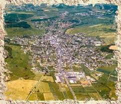
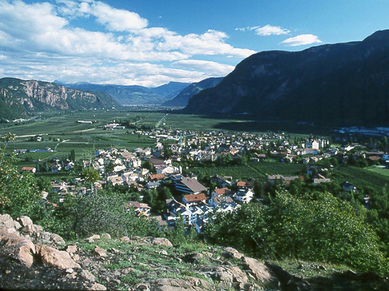
Stage 1: Nyon - Porrentruy, 188.5km. A stage that starts out quite gently, along the shores of the lakes of Geneva and Neuchâtel, but after the halfway point it crosses the Swiss Jura and becomes quite hilly, with 2 4th category climbs, 2 3rd category climbs and 3 2nd category climbs. This stage is clearly inspired by the best stage in the 2012 tour de France, but I shortened the distance from the last summit to the finishline with a couple of kilometres.

romet1.jpg

Climbs:
Côte de Valangin (3rd): 3,5km @ 6%
Col des Pontins (3rd): 6,7km @ 5,4%
Col du Mont Crostin (2nd): 6,3km @ 7,2%
Côte de la Caquerelle (2nd): 4,3 km @ 7,6%
Côte de la Croix (2nd): 3,7km @ 9,2%


Stage 2 : Delémont - Fribourg, 174km. Although there are some nasty hills in the first 100km of the stage, and the final covers rolling terrain, this is the flat stage of the race.

Climbs:
Montée de la Corniche du Jura (2nd): 9,2km @ 5,2%
Côte du Prévoux (3rd): 3km @ 6,1%
Col des Étroits (3rd): 5,8km @ 5,6%


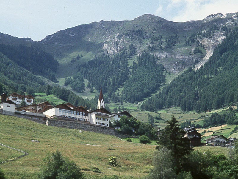
Stage 3: Payerne - Leysin, 145.5km. This stage crosses the highest point of the race, and has the only mountaintop (hilltop) finish, but it is certainly not the hardest of this tour. It's final will ensure that the number of candidates for the GC victory will be narrowed down to only a handful (or two) of riders.

romet3.jpg

Côte de Prévonloup (3rd): 5,3km @ 4,7%
Col des Mosses (2nd): 13,2km @ 4,2%
Col de la Croix (1st): 20km @ 6,7%
Montée de Leysin (3rd): 5,6km @ 4,6%


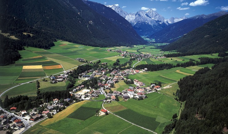
Stage 4: Aigle - Sion, 153km. This is the undeniable queen stage of this tour. It starts in front of the UCI headquarters, and basically follows the Rhône river upstream towards the town of Sion. To enforce a certain amount of spectacle, the race leaves the riverbanks and climbs the surrounding mountain roads often enough. The climbs here aren't the longest, highest or steepest on the continent, but 4 1st category climbs in just over 100km and as many tricky descents are certainly enough to sort the contenders from the pretenders.

romet4.jpg

Champex (1st): 11,4km @ 7,9%
Col du Lein (1st): 13,2 km @ 7,3%
Ovronnaz (1st): 9,6km @ 9%
Veysonnaz (1st): 16,4km @ 6%


Stage 5: Château de Chillon - Lausanne, 30km. We return to were it started five days ago: the shores of the lake of Geneva, for a final time trial. If the mountains didn't create decisive gaps, today the better TT'ers have the opportunity to take back lost time. For almost 25km the riders have to race on the quays next to the lake, before they start to climb the cobbled streets of the historical center of Lausanne, passing the cathedral to the olympic stadium.

romet5.jpg
 
Stage 4: Vipiteno-Sterzing - Martell-Val Martello, 188km

2v1p5oh.png


5nn2vc.png


Climbs:
Passo Pennes-Penserjoch (HC) 14,5km @ 8,7%
Passo della Mendola-Mendelpass (cat.1) 14,8km @ 6,5%
Passo Palade (cat.1) 13,0km @ 4,1%
Martell-Val Martello (cat.1) 16,1km @ 6,6%

My Giro del Trentino finishes with its only MTF, though the stage is, at least in theory, easier than yesterday's thanks to the soft run in to the final climb. But from this side it's not easy to find a really tough run-in to Val Martello, and I needed to complete the biathlon fixation route! To compensate for the fact that we are likely to see the whole showdown on the final climb, I have decided to add brutality to the early stage. This includes using one of Italy's toughest well-known climbs straight from the word go, the brutal Passo Pennes. This will ensure a strong and tough breakaway and also that the riders will hopefully be tired enough by the time they get to the base of Val Martello to ensure fireworks, especially after yesterday's difficult stage. After this we have 50km of downhill (which the riders will surely appreciate) into Bozen/Bolzano. Then it's two more climbs, the tougher side of Passo della Mendola, a particularly well-known climb, and the easier, gradual side of Passo Palade, parallel to yesterday's tougher climb of Castrin, before the descent into Merano.

Then, after 30km of valley roads, the final climb, after Antholz and Ridnaun, to yet another biathlon centre, in the Val Martello. This isn't quite at the summit of the climb, but at the small plateau just after the 16km mark of this profile. This gives us almost all of the tougher sections without the flattening out around the lake before the final ramps. There will no doubt have been gaps created on the previous three stages, so hopefully there will be people with enough time to gain here to make things exciting from the bottom of the final climb.

Vipiteno-Sterzing:
lo-vipiteno-e-gallery-01.jpg


Martell-Val Martello:
martell-martello.jpg
 
Another Tour De France...

kdy7DAP.png


Basic facts:

The Grand Depart is in Brest.
The route consists of a prologue (11.4 km) and 20 stages.
All of the race is within the borders of France
There is three ITTs: a short, a long and hilly and a long and flat.
There is a grand total of eight uphill/mtfs.
The is three mountain stages that end at the finish of a descent.
Seven of the stages are flat(ish).
The two rest days are in Perpignan and Lyon.
The Tour ends on the Champs-Elysée.
The total distance is ~3,400 km.
 
Stage 1 (Saturday): Brest-Brest, 11.4 km (ITT)

Map:
3Fvcvqv.png


Profile:
K0axWYL.png


Climbs:
None

Short description:
A short rolling ITT starting and finishing in Brest (counter-clockwise). The route isn't very technical and with relatively few bends despise being a 'point-A-to-A' timetrial.
 
Apr 11, 2009
2,250
0
0
Visit site
Tour of Oman this year was really good. Great parcours. Bit of everything.

Heard that Merckx "owns" :confused: the race, whatever that means. If he had a hand in setting the parcours, he deserves a lot of credit.
 
Parrot23 said:
Tour of Oman this year was really good. Great parcours. Bit of everything.

Heard that Merckx "owns" :confused: the race, whatever that means. If he had a hand in setting the parcours, he deserves a lot of credit.
I agree. I also think that it is a good thing for minor races to have loops, so the spectators can see the riders multiple times.
 
Stage 2 (Sunday): Brest - Vannes, 197 km

Map:
imRliJ1.png


Profile:
mfcbjnD.png


Climbs:
km 108: cat 4 (1.6 @ 5.6 %)
km 127: cat 4 (1.2 @ 6.0 %)

Short description:
The first road race stage will take us from the Grand Depart of Brest to the city Vannes. It's a simple flat stage for the sprinters, with two small hills so that we can award the polka dot jersey.
 
Stage 6 (Thursday): Bordeaux - Pau, 196 km

Map:
crV7GWq.png


Profile:
LlOphIA.png


Climbs:
None

Short description:
Straight south to the Tour familiar city Pau. This will be the last stage for the sprinters for some while, so whereas they will spend their teams today to ensure a sprint, the GC guys will try to waste as little energy as possible to be ready for tomorrow.
 

TRENDING THREADS