My Tour de Pologne - stage 6
Bielsko-Biała - Magurka Wilkowiecka 178km *****
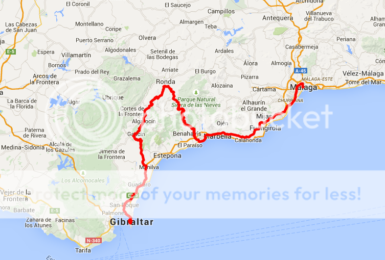
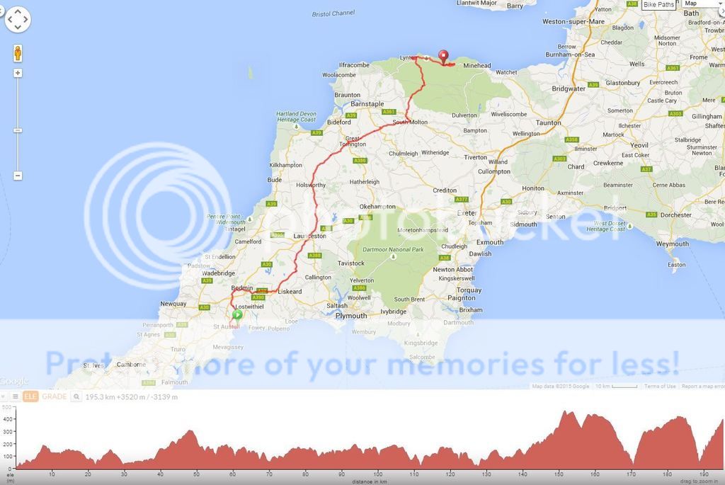
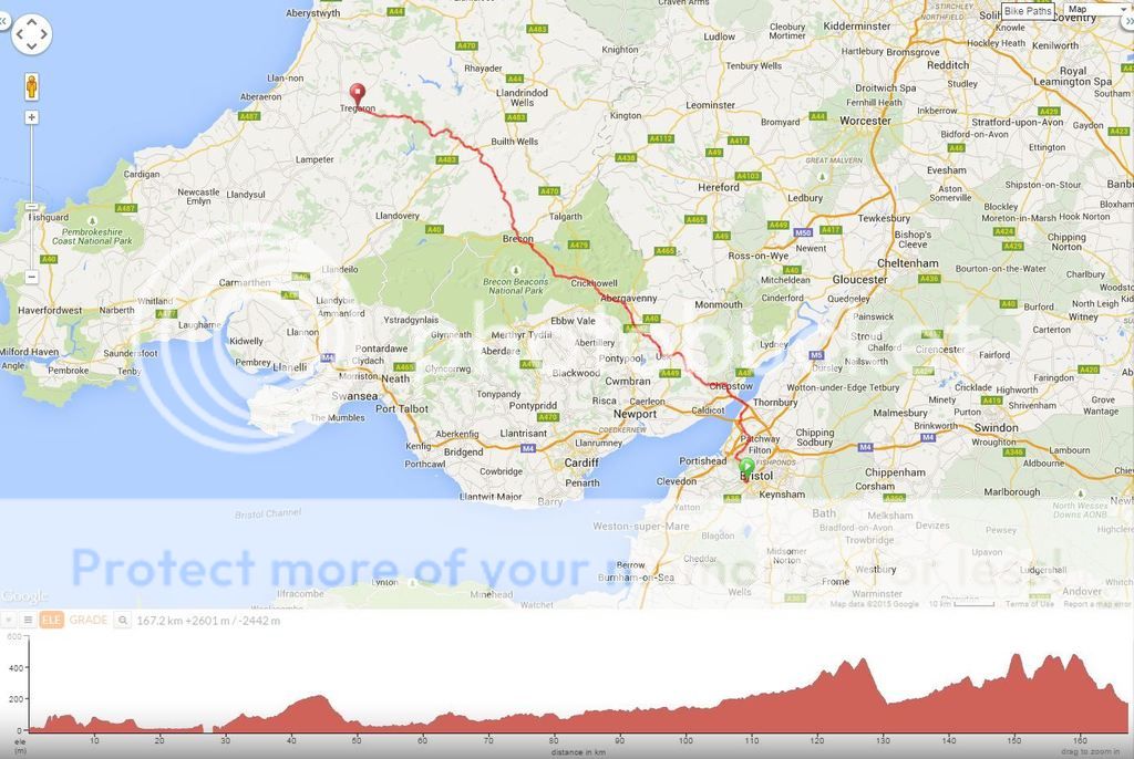
MAP:

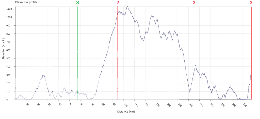
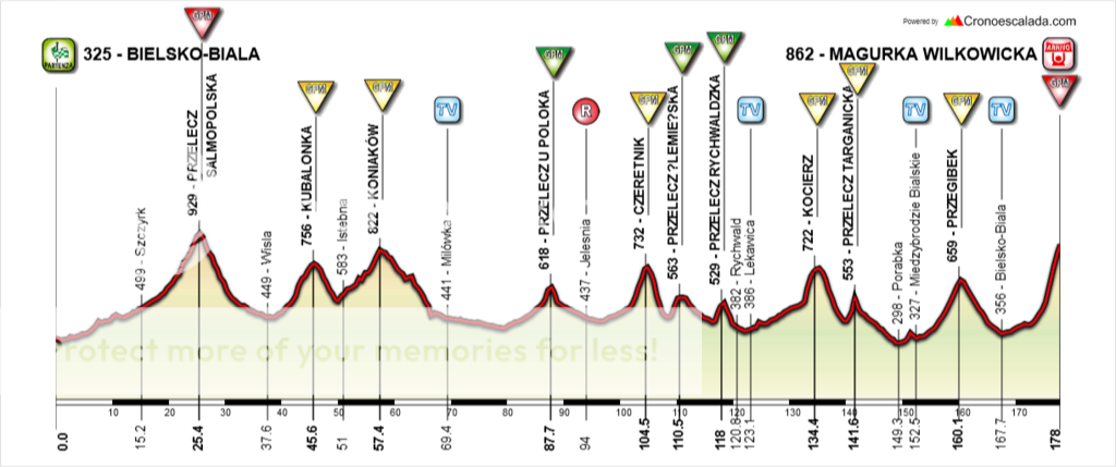
PROFILE:
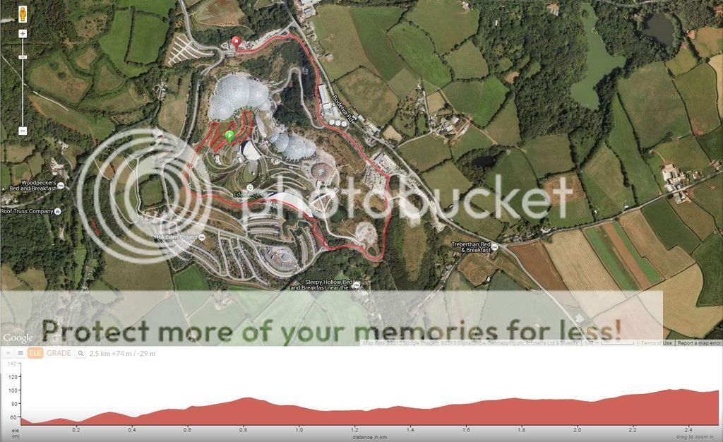
CLIMBS:
Przełęcz Salmopolska (cat.1) - 10,0km at 4,3% (max. 9,9%)
Przełęcz Kubalonka (cat.2) - 7,4km at 4,3% (max. 15%)
Koniaków (cat.2) - 7,4km at 4,0% (max. 12,6%)
Przełęcz u Poloka (cat.3)- 7,5km at 3,0% (max 9,3%)
Czertnik (cat.2) - 1,6km at 10,3% (max. 19%)
Przełęcz Ślemieńska (cat.3) - 1,1km at 10,5% (max. 19,7%)
Przełęcz Rychwaldzka (cat.3) - 1,4km at 8,4% (max. 15%)
Kocierz (cat.2) - 3,0km at 7,2% (first kilometer of this climb is 14,4% averange!!! max. 19,3%)
Przełęcz Targanicka (cat.2) - 1,8km at 7,5% (last kilometer of this climb is 10% averange, max. 19%)
Przełęcz Przegibek (cat.2) - 6,4km at 5,1% (max. 11,9%)
Magurka Wilkowicka (cat.1) - 7,0km at 7,5% (last 4km at 10,7%!!!, max. 16,7%)

DESCRPTION:
This is the last road stage of Tour de Pologne. Those who still are in the mix and feel power in their legs definitely don't have a reason to complain. Yellow jearsey can't feel safe as there are 11 categorized climbs yet to come. Some of them are reasonably long, but fairly easy, whereas other are rather short but truely steep. The last one though, is one of the hardest climbs in Poland. The climb to Magurka is like 7km long, but the last 4km are all that really matters. After long day in a saddle, taking into account 10 climbs climbed on this very day, and more of them in previous days, this is gonna be a hell. Riders will be finishing alone. Will the best climber from Karpacz increase his lead, or lose time?