Libertine Seguros said:
I am amazed, railxmig has managed to put together some posts that make my route posts seem pretty lazy and ill-thought-out, WITHOUT drawing attention to birthplaces of Spanish climbers (who are all unique and different in their own ways) or German biathletes (some of whom are more flatulent than others). Focusing on the cycling route at the expense of a Nordic sports travelogue simply will not do, so luckily I'm here to address that.
No worry, it was just a mockery joke to try to be funny. You're basically my idol. You can count me as your worshipper #Mark_David_Chapman.
")
Besides that, i love Carlos Sastre. My history with biathlon ended somewhere around 2005 with Sven Fisher, Hannevold, Bjoerndalen, Lars Berger etc. While i still am a quite big fan of Ski Jumping (watching from Lillehammer 1994) but not as much nowadays as in the past. I'm lacking time in my life and there's no Peterka ("Vodka"), Thoma ("Rubber Legs"), Hannavald ("Backstreet Boy"), Malysz ("Walesa"), Romoeren, Achonen (aka "The Statue") or Herr to spice things up while Kasai is only at the beginning of his career. Propably it's just my whiny, old and hemoroid butt speaking here. My post's are still very vague addresing each of the stage's elements only in couple of sentences, but then creating such posts would take for ever...
Your stage to Seefeld kinda reminds me like a harder version of Oropa stage in 2014 Giro with Silzer Sattel as Alpe Noveis and Kühtai Sattel as Bielmonte. Because the bunch's quality is mostly not as "good" as in parallel Tour then there might be some propability of serious attacks or crucial selection back in Silzer Sattel. It's a typical place where it's easy to lose whole race and hard to win the race.
Critérium du Dauphiné by railxmig - stage 3
Ok, i feel i should post another stage here. This is the stage I had most trouble with. It's quite unusual for ASO design standards nowadays. I'm slightly changing the formula of descriptions and i'm also introducing a section with basic geographical information (that i could find) about the stage. This stage might be hindered because next day there's an ITT but it theoretically isn't a GC in the first place.
library:
click here
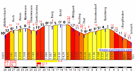
Chambéry - Bourgoin-Jallieu, 169km, ~2700m asc, Medium Mountain
Start: Chambéry, Boulevard du Musée, Statue de la Sasson
Km 0: Barberaz, Avenue du Granier, 3,8km from the start
Finish: Bourgoin-Jallieu, Avenue d'Italie, Porte de Médicis, 680m straight
Sprint: Chatonnay, Route des Alpes, 370m straight
Feed zone: Montferrat, Jalamion, D50
Start - km 0:
Boulevard du Musée - Boulevard de la Colonne - Place des Éléphants - Rue de Boigne - Place du
Château - Rue du Château - Place Caffe - Place Monge - Rue de la République - Place de la
Brigade de Savoie - Rond-Point Jean Jacques Rousseau - Rue Jean Jacques Rousseau - Chemin du
Vercors - Barberaz, Route de l'Église - Barberaz, Rue de la Chambotte - Barberaz, Route de la
Villette - Barberaz, Avenue du Granier
List of climbs:
Col du Granier - 9,7km, 8,6%, 1 Cat. 1134m
Col de la Croix des Mille Martyrs - 8,6km, 5,8%, 2 Cat. 884m
Côte des Pautes - 3,5km, 4,6%, 4 Cat. 560m
Côte de Bigallet - 1,6km, 6,7%, 4 Cat. 572m
Côte de la Rivoire - 1,1km, 10%, 3 Cat. 335m
Departaments:
Savoie, start - 13km
Isère, 13km - 23km
Savoie, 23km - 34km
Isère, 34km - finish
Preface:
As i've mentioned it's a quite unususal stage. I would call it even unorthodox for the ASO design standards nowadays. You don't see many of such stages, where the climbs are progressively easier and where the stage begins in a mountainous terrain with a flat/hilly finish. The closest one in design was stage 12 from Tour 2012 (and 2009 Pyrenean stages, but i refuse to even try remember them for obvious reasons). That stage had two climbs in the first part (Grand-Cucheron, not present, and Granier from exactly same side as today) and flat second part with a hilly finish. Placement of those two stages is similiar too – they're both after a hard mountain stage.
It's a transitional stage with big propability of a breakaway win. I've categorised it as a medium mountain one because of the presence of a cat. 1 and cat. 2 climbs even if accumulated uphill meters are just inside the benchmark of a medium mountain stage. This stage goes through two departaments: Savoie and Isère.
This stage can be divided into two parts.
First part – 0 – 65km. Part from Chambéry to Saint-Geoire-en-Valdaine is quite mountainous with two climbs: cat. 1 and cat. 2 soon after. There are only a couple of short stretches of flat roads as even the run-in to cat. 1 is bumpy.
Second part – 65km – 169km. It's mostly flat to bumpy with three climbs: two cat. 4 and a cat. 3 just 4km from the finish line. There are of course more small hills, but they're too small and too flat to be categorised.
This stage shouldn't be underestimated, as the roads are twisty and at times have questionable quality. Because this stage is technically challenging with it's twisty roads it could be counted as the technicall try of this race. Some of the roads in the first, montainous part of the stage will be present in my Tour.
Purpose:
The purpose of this stage is mostly to move out the peloton from Alps to Viennois region – highlands around Lyon and Vienne keeping the flow of the whole race by limiting transfers to a bare minimum in process. It can be a stage for either a breakaway, a sprinter, who manages to stay or catch up after the mountainous beginning and twisty final or a GC threat who will be eager for additional couple of seconds. This stage shouldn't be GC relevant unless a strong breakaway of GC outsiders will try to shake up a bit. It should however test the strategical mind of the teams, as it's a quite complicated stage with a lot of possible outcomes. The last hill shouldn't create big gaps (at most 10-15s).
Start:
Stage will start in Chambéry on Boulevard du Musée in front of Statue de la Sasson.
Chambéry is no stranger to hosting a stage for either Dauphine or Tour. It will have a quite important role in my own try at Tour de France.
The km 0 will be in Barberaz on Avenue du Granier [D12], 3,8km from the start. Barberaz is a small town south-east of Chambéry. It belongs to the aglomeration of Chambéry. To reach km 0 peloton will follow:
Boulevard du Musée - Boulevard de la Colonne - Place des Éléphants - Rue de Boigne - Place du Château - Rue du Château - Place Caffe - Place Monge - Rue de la République - Place de la Brigade de Savoie - Rond-Point Jean Jacques Rousseau - Rue Jean Jacques Rousseau - Chemin du Vercors - Barberaz, Route de l'Église - Barberaz, Rue de la Chambotte - Barberaz, Route de la Villette - Barberaz, Avenue du Granier.
Climbs:
This stage has only one climb that's relatively known from either Tour or Dauphine – Col du Granier. Rest of them does seem to be virgins with doubts about Col de la Croix des Mille Martyrs. Below is a list of categorised climbs to tackle and their short description.
Col du Granier (1134m). The first climb of the day is a cat. 1 climb – 9,7km at 8,6%. It's one of the most important cols in Chartreuse region and it's well known from Tour and Dauphine roads, especially as it always took part in classic north side Grenoble stages. This time will be used propably the most challenging west side from Cernon (Chapareillan) as in stage 12 from Tour 2012. It's much more irregular than the profile sugests with short stretches of 10 to 15% mixed with more flatish sections in close succesion. Maximum slope is supposedly at around 18%. It should be a good terrain to create a strong breakaway.
Col de la Croix des Mille Martyrs (884m). This one can turn to be problematic. It's a cat. 2 climb – 8,6km at 5,8% so nothing hard. The climb is quite irregular with some patches steeper and some flatter and a small plateau 3km into the climb. However the steeper parts doesn't seem to be steeper than 10%. I'm not sure if it ever was used in Tour or Dauphine. I think that Tour tried to include it somewhere around 2009 to 2012 but apparently without success. I've managed to create a profile of this climb, i hope it's closer to reality than last Vuelta profiles.

The problem in using this climb can arouse in form of a nearby protected area. I'm not sure if the road that will be used is in this protected area. If this climb is out of reach then an alternative can be used. Descending on D49 from Miribel-les-Échelles as far as Saint-Nicolas-de-Macherin and then turning into D49C to Le Burlet and back to the actual stage. It would be then a longer and flatter, but plausible journey. D49C is a two-lane road with average surface quality, perfectly suitable for the race.
Côte des Pautes (560m) begins just after Virieu after a long flattish section (around 25km). It's a cat. 4 climb, 3,5km at 4,6%. It's one of those climbs that begins tough but flattens progressively into a plateau on the summit. It is simillar to climbs on yesterday's stage. After the summit there is a small plateau before a long, shallow descend. First 300m up to Gare de Virieu are the steepest one at around 8%.
Côte de Bigallet (572m). Located in Bois Bigallet belonging to Massif des Bonnevaux north of Commelle in Plain du Liers. It's 28km after Côte des Pautes. It is a cat. 4 climb – 1,6km, 6,7%. It's an opposite to Côte des Pautes as it begins flattish and progressively steepens up. The summit is located in a small trench.
Côte de la Rivoire (335m). Last climb (or rather hill) of the day. It's short but steep. It begins at around 12% to slightly let down closer to the summit. It's a borderline cat. 3/4. I've decided to categorise it as a cat. 3 because of the steepness and closeness to the finish. It's 1,1km at 10% with maximum slope around 12%. It should be a good lounchpad for an attack for an eventual stage win or just getting a couple of seconds as the descend is technical.
Sprint:
It's interesting that the best places for a sprint in this stage are in the middle of nowhere. Today the sprint will propably be held in the entrance of Chatonnay on Route des Alpes at the end of a 370m straight line. Because this sprint is located just 37km from the finish it can end up being an important factor in this stage. This sprint will be won by a breakaway, but if the group is small then peloton might speed up for this sprint to take remaining points, making breakaway's life much harder. Still, it can get harder for both sides as this sprint is just 5km after a cat. 4 Côte de Bigallet.
Feed zone:
Feed zone is located just outside commune of Montferrat on D50 close to a small settlement Jalamion after 77,7km from the start. It's placed after cat. 2 Col de la Croix des Mille Martyrs and way before sprint so it makes a nice place to slow down and take a nap (on a bike obviously).
Run-in:
Run-in to the finish line is twisty and complicated, that's why i decided to give it a closer look. Riders should be very careful to not end in a crash. This terrain should help out the breakaway or/and guys from peloton eager to attack. I've defined the run-in as last 13km starting in Saint-Alban-de-Roche (just west of Bourgoin-Jallieu) from the intersection between Montée du Chemin Neuf [D124A] and Route de Lyon la Grive [D312]. Then, in nearby L'Isle-d'Abeau, after long right turn above D1006 and A43 there's a two-lane Avenue du Bourg separated by a road island (or whatever it's called). It's however just 350m long. In next 5kms on D208, before entering Bourgoin-Jallieu, there are no difficulties besides three rond-points.
In Bourgoin-Jallieu peloton goes first through two rond-points under A43 and over La Bourbre river. They will keep going close to La Bourbre turning left into Quai de la Bourbre. It's a two-lane road with fine quality surface. After around 700m they will turn left into Rue de la Rivoire D143C heading to la Rivoire, as the cat. 3 hill begins. The road quality isn't the best here, but it's interstingly still two-lane. On top of this hill the road however narrows keeping it's dodgy surface quality; it favours smaller groups. This stretch of road is however only 380m long so it shouldn't pose many (or any) organisational problems. The descend is twisty with some uncomfortable turns, but it's on two-lane roads with at least slightly better quality (not best though). It should help out any breakaways or attackers with good bike handling skills. Bigger groups should look out for any eventual crashes. Last part is in the city with 5 mostly 90-degree turns in last 2kms.
Finish:
Bourgoin-Jallieu is no stranger to Dauphine (2006 stage 1 finish won by Fabian Wegman and stage 2 start to Saint-Galmer won by Gilbert) and hosted a start in Tour (1962 ITT won by Anquetil and 2009 sprint won by Cavendish). I'm not sure if there was ever a stage finish, maybe in much older times.
Finish will be held in Bourgoin-Jallieu in the same place as it was in
2006 – Avenue d'Italie at the end of a 680m straight line, just outside Porte de Médicis. This time however the run-in is a lot more complicated, as I've described before. 700m before finish line there are two 90-degree turns in span of 100m. First is left, second is right. Because of complicated run-in the usual lead-out guys should be worried not only by good positioning of their leaders but to showcase good descending and technique.
Roads:
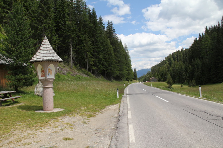
In this stage the roads are mostly twisty with only a handful of straights with the longest one being D51 around 45km off the finish and a 2km stretch on D1090 at the beginning. Most of the roads are two-lane and their overall quality is varied but should be enough to hold a cycling race. There are some stretches that are narrower and/or worser quality. There is around 1,5-lane, 2,6km long D17 Côte des Pautes (95-98km), 380m long around 1,3-lane road on top of Côte de la Rivoire and eventual narrowings in towns and cities. It makes less than 5km of roads narrower than a two-lane (6m wide). However a good bunch of those roads aren't in the best surface quality.
This stage uses 9,5kms of red roads (important ones that should be limited as much as possible for cycling tours) separated into three stretches: 2,5km long D1090 Chambéry – Grenoble road from 10,8-13,3km, 1km long D1075 Bourg-en-Bresse – Grenoble road from 76,5-77,5km and 6km long D51 from 118,3-124,3km. The stage doesn't interfeer with any autoroute or express road's junctions. I can only hope last 13km are not twisty and complicated enough to not be included in Dauphine.
Possible outcome:
As it was mentioned before, only stage similiar in last 5 years was only Tour 2012 stage 12. What happened there? I actualy missed that stage, so i will make use of the stage reports. In the first part with two mountains it was tense with a big (20 or sth) group with Moncoutie (later crashed on the descend), Kiserlovski and Millar. On Granier another group with Sagan tried to get away but failed. After descend from Granier situation stabilised and the remains of original breakaway comfortably stayed ahead of peloton to contest for the stage. Millar won with Peraud and Egoi Martinez closeby.
This stage can end up similiar with a brakaway winning it. First part of the stage should be fast, nervous and chaotic. The ending seems to be more complex than in it's 2012 counterpart. It is kinda similiar to Dauphine 2012 stage 2 finish in Saint-Vallier, where Cadel Evans with Coppel and Kashechkin managed to get only (but still) 4 sec on a 90-man peloton led by Bouhanni. If it would come to the Peloton then the stage could go to a sprinter, who will survive the first part or manages to come back to the front.
The last climb and it's location differs from Dauphine 2012 stage. On this stage the last climb – Côte de la Sizeranne – was propably tougher (3km, 6,5%) than this stage's Côte de la Rivoire (1,1km, 10%) but located further from the finish line (9km compared to Côte de la Rivoire 4km). Descend is twisty and technicall in both cases but the one from 2012 (where Evans attacked) was longer and narrower than today but with longer flat portion in the finish.
Location of the sprint just 37km from the finish can end up being important for the outcome of this stage. Fatigue can be a decisive factor in this stage.
Possible scenarios:
Breakaway win. If the breakaway will win, then the propablity of this breakaway being dangerous is small. Peloton will propably roll in 5 to 10 minutes in areas, propably complete. The bigger the breakaway the more chances of succeding it will have. The stage then should be won by the most willing/intelligent guy or the best sprinter in the group.
Sprintfest. This stage should be challenging enough to not end in a regular sprint. If a bigger group would end up fightning for the stage win it would have around 60 to 80 riders in it. The winner then should be either a tougher sprinter like Sagan, Degenkolb, Matthews or a puncher with good sprint like Alaphillipe, Gallopin, Kwiatkowski or Clarke. Even if a pure sprinter would hang on the last hill I don't think he could win the stage, as last kms are tough and technically challenging. Combine it with fatigue factor and yesterday's hard day then he should be quite worn out before even have a dig at sprint.
Attack close to the finish. Scenario à la Evans. If a puncher (GC threat or not) would try to get out on the last hill he'll have the terrain to maintain any advantage and try it to keep to the finish line getting around 5-10s in process. Similar scenario happened in the Dauphine 2012 stage 2 mentioned before.
Geography:
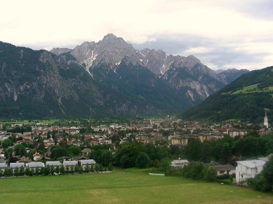
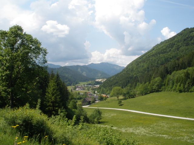
Start of the stage – Chambéry is located between Massif des Bauges and Massif de Chartreuse at the confluence of Leysse and Albanne rivers. The stage then goes west into Massif de Chartreuse passing by Mont Granier, goes by Le Cozon and Guiers Vif rivers south-east of La Cochette (1618m) turning west. The stage continues west and leaves Chartreuse at Val d'Ainan (Saint-Geoire-en-Valdaine) entering Les Terres Froides. Terrain here for another 40km is hilly with hills between 500 – 750m a.s.l. (highest peak – Les Montenvers at 734m east of Châbons). Through the area peloton will go by a couple of lakes with Lac de Paladru (82-87km) being the biggest.

At around 107km (Montrevel) the terrain changes from hilly to mostly flat as we enter Plaine du Liers. After 17km in Comelle stage turns north into Massif des Bonnevaux and then Val de Gervonde and Saint-Jean-de-Bournay. The stage keeps north into Artas and hills (up to 530m a.s.l.) west of Bourgoin-Jallieu where it turns east into Bourgoin-Jallieu. North of the city there are steep hills up to 350m a.s.l. where the last climb of the stage is located.
Mont Granier (1933m) – very characteristic climb in the northeast Chartreuse massif. Thanks to 1248 landslide it has now a limestone cliff of around 800m high.
Les Terres Froides – hilly region with lakes mainly around Bourgoin-Jallieu, stretching from Lyon outskirst to the base of Chartreuse massif. It's known to have quite harsh climate in winter because the area is builded mainly by clay that has a feature of being slow to warm up while the terrains surrounding this region are mainly builded by easier to warm up moraine sands (don't ask me, i'm not a geology specialist).
Plaine du Liers – flat at approx 500m a.s.l. from Châbons and Montrevel east to Comelle west.
Massif des Bonnevaux – hills located north of Comelle in la Plaine du Liers. Summits reaching up to around 610m (Mont Buffet, 606m). It's home to around 300 ponds that habits some rare dragonfly species.
Tourist attractions:
Sorry, but it's too time consuming to me more specific. That's why i'm only limiting myself to a mere list of more important ones.
Myans (5km) – Les Abîmes de Myans, Sanctuarie de Notre-Dame de Myans – church from XI c. One of the few (or only one) in the area to survive a massive landslide on Mt Granier in 1248. Apparently people found it as a sign from God and rest is history.
Gorges du Guiers Vif (34-45km) – Guiers Vif river valley between Saint-Pierre-d'Entremont and Entre-deux-Guiers
Saint-Geoire-en-Valdaine (65km) – Château de Longpra
Montferrat (78km) – Gîte La Marinière à Montferrat
Virieu (93,5km) – Château de Virieu
Bourgoin-Jallieu (finish) – Château de Petit Mont, Château de Rosière, Château de Thézieu, Hôtel de Ville etc.
I'll try to post next stage on Thursday as tomorrow i will have a busy day. Have a nice day/night.